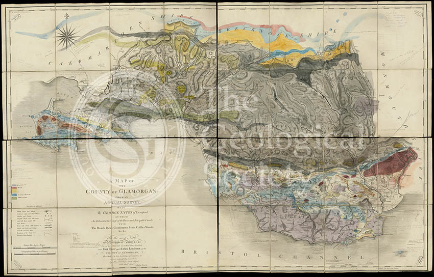
Title: Geological map of Glamorgan
Creator: George Bellas Greenough (1778-1855) and William Buckland (1784-1856)
Description: Rough geological colouring with ink and pencil annotations on base map ‘A Map of the County of Glamorgan from an actual survey’, by George Yates, of Liverpool, published by John Cary, 1799. Scale-1:63,360, 92cm x 144cm. The annotations are in the hand of George Bellas Greenough and William Buckland, a note on the top left states ‘This map has been corrected to Nov 1818’.
The map is likely to have been compiled as part of the research for George Bellas Greenough’s ‘Geological Map of England and Wales’ (1819/1820).
Date: 1799, up to November 1818
Format: Hand colouring on printed base map
Archive reference: LDGSL/947/6/E/1
Image reference: 07-157
Recommended print size: Up to 100 x 90cm