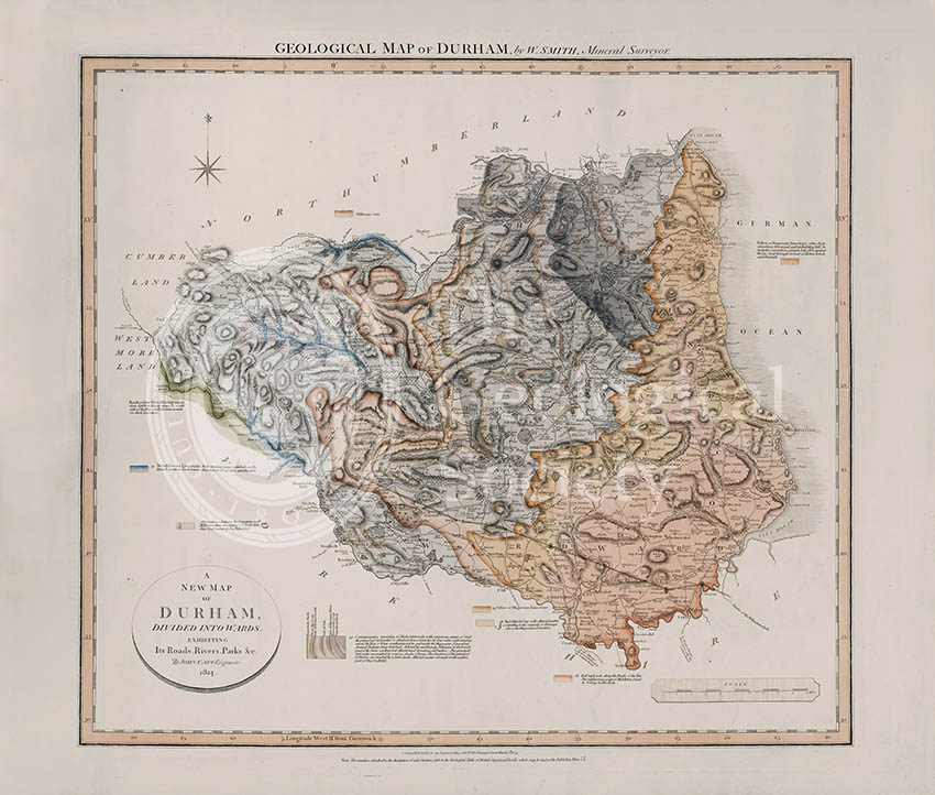
Title: Geological Map of Durham
Creator: William Smith
Description: Geological map of the English county of Durham. This map was published in the sixth of William Smith’s series of six atlases of geological maps of English counties.
A later 1831 edition can be found here: www.flickr.com/photos/geologicalsocietylibrary/1536435877…
Publisher: John Cary
Date: 1824
Format: Geological map, ink (lithograph from engraved plate) and water-colour, on paper, bound in atlas.
Image reference: 07-28
Size of original: 60 cm x 66 cm
Recommended print size: up to 100 cm x 70 cm
Also available from the Geological Society online shop at: http://www.geolsoc.org.uk/WSDurh