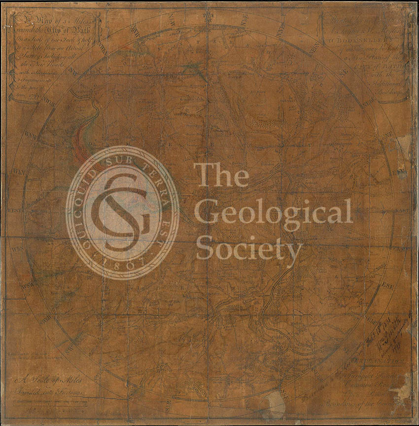
Title: Geological Map of Bath
Creator: William Smith (1769-1839)
Description: Geological colouring by William Smith, on base map ‘A Map of Five Miles round the City of Bath, on a scale of one inch and a half to a mile, from an Actual Survey, including all the new roads, with Alterations and Improvements to the present time, 1799’. Printed for and sold by A Taylor and W Nayler, Booksellers, Bath.
The map and two other items were presented to the Society by Smith, February 1831, in gratitude at being awarded the Society’s first Wollaston Medal. An inscription by Smith is on the bottom right hand corner.
The map hung in the library until c.1980s. Light has faded the colouring and base map, which is further exacerbated by its frequent varnishing over the years.
Date: 1799
Format: Hand colouring on engraved base map.
Archive reference: LDGSL/739
Image reference: 07-135
Recommended print size: Up to 20 x 16 inches (50 x 40cm)