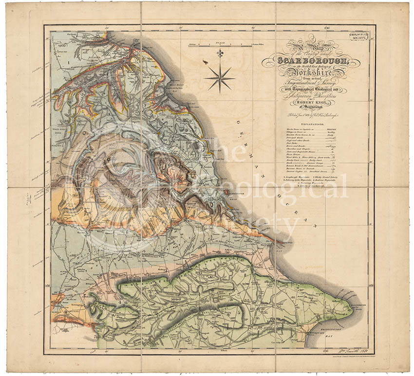
Title: Geological map of Scarborough
Creator: William Smith (1769-1839)
Description: Geological colouring by William Smith, on the base map ‘A map of the country round Scarborough in the North and East Ridings of Yorkshire from actual trigonometrical survey with topographical geological and antiquarian descriptions by Robert Knox of Scarborough, published June 1, 1821’. Signed and dated by Smith on the bottom right hand corner.
Smith retired to Scarborough in 1834, but had close associations with the seaside town from 1820. The above map is one of Smith’s last completed geological works.
The difference in the colouring is very subtle and there is no colour key, instead the strata is labelled around the edges:
Light blue – Sandstone, shale & coal
Yellow – Grey or Bath Oolite
Red – Dogger or Inferior Oolite
Grey – Alum or Lias Shale
Green – Chalk
Light brown – Hackness or Kelloways Rock
Mid brown – Calcareous Grit
Mid blue – Oxford Clay
Greyish blue – Kimmeridge Clay
Light orange – Coralline Oolite
Date: 1831
Format: Hand colouring on printed base map.
Archive reference: LDGSL/750
Image reference: 07-131
Recommended print size: Up to 100 x 70cm