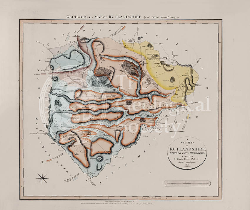
Title: Geological Map of Rutlandshire
Creator: William Smith
Description: Geological map of the English county of Rutlandshire, now called Rutland. This map was published in the fifth of William Smith’s series of six atlases of geological maps of English counties.
Publisher: John Cary
Date: 1822
Format: Geological map, ink (lithograph from engraved plate) and water-colour, on paper, bound in atlas.
Image reference: 07-34
Size of original: 66 cm x 57 cm
Recommended print size: up to 100 cm x 70 cm
Also available from the Geological Society online shop at: http://www.geolsoc.org.uk/WSRutld