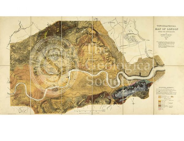
![Topographical [and Geological] Map of London… (Mylne, 1851)](https://gslpicturelibrary.org.uk/wp-content/uploads/2016/11/07-158-Mylne-Map-of-London-home.jpg)
Title: ‘Topographical [and Geological] Map of London and its Environs’
Creator: Robert William Mylne (1817-1890)
Description: Engraved by T Walsh, colour printed by J Aresti. Mounted on linen and dissected, 39 x 72cm.
According to the legend on the map, ‘The different colours represent the general surface soils. In the low Marshy grounds the Alluvial deposits (excepting Peat) are omitted – they vary from 3 to 6 feet in thickness. The Made Ground and accumulated debris occurring in the City & anciently populated parts adjacent is also omitted – it varies from 8 to 18 feet in thickness – in Westminster from 6 to 12 feet.’
Publisher: James Wyld, London.
Date: 1851
Format: Lithograph
Image reference: 07-158
Size of original: 39 cm x 73 cm.
Recommended print size: Up to 70 x 50cm