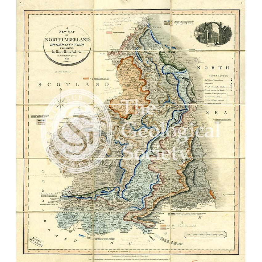
Title: ‘A New Map of Northumberland divided into Wards…’
Creator: John Cary (1755-1835) [and William Smith (1769-1839)]
Description: ‘A New Map of Northumberland divided into Wards, exhibiting its Roads, Rivers, Parks, &c’, published by John Cary, London, 1831. Although not acknowledged on the map, the geological colouring is by William Smith. Scale-1:c.225,000. Pencil annotations by George Bellas Greenough, from whose collection the map derives. Dissected on cloth, 53cm x 47cm. In slip case.
Publisher’s title on slip case ‘Geological map of Northumberland: on which are delineated by colours, the courses and width of the strata which occasion the varieties of soils; calculated to elucidate the agriculture of the county, to show the situation of the best materials for building, making roads, constructing canals, &c and pointing out those places where coal and other valuable minerals are likely to be found.’
Date: 1831
Format: Hand colouring on engraved base map
Archive reference: LDGSL/947/6/D/1/6
Image reference: 07-132
Recommended print size: Up to 70 x 50cm