
Matte
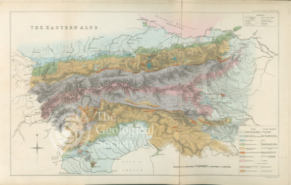
Geological map of the eastern Alps (1832)
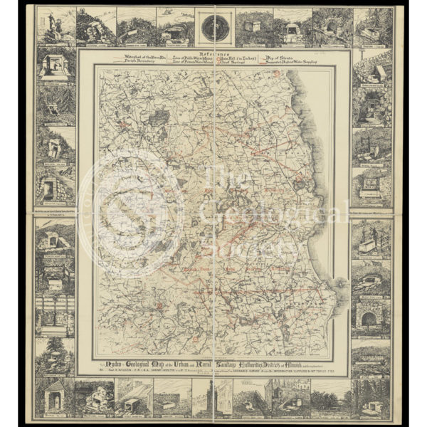
Hydrogeological map of Alnwick and its neighbourhood
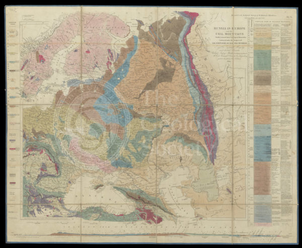
Murchison’s Map of Russia (1847)
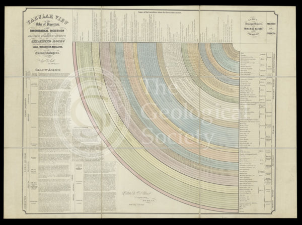
‘Tabular view of the order of deposit and chronological succession of the principal European groups of stratified rocks’
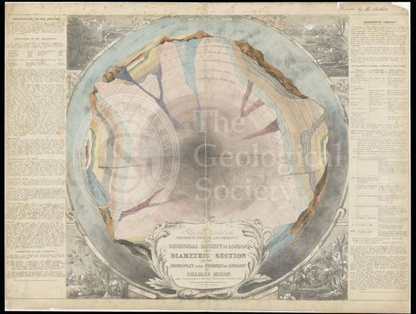
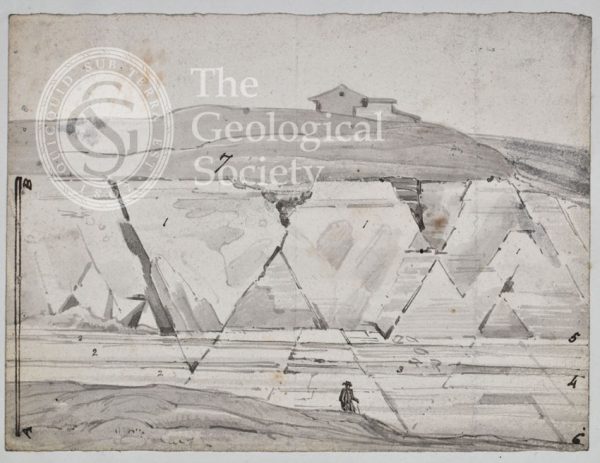
‘The diametric section of the principles and theories of geology’
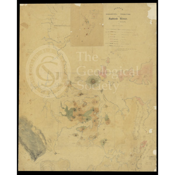
‘Sketch of the Geological Formation of the Auckland District’ (1857-1859)

Geognostic map of Sweden (1834)
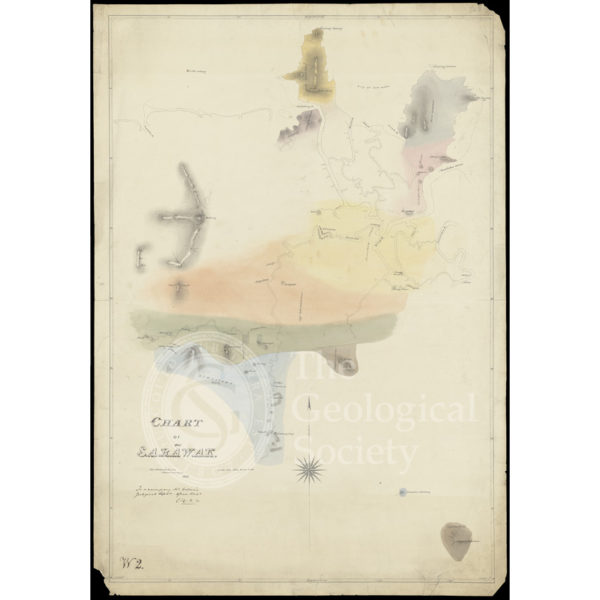
Chart of Sarawak, Borneo (1846)
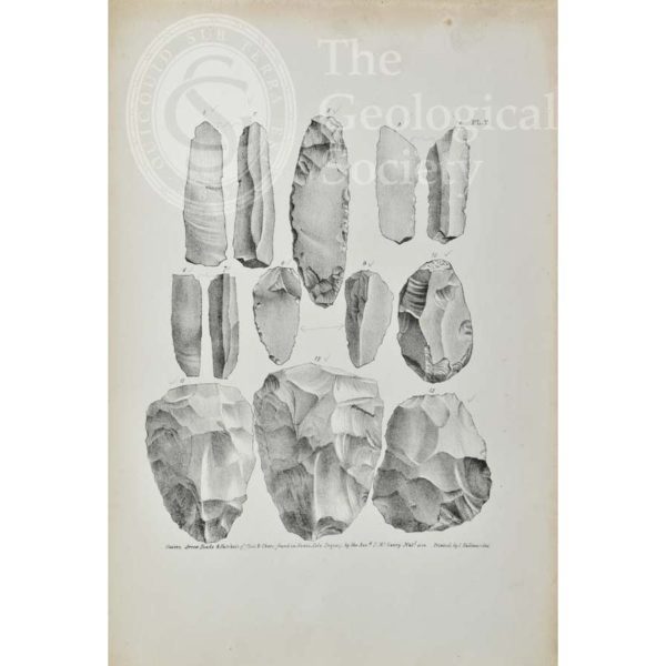
Knives, arrow heads and hatchets of flint and chert found in Kent’s Cavern
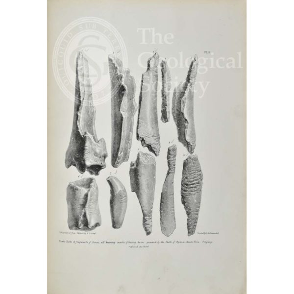
Bones bearing marks of having been gnawed by hyaenas, from Kent’s Cavern
Bones of rhinoceros and horse found in Kent’s Cavern
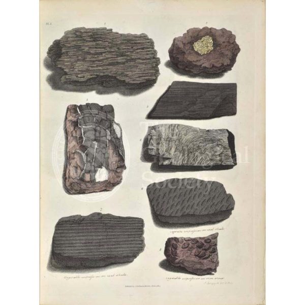
Remains of fossil plants
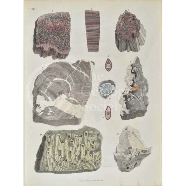
Remains of fossil plants
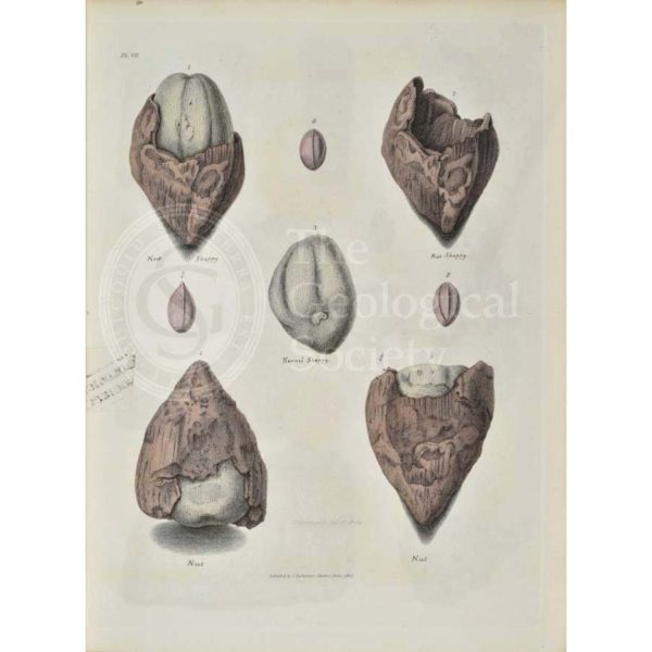
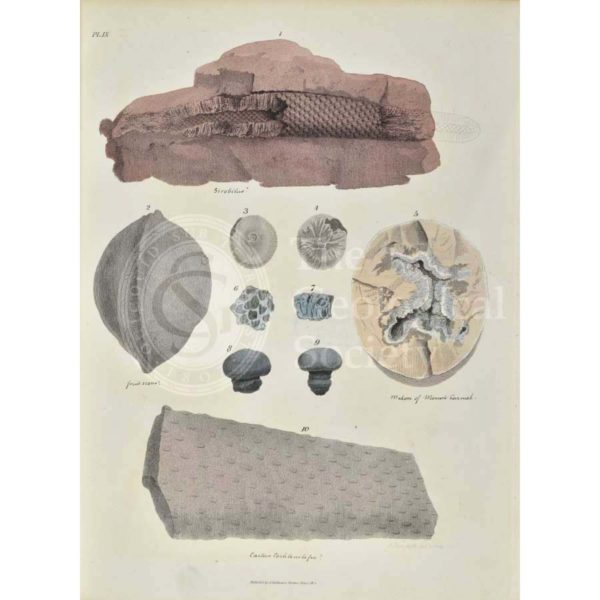
Remains of fossil plants, mostly nuts from the Isle of Sheppey
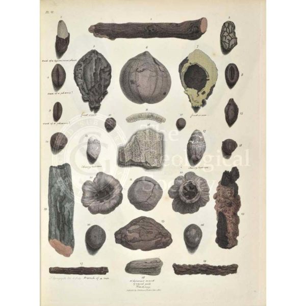
Remains of fossil plants, including twigs and nuts
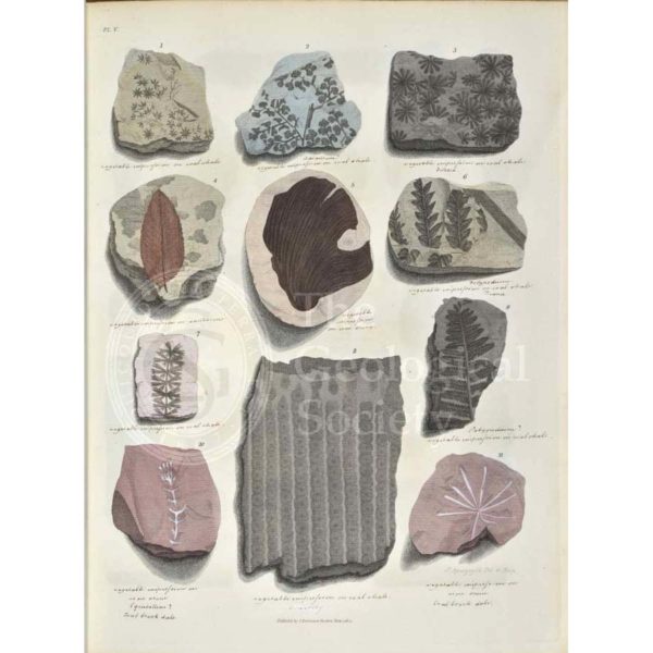
Remains of fossil plants, mostly leaves
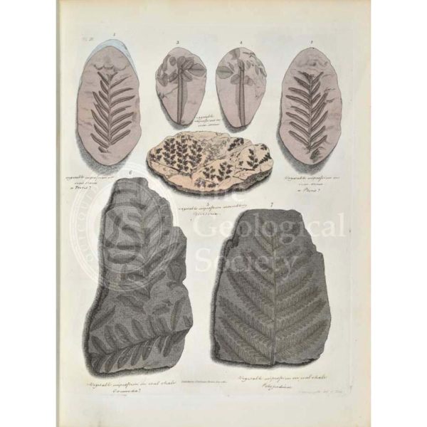
Remains of fossil plants, mostly ferns
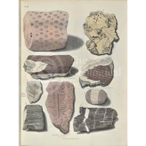
Remains of fossil plants
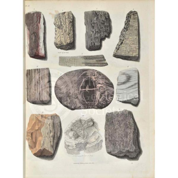
Remains of fossil plants, mostly trees
Remains of fossil plants, including fossil wood and bark
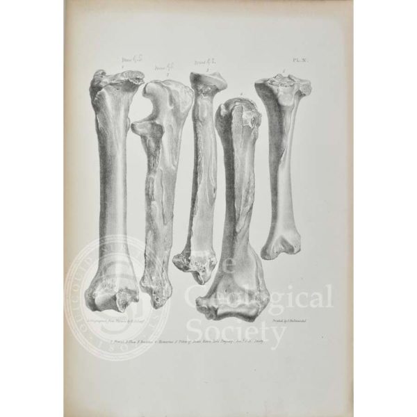
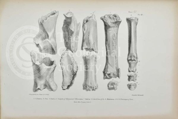
Femur, ulna, radius, humerus and tibia of Bear found in Kent’s Cavern
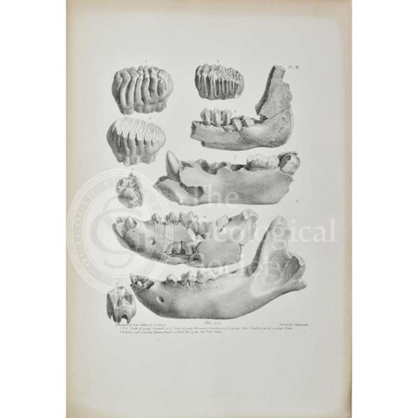
Teeth and jaws of young elephants, rhinoceros, deer, bear and hyaenas found in Kent’s Cavern
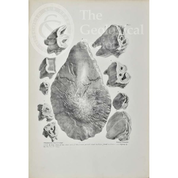
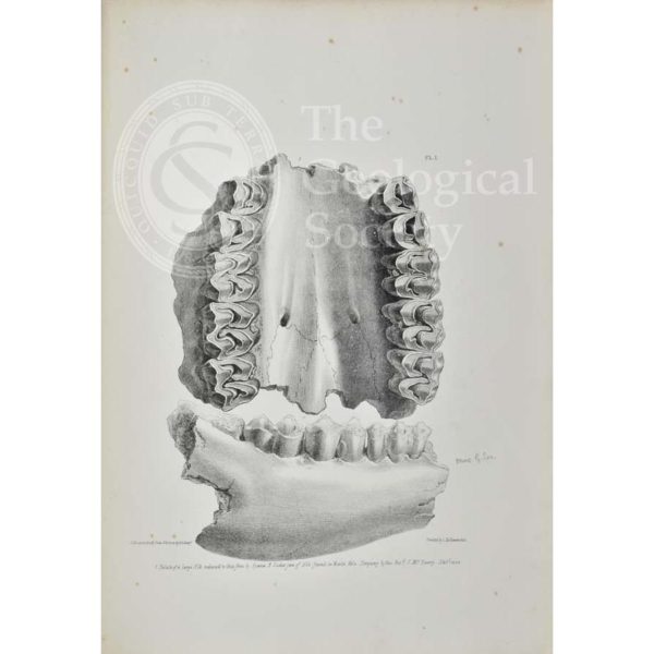
Teeth & bony base of the nose of Rhinoceros from Kent’s Cavern
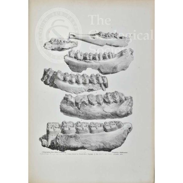
Jaws of a hog, deer, fox and horse found in Kent’s Cavern
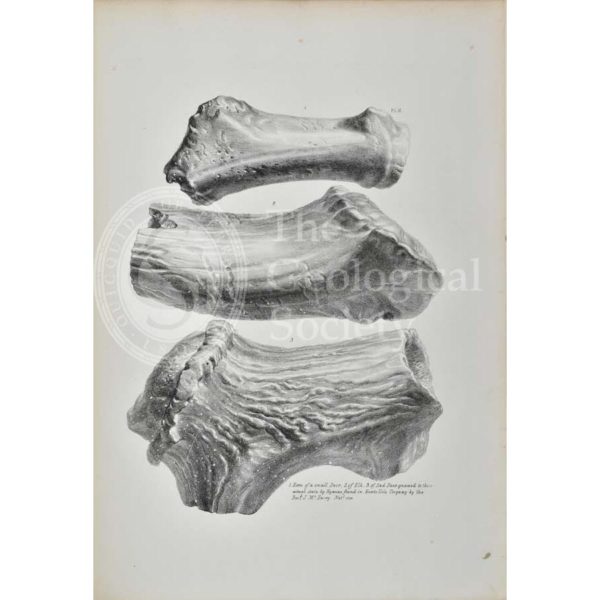
Horns of a small deer, elk and red deer from Kent’s Cavern
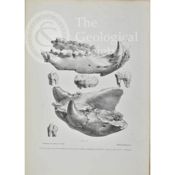
Palate of an elk, partially eaten by a hyaena, from Kent’s Cavern
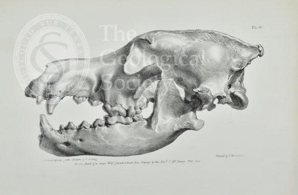
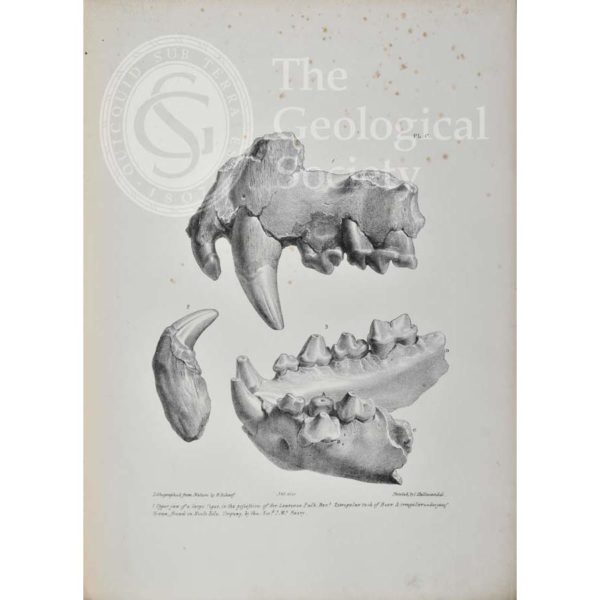
Head of a large wolf found in Kent’s Cavern, Torquay
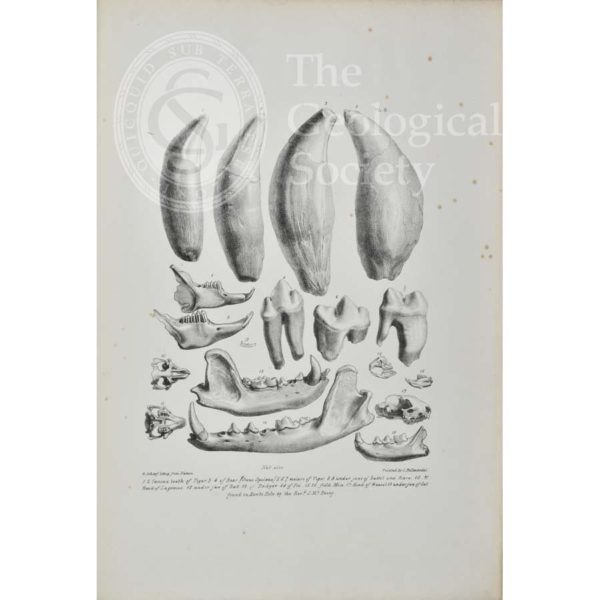
Teeth of tigers and bears, with jaws from a rabbit, hare, bat, badger, fox, field mice, weasel and cat from Kent’s Cavern
Jaws of bears found in Kent’s Cavern
Jaws and teeth of a tiger, bear and hyaena from Kent’s Cavern
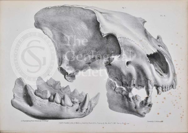
Skull of a hyaena from Kent’s Cavern
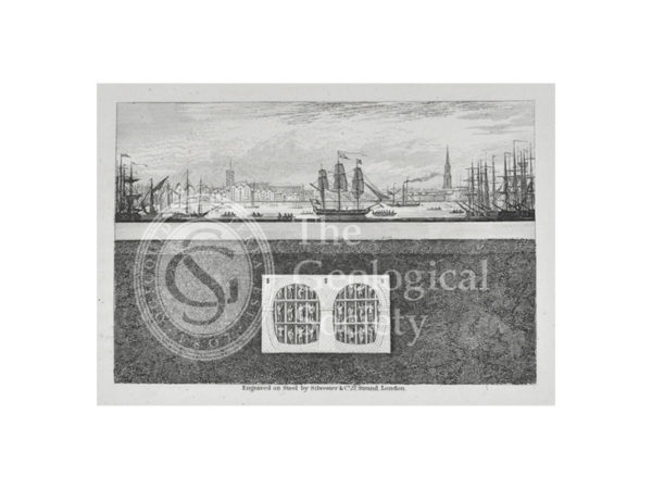
Cross section showing the progress of the Thames Tunnel under the Thames in 1838
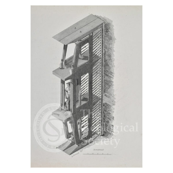
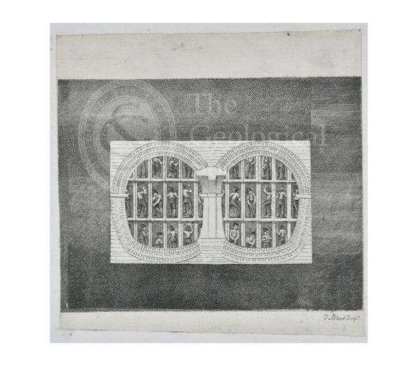
Isometrical view of Marc Brunel’s patent shield
Workmen excavating the Thames Tunnel protected by Brunel’s patent shield
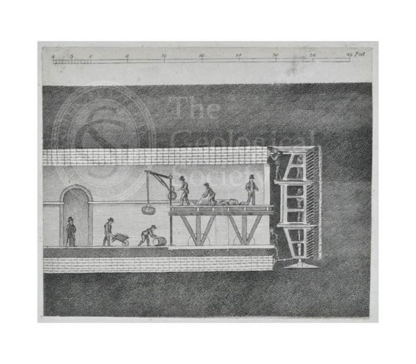
Cross section of the workmen excavating the Thames Tunnel
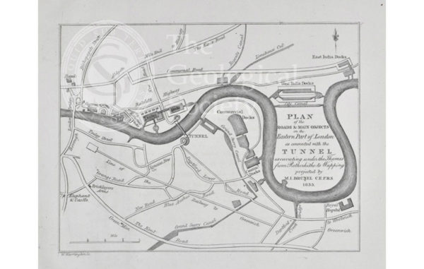
Plan of the roads & main objects on the Eastern Part of London as connected with the [Thames] Tunnel, 1835
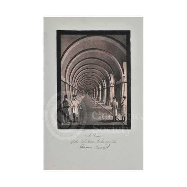
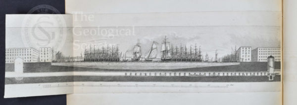
View of the Western Archway of the Thames Tunnel
Section showing the construction of the Thames Tunnel in progress
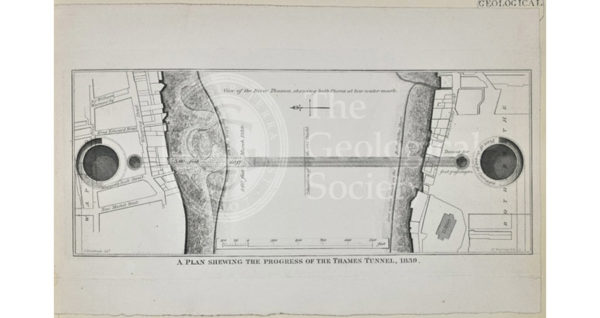
Plan shewing the progress of the Thames Tunnel, 1839
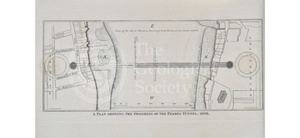
Plan shewing the progress of the Thames Tunnel, 1836
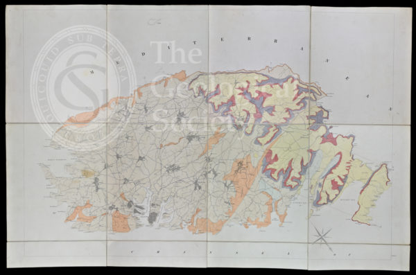
Geological map of Malta (1856)
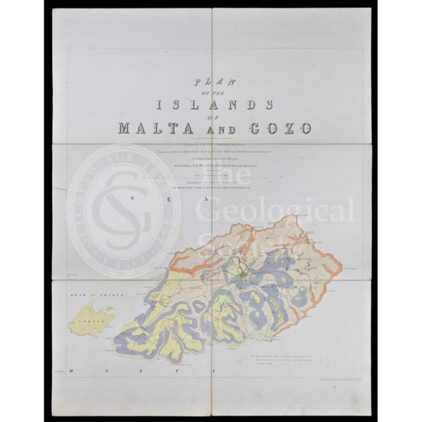
Geological map of Gozo and Cominos, Malta
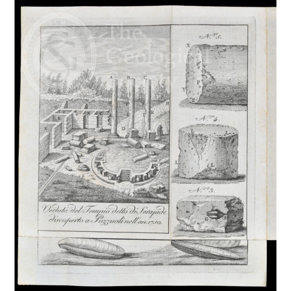
Temple of Serapis
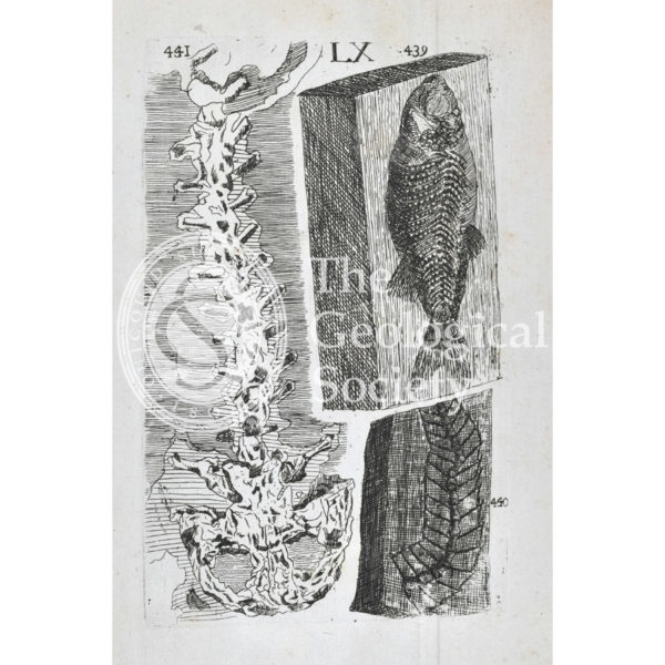
Homo diluvii testis
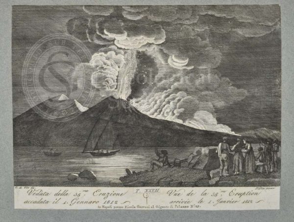
View of the 35th eruption of Mount Vesuvius, 1 January 1812
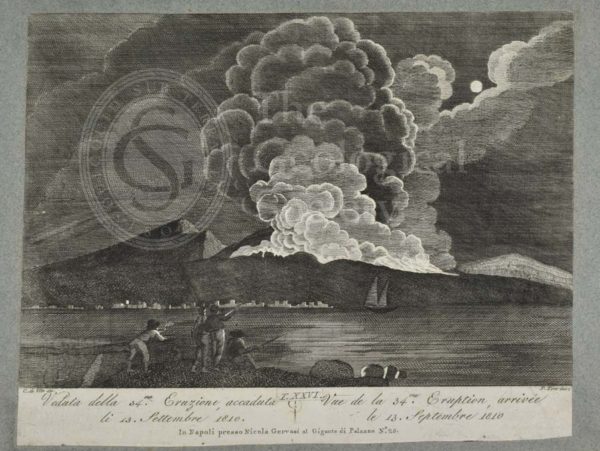
View of the 34th eruption of Mount Vesuvius, 13th September 1810
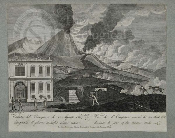
View of the eruption of Mount Vesuvius, 12 August 1805
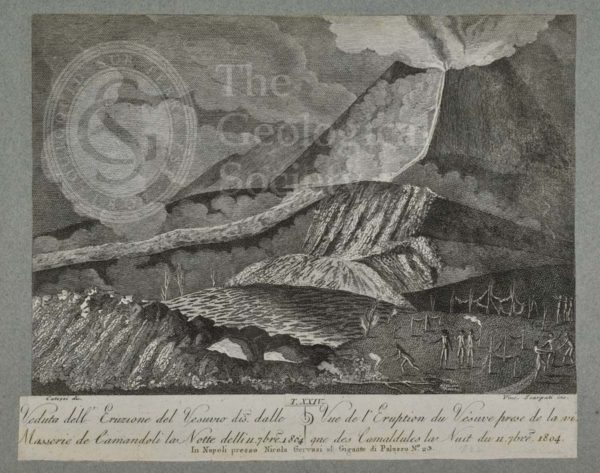
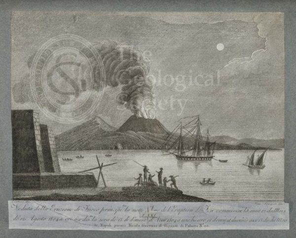
View of the eruption of Vesuvius on the night of 11 September 1804
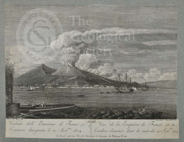
View of the eruption of smoke and ash from Mount Vesuvius, 11 September 1804
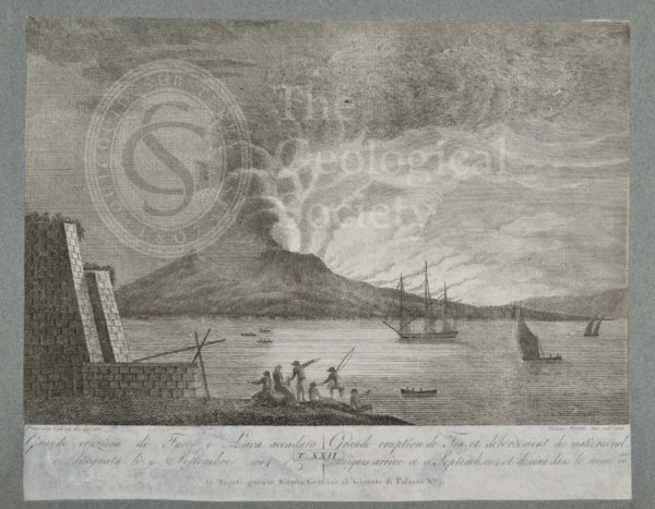
Great eruption of fire and lava from Mount Vesuvius, 9 September 1804
View of the eruption of Vesuvius which began in the night of 12 August 1804
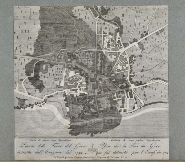
Plan of the Torre del Greco destroyed by the eruption of 1794
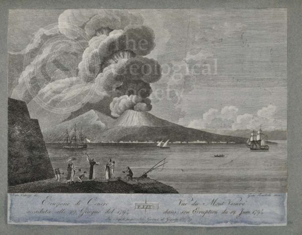
Eruption of ash from Mount Vesuvius, 19 June 1794
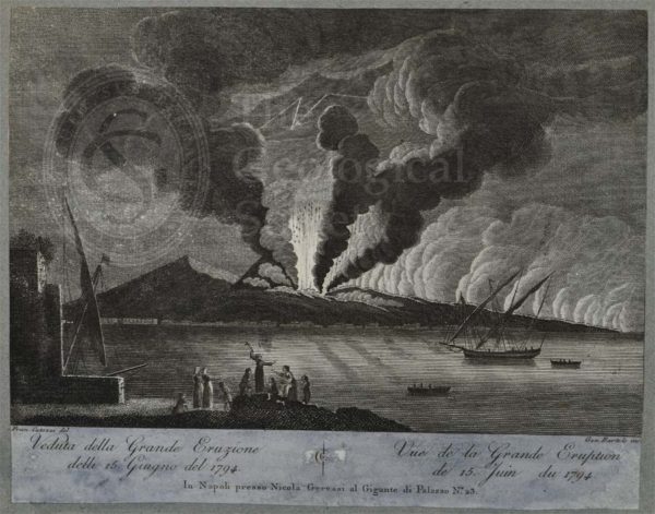
View of great eruption of Mount Vesuvius, 15 June 1794
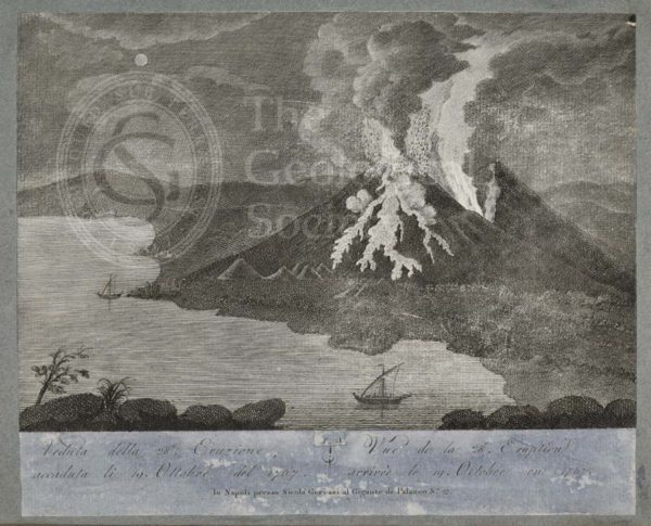
View of 28th eruption of Mount Vesuvius, 19 October 1767
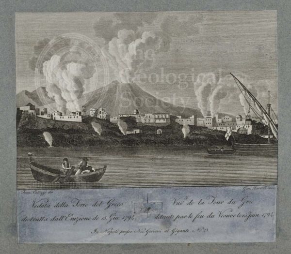
View of Torre del Greco destroyed by the eruption of 15 June 1794
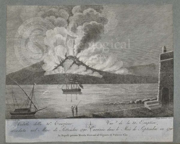
View of 31st eruption of Mount Vesuvius, September 1790
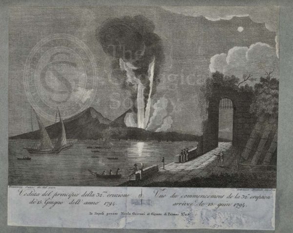
View of beginning of the 32nd eruption of Mount Vesuvius, 15 June 1794
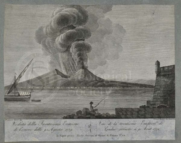
View of 30th eruption of ash of Mount Vesuvius, 9 August 1779
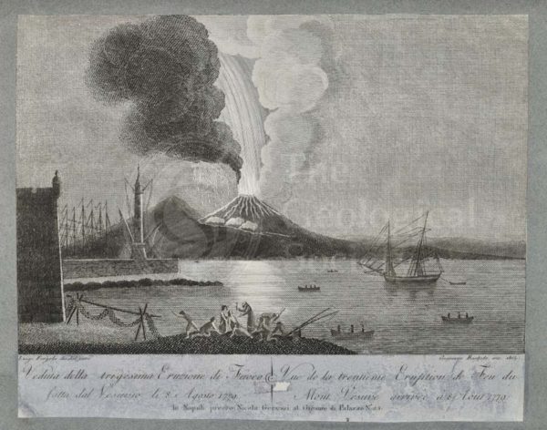
View of the 30th eruption of Mount Vesuvius, 8 August 1779
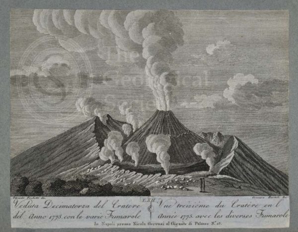
View of the crater of Mount Vesuvius, 1775
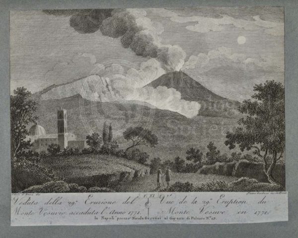
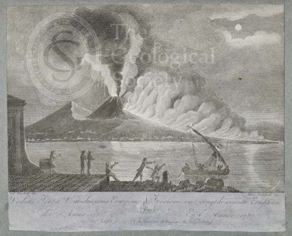
View of the 29th eruption of Mount Vesuvius, 1771
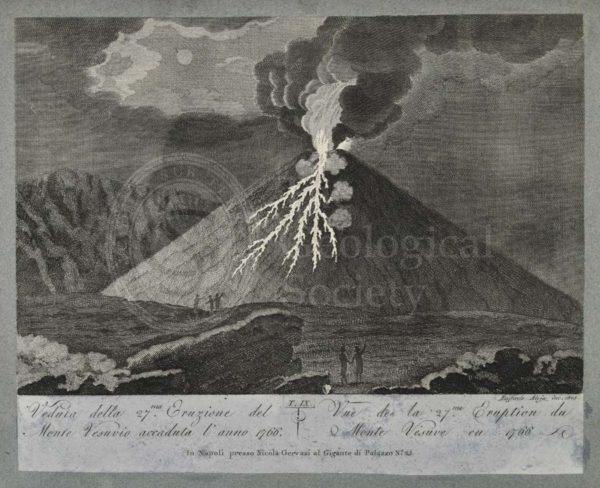
View of the 27th eruption of Mount Vesuvius, 1766
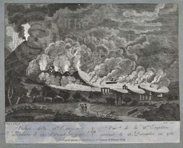
View of the 26th eruption of Mount Vesuvius, 23 December 1760
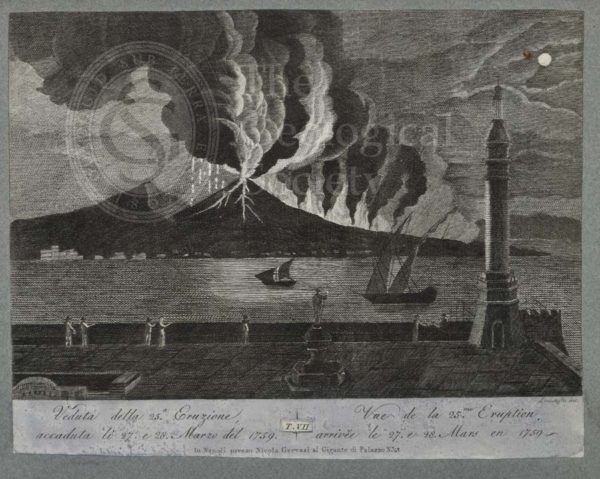
View of the 25th eruption of Mount Vesuvius, 27 and 28 March 1759
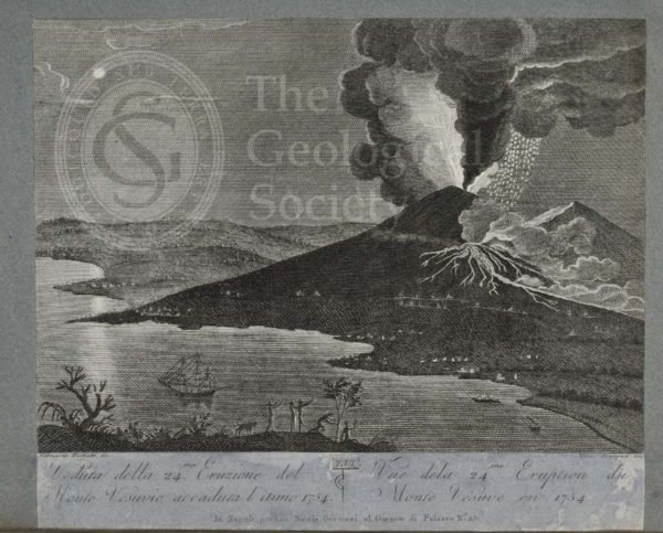
View of the 24th eruption of Mount Vesuvius, 1754
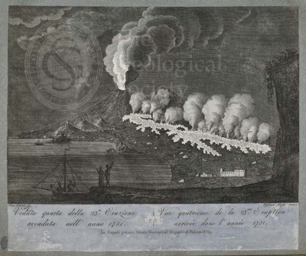
View of the 23rd eruption of Mount Vesuvius, 1751, taken from the south side
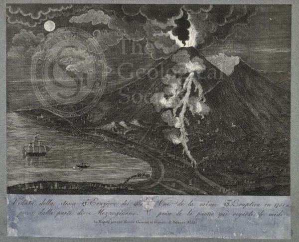
View of the 23rd eruption of Mount Vesuvius, 1751
View of the 22nd eruption of Mount Vesuvius, 1737
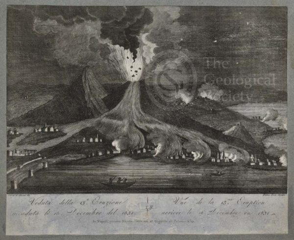
View of the 13th eruption of Mount Vesuvius, 16 December 1631
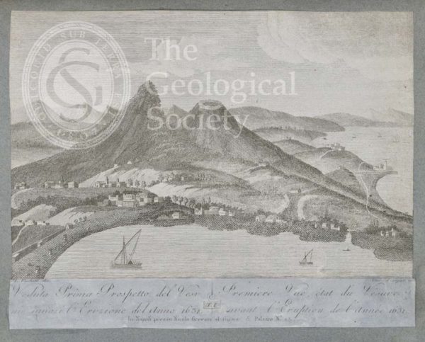
View of Mount Vesuvius before the eruption of 1631
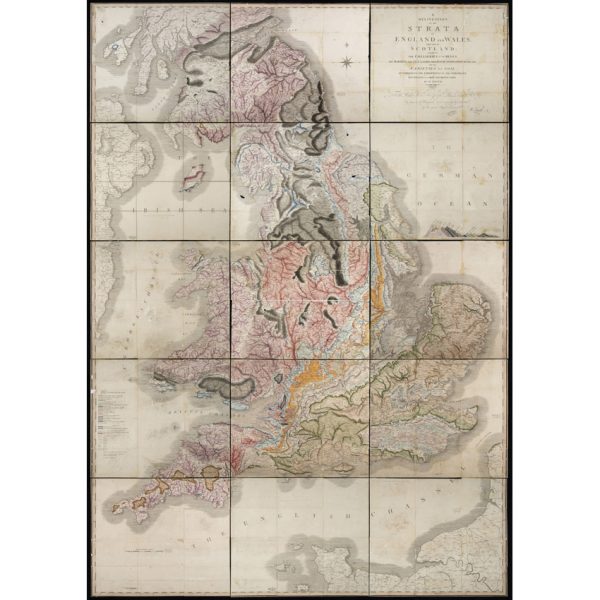
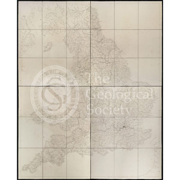
‘A Delineation of the Strata of England and Wales, with part of Scotland… (1815)
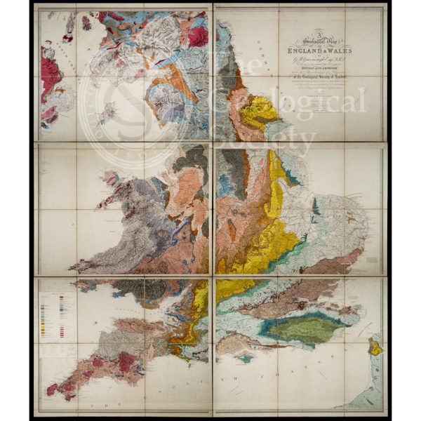
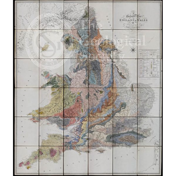
‘Geological Map of England and Wales’ (1865) 3rd edition
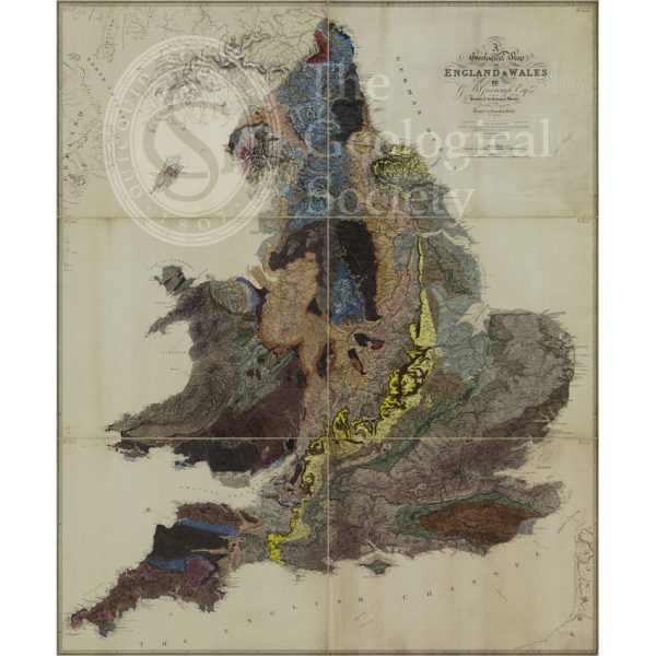
Greenough’s ‘Geological Map of England and Wales’ – uncorrected proof before mountains [1818]
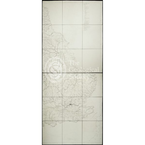
Greenough’s ‘Geological Map of England and Wales’ – earliest surviving proof [1816]
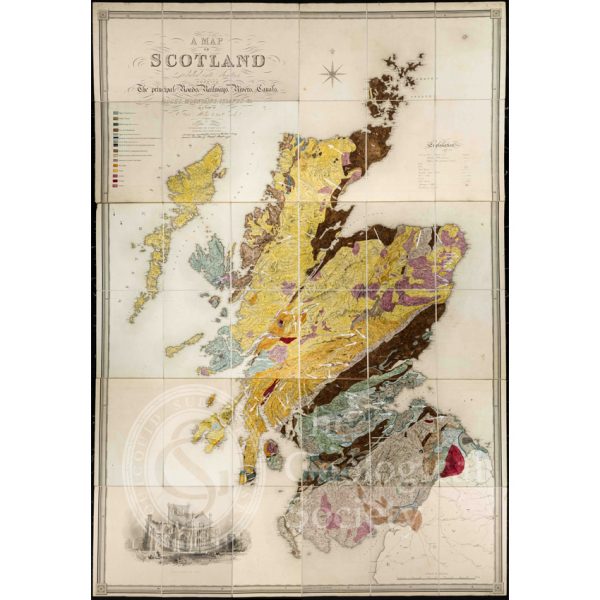
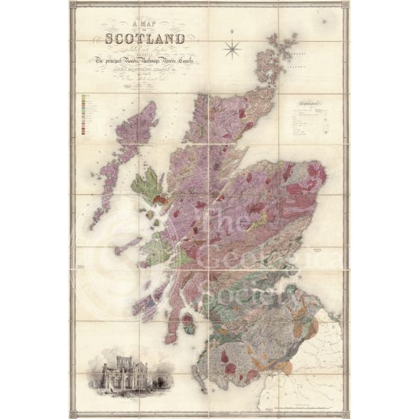
Greenough’s and Sharpe’s Geological Map of Scotland [1852] – final copy
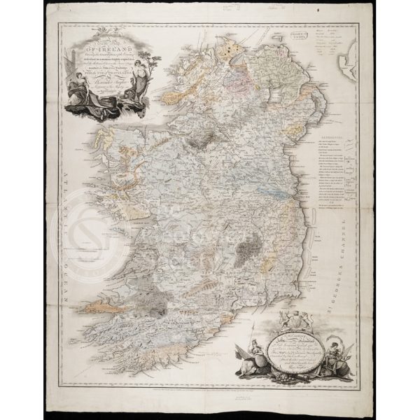
Earliest geological map of Ireland [?1814]
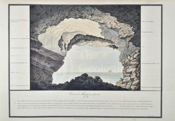
‘Cavern at Thompson’s Point’, St Helena
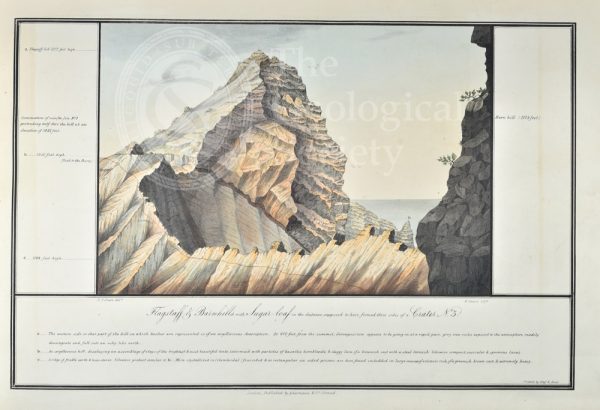
‘Flagstaff & Barnhills with Sugar-loaf in the distance…’, St Helena
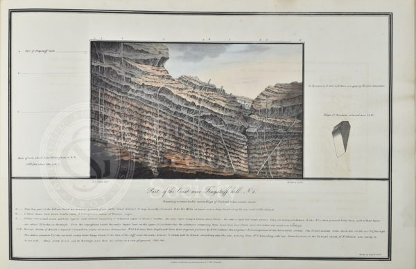
‘Part of the Coast near Flagstaff hill’, St Helena
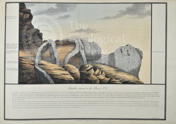
‘Basaltic strata in the Barn’, St Helena
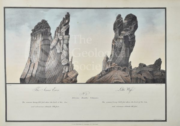
‘The Asses Ears’ & ‘Lott’s Wife’, St Helena
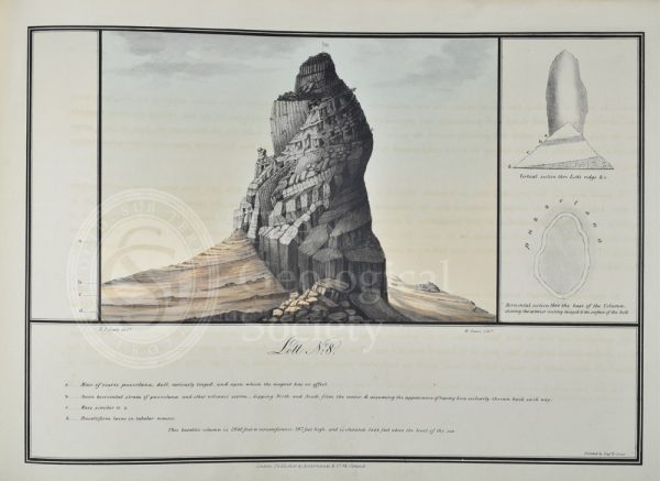
‘Lott’, St Helena
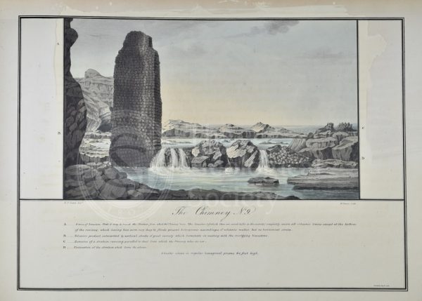
‘The Chimney’, St Helena
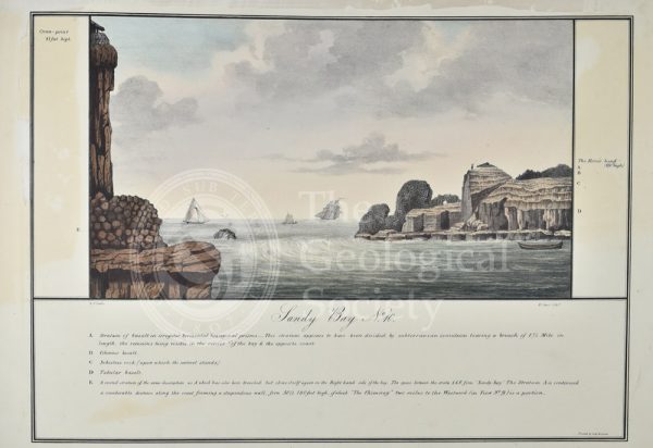
‘Sandy Bay’, St Helena
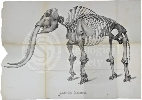
Mastodon giganteus
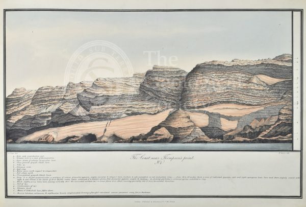
Coast near Thomson’s Point, St Helena
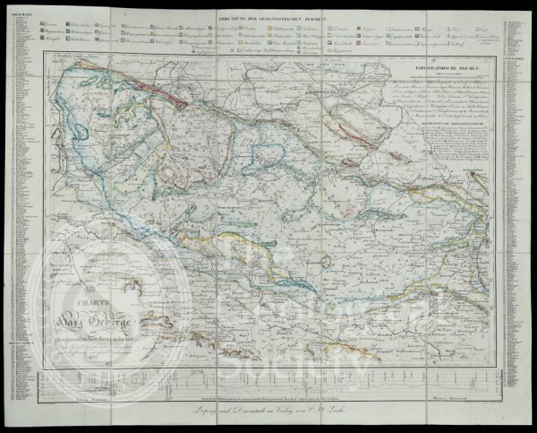
Geognostic map of the Harz Mountains (1832)
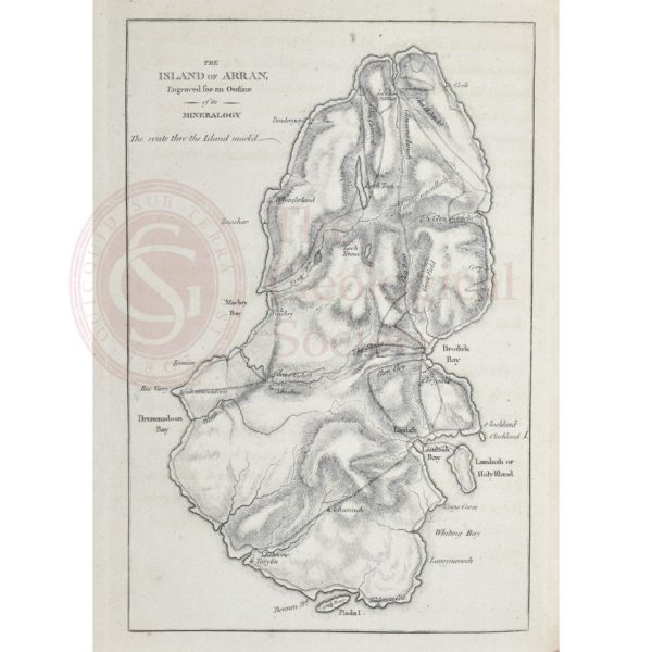
Island of Arran engraved for an outline of its mineralogy (1800)
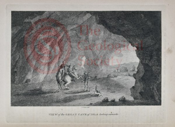
View of the Great Cave of Isla looking outwards
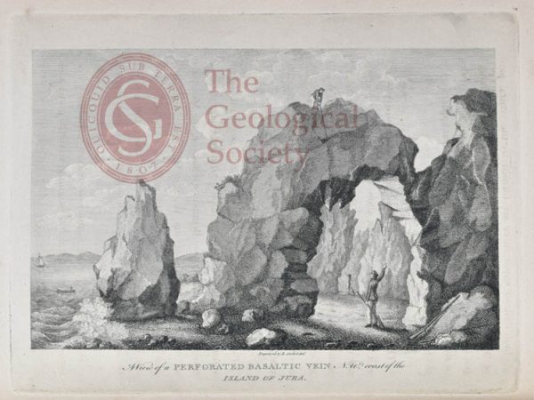
View of a perforated Basaltic Vein N W Coast of Jura
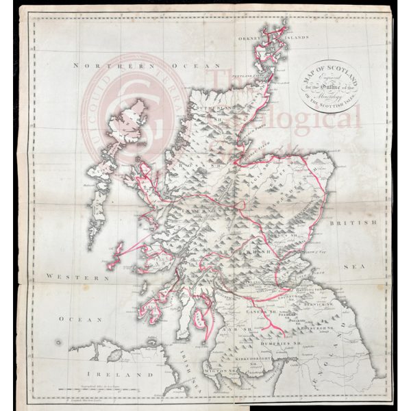
Jameson’s outline map of Scotland (1800)
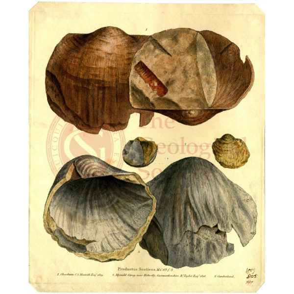
Productus scoticus
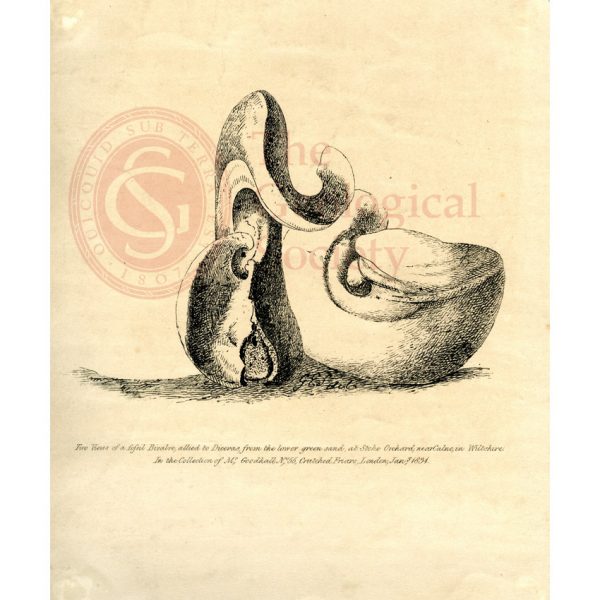
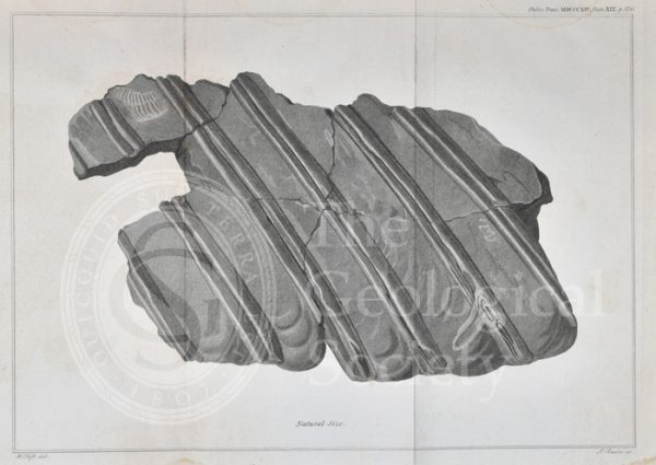
‘Two views of a fossil bivalve allied to Diceras…’
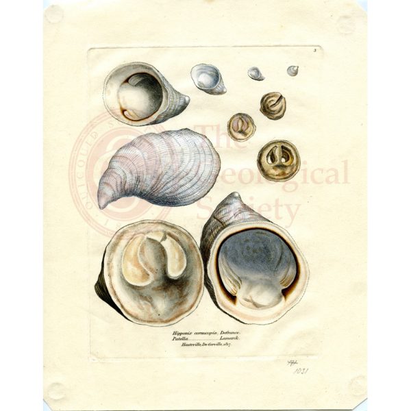
Hypponyx cornucopia & Patella, Hauteville, De Gerville
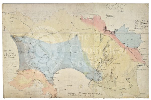
Draft of the first geological map of Jersey [c.1828]
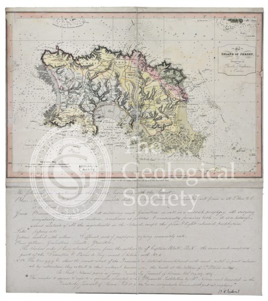
First geological map of Jersey [c.1828]
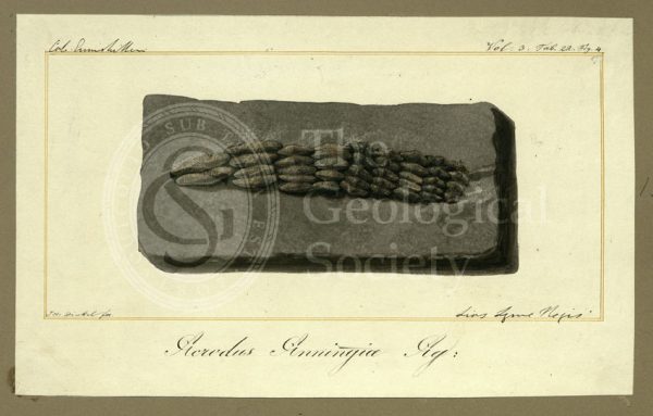
Teeth of Acrodus anningiae Agassiz
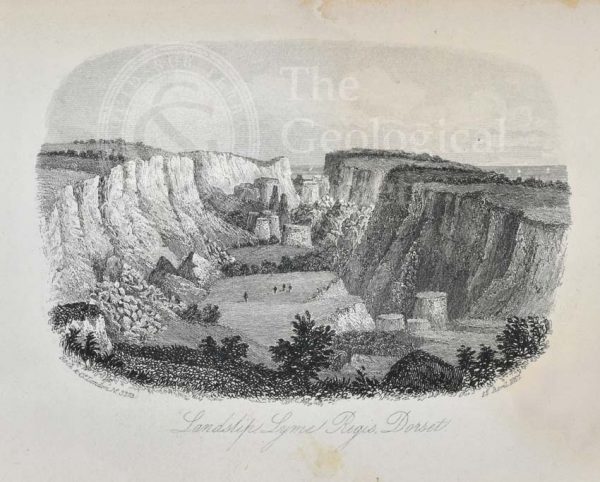
Landslip, Lyme Regis, Dorset
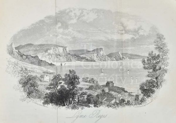
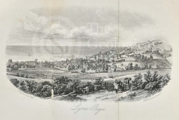
Lyme Regis
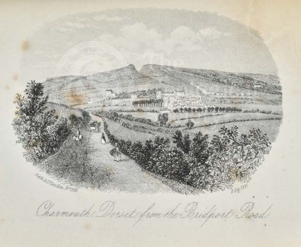
Charmouth, Dorset from the Bridport Road
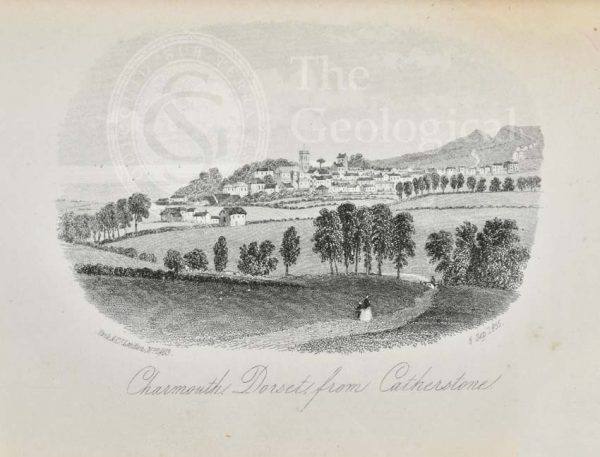
Charmouth, Dorset from Catherstone
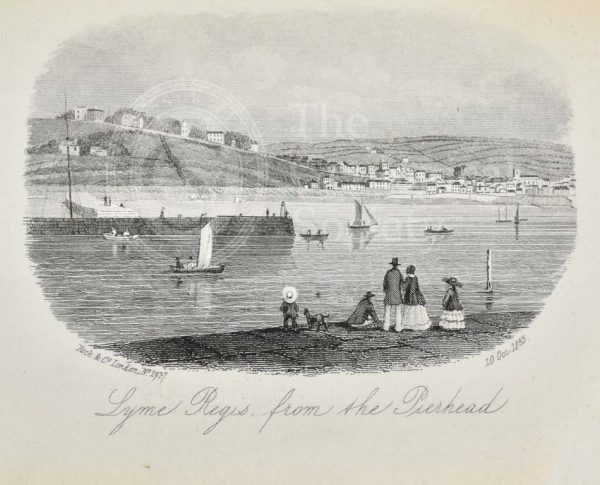
Lyme Regis, from Pierhead
View of Lyme Regis
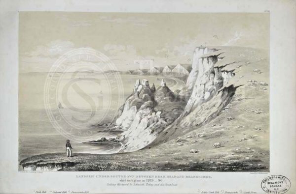
‘Landslip Under Southdown between Beer Head and Branscombe…’
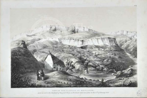
‘View of the Landslip from Whitlands…’
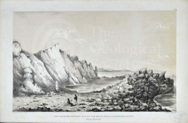
‘View from the Western End of the Beach near Culverhole Point…’
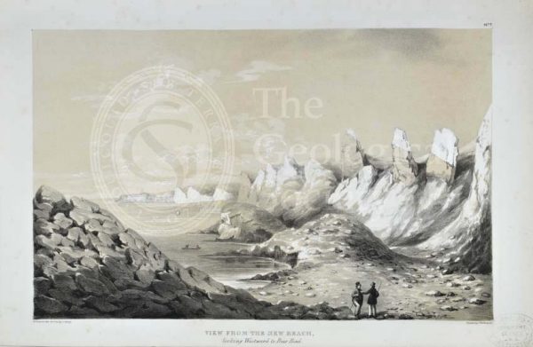
‘View from the New Beach looking Westward to Beer Head’
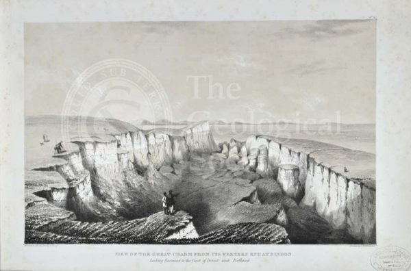
‘View of the Great Chasm from its Western end at Bindon…’
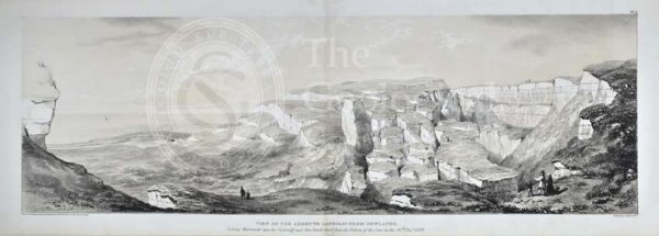
‘View of the Axmouth Landslip from Dowlands…’
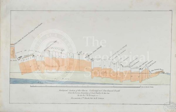
‘Geological section of the Chasm, Undercliff and New Raised Beach from the Eastern boundary of Great Bindon to the sea’
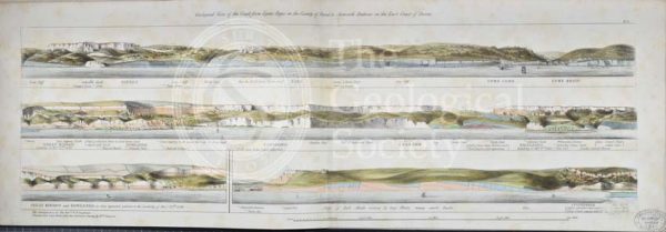
‘Geological view of the coast from Lyme Regis…to Axmouth Harbour…’
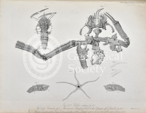
Coleia Antiqua
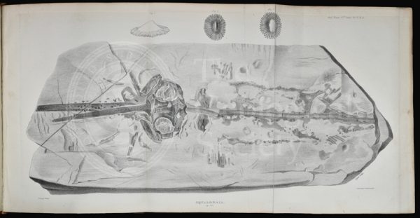
‘Squaloraia’ [lithograph]
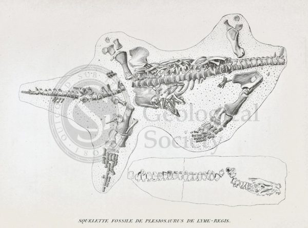
Skeleton of a Plesiosaur from Lyme Regis
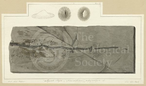
Tail of Squalo-raja (Spinacorhinus) polyspondila Agassiz
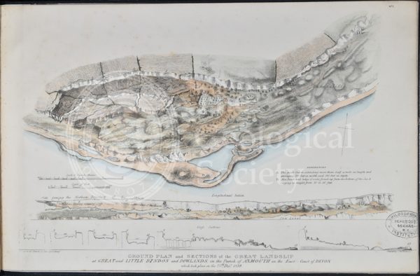
Ground plan and sections of the Great Landslip at Great and Little Bindon and Dowlands…
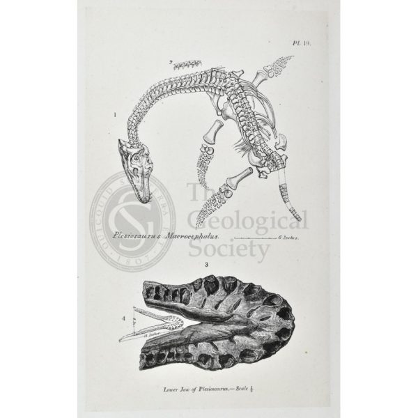
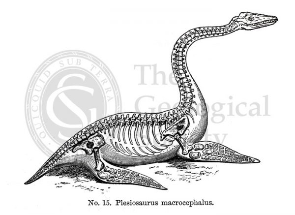
Plesiosaurus macrocephalus
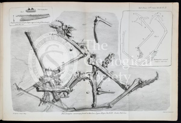
Pterodactylus macronyx
Dimorphodon macronyx
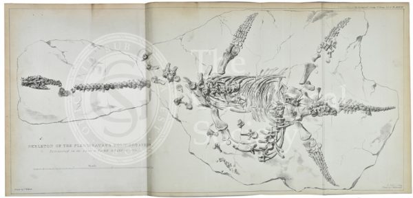
Plesiosaurus dolichodeirus
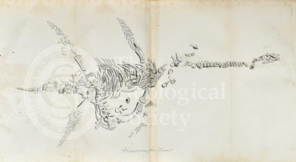
Plesiosaurus from Lyme Regis
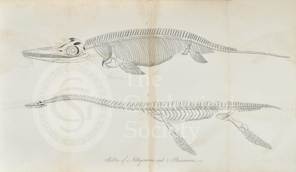
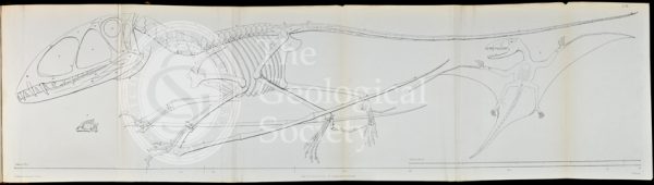
‘Skeleton of Ichthyosaurus and Plesiosaurus’
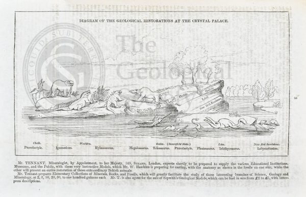
Diagram of the geological restorations at Crystal Palace
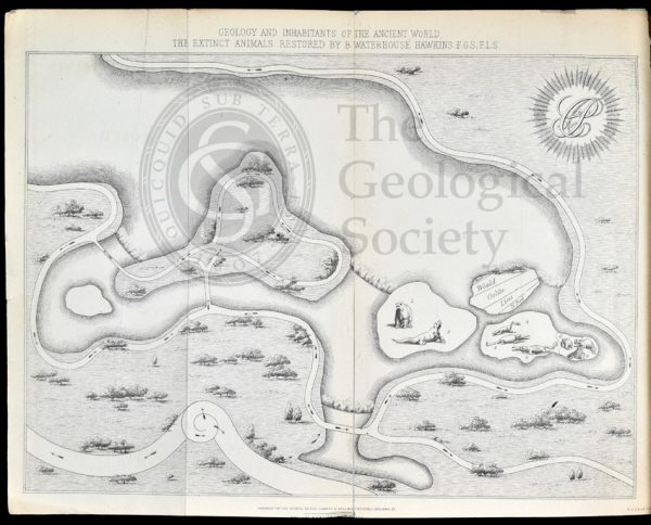
Map of Crystal Palace Park (1854)
Reconstruction of Plesiosaurus macrocephalus
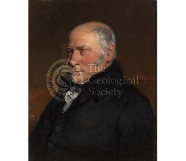
William Smith (1769-1839)

Mary Anning (1799-1847)
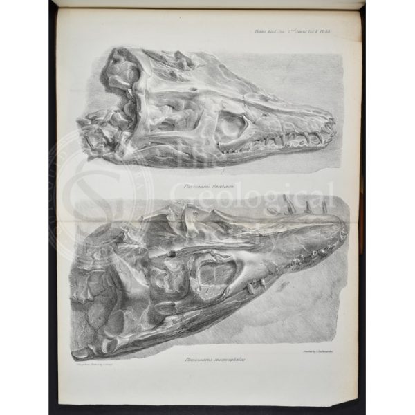
Skulls of Plesiosaurus hawkinsii and Plesiosaurus macrocephalus
Ribs of an ichthyosaur
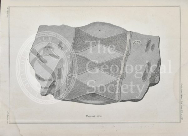
Section through the vertebrae of an ichthyosaur
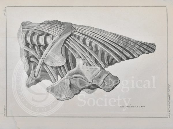
Vertebrae and ribs of an ichthyosaur
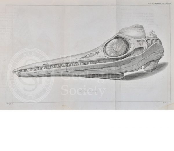
Head of an ichthyosaur
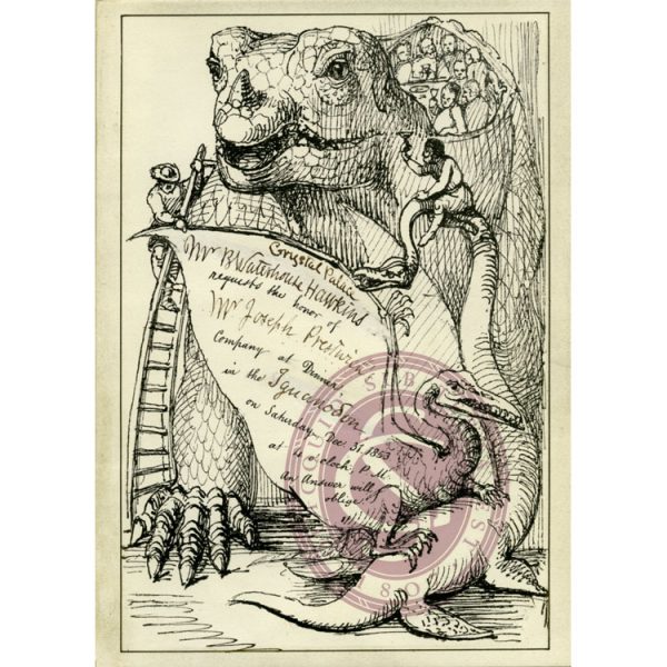
Invitation to the Dinner in the Iguanodon, Crystal Palace
Scharkathal near Prague at the time of the Mammoth
Northern Bohemia during the time of lignite formation (Tertiary)
The White Mountain (Bílá hora) during the Cretaceous
At the foot of the Riesengebirges (Krkonoše) during the Permian
Environs of Radnitz during the Coal Formation (Upper Carboniferous)
Kuchelbad near Prague during the Upper Silurian
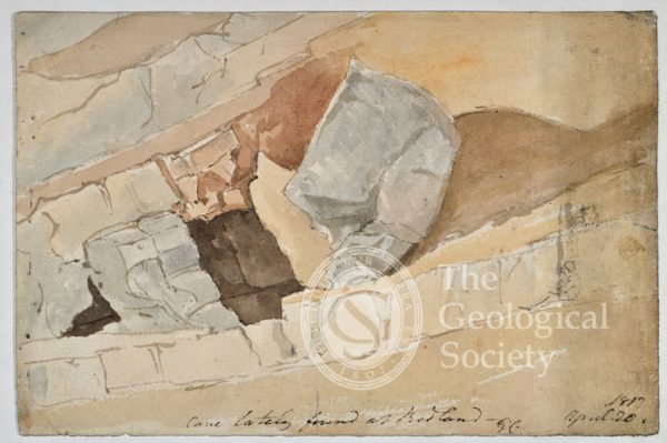
‘Cave lately found at Redland’
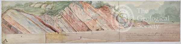
Long section probably showing limestone strata around Bristol
‘Sandstone at the new cut, River Avon, Bristol’
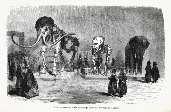
Skeleton of the Mammoth in the St Petersburg Museum
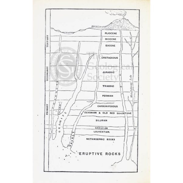
Geological timescale (1867)
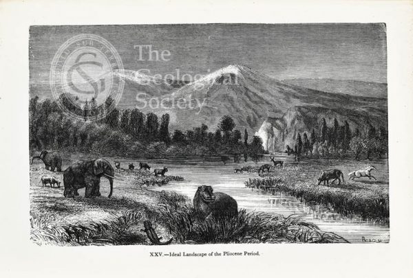
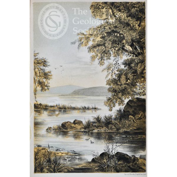
Ideal landscape of the Pliocene Period
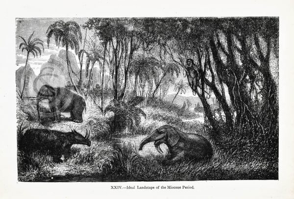
Ideal landscape of the Miocene Period
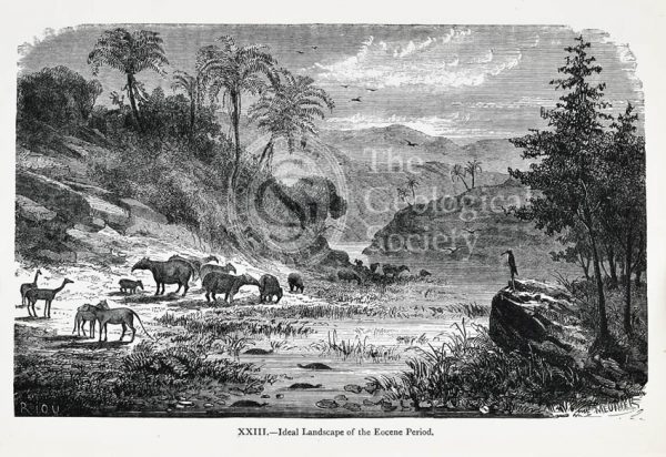
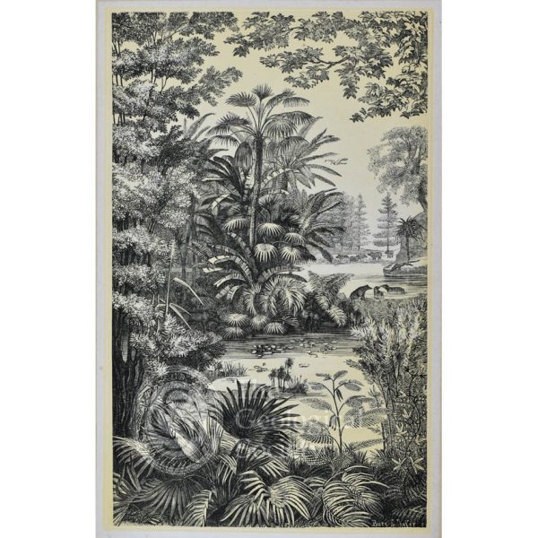
Ideal landscape of the Eocene Period
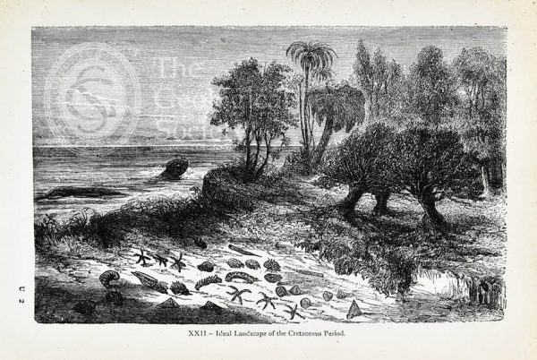
Ideal landscape of the Cretaceous Period
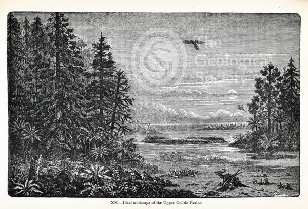
Ideal landscape of the Upper Oolitic Period
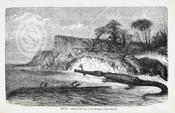
Ideal landscape of the Middle Oolitic Period
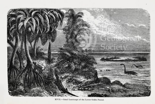
Ideal landscape of the Lower Oolite Period
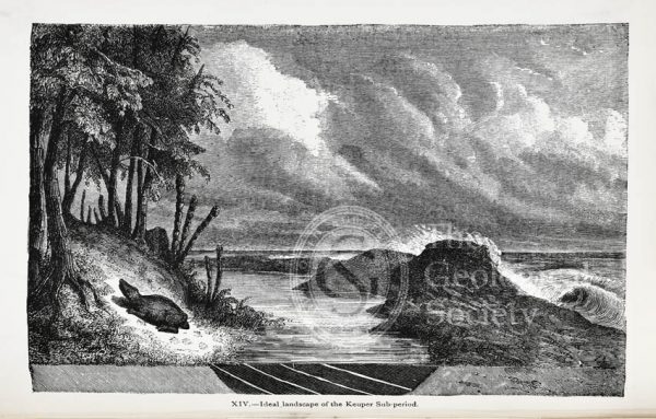
Ideal landscape of the Keuper Sub-period
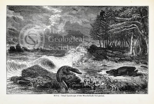
Ideal landscape of the Muschelkalk Sub-period
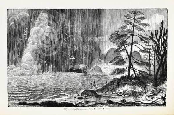
Ideal landscape of the Permian Period
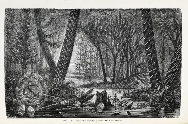
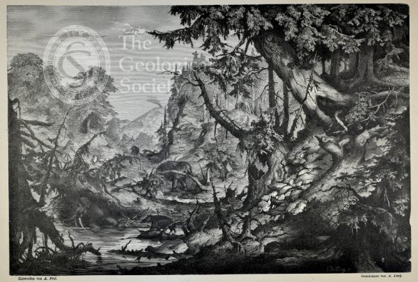
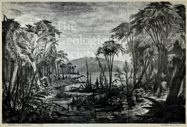
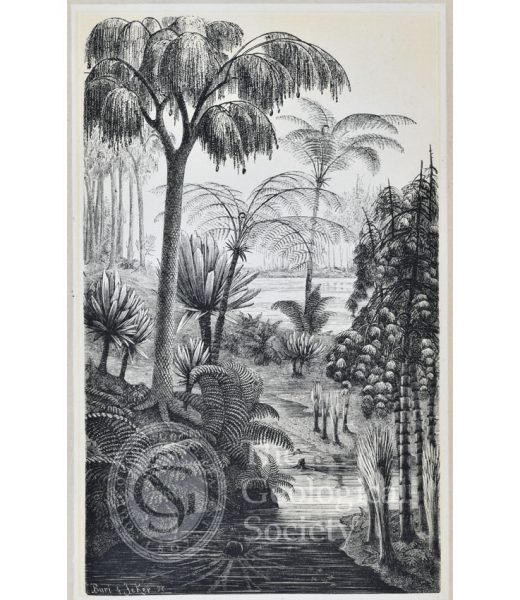
Ideal view of a marshy forest of the Coal Period
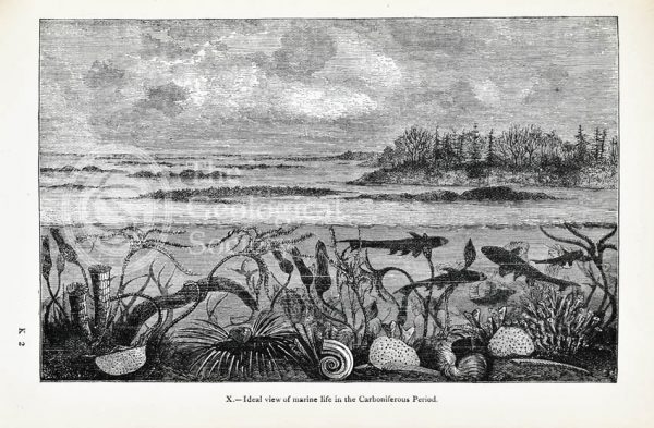
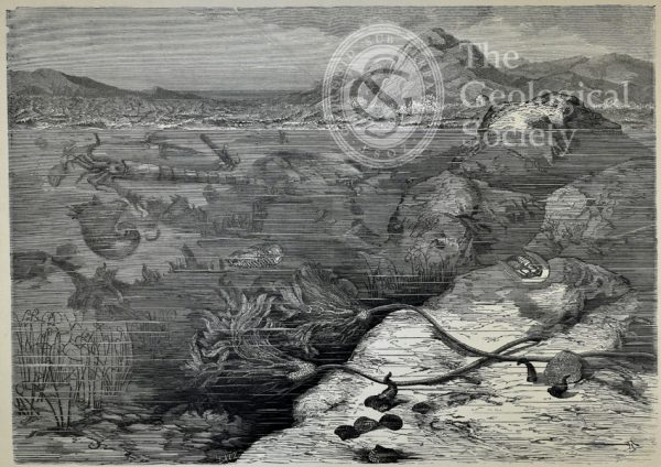
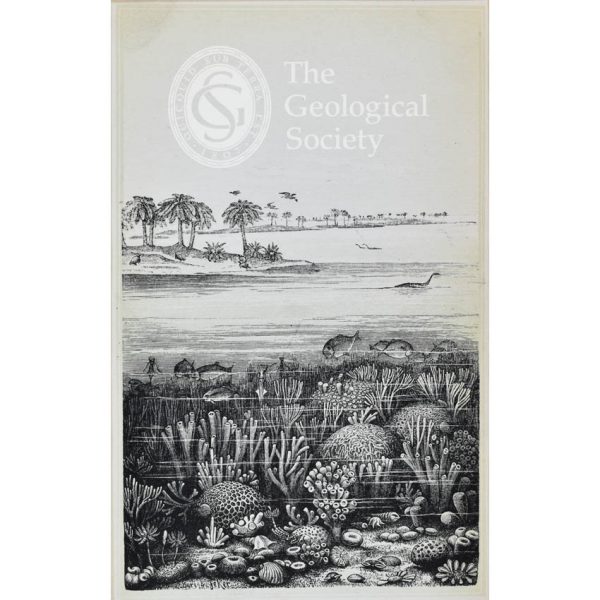
Ideal view of marine life in the Carboniferous Period
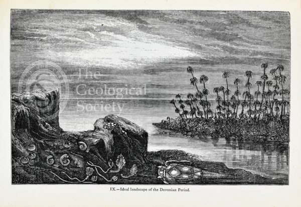
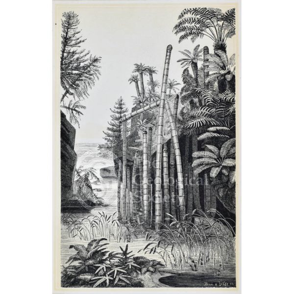
Ideal landscape of the Devonian Period
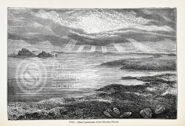
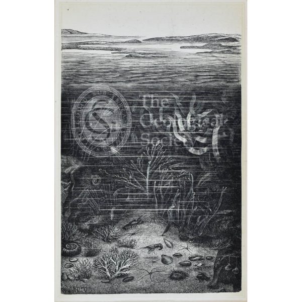
Ideal landscape of the Silurian Period
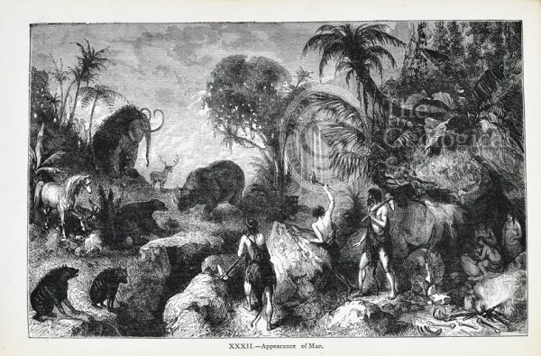
‘Appearance of Man’
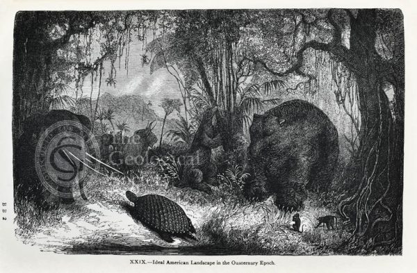
Ideal American landscape in the Quaternary Epoch
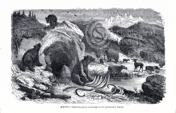
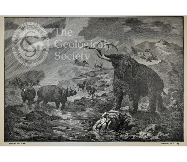
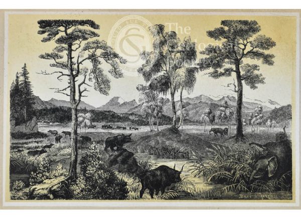
Ideal European landscape in the Quaternary Epoch
Dürnten during the formation of lignite
Lausanne during the Miocene Period
Life in the Miocene Period, Oeningen near Constance
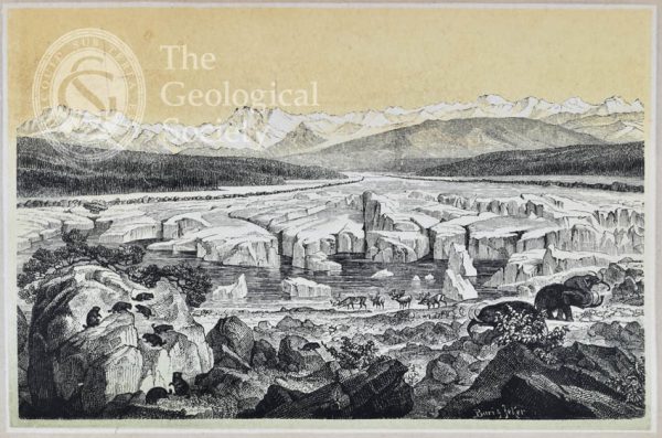
Zurich at the Glacial Period
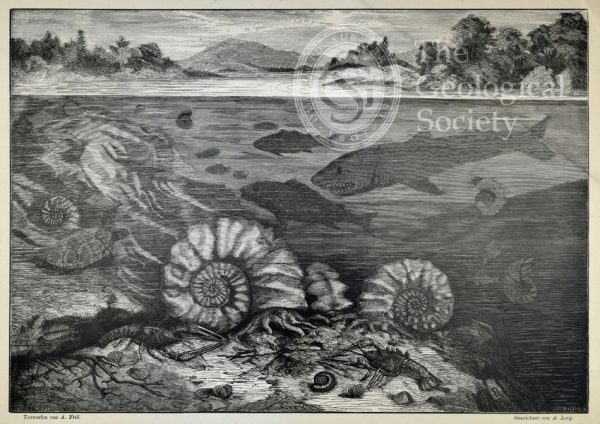
The coral islands of the Jura [Jurassic]
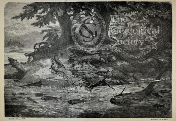
Submarine life of the Schambelen [Lower Jurassic]
Basle during the Keuper Period [Middle to Upper Triassic]
Carboniferous flora of Switzerland
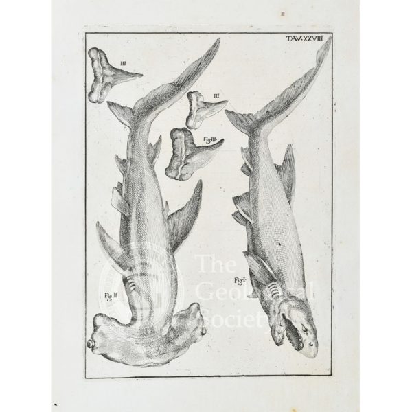
Hammerhead shark and white shark
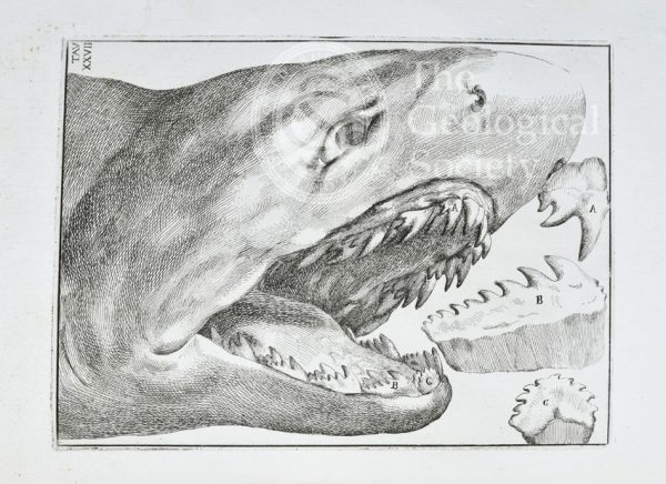
Shark’s head and teeth
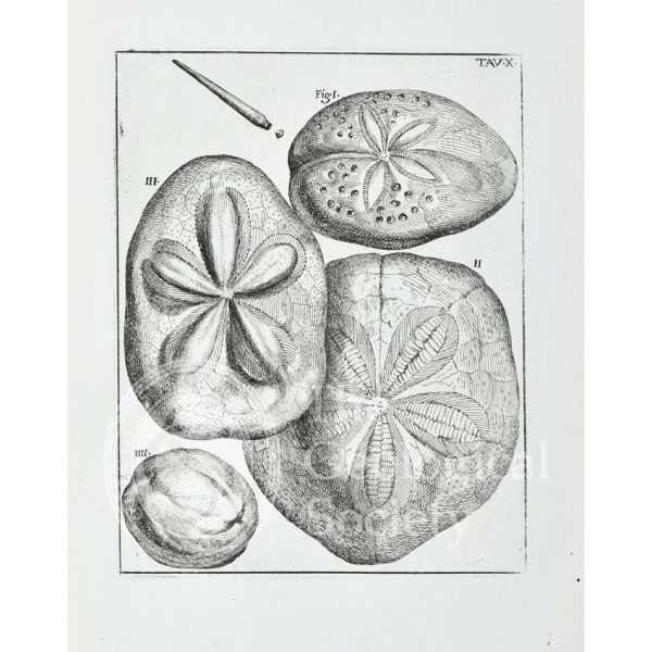
Sea urchins
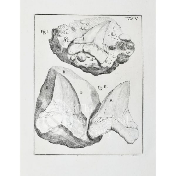
‘Glossopetra’ [Tongue stone]
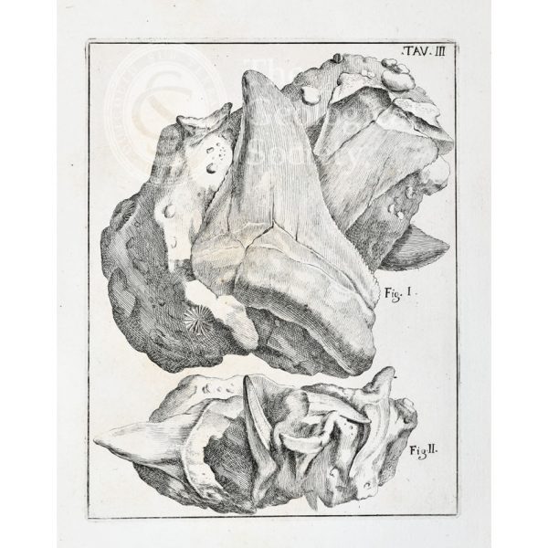
‘Glossopetrae’ [Tongue stones]
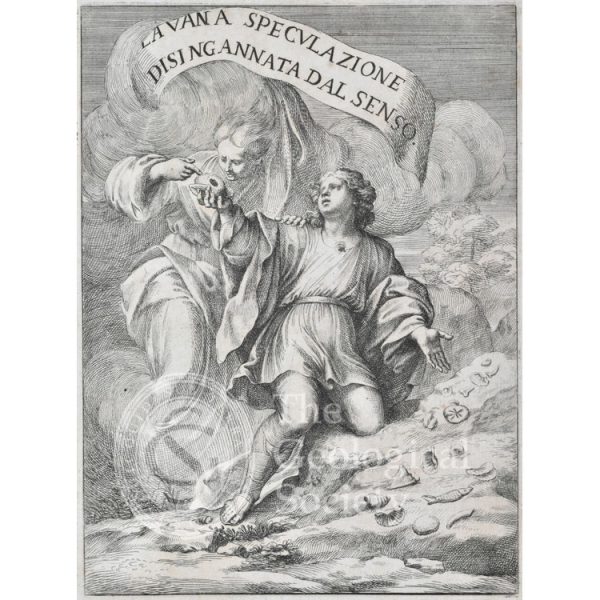
La vana speculazione disingannata dal senso
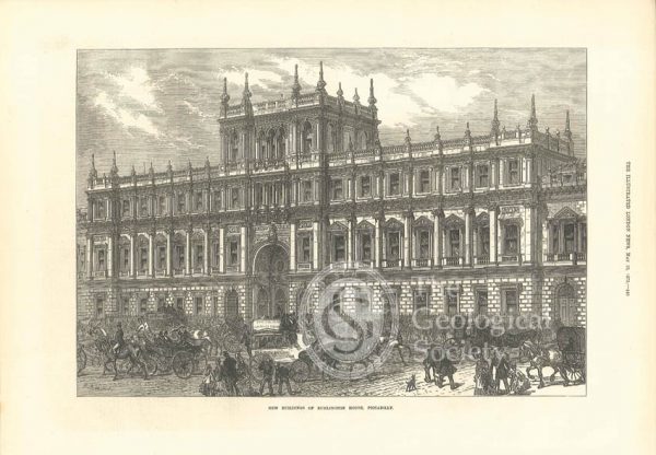
Burlington House, 1873
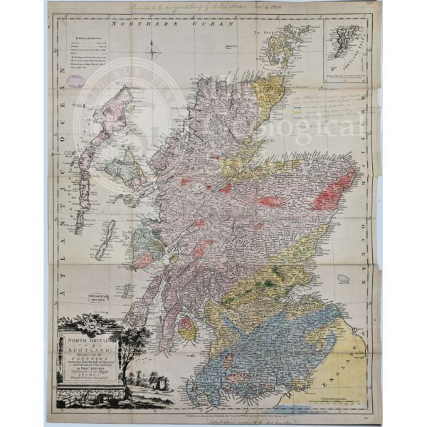
First Geological Map of Scotland [1808]
Greenough’s and Sharpe’s Geological Map of Scotland [1852] – draft
Geological Map of England and Wales [1839] 2nd edition
Geological Map of England and Wales (1820) 1st edition
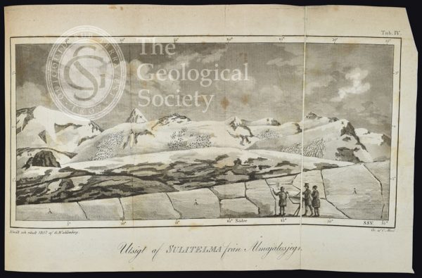
Utsigt af Sulitelma från Ålmajalosjegna’ (1807)
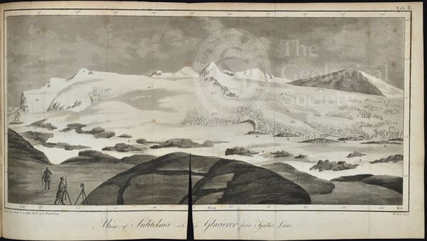
Utsigt af Sulitelma och dess glacierer från fjället Lairo (1807)
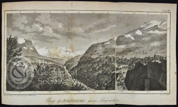
Ustigt af Sulitelma genom Langvandalen, Lapland (1807)
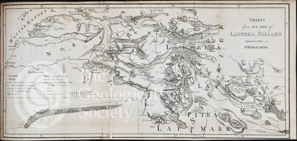
Charta õfver en del af Lappska Fjällen (1807)
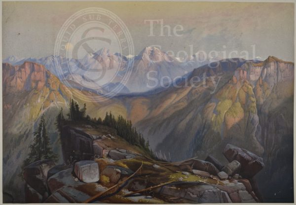
Lower Yellowstone Range
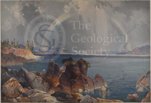
Yellowstone Lake
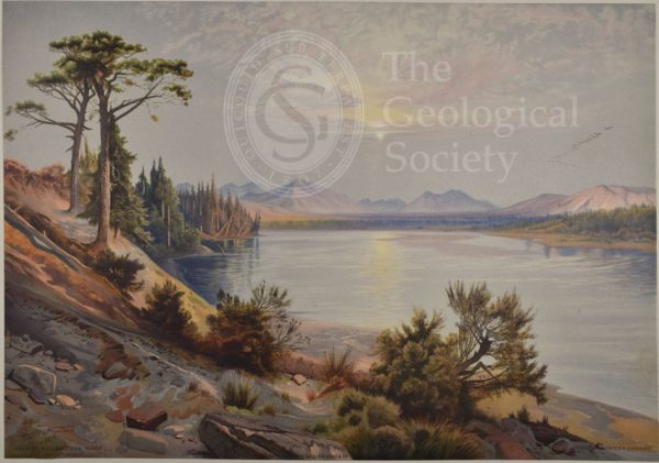
Head of Yellowstone River
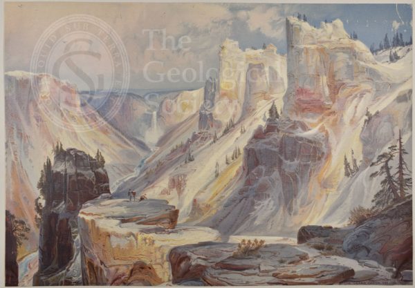
Grand Cañon, Yellowstone
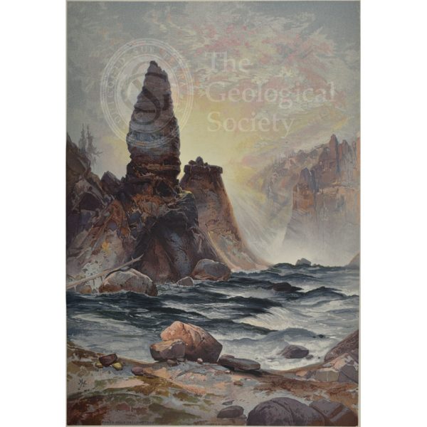
Towers of Tower Falls, Yellowstone
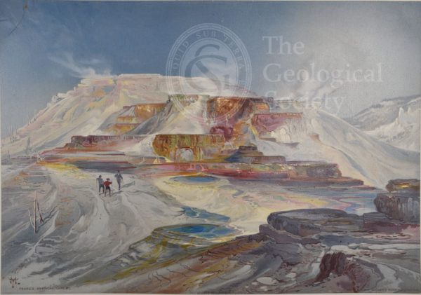
Hot springs of Gardiner’s River, Yellowstone
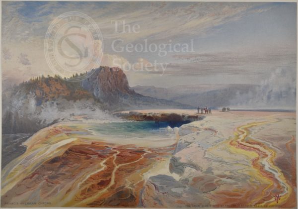
Great Blue Spring of the Lower Geyser Basin, Yellowstone
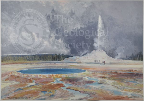
Castle Geyser, Upper Geyser Basin, Yellowstone
Mountain of the Holy Cross, Colorado
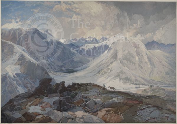
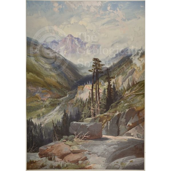
Mosquito Trail, Rocky Mountains of Colorado
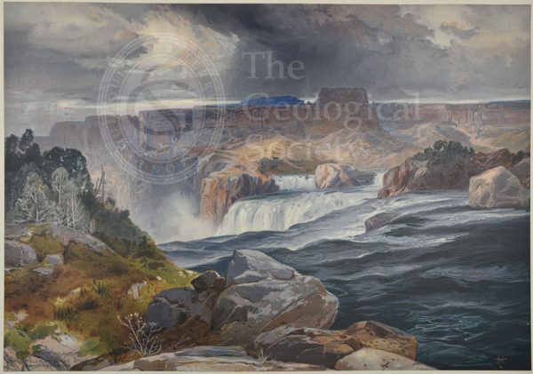
Great Falls of Snake River, Idaho Territory
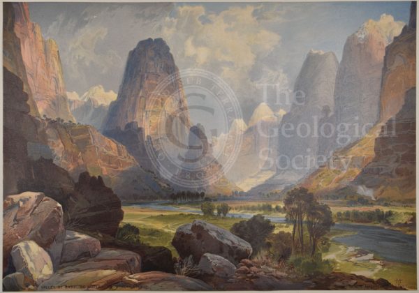
Valley of Babbling Waters, Southern Utah
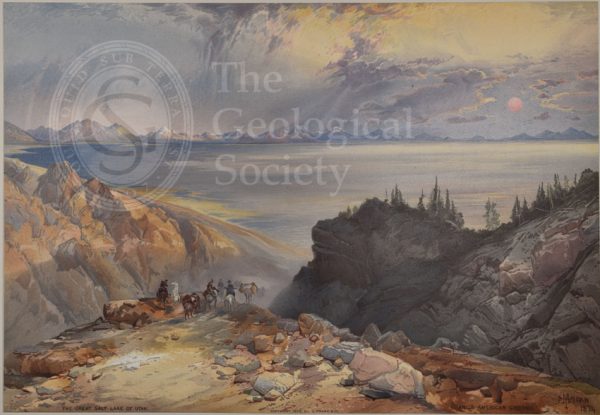
Great Salt Lake of Utah
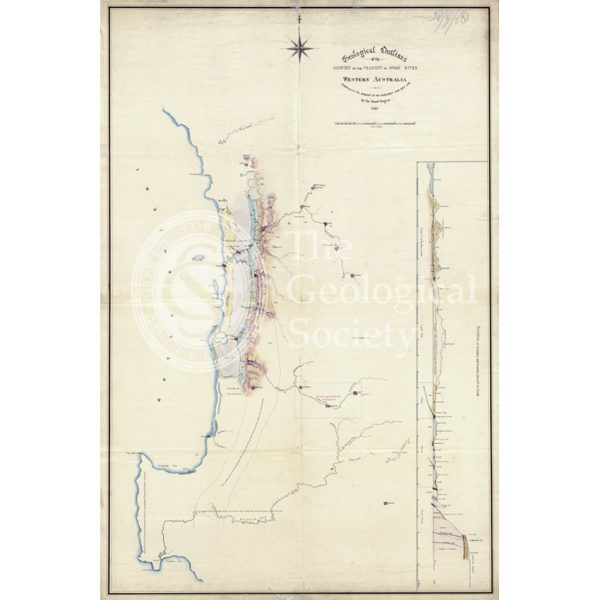
Map of the geology around Swan River, Western Australia
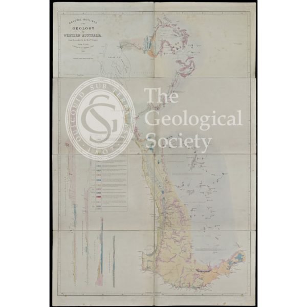
General Outlines of the Geology of Western Australia (Gregory, 1860)