
William Smith
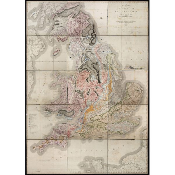
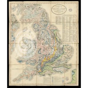
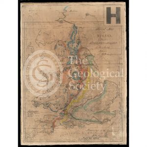
‘A Delineation of the Strata of England and Wales, with part of Scotland… (1815)
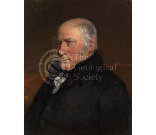
William Smith (1769-1839)
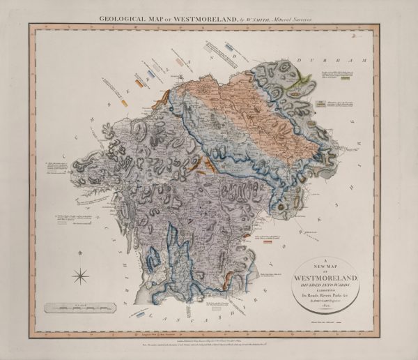
Geological Map of Westmoreland (William Smith, 1824)
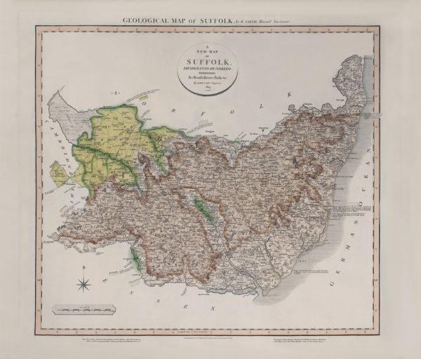
Geological Map of Suffolk (William Smith, 1819)
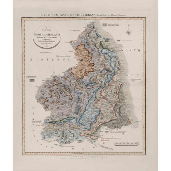
Geological Map of Northumberland (William Smith, 1824)
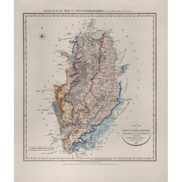
Geological Map of Nottinghamshire (William Smith, 1821)
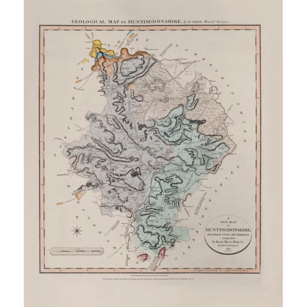
Geological Map of Huntingdonshire (William Smith, 1821)
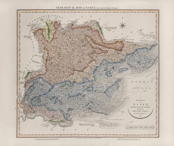
Geological Map of Essex (William Smith, 1820)
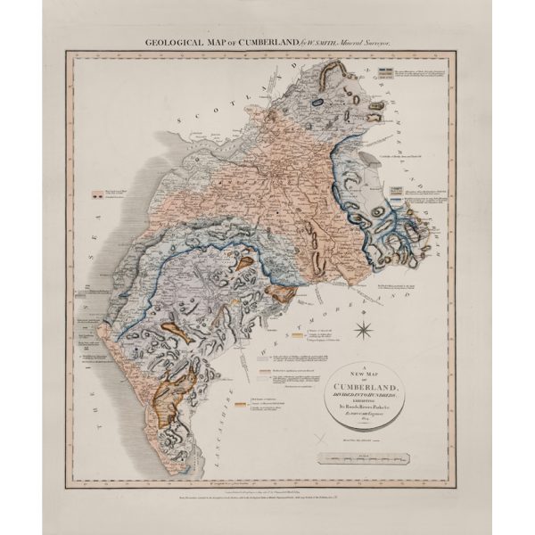
Geological Map of Cumberland (William Smith, 1824)
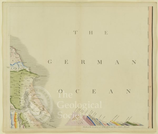
Plate VI [German Ocean]
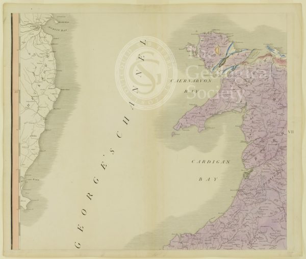
Plate VII [St George’s Channel]
Plate XV [France]
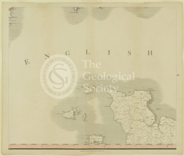
Plate XIV [English Channel]
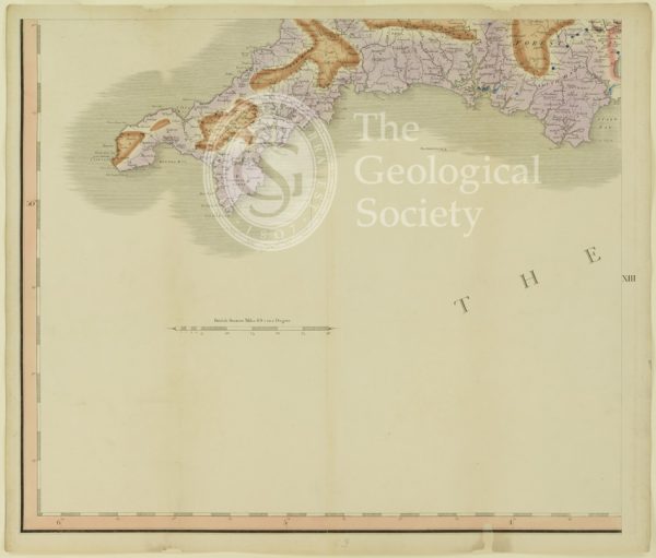
Plate XIII [Cornwall]
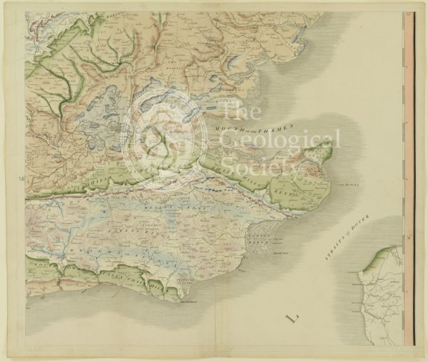
Plate XII [Kent]
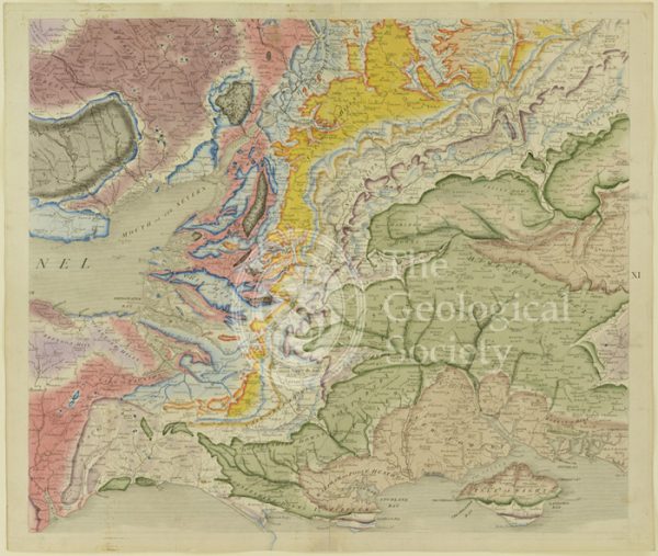
Plate X [Isle of Wight]
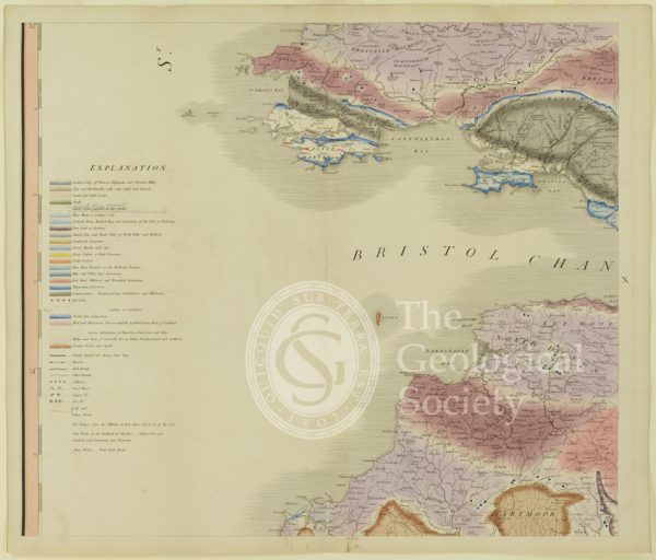
Plate X [Bristol Channel]
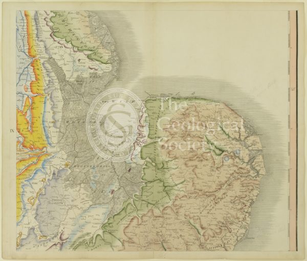
Plate IX [East Anglia]
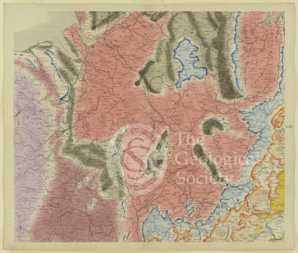
Plate VIII [Welsh border]
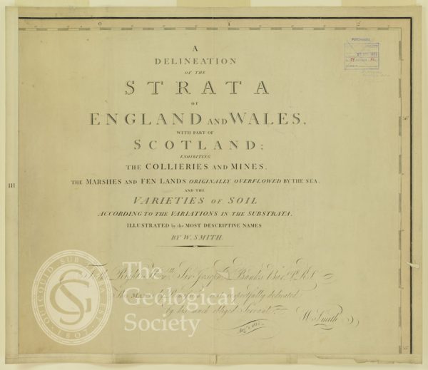
Plate III [Title page]
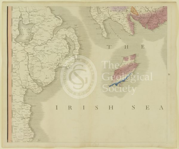
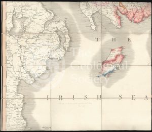
Plate IV [Irish Sea]
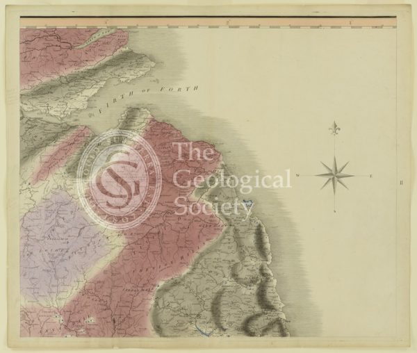
Plate II [Firth of Forth]
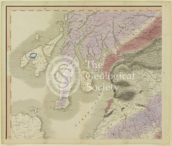
Plate I [Firth of Clyde]
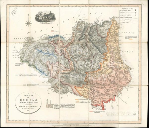
‘A New Map of Durham divided into Wards…’ (Smith, 1831)
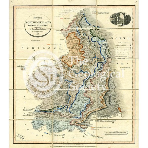
‘A New Map of Northumberland divided into Wards…’ (Smith, 1831)
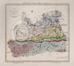
Geological Map of Surry (William Smith, 1819)
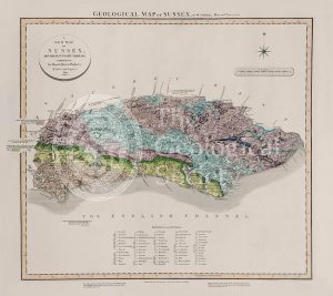
Geological Map of Sussex (William Smith, 1819)
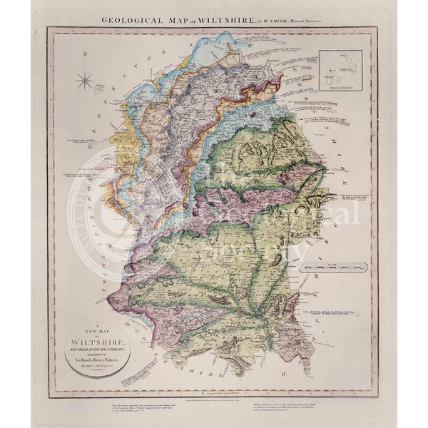
Geological Map of Wiltshire (William Smith, 1819)
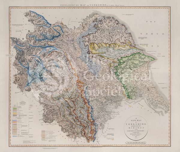
Geological Map of Yorkshire (William Smith, 1821)
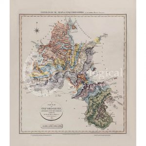
Geological map of Oxfordshire (William Smith, 1820)
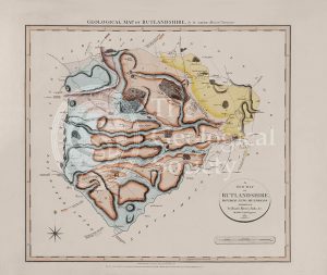
Geological Map of Rutlandshire (William Smith, 1822)
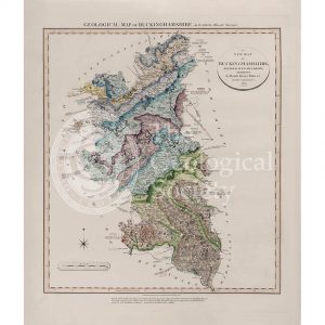
Geological Map of Buckinghamshire (William Smith, 1820)
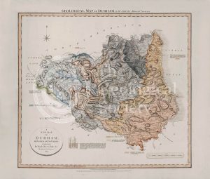
Geological Map of Durham (William Smith, 1824)
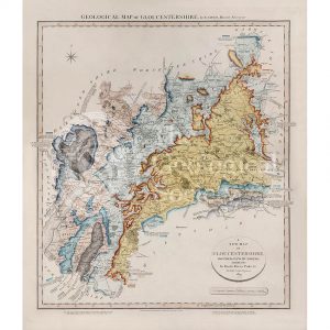
Geological Map of Gloucestershire (William Smith, 1819)
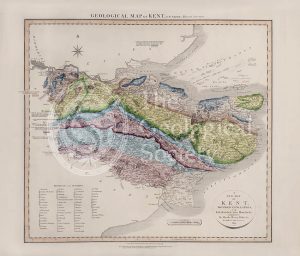
Geological Map of Kent (William Smith, 1819)
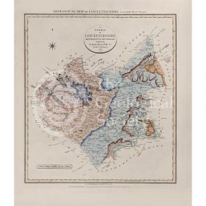
Geological Map of Leicestershire (William Smith, 1822)
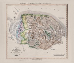
Geological Map of Norfolk (William Smith, 1819)
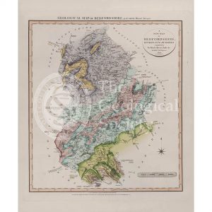
Geological Map of Bedfordshire (William Smith, 1820)
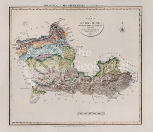
Geological Map of Berkshire (William Smith, 1819)
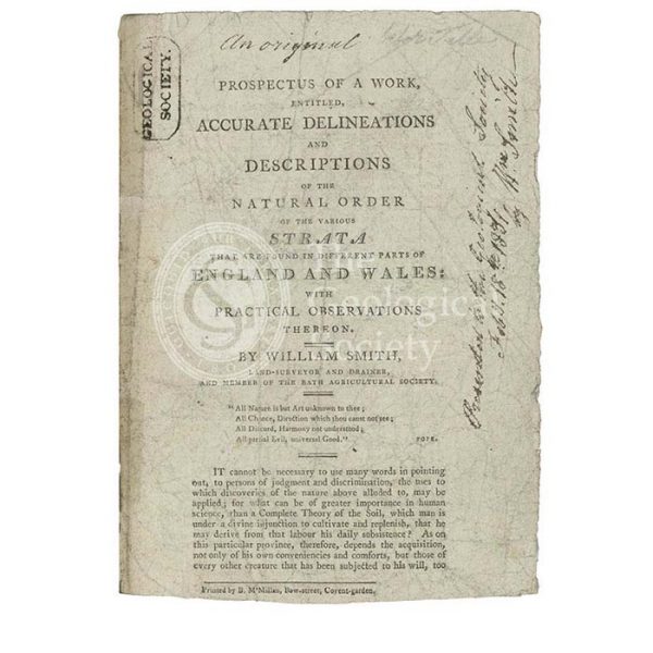
Prospectus for ‘Accurate Delineations and Descriptions of the Natural Order of the Various Strata…’
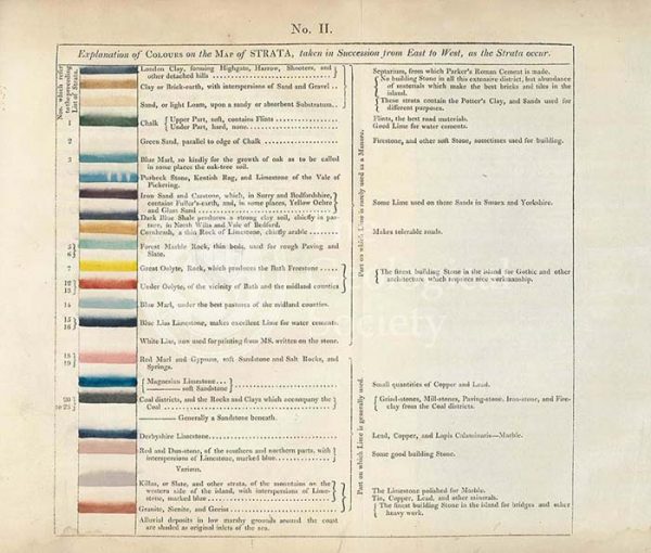
Table of the ‘Explanation of Colours on the Map of Strata…’
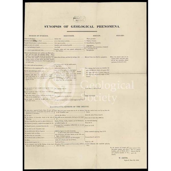
‘Synopsis of Geological Phenomena’
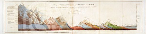
Geological Section from London to Snowdon (Smith, 1817)
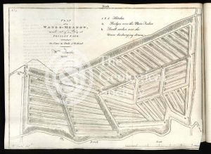
‘Plan of a Water-Meadow made out of a Bog…’
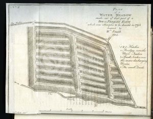
‘Plan of a Water-Meadow made out of part of a Bog…’
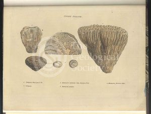
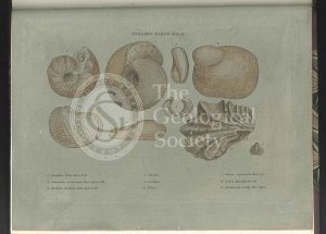
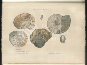
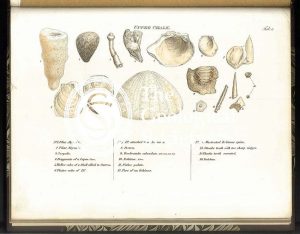
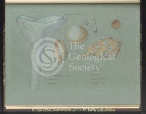
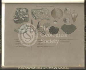
Upper Oolite fossils
Forest Marble fossils
Clay over the Upper Oolite fossils
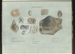
Fullers Earth fossils
Coral Rag fossils
Clunch Clay fossils
A New Geological Map of England & Wales… [Smith reduction] (Smith & Cary, 1827)
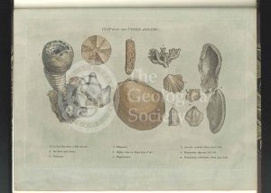
Kelloways Stone fossils
Cornbrash fossils
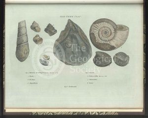
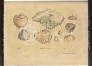
Oak Tree Clay fossils
Section of the Bath Easton Coal Mine, Avon (Unknown, 1808?)
Greenough’s copy of William Smith’s geological map (Smith with notes by Greenough, 1815/1818)
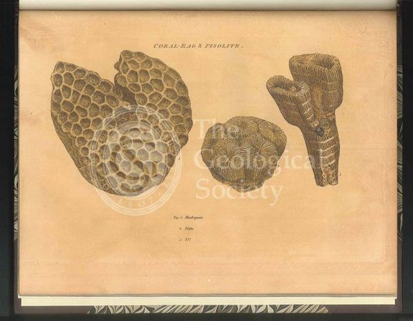
Coral Rag fossils
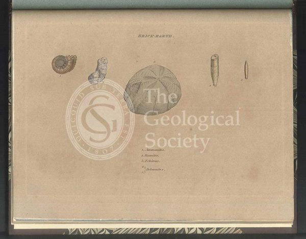
Brick Earth fossils
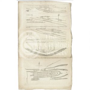
Sections and plan of the collieries around Nailsea (Martin and Smith, 1811)
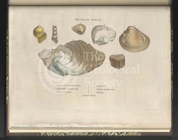
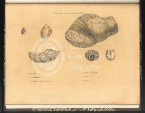
Portland Stone fossils
William Smith’s Table of Strata… under UVA light (Smith original 1799, UVA negative 1972)
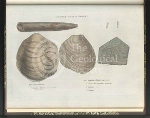
Green Sand fossils
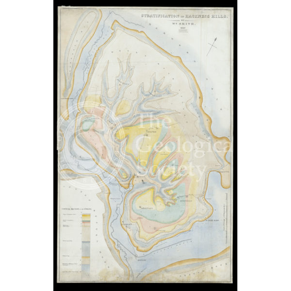
Stratification in Hackness Hills (Smith, 1832)
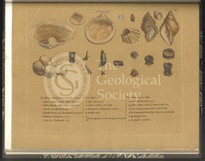
‘Craig’ [Crag] fossils
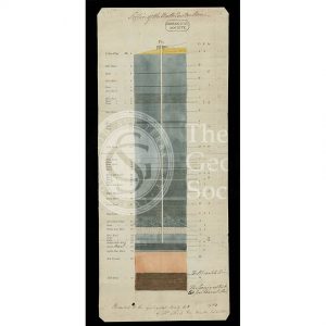
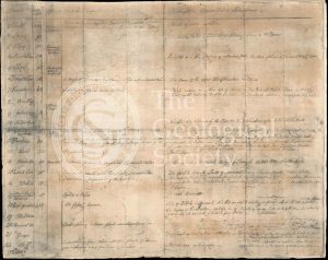
Table of Strata in the Vicinity of Bath (Smith & Richardson, 1799)
Upper Chalk fossils
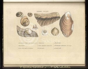
Lower Chalk fossils
Reproduction of William Smith’s Table of Strata… (Judd after Smith & Richardson, 1897)
Green Sand fossils
‘General Map of Strata…’ under infrared light (Smith, 1801 – negative created 1972)
Tooth of a Mastodon
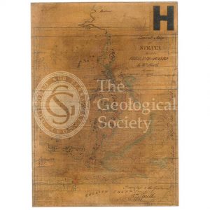
General map of strata found in England & Wales (Smith 1794/1801)
London Clay fossils
Reconstruction of William Smith’s “General Map of Strata found in England & Wales” (Judd & Reekes, 1897)
Reconstruction of William Smith’s Geological Map of Bath (1799) (Lam, 2014)
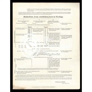
‘Deductions from established facts in geology’
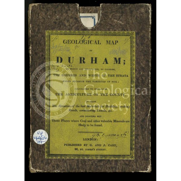
Original box and label for a ‘Geological Map of Durham’ (1831)
Geological Map of Bath (Smith, 1799)
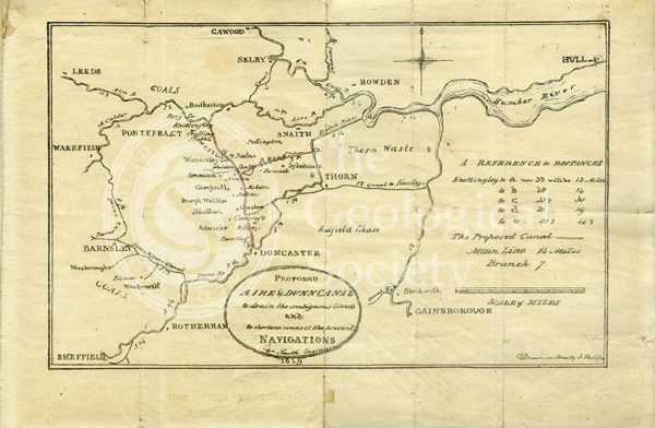
Plan of the ‘Proposed Aire & Dunn Canal’ (Smith and Phillips, 1819)
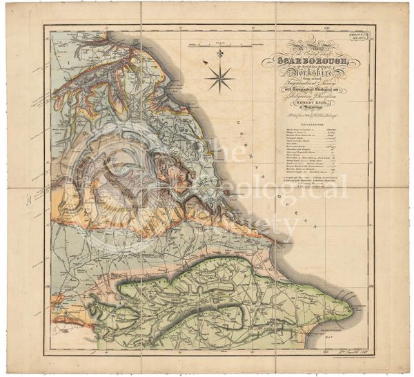
Geological map of Scarborough (Smith, 1831)
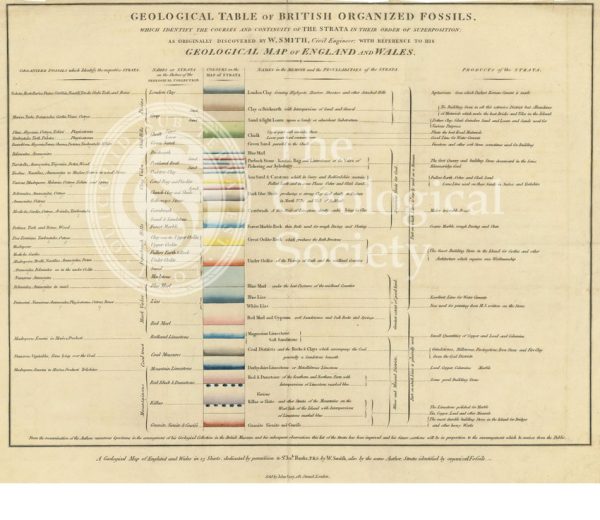
‘Geological table of British organized fossils…’
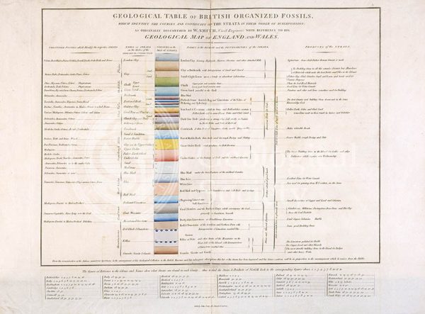
Geological Table of British Organized Fossils
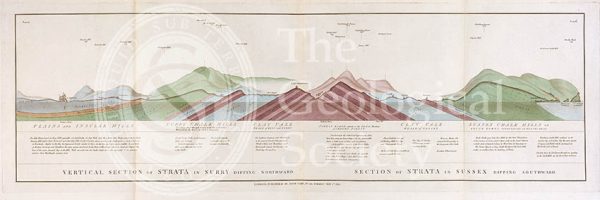
Vertical Section of Strata in Surry (Smith, 1819)
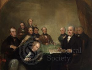
The British Association at Newcastle
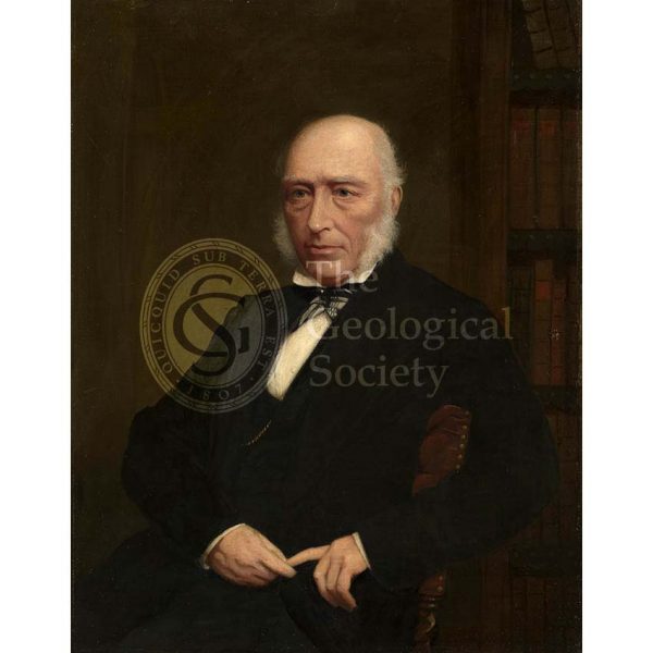
John Phillips (1800-1874)
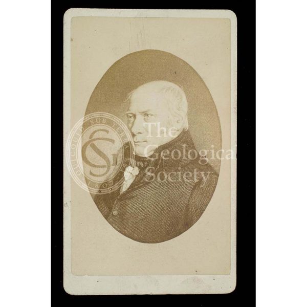
William Smith (1769-1839)
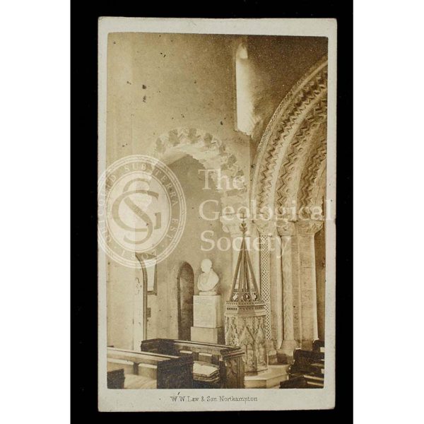
William Smith’s memorial
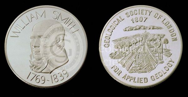
William Smith Medal
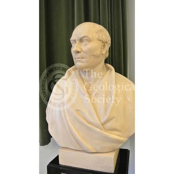
Bust of William Smith (1769-1839)
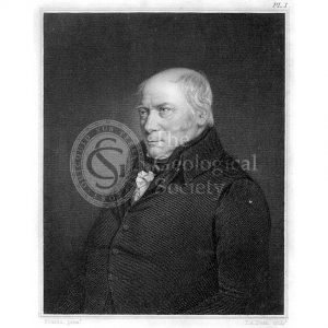
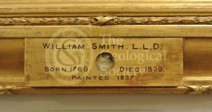
William Smith (1769-1839)
Lock of William Smith’s hair
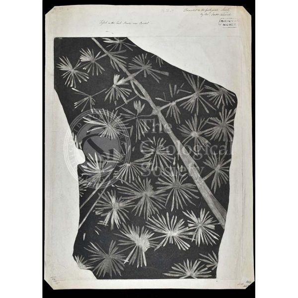
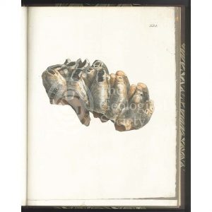
Fossil horsetail from Bristol