
Maps & Sections
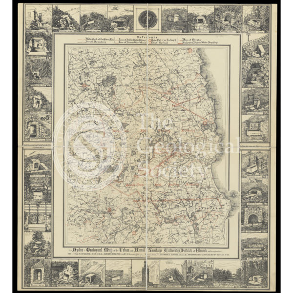
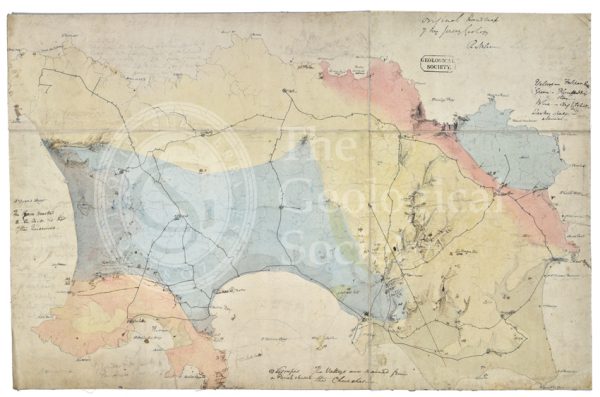
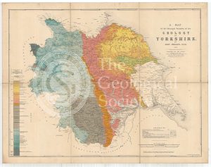
Hydrogeological map of Alnwick and its neighbourhood
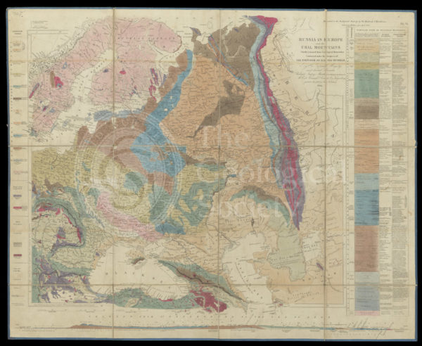
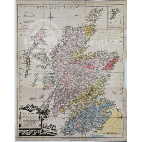
Murchison’s Map of Russia (1847)
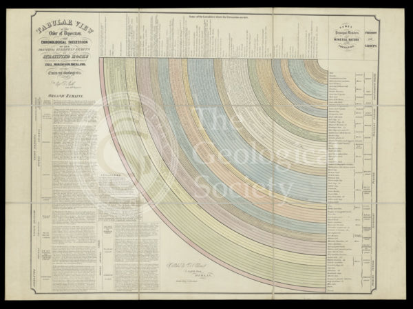
‘Tabular view of the order of deposit and chronological succession of the principal European groups of stratified rocks’
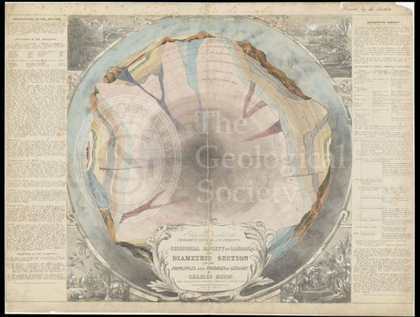
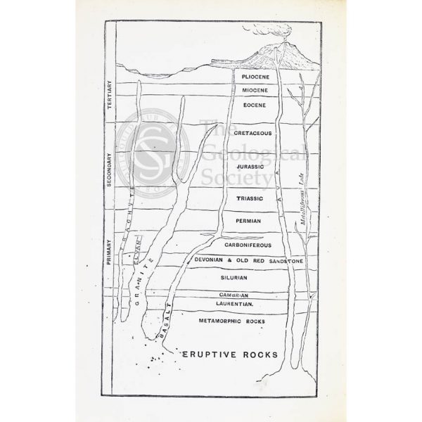
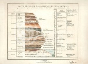
‘The diametric section of the principles and theories of geology’
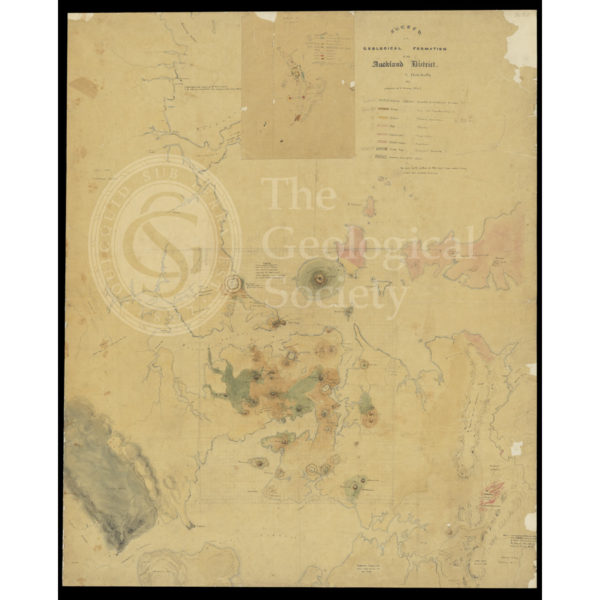
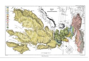
‘Sketch of the Geological Formation of the Auckland District’ (1857-1859)

Geognostic map of Sweden (1834)
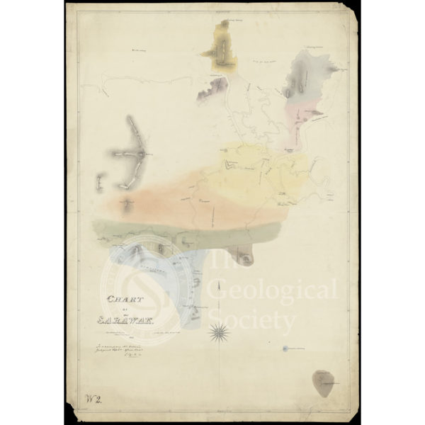
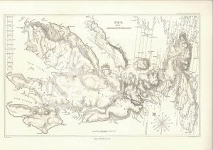
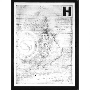
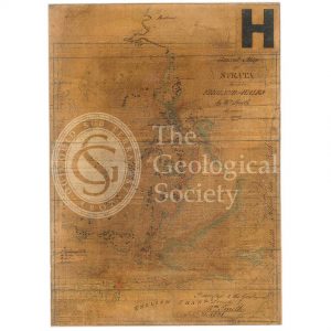
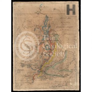
Chart of Sarawak, Borneo (1846)
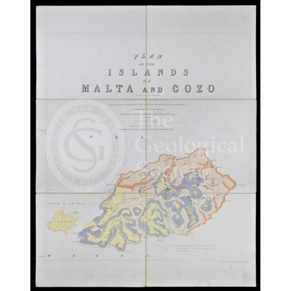
Geological map of Malta (1856)
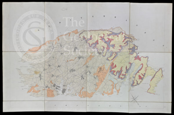
Geological map of Gozo and Cominos, Malta
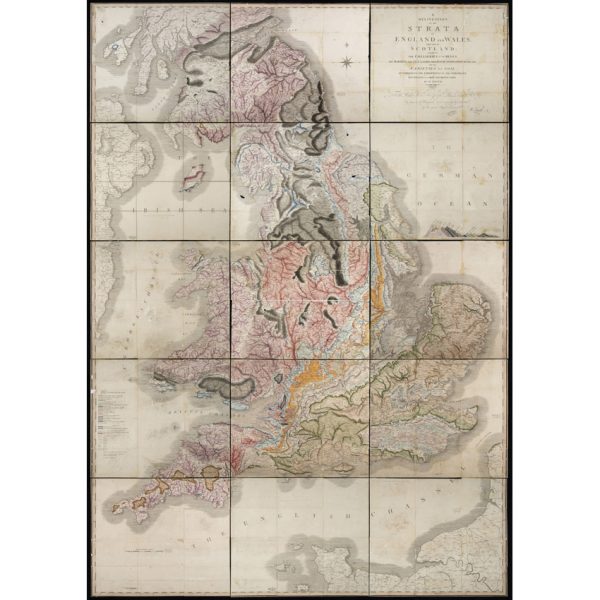
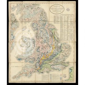
‘A Delineation of the Strata of England and Wales, with part of Scotland… (1815)
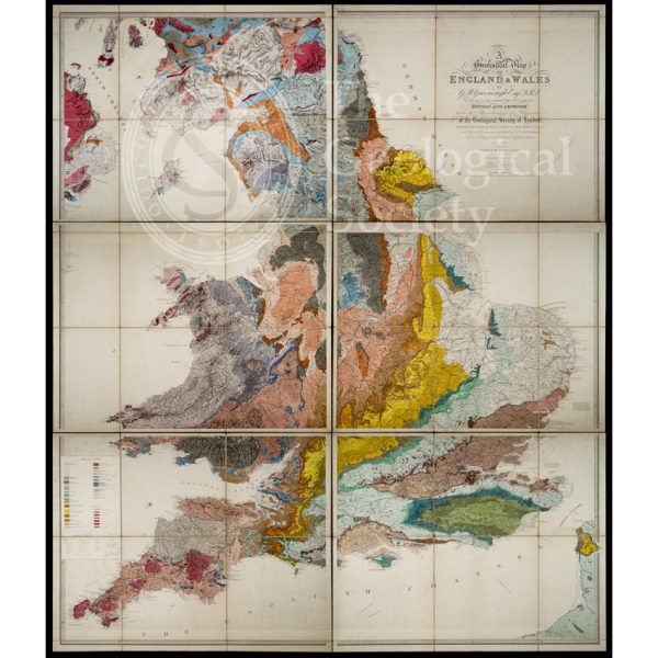
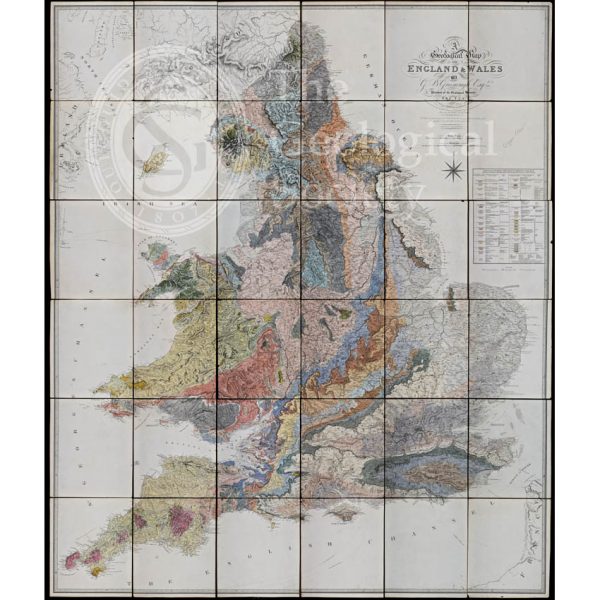
‘Geological Map of England and Wales’ (1865) 3rd edition
Greenough’s ‘Geological Map of England and Wales’ – uncorrected proof before mountains [1818]
Greenough’s ‘Geological Map of England and Wales’ – earliest surviving proof [1816]
Greenough’s and Sharpe’s Geological Map of Scotland [1852] – final copy
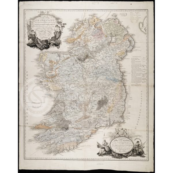
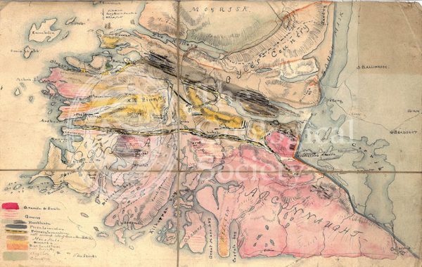
Earliest geological map of Ireland [?1814]
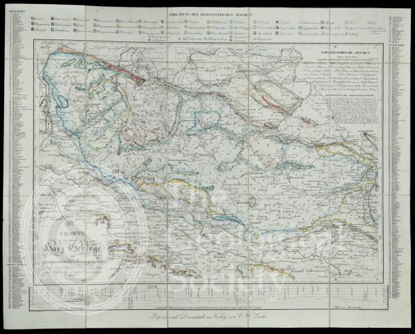
Geognostic map of the Harz Mountains (1832)
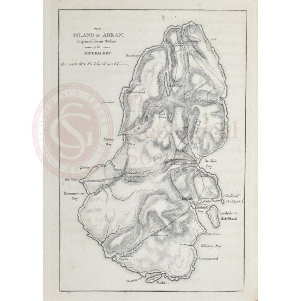
Island of Arran engraved for an outline of its mineralogy (1800)
Jameson’s outline map of Scotland (1800)
Draft of the first geological map of Jersey [c.1828]
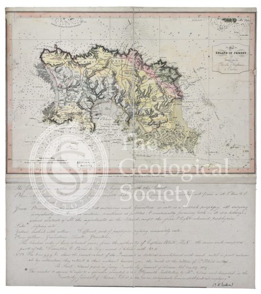
First geological map of Jersey [c.1828]
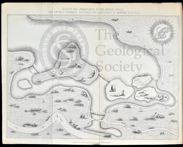
Map of Crystal Palace Park (1854)
Geological timescale (1867)
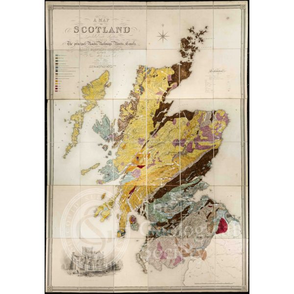
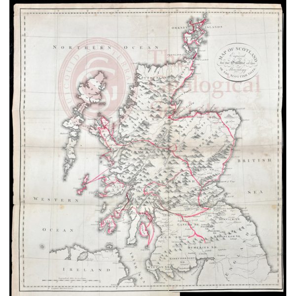
First Geological Map of Scotland [1808]
Greenough’s and Sharpe’s Geological Map of Scotland [1852] – draft
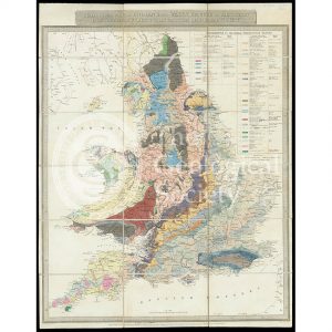
Geological Map of England and Wales [1839] 2nd edition
Geological Map of England and Wales (1820) 1st edition
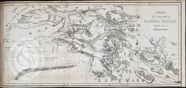
Charta õfver en del af Lappska Fjällen (1807)
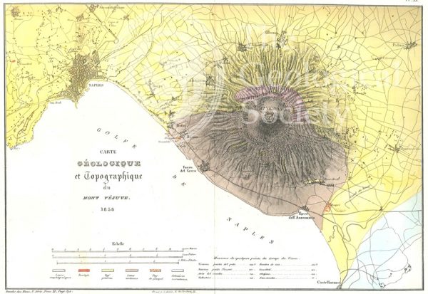
Carte géologique et topographique du Mont Vésuve (Dufrenoy, 1838)
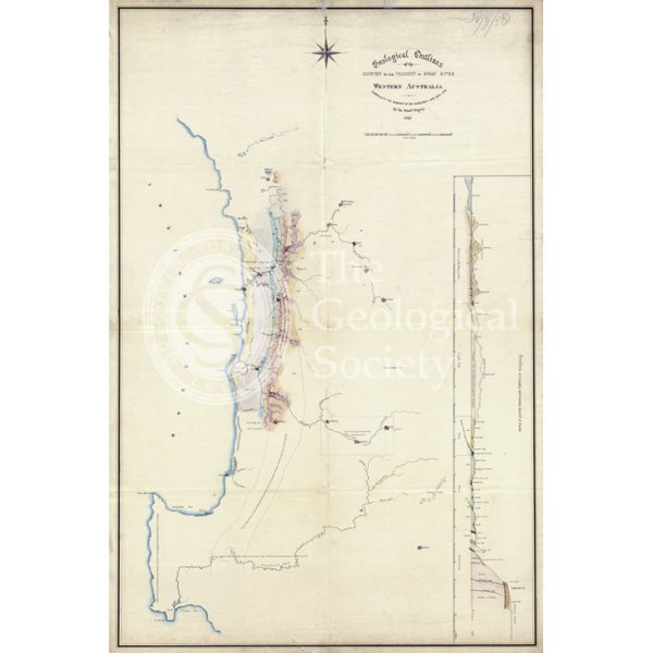
Map of the geology around Swan River, Western Australia
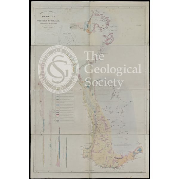
General Outlines of the Geology of Western Australia (Gregory, 1860)
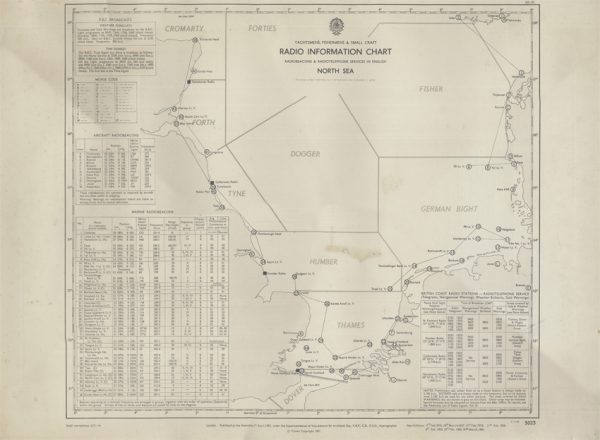
Yachtsmen’s, Fishermen’s & Small Craft Radio Information Chart (Hydrographic Office 1961)
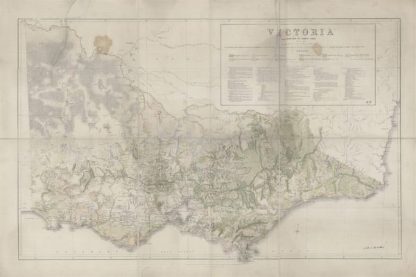
Victoria Distribution of Forest Trees (Everett, 1872)
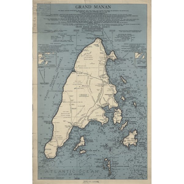
Grand Manan (Charles, 1939)
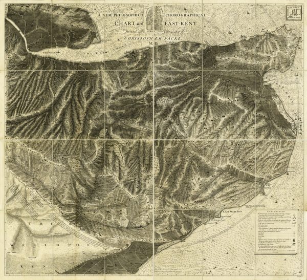
A new philosophico chorographical chart of East-Kent (Packe, 1743)

Map of the English Lakes (Ruthven, 1855)
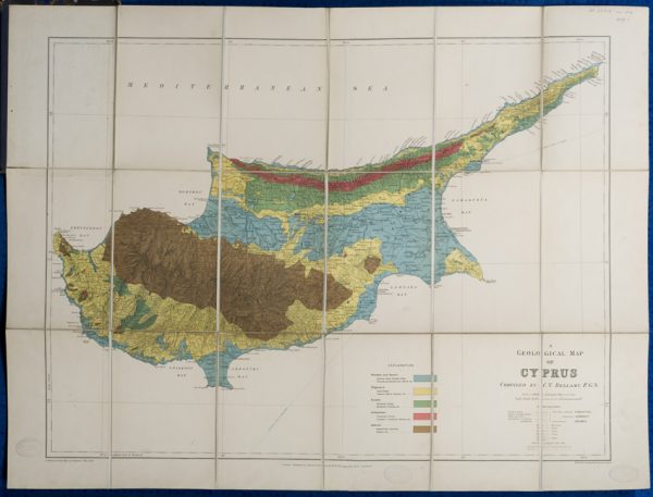
Geological map of Cyprus (Bellamy, 1905)
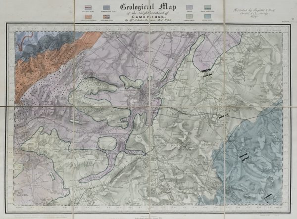
Geological map of the neighbourhood of Cambridge (Jukes-Browne, 1874)
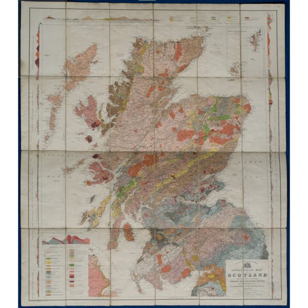
Geological map of Scotland (Geikie, 1910)
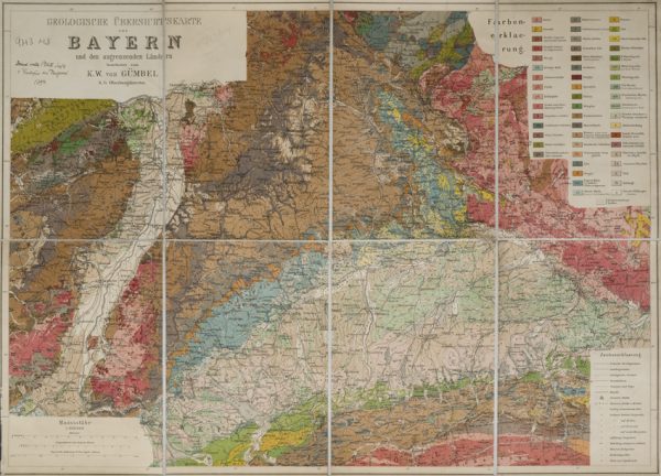
Geologische Übersichtskarte von Bayern und den angrenzenden Ländern (Karl Wilhelm von Gümbel, 1893)
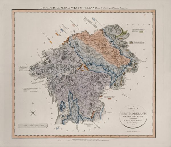
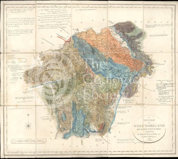
Geological Map of Westmoreland (William Smith, 1824)
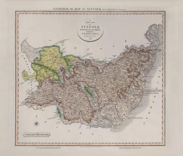
Geological Map of Suffolk (William Smith, 1819)
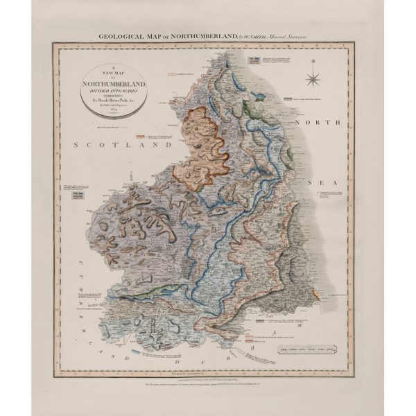
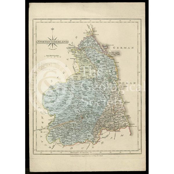
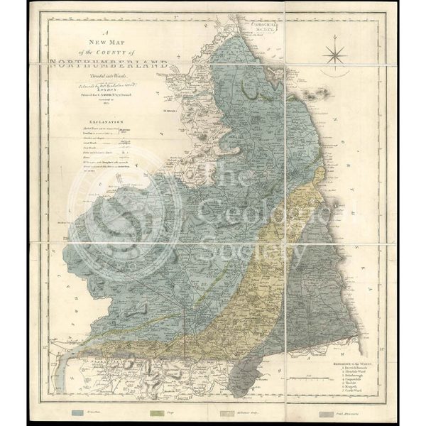
Geological Map of Northumberland (William Smith, 1824)
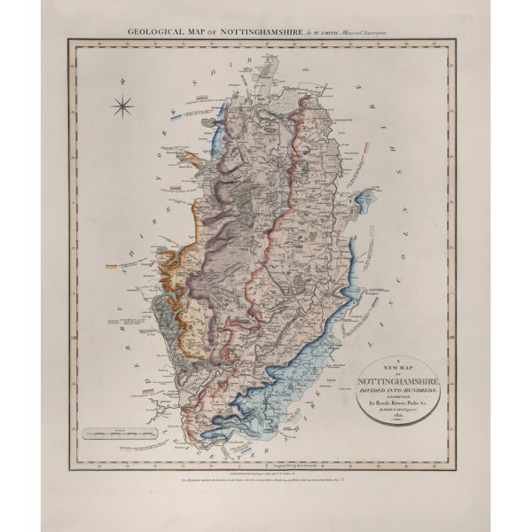
Geological Map of Nottinghamshire (William Smith, 1821)
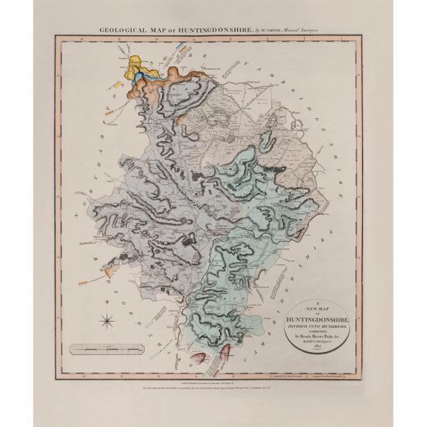
Geological Map of Huntingdonshire (William Smith, 1821)
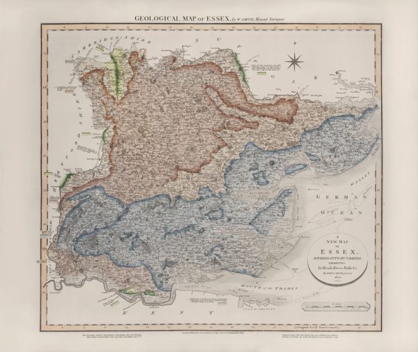
Geological Map of Essex (William Smith, 1820)
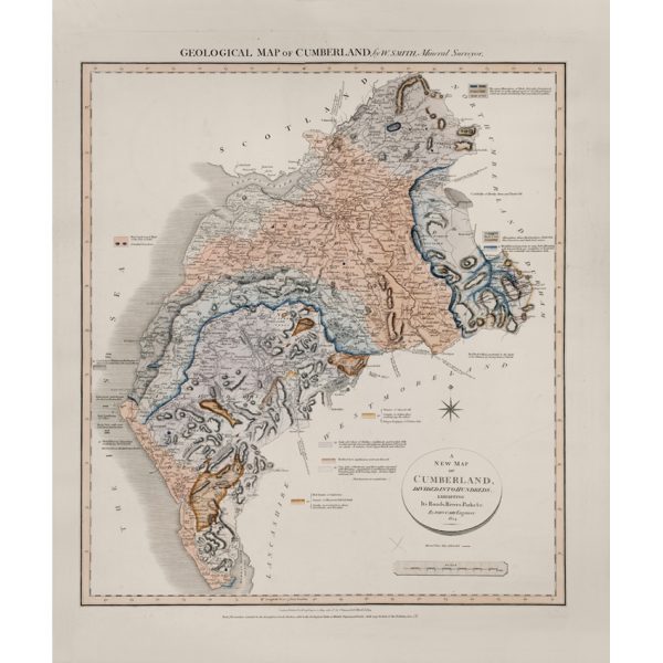
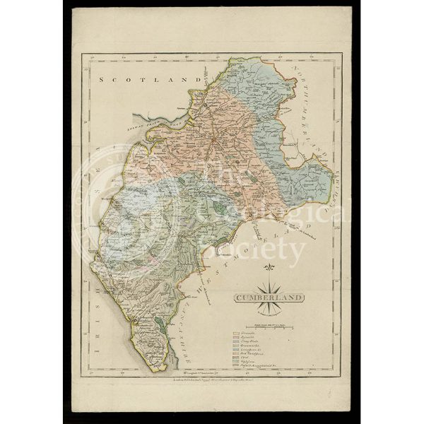
Geological Map of Cumberland (William Smith, 1824)
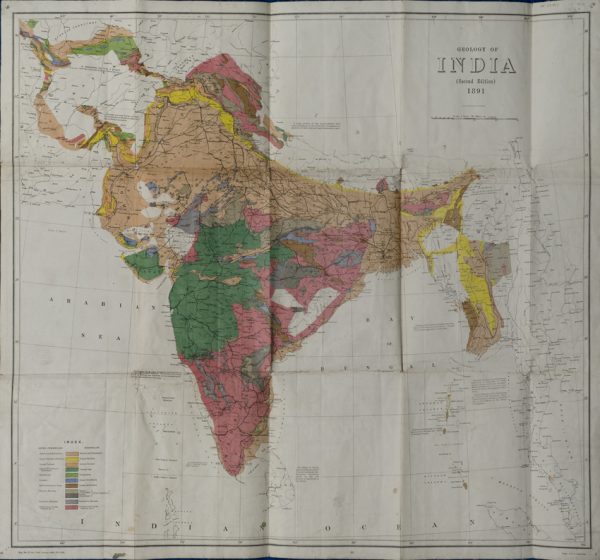
Geological Map of India (Geological Survey of India, 1891)
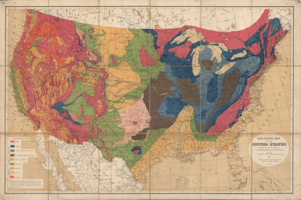
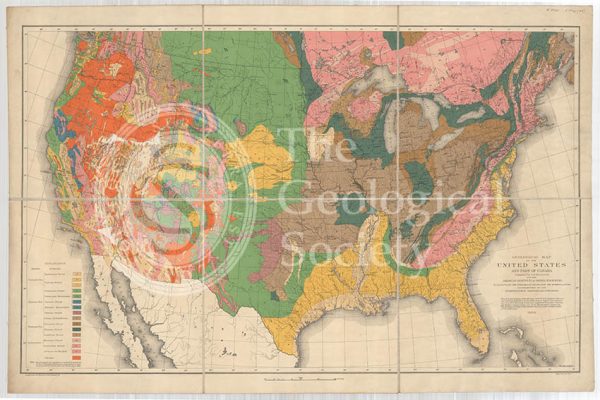
Geological map of the United States (Hitchcock and Blake, 1872)
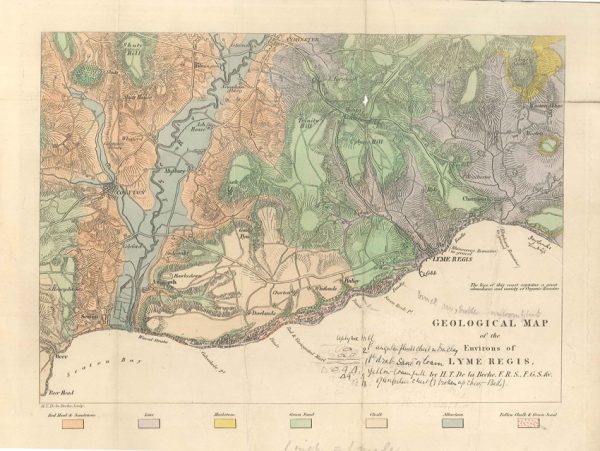
Geological map of the environs of Lyme Reis (De La Beche, 1826)
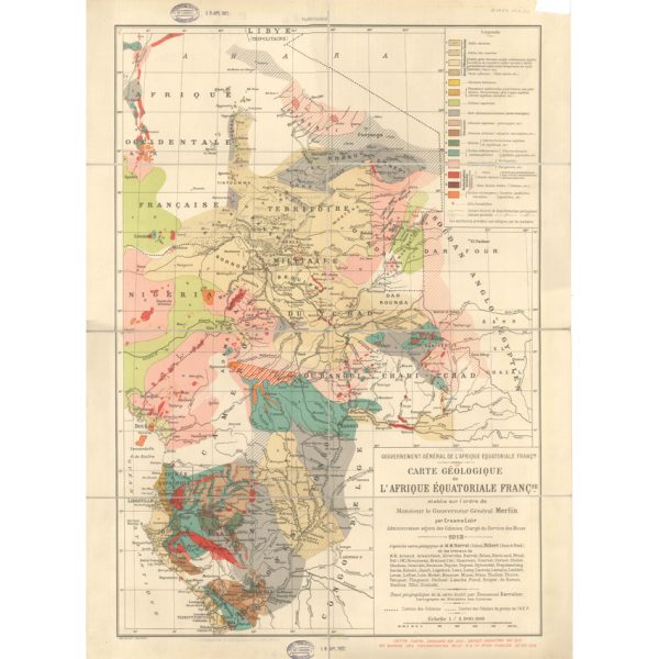
Carte géologique de l’Afrique Équatoriale Française (Loir, 1913)
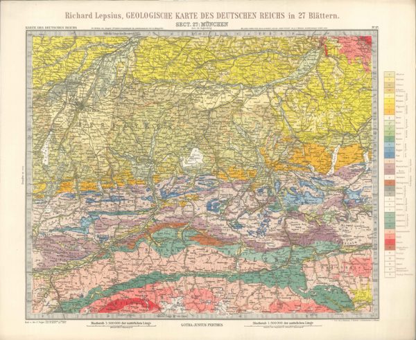
Geologisches Karte des Deutschen Reichs – 27. Munchen (Lepsius, 1897)
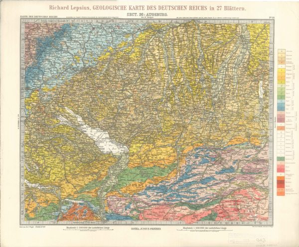
Geologisches Karte des Deutschen Reichs – 26. Augsburg (Lepsius, 1897)
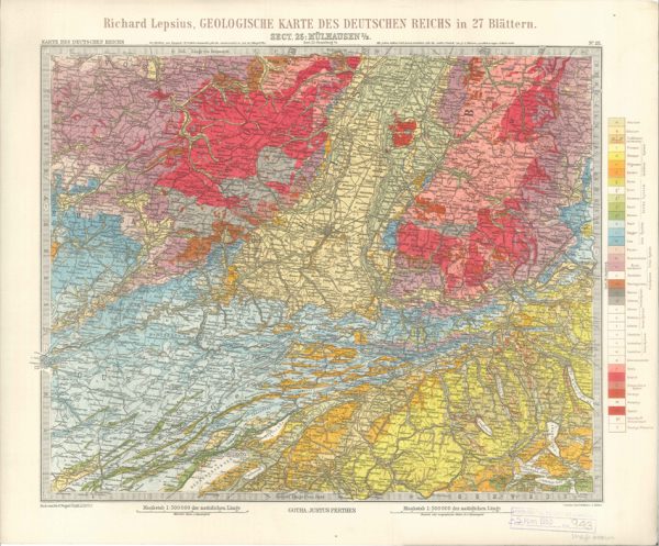
Geologisches Karte des Deutschen Reichs – 25. Mulhausen I-E (Lepsius, 1897)
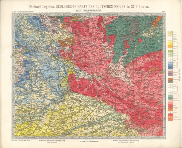
Geologisches Karte des Deutschen Reichs – 24. Regensburg (Lepsius, 1897)
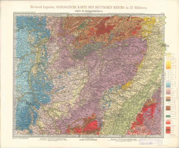
Geologisches Karte des Deutschen Reichs – 22. Strassburg I-E (Lepsius, 1897)
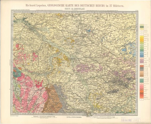
Geologisches Karte des Deutschen Reichs – 21. Breslau (Lepsius, 1897)
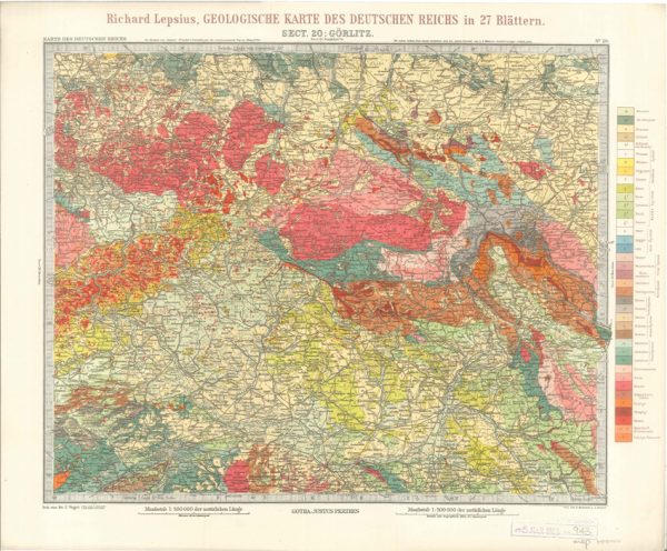
Geologisches Karte des Deutschen Reichs – 20. Gorlitz (Lepsius, 1897)
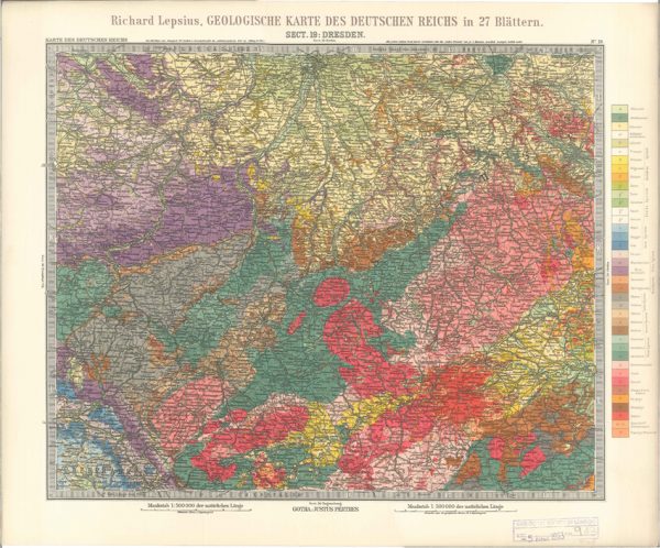
Geologisches Karte des Deutschen Reichs – 19. Dresden (Lepsius, 1897)
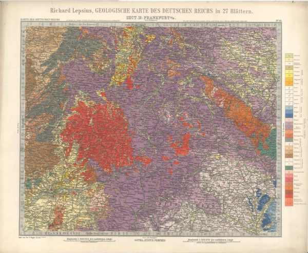
Geologisches Karte des Deutschen Reichs – 18. Frankfurt A-M (Lepsius, 1897)
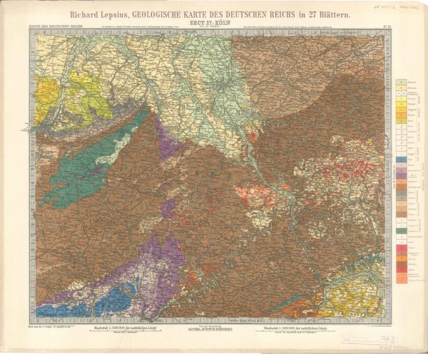
Geologisches Karte des Deutschen Reichs – 17. Koln (Lepsius, 1897)
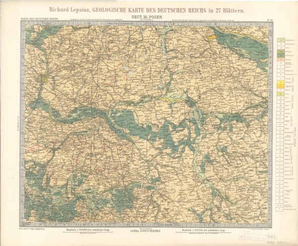
Geologisches Karte des Deutschen Reichs – 16. Posen (Lepsius, 1897)
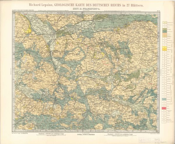
Geologisches Karte des Deutschen Reichs – 15. Frankfurt A-O (Lepsius, 1897)
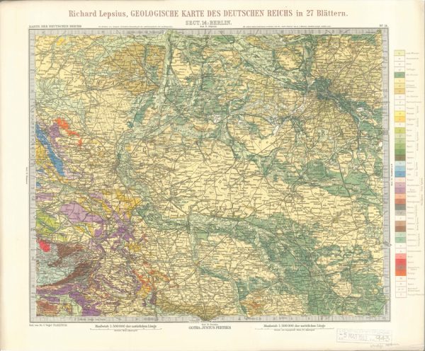
Geologisches Karte des Deutschen Reichs – 14. Berlin (Lepsius, 1897)
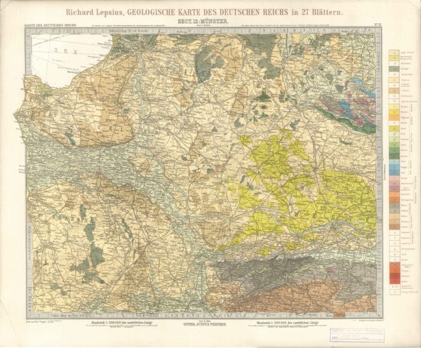
Geologisches Karte des Deutschen Reichs – 12. Munster (Lepsius, 1897)
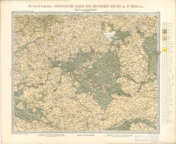
Geologisches Karte des Deutschen Reichs – 11. Allenstein (Lepsius, 1897)
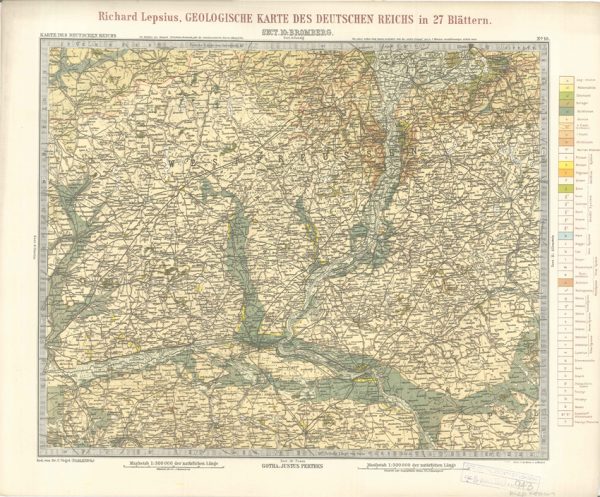
Geologisches Karte des Deutschen Reichs – 10. Bromberg (Lepsius, 1897)
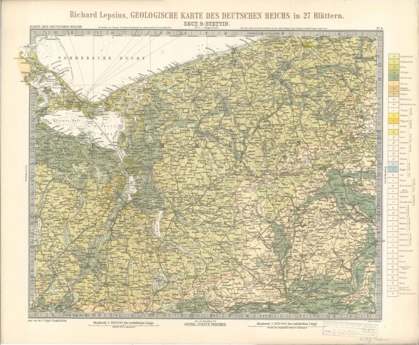
Geologisches Karte des Deutschen Reichs – 9. Stettin (Lepsius, 1897)
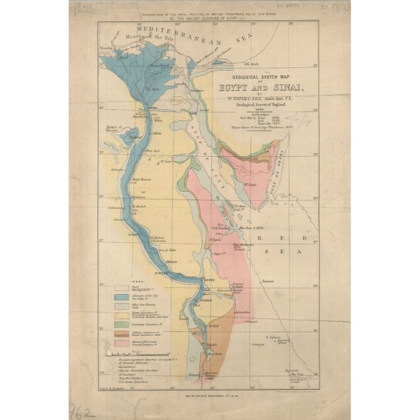
Geological Sketch Map of Egypt and Sinai (Topley 1888)
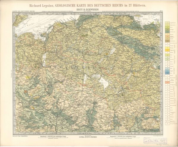
Geologisches Karte des Deutschen Reichs – 8. Schwerin (Lepsius, 1897)
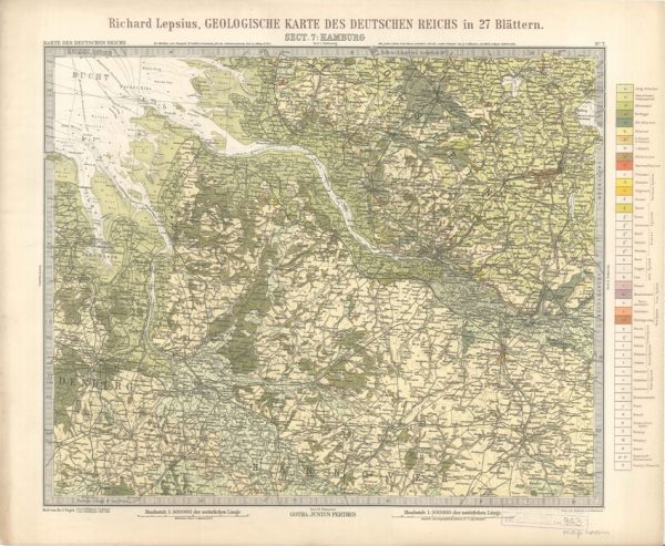
Geologisches Karte des Deutschen Reichs – 7. Hamburg (Lepsius, 1897)
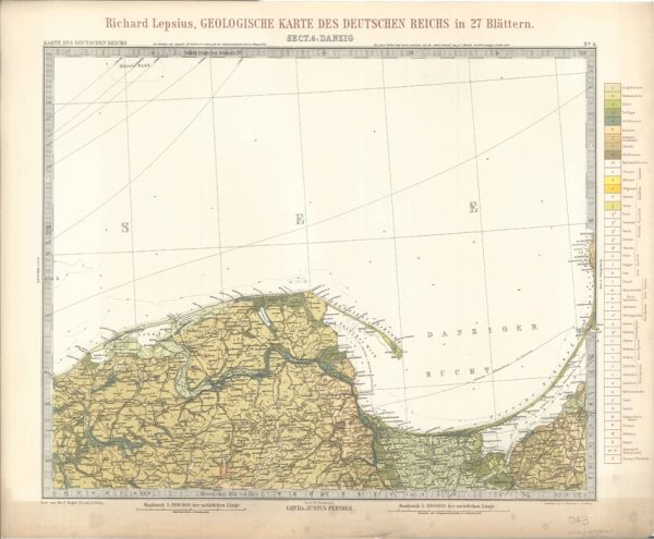
Geologisches Karte des Deutschen Reichs – 4. Danzig (Lepsius, 1897)
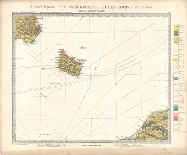
Geologisches Karte des Deutschen Reichs – 3. Rugenwalde (Lepsius, 1897)
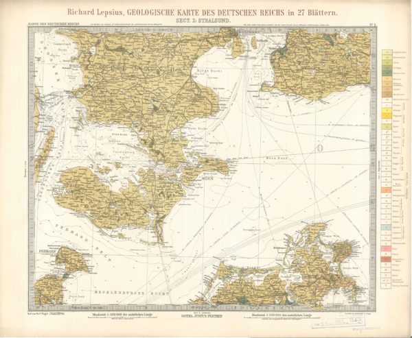
Geologisches Karte des Deutschen Reichs – 2. Stralsund (Lepsius, 1897)
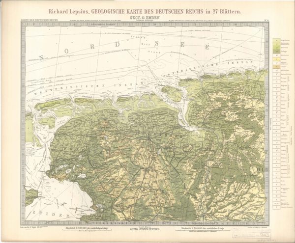
Geologisches Karte des Deutschen Reichs – 6. Emden (Lepsius, 1897)
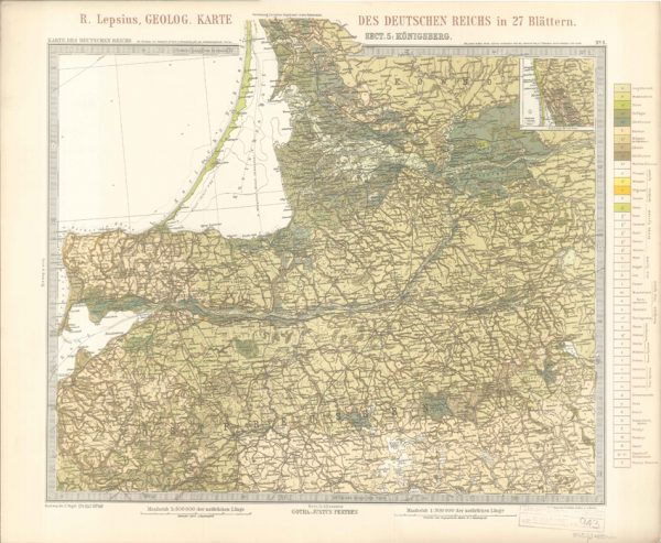
Geologisches Karte des Deutschen Reichs – 5. Konigsberg (Lepsius, 1897)
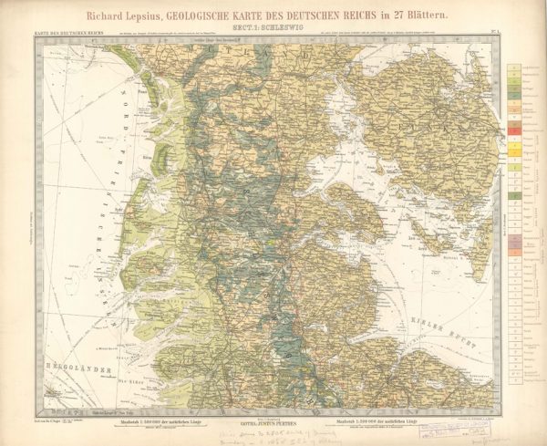
Geologisches Karte des Deutschen Reichs – 1. Schleswig (Lepsius, 1897)
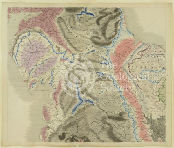
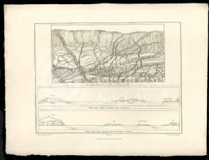
Plate V [Yorkshire]
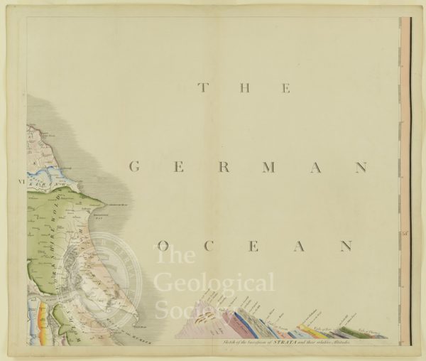
Plate VI [German Ocean]
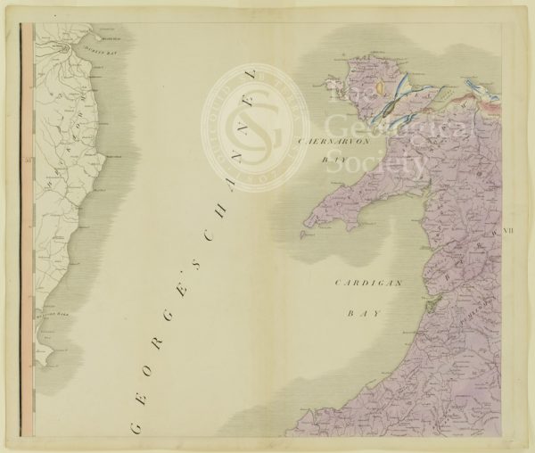
Plate VII [St George’s Channel]
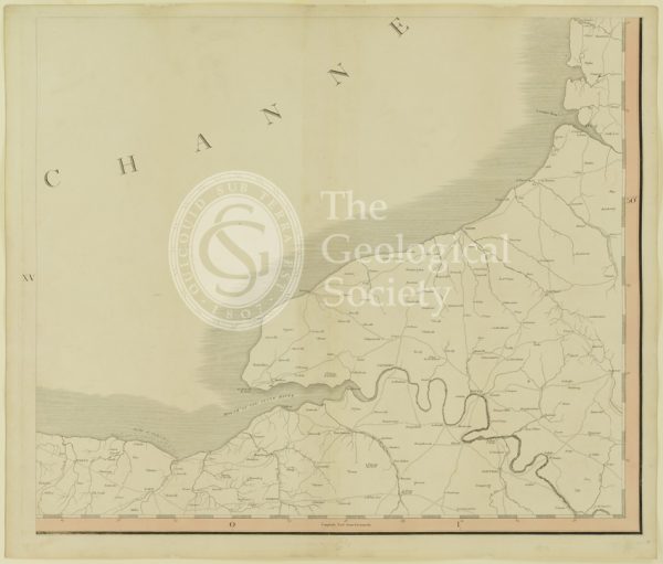
Plate XV [France]
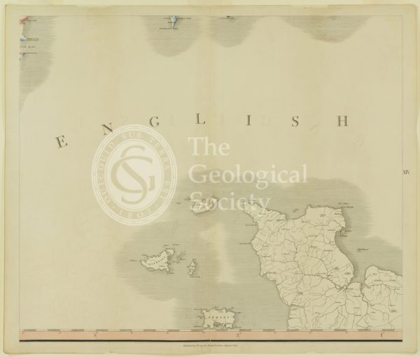
Plate XIV [English Channel]
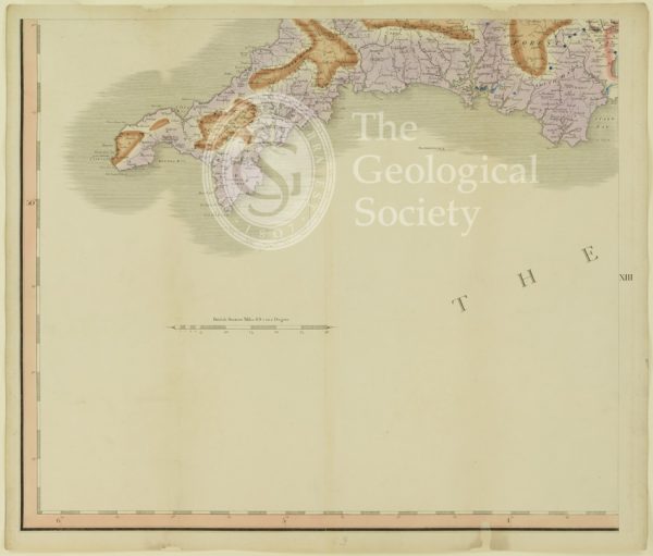
Plate XIII [Cornwall]
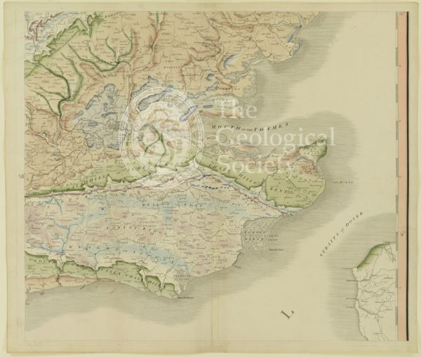
Plate XII [Kent]
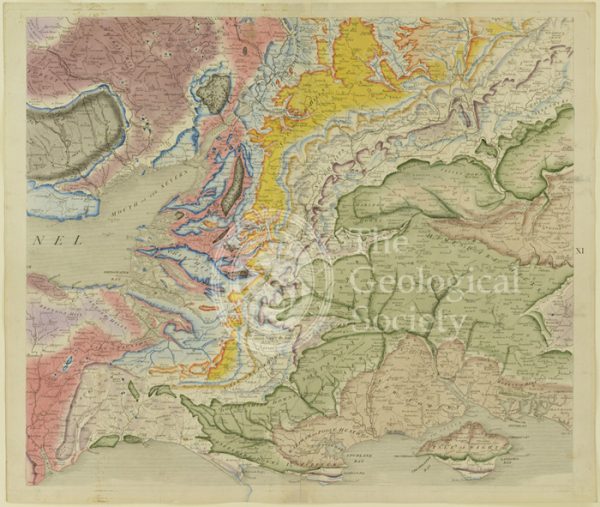
Plate X [Isle of Wight]
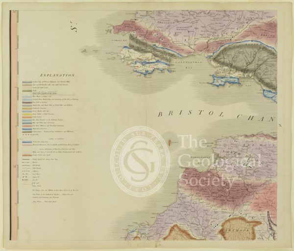
Plate X [Bristol Channel]
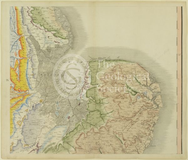
Plate IX [East Anglia]
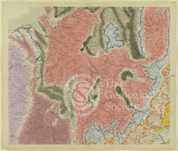
Plate VIII [Welsh border]
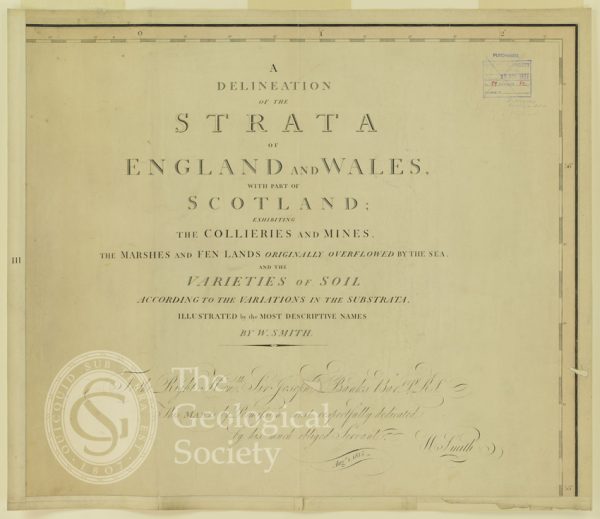
Plate III [Title page]
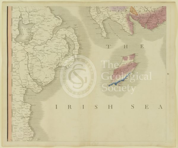
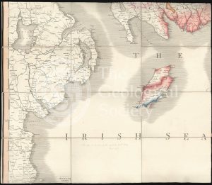
Plate IV [Irish Sea]
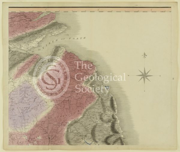
Plate II [Firth of Forth]
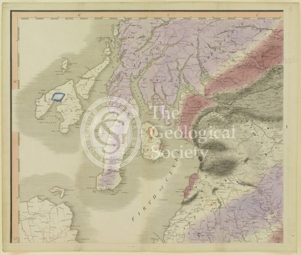
Plate I [Firth of Clyde]
Geological map of Northumberland (Fry, c.1814)
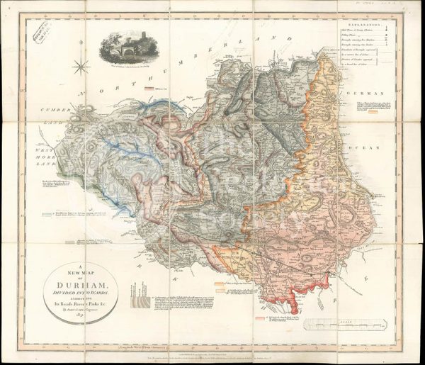
‘A New Map of Durham divided into Wards…’ (Smith, 1831)
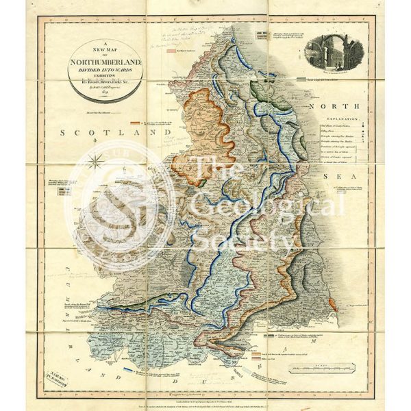
‘A New Map of Northumberland divided into Wards…’ (Smith, 1831)
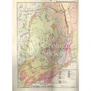
Geological Map of the Rhobell Fawr District (Wells, 1925)
Sky and the adjoining islands (Stewart after MacCulloch, 1817)
Geologische Elementarkarte, plate 3 (Klöpfel, 1838)
Sketch map of the Rhenosterberg, South Africa (Stow, 1858)
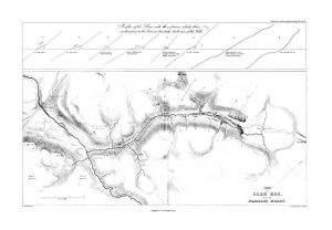
Plan of Glen Roy and of the Parallel Roads (MacCulloch, 1817)
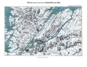
Map shewing the Connections of Glen Roy with the Sea (Cross, 1817)
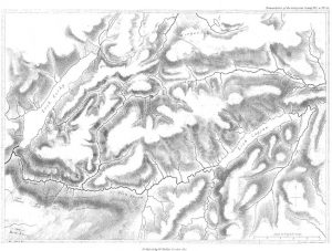
Map of Glen Roy (MacCulloch, 1817)
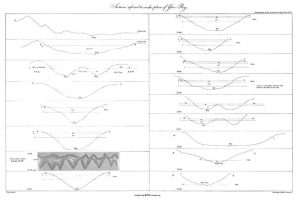
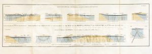
Sections of Glen Roy (MacCulloch, 1817)
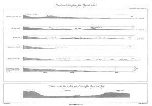
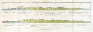
Curvilinear Sections from Glen Roy to the Sea (MacCulloch, 1817)
Various flexures of gneiss in Lewis (Stewart after MacCulloch, 1819)
Selected parts of the East Coast of Trotternish (Stewart after MacCulloch, 1819)
Granite veins and gneiss at Cape Wrath… (Stewart after MacCulloch, 1819)
Trap veins at Airdnamurchan point… (Stewart after MacCulloch, 1819)
Sky and the adjoining islands (Stewart after MacCulloch, 1817)
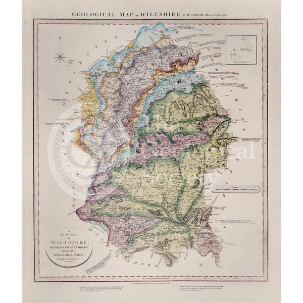
Geological Map of Wiltshire (William Smith, 1819)
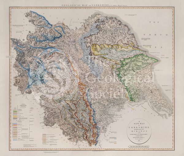
Geological Map of Yorkshire (William Smith, 1821)
Theoretical section through the Paris Basin (Cuvier, Brongniart and Clerget, 1832)
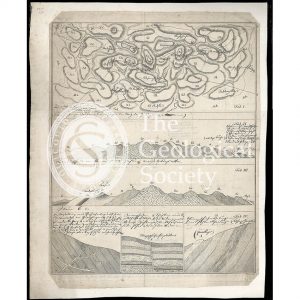
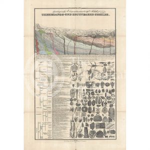
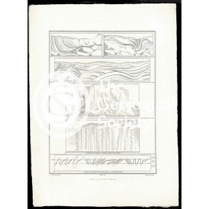
Imaginary plan and sections of Wernerian formations (Theonert, c.1810)
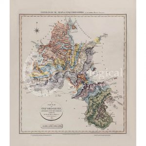
Geological map of Oxfordshire (William Smith, 1820)
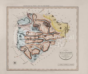
Geological Map of Rutlandshire (William Smith, 1822)
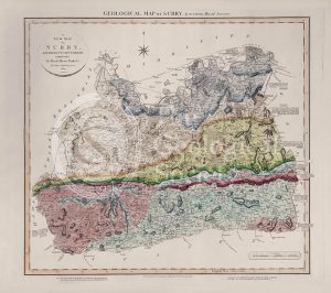
Geological Map of Surry (William Smith, 1819)
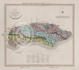
Geological Map of Sussex (William Smith, 1819)
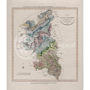
Geological Map of Buckinghamshire (William Smith, 1820)
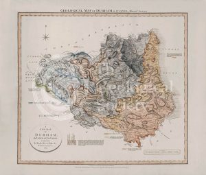
Geological Map of Durham (William Smith, 1824)
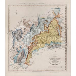
Geological Map of Gloucestershire (William Smith, 1819)
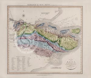
Geological Map of Kent (William Smith, 1819)
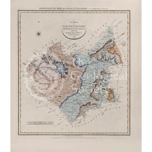
Geological Map of Leicestershire (William Smith, 1822)
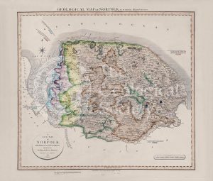
Geological Map of Norfolk (William Smith, 1819)
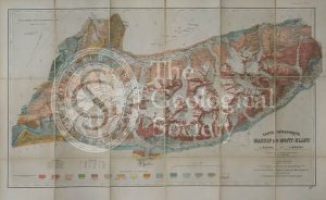
Carte géologique du Massif du Mont-Blanc (Duparc and Mrazec, 1896)
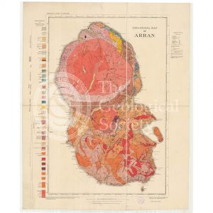
Geological Map of Arran (The Survey, 1910)
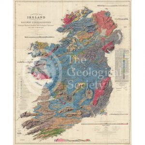
A general map of Ireland… (Griffith, 1855)
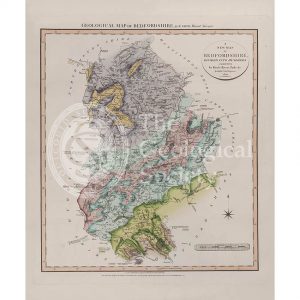
Geological Map of Bedfordshire (William Smith, 1820)
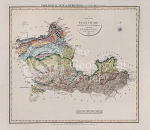
Geological Map of Berkshire (William Smith, 1819)
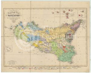
Geognostische Karte Sicilien (Hoffmann, 1839)
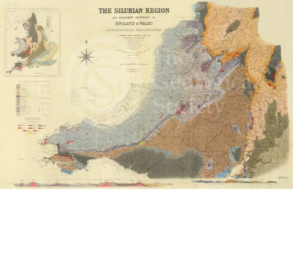
Map of the Silurian Region (Murchison, 1838)
Geological map of Brough-under-Stainmore (Geological Survey of England & Wales, 1893)
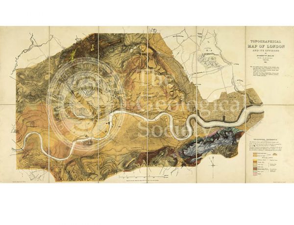
Topographical [and Geological] Map of London… (Mylne, 1851)
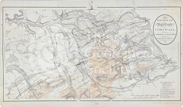
Geological map of the mining district of Cornwall… (Thomas, 1819)
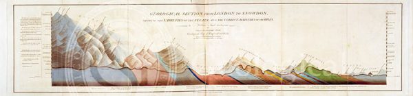
Geological Section from London to Snowdon (Smith, 1817)
Section of the country east of Lake Baikal, Siberia (geology near Nerchinsk) (Austin, 1848-1862)
Geological map of Cumberland (Fry, c.1814)
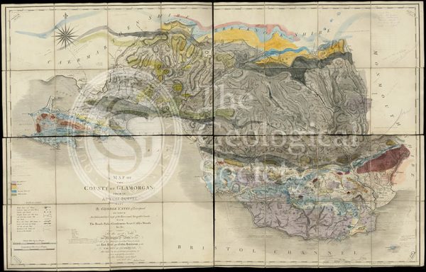
Geological map of Glamorgan (Greenough/Smith 1799-1818)
Geological Map of England & Wales. Sheet 10 Isle of Wight (Murchison, 1856)
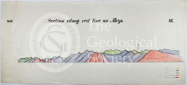
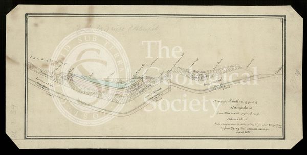
Section from the Medway through Upnor to Cockham Wood (Dadd, 1833)
A New Geological Map of England & Wales… [Smith reduction] (Smith & Cary, 1827)
Geological Map of England & Wales… [Greenough reduction] (Gardner after Greenough, 1826)
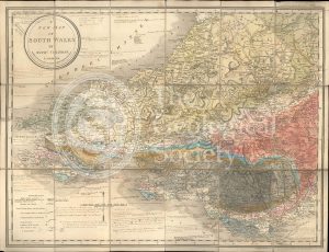
A New Map of South Wales (Greenough and Coltman, between 1813-1839)
Section of the Bath Easton Coal Mine, Avon (Unknown, 1808?)
Section of the Bath Easton Mine in Somersetshire (Webster, 1812)
Greenough’s copy of William Smith’s geological map (Smith with notes by Greenough, 1815/1818)
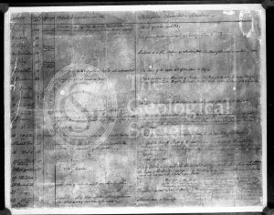
William Smith’s Table of Strata… under UVA light (Smith original 1799, UVA negative 1972)
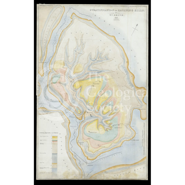
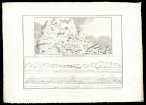
Stratification in Hackness Hills (Smith, 1832)
Sections and plan of the collieries around Nailsea (Martin and Smith, 1811)
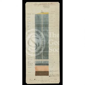
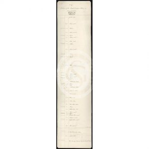
Table of Strata in the Vicinity of Bath (Smith & Richardson, 1799)
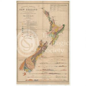
Map of New Zealand (James Hector, 1873)
Reproduction of William Smith’s Table of Strata… (Judd after Smith & Richardson, 1897)
‘General Map of Strata…’ under infrared light (Smith, 1801 – negative created 1972)
General map of strata found in England & Wales (Smith 1794/1801)
Reconstruction of William Smith’s “General Map of Strata found in England & Wales” (Judd & Reekes, 1897)
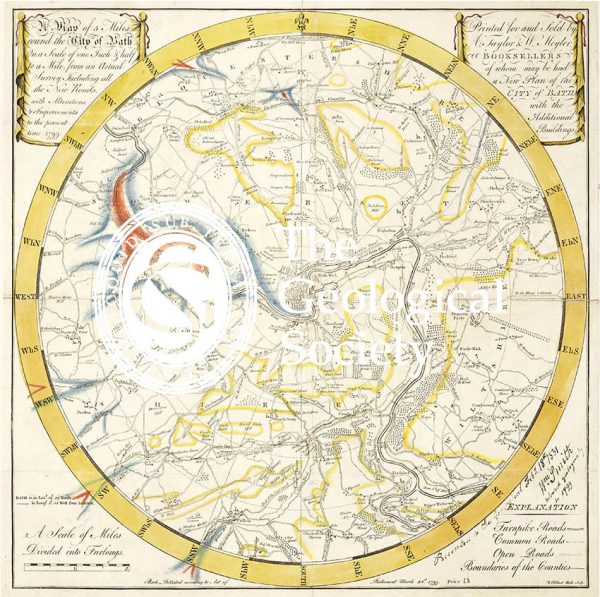
Geological Map of Bath (Smith, 1799)
Reconstruction of William Smith’s Geological Map of Bath (1799) (Lam, 2014)
Greenough’s Map of Westmoreland (Greenough after Smith, 1824-1843)
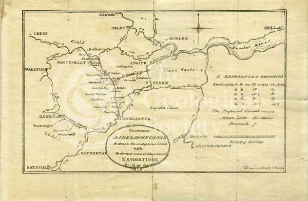
Plan of the ‘Proposed Aire & Dunn Canal’ (Smith and Phillips, 1819)
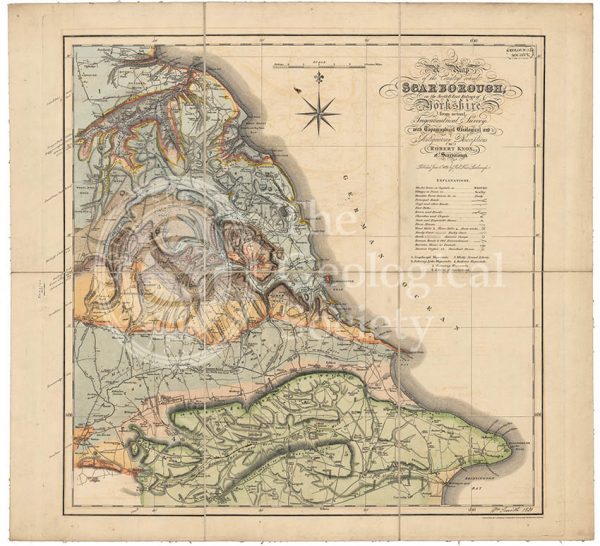
Geological map of Scarborough (Smith, 1831)
Geological map of Northumberland (Wood, 1831)
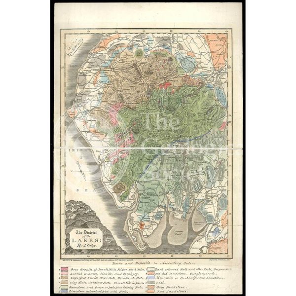
District of the Lakes (Otley, 1837)
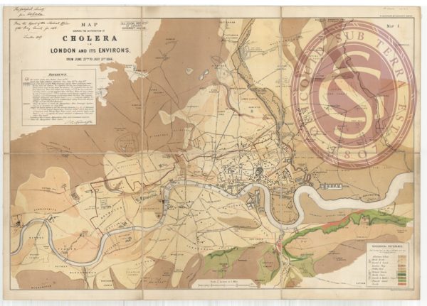
Map showing the distribution of cholera in London
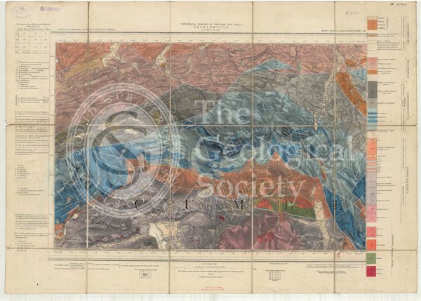
Geological map of England and Wales, Sheet 101 NE Cockermouth (1890)
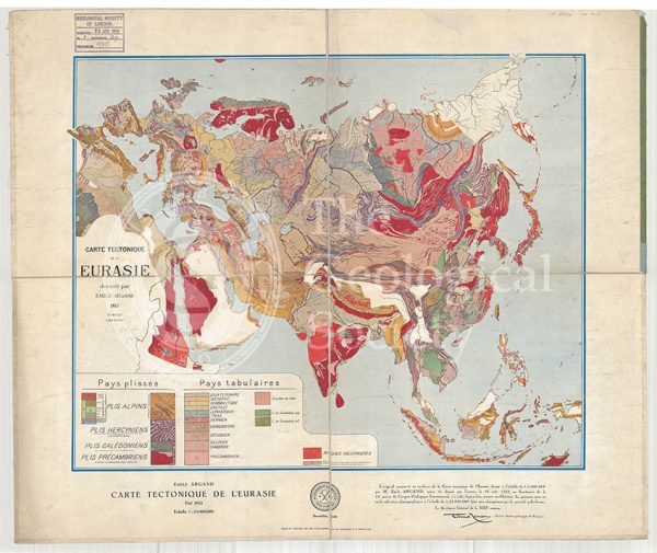
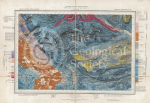
Carte tectonique de l’Eurasie (Argand, 1928)
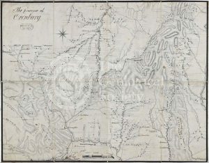
Map of the Province of Orenburg
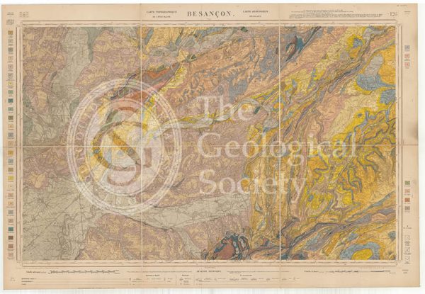
Carte géologique de la France 1:80,000. Feuille 126 Besançon (1892)
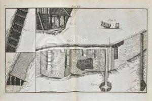
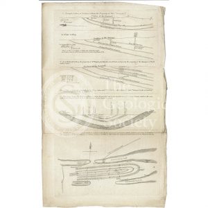
Timber supports for mining
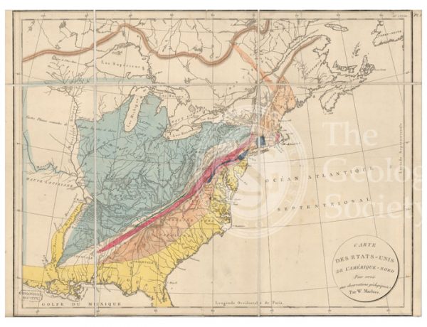
Carte des Etats-Unis de l’Amerique-Nord [Map of North America] (Maclure, 1811)
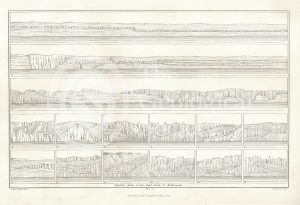
A Map of the Principal Features of the Geology of Yorkshire (Phillips, 1853)
Geological Sections in Illustration of the Map of the Mining District of Cornwall (Smith, 1819)
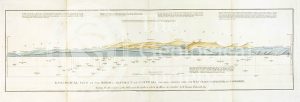
Geological view and sections of Norfolk and Suffolk (Smith, 1819)
Geological views and sections of Essex/Hertfordshire and between London and Cambridge (Smith, 1819)
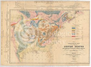
Geological Map of the United States and the British Provinces of North America (Marcou, 1853)
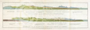
Geological view and section through Dorsetshire and Somersetshire to Taunton (Smith, 1819)
Geological View of the Mining District of Cornwall (Smith, 1819)
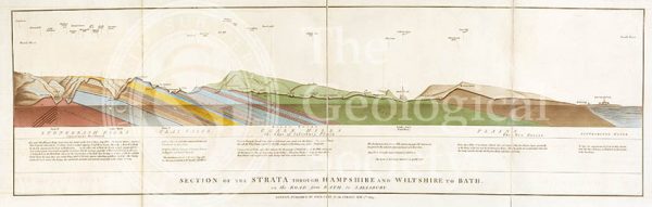
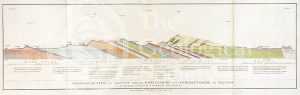
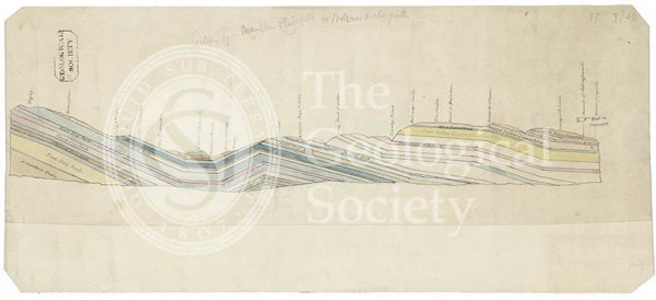
Section of the Strata through Hampshire and Wiltshire to Bath (Smith, 1819)
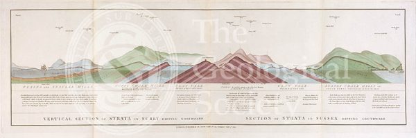
Vertical Section of Strata in Surry (Smith, 1819)
Geological map of the United States and part of Canada (Hitchcock, 1886)
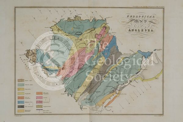
Geological map of Anglesea (Henslow, 1822)
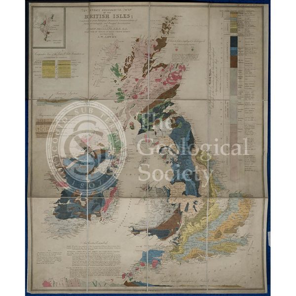
Geological map of the British Isles (Phillips, 1838)
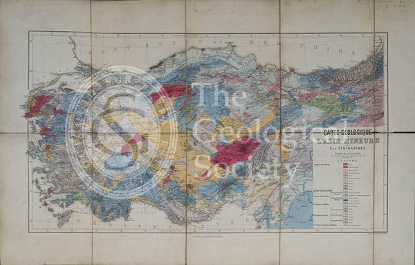
Carte géologique de l’Asia Mineure (Tchihatcheff, 1867)
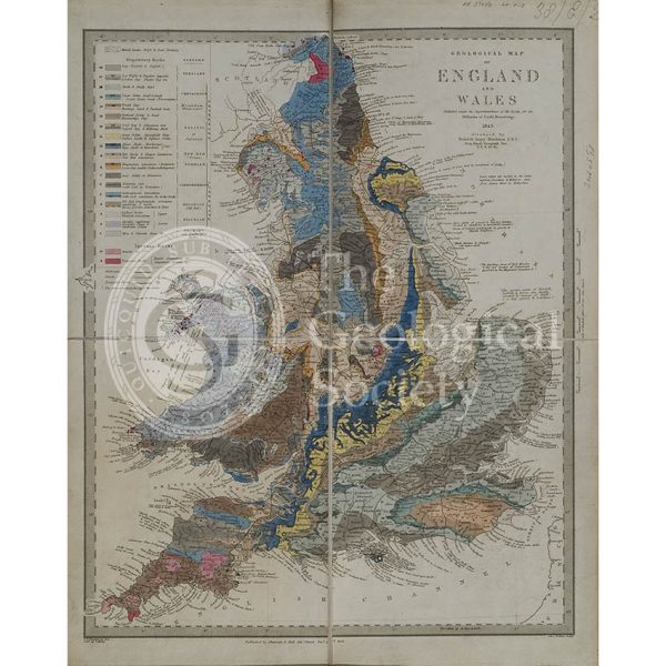
Geological map of England and Wales (Murchison, 1843)
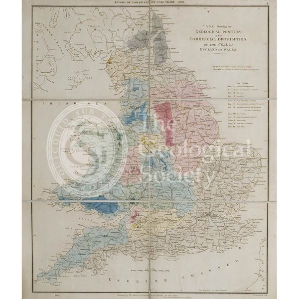
Map showing the Geological Position and Commercial Distribution of the Coal of England and Wales (House of Commons, 1830)
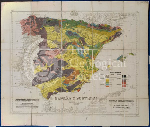
Mapa Geologico de España y Portugal (Coello, 1864)
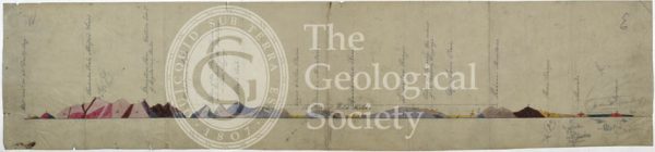
Geological cross section of Otago, New Zealand (Hector, 1862-1864)
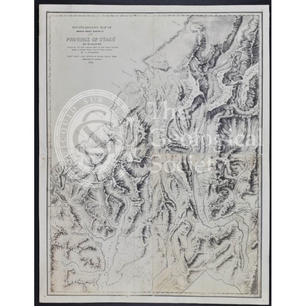
Map of the north west district of Otago, New Zealand (Hector, 1864)
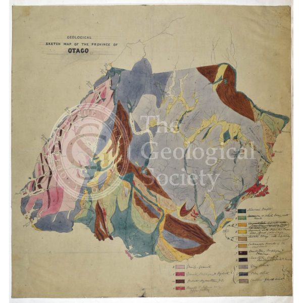
Map of Otago, New Zealand (Hector, 1862-1864)
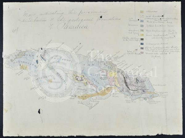
Map of Jamaica (Wall, 1864)
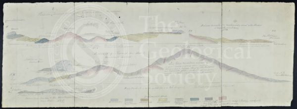
Geological cross sections of Jamaica (Wall, 1864)
Section of England: Petersfield to the Isle of Wight (Greenough, 1812)
Section of England: Chesterfield to Bolsover (Greenough, 1810)
Geological Map of Connemara, Ireland (Nimmo, c.1813)
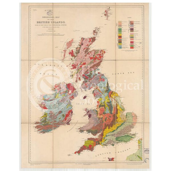
Geological Map of the British Isles (Teall, 1912)