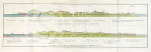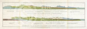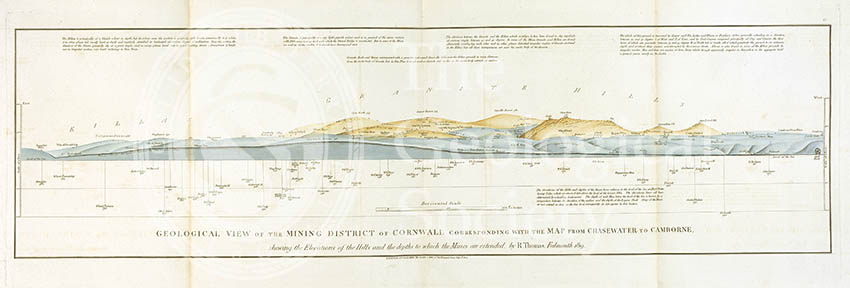
Title: Geological view of the mining district of Cornwall corresponding with the map from Chasewater to Cambourne shewing the elevations of the hills and the depths to which the mines are extended by R. Thomas
Creator: William Smith
Description: One of Smith’s geological views and cross-sections through England and Wales published by John Cary in 1819. This section was done with reference to R. Thomas’s map of Cornwall
Publisher: John Cary
Date: 1819
Format: Watercolours and lithographed ink on paper
Image reference: 07-112
Recommended print size: up to 70 x 50 cm.