
geology

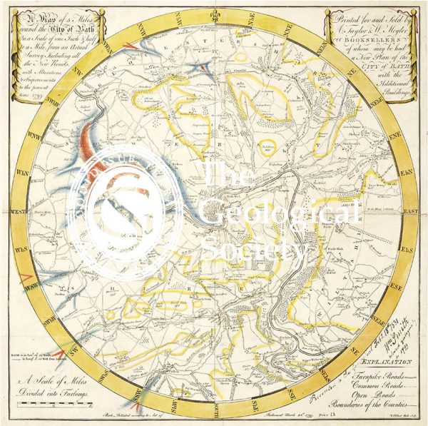
Map of the English Lakes (Ruthven, 1855)
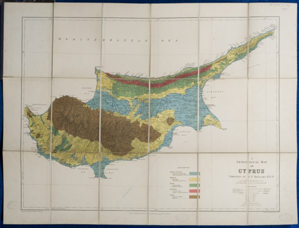
Geological map of Cyprus (Bellamy, 1905)
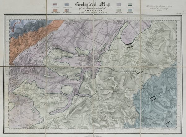
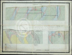
Geological map of the neighbourhood of Cambridge (Jukes-Browne, 1874)
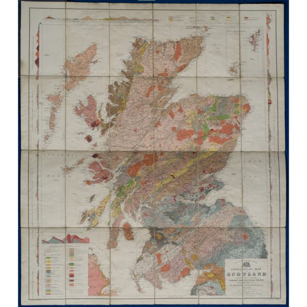
Geological map of Scotland (Geikie, 1910)
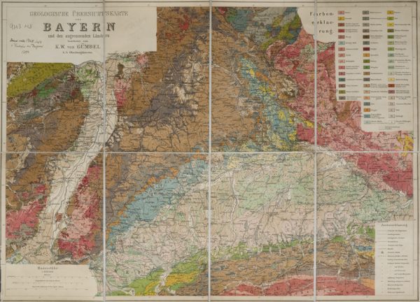
Geologische Übersichtskarte von Bayern und den angrenzenden Ländern (Karl Wilhelm von Gümbel, 1893)
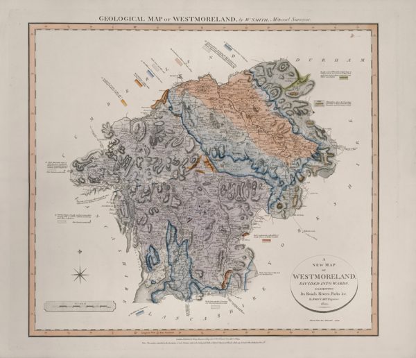
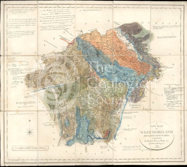
Geological Map of Westmoreland (William Smith, 1824)
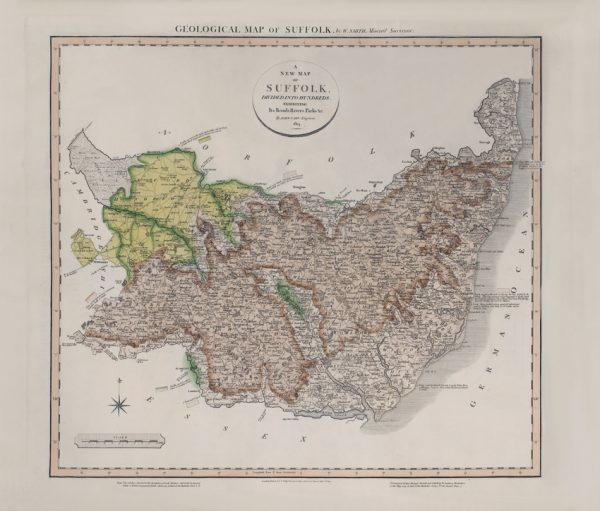
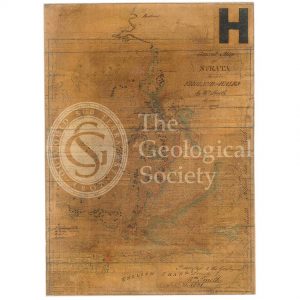
Geological Map of Suffolk (William Smith, 1819)
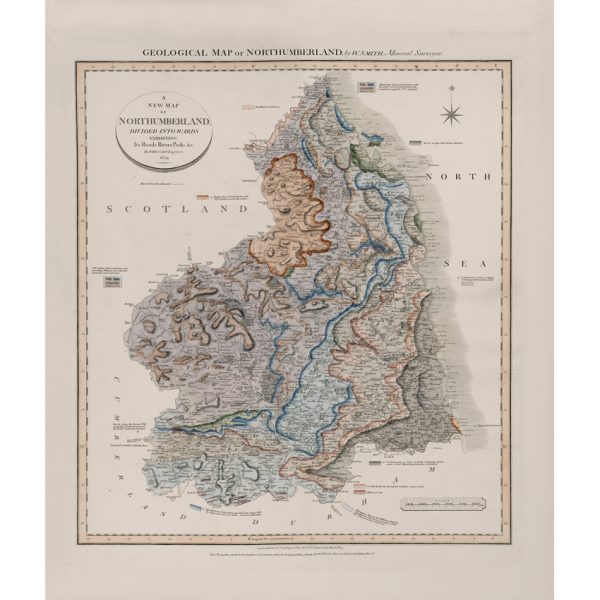
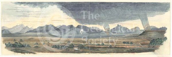
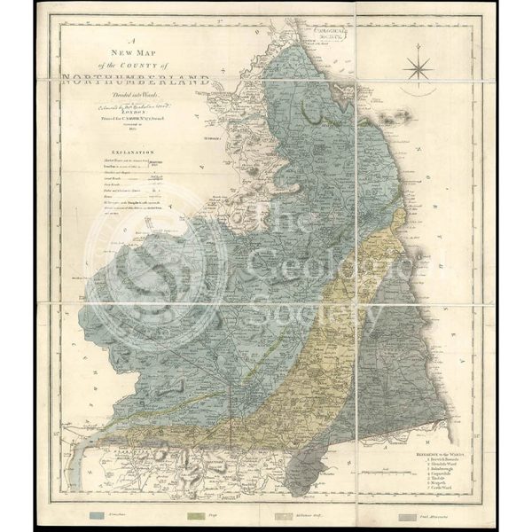
Geological Map of Northumberland (William Smith, 1824)
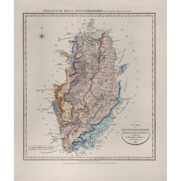
Geological Map of Nottinghamshire (William Smith, 1821)
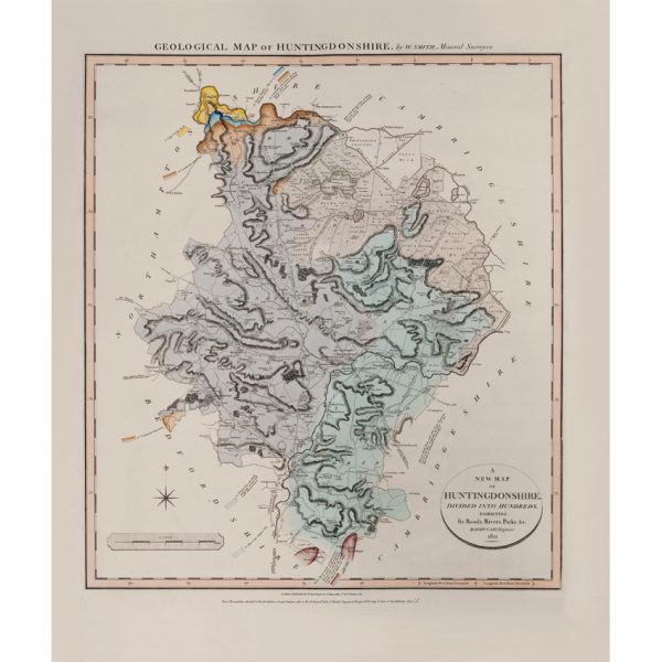
Geological Map of Huntingdonshire (William Smith, 1821)
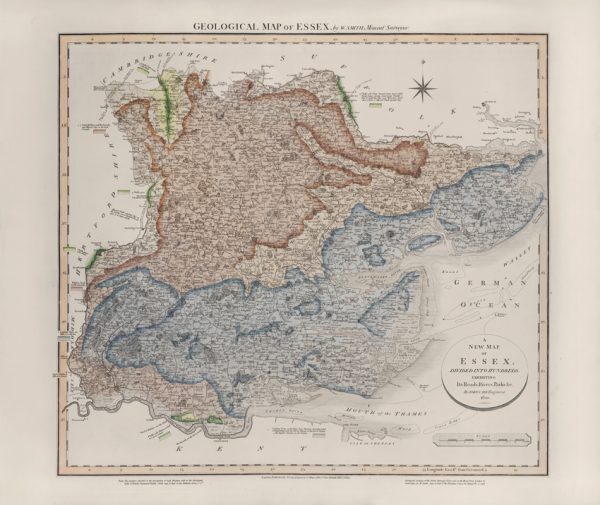
Geological Map of Essex (William Smith, 1820)
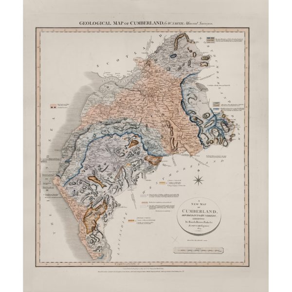
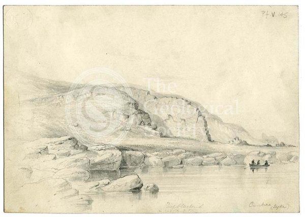
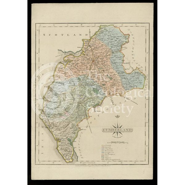
Geological Map of Cumberland (William Smith, 1824)
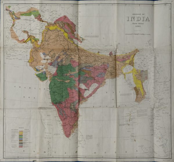
Geological Map of India (Geological Survey of India, 1891)
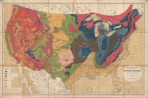
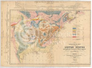
Geological map of the United States (Hitchcock and Blake, 1872)
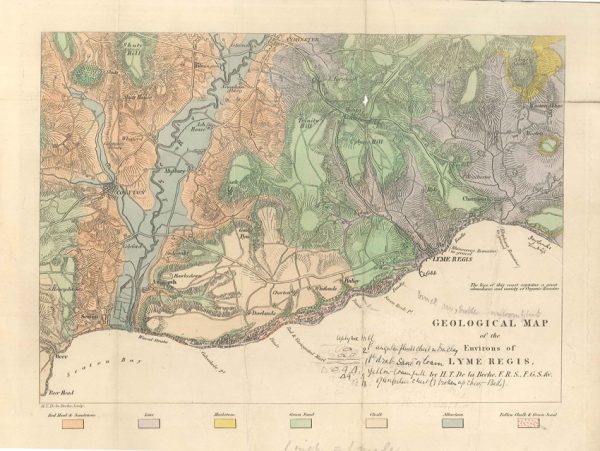
Geological map of the environs of Lyme Reis (De La Beche, 1826)
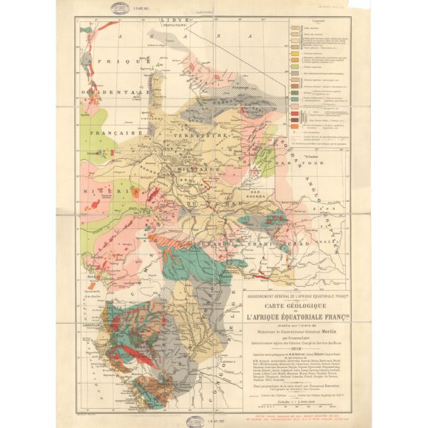
Carte géologique de l’Afrique Équatoriale Française (Loir, 1913)
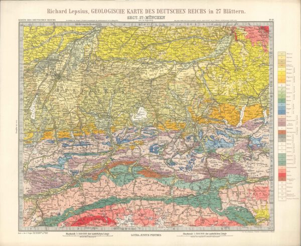
Geologisches Karte des Deutschen Reichs – 27. Munchen (Lepsius, 1897)
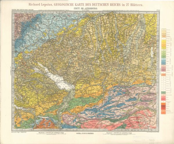
Geologisches Karte des Deutschen Reichs – 26. Augsburg (Lepsius, 1897)
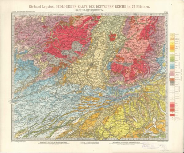
Geologisches Karte des Deutschen Reichs – 25. Mulhausen I-E (Lepsius, 1897)
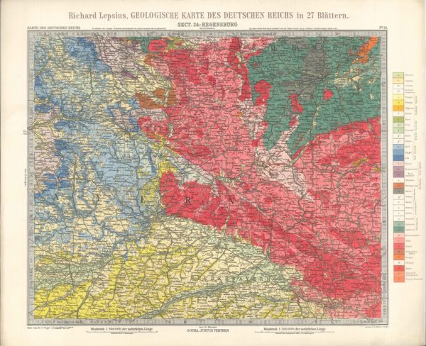
Geologisches Karte des Deutschen Reichs – 24. Regensburg (Lepsius, 1897)
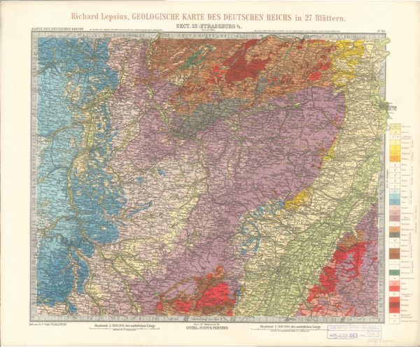
Geologisches Karte des Deutschen Reichs – 22. Strassburg I-E (Lepsius, 1897)
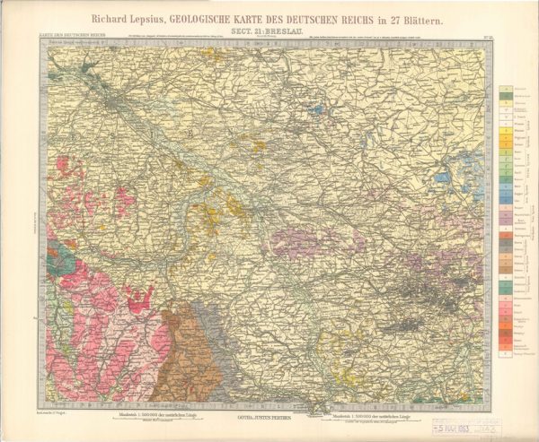
Geologisches Karte des Deutschen Reichs – 21. Breslau (Lepsius, 1897)
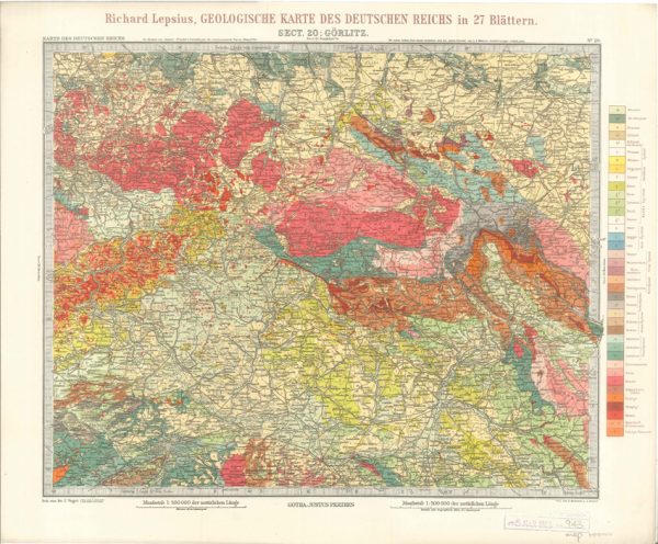
Geologisches Karte des Deutschen Reichs – 20. Gorlitz (Lepsius, 1897)
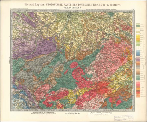
Geologisches Karte des Deutschen Reichs – 19. Dresden (Lepsius, 1897)
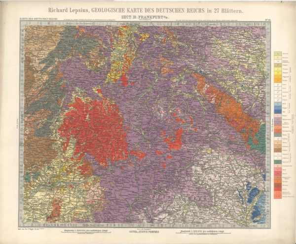
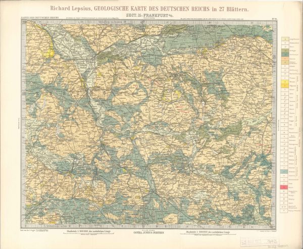
Geologisches Karte des Deutschen Reichs – 18. Frankfurt A-M (Lepsius, 1897)
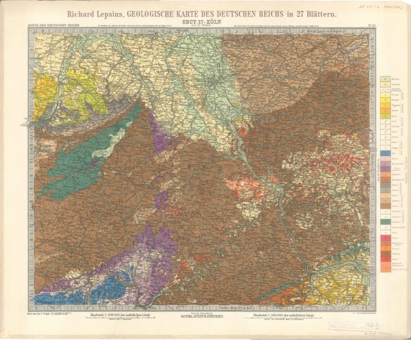
Geologisches Karte des Deutschen Reichs – 17. Koln (Lepsius, 1897)
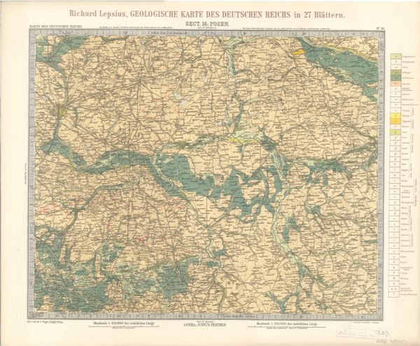
Geologisches Karte des Deutschen Reichs – 16. Posen (Lepsius, 1897)
Geologisches Karte des Deutschen Reichs – 15. Frankfurt A-O (Lepsius, 1897)
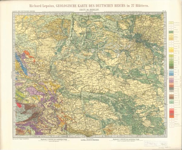
Geologisches Karte des Deutschen Reichs – 14. Berlin (Lepsius, 1897)
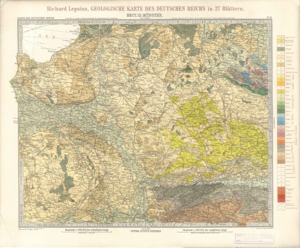
Geologisches Karte des Deutschen Reichs – 12. Munster (Lepsius, 1897)
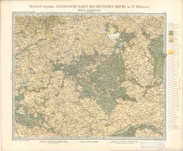
Geologisches Karte des Deutschen Reichs – 11. Allenstein (Lepsius, 1897)
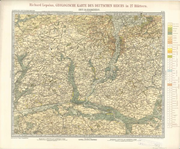
Geologisches Karte des Deutschen Reichs – 10. Bromberg (Lepsius, 1897)
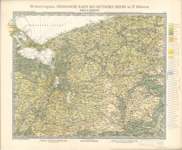
Geologisches Karte des Deutschen Reichs – 9. Stettin (Lepsius, 1897)
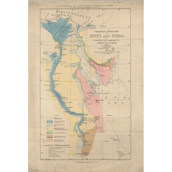
Geological Sketch Map of Egypt and Sinai (Topley 1888)
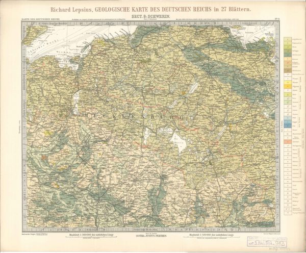
Geologisches Karte des Deutschen Reichs – 8. Schwerin (Lepsius, 1897)
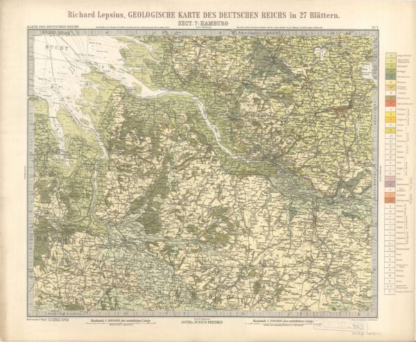
Geologisches Karte des Deutschen Reichs – 7. Hamburg (Lepsius, 1897)
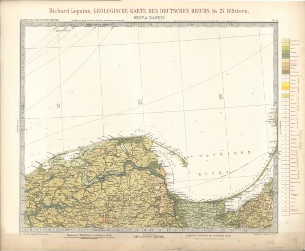
Geologisches Karte des Deutschen Reichs – 4. Danzig (Lepsius, 1897)
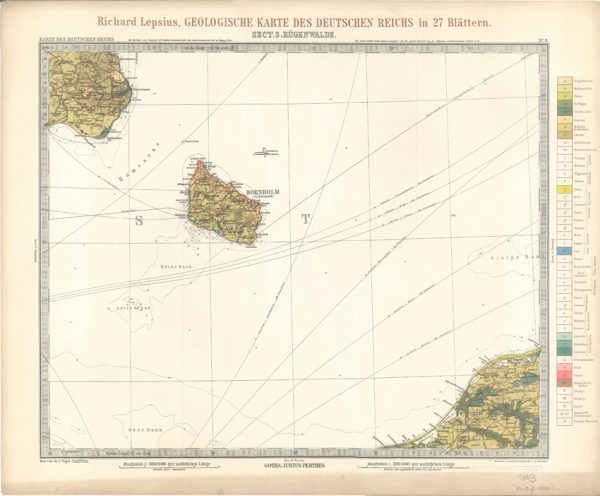
Geologisches Karte des Deutschen Reichs – 3. Rugenwalde (Lepsius, 1897)
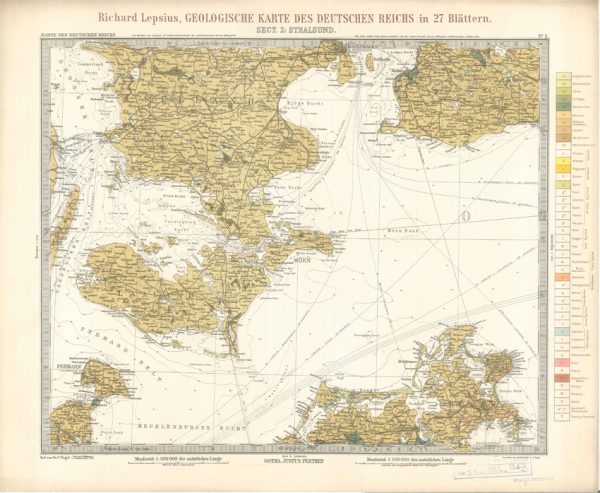
Geologisches Karte des Deutschen Reichs – 2. Stralsund (Lepsius, 1897)
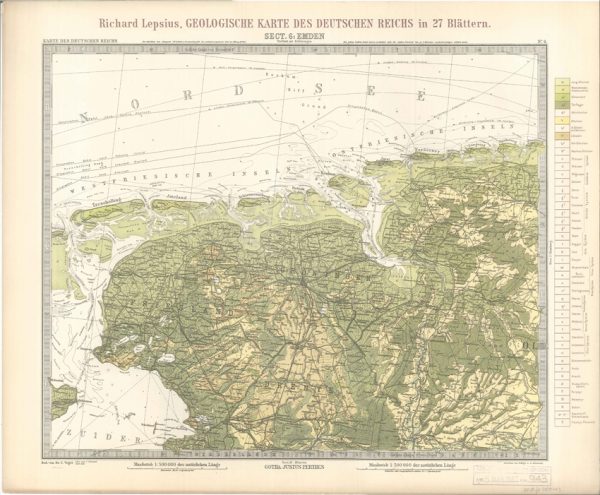
Geologisches Karte des Deutschen Reichs – 6. Emden (Lepsius, 1897)
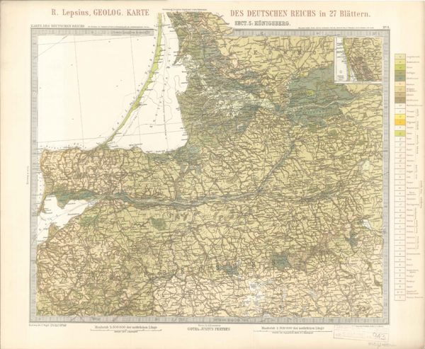
Geologisches Karte des Deutschen Reichs – 5. Konigsberg (Lepsius, 1897)
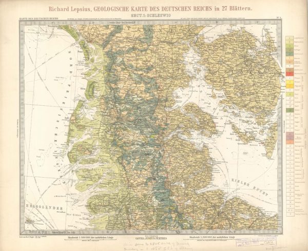
Geologisches Karte des Deutschen Reichs – 1. Schleswig (Lepsius, 1897)
George Simmonds [Simonds] Boulger (1853-1922)
William Buckland (1784-1856)

Discussion on the Piltdown Skull
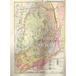
Geological Map of the Rhobell Fawr District (Wells, 1925)
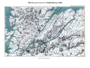
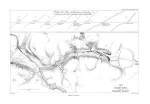
Map shewing the Connections of Glen Roy with the Sea (Cross, 1817)
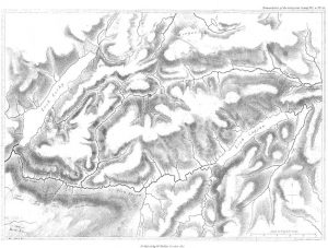
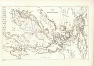
Map of Glen Roy (MacCulloch, 1817)
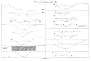
Sections of Glen Roy (MacCulloch, 1817)
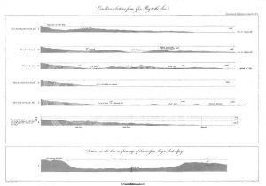
Curvilinear Sections from Glen Roy to the Sea (MacCulloch, 1817)
Various flexures of gneiss in Lewis (Stewart after MacCulloch, 1819)
Selected parts of the East Coast of Trotternish (Stewart after MacCulloch, 1819)
Granite veins and gneiss at Cape Wrath… (Stewart after MacCulloch, 1819)
Trap veins at Airdnamurchan point… (Stewart after MacCulloch, 1819)
Sky and the adjoining islands (Stewart after MacCulloch, 1817)
Sky and the adjoining islands (Stewart after MacCulloch, 1817)
Geologische Elementarkarte, plate 3 (Klöpfel, 1838)
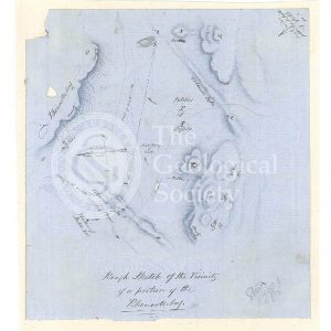
Sketch map of the Rhenosterberg, South Africa (Stow, 1858)
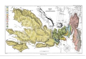
Plan of Glen Roy and of the Parallel Roads (MacCulloch, 1817)
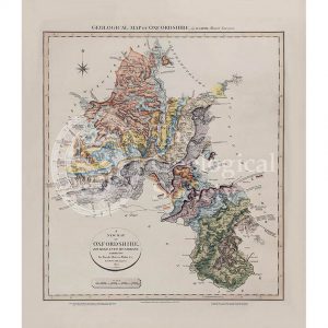
Geological map of Oxfordshire (William Smith, 1820)
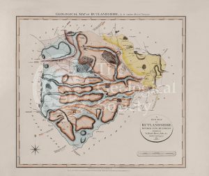
Geological Map of Rutlandshire (William Smith, 1822)
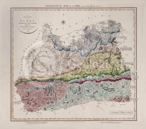
Geological Map of Surry (William Smith, 1819)
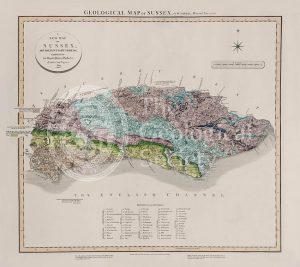
Geological Map of Sussex (William Smith, 1819)
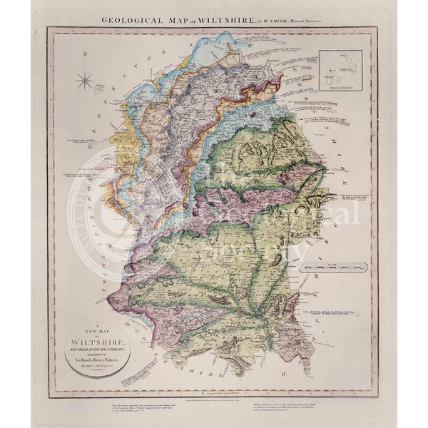
Geological Map of Wiltshire (William Smith, 1819)
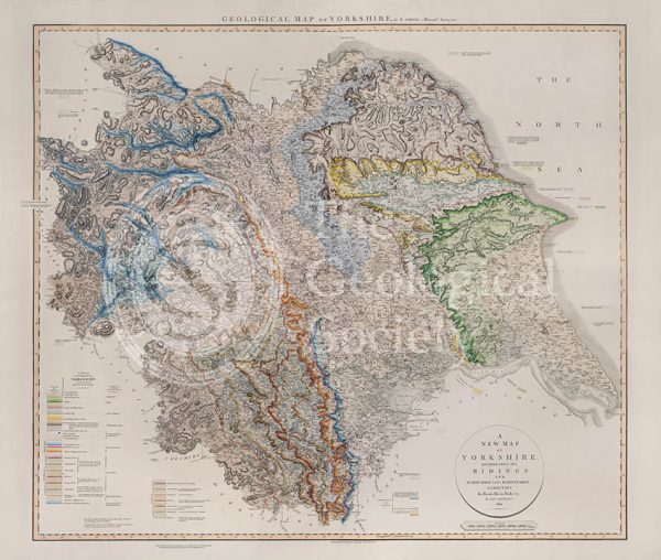
Geological Map of Yorkshire (William Smith, 1821)
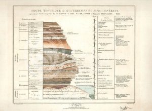
Theoretical section through the Paris Basin (Cuvier, Brongniart and Clerget, 1832)
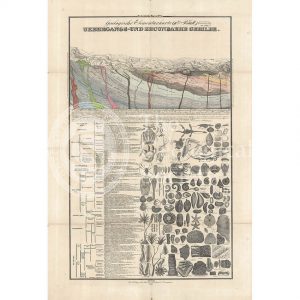
Imaginary plan and sections of Wernerian formations (Theonert, c.1810)
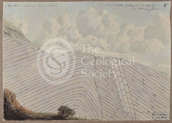
‘Curvature in Lias near Shepton Mallet’
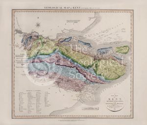
Geological Map of Kent (William Smith, 1819)
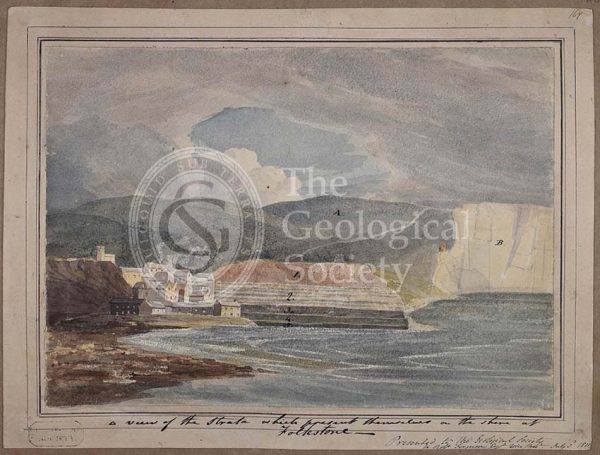
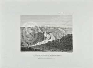
‘A view of the strata which present themselves on the shore of Folkestone’
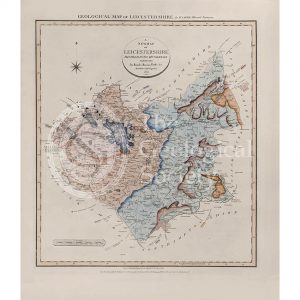
Geological Map of Leicestershire (William Smith, 1822)
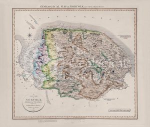
Geological Map of Norfolk (William Smith, 1819)
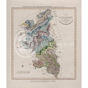
Geological Map of Buckinghamshire (William Smith, 1820)
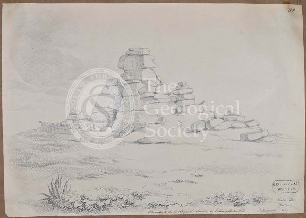
Vixen Tor, Dartmoor
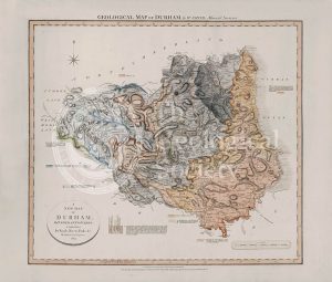
Geological Map of Durham (William Smith, 1824)
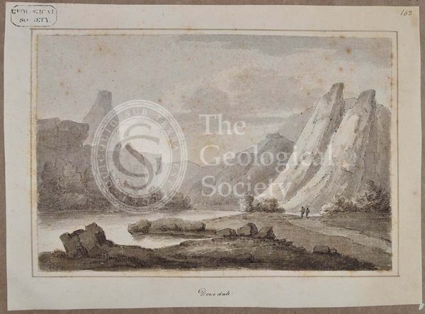
‘Dovedale’
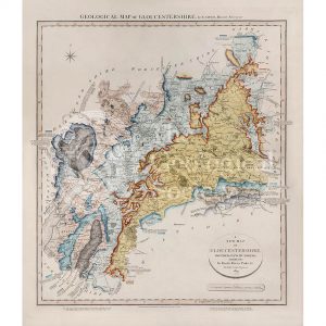
Geological Map of Gloucestershire (William Smith, 1819)
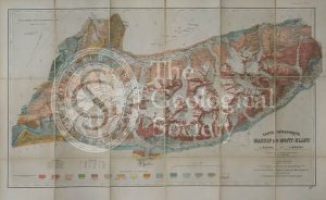
Carte géologique du Massif du Mont-Blanc (Duparc and Mrazec, 1896)
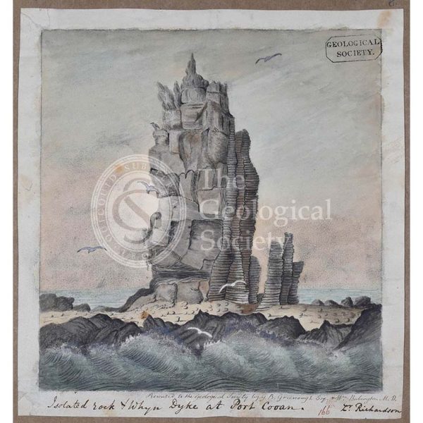
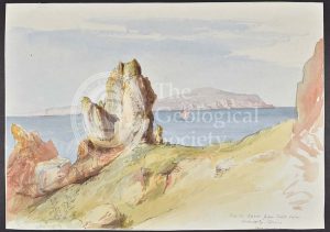
‘Isolated rock and whyn dyke at Port Cooan’
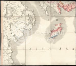
Geological Map of Arran (The Survey, 1910)
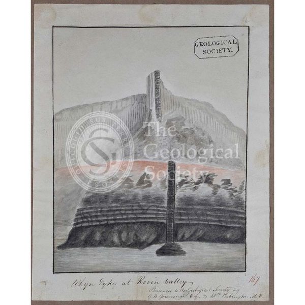
‘Whyn dyke at Rovin Valley’
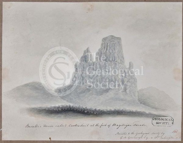
‘Basaltic tower called Castro Levit at the foot of Magilligan Facade’
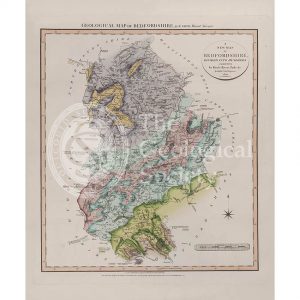
Geological Map of Bedfordshire (William Smith, 1820)
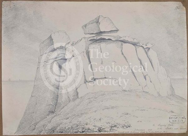
The logging rock at the Lands End Cornwall
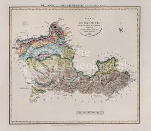
Geological Map of Berkshire (William Smith, 1819)
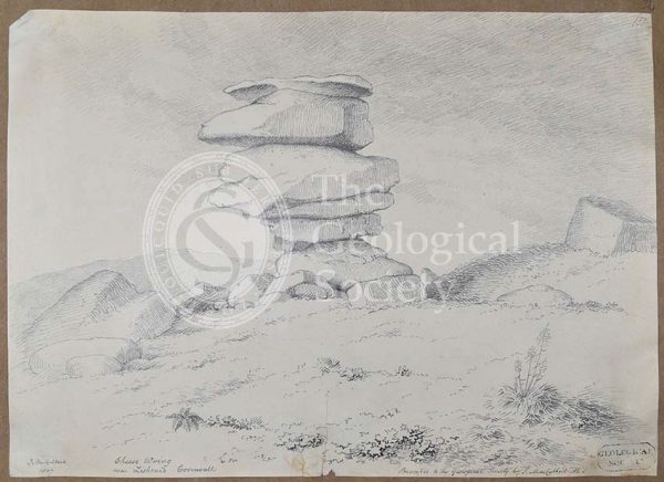
Cheese Wring near Liskeard, Cornwall
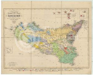
Geognostische Karte Sicilien (Hoffmann, 1839)
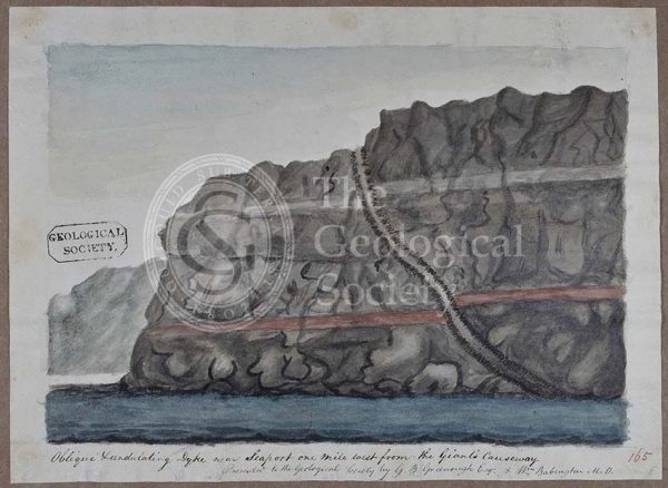
‘Oblique undulating dyke near Seaport one mile west from the Giants Causeway’
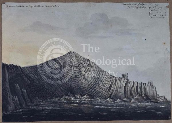
‘Grauwacke rocks at Fass Castle in Berwickshire’
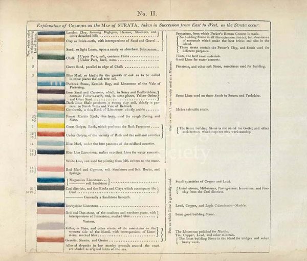
Table of the ‘Explanation of Colours on the Map of Strata…’
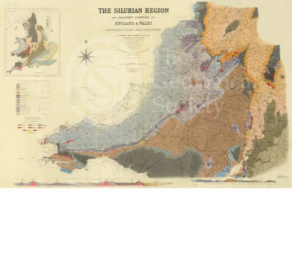
Map of the Silurian Region (Murchison, 1838)
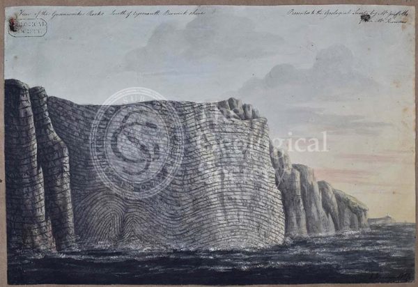
‘View of the Grauwacke rocks south of Eyemouth Berwickshire’
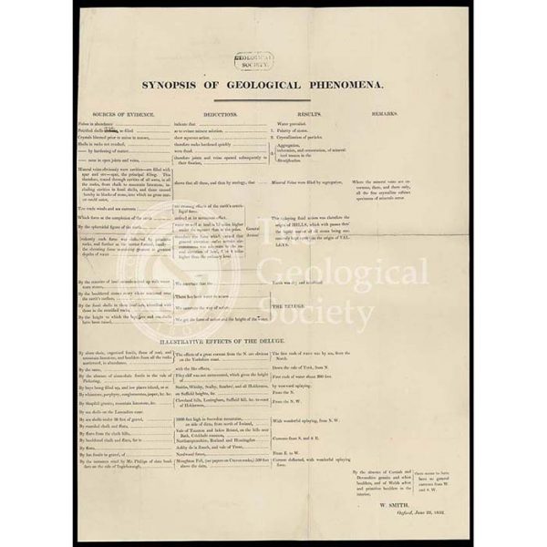
‘Synopsis of Geological Phenomena’
Geological map of Brough-under-Stainmore (Geological Survey of England & Wales, 1893)
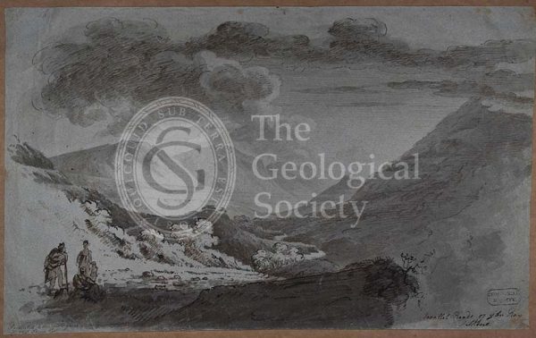
‘Parallel roads of Glen Roy’
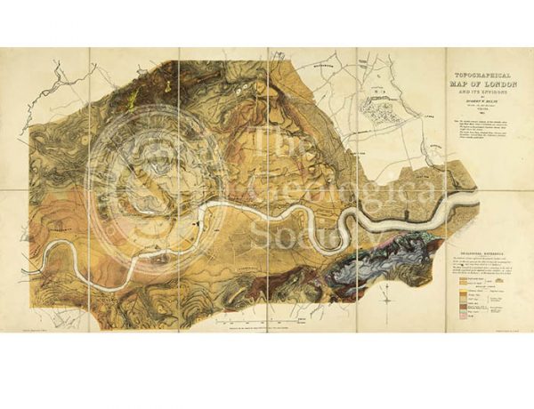
Topographical [and Geological] Map of London… (Mylne, 1851)
Dyke on Great Cumbra, Western Isles, Scotland
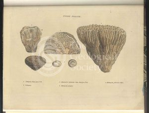
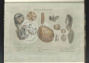
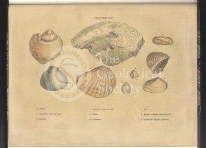
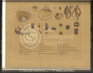
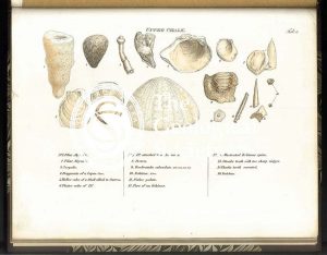
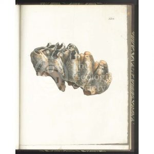
Upper Oolite fossils
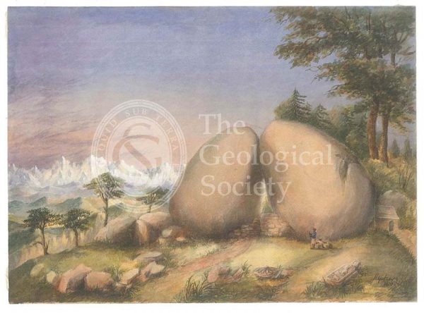
Boulder rocks at Debre Doura, Kumaun, India
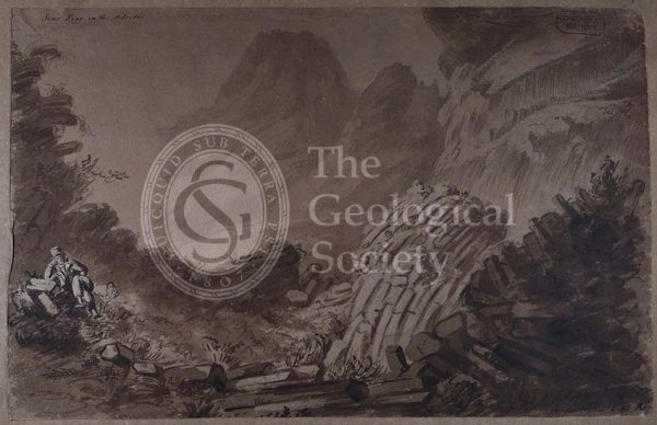
‘Scur Eigg in the Hebrides’
Sukhoboisk, Samilovsky and Froloosky copper mines
Clay over the Upper Oolite fossils
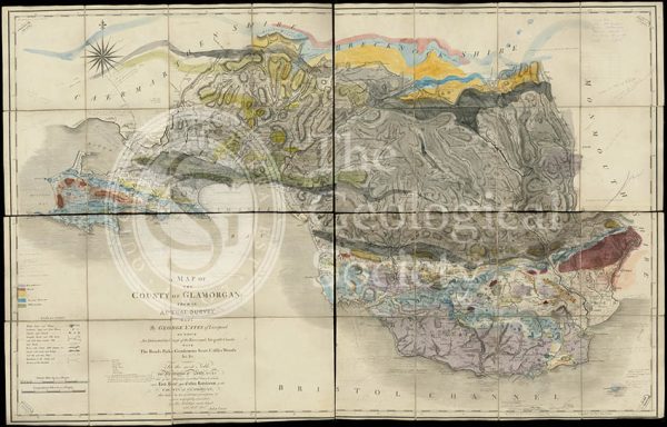
Geological map of Glamorgan (Greenough/Smith 1799-1818)
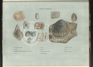
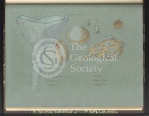
Fullers Earth fossils
Geological map of Cumberland (Fry, c.1814)
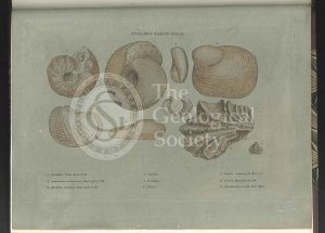
Forest Marble fossils
Coral Rag fossils
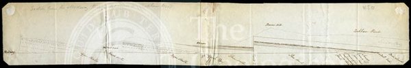
Section from the Medway through Upnor to Cockham Wood (Dadd, 1833)
Clunch Clay fossils
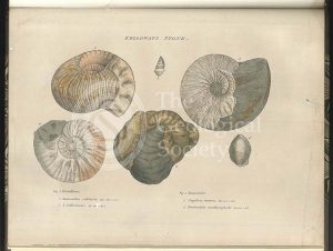
Kelloways Stone fossils
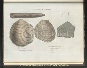
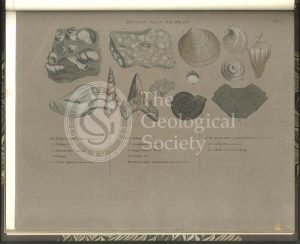
Cornbrash fossils
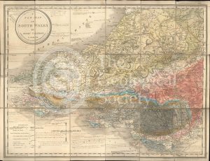
A New Map of South Wales (Greenough and Coltman, between 1813-1839)
‘Cape Wrath’
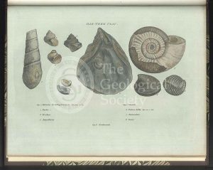
Oak Tree Clay fossils
‘North Suter from South Suter’
Section of the Bath Easton Mine in Somersetshire (Webster, 1812)
Greenough’s copy of William Smith’s geological map (Smith with notes by Greenough, 1815/1818)
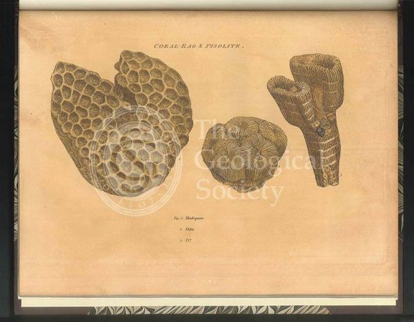
Coral Rag fossils
Sections and plan of the collieries around Nailsea (Martin and Smith, 1811)
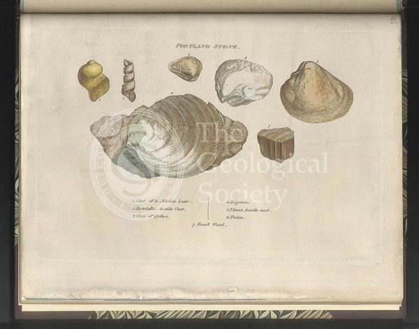
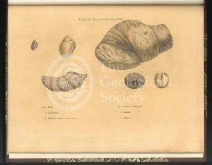
Portland Stone fossils
William Smith’s Table of Strata… under UVA light (Smith original 1799, UVA negative 1972)
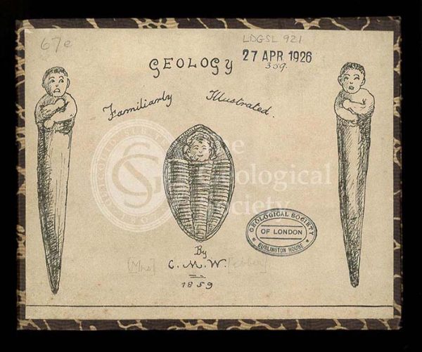
‘Geology, familiarly illustrated’
Green Sand fossils
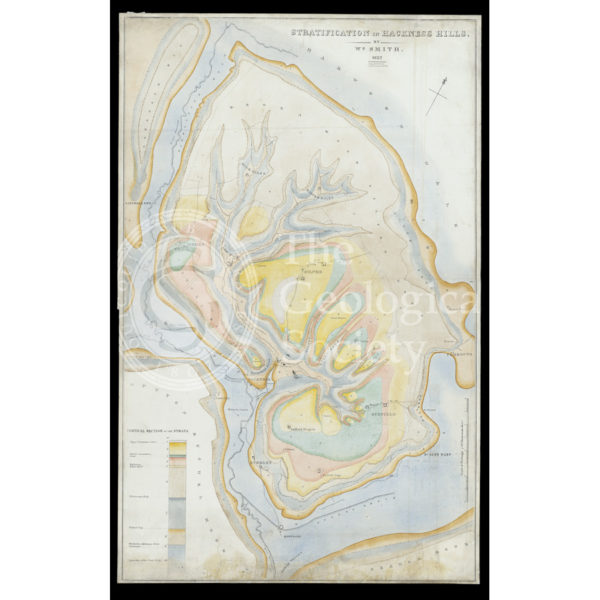
Stratification in Hackness Hills (Smith, 1832)
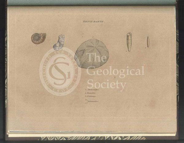
Brick Earth fossils
‘Cunaig in Assynt, Sutherlandshire’
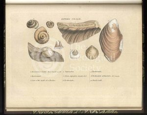
‘Craig’ [Crag] fossils
Table of Strata in the Vicinity of Bath (Smith & Richardson, 1799)
Upper Chalk fossils
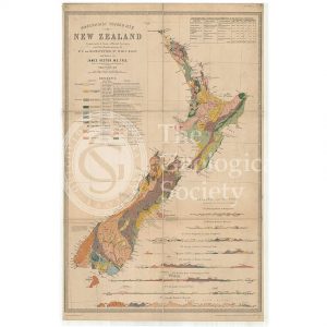
Map of New Zealand (James Hector, 1873)
Lower Chalk fossils
Reproduction of William Smith’s Table of Strata… (Judd after Smith & Richardson, 1897)
Green Sand fossils
London Clay fossils
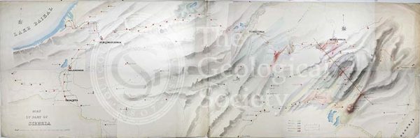
Geological Map of the country east of Lake Baikal, Siberia
Reconstruction of William Smith’s “General Map of Strata found in England & Wales” (Judd & Reekes, 1897)
Tooth of a Mastodon
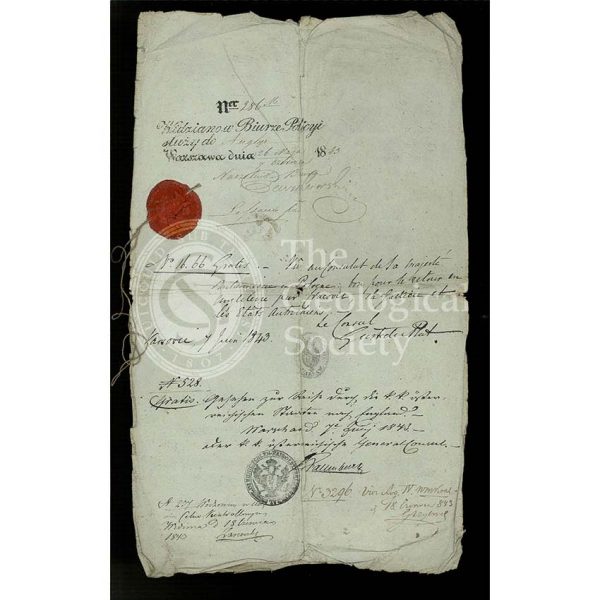
Roderick Murchison’s Russian ‘passport’
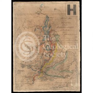
General map of strata found in England & Wales (Smith 1794/1801)
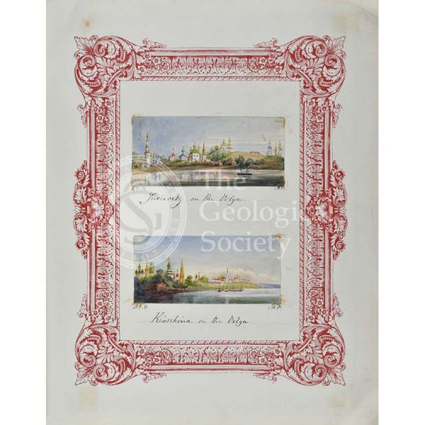
Jurievetz & Kinschina on the Volga
Geological Map of Bath (Smith, 1799)
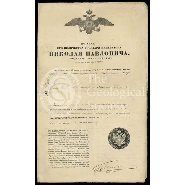
Roderick Murchison’s travel permit for Russia
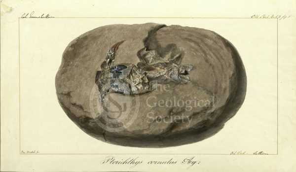
Pterichthys cornutus Agassiz
Roderick Murchison’s Russian ‘passport’
Reconstruction of William Smith’s Geological Map of Bath (1799) (Lam, 2014)
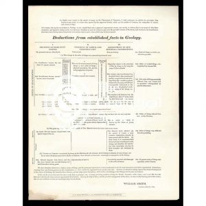
‘Deductions from established facts in geology’
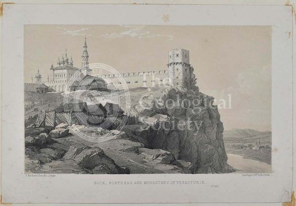
‘Rock, Fortress and monastery of Verkoturie’
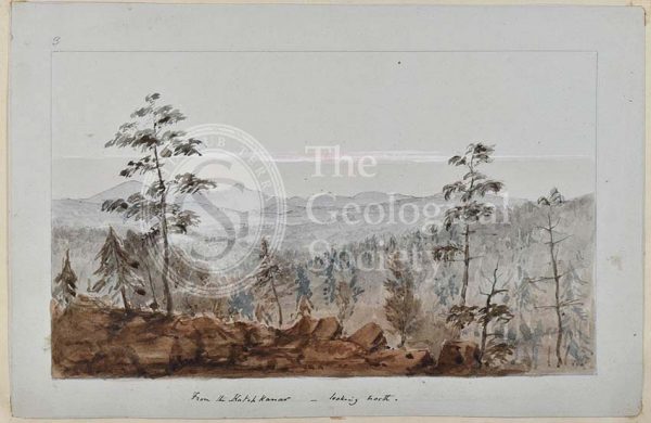
‘From the Katchnakar – looking north’
Greenough’s Map of Westmoreland (Greenough after Smith, 1824-1843)
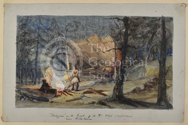
‘Balagan in the Forests of the N Ural’
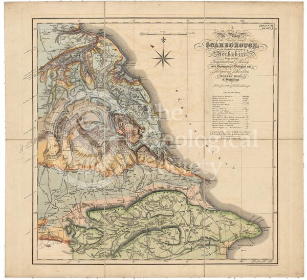
Geological map of Scarborough (Smith, 1831)
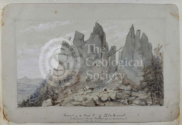
‘Summit of the Ural E of Zlatoust’
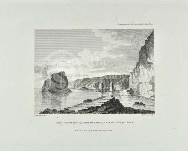
‘General view of Port Des Moulins in the Isle of Sercq’
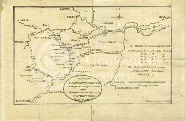
Plan of the ‘Proposed Aire & Dunn Canal’ (Smith and Phillips, 1819)
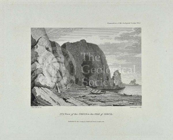
‘View of the Creux in the Isle of Sercq’
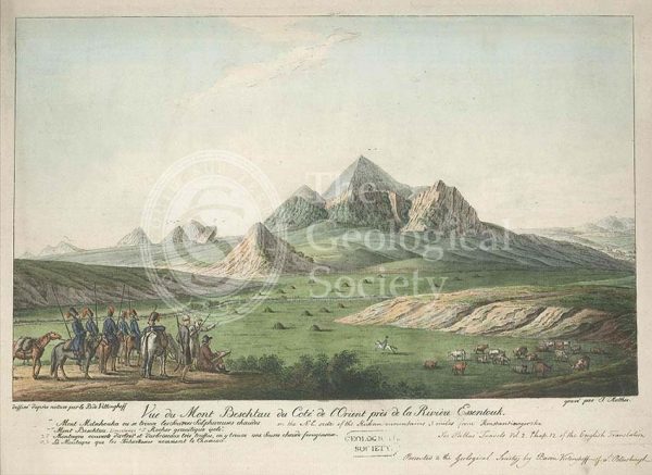
Mount Beshtau, Russia
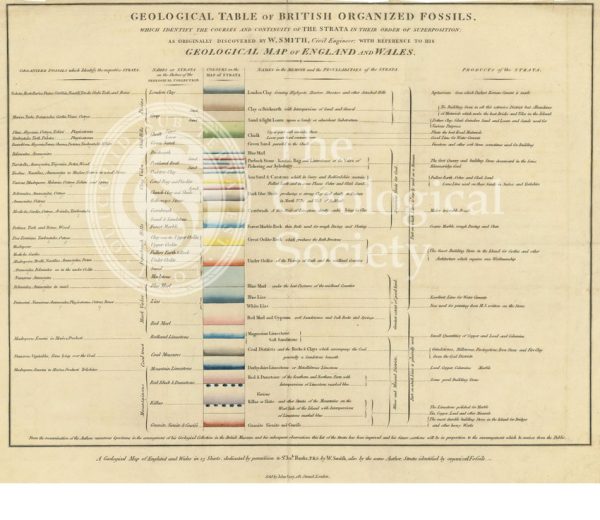
‘Geological table of British organized fossils…’
‘View of the Coupee in the Isle of Sercq’
View of the Rhenosterberg mountains, South Africa
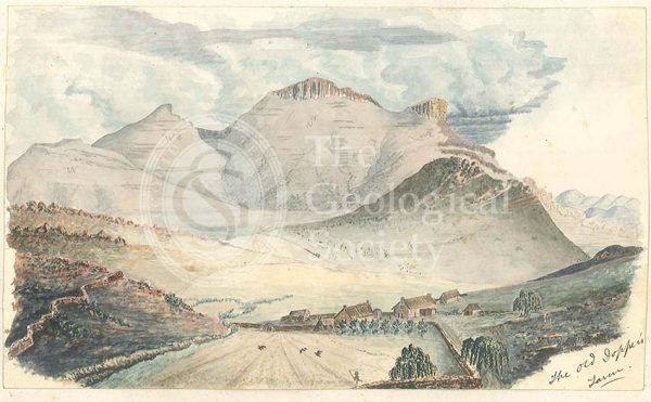
Old Dopper’s Farm, in the Rhenosterberg mountains, South Africa
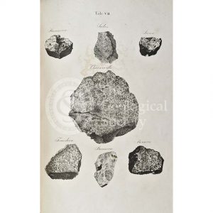
Meteorites (ordinary chondrite)
Geological map of Northumberland (Wood, 1831)
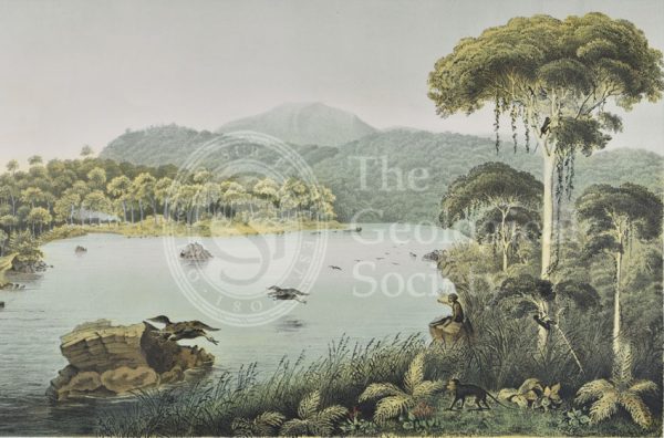
Lake Patengan, Java
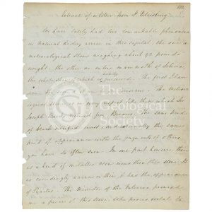
‘Extract of a letter from St Petersburg’
Dieng Plateau, Java
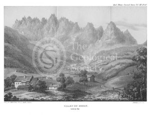
Valley of Gosau, Salzburg Alps
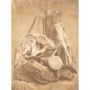
Whale bones from Spitzbergen
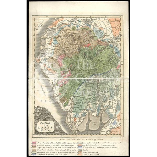
District of the Lakes (Otley, 1837)
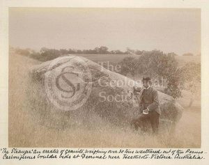
‘The Stranger’
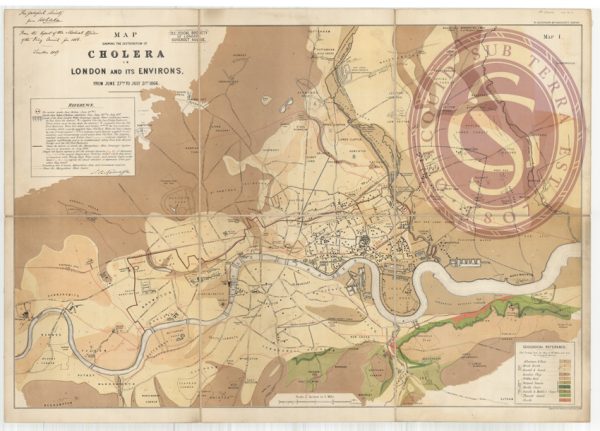
Map showing the distribution of cholera in London
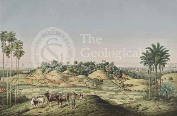
North coast of Java, Indonesia
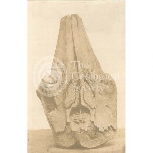
Skull of a whale from Spitzbergen
Section of a [gold] mine, north of Orenburg, Russia
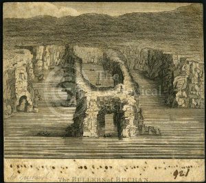
‘The Bullers of Buchan’
‘Human fossil’
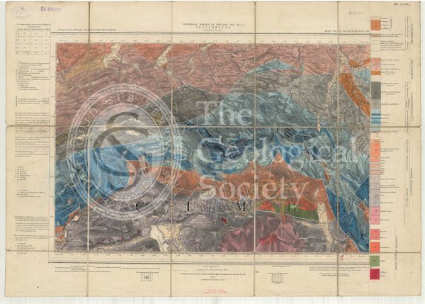
Geological map of England and Wales, Sheet 101 NE Cockermouth (1890)
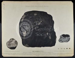
‘Meteorolites’
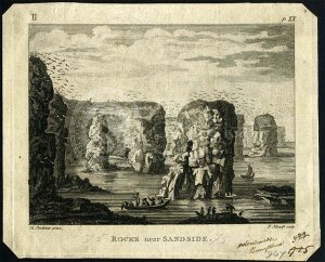
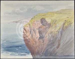
‘Rocks near Sandside’
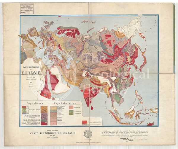
Carte tectonique de l’Eurasie (Argand, 1928)
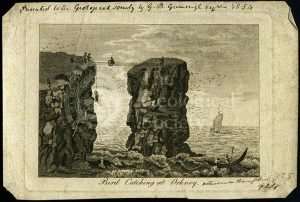
‘Bird catching at Orkney’
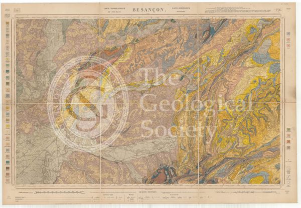
Carte géologique de la France 1:80,000. Feuille 126 Besançon (1892)
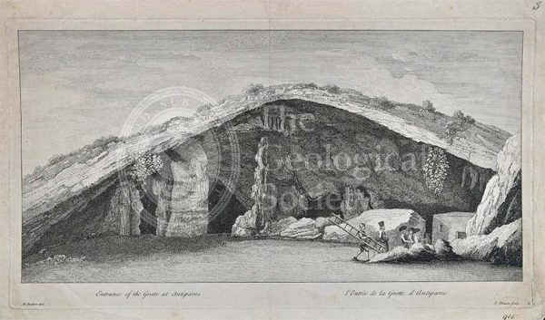
Entrance to the Grotto of Antiparos
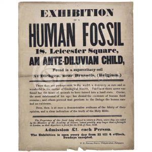
Advertisement for a ‘Human Fossil’
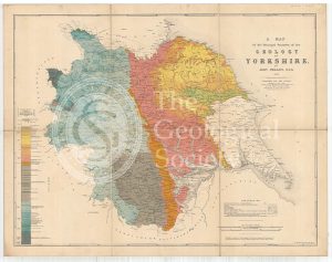
A Map of the Principal Features of the Geology of Yorkshire (Phillips, 1853)
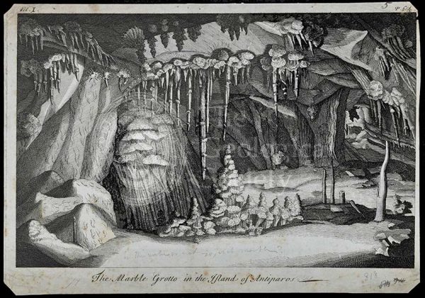
Marble Grotto in the Island of Antiparos
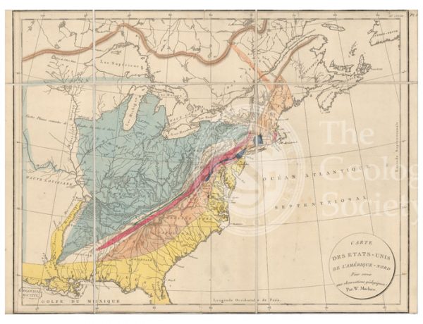
Carte des Etats-Unis de l’Amerique-Nord [Map of North America] (Maclure, 1811)
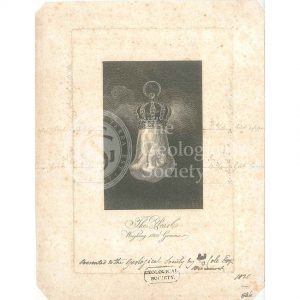
The ‘Hope Pearl’
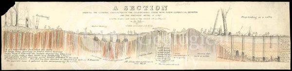
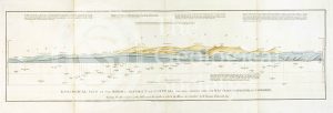
‘Section showing the general characters of the gold-bearing rocks with their superficial detritus…’
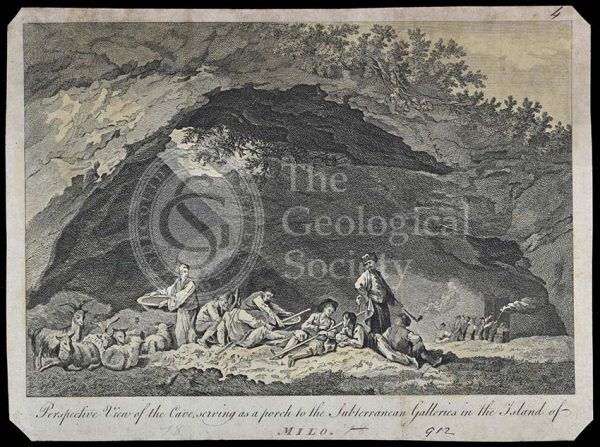
Subterranean galleries in the Island of Milo
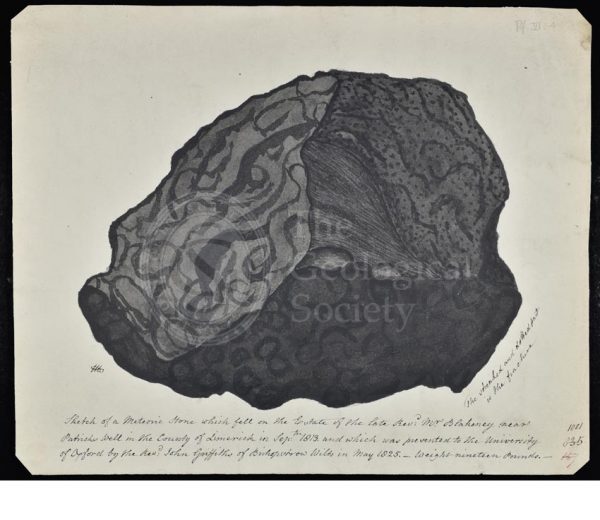
Meteorite that fell in County Limerick
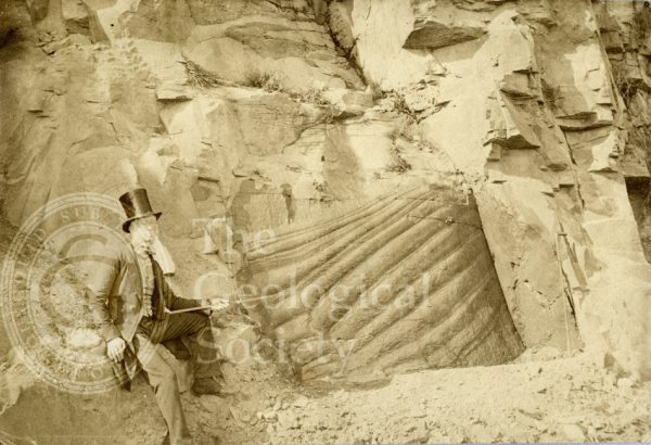
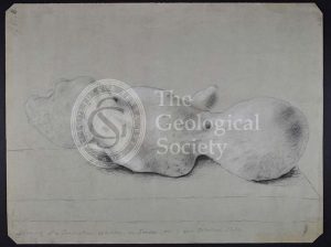
Peculiar appearance of a rock surface
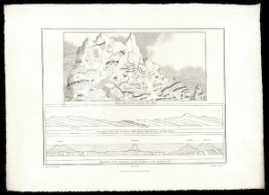
Geological Sections in Illustration of the Map of the Mining District of Cornwall (Smith, 1819)
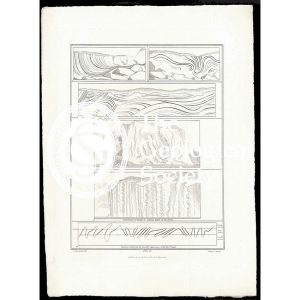
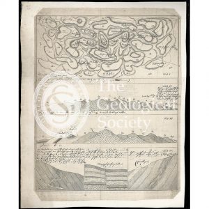
Geological view and sections of Norfolk and Suffolk (Smith, 1819)
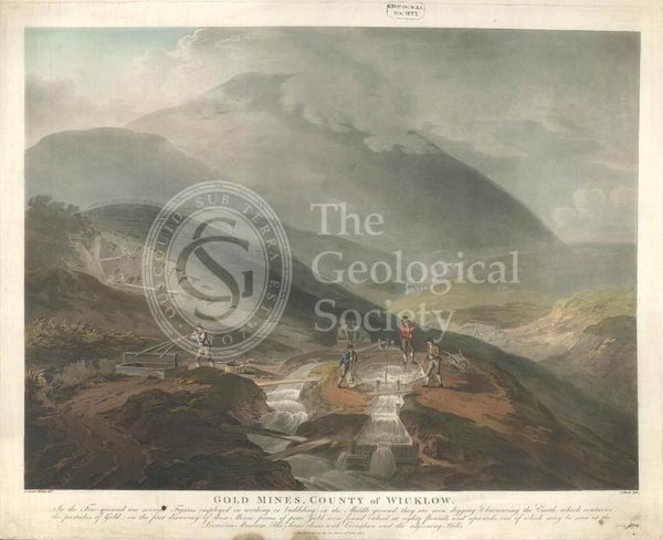
‘Gold mines, County of Wicklow’
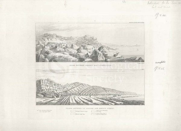
Views of the French coast
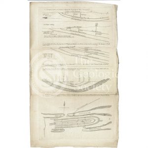
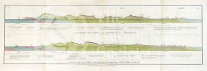
Geological views and sections of Essex/Hertfordshire and between London and Cambridge (Smith, 1819)
Geological Map of the United States and the British Provinces of North America (Marcou, 1853)
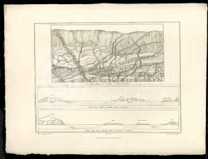
Geological View of the Mining District of Cornwall (Thomas, 1819)
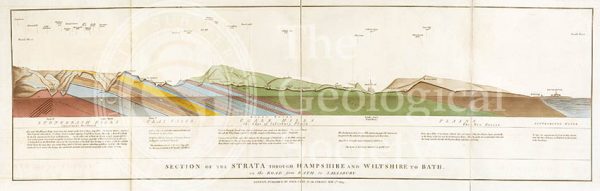
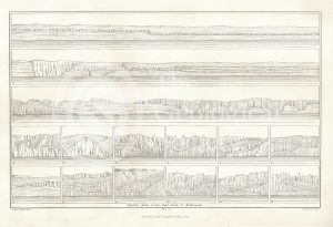
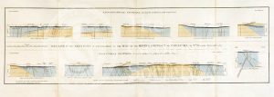
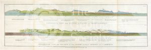
Section of the Strata through Hampshire and Wiltshire to Bath (Smith, 1819)
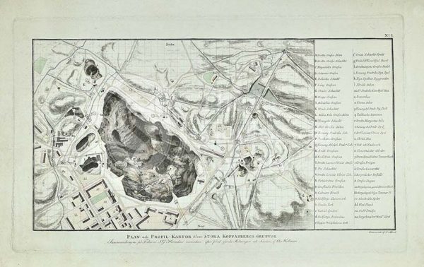
Plan of Stora Grufna coppermine, Sweden