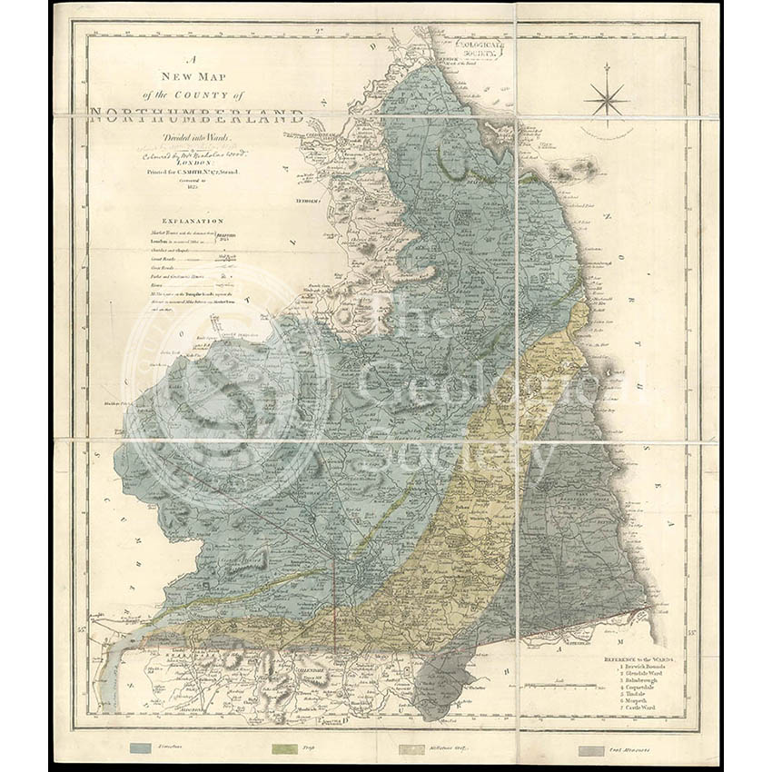
Title: Geological map of Northumberland
Creator: By or after Nicholas Wood (1795-1865)
Description: Geological map of the county of Northumberland, manuscript colouring by or after Nicholas Wood, [1831], on base map ‘A New and Correct Map of the County of Northumberland divided into Wards’, engraved by Jones, Smith & Co, published by Charles Smith, 1825. With key. Scale-1:220,000, 54cm x 47cm. Dissected on cloth.
Note: The colouring is from ‘Wood, Nicholas’, “On the Geology of a part of Northumberland and Cumberland”, ‘Transactions of the Natural History Society of Northumberland, Durham and Newcastle Upon Tyne’, vol 1 (1831), pp302-334′, plate XXVIII. However it is unclear if the map was actually coloured by Wood (and therefore was the artwork for the above) or was copied from Wood’s map by another hand. The map is from the collection of George Bellas Greenough (1778-1855) who was interested in geological mapping.
Date: Colouring [1831], base map, 1825
Format: Watercolour on engraved base
Archive reference: LDGSL/947/6/D/1/2
Image reference: 07-127
Recommended print size: Up to 70 x 50cm