
geologicalmap
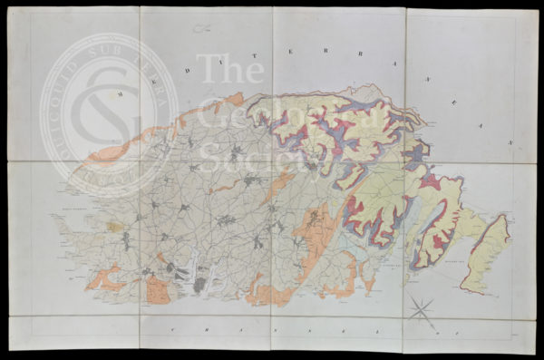
Geological map of Malta (1856)
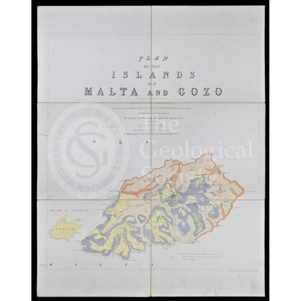
Geological map of Gozo and Cominos, Malta
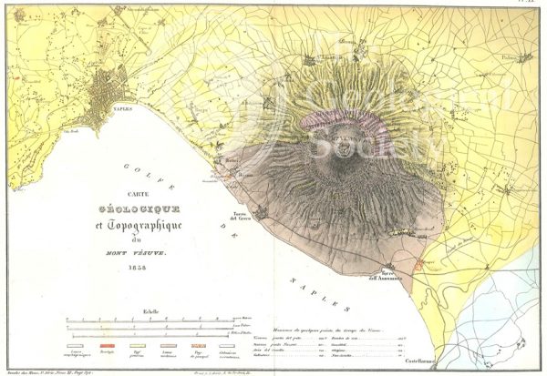
Carte géologique et topographique du Mont Vésuve (Dufrenoy, 1838)
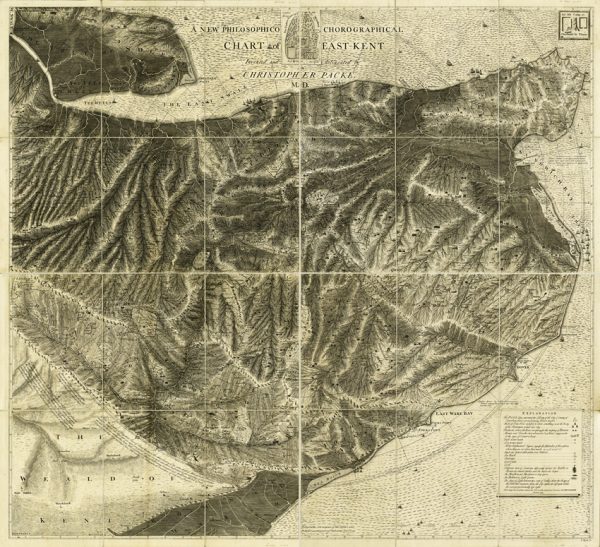
A new philosophico chorographical chart of East-Kent (Packe, 1743)

Map of the English Lakes (Ruthven, 1855)
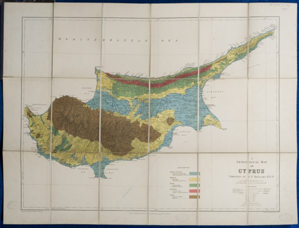
Geological map of Cyprus (Bellamy, 1905)
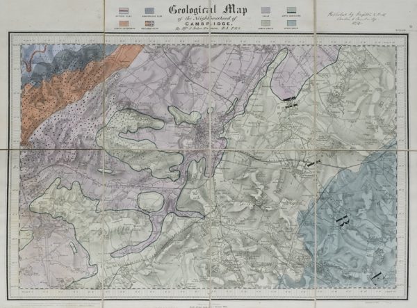
Geological map of the neighbourhood of Cambridge (Jukes-Browne, 1874)
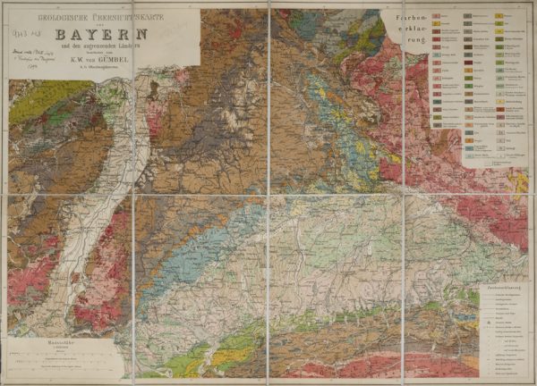
Geologische Übersichtskarte von Bayern und den angrenzenden Ländern (Karl Wilhelm von Gümbel, 1893)
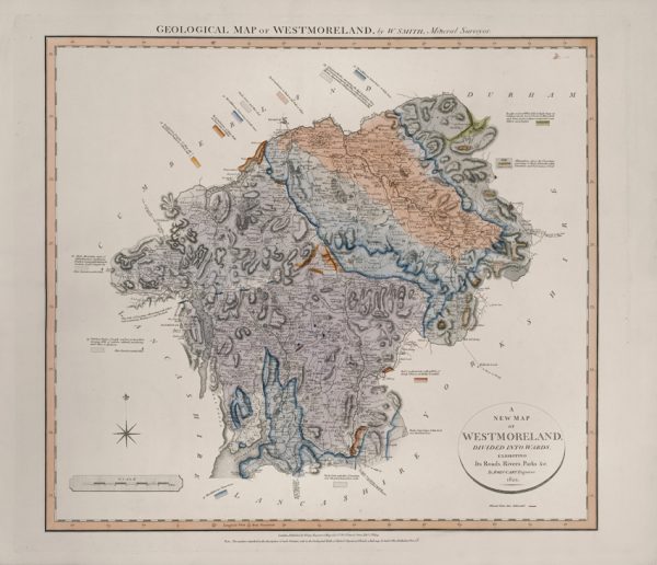
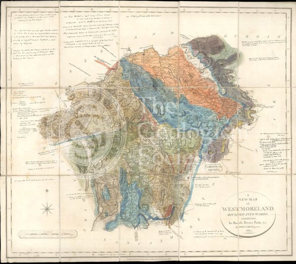
Geological Map of Westmoreland (William Smith, 1824)
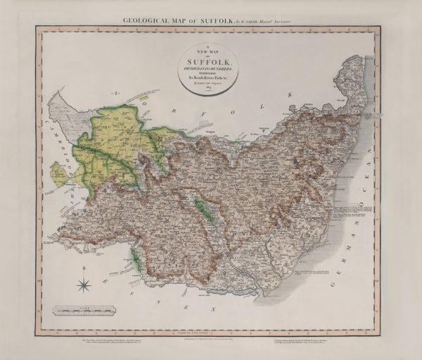
Geological Map of Suffolk (William Smith, 1819)
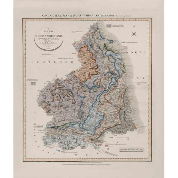
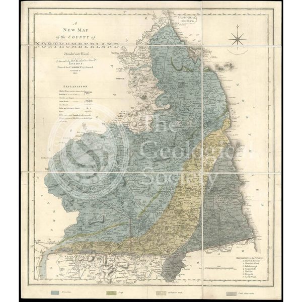
Geological Map of Northumberland (William Smith, 1824)
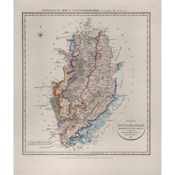
Geological Map of Nottinghamshire (William Smith, 1821)
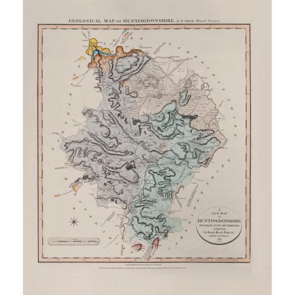
Geological Map of Huntingdonshire (William Smith, 1821)
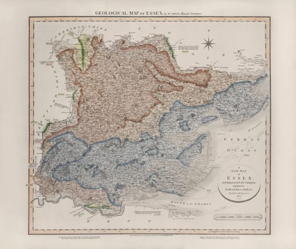
Geological Map of Essex (William Smith, 1820)
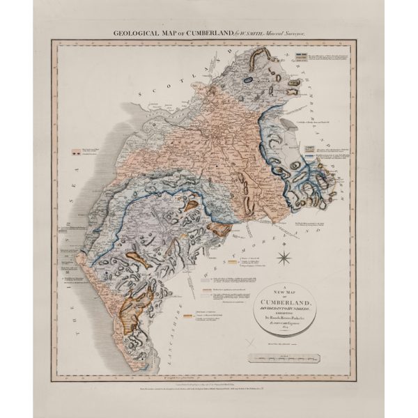
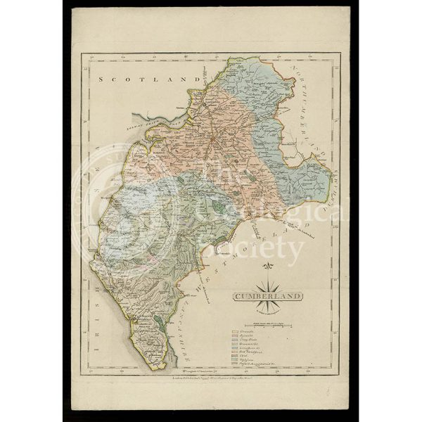
Geological Map of Cumberland (William Smith, 1824)
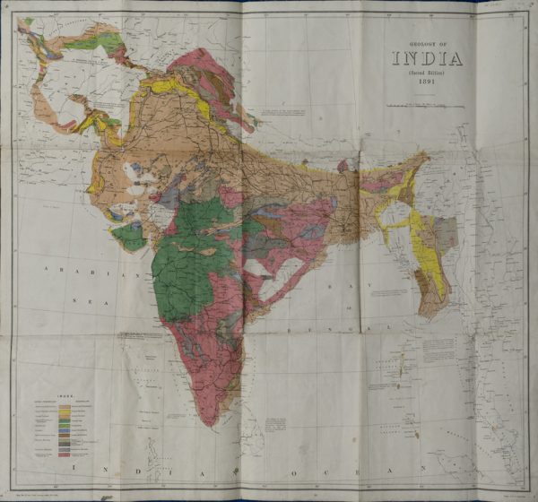
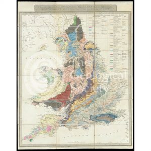
Geological Map of India (Geological Survey of India, 1891)
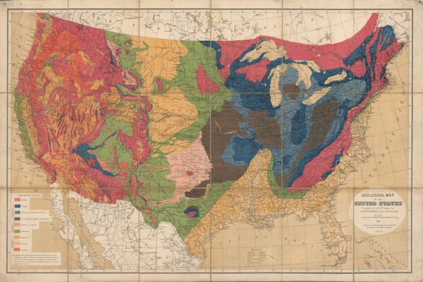
Geological map of the United States (Hitchcock and Blake, 1872)
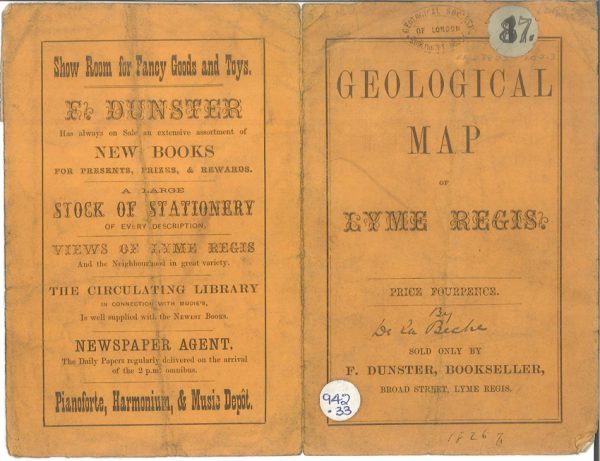
Geological map of the environs of Lyme Reis – Cover (De La Beche, 1826)
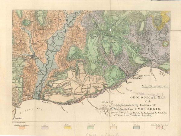
Geological map of the environs of Lyme Reis (De La Beche, 1826)
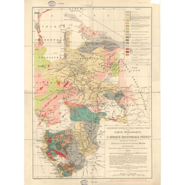
Carte géologique de l’Afrique Équatoriale Française (Loir, 1913)
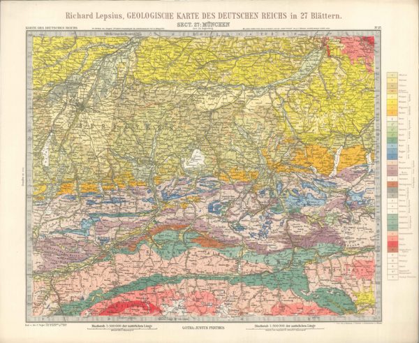
Geologisches Karte des Deutschen Reichs – 27. Munchen (Lepsius, 1897)
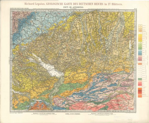
Geologisches Karte des Deutschen Reichs – 26. Augsburg (Lepsius, 1897)
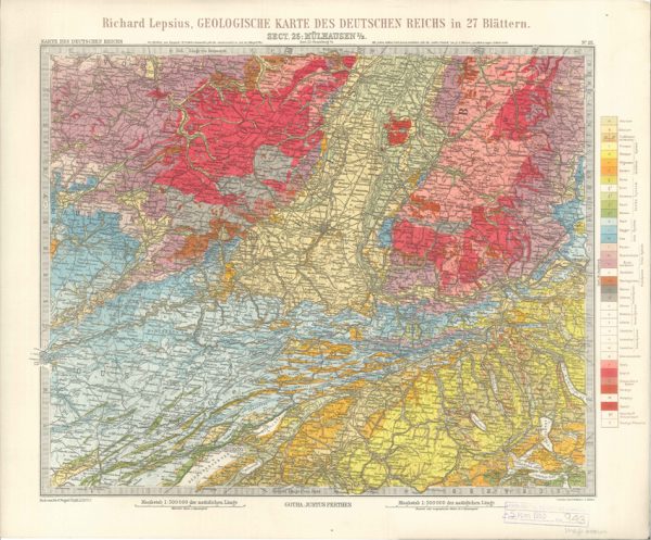
Geologisches Karte des Deutschen Reichs – 25. Mulhausen I-E (Lepsius, 1897)
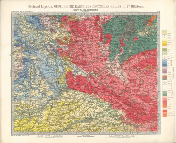
Geologisches Karte des Deutschen Reichs – 24. Regensburg (Lepsius, 1897)
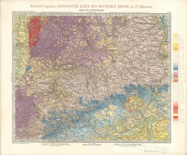
Geologisches Karte des Deutschen Reichs – 23. Stuttgart (Lepsius, 1897)
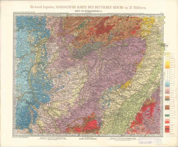
Geologisches Karte des Deutschen Reichs – 22. Strassburg I-E (Lepsius, 1897)
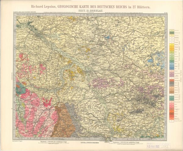
Geologisches Karte des Deutschen Reichs – 21. Breslau (Lepsius, 1897)
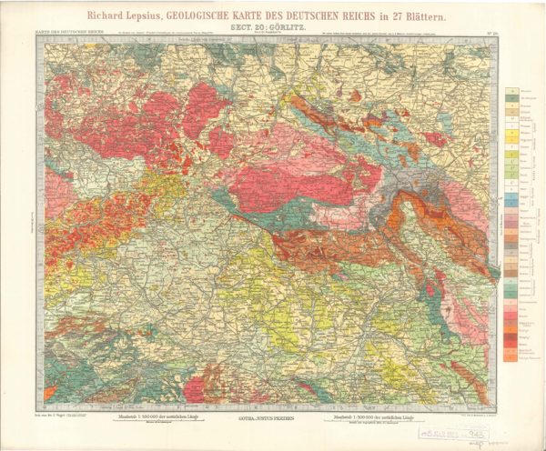
Geologisches Karte des Deutschen Reichs – 20. Gorlitz (Lepsius, 1897)
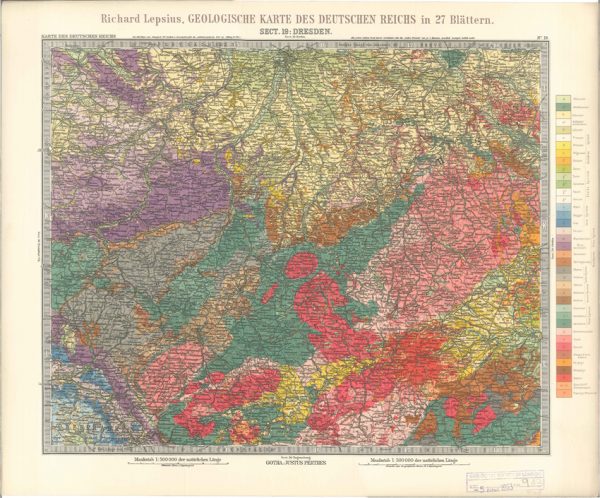
Geologisches Karte des Deutschen Reichs – 19. Dresden (Lepsius, 1897)
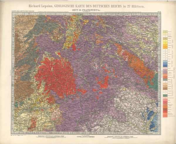
Geologisches Karte des Deutschen Reichs – 18. Frankfurt A-M (Lepsius, 1897)
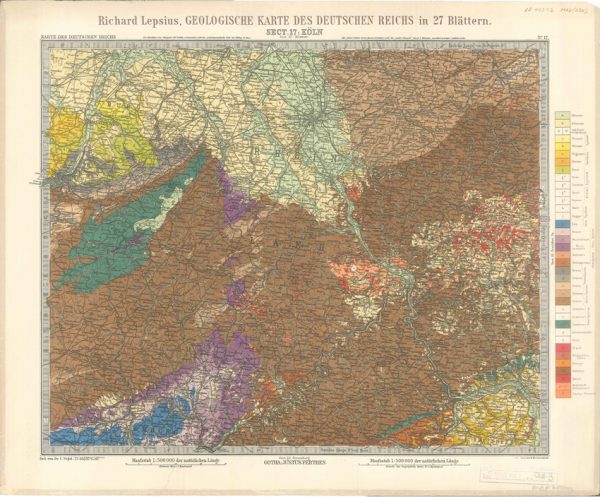
Geologisches Karte des Deutschen Reichs – 17. Koln (Lepsius, 1897)
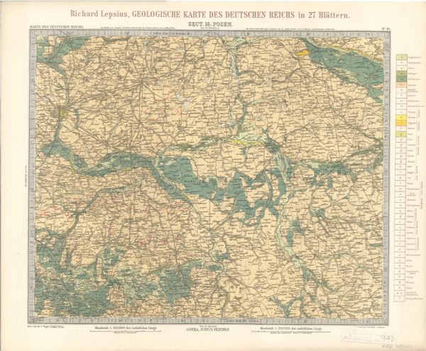
Geologisches Karte des Deutschen Reichs – 16. Posen (Lepsius, 1897)
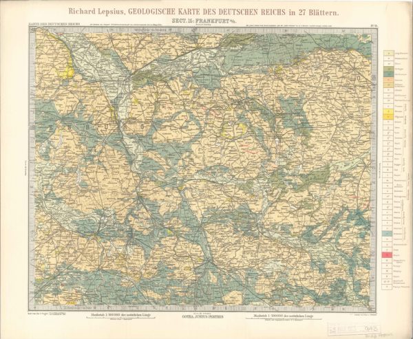
Geologisches Karte des Deutschen Reichs – 15. Frankfurt A-O (Lepsius, 1897)
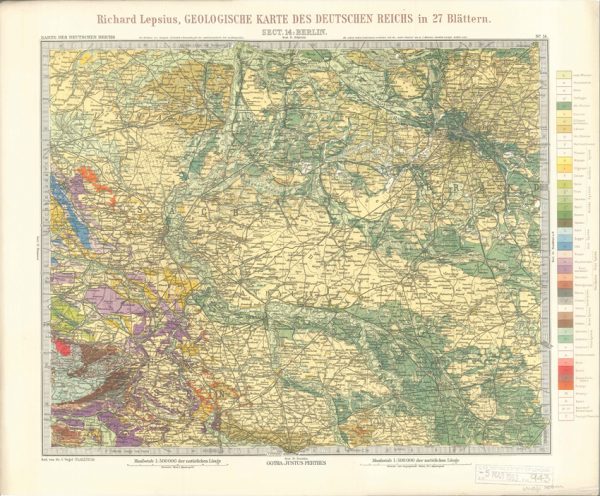
Geologisches Karte des Deutschen Reichs – 14. Berlin (Lepsius, 1897)
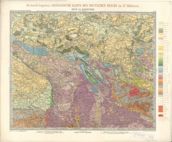
Geologisches Karte des Deutschen Reichs – 13. Hannover (Lepsius, 1897)
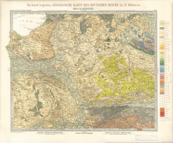
Geologisches Karte des Deutschen Reichs – 12. Munster (Lepsius, 1897)
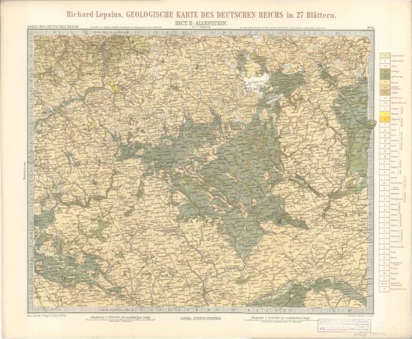
Geologisches Karte des Deutschen Reichs – 11. Allenstein (Lepsius, 1897)
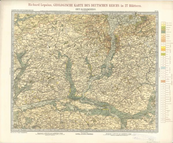
Geologisches Karte des Deutschen Reichs – 10. Bromberg (Lepsius, 1897)
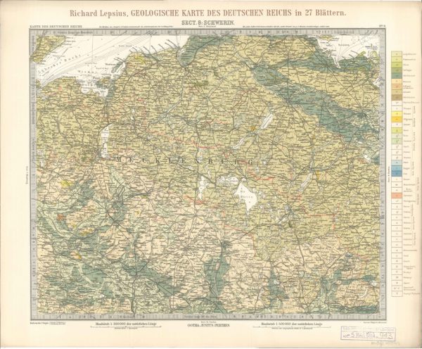
Geologisches Karte des Deutschen Reichs – 8. Schwerin (Lepsius, 1897)
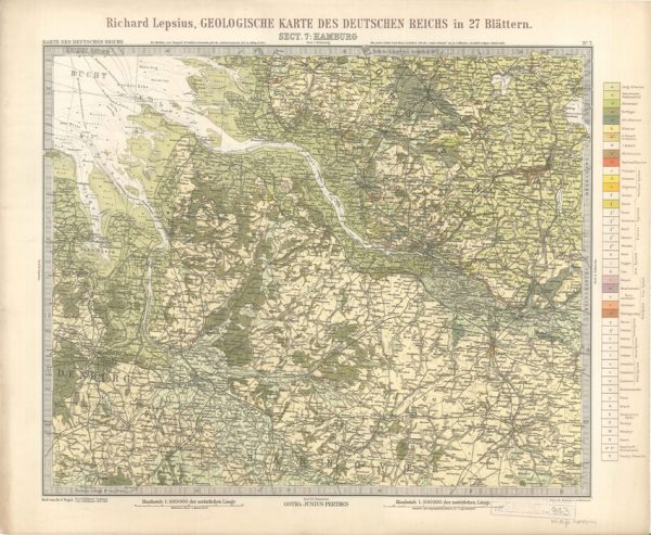
Geologisches Karte des Deutschen Reichs – 7. Hamburg (Lepsius, 1897)
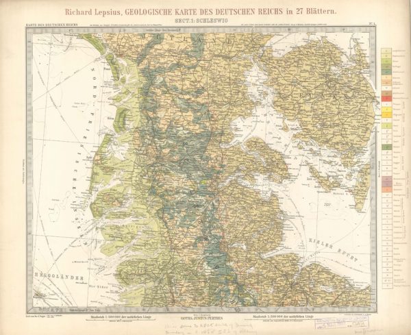
Geologisches Karte des Deutschen Reichs – 1. Schleswig (Lepsius, 1897)
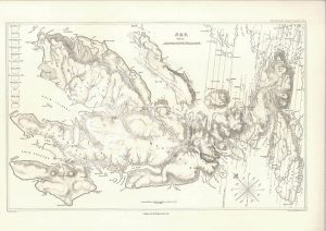
Sky and the adjoining islands (Stewart after MacCulloch, 1817)
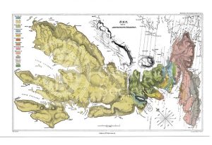
Sky and the adjoining islands (Stewart after MacCulloch, 1817)
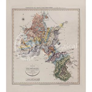
Geological map of Oxfordshire (William Smith, 1820)
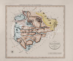
Geological Map of Rutlandshire (William Smith, 1822)
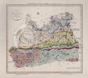
Geological Map of Surry (William Smith, 1819)
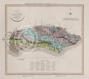
Geological Map of Sussex (William Smith, 1819)
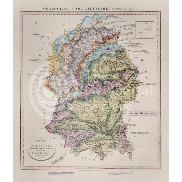
Geological Map of Wiltshire (William Smith, 1819)
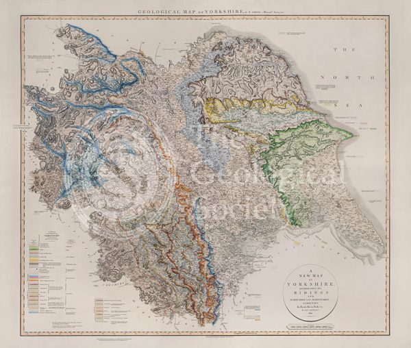
Geological Map of Yorkshire (William Smith, 1821)
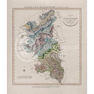
Geological Map of Buckinghamshire (William Smith, 1820)
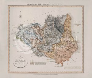
Geological Map of Durham (William Smith, 1824)
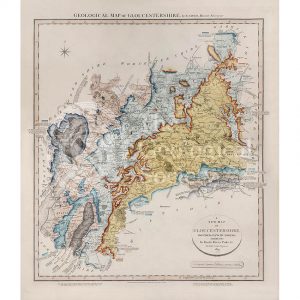
Geological Map of Gloucestershire (William Smith, 1819)
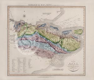
Geological Map of Kent (William Smith, 1819)
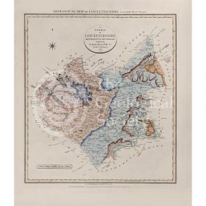
Geological Map of Leicestershire (William Smith, 1822)
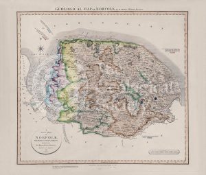
Geological Map of Norfolk (William Smith, 1819)
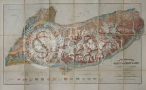
Carte géologique du Massif du Mont-Blanc (Duparc and Mrazec, 1896)
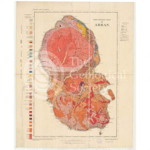
Geological Map of Arran (The Survey, 1910)
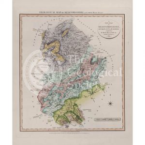
Geological Map of Bedfordshire (William Smith, 1820)
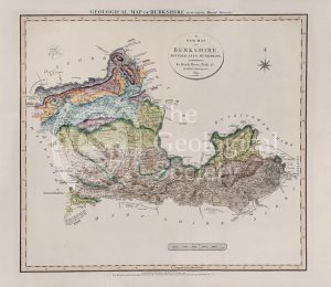
Geological Map of Berkshire (William Smith, 1819)
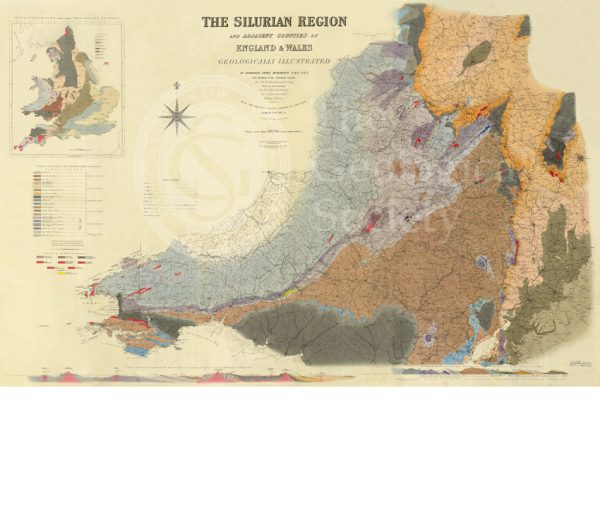
Map of the Silurian Region (Murchison, 1838)
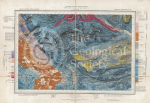
Geological map of Brough-under-Stainmore (Geological Survey of England & Wales, 1893)
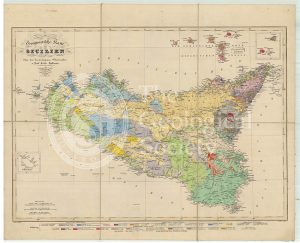
Geognostische Karte Sicilien (Hoffmann, 1839)
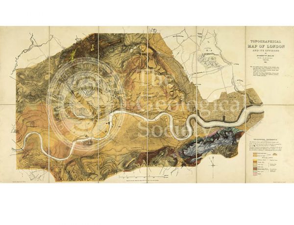
Topographical [and Geological] Map of London… (Mylne, 1851)
Geological map of Cumberland (Fry, c.1814)
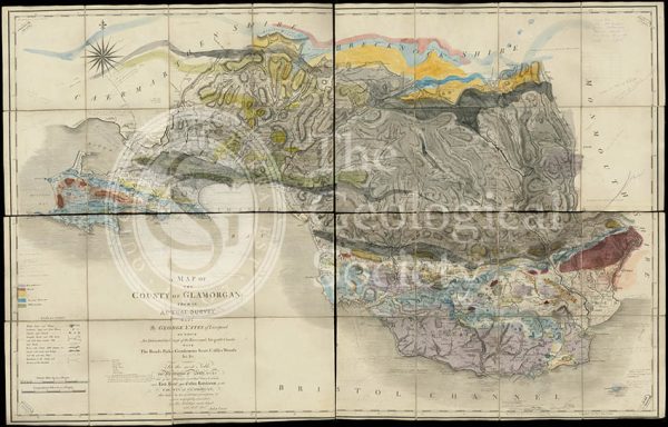
Geological map of Glamorgan (Greenough/Smith 1799-1818)
Geological Map of England & Wales… [Greenough reduction] (Gardner after Greenough, 1826)
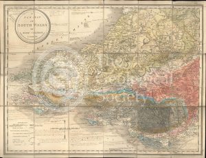
A New Map of South Wales (Greenough and Coltman, between 1813-1839)
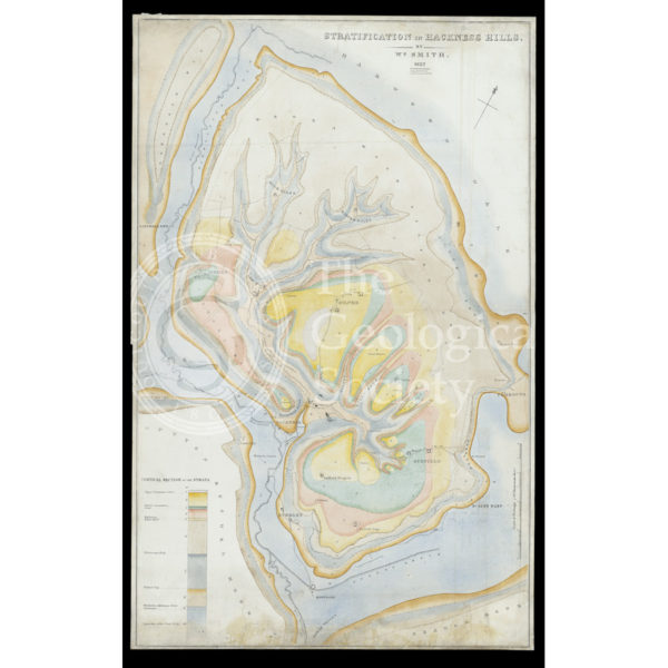
Stratification in Hackness Hills (Smith, 1832)
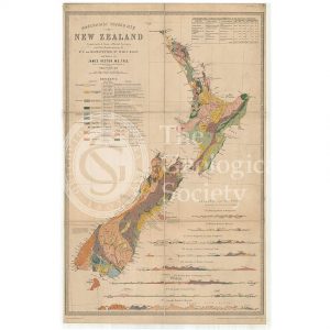
Map of New Zealand (James Hector, 1873)
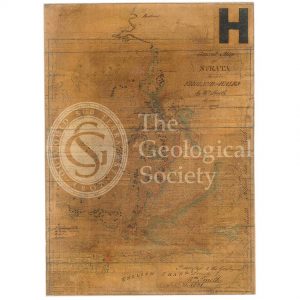
General map of strata found in England & Wales (Smith 1794/1801)
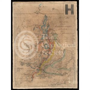
Reconstruction of William Smith’s “General Map of Strata found in England & Wales” (Judd & Reekes, 1897)
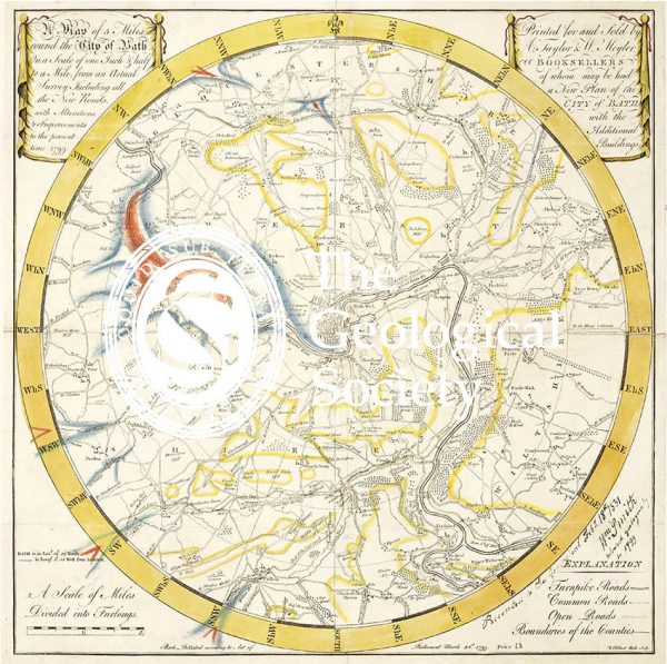
Geological Map of Bath (Smith, 1799)
Reconstruction of William Smith’s Geological Map of Bath (1799) (Lam, 2014)
Greenough’s Map of Westmoreland (Greenough after Smith, 1824-1843)
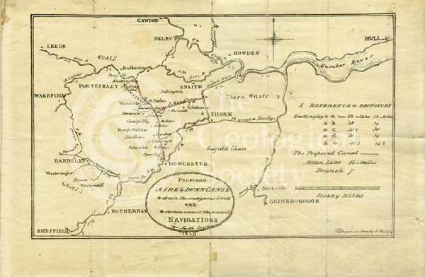
Plan of the ‘Proposed Aire & Dunn Canal’ (Smith and Phillips, 1819)
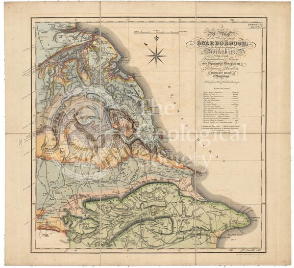
Geological map of Scarborough (Smith, 1831)
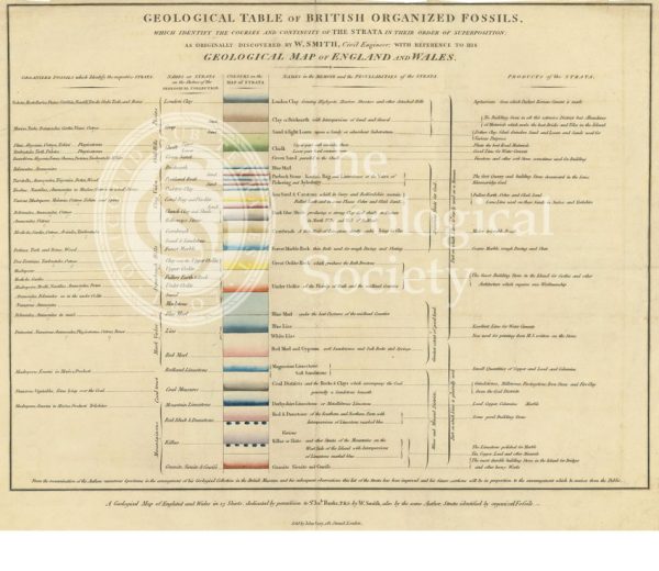
‘Geological table of British organized fossils…’
Geological map of Northumberland (Wood, 1831)
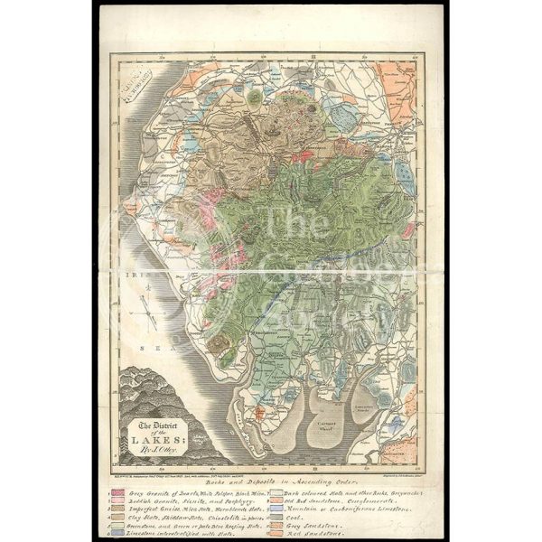
District of the Lakes (Otley, 1837)
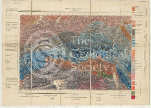
Geological map of England and Wales, Sheet 101 NE Cockermouth (1890)
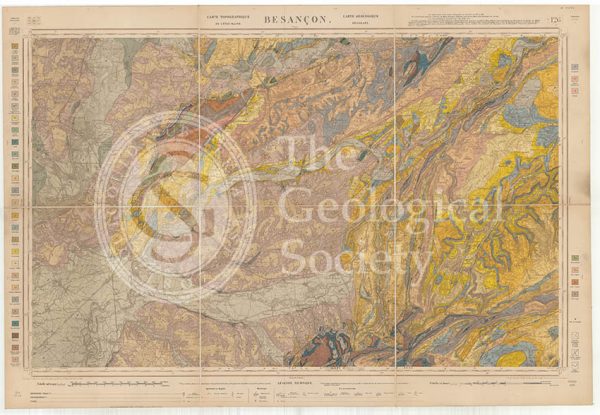
Carte géologique de la France 1:80,000. Feuille 126 Besançon (1892)
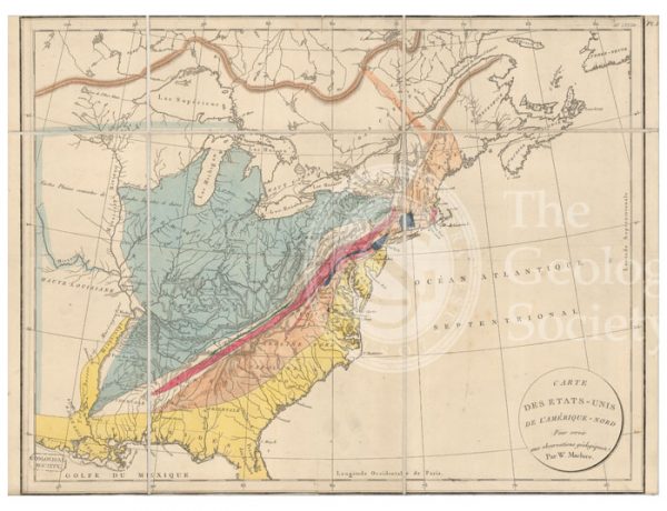
Carte des Etats-Unis de l’Amerique-Nord [Map of North America] (Maclure, 1811)
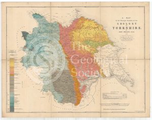
A Map of the Principal Features of the Geology of Yorkshire (Phillips, 1853)
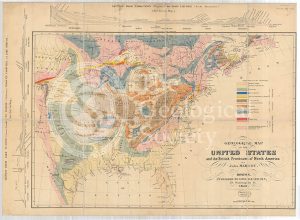
Geological Map of the United States and the British Provinces of North America (Marcou, 1853)
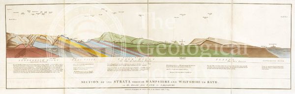
Section of the Strata through Hampshire and Wiltshire to Bath (Smith, 1819)
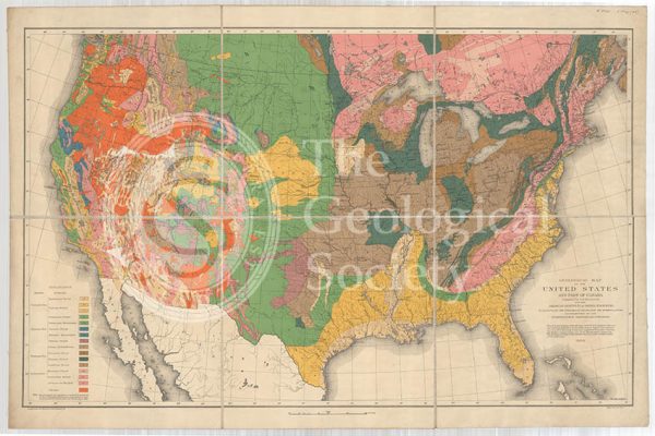
Geological map of the United States and part of Canada (Hitchcock, 1886)
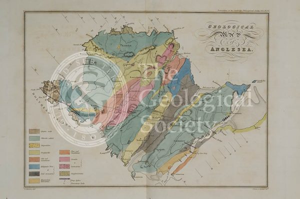
Geological map of Anglesea (Henslow, 1822)
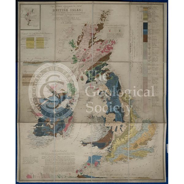
Geological map of the British Isles (Phillips, 1838)
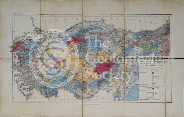
Carte géologique de l’Asia Mineure (Tchihatcheff, 1867)
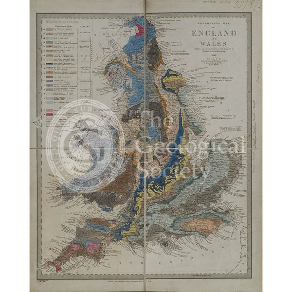
Geological map of England and Wales (Murchison, 1843)
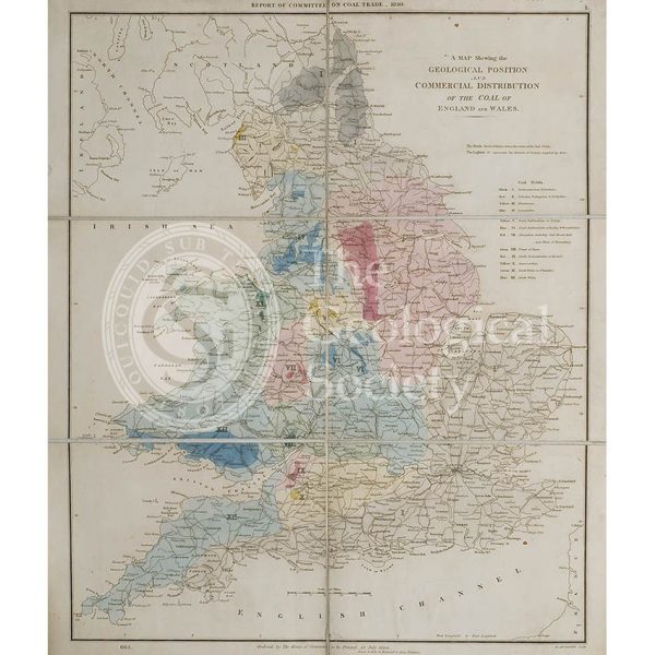
Map showing the Geological Position and Commercial Distribution of the Coal of England and Wales (House of Commons, 1830)
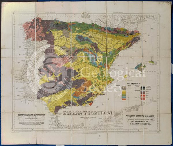
Mapa Geologico de España y Portugal (Coello, 1864)
Geological cross section of Otago, New Zealand (Hector, 1862-1864)
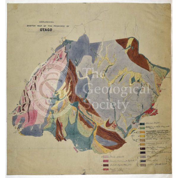
Map of Otago, New Zealand (Hector, 1862-1864)
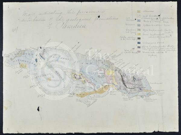
Map of Jamaica (Wall, 1864)
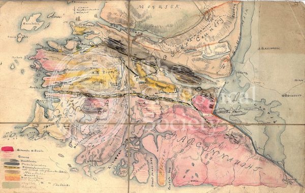
Geological Map of Connemara, Ireland (Nimmo, c.1813)
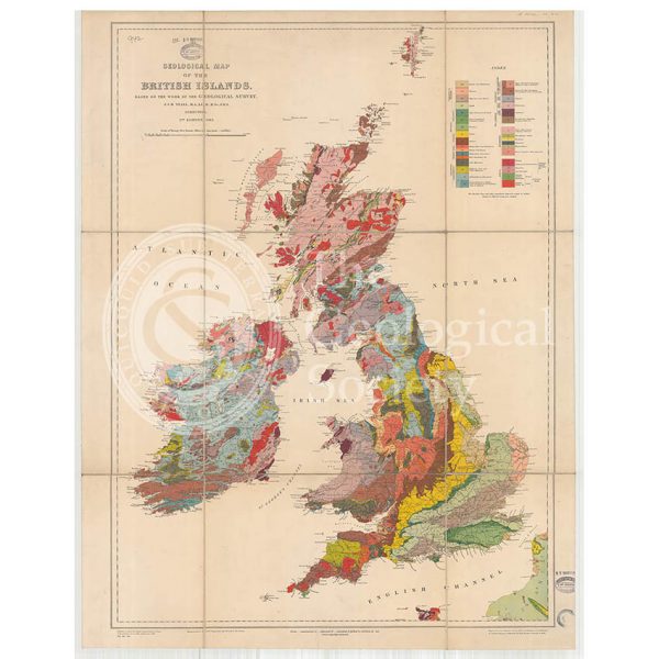
Geological Map of the British Isles (Teall, 1912)