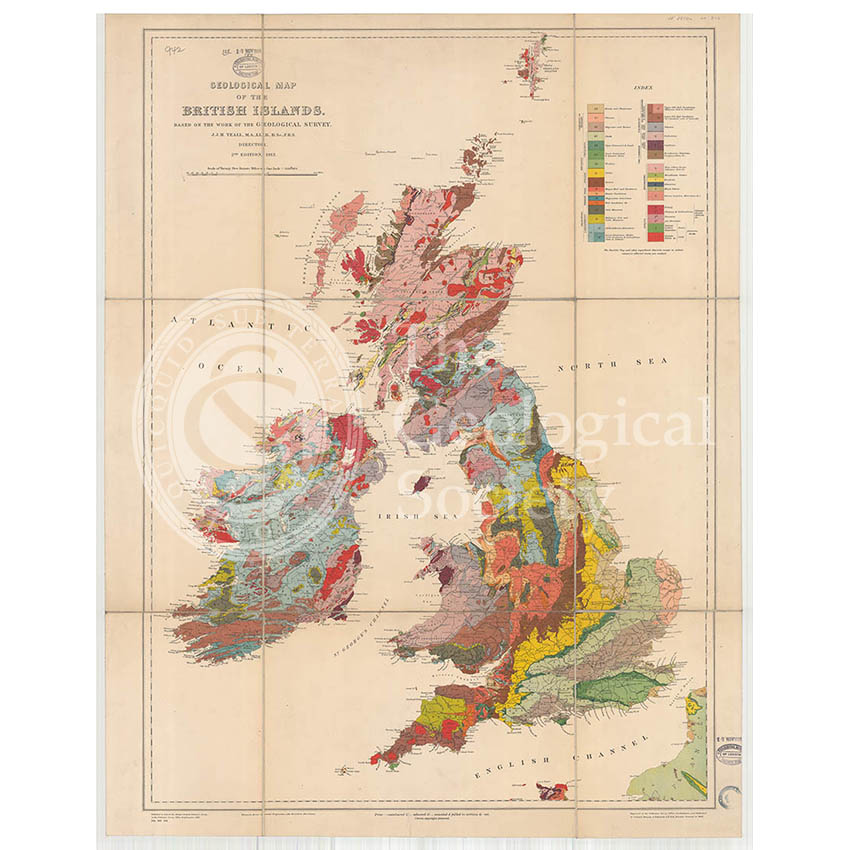
Title: Geological Map of the British Islands based on the work of the Geological Survey
Creator: Jethro Justinian Harris Teall
Description: Geological map of the British Isles, at a scale of 1:1,584,000.
Publisher: Ordnance Survey
Date: 1912
Format: Geological map
Image reference: 07-09
Size of original: 80 cm. x 58 cm.
Recommended print size: up to 100 cm x 70 cm.