
geological
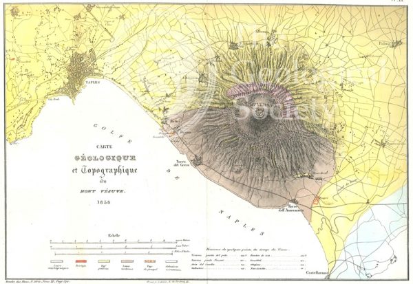
Carte géologique et topographique du Mont Vésuve (Dufrenoy, 1838)

Map of the English Lakes (Ruthven, 1855)
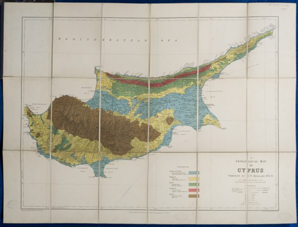
Geological map of Cyprus (Bellamy, 1905)
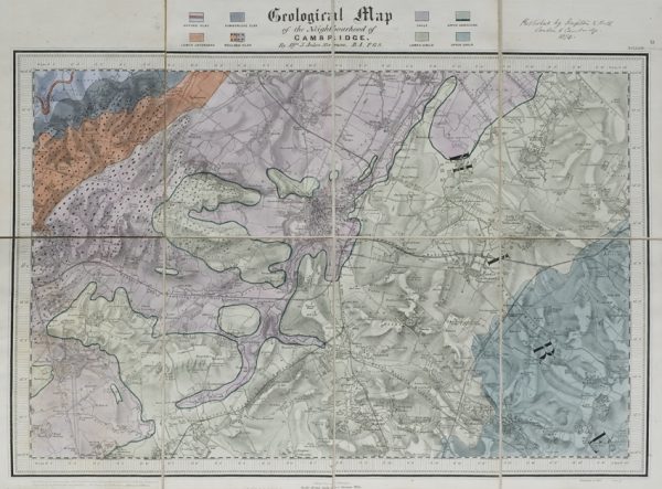
Geological map of the neighbourhood of Cambridge (Jukes-Browne, 1874)
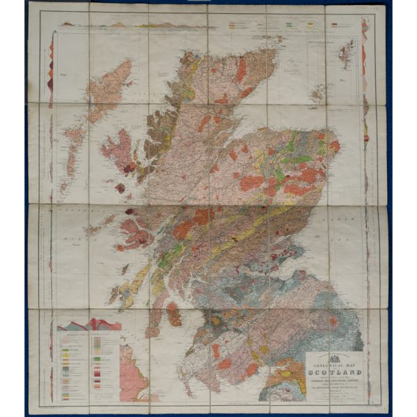
Geological map of Scotland (Geikie, 1910)
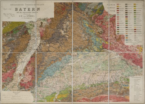
Geologische Übersichtskarte von Bayern und den angrenzenden Ländern (Karl Wilhelm von Gümbel, 1893)
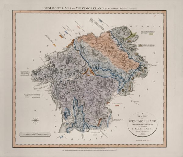
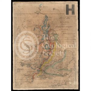
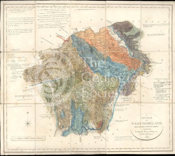
Geological Map of Westmoreland (William Smith, 1824)
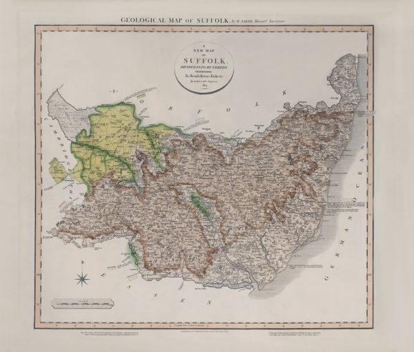
Geological Map of Suffolk (William Smith, 1819)
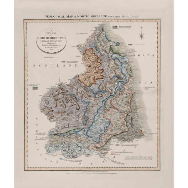
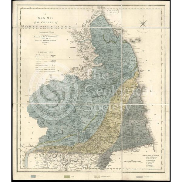
Geological Map of Northumberland (William Smith, 1824)
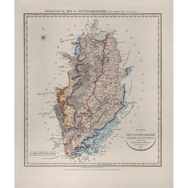
Geological Map of Nottinghamshire (William Smith, 1821)
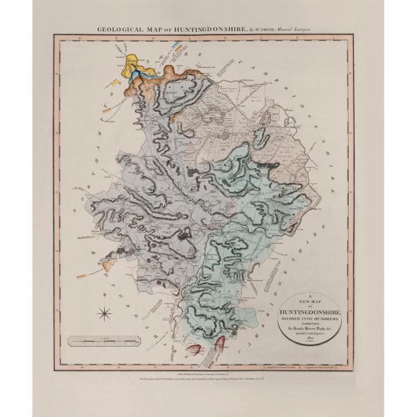
Geological Map of Huntingdonshire (William Smith, 1821)
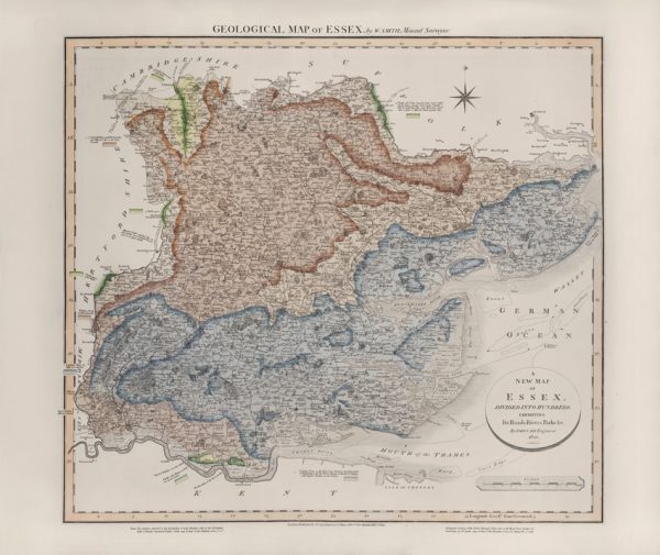
Geological Map of Essex (William Smith, 1820)
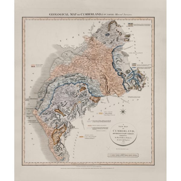
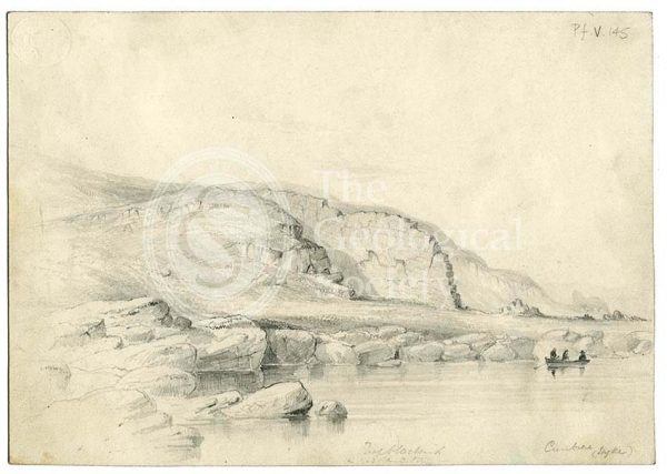
Geological Map of Cumberland (William Smith, 1824)
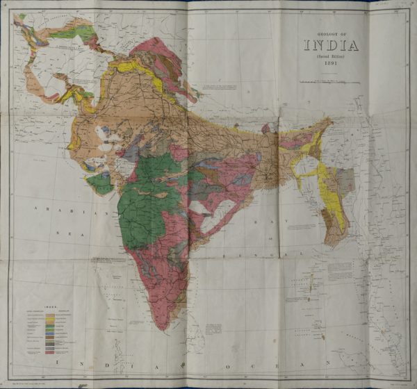
Geological Map of India (Geological Survey of India, 1891)
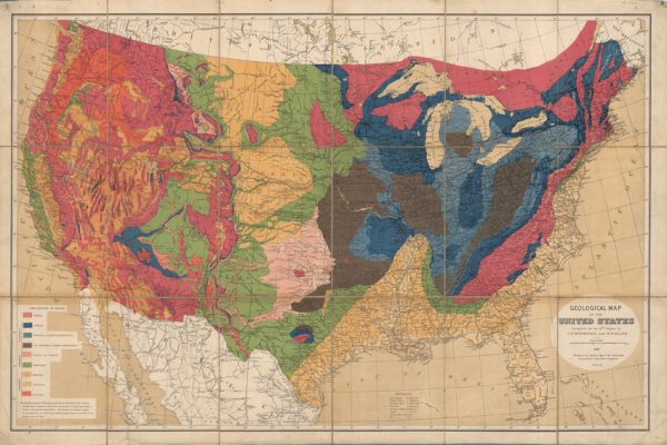
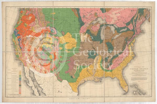
Geological map of the United States (Hitchcock and Blake, 1872)
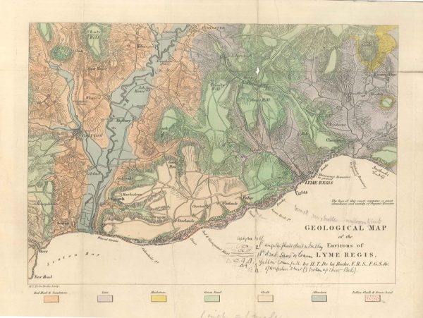
Geological map of the environs of Lyme Reis (De La Beche, 1826)
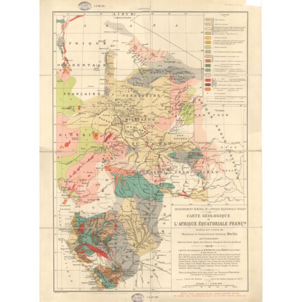
Carte géologique de l’Afrique Équatoriale Française (Loir, 1913)
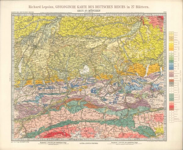
Geologisches Karte des Deutschen Reichs – 27. Munchen (Lepsius, 1897)
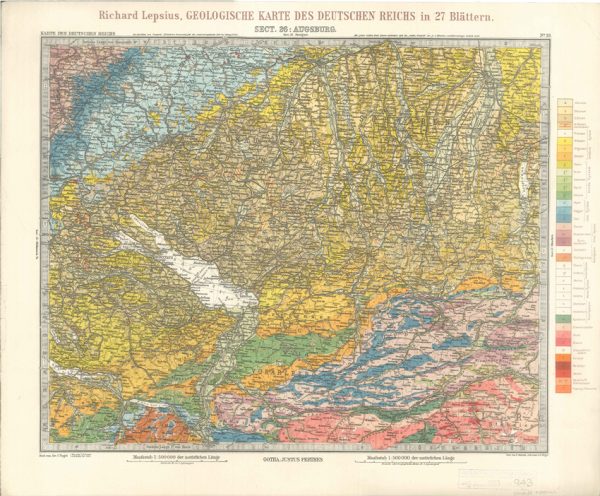
Geologisches Karte des Deutschen Reichs – 26. Augsburg (Lepsius, 1897)
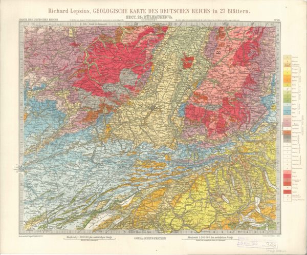
Geologisches Karte des Deutschen Reichs – 25. Mulhausen I-E (Lepsius, 1897)
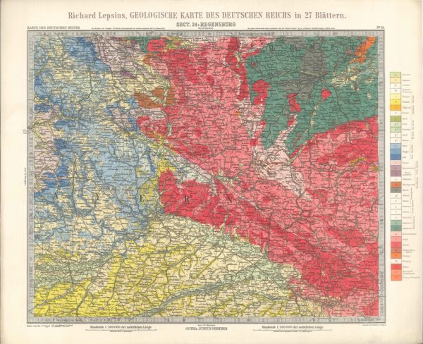
Geologisches Karte des Deutschen Reichs – 24. Regensburg (Lepsius, 1897)
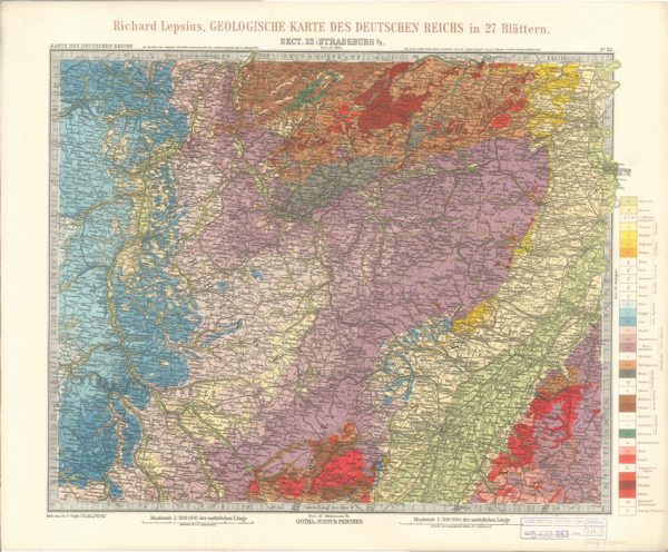
Geologisches Karte des Deutschen Reichs – 22. Strassburg I-E (Lepsius, 1897)
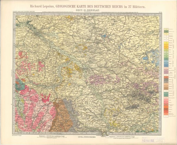
Geologisches Karte des Deutschen Reichs – 21. Breslau (Lepsius, 1897)
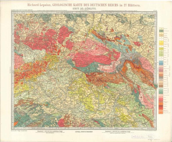
Geologisches Karte des Deutschen Reichs – 20. Gorlitz (Lepsius, 1897)
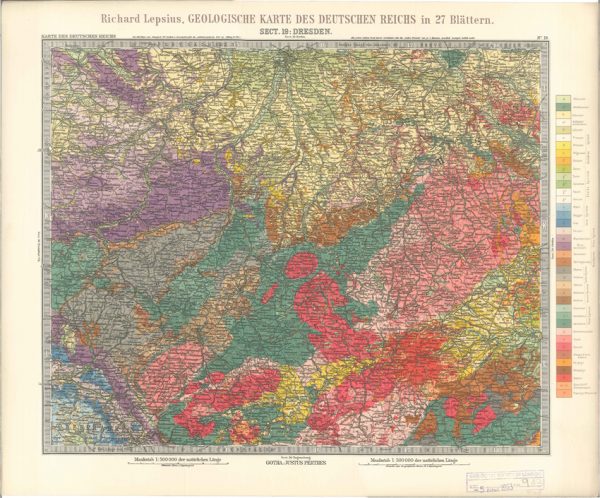
Geologisches Karte des Deutschen Reichs – 19. Dresden (Lepsius, 1897)
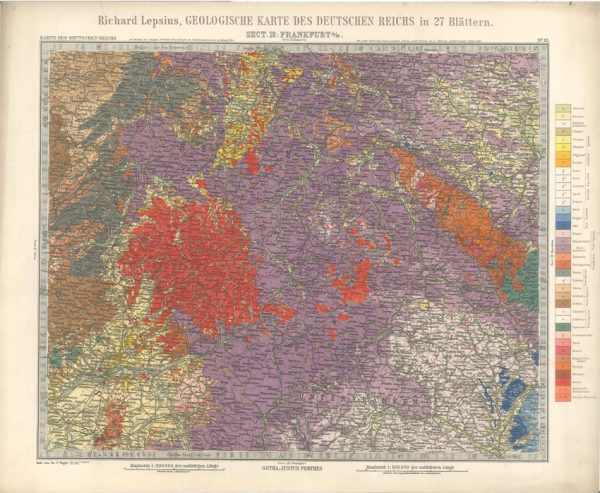
Geologisches Karte des Deutschen Reichs – 18. Frankfurt A-M (Lepsius, 1897)
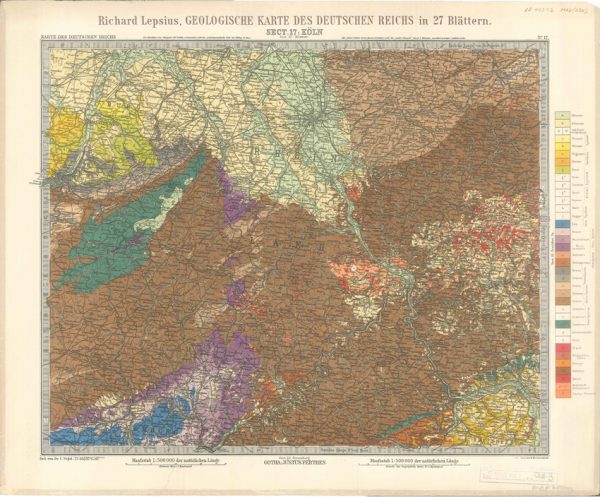
Geologisches Karte des Deutschen Reichs – 17. Koln (Lepsius, 1897)
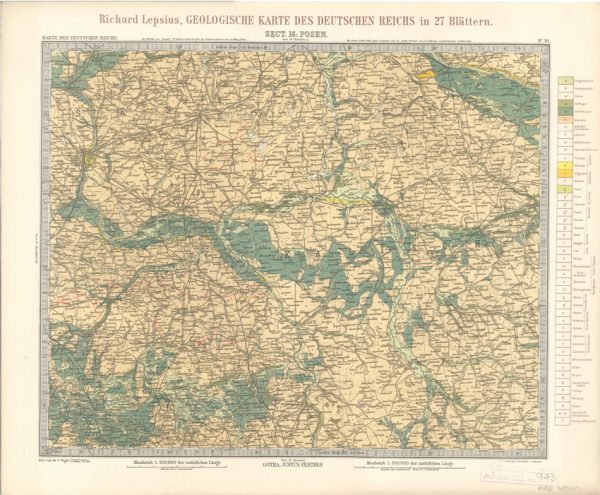
Geologisches Karte des Deutschen Reichs – 16. Posen (Lepsius, 1897)
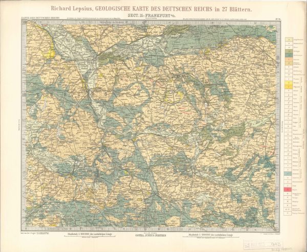
Geologisches Karte des Deutschen Reichs – 15. Frankfurt A-O (Lepsius, 1897)
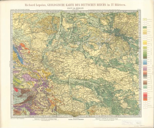
Geologisches Karte des Deutschen Reichs – 14. Berlin (Lepsius, 1897)
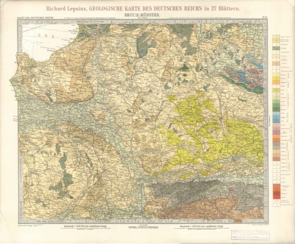
Geologisches Karte des Deutschen Reichs – 12. Munster (Lepsius, 1897)
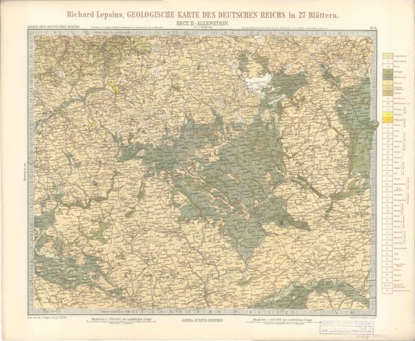
Geologisches Karte des Deutschen Reichs – 11. Allenstein (Lepsius, 1897)
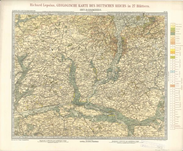
Geologisches Karte des Deutschen Reichs – 10. Bromberg (Lepsius, 1897)
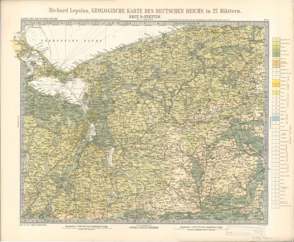
Geologisches Karte des Deutschen Reichs – 9. Stettin (Lepsius, 1897)
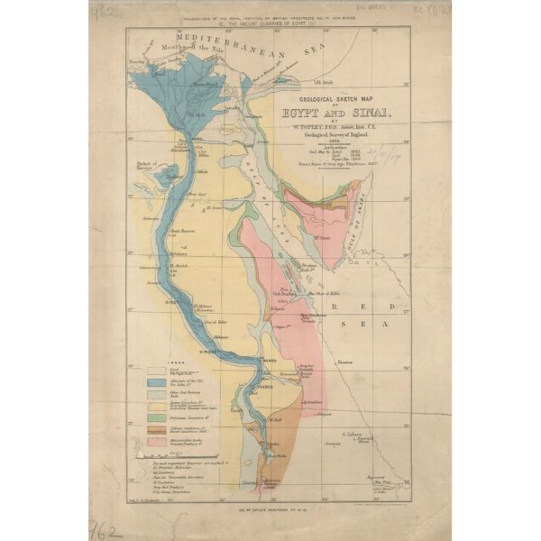
Geological Sketch Map of Egypt and Sinai (Topley 1888)
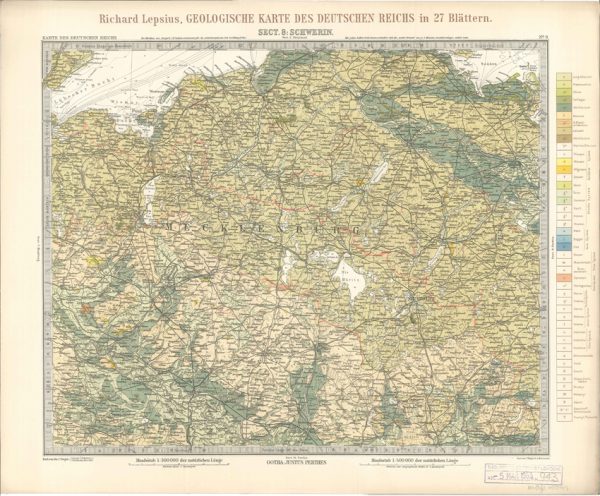
Geologisches Karte des Deutschen Reichs – 8. Schwerin (Lepsius, 1897)
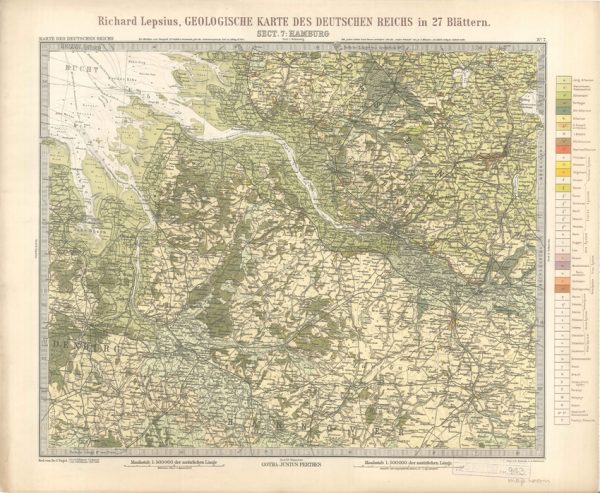
Geologisches Karte des Deutschen Reichs – 7. Hamburg (Lepsius, 1897)
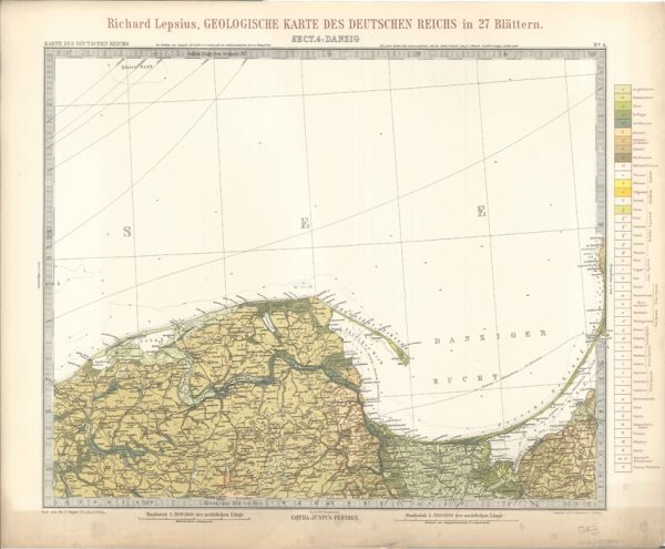
Geologisches Karte des Deutschen Reichs – 4. Danzig (Lepsius, 1897)
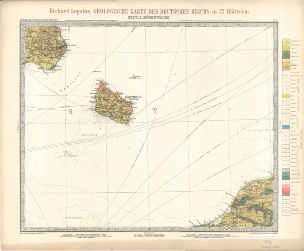
Geologisches Karte des Deutschen Reichs – 3. Rugenwalde (Lepsius, 1897)
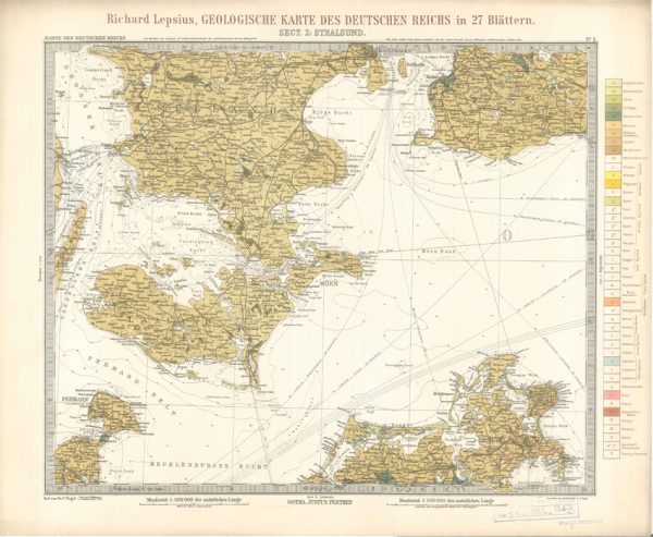
Geologisches Karte des Deutschen Reichs – 2. Stralsund (Lepsius, 1897)
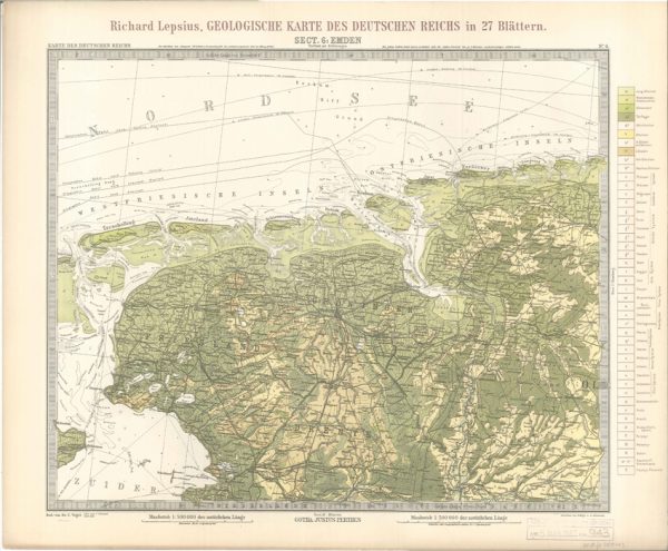
Geologisches Karte des Deutschen Reichs – 6. Emden (Lepsius, 1897)
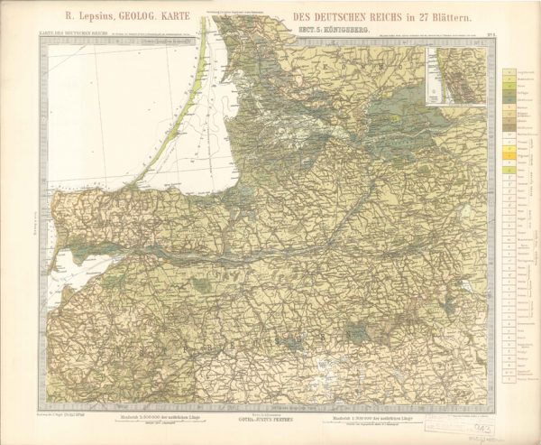
Geologisches Karte des Deutschen Reichs – 5. Konigsberg (Lepsius, 1897)
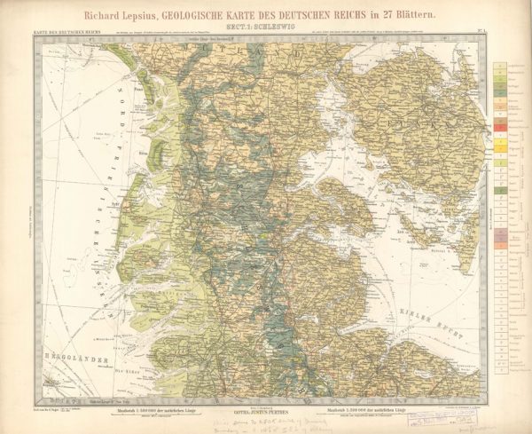
Geologisches Karte des Deutschen Reichs – 1. Schleswig (Lepsius, 1897)

Discussion on the Piltdown Skull
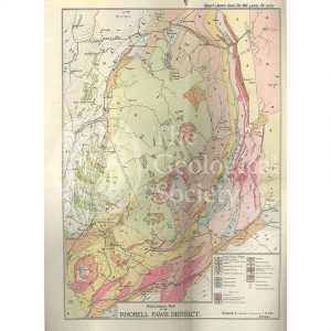
Geological Map of the Rhobell Fawr District (Wells, 1925)
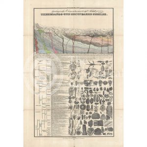
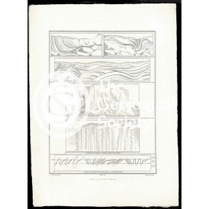
Geologische Elementarkarte, plate 3 (Klöpfel, 1838)
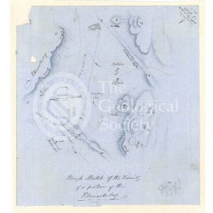
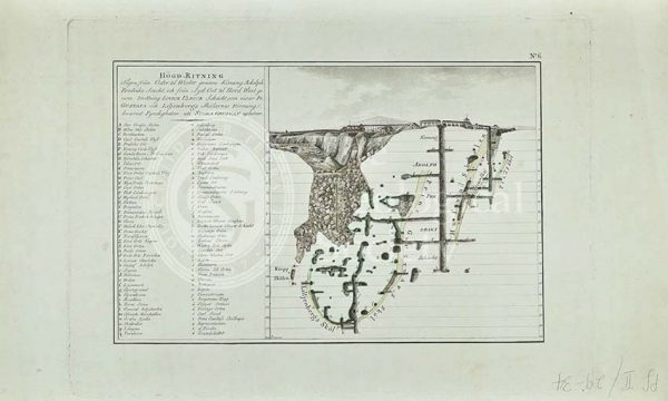
Sketch map of the Rhenosterberg, South Africa (Stow, 1858)
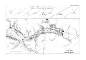
Plan of Glen Roy and of the Parallel Roads (MacCulloch, 1817)
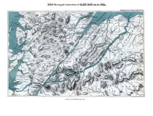
Map shewing the Connections of Glen Roy with the Sea (Cross, 1817)
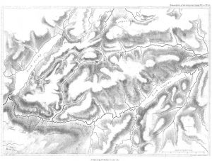
Map of Glen Roy (MacCulloch, 1817)
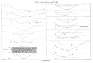
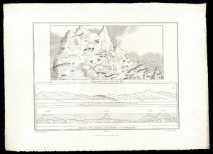
Sections of Glen Roy (MacCulloch, 1817)
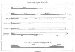
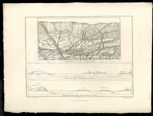
Curvilinear Sections from Glen Roy to the Sea (MacCulloch, 1817)
Various flexures of gneiss in Lewis (Stewart after MacCulloch, 1819)
Selected parts of the East Coast of Trotternish (Stewart after MacCulloch, 1819)
Granite veins and gneiss at Cape Wrath… (Stewart after MacCulloch, 1819)
Trap veins at Airdnamurchan point… (Stewart after MacCulloch, 1819)
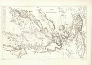
Sky and the adjoining islands (Stewart after MacCulloch, 1817)
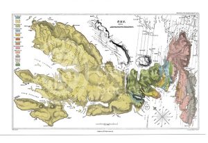
Sky and the adjoining islands (Stewart after MacCulloch, 1817)
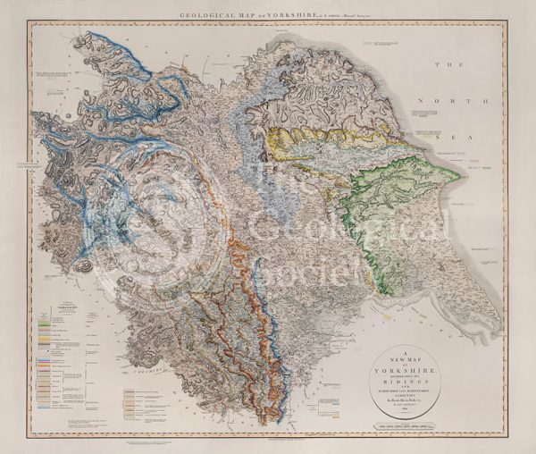
Geological Map of Yorkshire (William Smith, 1821)
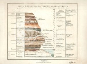
Theoretical section through the Paris Basin (Cuvier, Brongniart and Clerget, 1832)
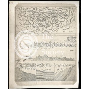
Imaginary plan and sections of Wernerian formations (Theonert, c.1810)
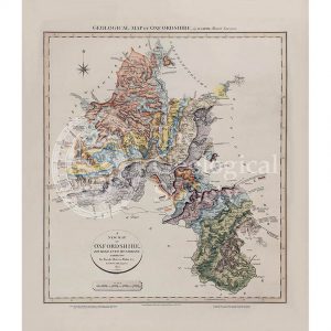
Geological map of Oxfordshire (William Smith, 1820)
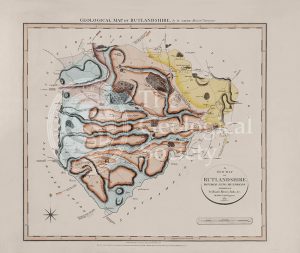
Geological Map of Rutlandshire (William Smith, 1822)
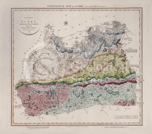
Geological Map of Surry (William Smith, 1819)
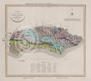
Geological Map of Sussex (William Smith, 1819)
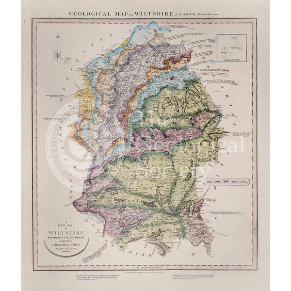
Geological Map of Wiltshire (William Smith, 1819)
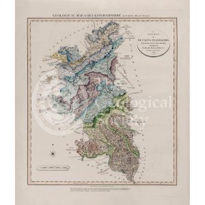
Geological Map of Buckinghamshire (William Smith, 1820)
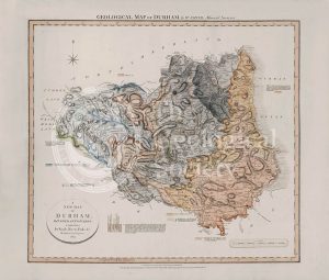
Geological Map of Durham (William Smith, 1824)
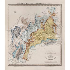
Geological Map of Gloucestershire (William Smith, 1819)
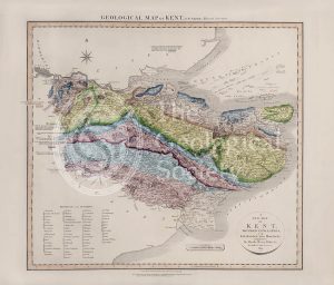
Geological Map of Kent (William Smith, 1819)
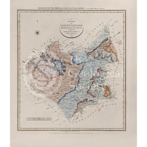
Geological Map of Leicestershire (William Smith, 1822)
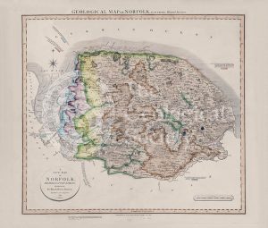
Geological Map of Norfolk (William Smith, 1819)
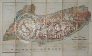
Carte géologique du Massif du Mont-Blanc (Duparc and Mrazec, 1896)
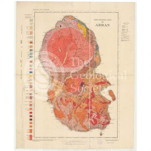
Geological Map of Arran (The Survey, 1910)
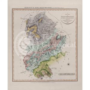
Geological Map of Bedfordshire (William Smith, 1820)
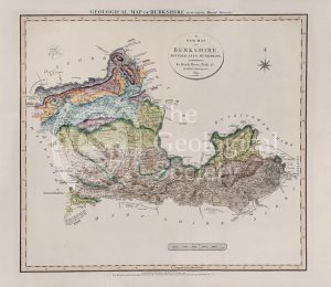
Geological Map of Berkshire (William Smith, 1819)
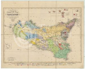
Geognostische Karte Sicilien (Hoffmann, 1839)
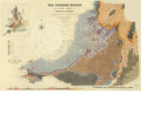
Map of the Silurian Region (Murchison, 1838)
Geological map of Brough-under-Stainmore (Geological Survey of England & Wales, 1893)
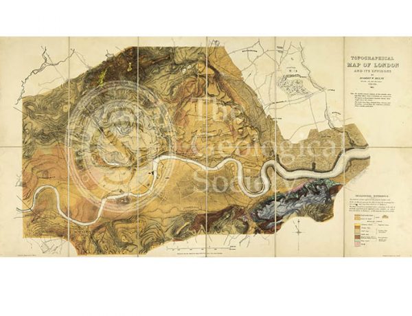
Topographical [and Geological] Map of London… (Mylne, 1851)
Dyke on Great Cumbra, Western Isles, Scotland
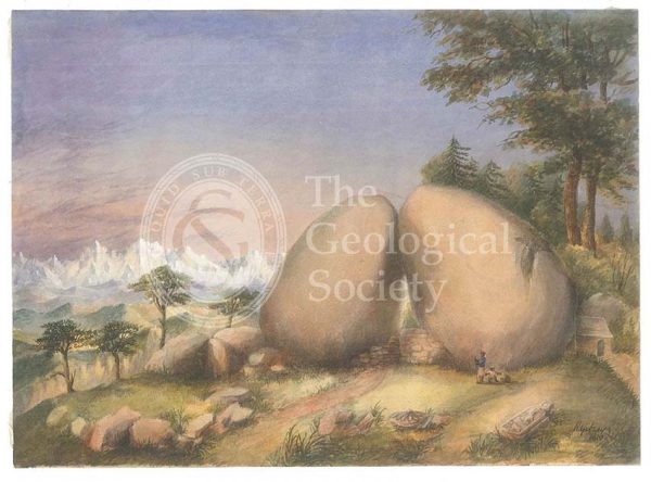
Boulder rocks at Debre Doura, Kumaun, India
‘Staffa’
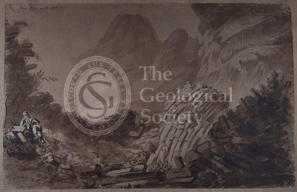
‘Scur Eigg in the Hebrides’
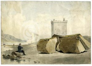
Split boulder on Little Cumbra, Western Isles
Sukhoboisk, Samilovsky and Froloosky copper mines
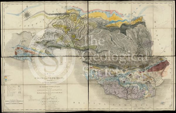
Geological map of Glamorgan (Greenough/Smith 1799-1818)
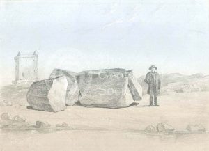
Split boulder on Little Cumbra, Western Isles
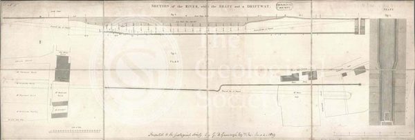
Section from the Medway through Upnor to Cockham Wood (Dadd, 1833)
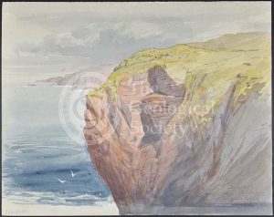
‘Cape Wrath’
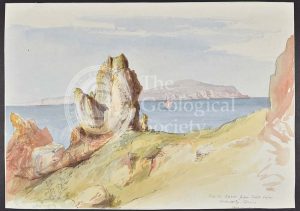
‘North Suter from South Suter’
Greenough’s copy of William Smith’s geological map (Smith with notes by Greenough, 1815/1818)
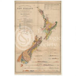
Map of New Zealand (James Hector, 1873)
General map of strata found in England & Wales (Smith 1794/1801)
Reconstruction of William Smith’s “General Map of Strata found in England & Wales” (Judd & Reekes, 1897)
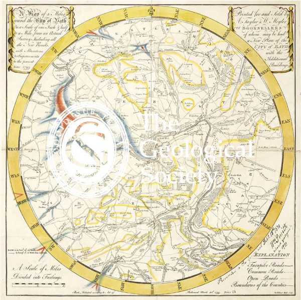
Geological Map of Bath (Smith, 1799)
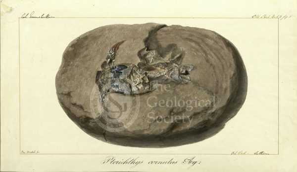
Pterichthys cornutus Agassiz
Reconstruction of William Smith’s Geological Map of Bath (1799) (Lam, 2014)
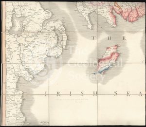
Greenough’s Map of Westmoreland (Greenough after Smith, 1824-1843)
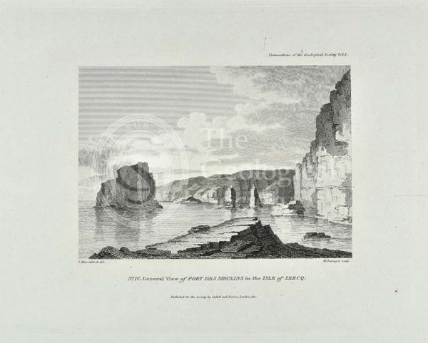
‘General view of Port Des Moulins in the Isle of Sercq’
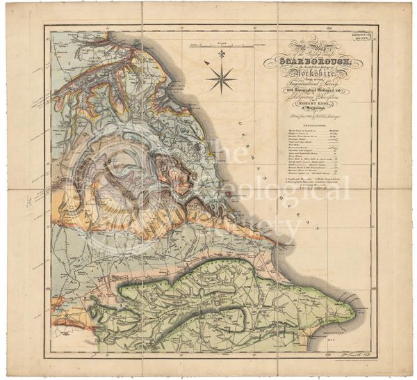
Geological map of Scarborough (Smith, 1831)
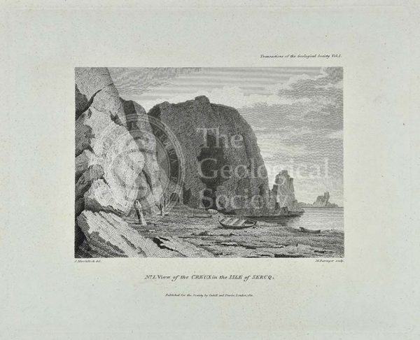
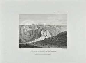
‘View of the Creux in the Isle of Sercq’
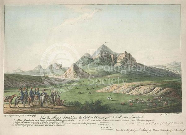
Mount Beshtau, Russia
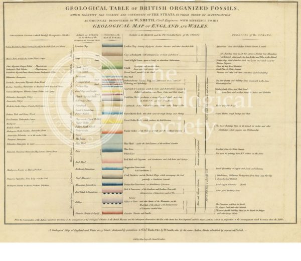
‘Geological table of British organized fossils…’
‘View of the Coupee in the Isle of Sercq’
View of the Rhenosterberg mountains, South Africa
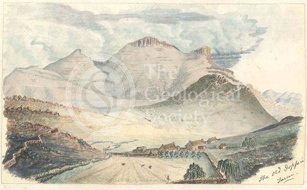
Old Dopper’s Farm, in the Rhenosterberg mountains, South Africa
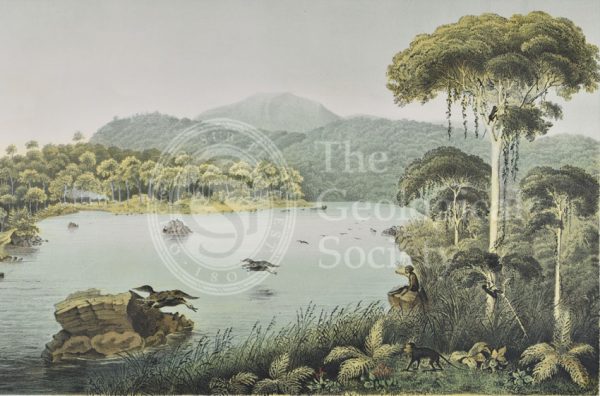
Lake Patengan, Java
Dieng Plateau, Java
Geological map of Northumberland (Wood, 1831)
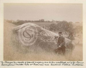
‘The Stranger’
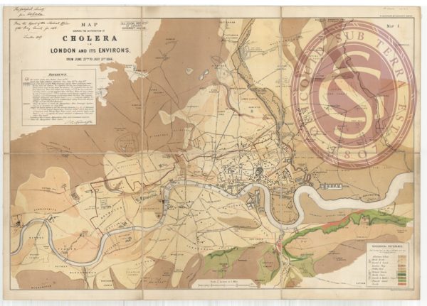
Map showing the distribution of cholera in London
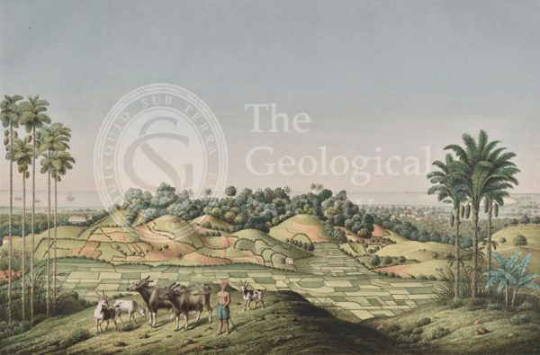
North coast of Java, Indonesia
Section of a [gold] mine, north of Orenburg, Russia
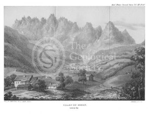
Valley of Gosau, Salzburg Alps
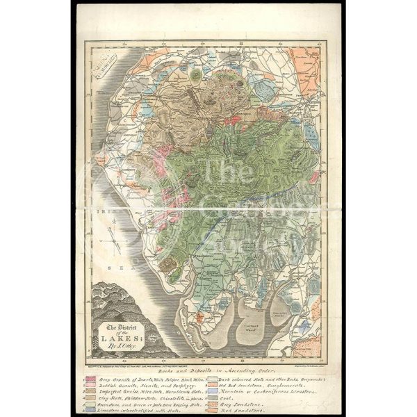
District of the Lakes (Otley, 1837)
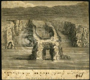
‘The Bullers of Buchan’
‘Human fossil’
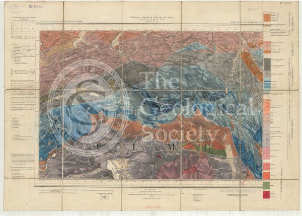
Geological map of England and Wales, Sheet 101 NE Cockermouth (1890)
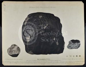
‘Meteorolites’
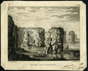
‘Rocks near Sandside’
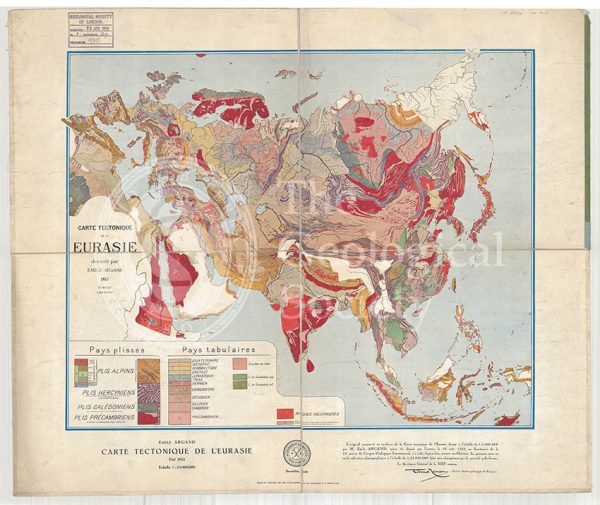
Carte tectonique de l’Eurasie (Argand, 1928)
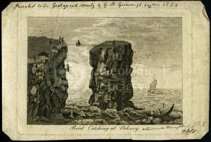
‘Bird catching at Orkney’
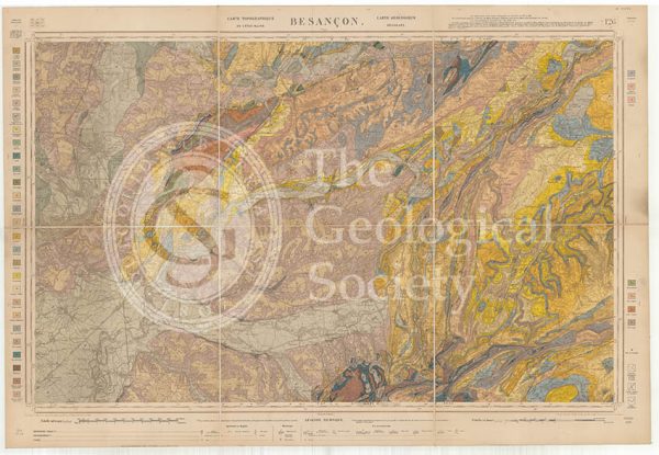
Carte géologique de la France 1:80,000. Feuille 126 Besançon (1892)
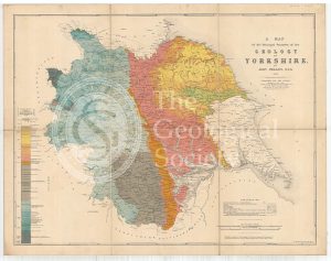
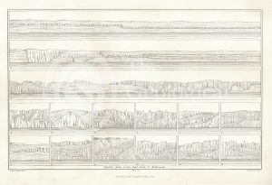
A Map of the Principal Features of the Geology of Yorkshire (Phillips, 1853)
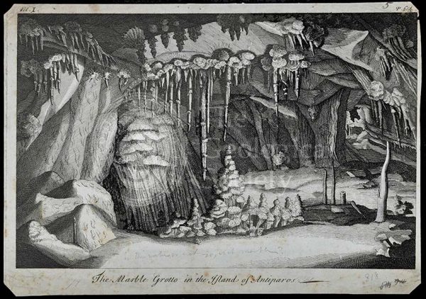
Marble Grotto in the Island of Antiparos
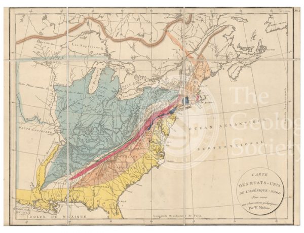
Carte des Etats-Unis de l’Amerique-Nord [Map of North America] (Maclure, 1811)
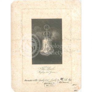
The ‘Hope Pearl’
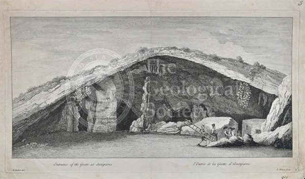
Entrance to the Grotto of Antiparos
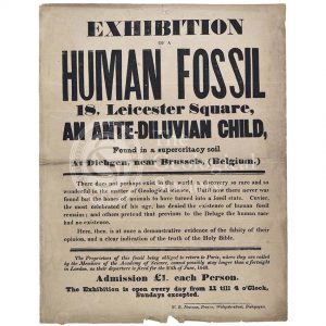
Advertisement for a ‘Human Fossil’
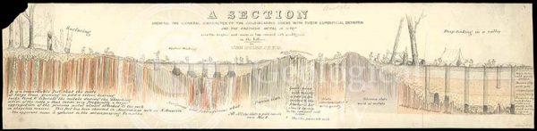
‘Section showing the general characters of the gold-bearing rocks with their superficial detritus…’
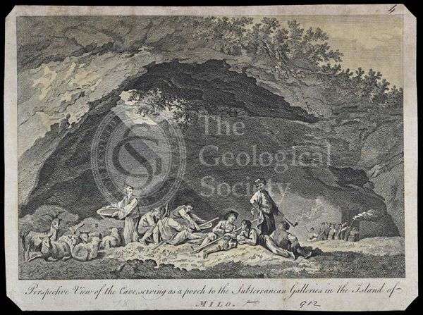
Subterranean galleries in the Island of Milo
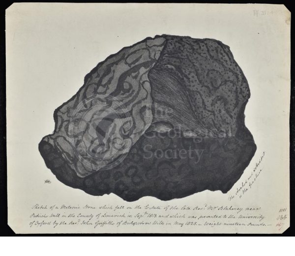
Meteorite that fell in County Limerick
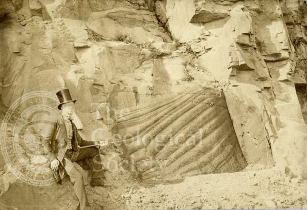
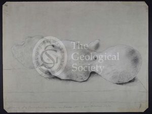
Peculiar appearance of a rock surface
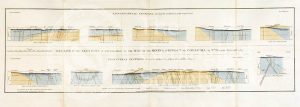
Geological Sections in Illustration of the Map of the Mining District of Cornwall (Smith, 1819)
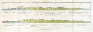
Geological view and sections of Norfolk and Suffolk (Smith, 1819)
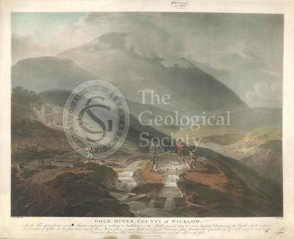
‘Gold mines, County of Wicklow’
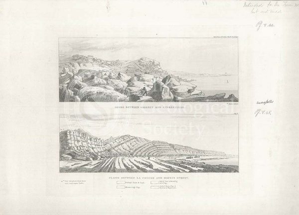
Views of the French coast
Geological views and sections of Essex/Hertfordshire and between London and Cambridge (Smith, 1819)
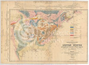
Geological Map of the United States and the British Provinces of North America (Marcou, 1853)
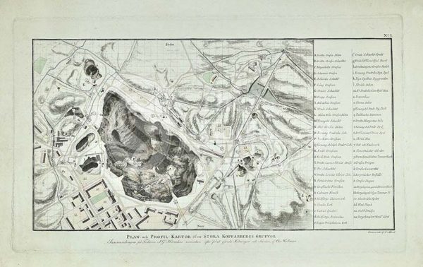
Plan of Stora Grufna coppermine, Sweden
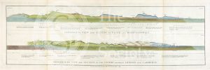
Geological view and section through Dorsetshire and Somersetshire to Taunton (Smith, 1819)
Section of Stora Grufna coppermine, Sweden
Fungus Rock, Gozo
Geological View of the Mining District of Cornwall (Smith, 1819)
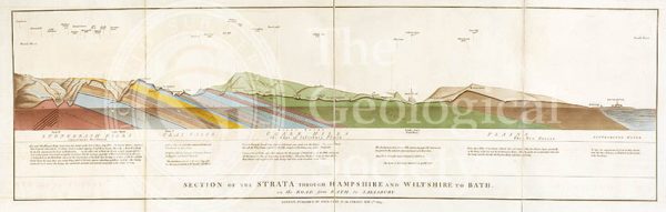
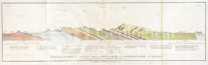
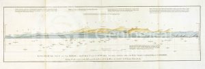
Section of the Strata through Hampshire and Wiltshire to Bath (Smith, 1819)
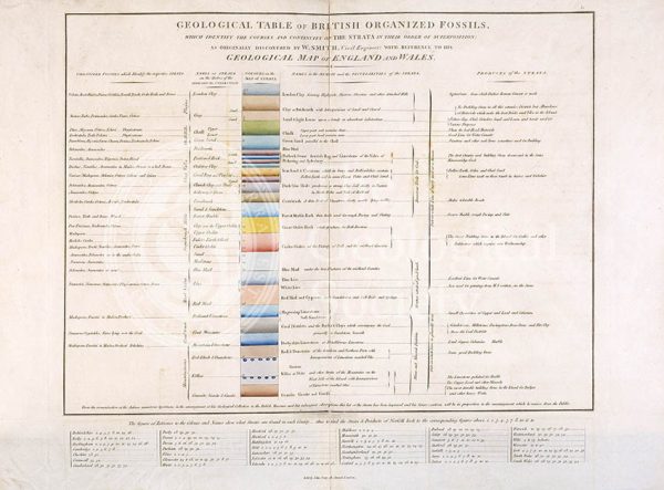
Geological Table of British Organized Fossils
Pleistocene geological feature, Malta
Malta Beds from Gebel Ciantar
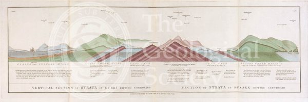
Vertical Section of Strata in Surry (Smith, 1819)
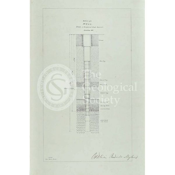
Section of a well sunk at Hampstead Road Reservoir
Syncline, Malta
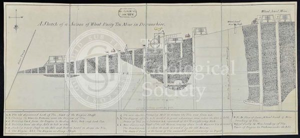
‘A sketch of a section of Wheal Unity Tin Mine in Devonshire’
Geological map of the United States and part of Canada (Hitchcock, 1886)
Swanscombe Hill. Looking NNW
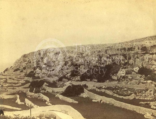
Mellieha Fault, Malta
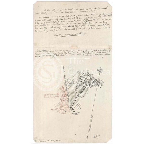
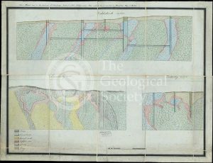
Fault in the coal workings of Cwm Sychan, Monmouthshire
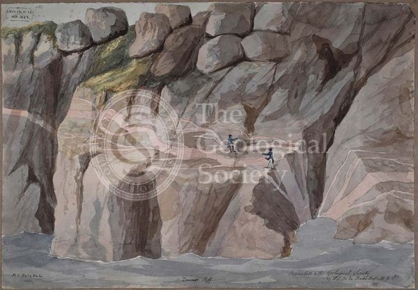
Cliffs at Zennor, Cornwall
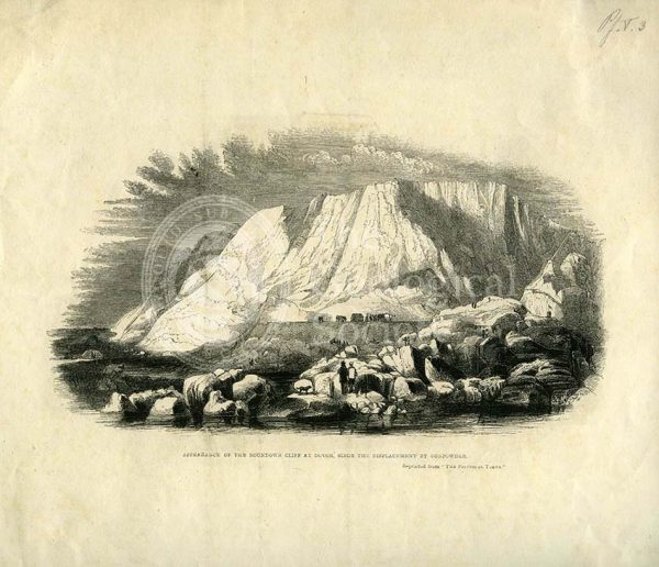
‘Appearance of the Roundown Cliff at Dovor (sic) since the displacement by gunpowder’
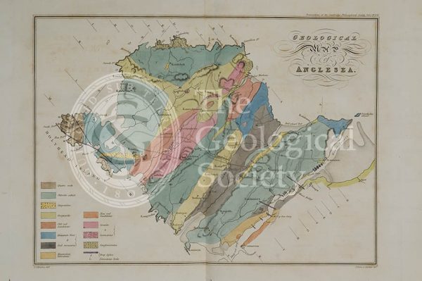
Geological map of Anglesea (Henslow, 1822)
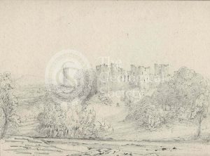
Ludlow Castle, Shropshire
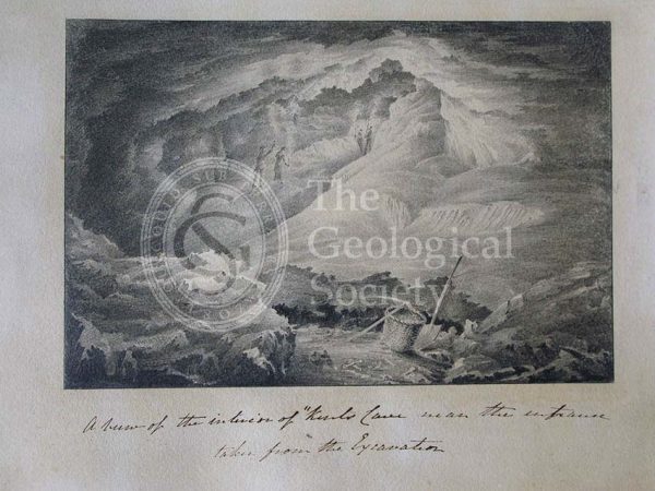
Inside Kent’s Cavern
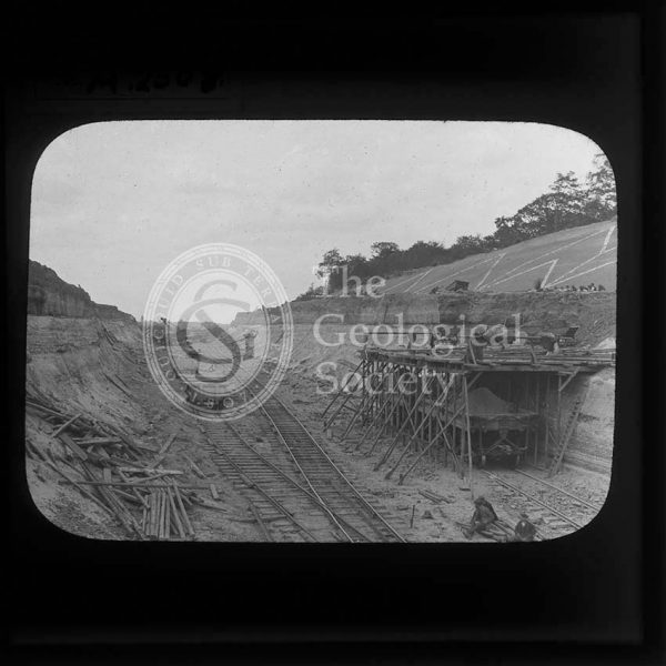
Proposed Gravesend to Tilbury Fort Tunnel
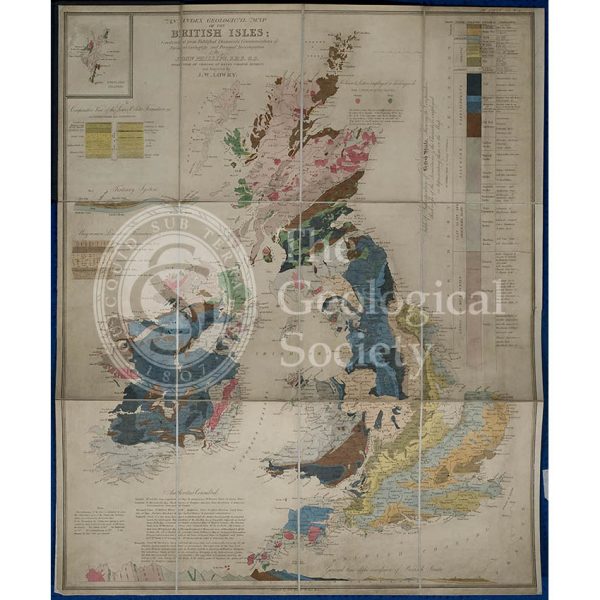
Geological map of the British Isles (Phillips, 1838)
Dattenberg Quarry, Germany
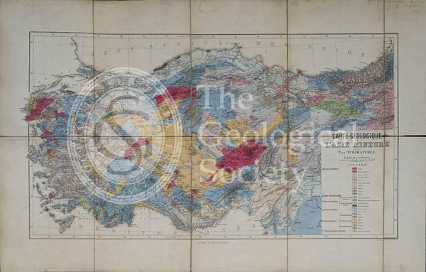
Carte géologique de l’Asia Mineure (Tchihatcheff, 1867)
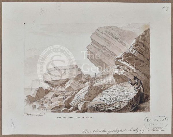
Isle of Wight coast
Dattenberg Quarry, Germany
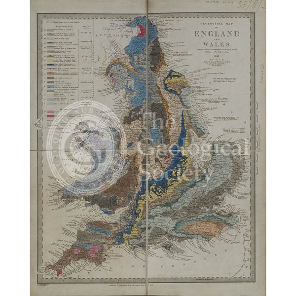
Geological map of England and Wales (Murchison, 1843)
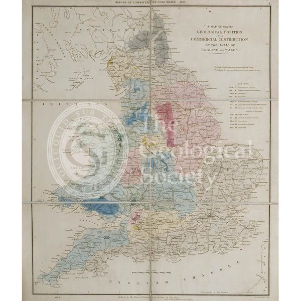
Map showing the Geological Position and Commercial Distribution of the Coal of England and Wales (House of Commons, 1830)
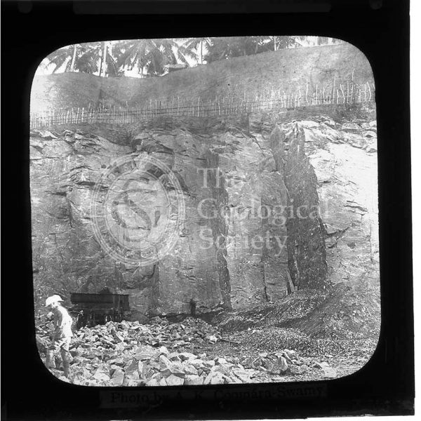
Mahara Quarry, Sri Lanka
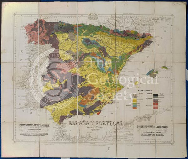
Mapa Geologico de España y Portugal (Coello, 1864)
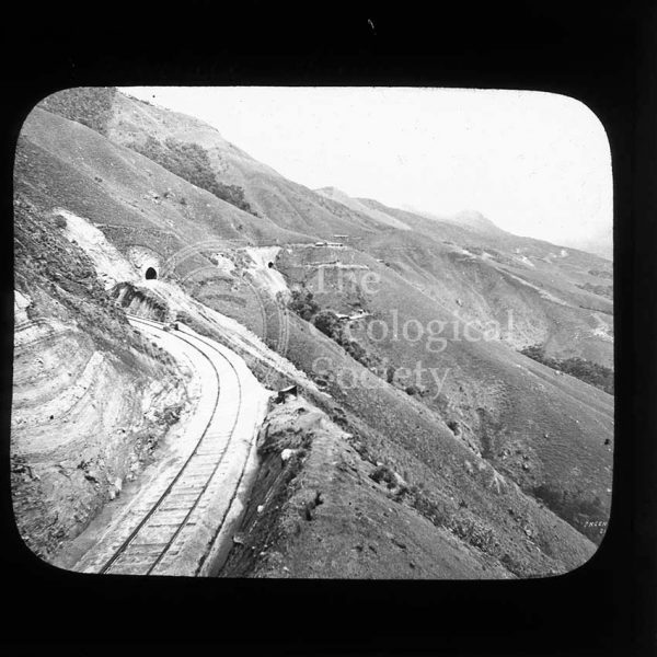
Railway line near Haputale, Sri Lanka
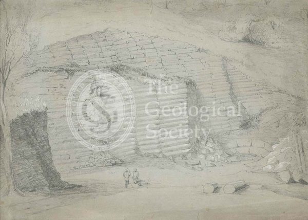
Standard Quarry, Welshpool
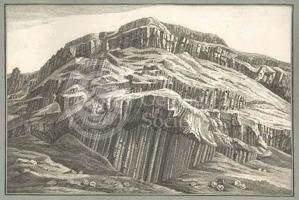
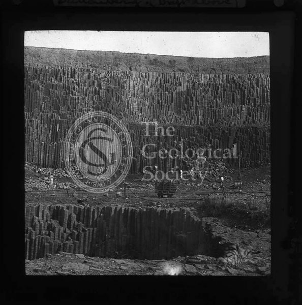
Giant’s Causeway
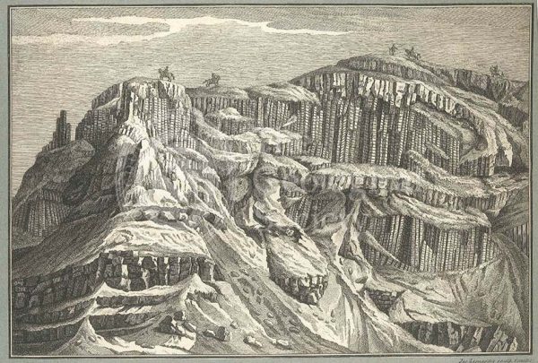
Giant’s Causeway
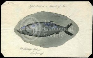
‘Fossil fish in a nodule of Lias’
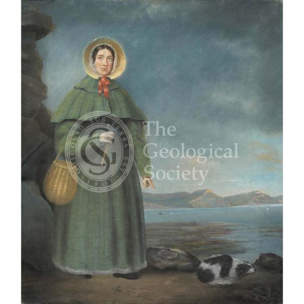
Mary Anning (1799-1847)
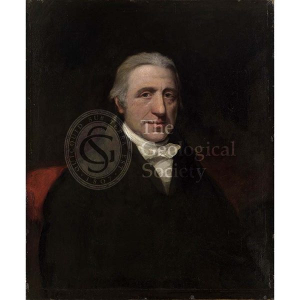
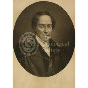
William Babington (1756-1833)

The British Association at Newcastle
John Phillips (1800-1874)
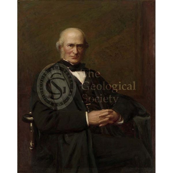
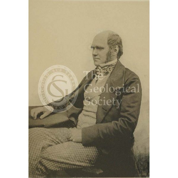
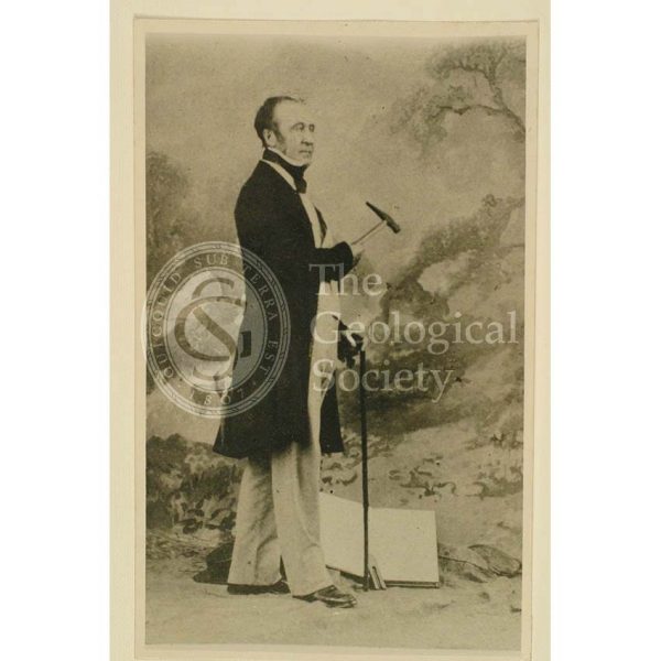
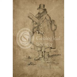
William Smith (1769-1839)

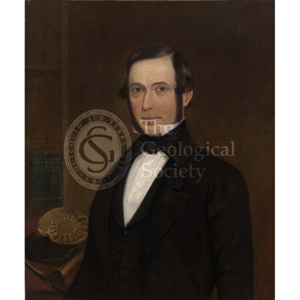
Henry Woodward (1832-1921)
Sir Henry Thomas De la Beche (1796-1854)
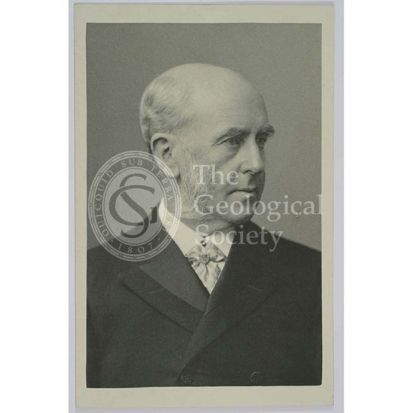
Sir Archibald Geikie (1835-1924)
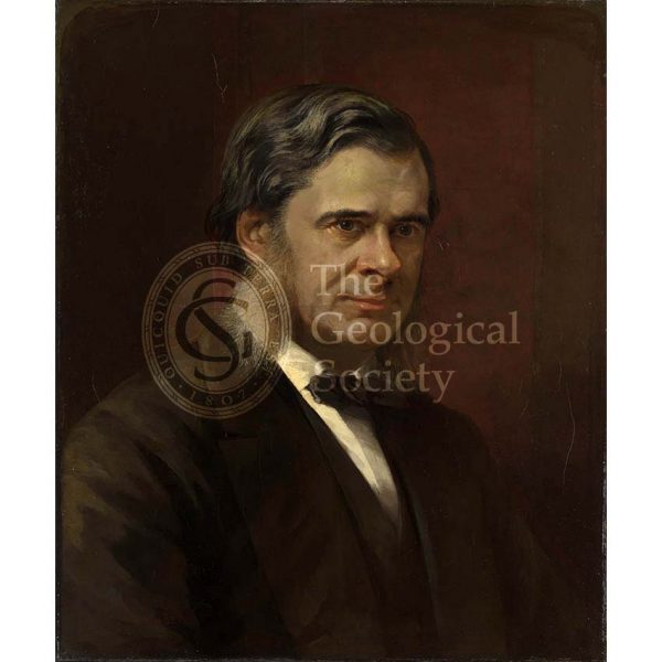
Thomas Henry Huxley (1825-1895)
Gideon Algernon Mantell (1790-1852)
William Pengelly (1812-1894)
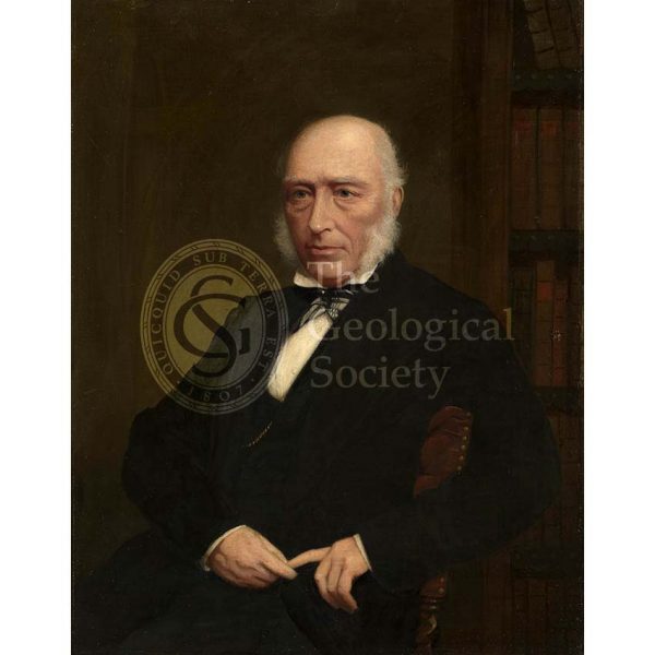
Sir Joseph Prestwich (1812-1896)
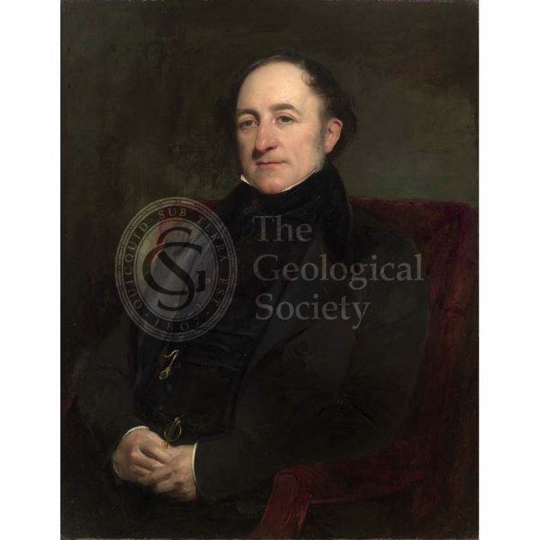
Sir Andrew Crombie Ramsay (1814-1891)
Charles Darwin (1809-1882)
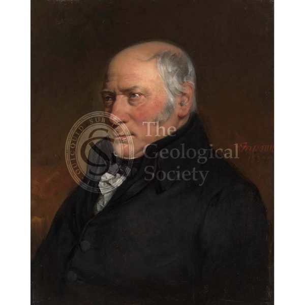
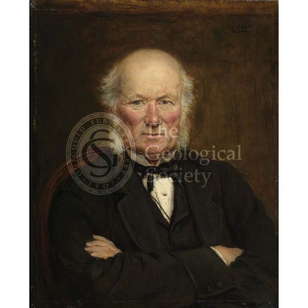
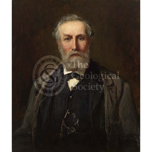
Sir Roderick Impey Murchison (1792-1871)
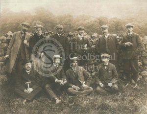
Centenary field excursion to the Lake District
William Buckland (1784-1856)
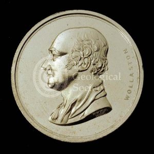
Wollaston Medal
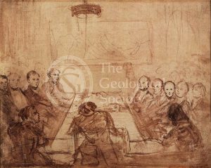
Ordinary Meeting of the Geological Society
Gideon Mantell (1790-1852)
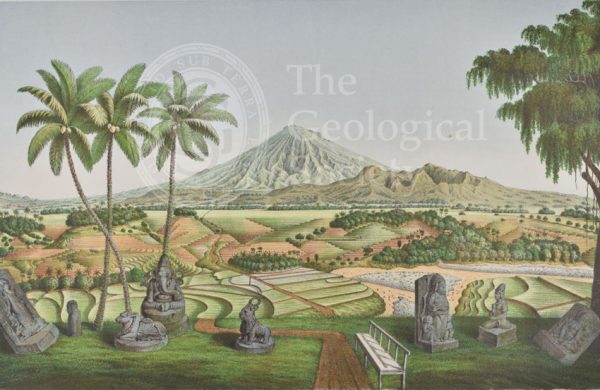
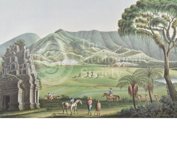
Mount Sumbing, Java

‘A view of the landslip from Great Bindon…’
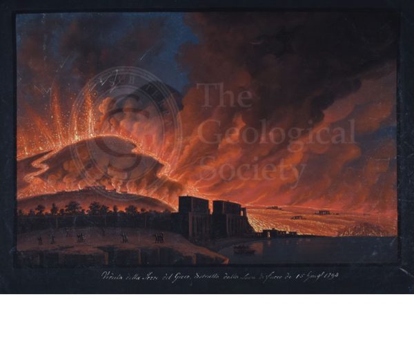
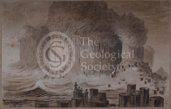
Destruction of Torre del Greco, 15th June 1794