
history
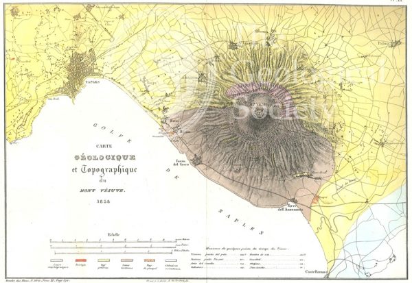
Carte géologique et topographique du Mont Vésuve (Dufrenoy, 1838)

Map of the English Lakes (Ruthven, 1855)
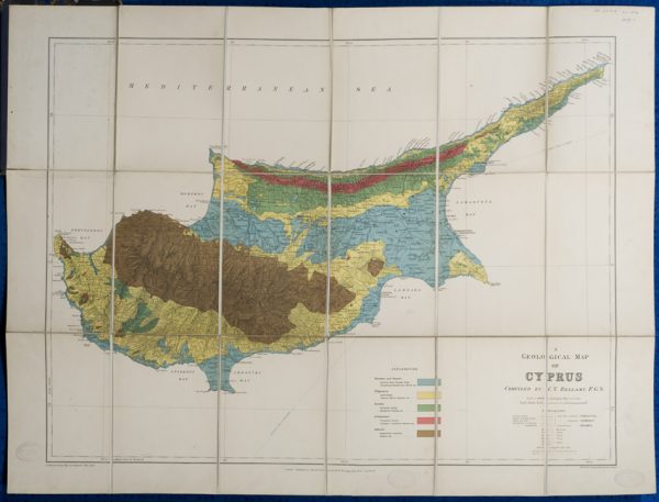
Geological map of Cyprus (Bellamy, 1905)
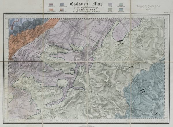
Geological map of the neighbourhood of Cambridge (Jukes-Browne, 1874)
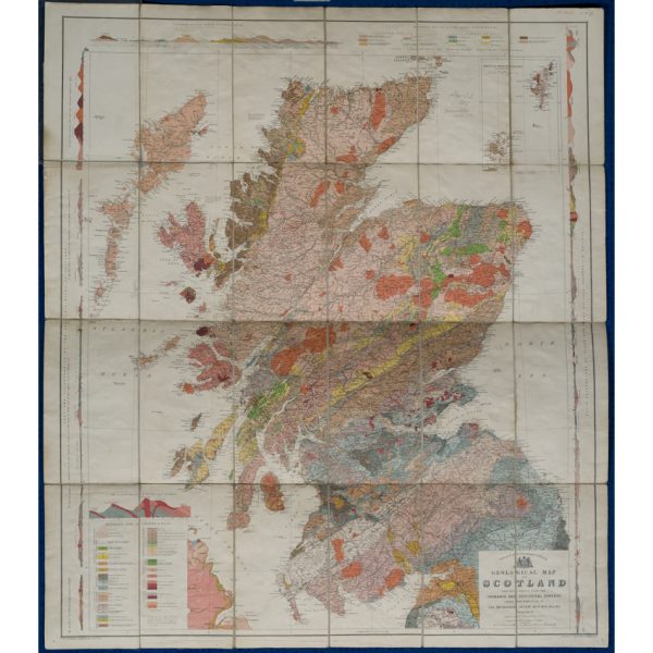
Geological map of Scotland (Geikie, 1910)
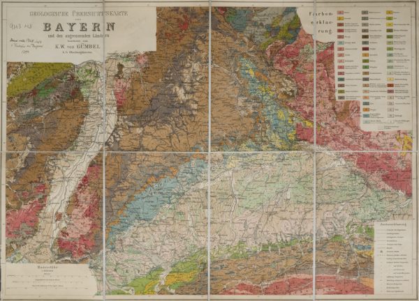
Geologische Übersichtskarte von Bayern und den angrenzenden Ländern (Karl Wilhelm von Gümbel, 1893)
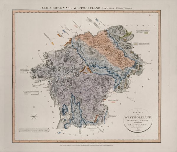
Geological Map of Westmoreland (William Smith, 1824)
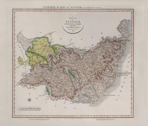
Geological Map of Suffolk (William Smith, 1819)
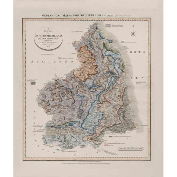
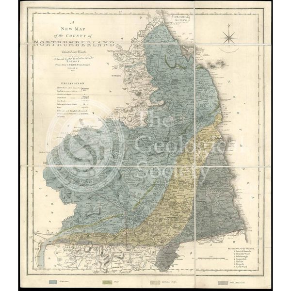
Geological Map of Northumberland (William Smith, 1824)
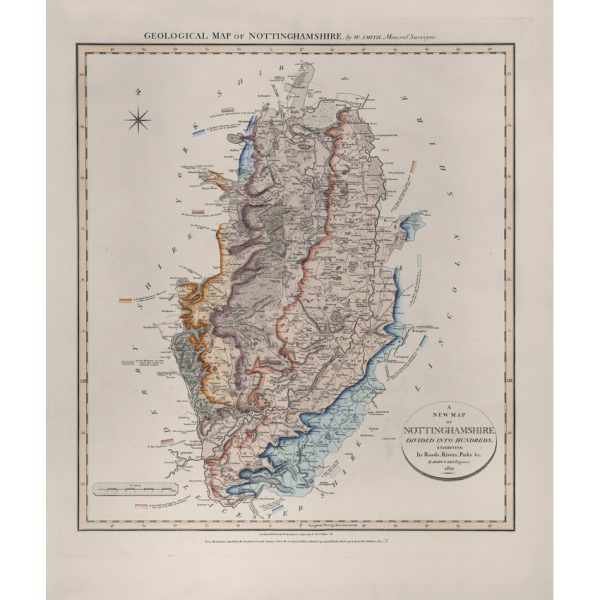
Geological Map of Nottinghamshire (William Smith, 1821)
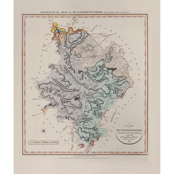
Geological Map of Huntingdonshire (William Smith, 1821)
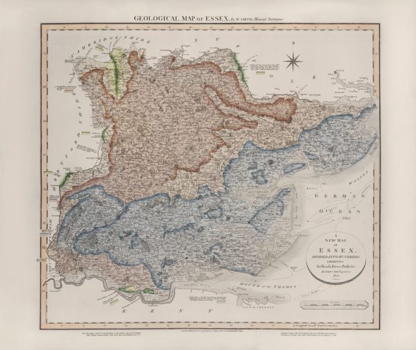
Geological Map of Essex (William Smith, 1820)
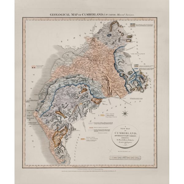
Geological Map of Cumberland (William Smith, 1824)
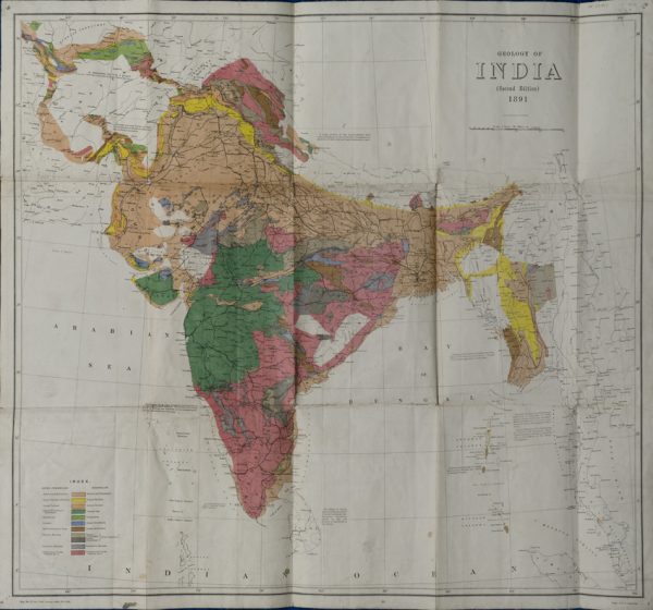
Geological Map of India (Geological Survey of India, 1891)
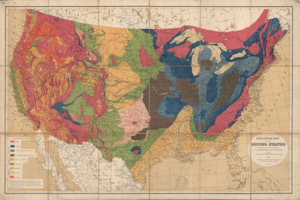
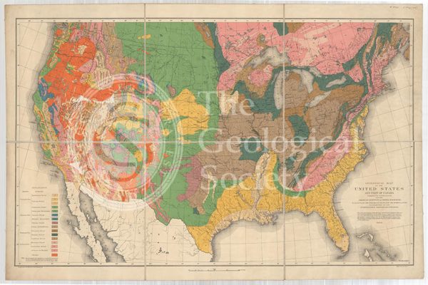
Geological map of the United States (Hitchcock and Blake, 1872)
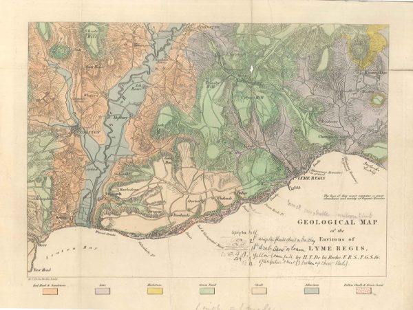
Geological map of the environs of Lyme Reis (De La Beche, 1826)
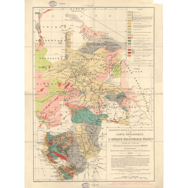
Carte géologique de l’Afrique Équatoriale Française (Loir, 1913)
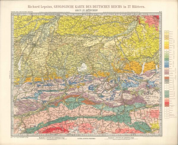
Geologisches Karte des Deutschen Reichs – 27. Munchen (Lepsius, 1897)
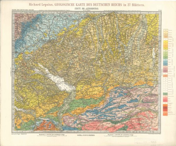
Geologisches Karte des Deutschen Reichs – 26. Augsburg (Lepsius, 1897)
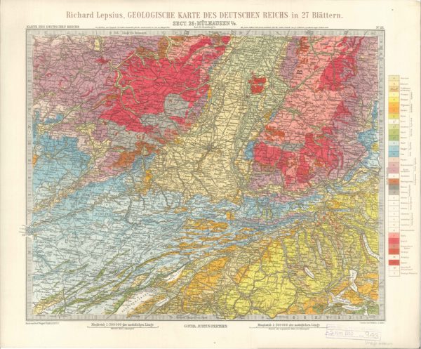
Geologisches Karte des Deutschen Reichs – 25. Mulhausen I-E (Lepsius, 1897)
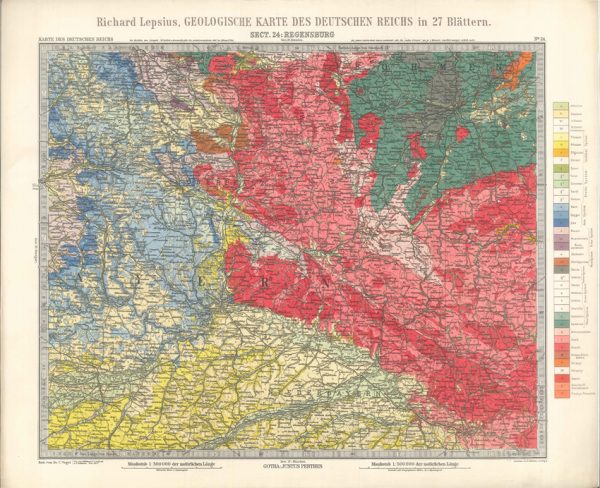
Geologisches Karte des Deutschen Reichs – 24. Regensburg (Lepsius, 1897)
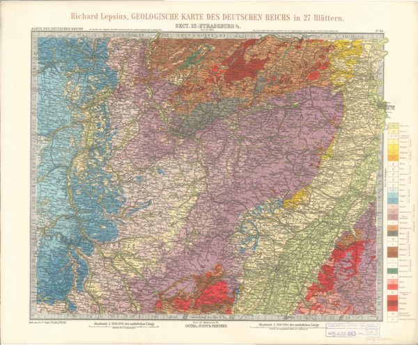
Geologisches Karte des Deutschen Reichs – 22. Strassburg I-E (Lepsius, 1897)
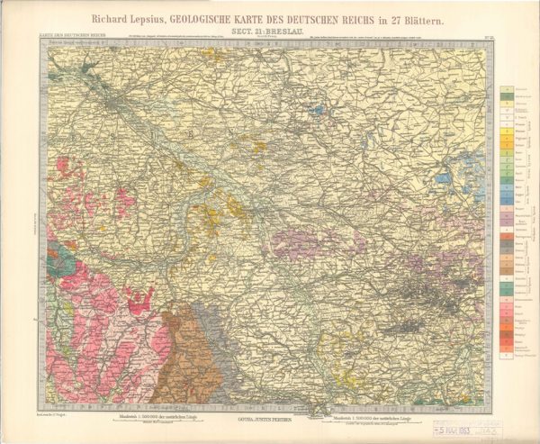
Geologisches Karte des Deutschen Reichs – 21. Breslau (Lepsius, 1897)
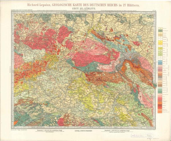
Geologisches Karte des Deutschen Reichs – 20. Gorlitz (Lepsius, 1897)
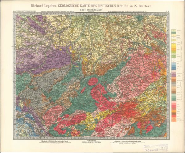
Geologisches Karte des Deutschen Reichs – 19. Dresden (Lepsius, 1897)
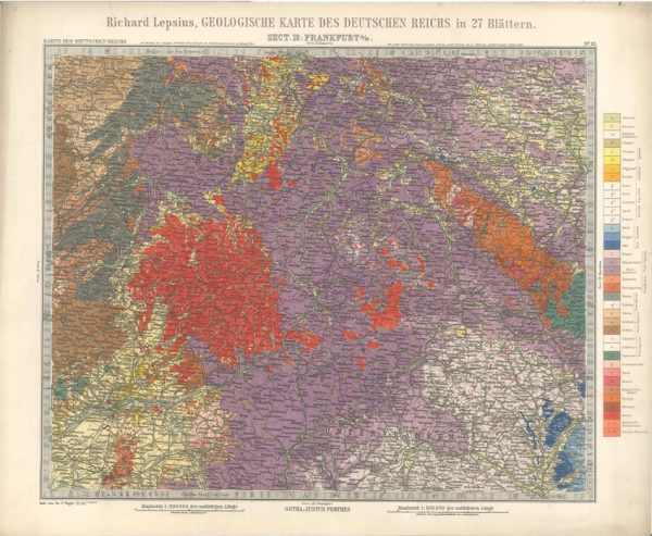
Geologisches Karte des Deutschen Reichs – 18. Frankfurt A-M (Lepsius, 1897)
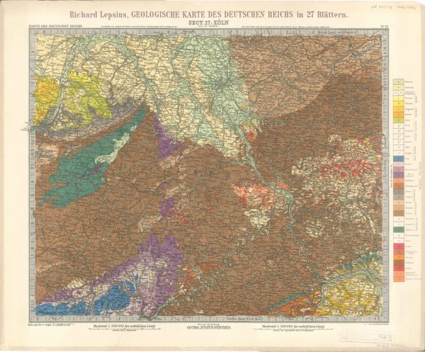
Geologisches Karte des Deutschen Reichs – 17. Koln (Lepsius, 1897)
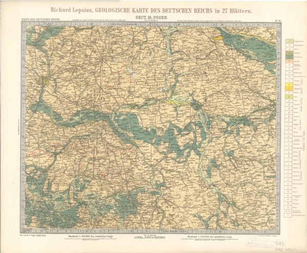
Geologisches Karte des Deutschen Reichs – 16. Posen (Lepsius, 1897)
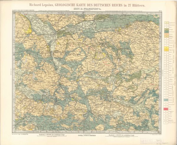
Geologisches Karte des Deutschen Reichs – 15. Frankfurt A-O (Lepsius, 1897)
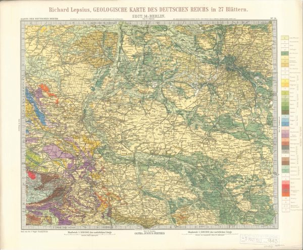
Geologisches Karte des Deutschen Reichs – 14. Berlin (Lepsius, 1897)
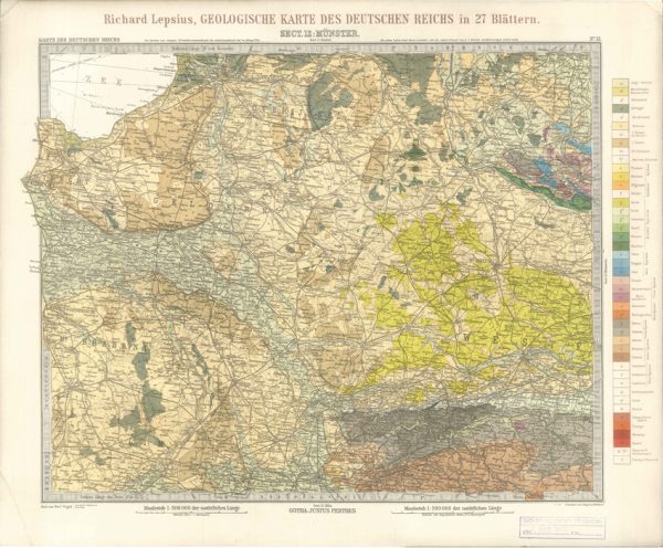
Geologisches Karte des Deutschen Reichs – 12. Munster (Lepsius, 1897)
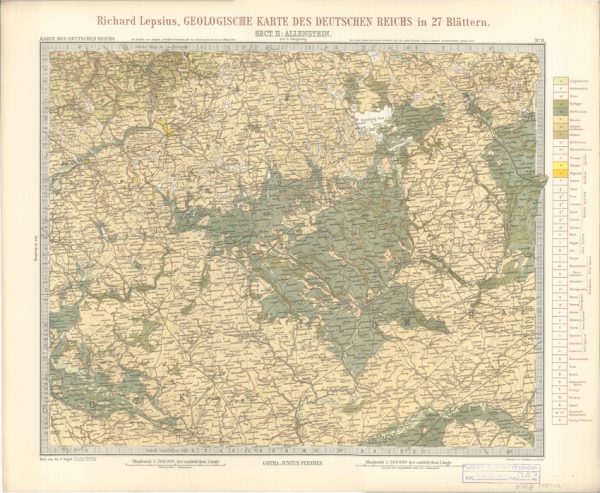
Geologisches Karte des Deutschen Reichs – 11. Allenstein (Lepsius, 1897)
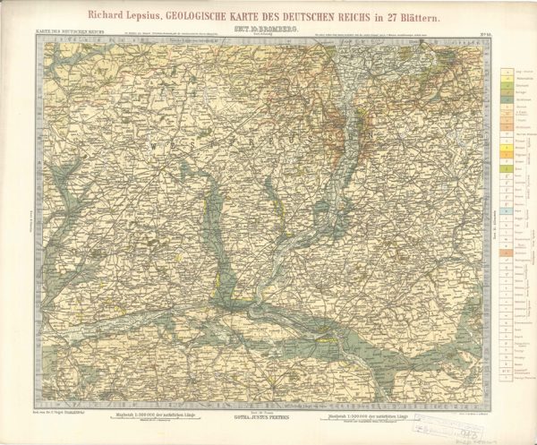
Geologisches Karte des Deutschen Reichs – 10. Bromberg (Lepsius, 1897)
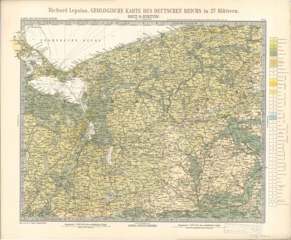
Geologisches Karte des Deutschen Reichs – 9. Stettin (Lepsius, 1897)
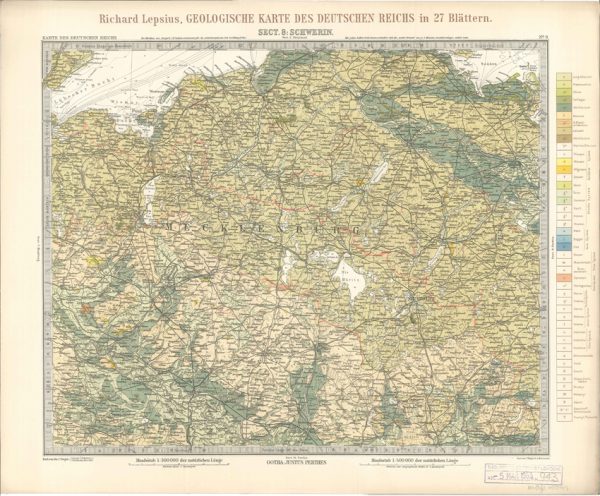
Geologisches Karte des Deutschen Reichs – 8. Schwerin (Lepsius, 1897)
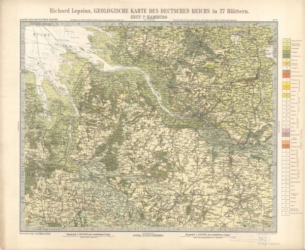
Geologisches Karte des Deutschen Reichs – 7. Hamburg (Lepsius, 1897)
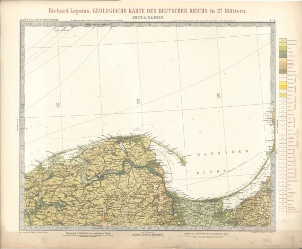
Geologisches Karte des Deutschen Reichs – 4. Danzig (Lepsius, 1897)
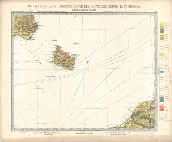
Geologisches Karte des Deutschen Reichs – 3. Rugenwalde (Lepsius, 1897)
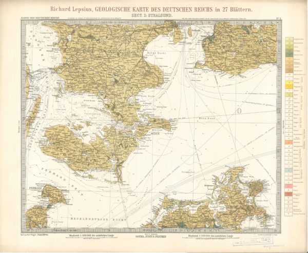
Geologisches Karte des Deutschen Reichs – 2. Stralsund (Lepsius, 1897)
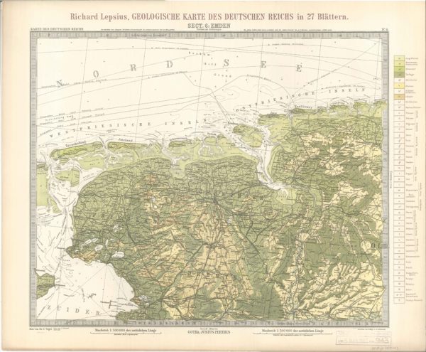
Geologisches Karte des Deutschen Reichs – 6. Emden (Lepsius, 1897)
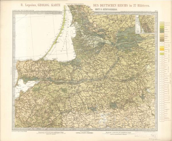
Geologisches Karte des Deutschen Reichs – 5. Konigsberg (Lepsius, 1897)
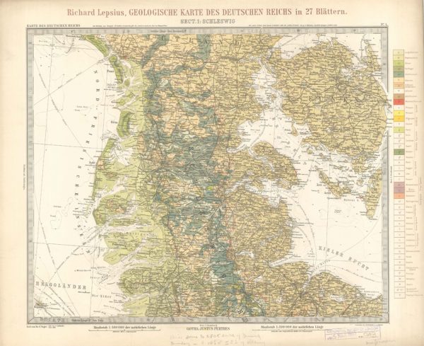
Geologisches Karte des Deutschen Reichs – 1. Schleswig (Lepsius, 1897)
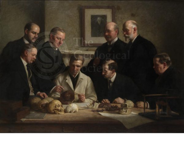
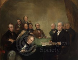
Discussion on the Piltdown Skull
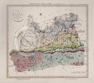
Geological Map of Surry (William Smith, 1819)
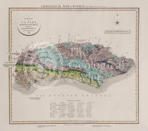
Geological Map of Sussex (William Smith, 1819)
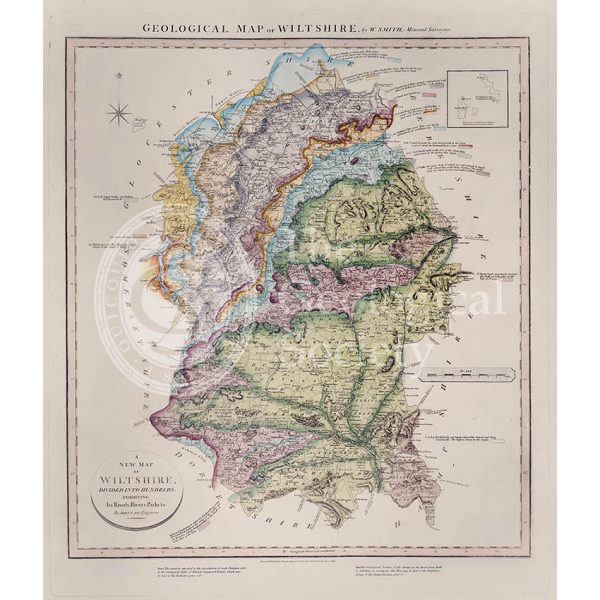
Geological Map of Wiltshire (William Smith, 1819)
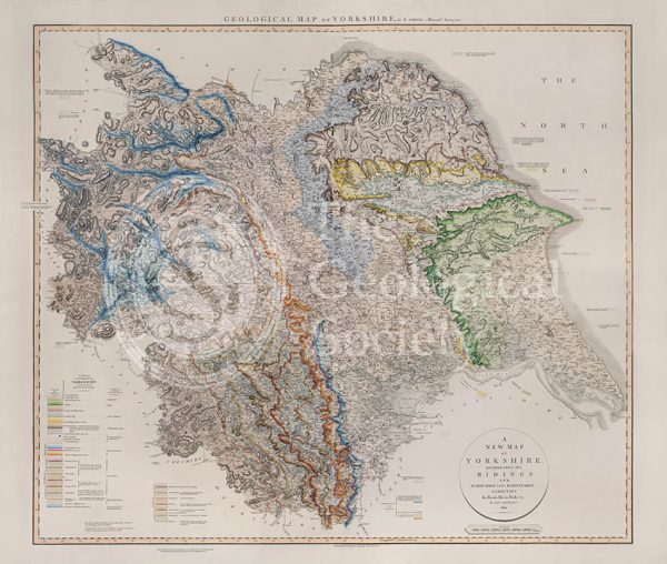
Geological Map of Yorkshire (William Smith, 1821)
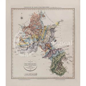
Geological map of Oxfordshire (William Smith, 1820)
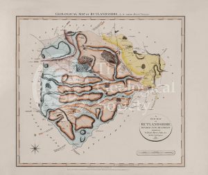
Geological Map of Rutlandshire (William Smith, 1822)
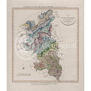
Geological Map of Buckinghamshire (William Smith, 1820)
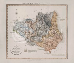
Geological Map of Durham (William Smith, 1824)
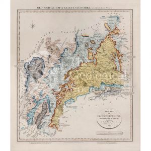
Geological Map of Gloucestershire (William Smith, 1819)
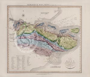
Geological Map of Kent (William Smith, 1819)
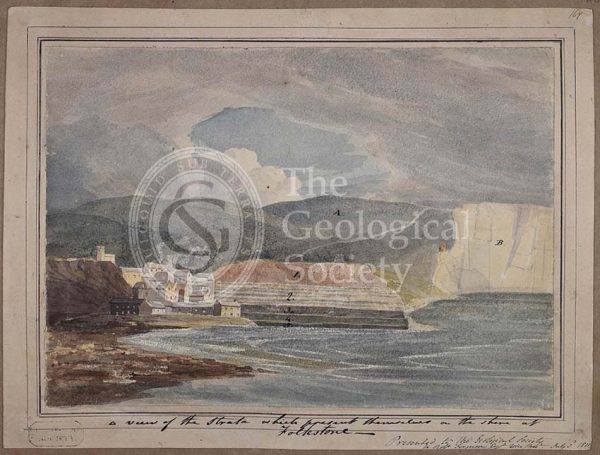
‘A view of the strata which present themselves on the shore of Folkestone’
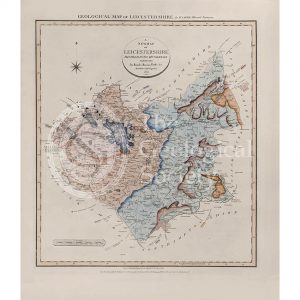
Geological Map of Leicestershire (William Smith, 1822)
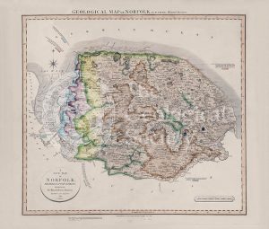
Geological Map of Norfolk (William Smith, 1819)
Carte géologique du Massif du Mont-Blanc (Duparc and Mrazec, 1896)
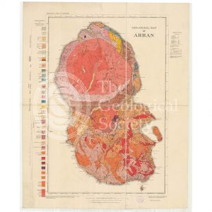
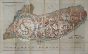
Geological Map of Arran (The Survey, 1910)
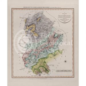
Geological Map of Bedfordshire (William Smith, 1820)
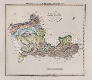
Geological Map of Berkshire (William Smith, 1819)
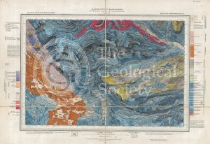
Geological map of Brough-under-Stainmore (Geological Survey of England & Wales, 1893)
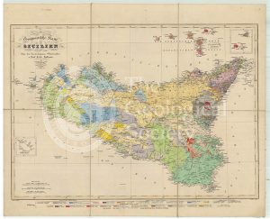
Geognostische Karte Sicilien (Hoffmann, 1839)
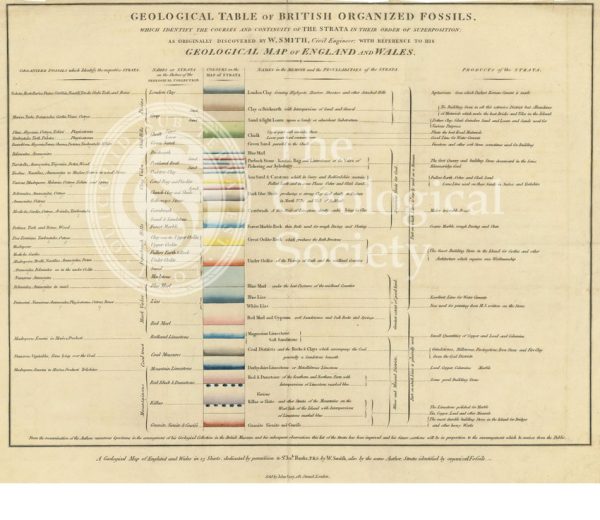
‘Geological table of British organized fossils…’
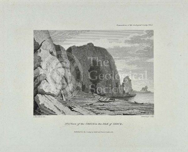
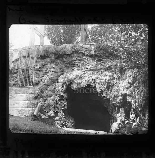
‘View of the Creux in the Isle of Sercq’
Geological map of Northumberland (Wood, 1831)
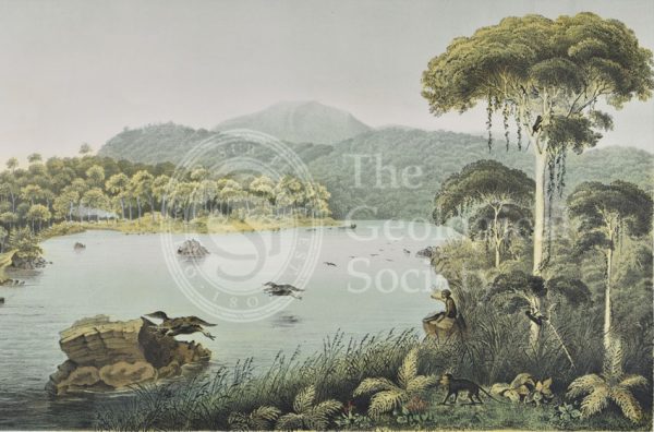
Lake Patengan, Java
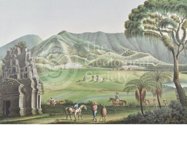
Dieng Plateau, Java
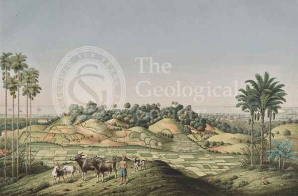
North coast of Java, Indonesia
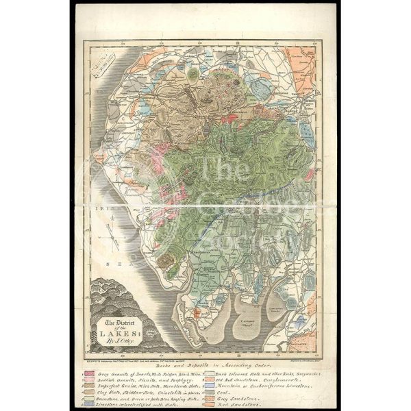
District of the Lakes (Otley, 1837)
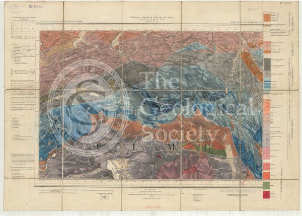
Geological map of England and Wales, Sheet 101 NE Cockermouth (1890)
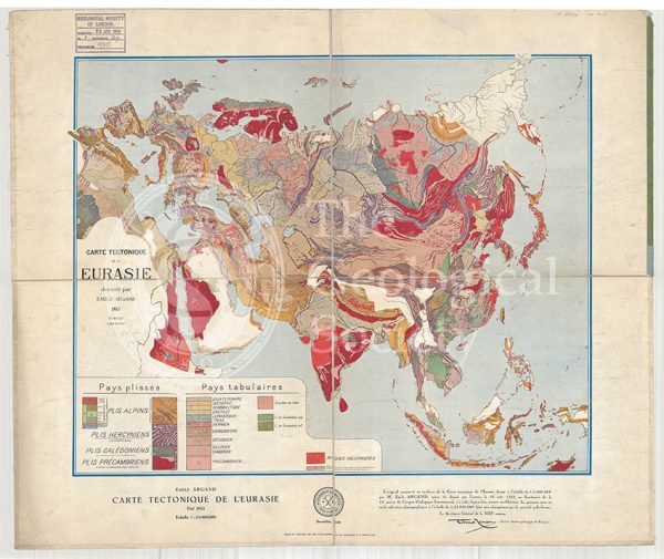
Carte tectonique de l’Eurasie (Argand, 1928)
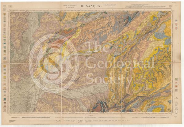
Carte géologique de la France 1:80,000. Feuille 126 Besançon (1892)
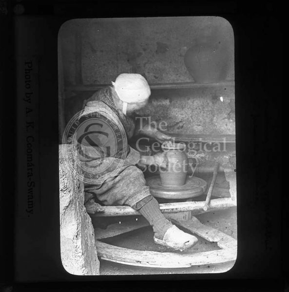
Woman making pottery, Brittany
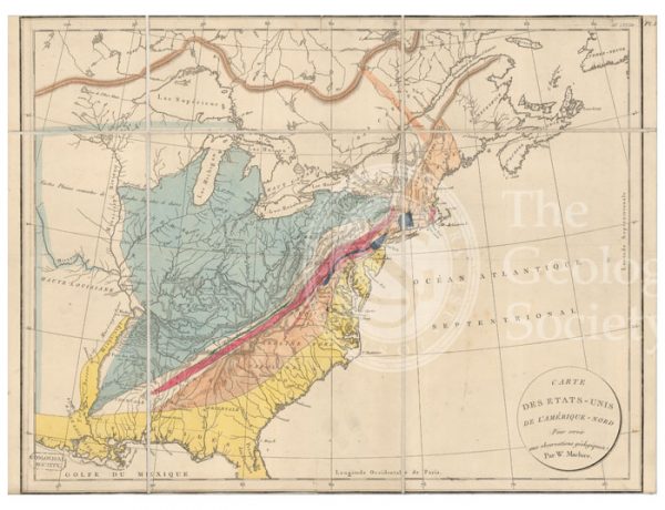
Carte des Etats-Unis de l’Amerique-Nord [Map of North America] (Maclure, 1811)
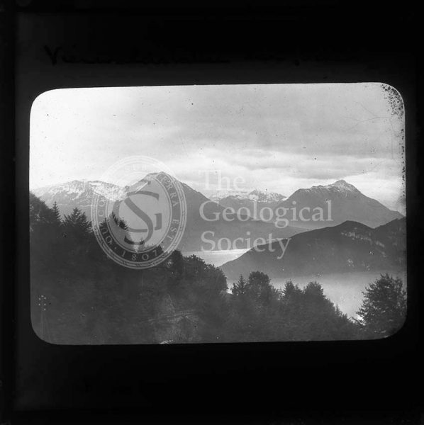
Lake Lucerne, Switzerland
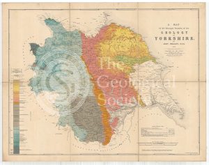
A Map of the Principal Features of the Geology of Yorkshire (Phillips, 1853)
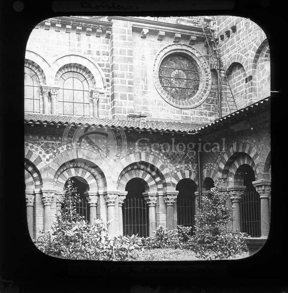
Cathedral cloisters, Le Puy
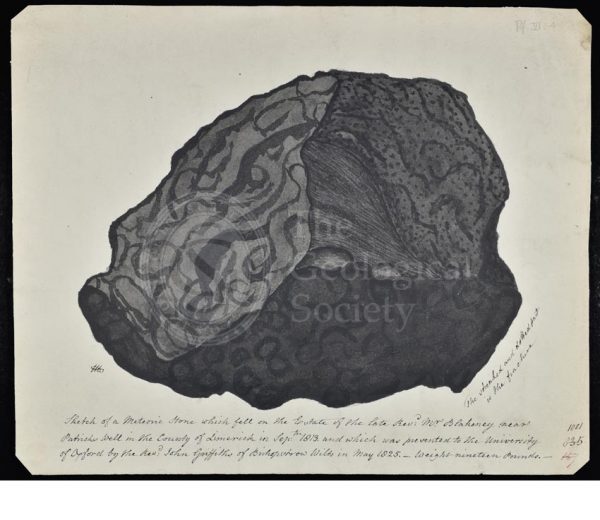
Meteorite that fell in County Limerick
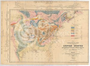
Geological Map of the United States and the British Provinces of North America (Marcou, 1853)
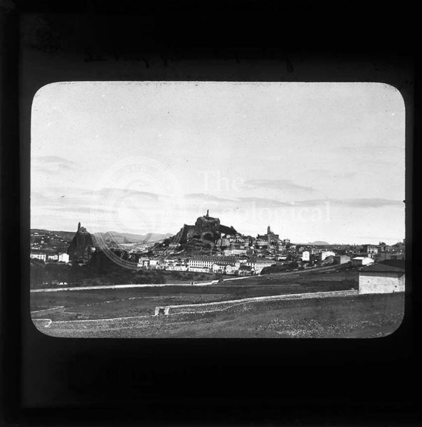
Le Puy, France
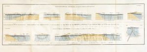
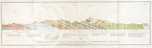
Geological Sections in Illustration of the Map of the Mining District of Cornwall (Smith, 1819)
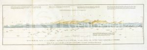
Geological view and sections of Norfolk and Suffolk (Smith, 1819)
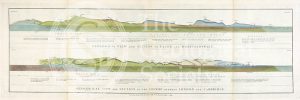
Geological views and sections of Essex/Hertfordshire and between London and Cambridge (Smith, 1819)
Glacial valley, France
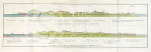
Geological view and section through Dorsetshire and Somersetshire to Taunton (Smith, 1819)
Visitors to Brehec, Brittany
Geological View of the Mining District of Cornwall (Smith, 1819)
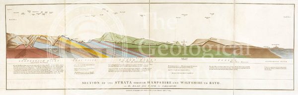
Section of the Strata through Hampshire and Wiltshire to Bath (Smith, 1819)
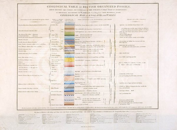
Geological Table of British Organized Fossils
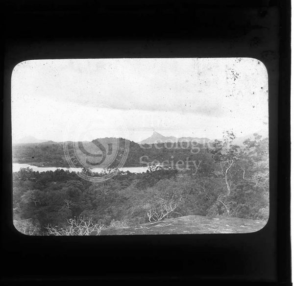
View from a Kurunegala rock, Sri Lanka
Geological map of the United States and part of Canada (Hitchcock, 1886)
Nalanda, Sri Lanka
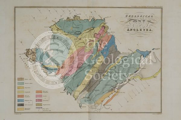
Geological map of Anglesea (Henslow, 1822)
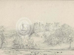
Ludlow Castle, Shropshire
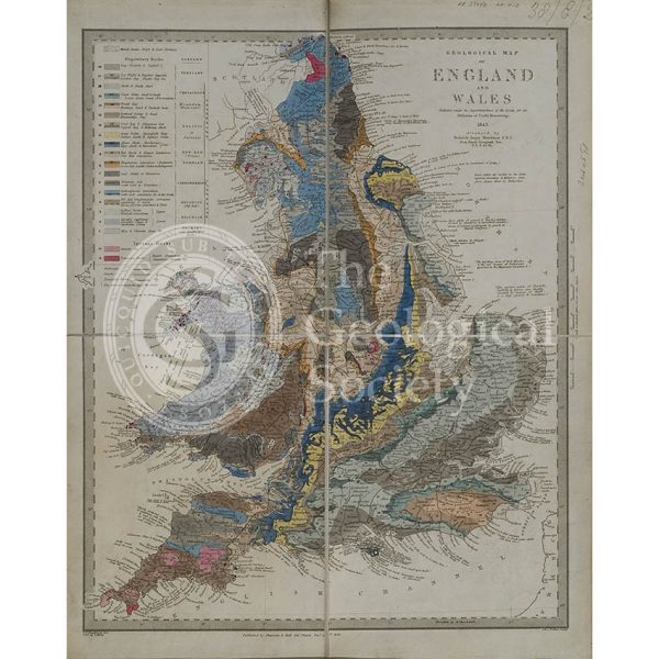
Geological map of England and Wales (Murchison, 1843)
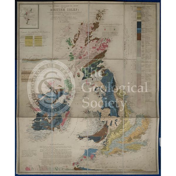
Geological map of the British Isles (Phillips, 1838)
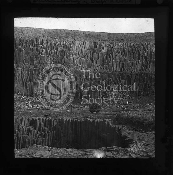
Dattenberg Quarry, Germany
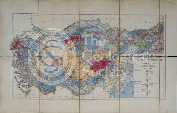
Carte géologique de l’Asia Mineure (Tchihatcheff, 1867)
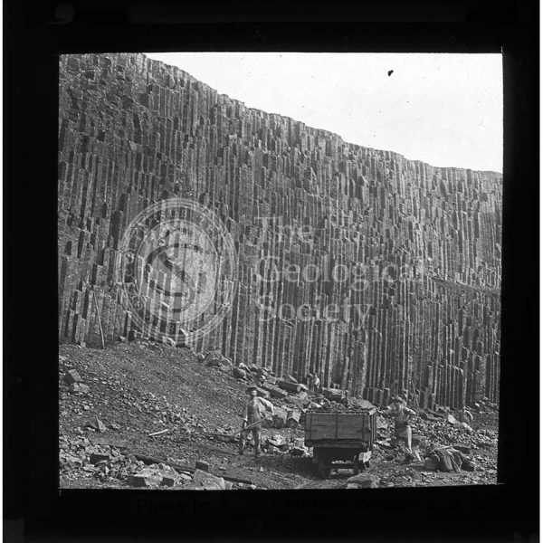
Dattenberg Quarry, Germany
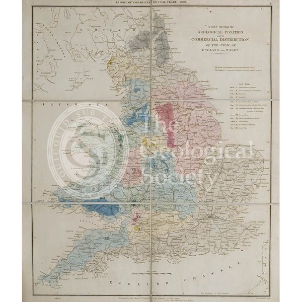
Map showing the Geological Position and Commercial Distribution of the Coal of England and Wales (House of Commons, 1830)
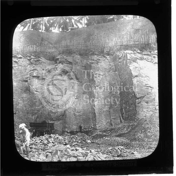
Mahara Quarry, Sri Lanka
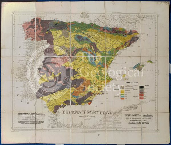
Mapa Geologico de España y Portugal (Coello, 1864)
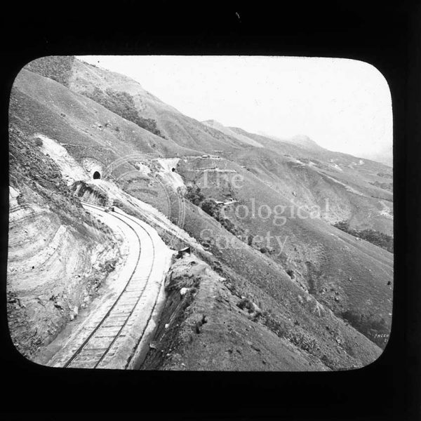
Railway line near Haputale, Sri Lanka
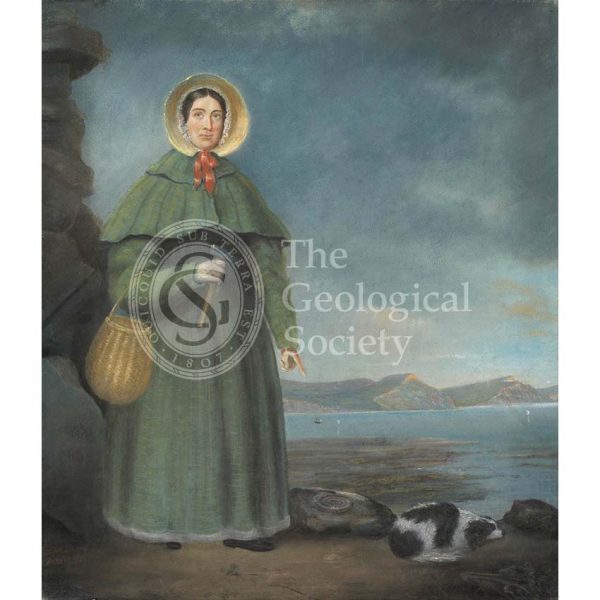
Mary Anning (1799-1847)
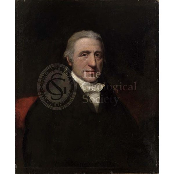
William Babington (1756-1833)
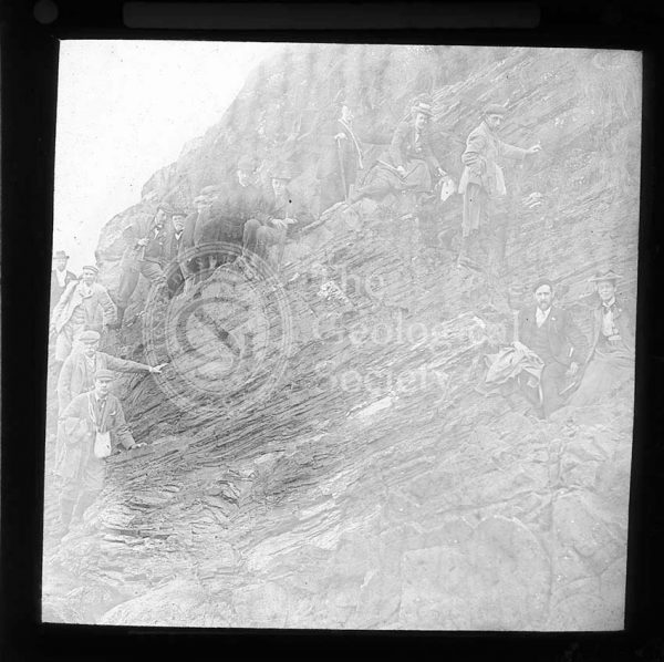
The British Association at Newcastle
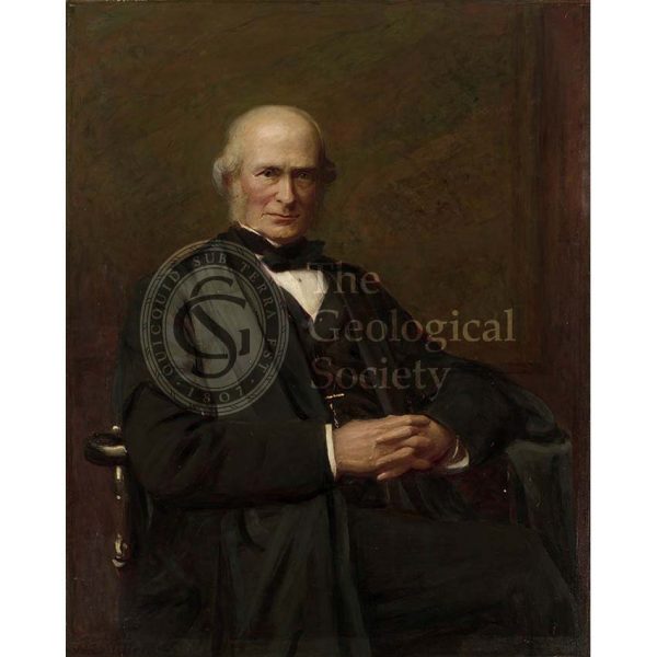
John Phillips (1800-1874)
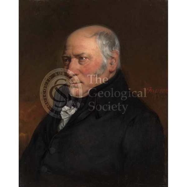
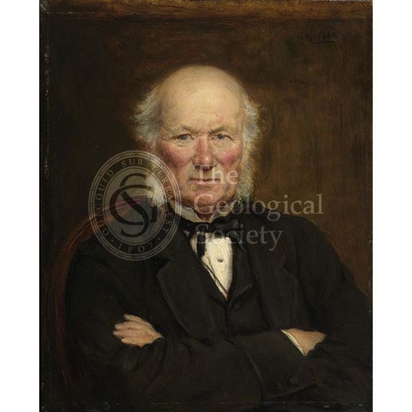
William Smith (1769-1839)
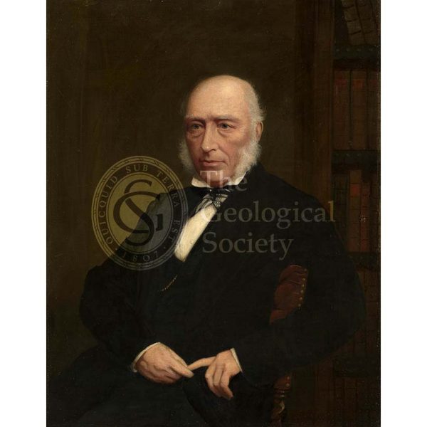
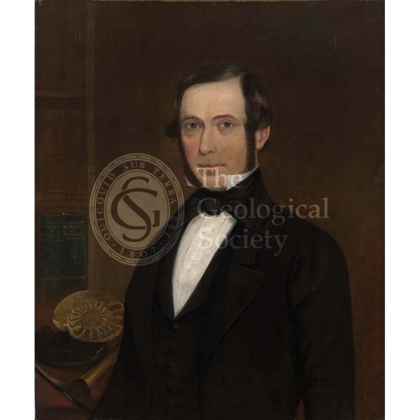
Henry Woodward (1832-1921)
Sir Henry Thomas De la Beche (1796-1854)
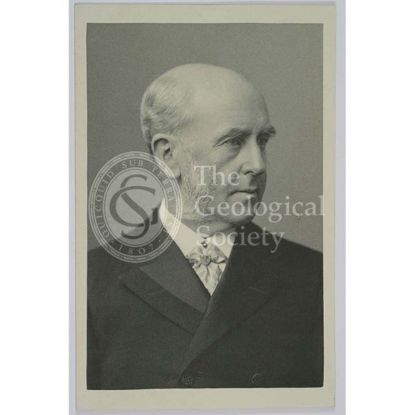
Sir Archibald Geikie (1835-1924)
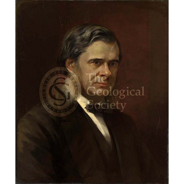
Thomas Henry Huxley (1825-1895)
Gideon Algernon Mantell (1790-1852)
William Pengelly (1812-1894)
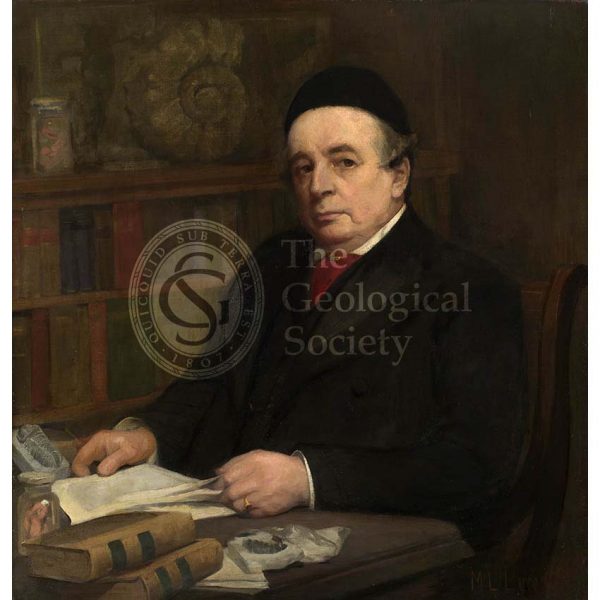
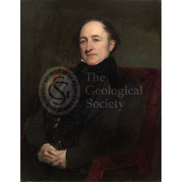
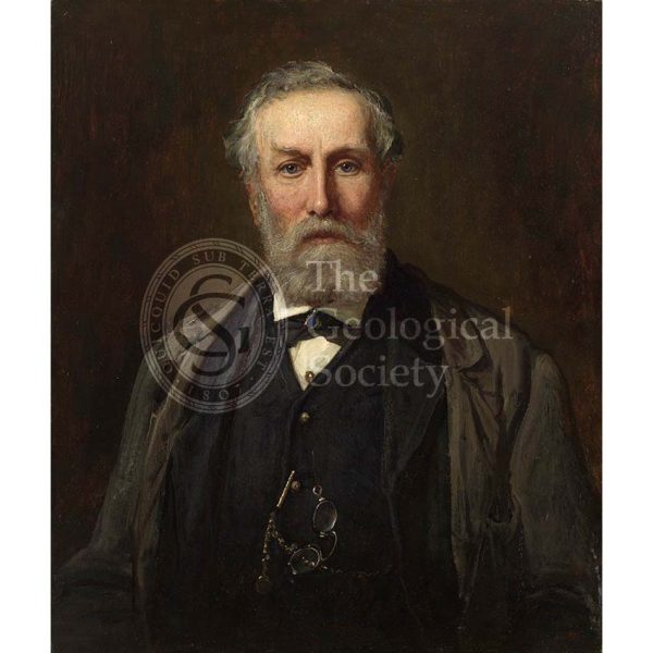
Sir Joseph Prestwich (1812-1896)
Sir Andrew Crombie Ramsay (1814-1891)
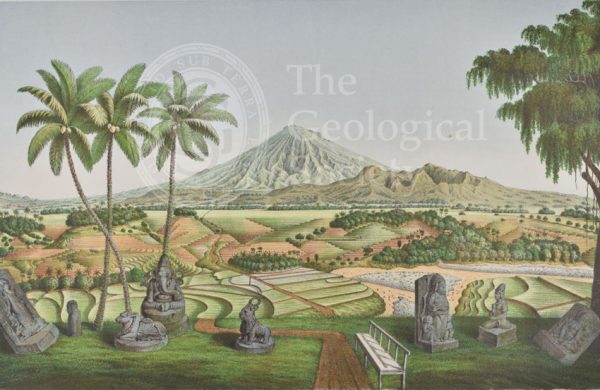
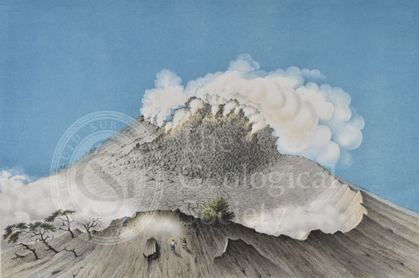
Mount Sumbing, Java

‘A view of the landslip from Great Bindon…’
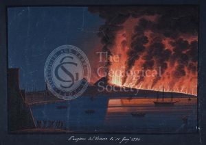
Eruption of Vesuvius, 15th June 1794
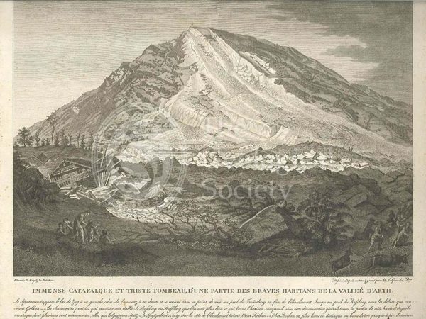
Landslide in the Arth valley, Switzerland
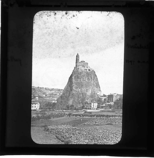
Saint Michel d’Aiguilhe, Le Puy-en-Velay, Auvergne
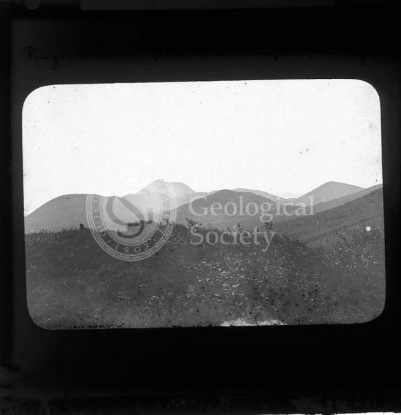
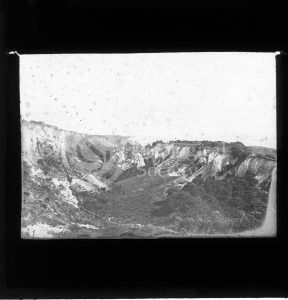
View south from Puy de la Nugère, Auvergne
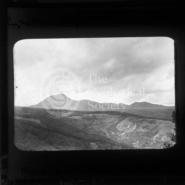
Puy de Dôme and Puy de Parion, Auvergne
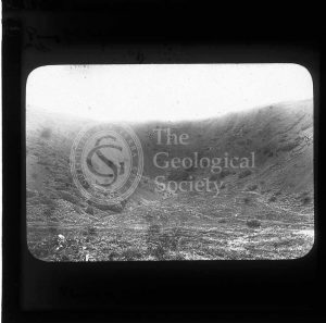
Puy de la Vache, Auvergne
Volcanic neck, St Monans
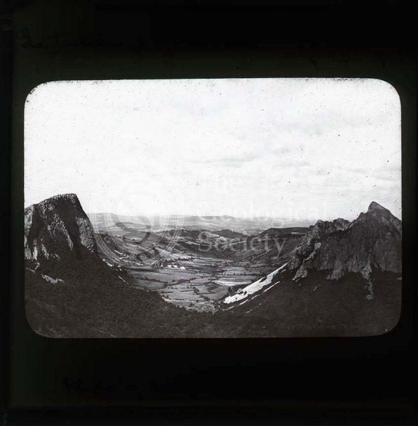
Landslip near Axmouth
Volcanic neck, Cushendall
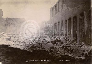
Rue Victor Hugo, St Pierre
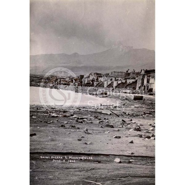
St Pierre and Mt Pelée
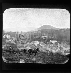
St Pierre before the eruption
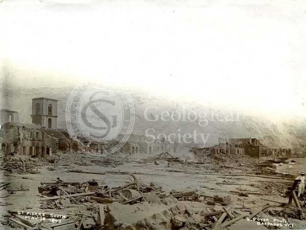
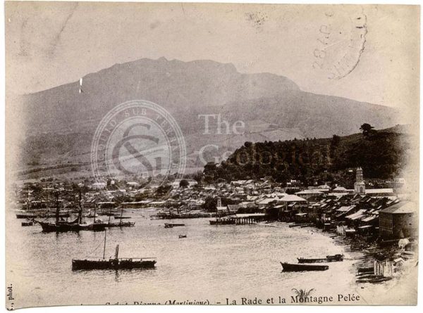
St Pierre
Theatre, St Pierre
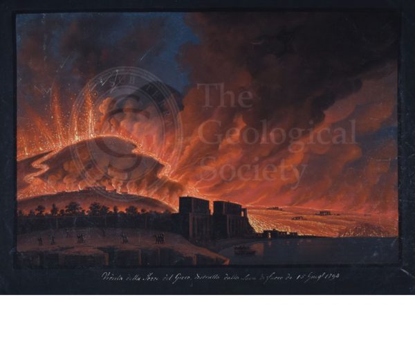
Destruction of Torre del Greco, 15th June 1794
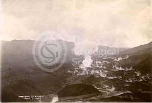
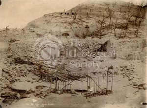
Wallibou, St Vincent
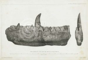
Fragment of jaw of Megalosaurus
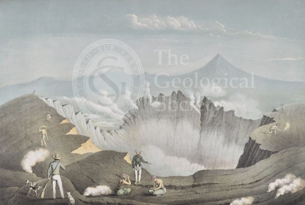
Mount Guntur, Java
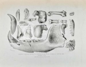
Teeth and bones from Kent’s Cavern
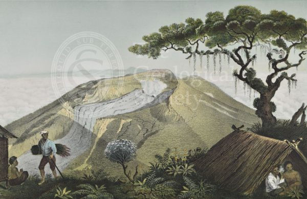
Mount Gede, Java
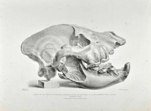
Skull of extinct hyena
Mount Merapi, Java
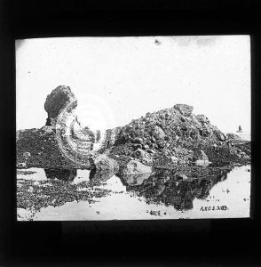
Grand Sarcoui, Auvergne
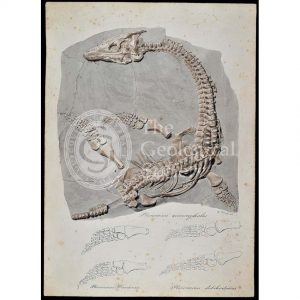
Plesiosaurus macrocephalus (original artwork)
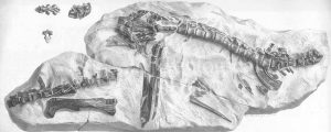
Hypsilophodon skeleton
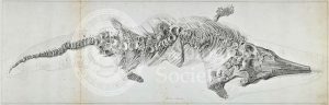
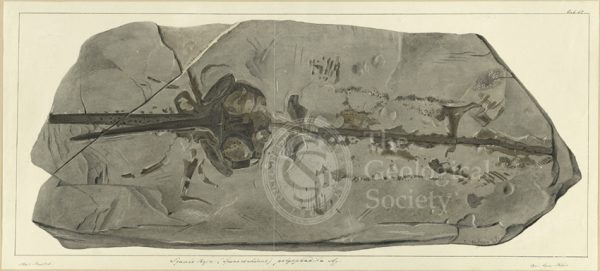
Proteosaurus, an ichthyosaur
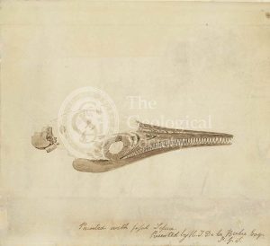
Ichthyosaur skull in fossil sepia
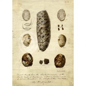
Fossil fruits
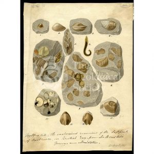
Molluskite (fossilised molluscs)
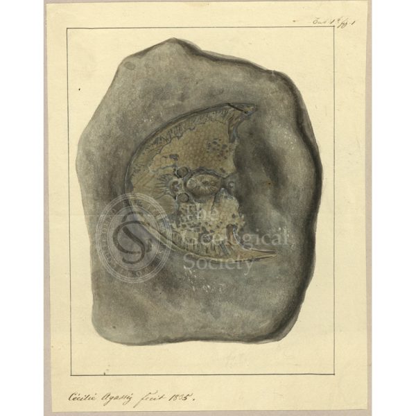
Cephalaspis Lyelli
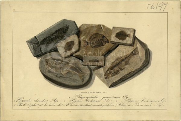
Fossil Fish of Sir Philip de Malpas Grey Egerton
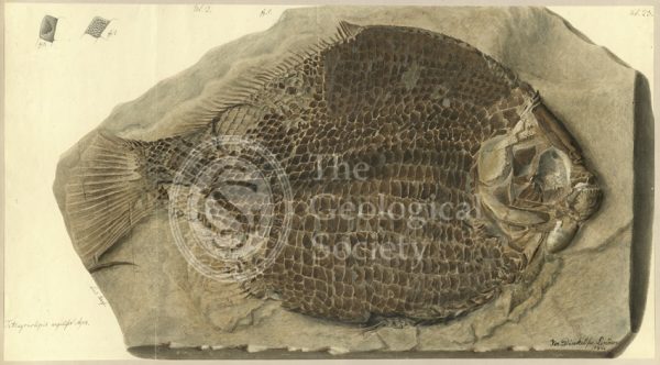
Tetragonolepis angulifer Agassiz
Squalo-raja (Spinacorhinus) polyspondila Agassiz
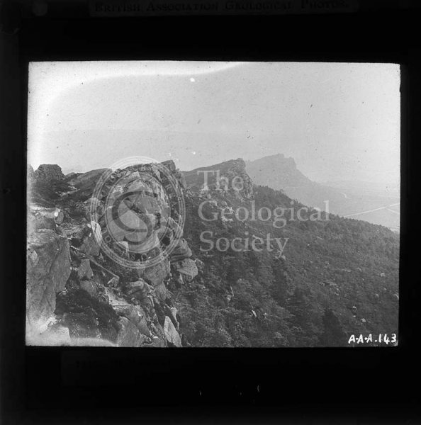
The Roaches, Peak District
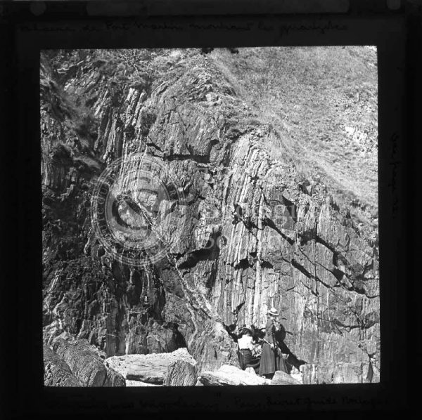
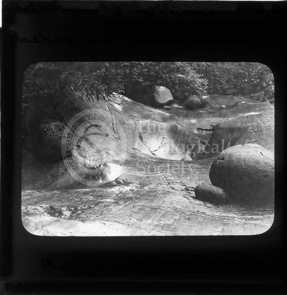
Quartzite at Port Martin Cliff
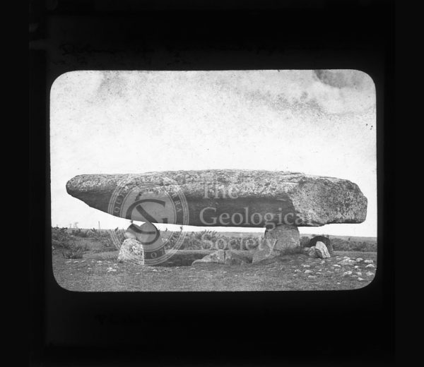
Table des Marchand
Natural bridge, Clermont
Glacier Garden, Lucerne
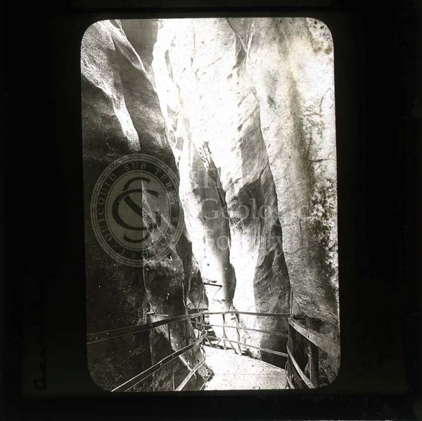
Aar Gorge, Switzerland
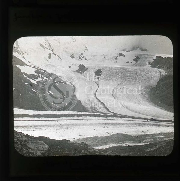
Junction of Gorner and Theodule glaciers
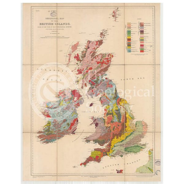
Geological Map of the British Isles (Teall, 1912)