
england
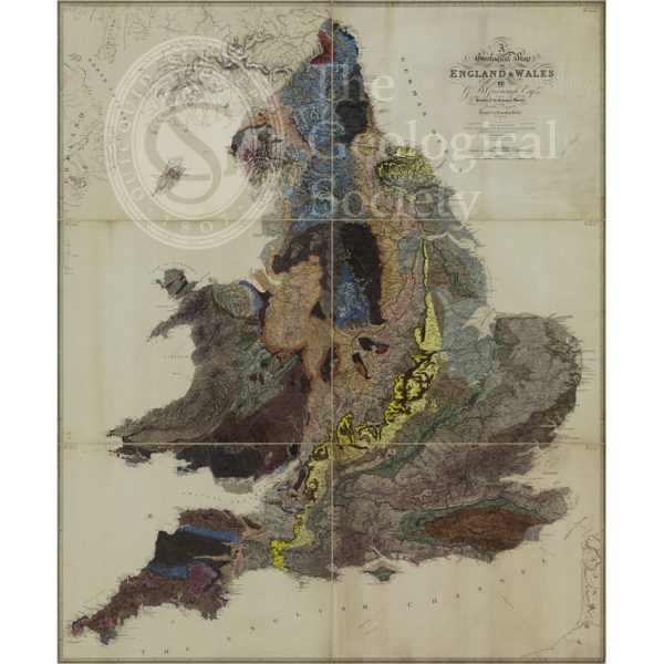
Geological Map of England and Wales [1839] 2nd edition
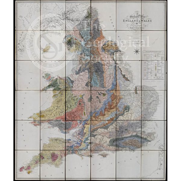
Geological Map of England and Wales (1820) 1st edition
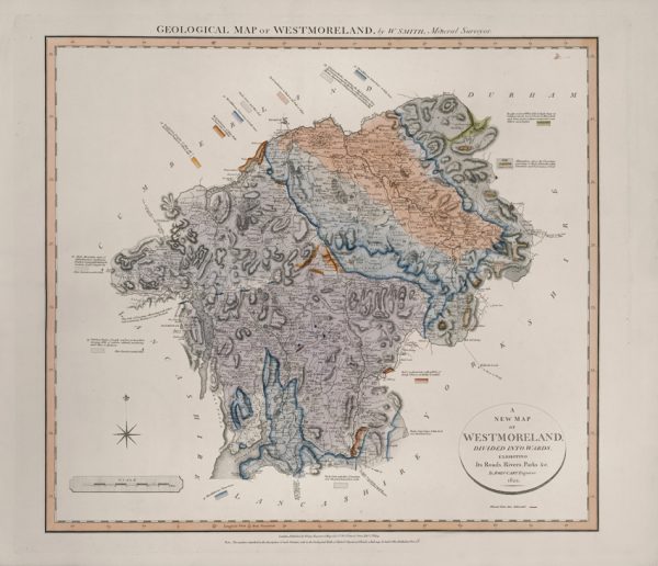
Geological Map of Westmoreland (William Smith, 1824)
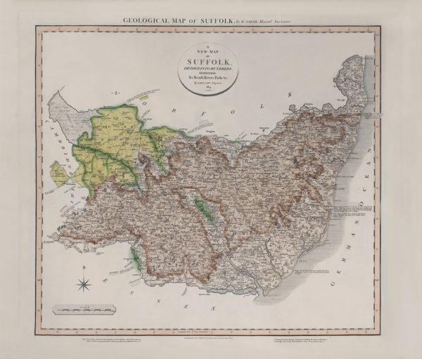
Geological Map of Suffolk (William Smith, 1819)
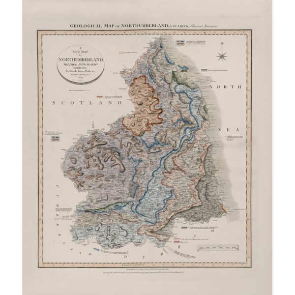
Geological Map of Northumberland (William Smith, 1824)
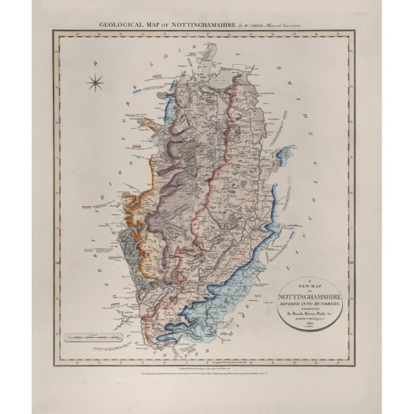
Geological Map of Nottinghamshire (William Smith, 1821)
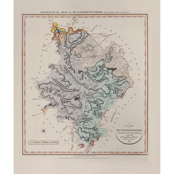
Geological Map of Huntingdonshire (William Smith, 1821)
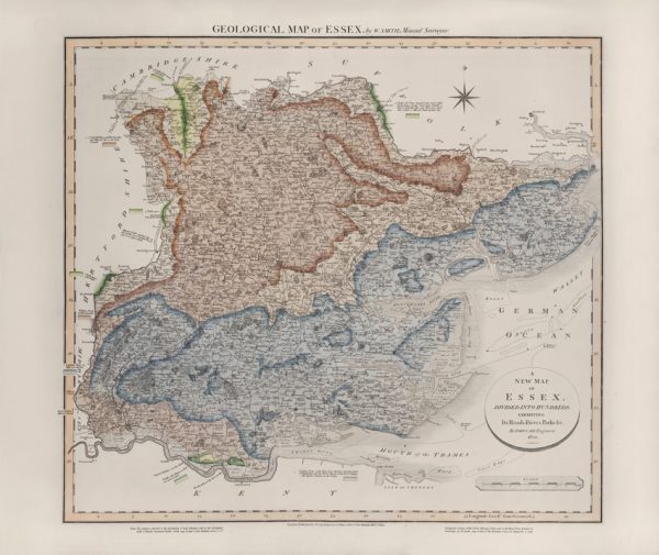
Geological Map of Essex (William Smith, 1820)
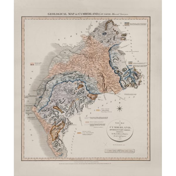
Geological Map of Cumberland (William Smith, 1824)
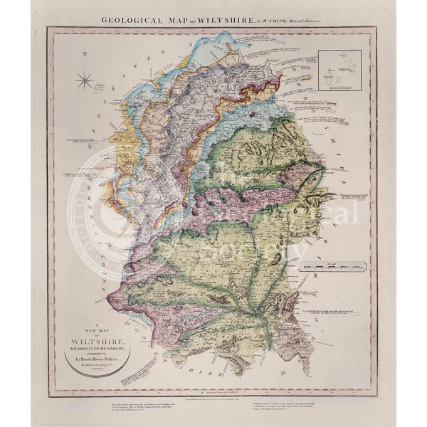
Geological Map of Wiltshire (William Smith, 1819)
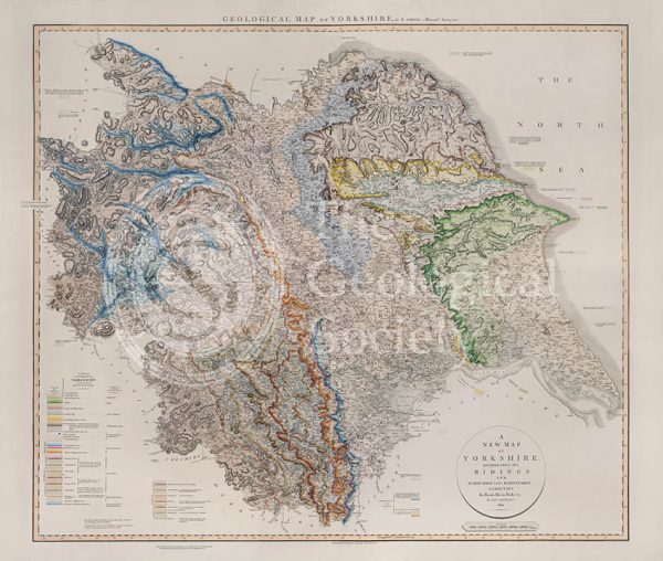
Geological Map of Yorkshire (William Smith, 1821)
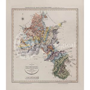
Geological map of Oxfordshire (William Smith, 1820)
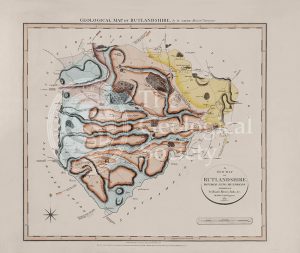
Geological Map of Rutlandshire (William Smith, 1822)
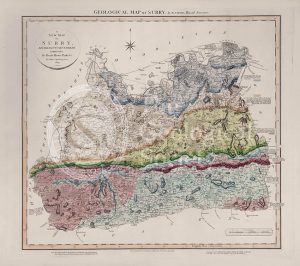
Geological Map of Surry (William Smith, 1819)
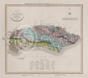
Geological Map of Sussex (William Smith, 1819)
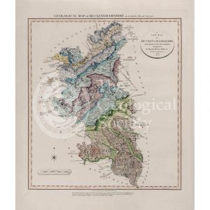
Geological Map of Buckinghamshire (William Smith, 1820)
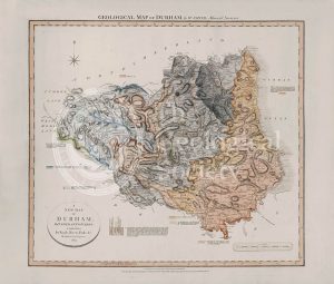
Geological Map of Durham (William Smith, 1824)
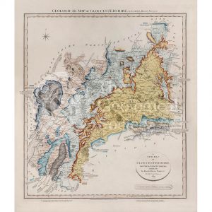
Geological Map of Gloucestershire (William Smith, 1819)
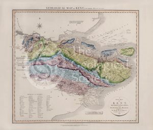
Geological Map of Kent (William Smith, 1819)
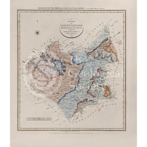
Geological Map of Leicestershire (William Smith, 1822)
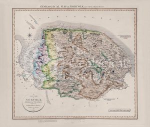
Geological Map of Norfolk (William Smith, 1819)
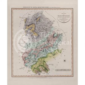
Geological Map of Bedfordshire (William Smith, 1820)
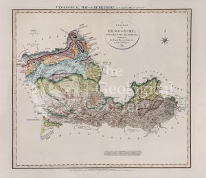
Geological Map of Berkshire (William Smith, 1819)
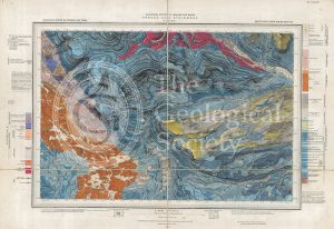
Geological map of Brough-under-Stainmore (Geological Survey of England & Wales, 1893)
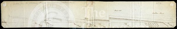
Section from the Medway through Upnor to Cockham Wood (Dadd, 1833)
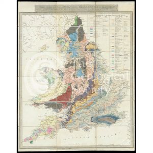
Geological Map of England & Wales… [Greenough reduction] (Gardner after Greenough, 1826)
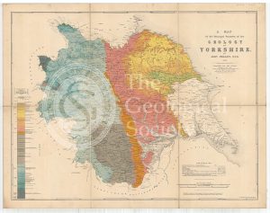
A Map of the Principal Features of the Geology of Yorkshire (Phillips, 1853)
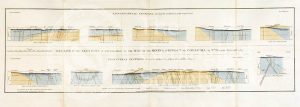
Geological Sections in Illustration of the Map of the Mining District of Cornwall (Smith, 1819)
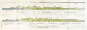
Geological view and sections of Norfolk and Suffolk (Smith, 1819)
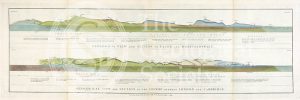
Geological views and sections of Essex/Hertfordshire and between London and Cambridge (Smith, 1819)
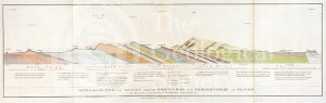
Geological view and section through Dorsetshire and Somersetshire to Taunton (Smith, 1819)
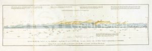
Geological View of the Mining District of Cornwall (Smith, 1819)
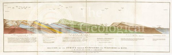
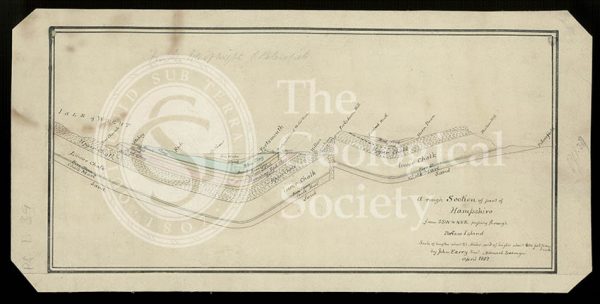
Section of the Strata through Hampshire and Wiltshire to Bath (Smith, 1819)
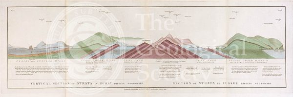
Vertical Section of Strata in Surry (Smith, 1819)
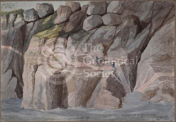
Cliffs at Zennor, Cornwall
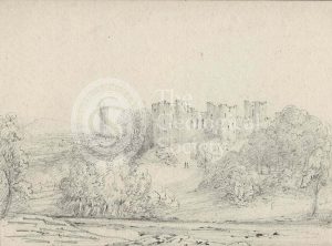
Ludlow Castle, Shropshire
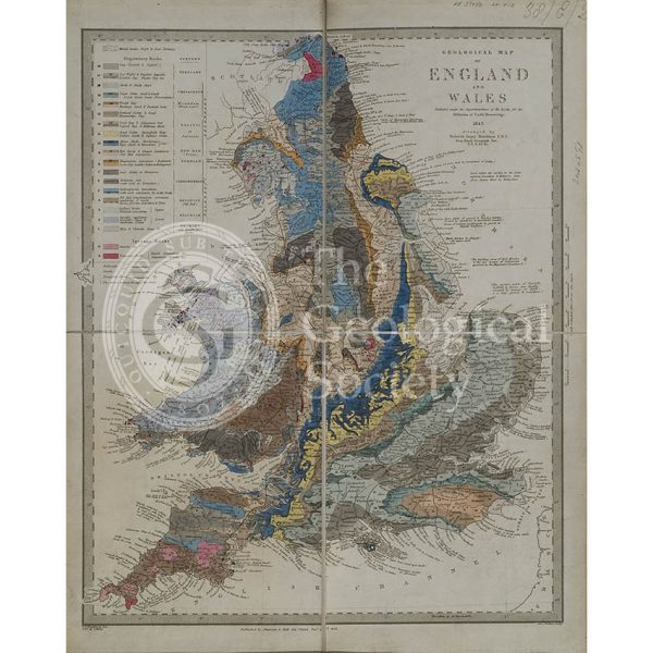
Geological map of England and Wales (Murchison, 1843)
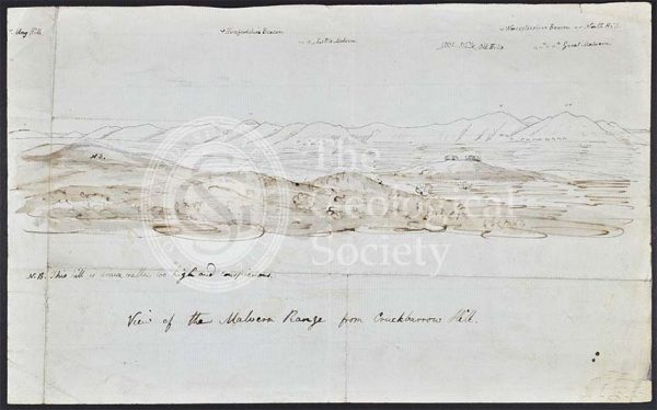
Malvern Range from Crookbarrow Hill
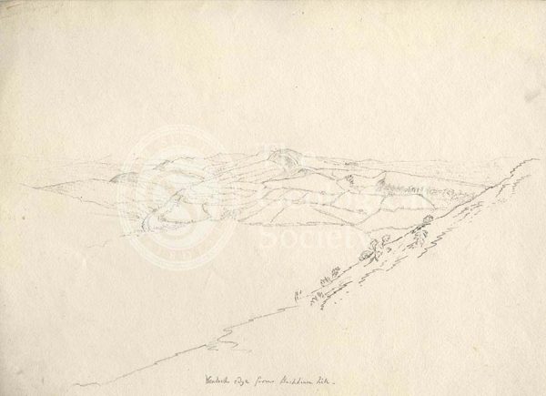
Wenlock Edge
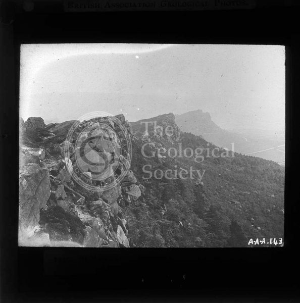
The Roaches, Peak District
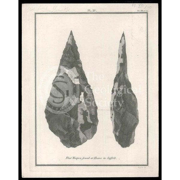
Flint axes from Hoxne
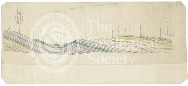
Section of England: Petersfield to the Isle of Wight (Greenough, 1812)
Section of England: Chesterfield to Bolsover (Greenough, 1810)