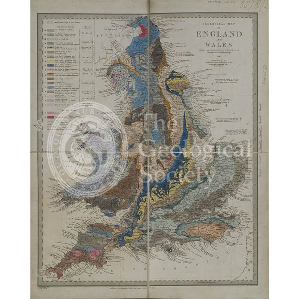
![Geological Map of England and Wales [1839] 2nd edition](https://gslpicturelibrary.org.uk/wp-content/uploads/2020/04/07-168-LDGSL-979A-2.jpg)
Title: ‘Geological Map of England and Wales’ [1839]
Creator: George Bellas Greenough (1778-1855)
Description: Pattern copy of the second edition of the Geological Society’s ‘Geological Map of England and Wales’ under the authorship of its first President, George Bellas Greenough.
In the corner of each of the six sheets which make up this map are the signatures of Greenough and William Lonsdale (1794-1871), in his role as Assistant Secretary of the Society, indicating that it is one of at least two ‘standard’ or ‘pattern copies’ of the map produced in December 1839 from which all subsequent maps were to be copied. Although all copies of the second edition of the map have a publication date of 1 November 1839 it was officially issued in 1840.
The map is probably by the cartographer James Gardner who was to print and colour the map for the Society. However he suddenly announced his intention to immediately retire in January 1840 so the production was taken over by Arrowsmith.
The map continued to be produced in batches to order until the third and final edition was issued in 1865.
Date: [1839]
Format: Watercolour on engraved base
Archive reference: LDGSL/979A/2
Image reference: 07-168
Recommended print size: Up to 100 x 70cm (40in x 27in)