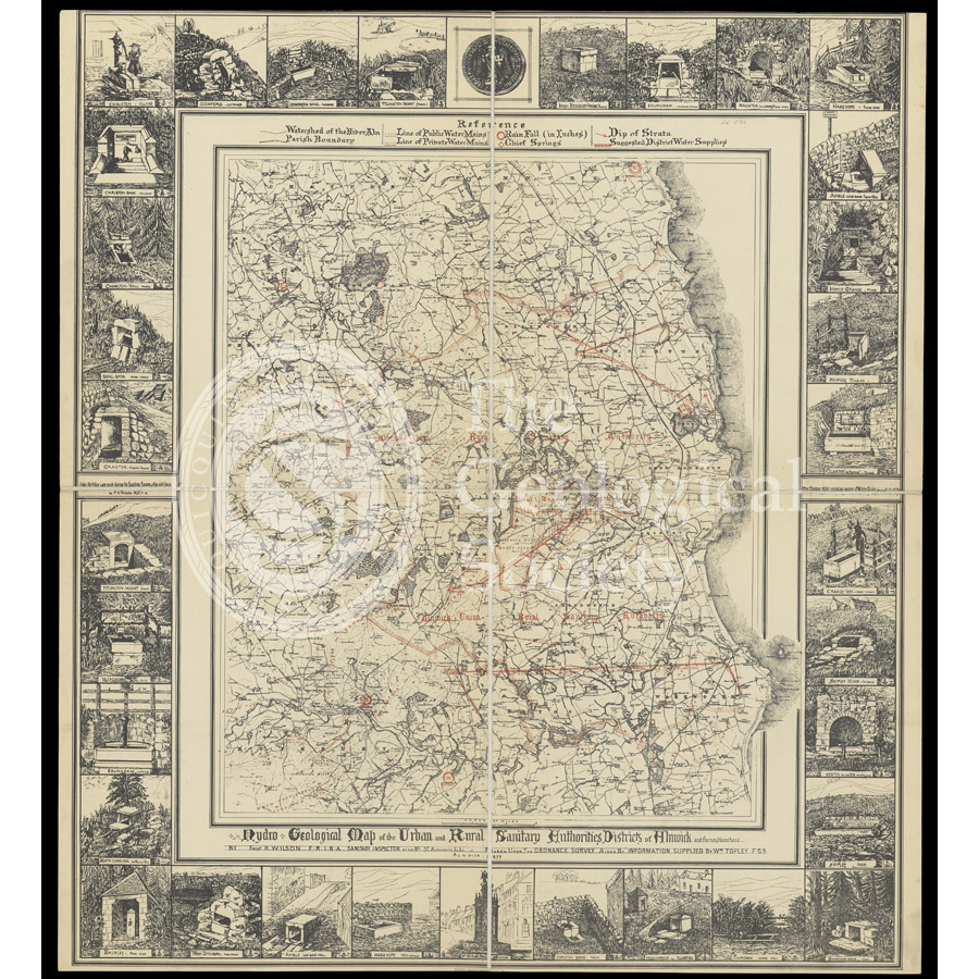
Title: Hydrogeological map of Alnwick and its neighbourhood
Creator: Frederick R Wilson
Description: Hydro-geological map of the Urban and Rural Sanitary Authorities Districts of Alnwick and the neighbourhood.
The map was produced by Frederick Wilson who was a sanitary inspector for the Rural Sanitary Authority. The effects on people’s health due to poor quality drinking water had at last been recognised due in most part to the multiple cholera outbreaks which had occurred across the country.
Wilson has marked in red the various possible sources of water such as rainfall, springs and the watershed of the River Aln, along with a suggested route for channels of clean water supply. The illustrated border around the map depicts wells and spring heads in the district.
Date: 1877
Format: Lithograph
Image reference: 07-191
Recommended print size: Up to 70 x 50cm (27in x 20in) [Note: dimensions of original are 70 x 60cm]