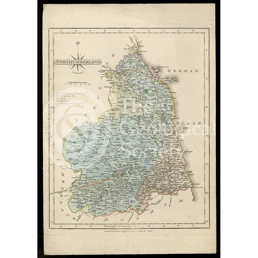
Title: Geological map of Northumberland
Creator: Probably Joseph Harrison Fry (1777-1855)
Description: Geological colouring of the strata of Northumberland, on a base map by John Cary, 1793.
In the Memoir to George Bellas Greenough’s ‘Geological Map of England & Wales’ (1820) he thanks Joseph H Fryer of Lysick Hall, Cumberland, who had sent him three maps of Cumberland, Westmorland and Durham ‘coloured according to the boundaries of their respective strata’ in 1814. Although this map is technically not cited, it is very similar to another which is.
Date: Base map 1793, geological colouring c.1814.
Format: Watercolour on printed base.
Archive reference: LDGSL/947/6/D/1/1
Image reference: 07-156
Recommended print size: Up to 16 x 12 inches (40 x 30cm)