![Plate X [Isle of Wight]](https://gslpicturelibrary.org.uk/wp-content/uploads/2017/10/22-11-Plate-XI-Isle-of-Wight-700-test.jpg)
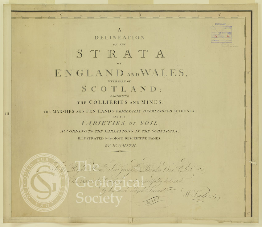
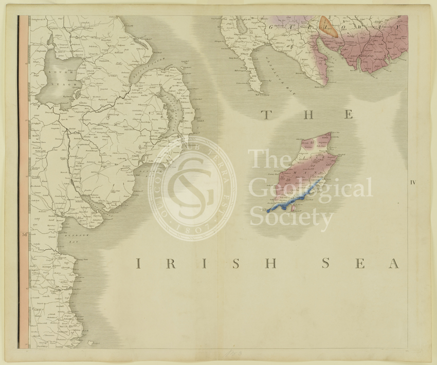
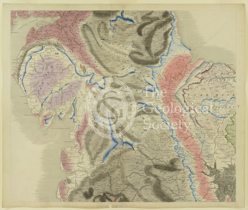
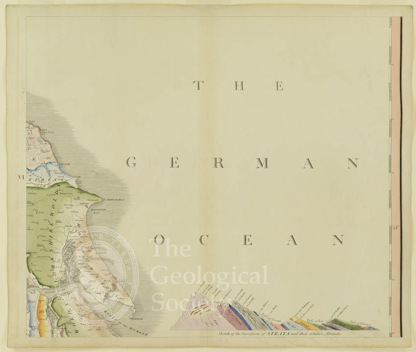
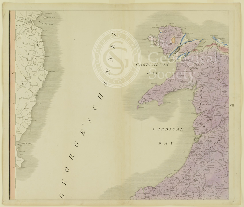
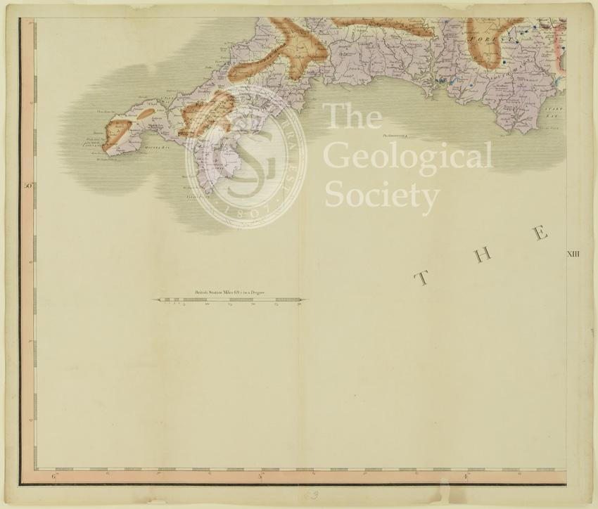
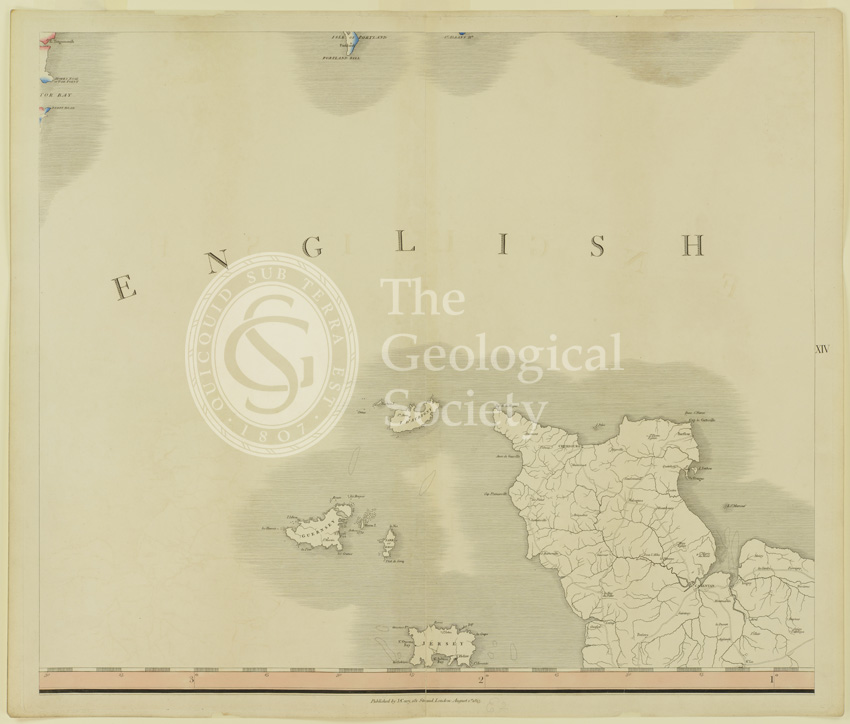
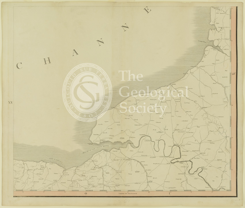
Title: Plate XI [Isle of Wight] of ‘A Delineation of the Strata of England and Wales, with part of Scotland; exhibiting the collieries and mines, the marshes and fen lands originally overflowed by the sea, and the varieties of soil according to the variations in the substrata, illustrated by the most descriptive names’
Creator: William Smith (1769-1839)
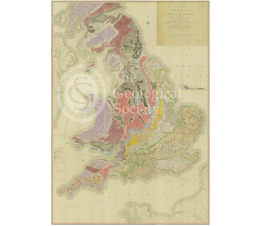
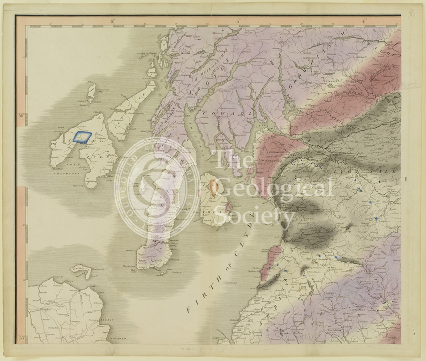
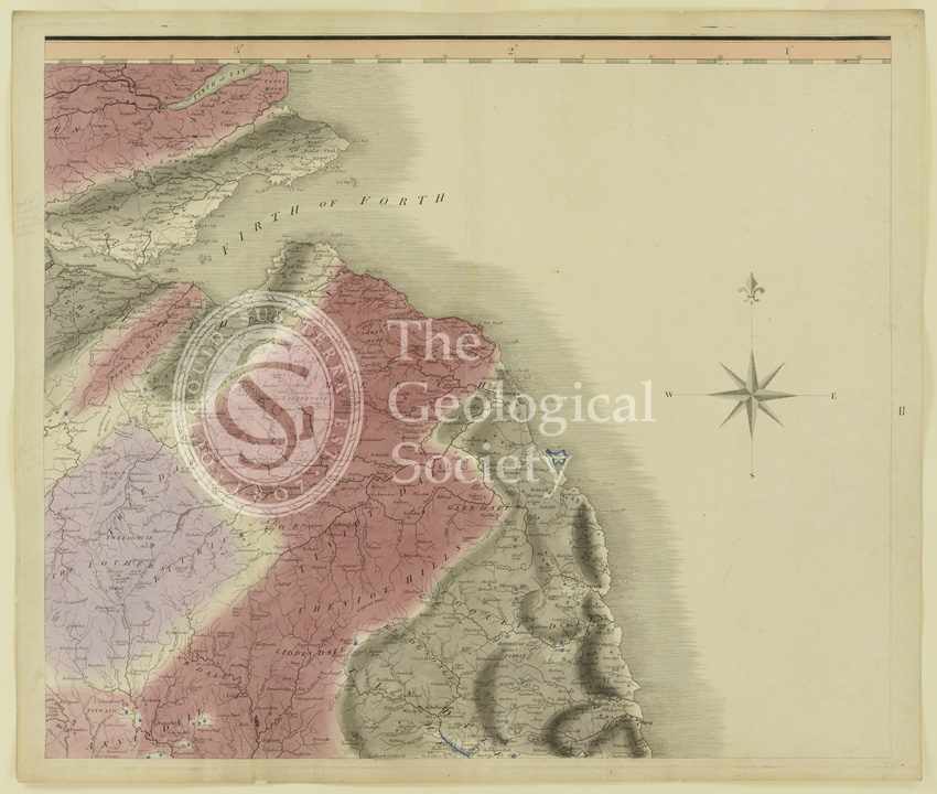
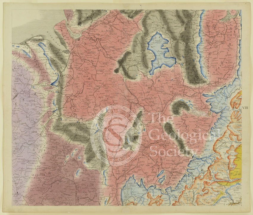
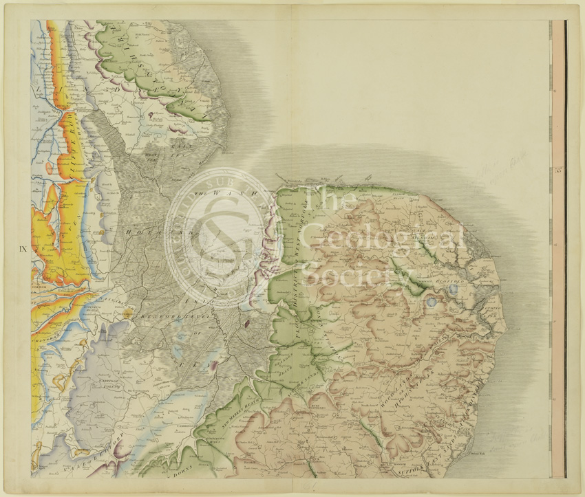
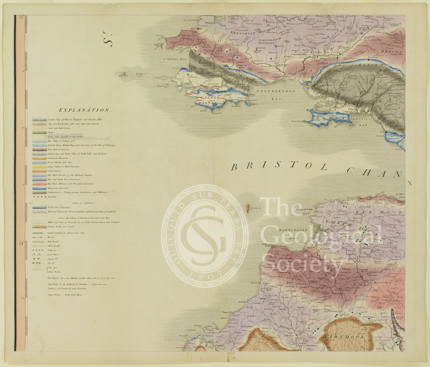
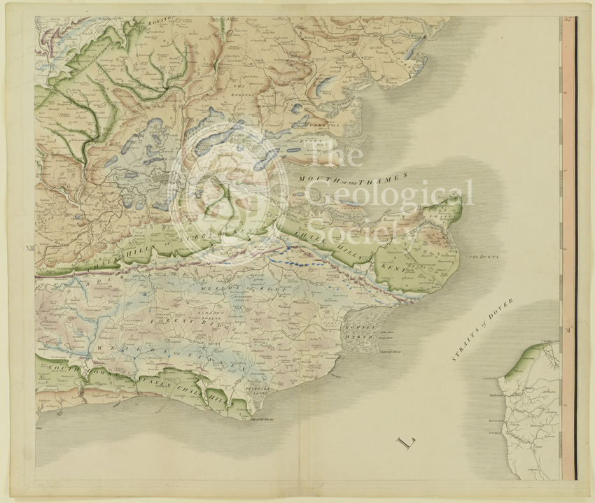
Description: This map, by William Smith, is acknowledged as the first geological map of a country ever produced. Although there were ‘geological’ maps in existence before this, these invariably only identified rocks by types and are therefore more accurately described as ‘mineralogical’ maps. Smith’s innovation was to attempt to classify rocks according to age and manner of deposition – that is stratigraphically.
Smith’s distinctive ‘fading’ watercolour technique picked out the outcrops of each strata, the darker tones being the oldest rocks and fading as they become younger. The hues were chosen by Smith as being the closest representation to each specific rock type (although obviously brighter), but chalk was marked in green as otherwise much of the map would have been white.
The Map was, like his other publications, to be of utility to industry, agriculture and the arts, as Smith explained in the accompanying Memoir:
“…the most proper soil will be known for plantations of timber; miners and colliers, in searching for metals and coal; builders for freestone, limestone, and brick-earth; the inhabitants of dry countries for water; the farmer, for fossil manures; will all be directed to proper situations, in search of the various articles they require; and will be prevented from expensive trials, where there can be no prospect of success.”
Produced at a scale of 5 miles to the inch, the Map measured (when joined) 259cm x 176cm and could be purchased in a variety of formats. This copy, made of 15 individual sheets, is the first imprint. It is one from the first batch of 20 or so unsigned copies and is likely to be the Geological Society’s subscription copy. It was believed lost for many decades but was rediscovered during an archival audit in 2014. Ironically its ‘disappearance’ has meant that the colours are extremely fresh and the cotton rag paper was in relatively good condition.
Publisher: John Cary
Date: [September] 1815
Format: Watercolour on engraved base
Image reference: 22-11
Size of original sheet: 65 x 55cm