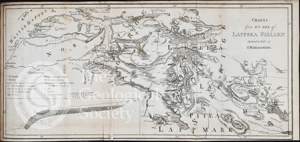
Title: ‘Charta õfver en del af Lappska Fjällen’ [Map of part of the Lapland Mountains]
Creator: Göran Wahlenberg (1780-1851)
Description: Map of part of Lapland Mountains, showing the location of glaciers. Taken from Wahlenberg, Göran, ‘Berättelse om mätningar och observationer för att bestämma lappska fjällens höjd och temperatur vid 67 graders polhöjd’ [Narrative of measurements and observations to decide the altitude and temperature of the Lapland Mountains at 67 degrees north], Stockholm (1808).
Date: 1807
Format: Engraving
Image reference: 09-50
Recommended print size: Up to 20 x 16 inches (50 x 40cm)