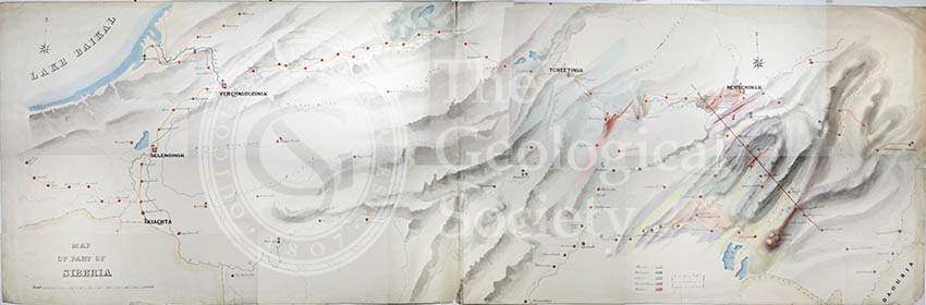
Title: Geological Map of the country east of Lake Baikal, Siberia
Creator: Charles Edward Austin (1819-1893)
Description: Composite photograph of the very large map (c. 2m long) of the country east of Lake Baikal, Siberia, Russia.
The map & section originally accompanied a paper read before the Society, 3 December 1862, an abridged version published as: Austin, C E. “Geological Notes on the Locality in Siberia where Fossil Fish and Estheriæ have been found: With a Note on Estheria Middendorfii; by Professor T. Rupert Jones, F.G.S.”, ‘Quarterly Journal of the Geological Society’, vol 19 (1863), pp71-74.
Charles Edward Austin, elected to the Society on 24 February 1858, was an English civil engineer who had worked under Brunel in the construction of the Great Western Railway. He travelled to Russia & Siberia between 1847-1848.
Date: [1848-1862]
Format: Watercolour & ink on paper
Archive reference: LDGSL/266
Image reference: 09-33
Recommended print size: Up to 100 x 70cm [note: the image is a composite photograph which is indicated in the joins]