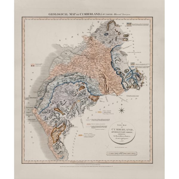
Title: Geological map of Cumberland
Creator: Probably Joseph Harrison Fry (1777-1855)
Description: Geological colouring of the strata of Cumberland, on a base map by John Cary, 1793.
On the reverse, underneath the cloth on which the map has been mounted can be faintly seen the following annotation: ‘Cumberland geolog report by Mr Fryer’. In the Memoir to George Bellas Greenough’s ‘Geological Map of England & Wales’ (1820) he thanks Joseph H Fryer of Lysick Hall, Cumberland, who had sent him three maps of Cumberland, Westmorland and Durham ‘coloured according to the boundaries of their respective strata’ in 1814. This item is presumably one of these.
Date: Base map 1793, geological colouring c.1814.
Format: Watercolour on printed base.
Archive reference: LDGSL/947/6/D/2/1
Image reference: 07-155
Recommended print size: Up to 16 x 12 inches (40 x 30cm)