
stratigraphy
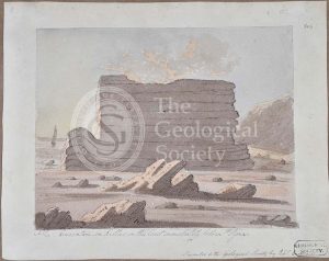
‘Eastern side of second cove east of St Agnes called Park Cove’
‘Eastern side of the fourth cove east of St Agnes’
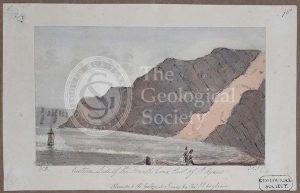
‘Eastern promontory of the first cove east of St Agnes’
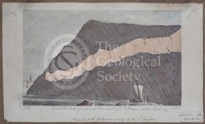
‘Curvature in killas on the coast immediately below St Agnes’
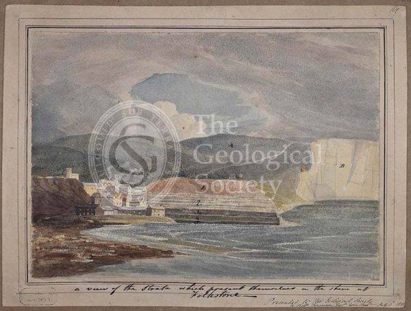
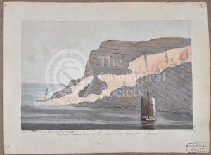
‘A view of the strata which present themselves on the shore of Folkestone’
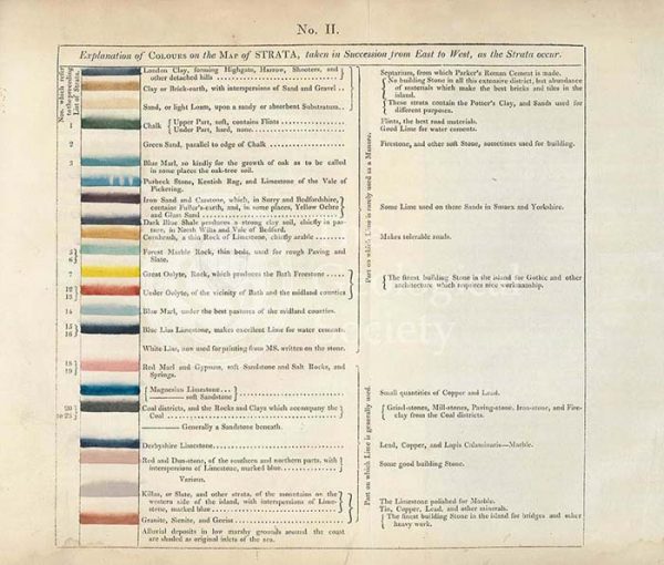
Table of the ‘Explanation of Colours on the Map of Strata…’
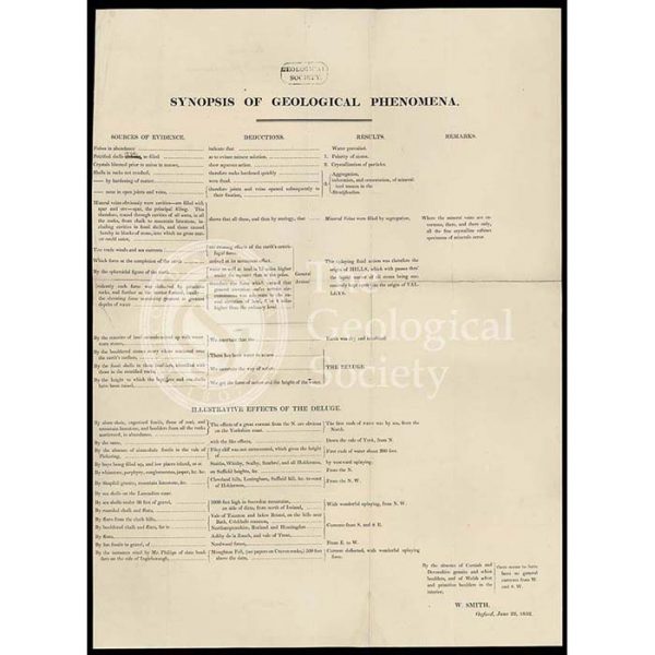
‘Synopsis of Geological Phenomena’
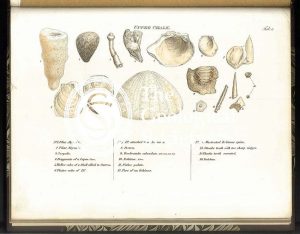
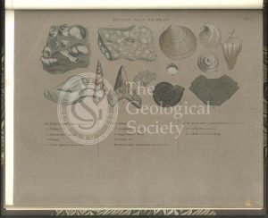
Upper Oolite fossils
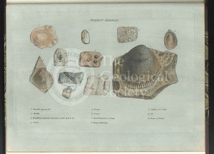
Fullers Earth fossils
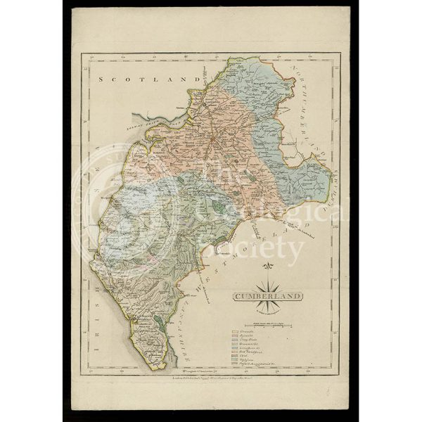
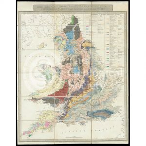
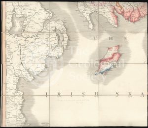
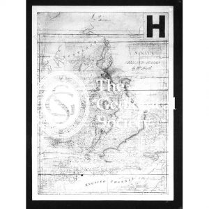
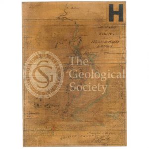
Geological map of Cumberland (Fry, c.1814)
Forest Marble fossils
Clay over the Upper Oolite fossils
Coral Rag fossils
Clunch Clay fossils
Geological Map of England & Wales… [Greenough reduction] (Gardner after Greenough, 1826)
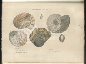
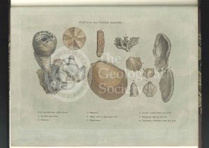
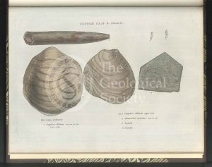
Kelloways Stone fossils
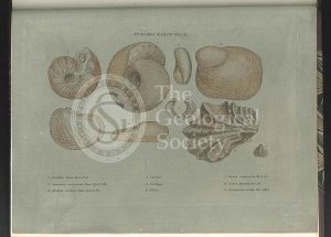
Cornbrash fossils
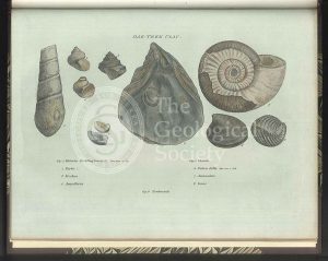
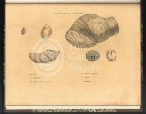
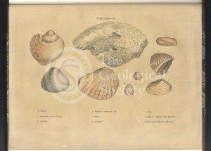
Oak Tree Clay fossils
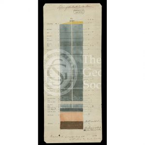
Section of the Bath Easton Coal Mine, Avon (Unknown, 1808?)
Section of the Bath Easton Mine in Somersetshire (Webster, 1812)
Greenough’s copy of William Smith’s geological map (Smith with notes by Greenough, 1815/1818)
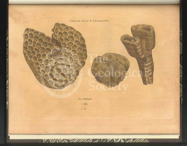
Coral Rag fossils
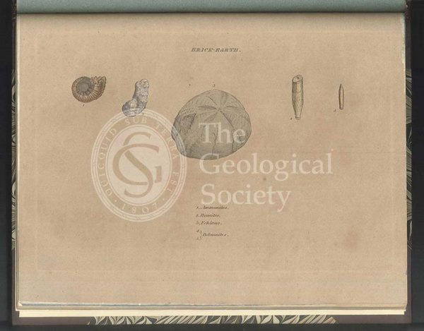
Brick Earth fossils
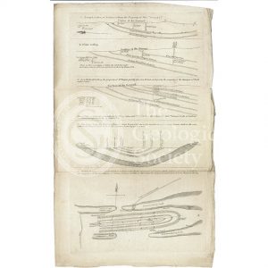
Sections and plan of the collieries around Nailsea (Martin and Smith, 1811)
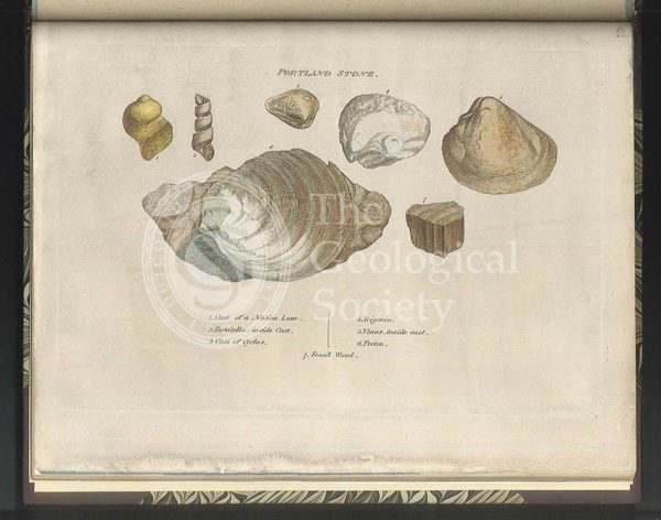
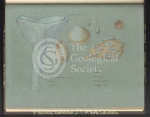
Portland Stone fossils
William Smith’s Table of Strata… under UVA light (Smith original 1799, UVA negative 1972)
Green Sand fossils
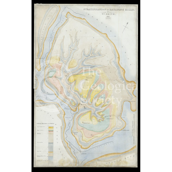
Stratification in Hackness Hills (Smith, 1832)
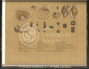
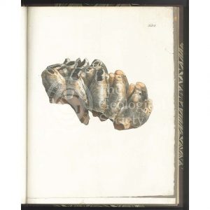
‘Craig’ [Crag] fossils
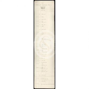
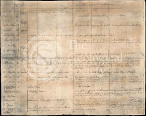
Table of Strata in the Vicinity of Bath (Smith & Richardson, 1799)
Upper Chalk fossils
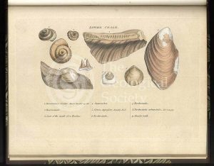
Lower Chalk fossils
Reproduction of William Smith’s Table of Strata… (Judd after Smith & Richardson, 1897)
Green Sand fossils
‘General Map of Strata…’ under infrared light (Smith, 1801 – negative created 1972)
Tooth of a Mastodon
General map of strata found in England & Wales (Smith 1794/1801)
London Clay fossils
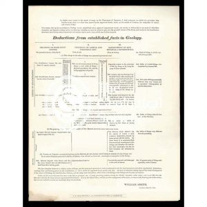
‘Deductions from established facts in geology’
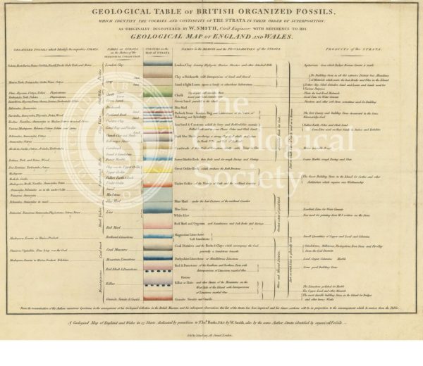
‘Geological table of British organized fossils…’
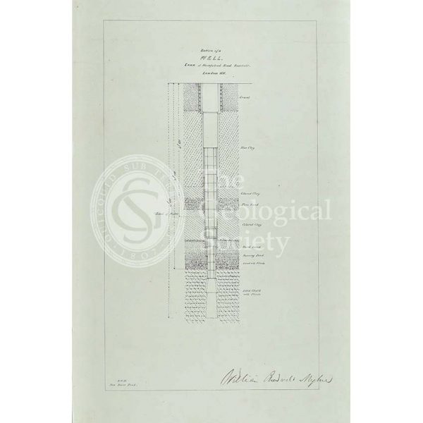
Section of a well sunk at Hampstead Road Reservoir