
cartography
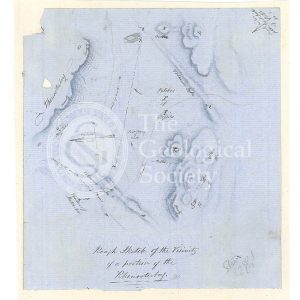
Sketch map of the Rhenosterberg, South Africa (Stow, 1858)
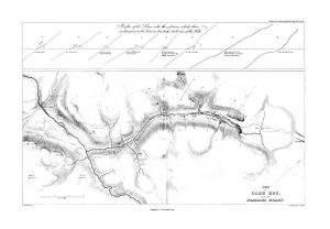
Plan of Glen Roy and of the Parallel Roads (MacCulloch, 1817)
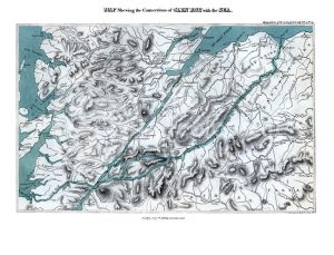
Map shewing the Connections of Glen Roy with the Sea (Cross, 1817)
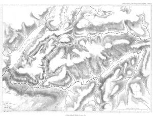
Map of Glen Roy (MacCulloch, 1817)
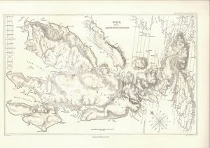
Sky and the adjoining islands (Stewart after MacCulloch, 1817)
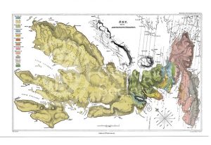
Sky and the adjoining islands (Stewart after MacCulloch, 1817)
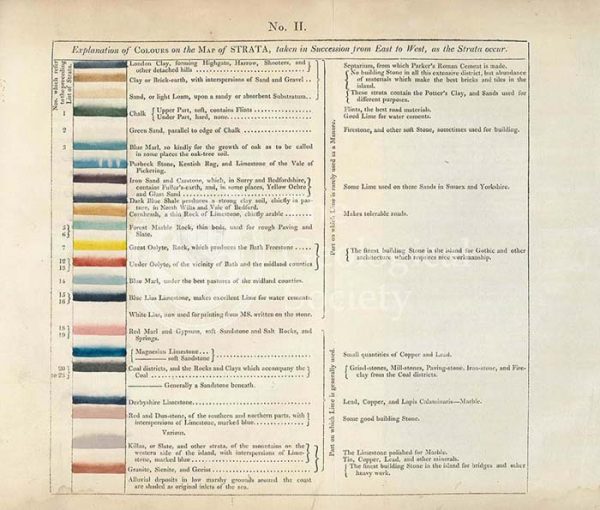
Table of the ‘Explanation of Colours on the Map of Strata…’
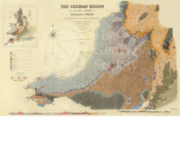
Map of the Silurian Region (Murchison, 1838)
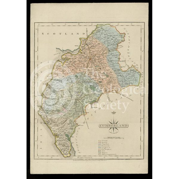
Geological map of Cumberland (Fry, c.1814)
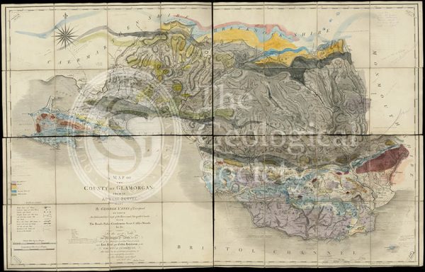
Geological map of Glamorgan (Greenough/Smith 1799-1818)
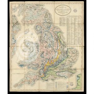
A New Geological Map of England & Wales… [Smith reduction] (Smith & Cary, 1827)
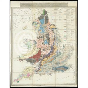
Geological Map of England & Wales… [Greenough reduction] (Gardner after Greenough, 1826)
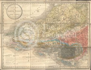
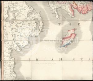
A New Map of South Wales (Greenough and Coltman, between 1813-1839)
Greenough’s copy of William Smith’s geological map (Smith with notes by Greenough, 1815/1818)
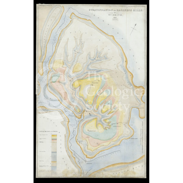
Stratification in Hackness Hills (Smith, 1832)
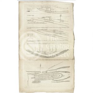
Sections and plan of the collieries around Nailsea (Martin and Smith, 1811)
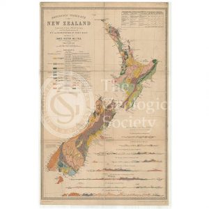
Map of New Zealand (James Hector, 1873)
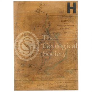
General map of strata found in England & Wales (Smith 1794/1801)
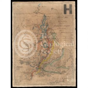
Reconstruction of William Smith’s “General Map of Strata found in England & Wales” (Judd & Reekes, 1897)
Geological Map of Bath (Smith, 1799)
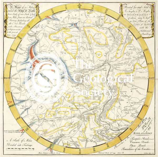
Reconstruction of William Smith’s Geological Map of Bath (1799) (Lam, 2014)
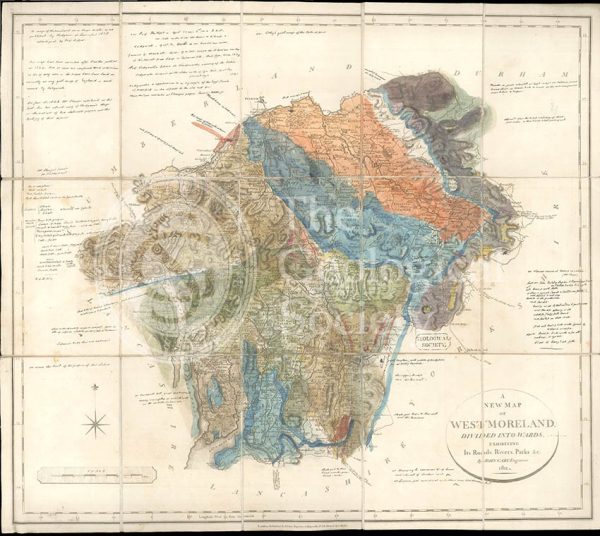
Greenough’s Map of Westmoreland (Greenough after Smith, 1824-1843)
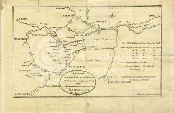
Plan of the ‘Proposed Aire & Dunn Canal’ (Smith and Phillips, 1819)
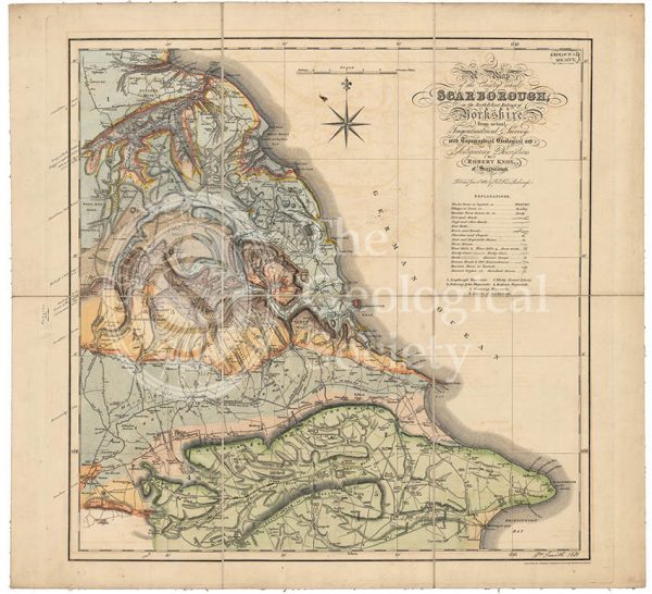
Geological map of Scarborough (Smith, 1831)