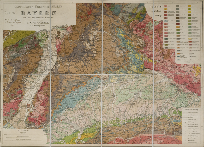
Title: Geologische Übersichtskarte von Bayern und den angrenzenden Ländern
Creator: Karl Wilhelm von Gümbel
Description: Geological map of Bayern at a scale of 1:1,000,000 from Geologie von Bayern vol.2 by K. Wilhelm von Gümbel, 1894)
Date: 1893
Format: Geological map
Image reference: 07-95
Original size: 41 x 58 cm.
Recommend print size: Up to 27 x 20 inches (70 x 50 cm.)