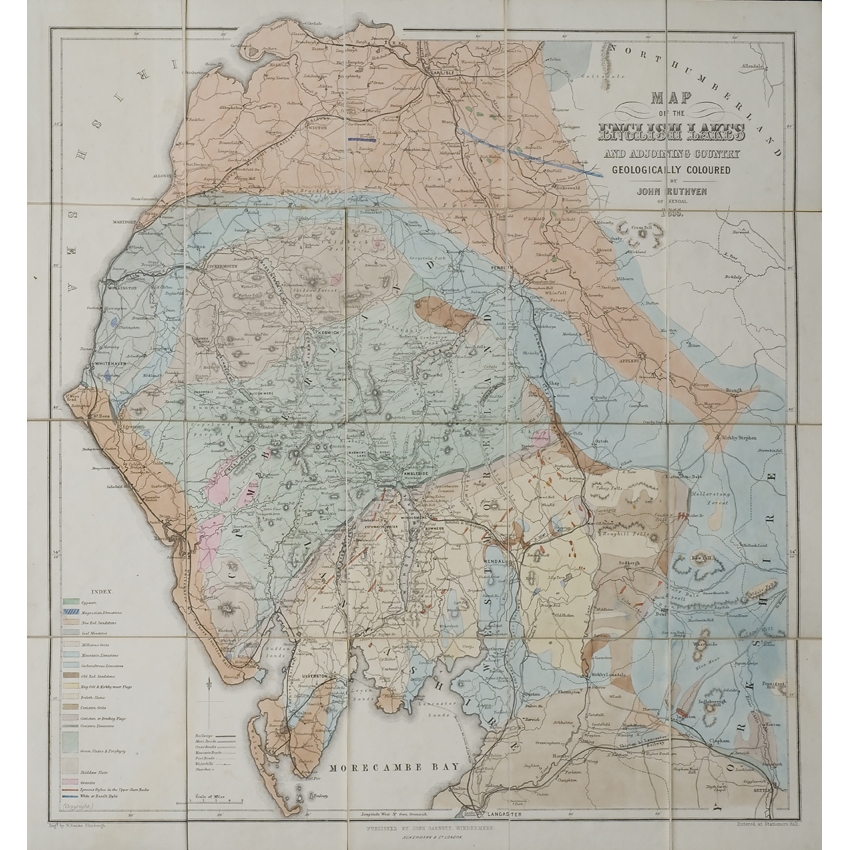
Title: Map of the English Lakes and adjoining country geologically coloured
Creator: John Ruthven
Description: Hand-coloured geological map of the Lake District in north-west England
Date: 1855
Format: Geological map
Image reference: 07-99
Original size: 47 x 42 cm.
Recommend print size: Up to 27 x 20 inches (70 x 50 cm.)