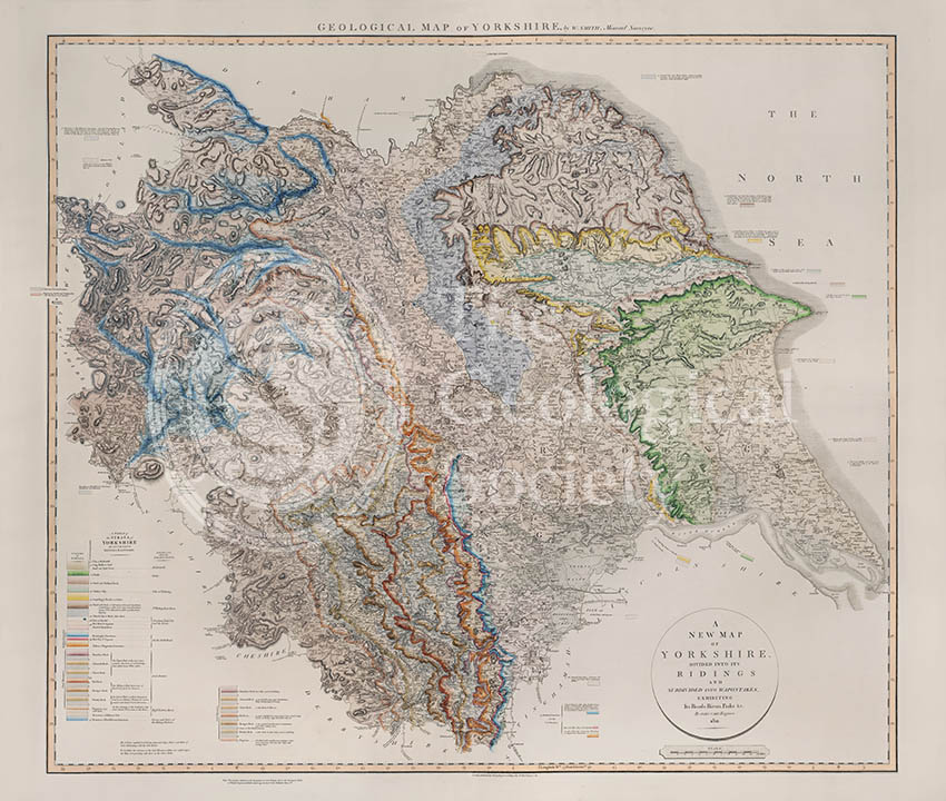
Title: Geological Map of Yorkshire
Creator: William Smith
Description: Geological map of the English county of Yorkshire, today divided into North, South and West Yorkshire, and the East Riding of Yorkshire. This map was originally published in four seperate sheets in the fourth of William Smith’s series of six atlases of geological maps of English counties. Copies of the four sheets have been digitally stitched together to produce the image above.
Publisher: John Cary
Date: 1821
Format: Geological map, ink (lithograph from engraved plate) and water-colour, on paper, bound in atlas. Digital stitched from four original images.
Image reference: 07-38
Size of original: 85 cm. x 97 cm.
Recommended print size: up to 100 cm x 90 cm
Also available from the Geological Society online shop at: http://www.geolsoc.org.uk/WSYorks