
Showing results for pictures
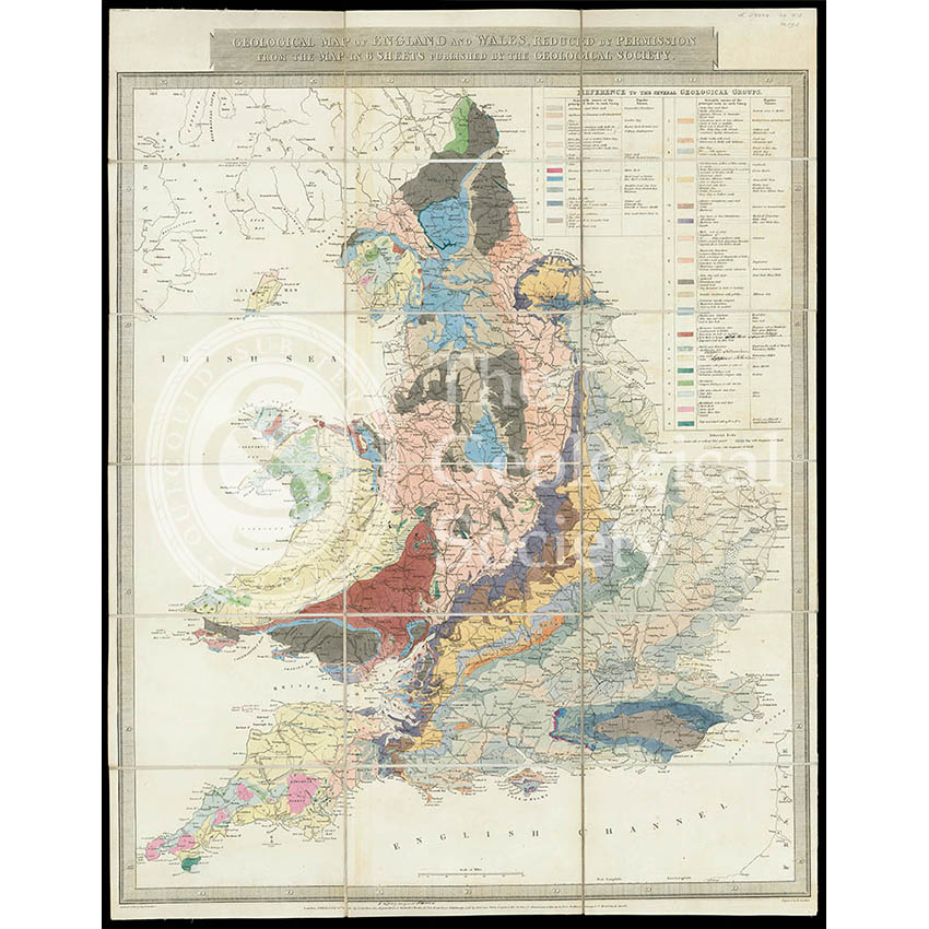
Geological Map of England & Wales… [Greenough reduction] (Gardner after Greenough, 1826)
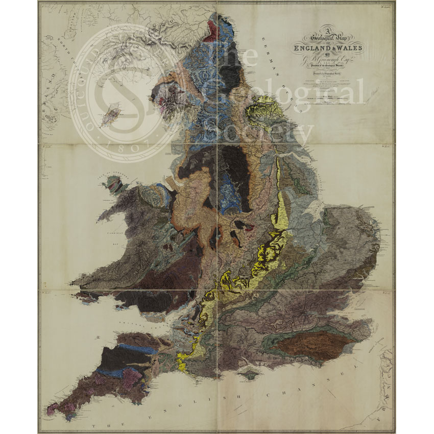
Geological Map of England and Wales (1820) 1st edition
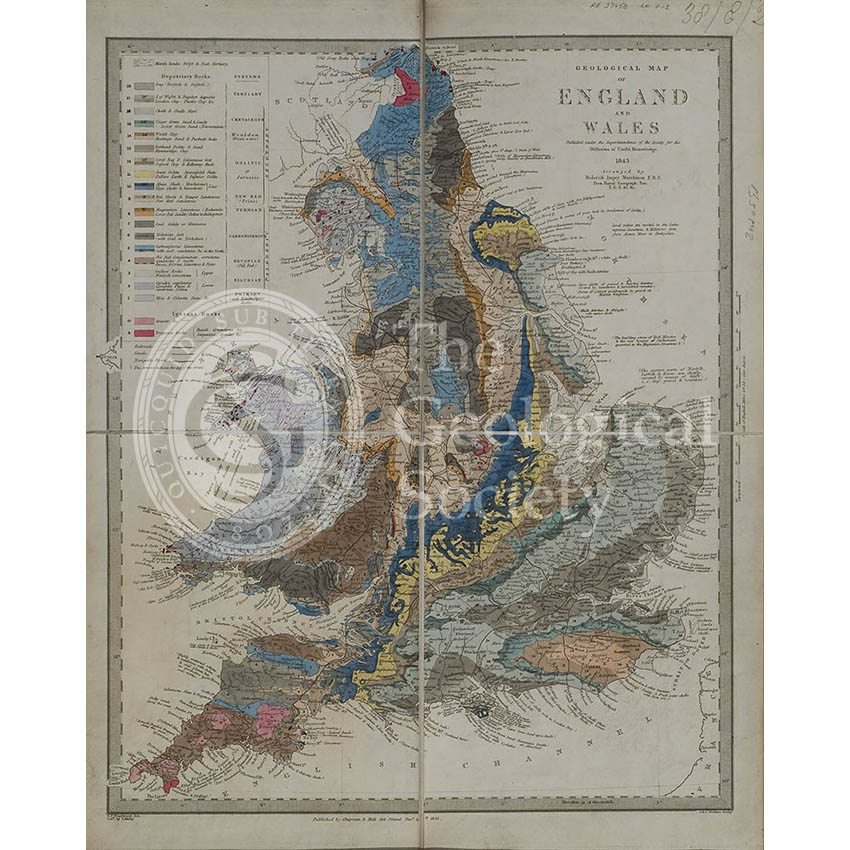
Geological map of England and Wales (Murchison, 1843)
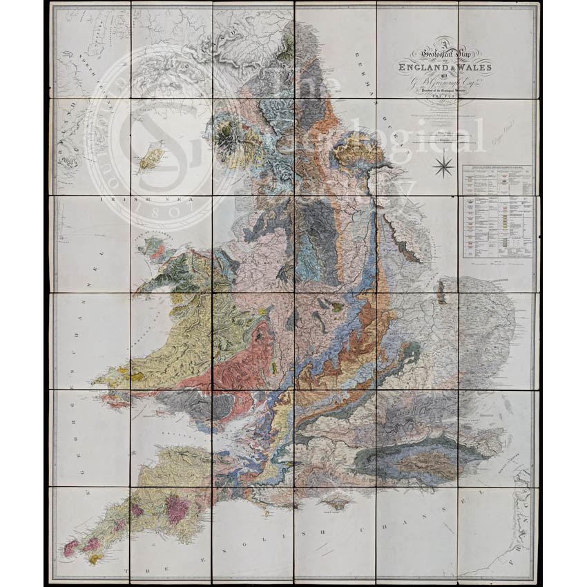
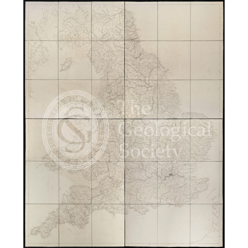
Geological Map of England and Wales [1839] 2nd edition
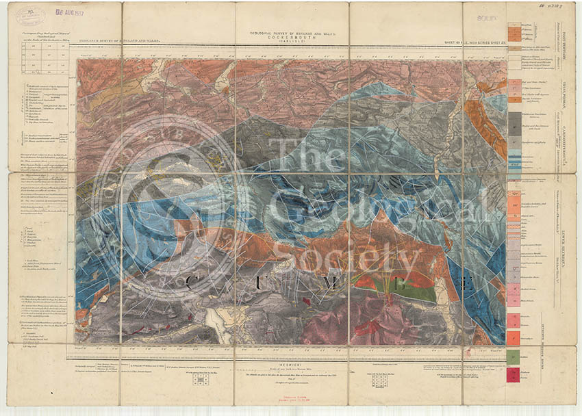
Geological map of England and Wales, Sheet 101 NE Cockermouth (1890)
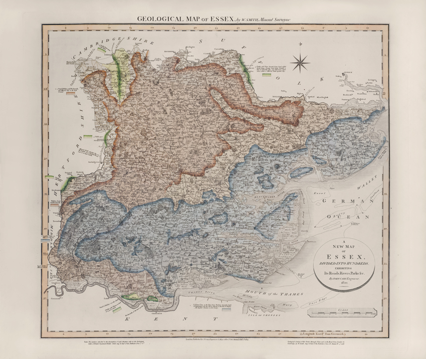
Geological Map of Essex (William Smith, 1820)
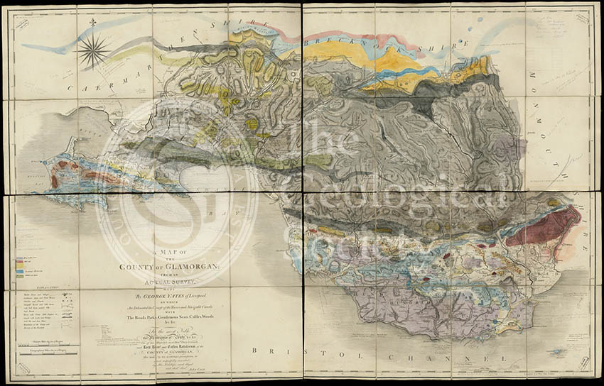
Geological map of Glamorgan (Greenough/Smith 1799-1818)
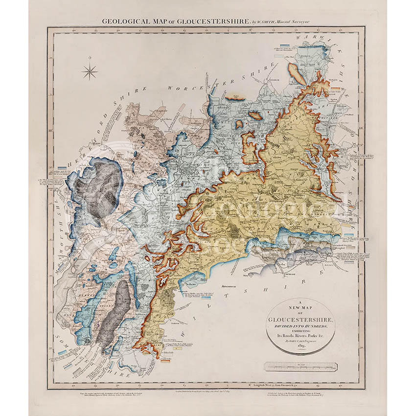
Geological Map of Gloucestershire (William Smith, 1819)
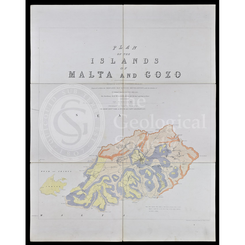
Geological map of Gozo and Cominos, Malta
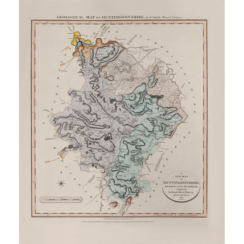
Geological Map of Huntingdonshire (William Smith, 1821)
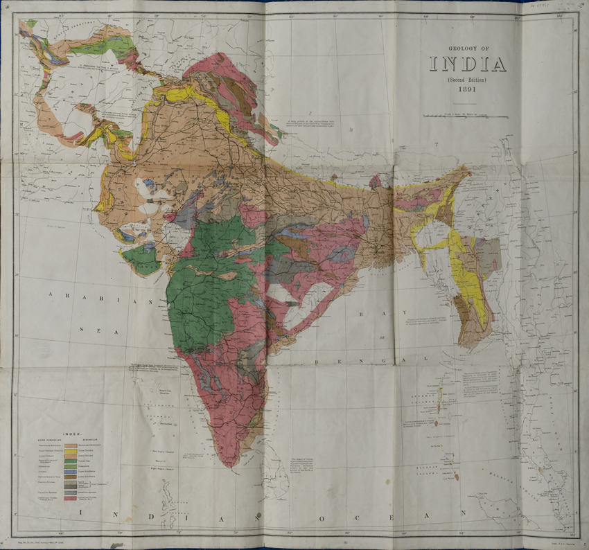
Geological Map of India (Geological Survey of India, 1891)
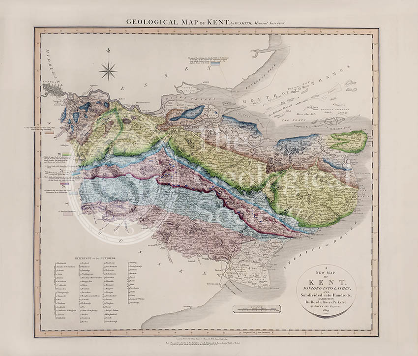
Geological Map of Kent (William Smith, 1819)
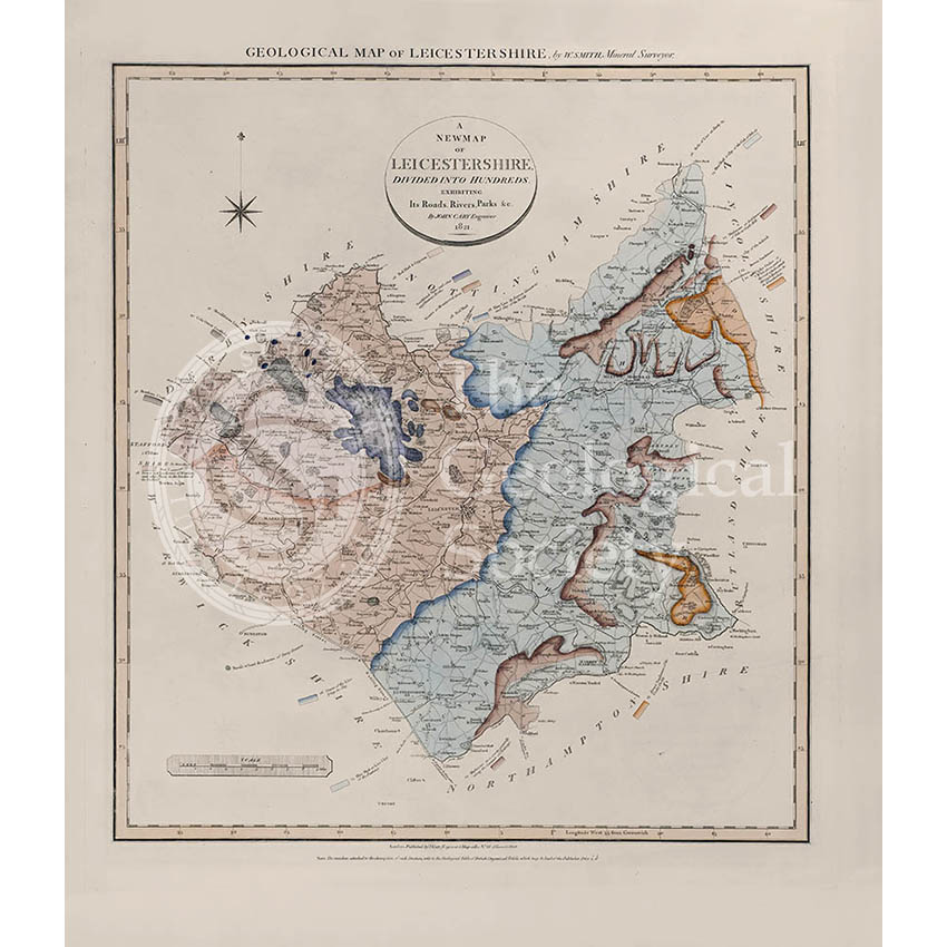
Geological Map of Leicestershire (William Smith, 1822)
Geological map of Malta (1856)
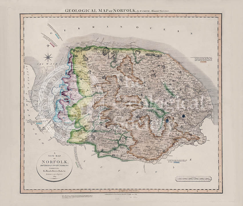
Geological Map of Norfolk (William Smith, 1819)
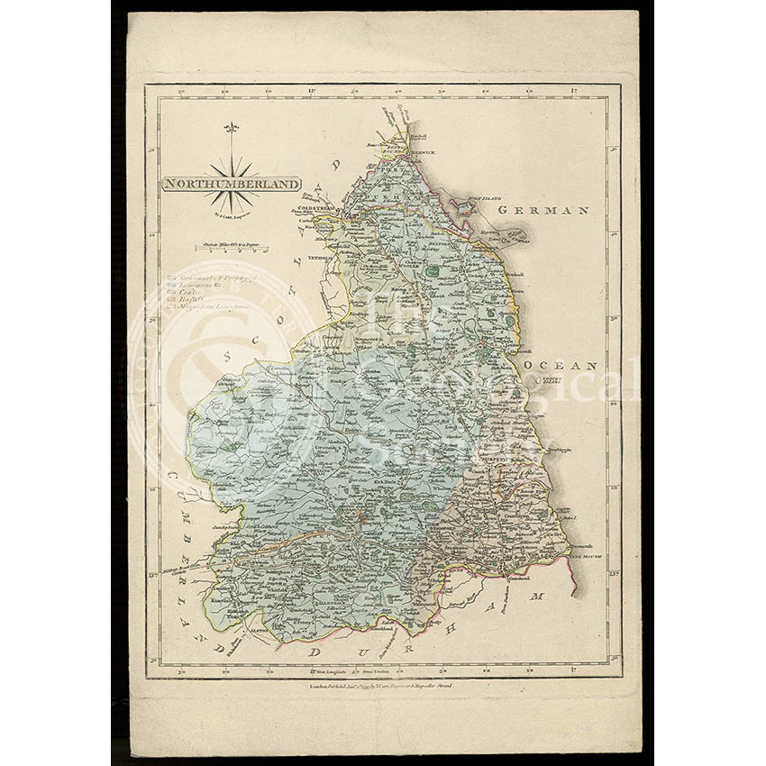
Geological map of Northumberland (Fry, c.1814)
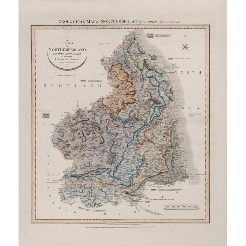
Geological Map of Northumberland (William Smith, 1824)
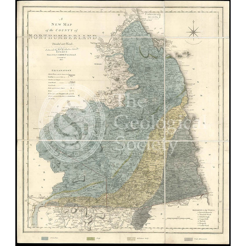
Geological map of Northumberland (Wood, 1831)
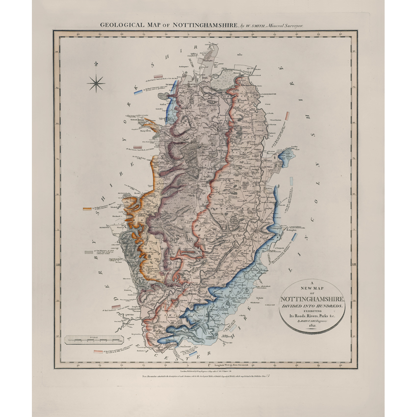
Geological Map of Nottinghamshire (William Smith, 1821)
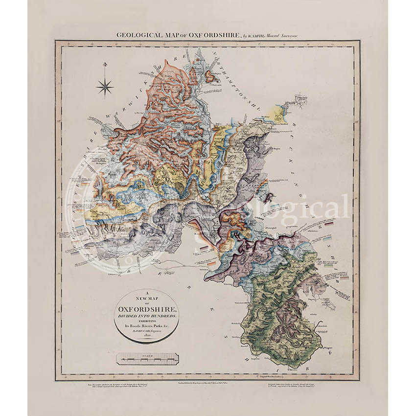
Geological map of Oxfordshire (William Smith, 1820)
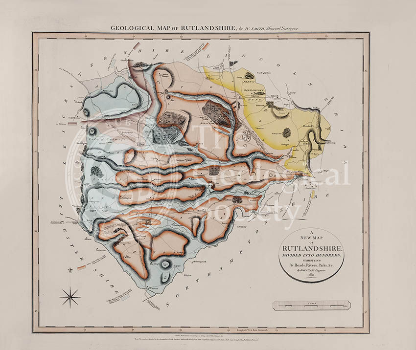
Geological Map of Rutlandshire (William Smith, 1822)
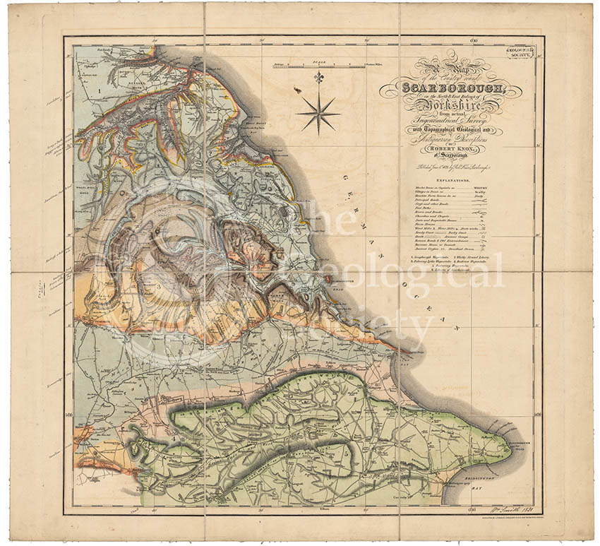
Geological map of Scarborough (Smith, 1831)
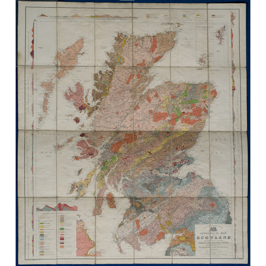
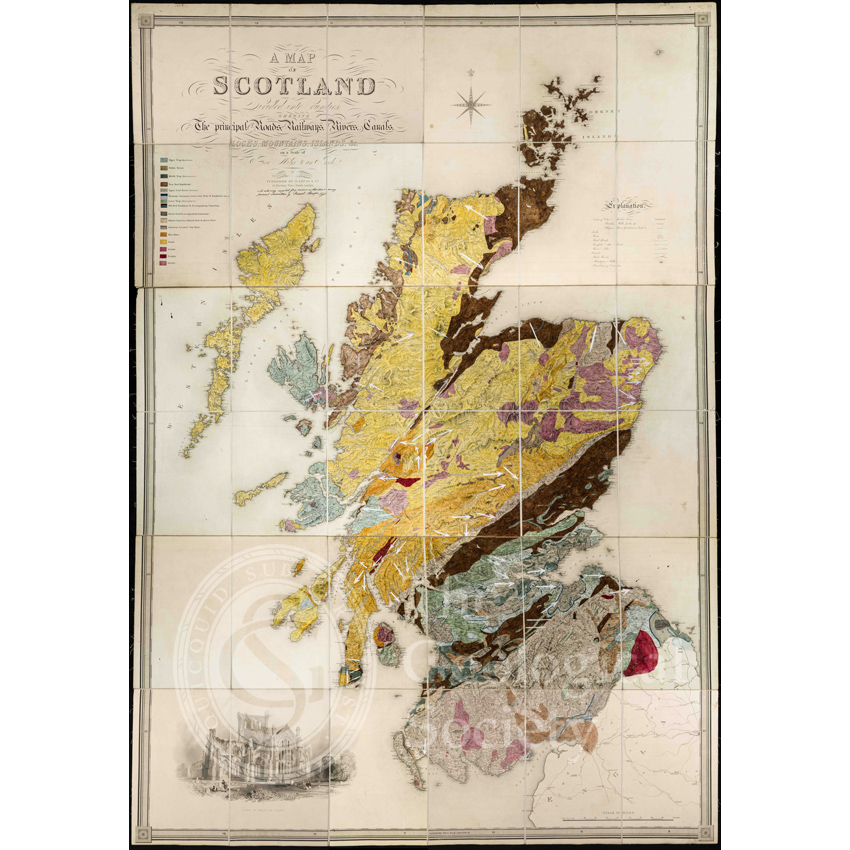
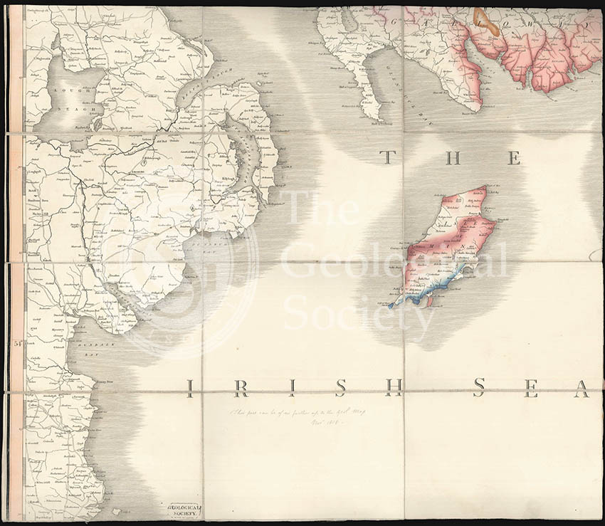
Geological map of Scotland (Geikie, 1910)
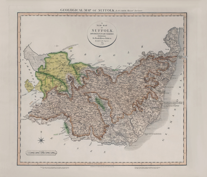
Geological Map of Suffolk (William Smith, 1819)

Geological Map of Surry (William Smith, 1819)
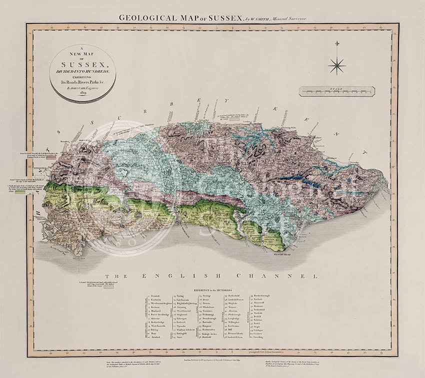
Geological Map of Sussex (William Smith, 1819)
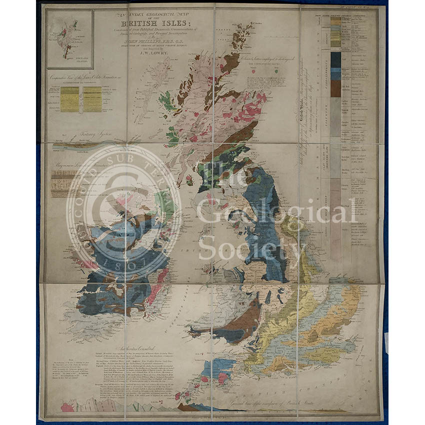
Geological map of the British Isles (Phillips, 1838)
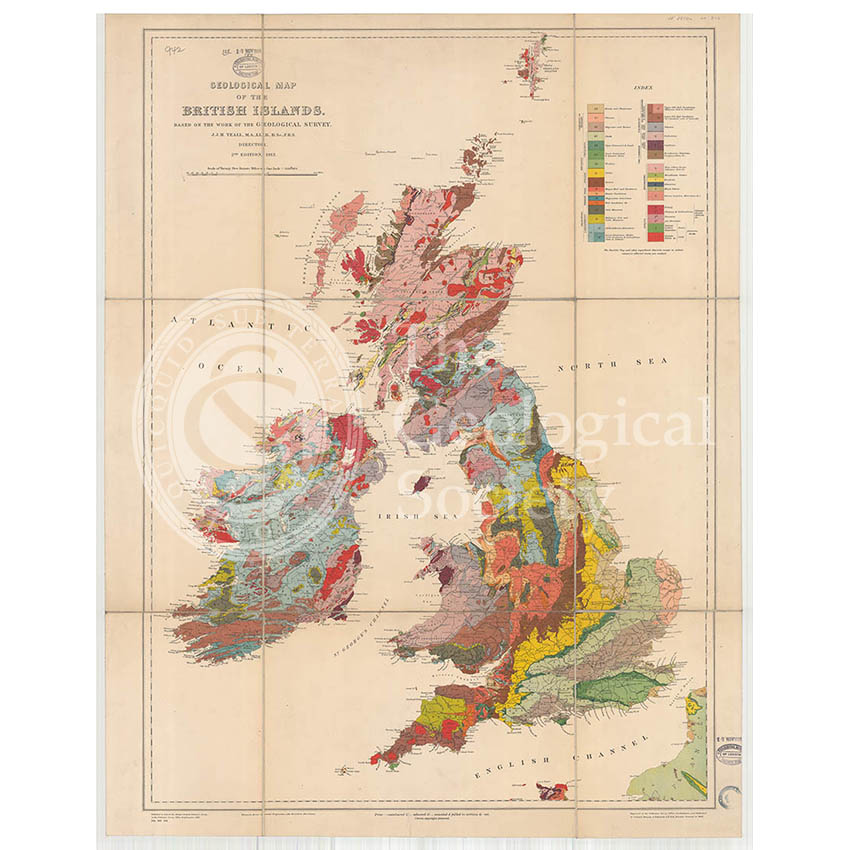
Geological Map of the British Isles (Teall, 1912)
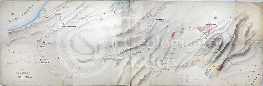
Geological Map of the country east of Lake Baikal, Siberia
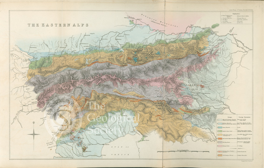
Geological map of the eastern Alps (1832)
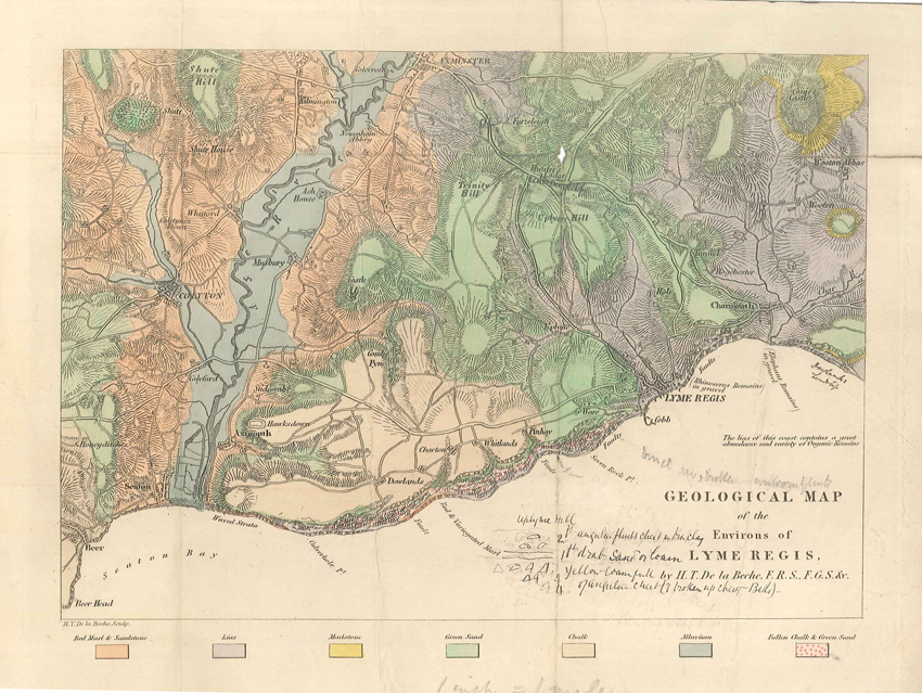
Geological map of the environs of Lyme Reis (De La Beche, 1826)
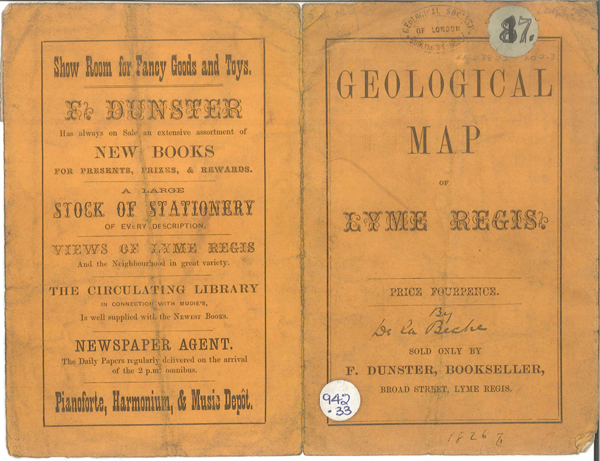
Geological map of the environs of Lyme Reis – Cover (De La Beche, 1826)
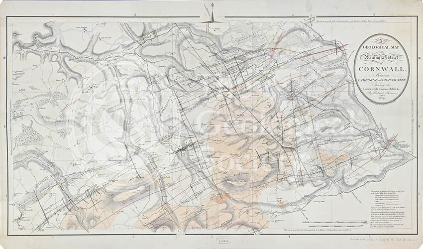
Geological map of the mining district of Cornwall… (Thomas, 1819)
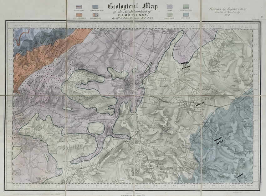
Geological map of the neighbourhood of Cambridge (Jukes-Browne, 1874)
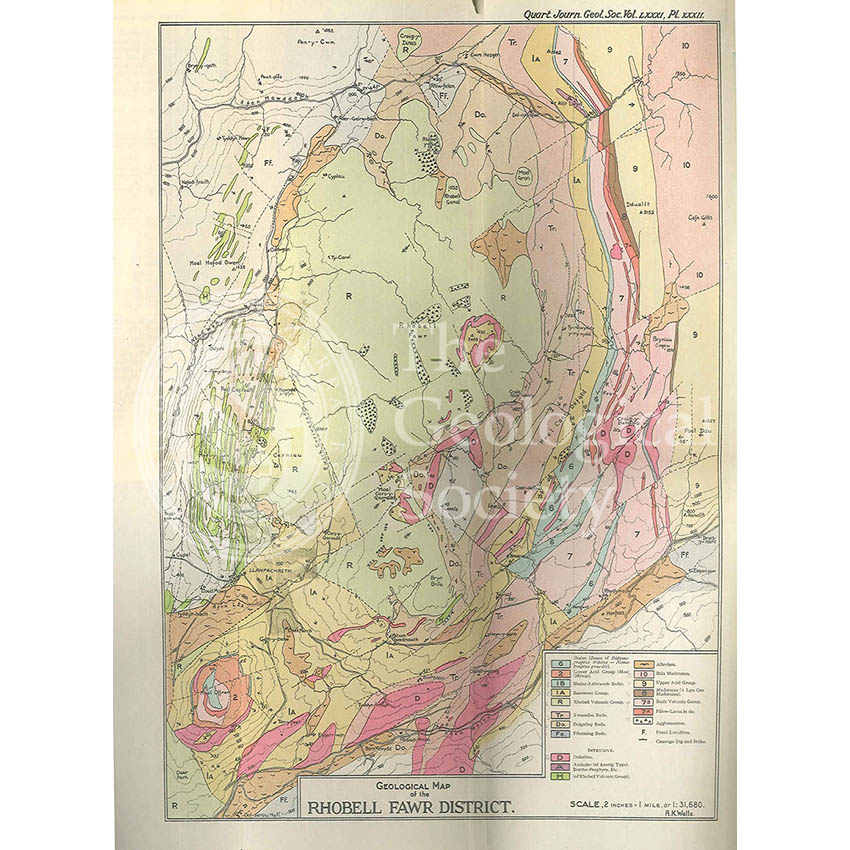
Geological Map of the Rhobell Fawr District (Wells, 1925)
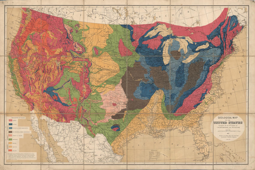
Geological map of the United States (Hitchcock and Blake, 1872)
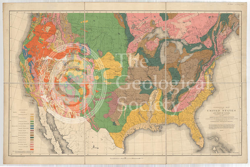
Geological map of the United States and part of Canada (Hitchcock, 1886)
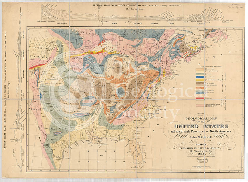
Geological Map of the United States and the British Provinces of North America (Marcou, 1853)
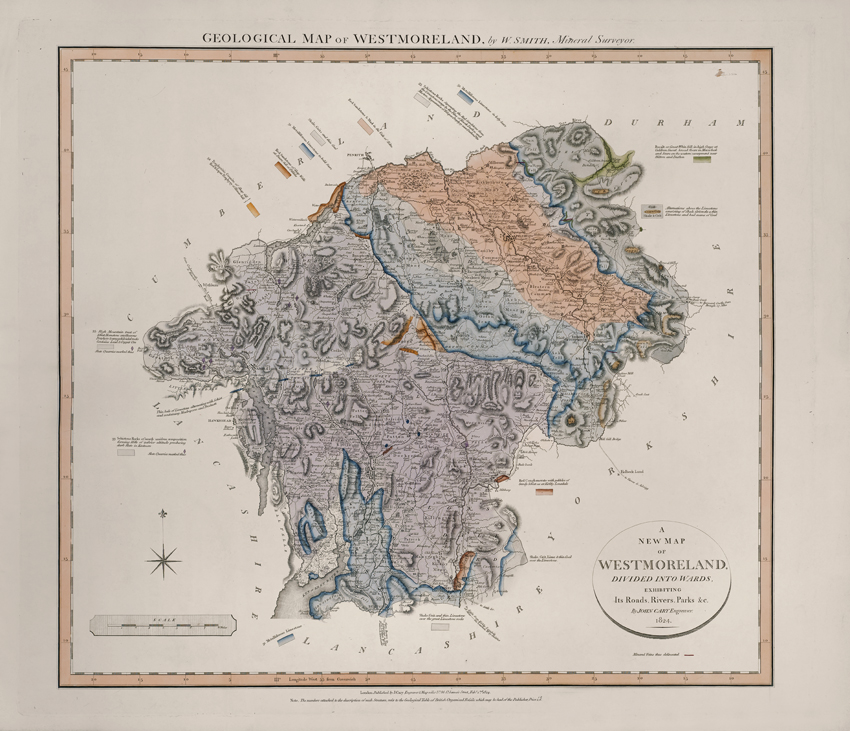
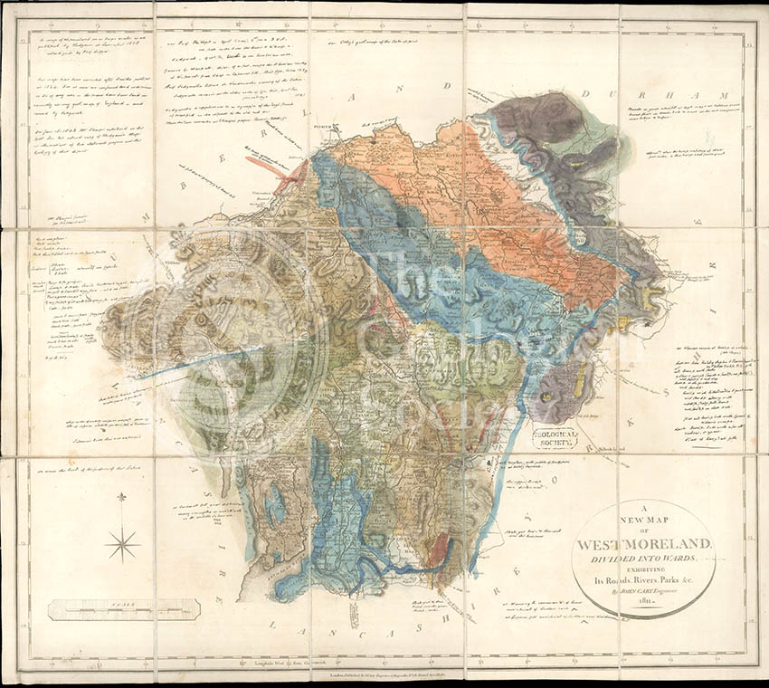
Geological Map of Westmoreland (William Smith, 1824)
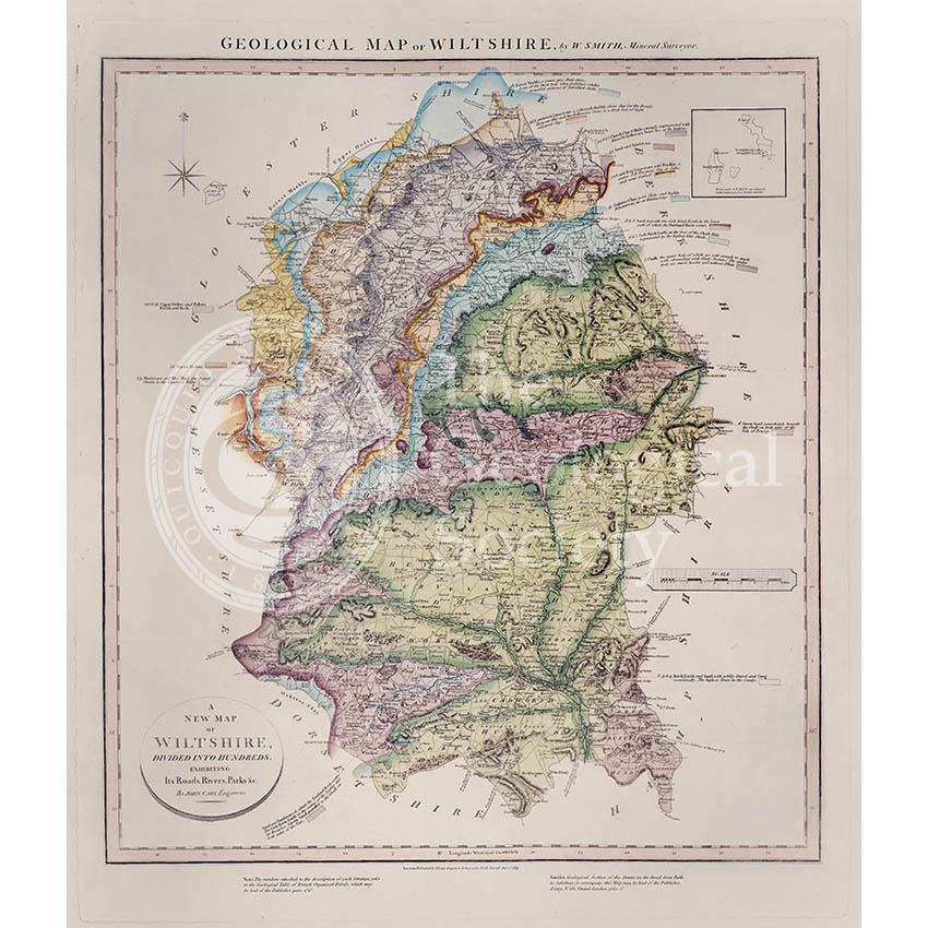
Geological Map of Wiltshire (William Smith, 1819)
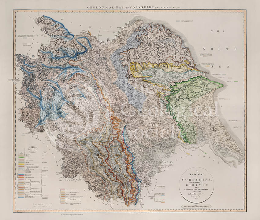
Geological Map of Yorkshire (William Smith, 1821)
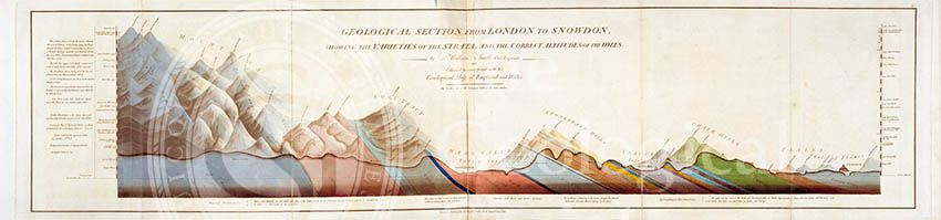
Geological Section from London to Snowdon (Smith, 1817)
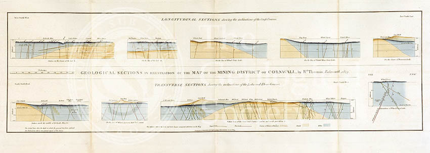
Geological Sections in Illustration of the Map of the Mining District of Cornwall (Smith, 1819)
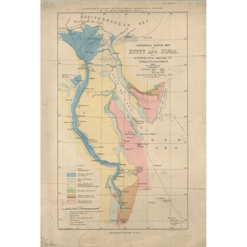
Geological Sketch Map of Egypt and Sinai (Topley 1888)

Geological Society Club dinner, 1907 (1)

Geological Society Club’s dinner, 1907 (2)
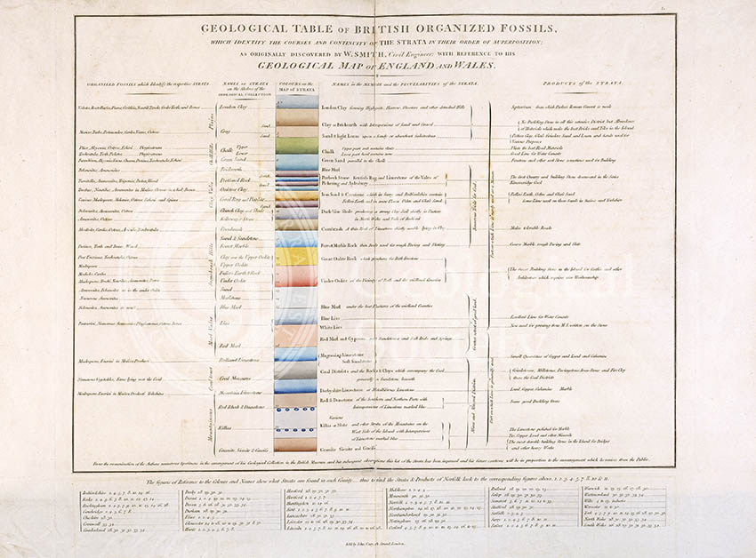
Geological Table of British Organized Fossils
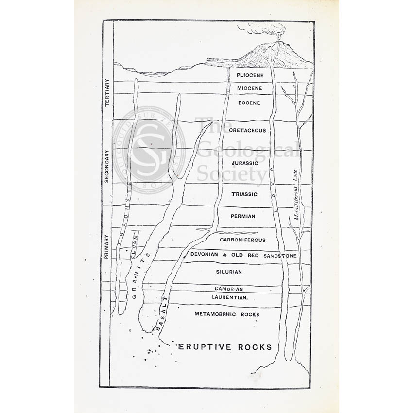
Geological timescale (1867)
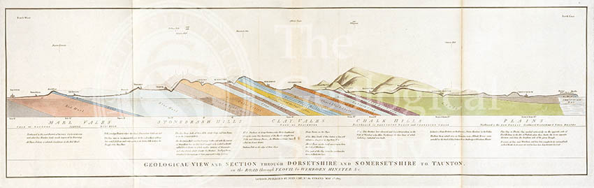
Geological view and section through Dorsetshire and Somersetshire to Taunton (Smith, 1819)
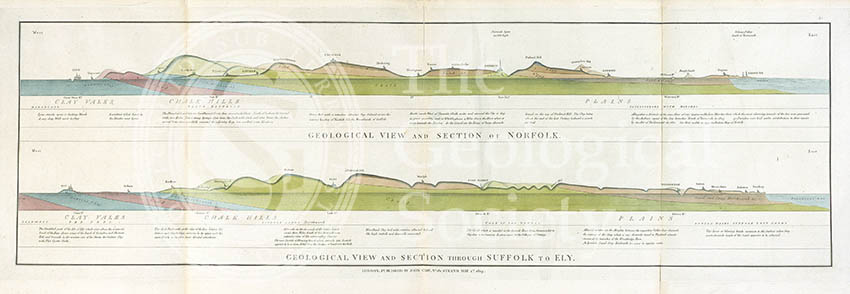
Geological view and sections of Norfolk and Suffolk (Smith, 1819)
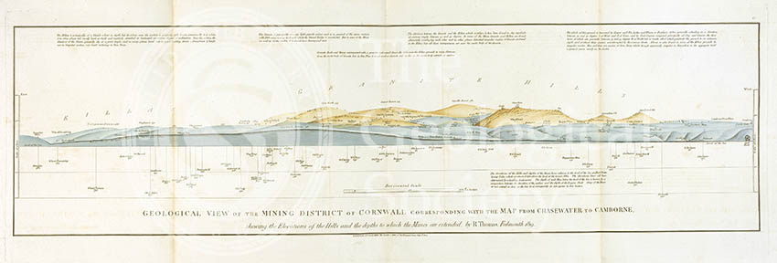
Geological View of the Mining District of Cornwall (Thomas, 1819)
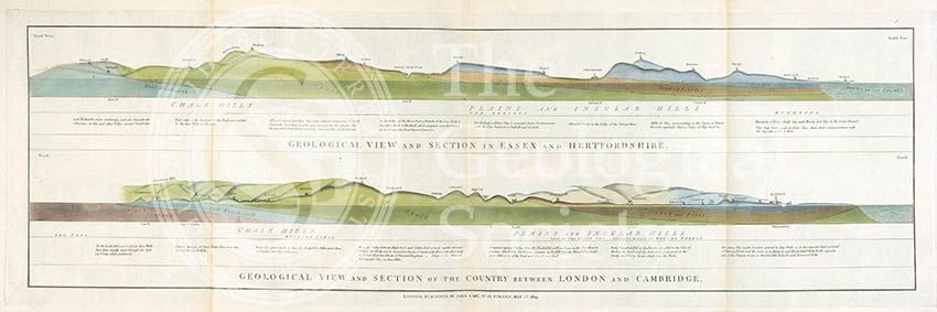
Geological views and sections of Essex/Hertfordshire and between London and Cambridge (Smith, 1819)
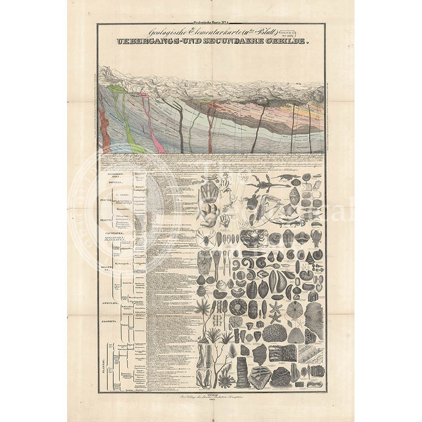
Geologische Elementarkarte, plate 3 (Klöpfel, 1838)
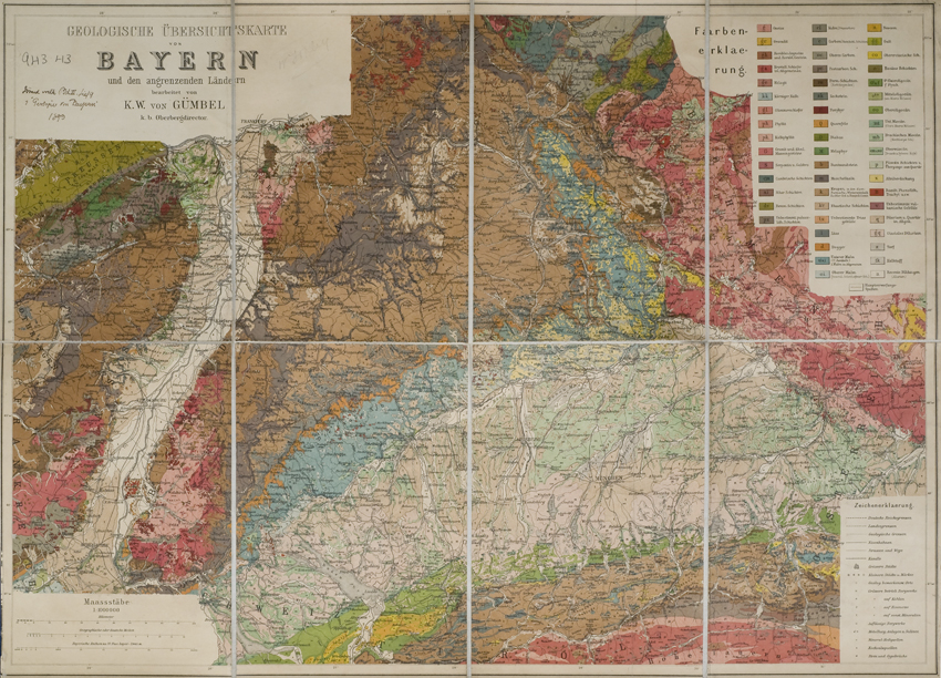
Geologische Übersichtskarte von Bayern und den angrenzenden Ländern (Karl Wilhelm von Gümbel, 1893)
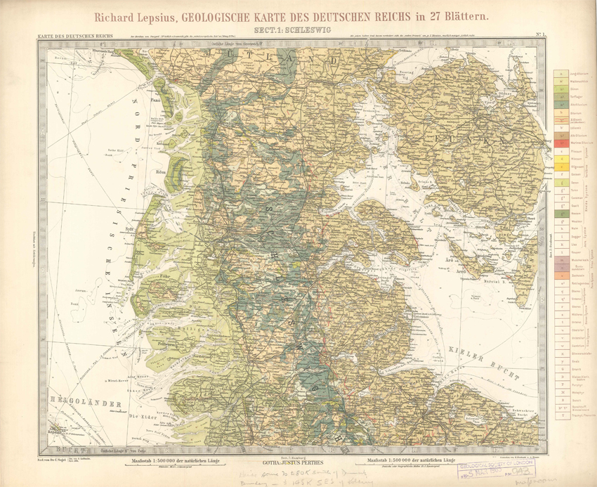
Geologisches Karte des Deutschen Reichs – 1. Schleswig (Lepsius, 1897)
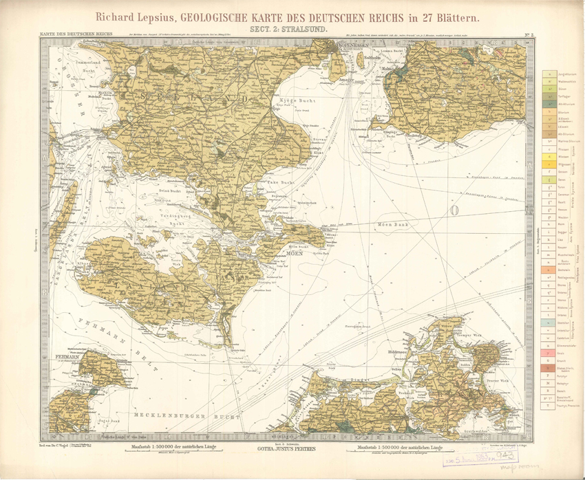
Geologisches Karte des Deutschen Reichs – 2. Stralsund (Lepsius, 1897)
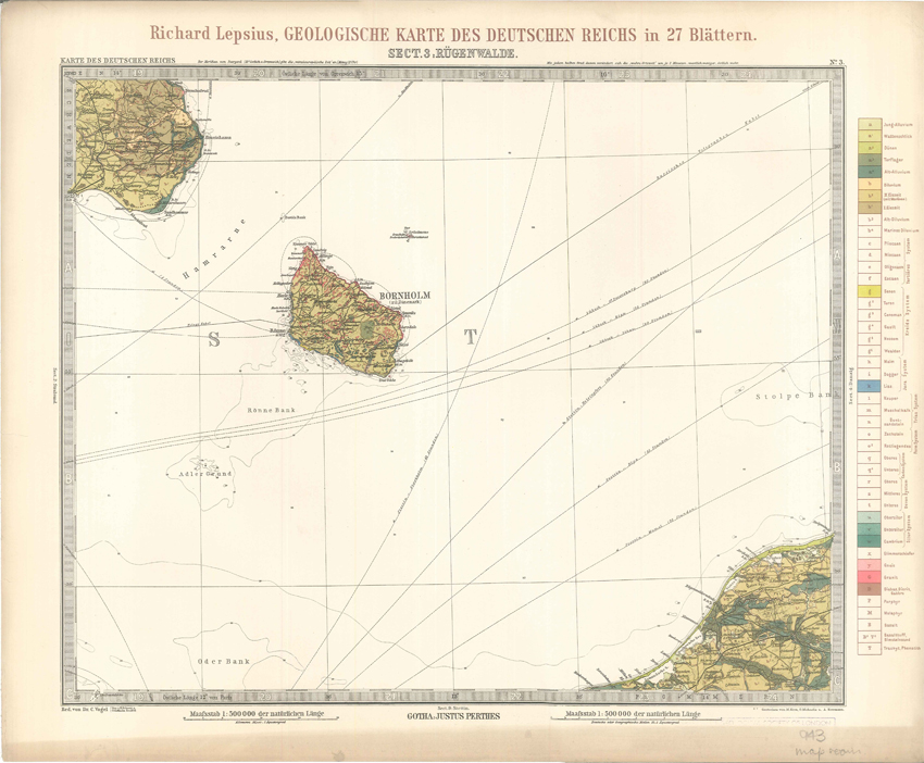
Geologisches Karte des Deutschen Reichs – 3. Rugenwalde (Lepsius, 1897)
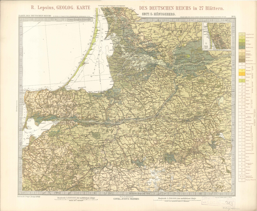
Geologisches Karte des Deutschen Reichs – 5. Konigsberg (Lepsius, 1897)
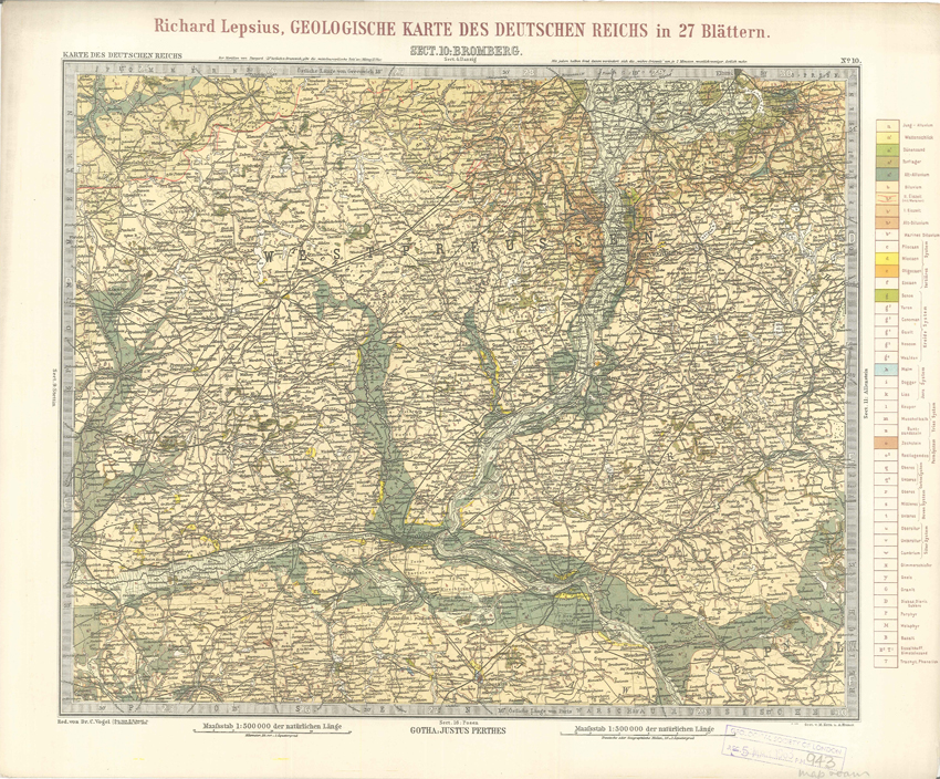
Geologisches Karte des Deutschen Reichs – 10. Bromberg (Lepsius, 1897)
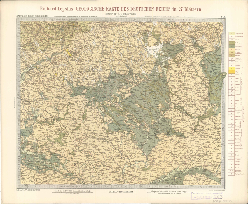
Geologisches Karte des Deutschen Reichs – 11. Allenstein (Lepsius, 1897)
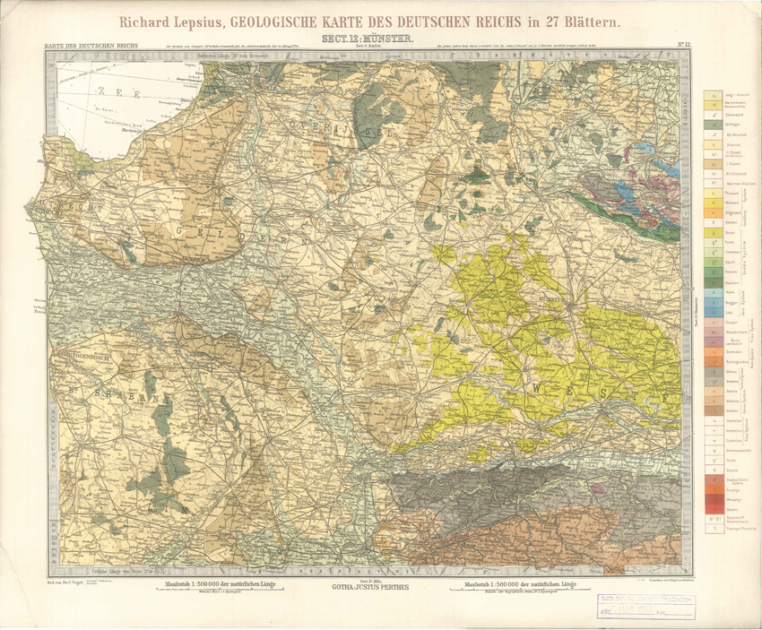
Geologisches Karte des Deutschen Reichs – 12. Munster (Lepsius, 1897)
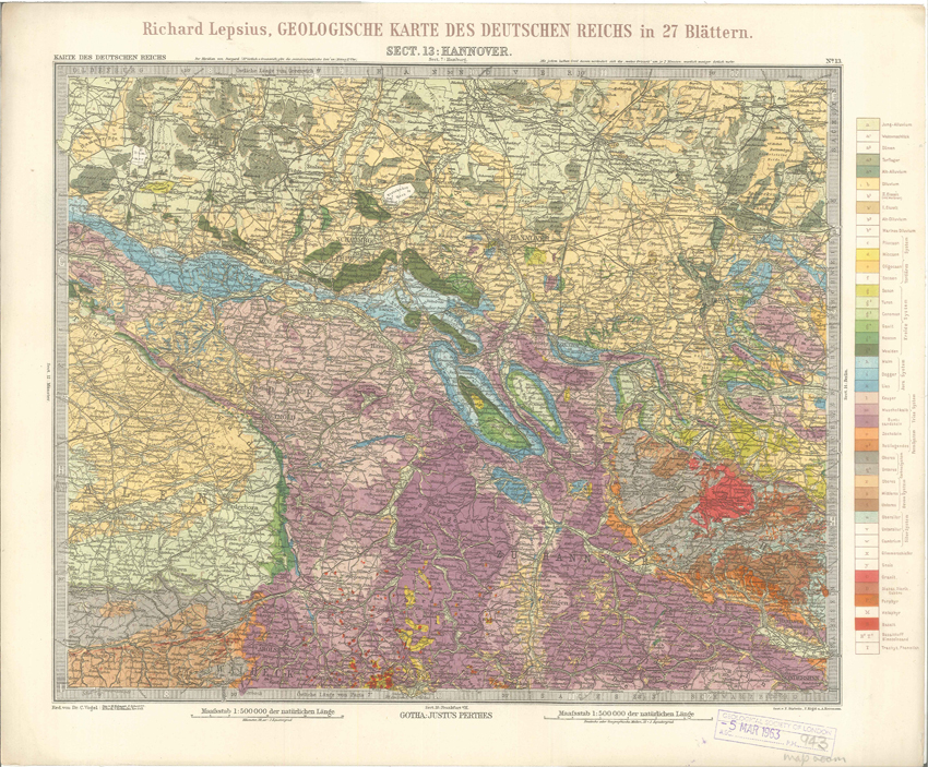
Geologisches Karte des Deutschen Reichs – 13. Hannover (Lepsius, 1897)
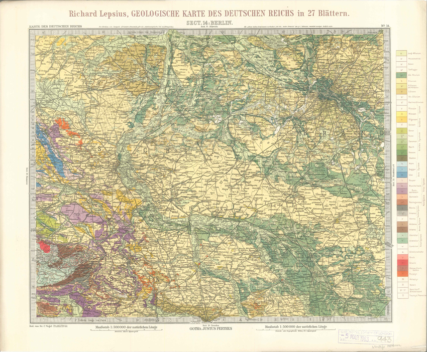
Geologisches Karte des Deutschen Reichs – 14. Berlin (Lepsius, 1897)
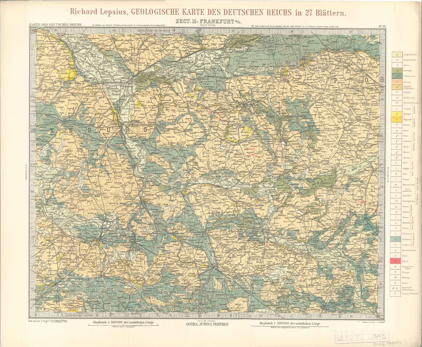
Geologisches Karte des Deutschen Reichs – 15. Frankfurt A-O (Lepsius, 1897)
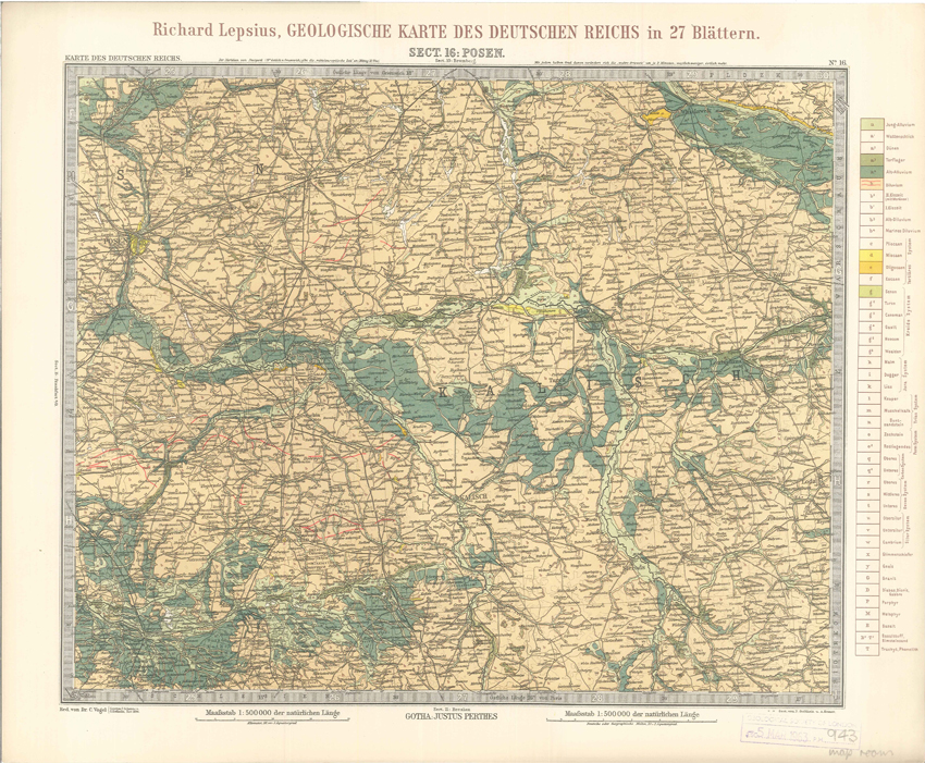
Geologisches Karte des Deutschen Reichs – 16. Posen (Lepsius, 1897)
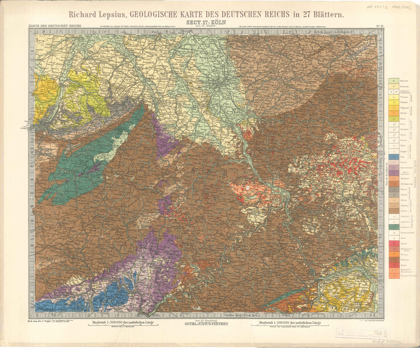
Geologisches Karte des Deutschen Reichs – 17. Koln (Lepsius, 1897)
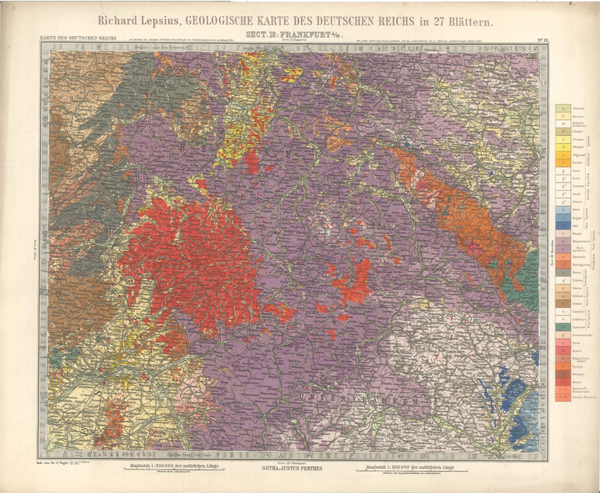
Geologisches Karte des Deutschen Reichs – 18. Frankfurt A-M (Lepsius, 1897)
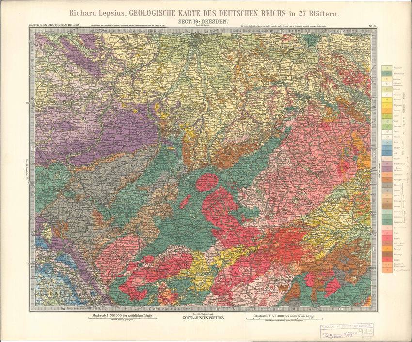
Geologisches Karte des Deutschen Reichs – 19. Dresden (Lepsius, 1897)
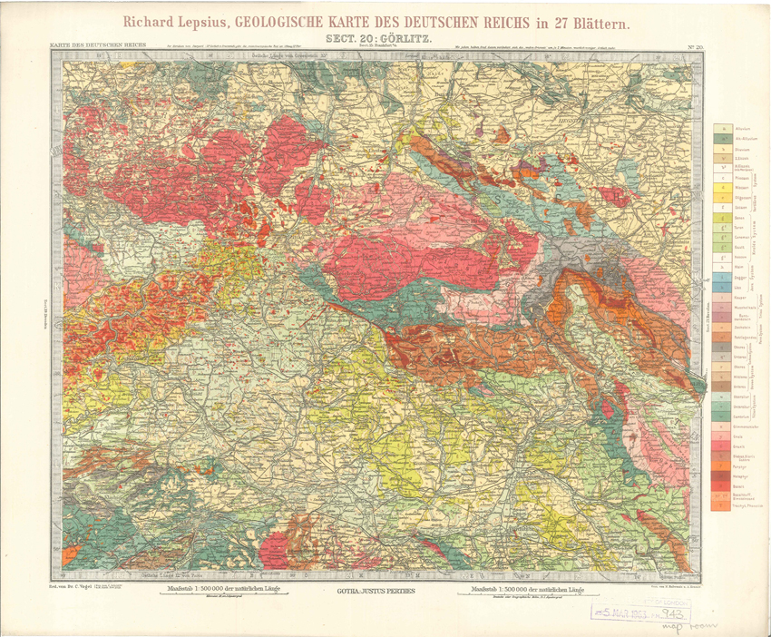
Geologisches Karte des Deutschen Reichs – 20. Gorlitz (Lepsius, 1897)
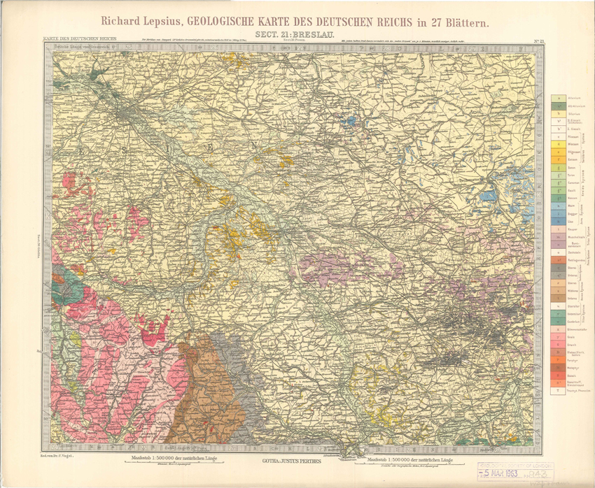
Geologisches Karte des Deutschen Reichs – 21. Breslau (Lepsius, 1897)
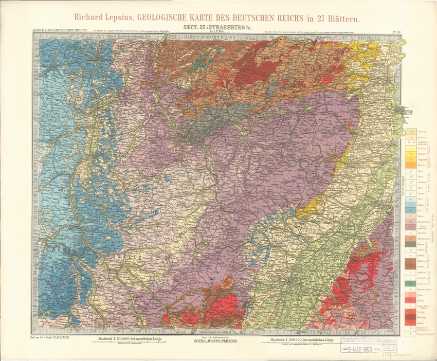
Geologisches Karte des Deutschen Reichs – 22. Strassburg I-E (Lepsius, 1897)
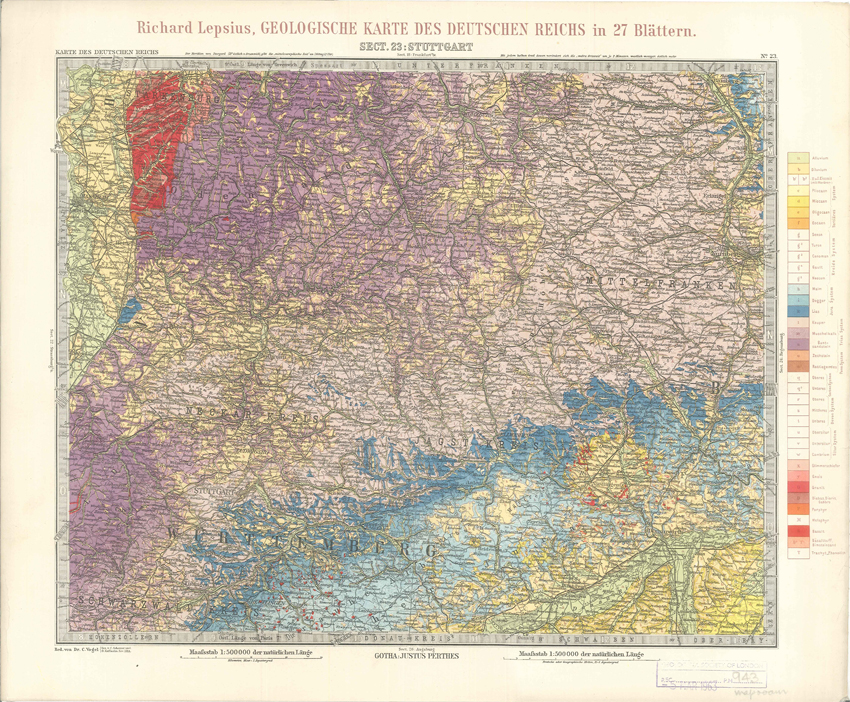
Geologisches Karte des Deutschen Reichs – 23. Stuttgart (Lepsius, 1897)
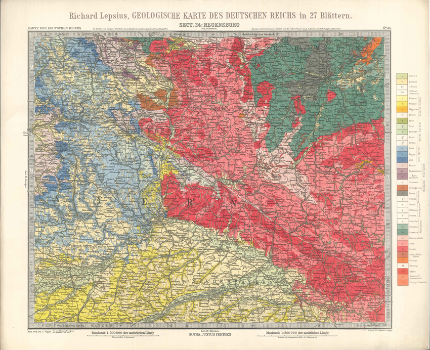
Geologisches Karte des Deutschen Reichs – 24. Regensburg (Lepsius, 1897)
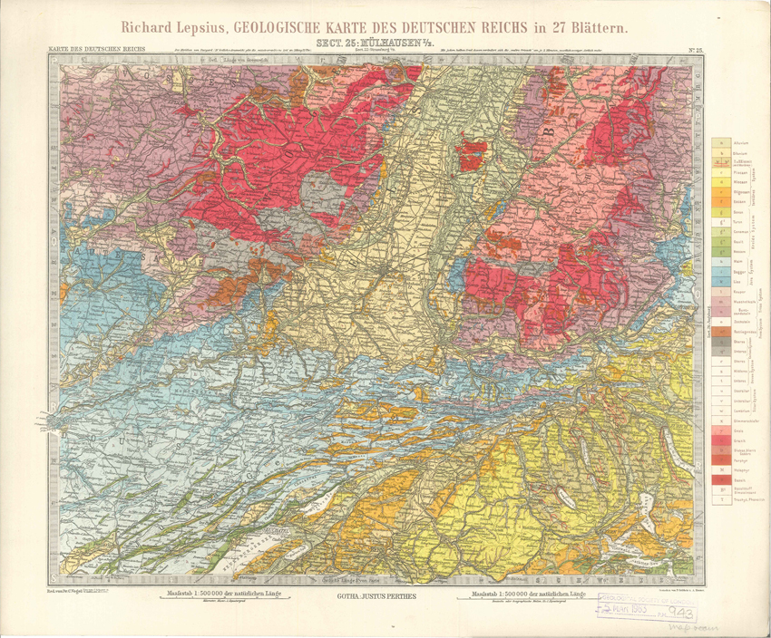
Geologisches Karte des Deutschen Reichs – 25. Mulhausen I-E (Lepsius, 1897)
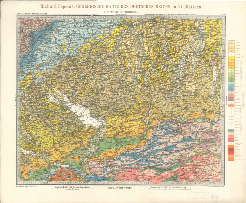
Geologisches Karte des Deutschen Reichs – 26. Augsburg (Lepsius, 1897)
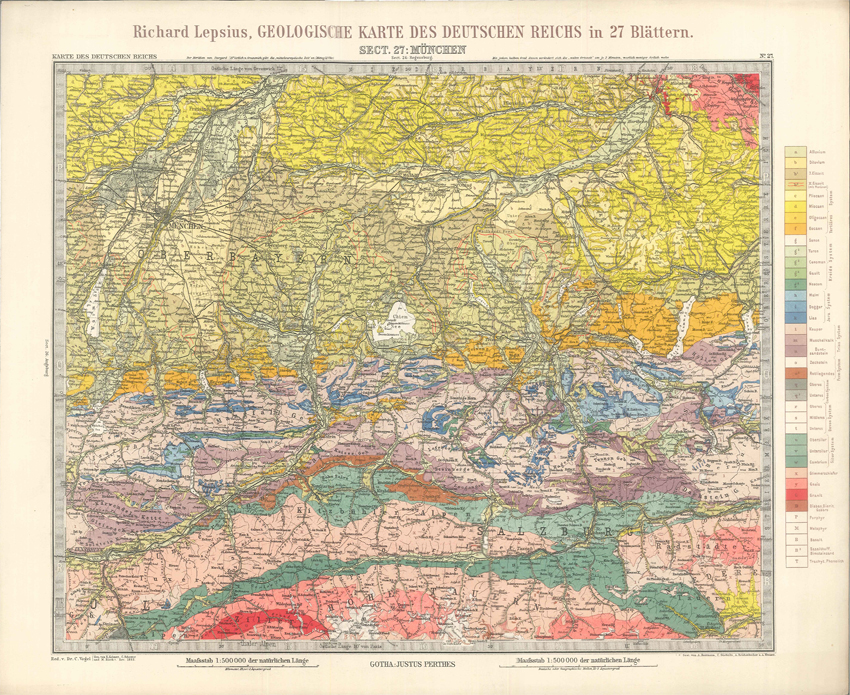
Geologisches Karte des Deutschen Reichs – 27. Munchen (Lepsius, 1897)
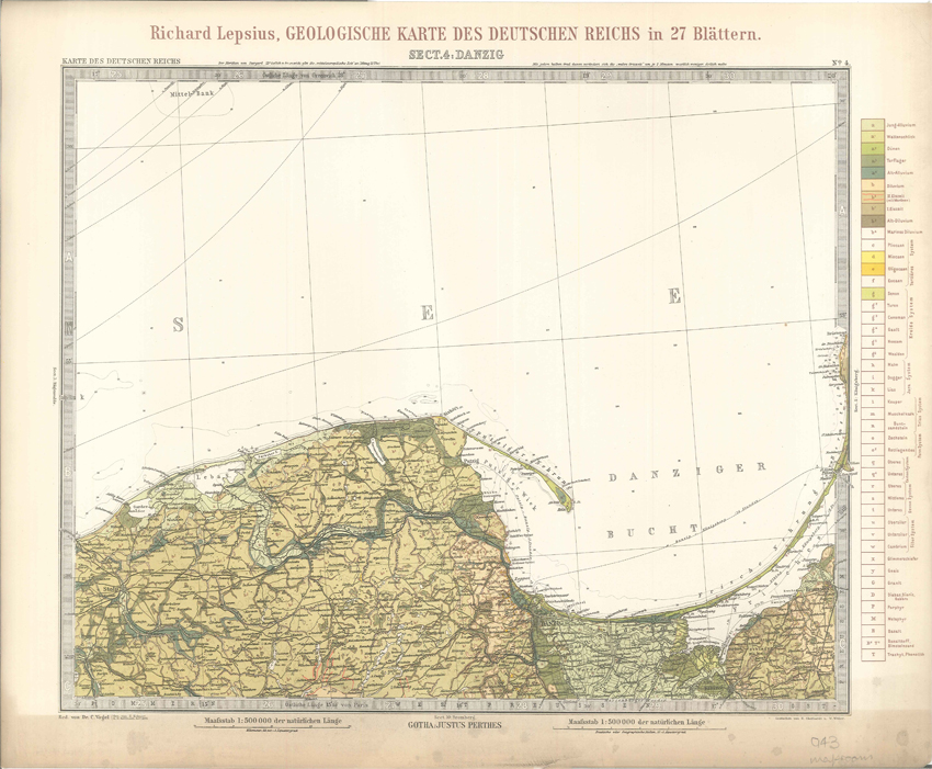
Geologisches Karte des Deutschen Reichs – 4. Danzig (Lepsius, 1897)
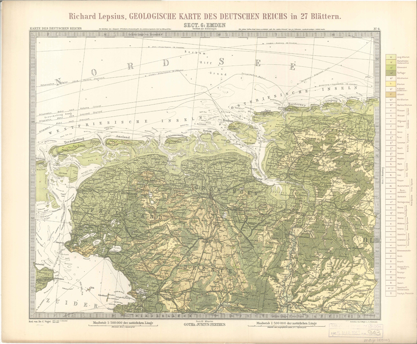
Geologisches Karte des Deutschen Reichs – 6. Emden (Lepsius, 1897)
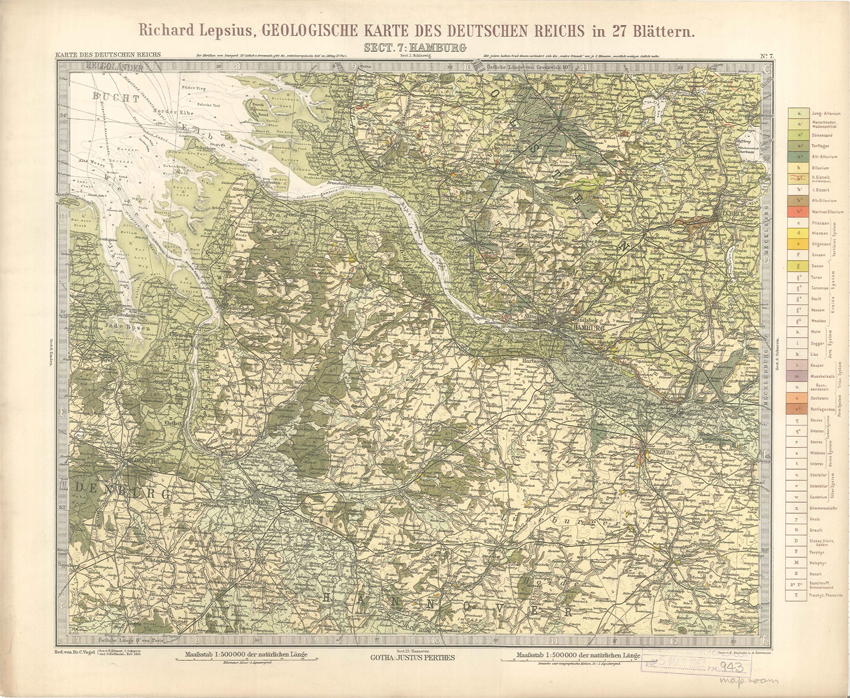
Geologisches Karte des Deutschen Reichs – 7. Hamburg (Lepsius, 1897)
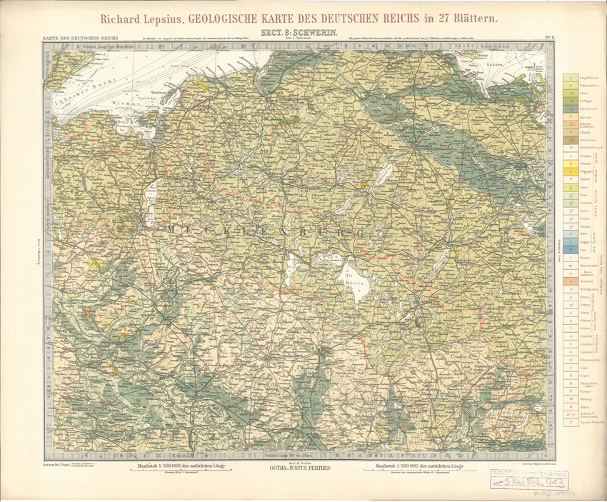
Geologisches Karte des Deutschen Reichs – 8. Schwerin (Lepsius, 1897)
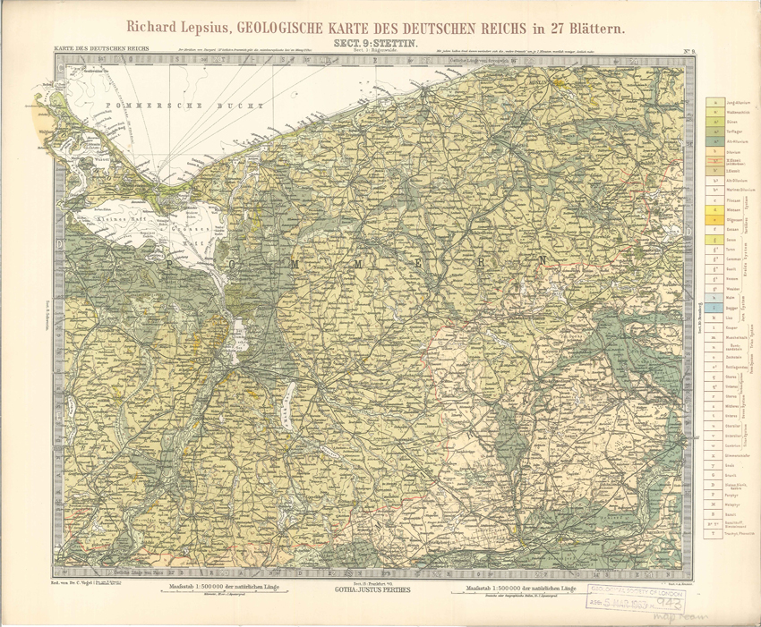
Geologisches Karte des Deutschen Reichs – 9. Stettin (Lepsius, 1897)
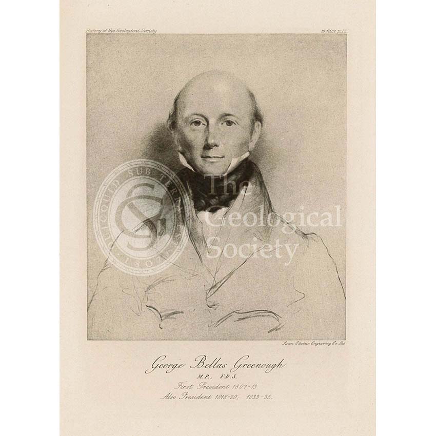
George Bellas Greenough (1778-1855)
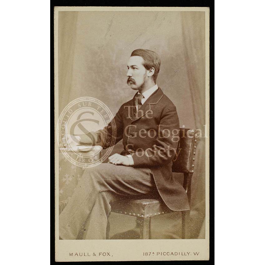
George Simmonds [Simonds] Boulger (1853-1922)
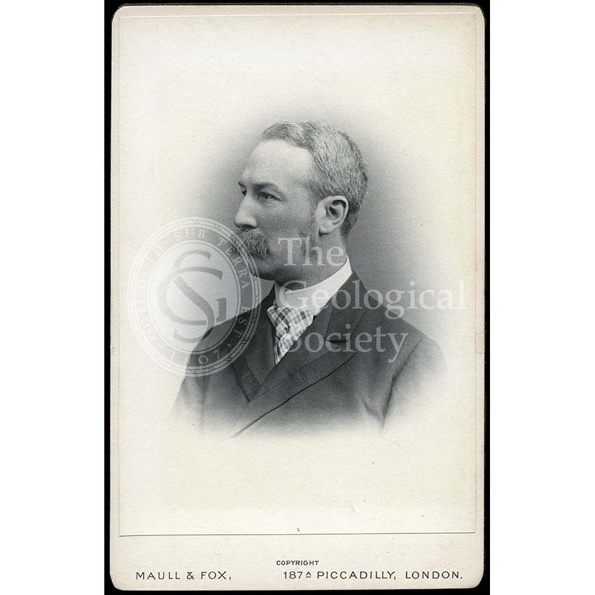
George Simmonds [Simonds] Boulger (1853-1922)
George Simmonds [Simonds] Boulger (1853-1922)
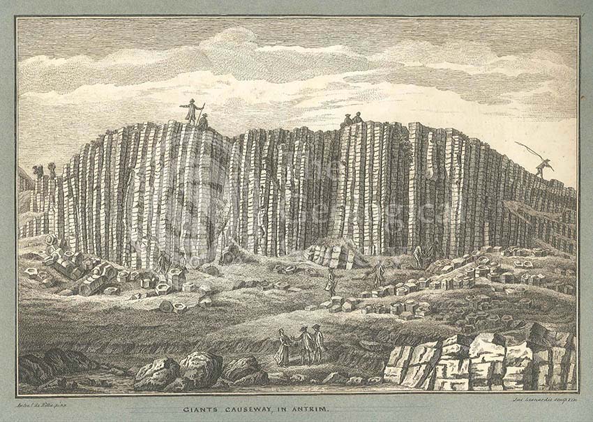
Giant’s Causeway
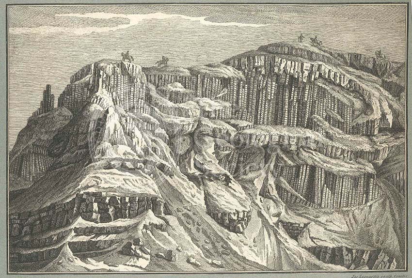
Giant’s Causeway
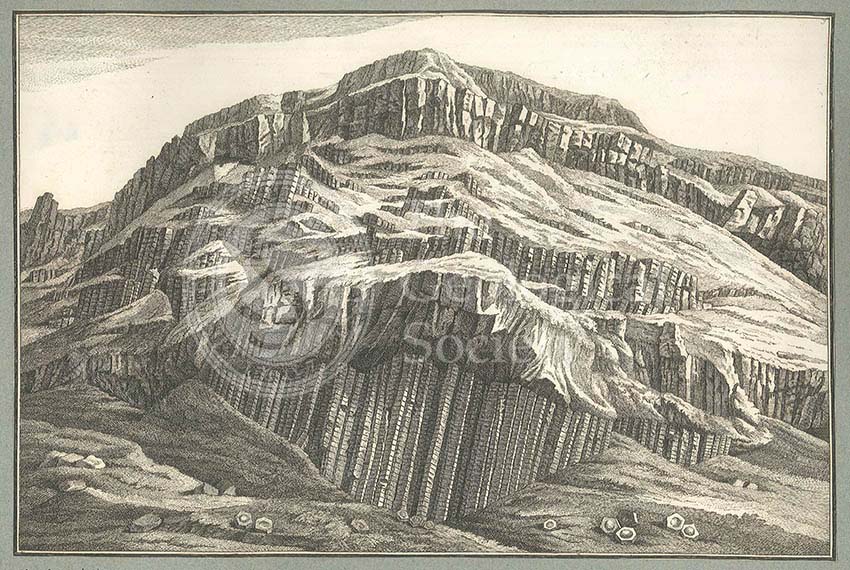
Giant’s Causeway

Gideon Algernon Mantell (1790-1852)

Gideon Mantell (1790-1852)
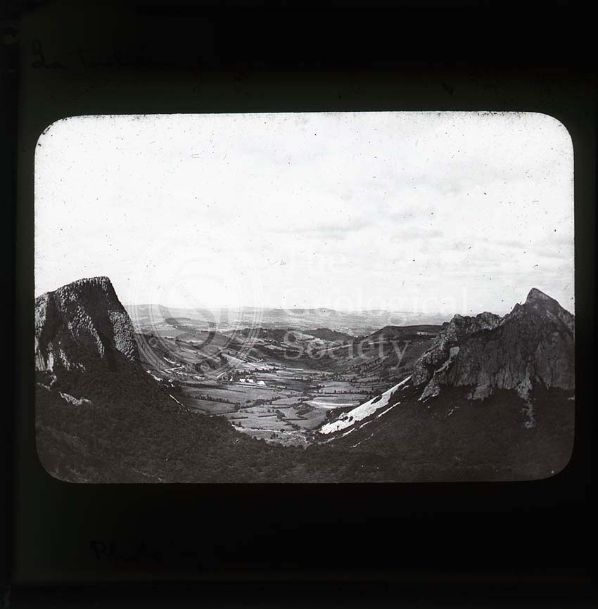
Glacial valley, France
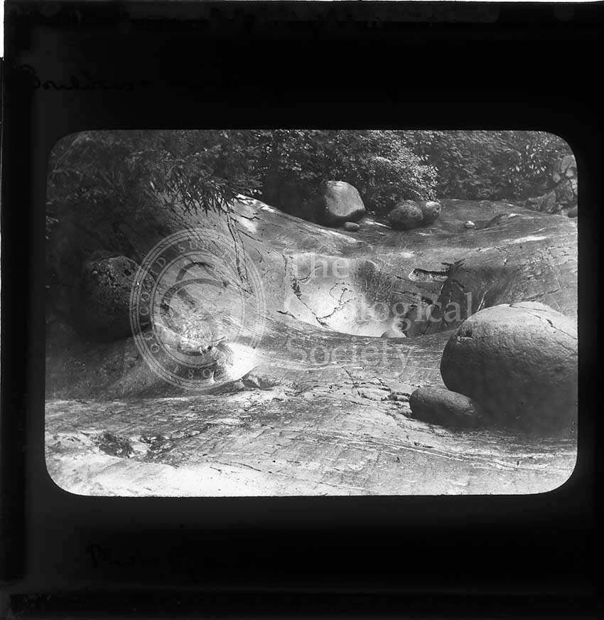
Glacier Garden, Lucerne
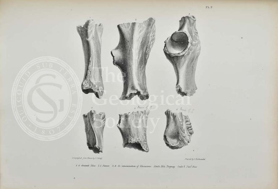
Gnawed bones of Rhinoceros found in Kent’s Cavern
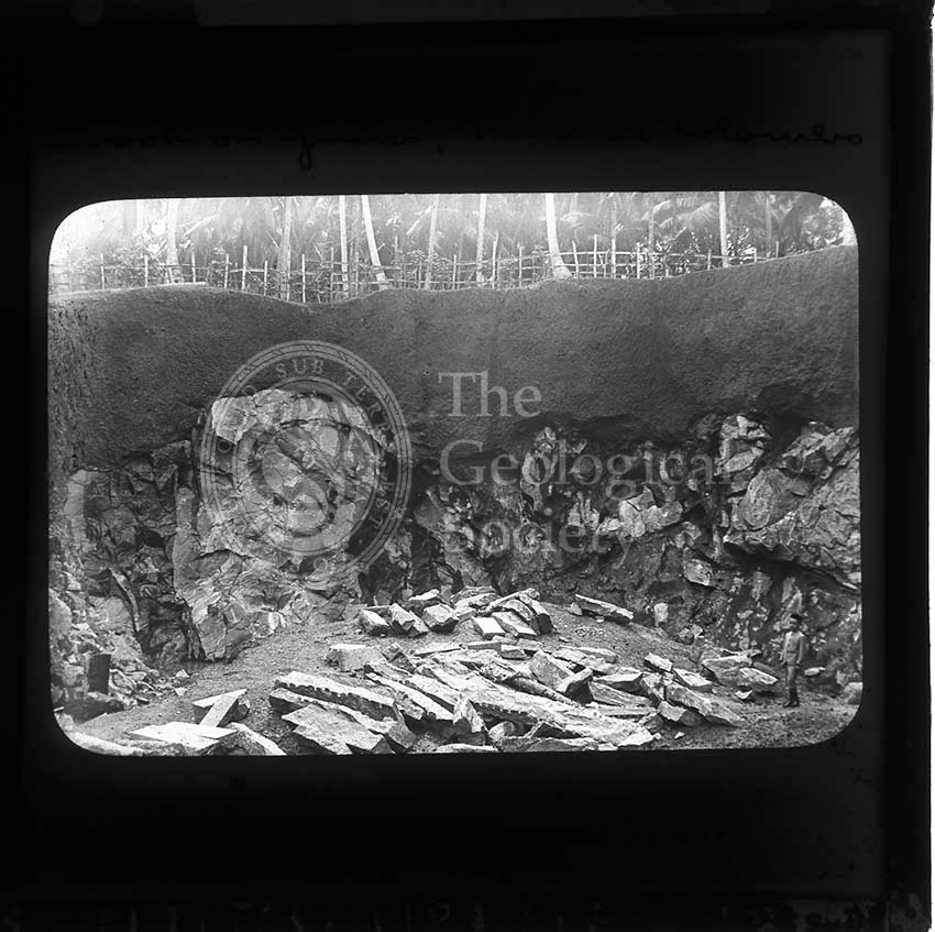
Gneiss, Colombo
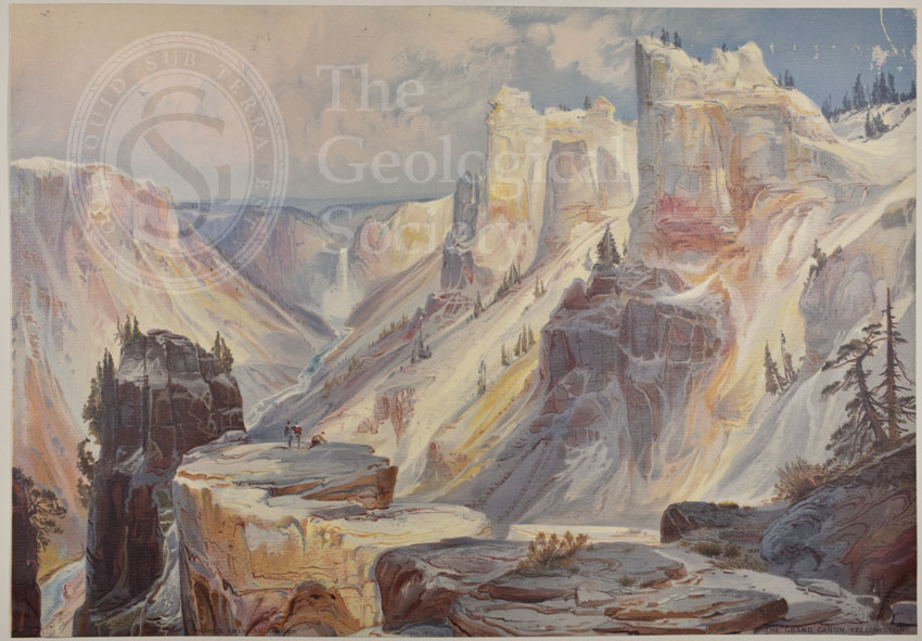
Grand Cañon, Yellowstone
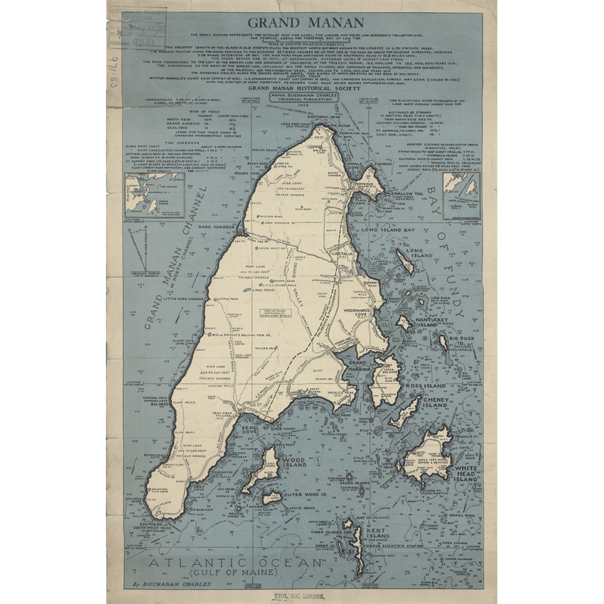
Grand Manan (Charles, 1939)
Grand Sarcoui, Auvergne
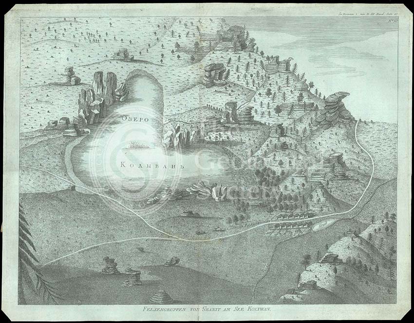
Granite outcrops in Kolyvan, Sibiera
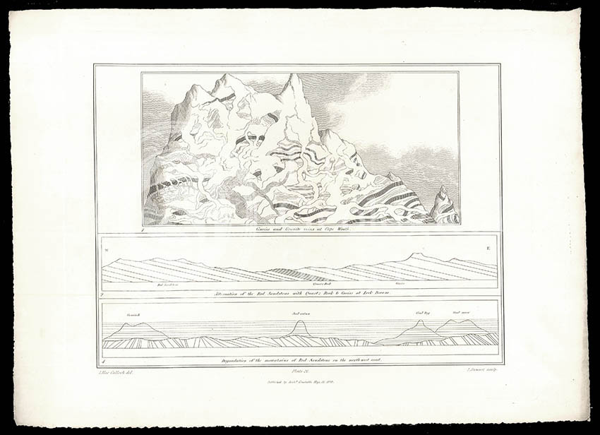
Granite veins and gneiss at Cape Wrath… (Stewart after MacCulloch, 1819)
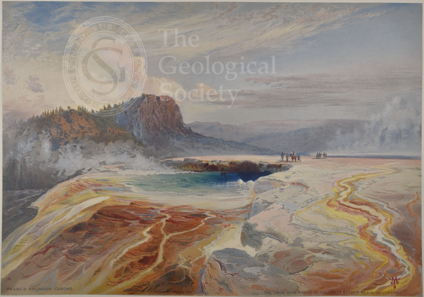
Great Blue Spring of the Lower Geyser Basin, Yellowstone
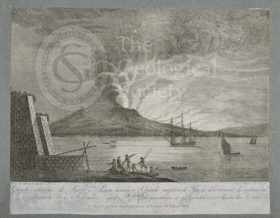
Great eruption of fire and lava from Mount Vesuvius, 9 September 1804
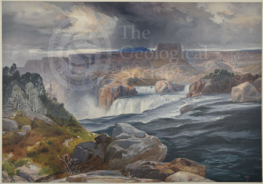
Great Falls of Snake River, Idaho Territory
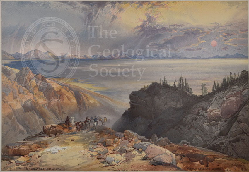
Great Salt Lake of Utah
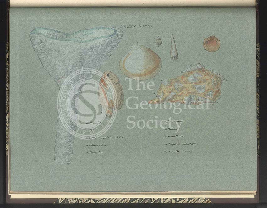
Green Sand fossils
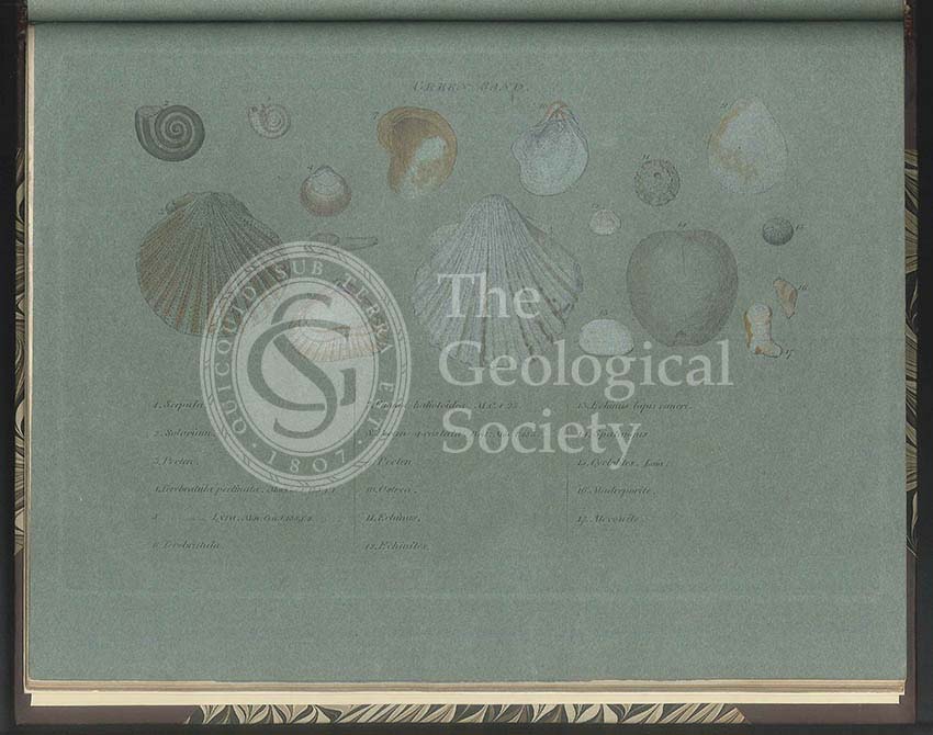
Green Sand fossils

Greenough’s and Sharpe’s Geological Map of Scotland [1852] – draft
Greenough’s and Sharpe’s Geological Map of Scotland [1852] – final copy
Greenough’s copy of William Smith’s geological map (Smith with notes by Greenough, 1815/1818)
Greenough’s Map of Westmoreland (Greenough after Smith, 1824-1843)
Greenough’s ‘Geological Map of England and Wales’ – earliest surviving proof [1816]
Greenough’s ‘Geological Map of England and Wales’ – uncorrected proof before mountains [1818]
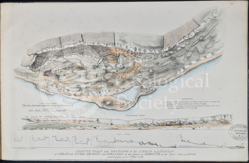
Ground plan and sections of the Great Landslip at Great and Little Bindon and Dowlands…
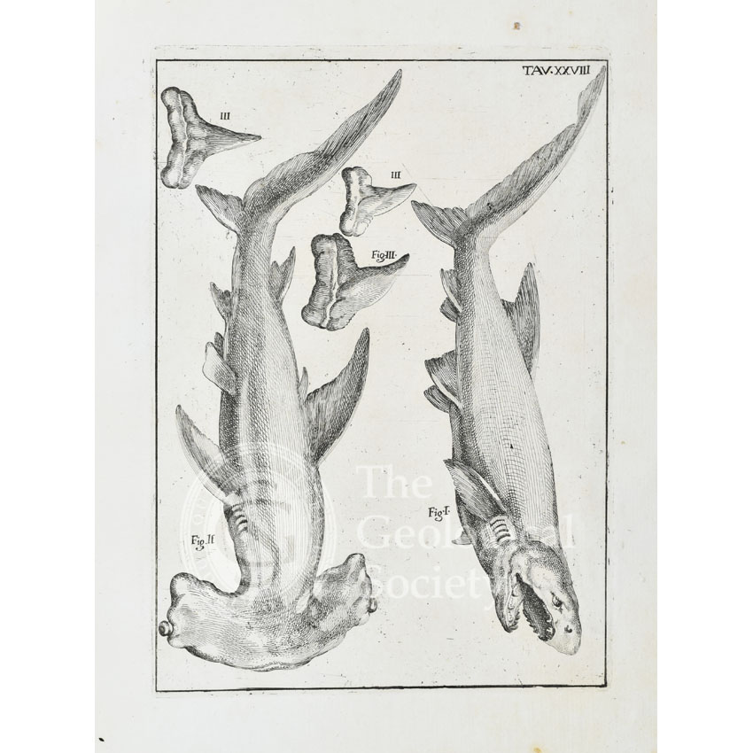
Hammerhead shark and white shark
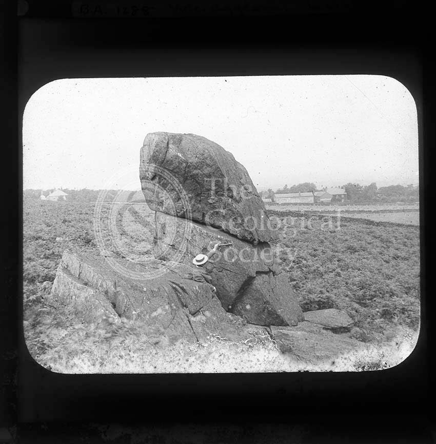
Hanging Stone, Charnwood
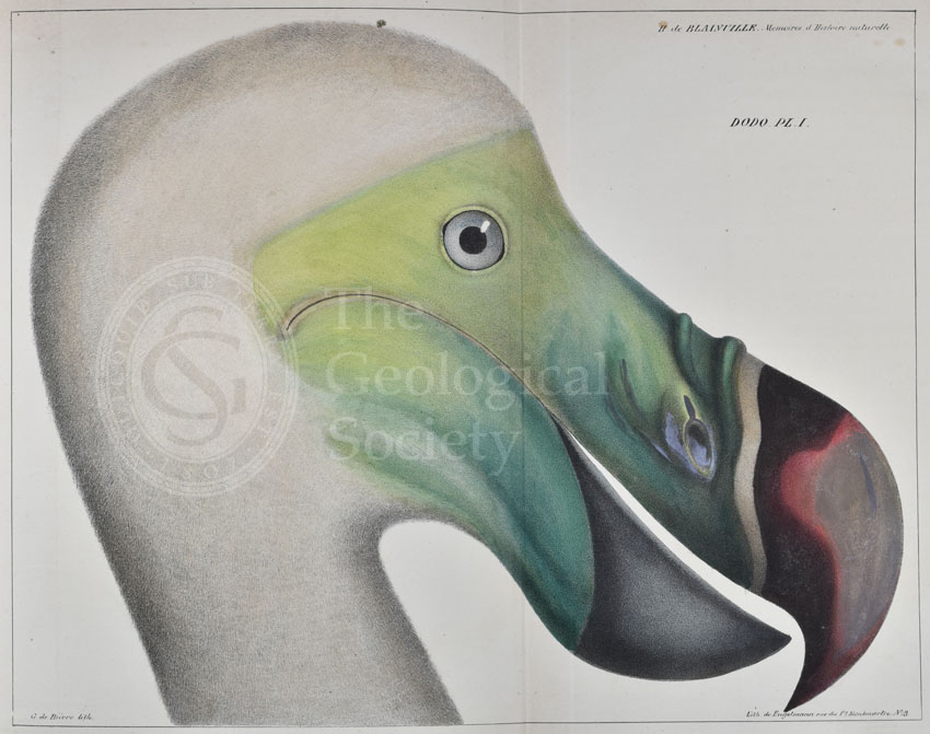
Head of a dodo
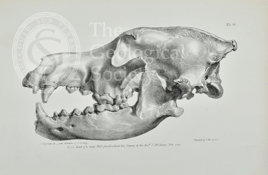
Head of a large wolf found in Kent’s Cavern, Torquay
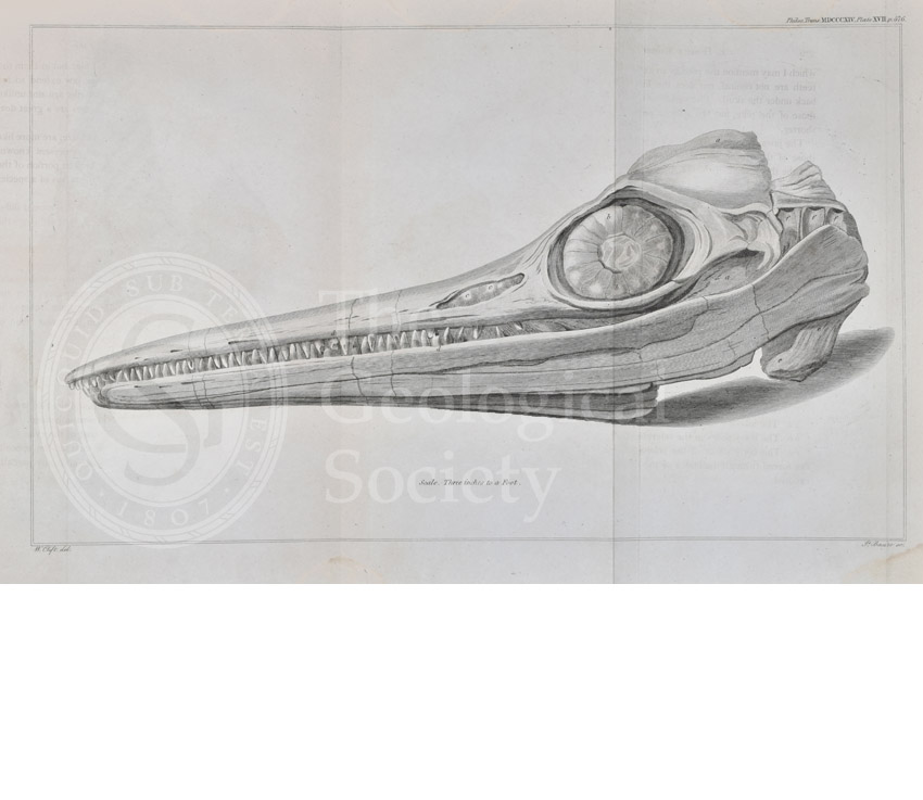
Head of an ichthyosaur
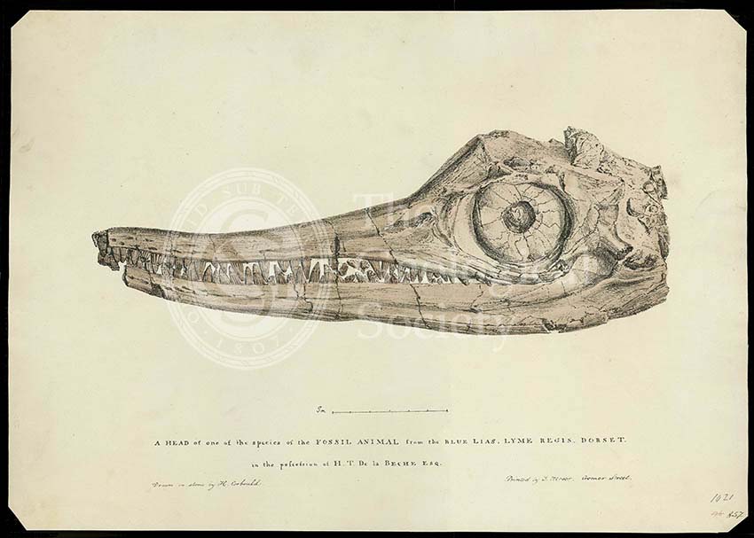
Head of an ichthyosaur
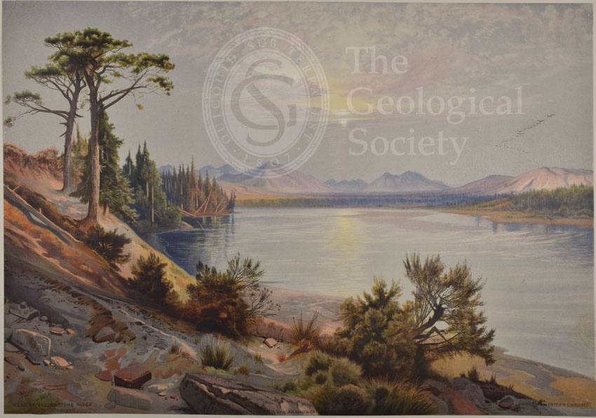
Head of Yellowstone River
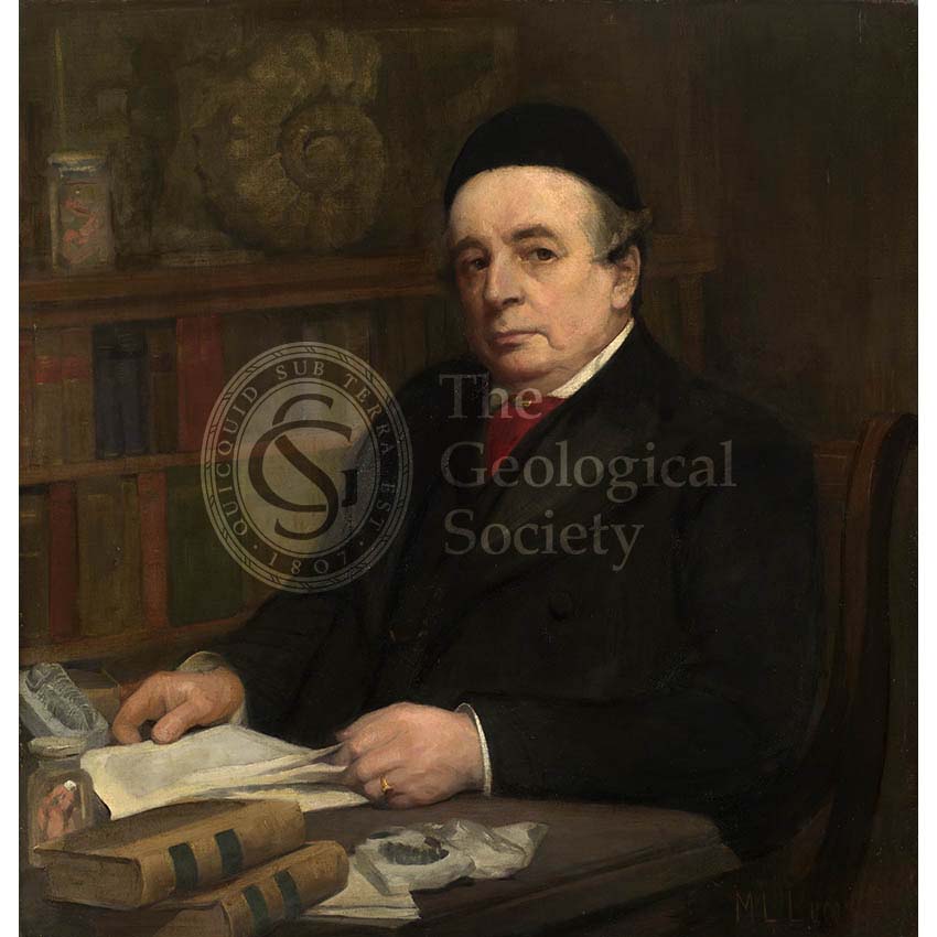
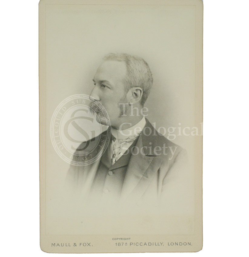
Henry Woodward (1832-1921)