
27×20
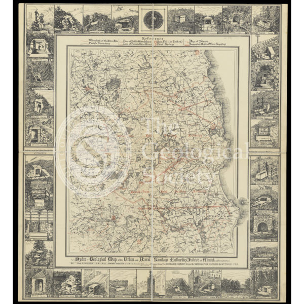
Hydrogeological map of Alnwick and its neighbourhood
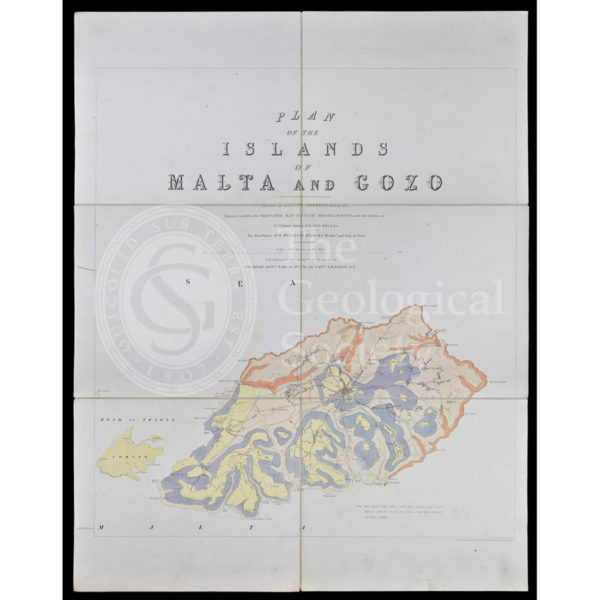
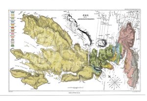
Geological map of Gozo and Cominos, Malta
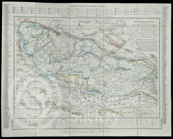
Geognostic map of the Harz Mountains (1832)
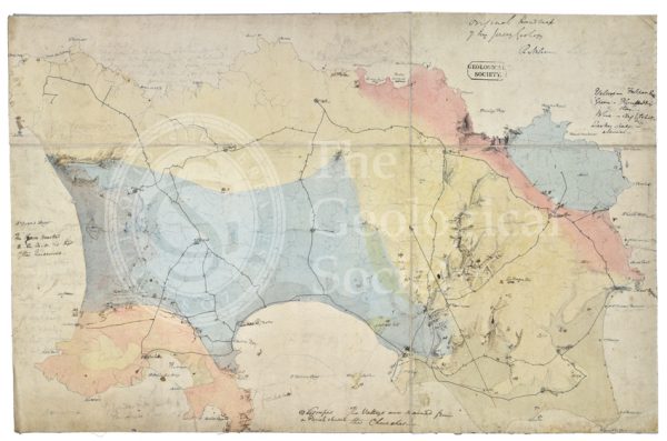
Draft of the first geological map of Jersey [c.1828]
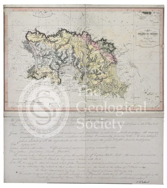
First geological map of Jersey [c.1828]
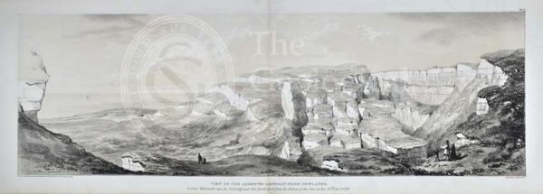
‘View of the Axmouth Landslip from Dowlands…’
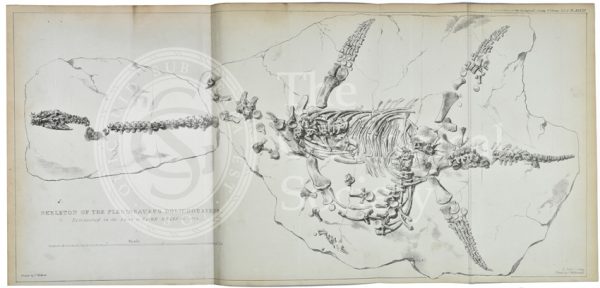
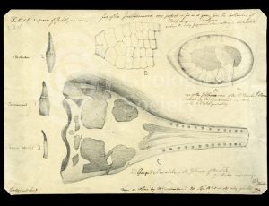
Plesiosaurus dolichodeirus
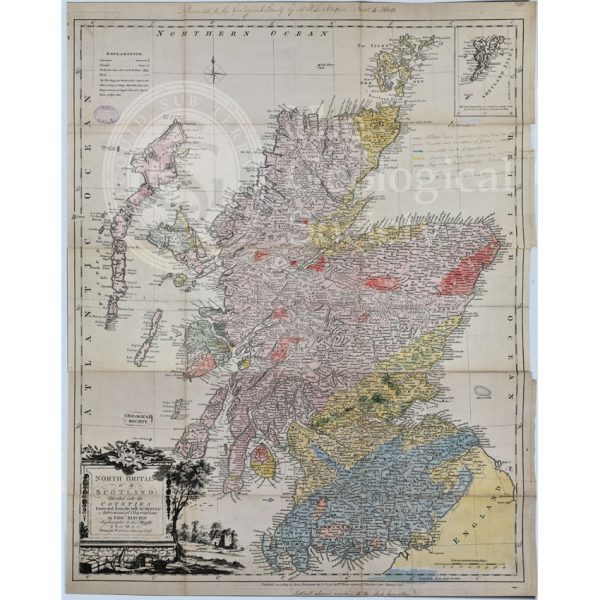
First Geological Map of Scotland [1808]
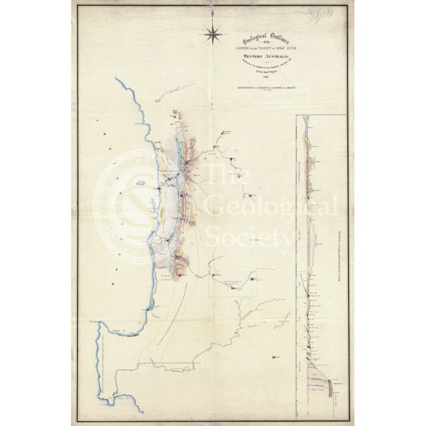
Map of the geology around Swan River, Western Australia
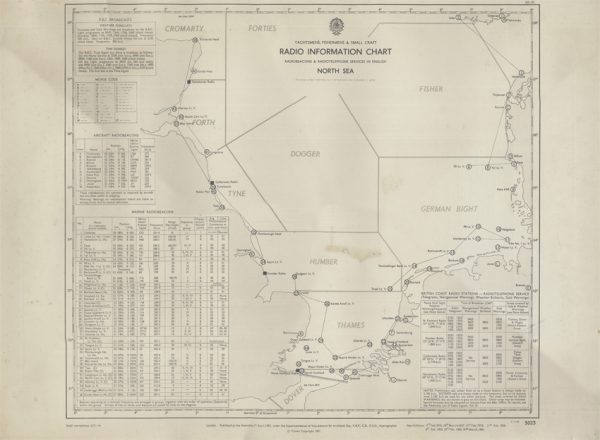
Yachtsmen’s, Fishermen’s & Small Craft Radio Information Chart (Hydrographic Office 1961)
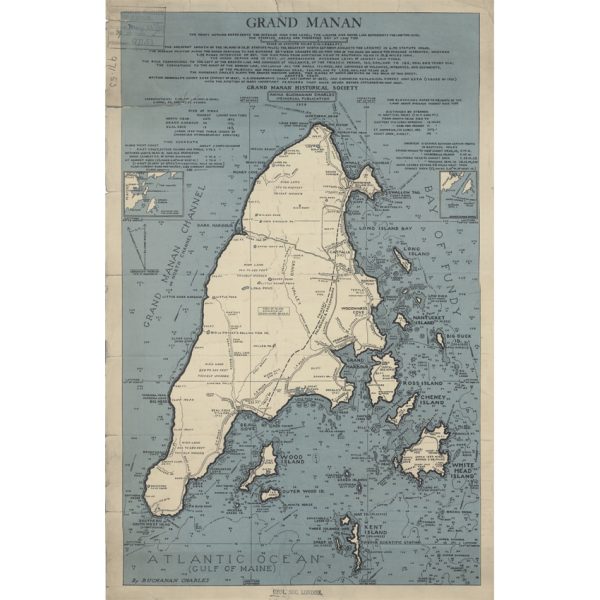
Grand Manan (Charles, 1939)

Map of the English Lakes (Ruthven, 1855)
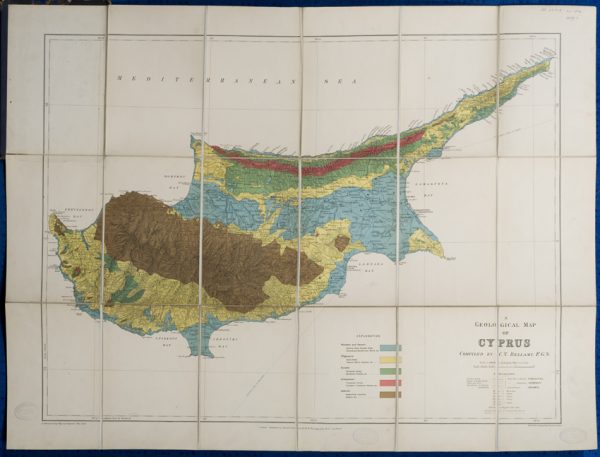
Geological map of Cyprus (Bellamy, 1905)
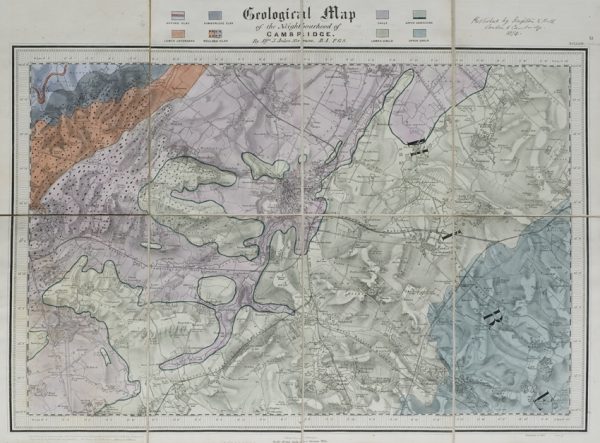
Geological map of the neighbourhood of Cambridge (Jukes-Browne, 1874)
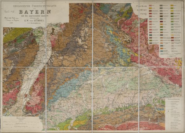
Geologische Übersichtskarte von Bayern und den angrenzenden Ländern (Karl Wilhelm von Gümbel, 1893)
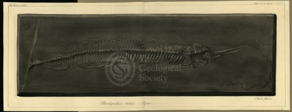
Palaeorhynchum latum Agassiz
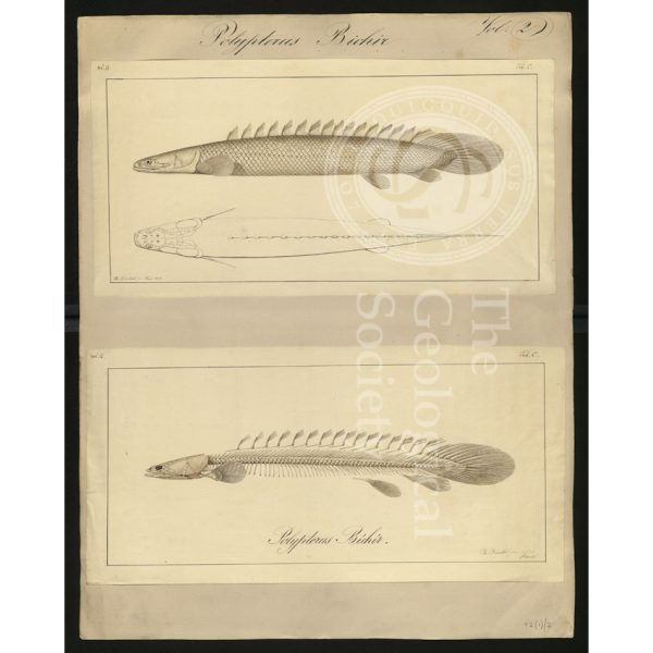
Polypterus bichir
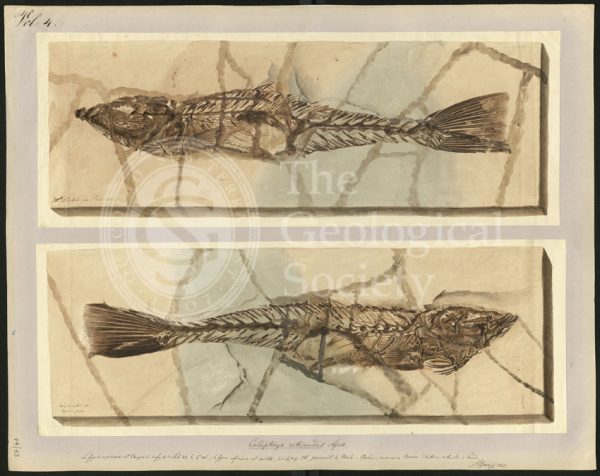
Callipteryx reticaudus Agassiz
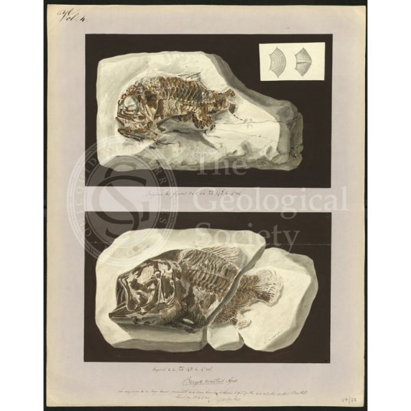
Beryx ornatus Agassiz
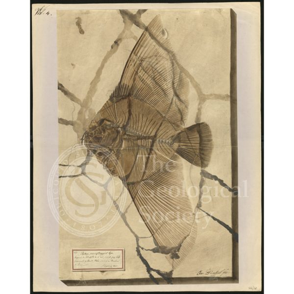
Platax macropterygius Agassiz
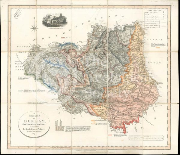
‘A New Map of Durham divided into Wards…’ (Smith, 1831)
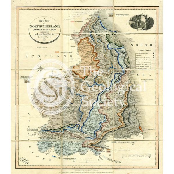
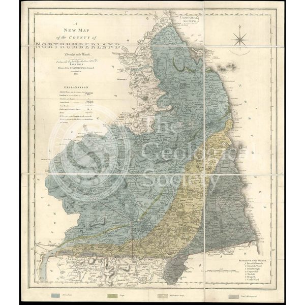
‘A New Map of Northumberland divided into Wards…’ (Smith, 1831)
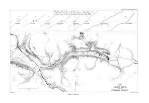
Plan of Glen Roy and of the Parallel Roads (MacCulloch, 1817)
Sky and the adjoining islands (Stewart after MacCulloch, 1817)
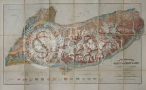
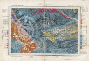
Carte géologique du Massif du Mont-Blanc (Duparc and Mrazec, 1896)
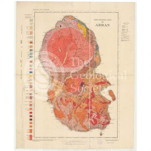
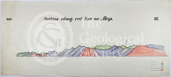
Geological Map of Arran (The Survey, 1910)
Geological map of Brough-under-Stainmore (Geological Survey of England & Wales, 1893)
Section of the country east of Lake Baikal, Siberia (geology near Nerchinsk) (Austin, 1848-1862)
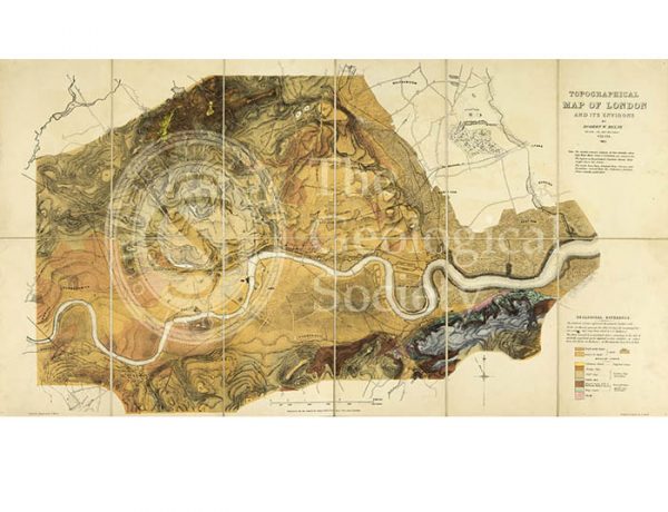
Topographical [and Geological] Map of London… (Mylne, 1851)
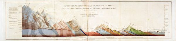
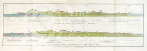
Geological Section from London to Snowdon (Smith, 1817)
Granite outcrops in Kolyvan, Sibiera
Sukhoboisk, Samilovsky and Froloosky copper mines
Geological Map of England & Wales… [Greenough reduction] (Gardner after Greenough, 1826)
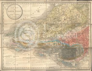
A New Map of South Wales (Greenough and Coltman, between 1813-1839)
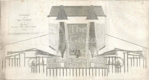
Section of the Bath Easton Mine in Somersetshire (Webster, 1812)
Greenough’s copy of William Smith’s geological map (Smith with notes by Greenough, 1815/1818)
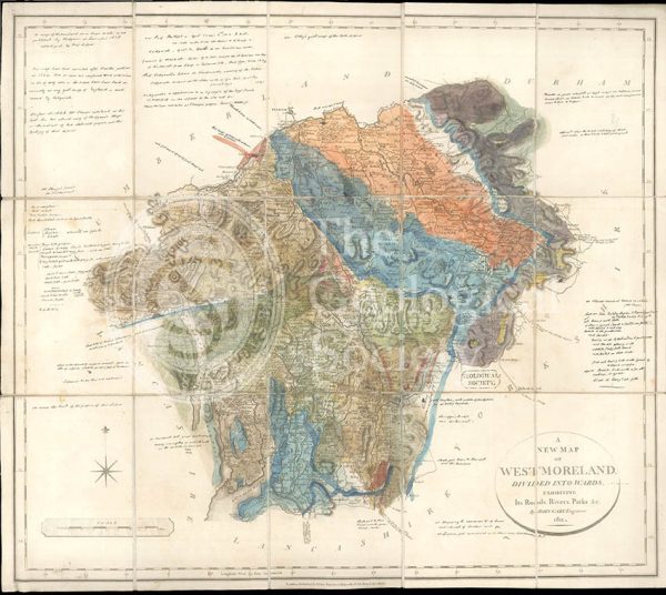
Greenough’s Map of Westmoreland (Greenough after Smith, 1824-1843)
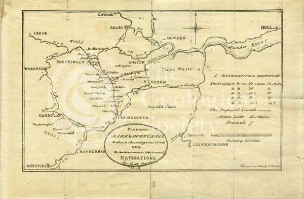
Plan of the ‘Proposed Aire & Dunn Canal’ (Smith and Phillips, 1819)
Geological map of Northumberland (Wood, 1831)
Section of a [gold] mine, north of Orenburg, Russia
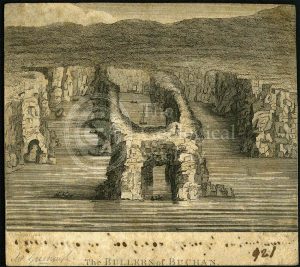
‘The Bullers of Buchan’
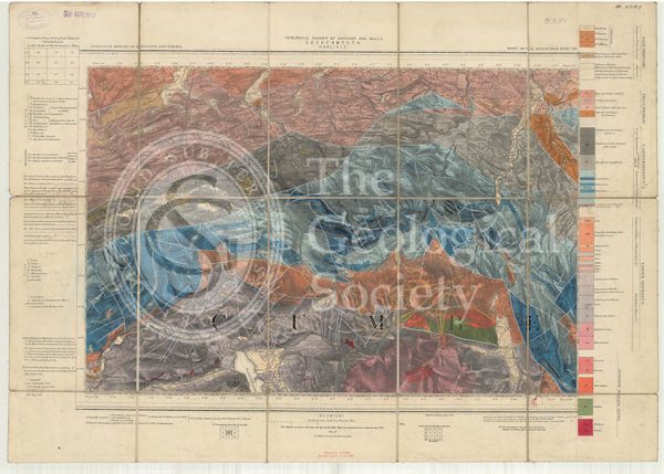
Geological map of England and Wales, Sheet 101 NE Cockermouth (1890)
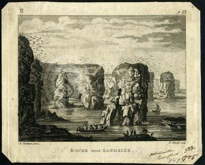
‘Rocks near Sandside’
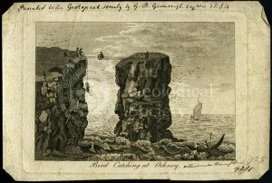
‘Bird catching at Orkney’
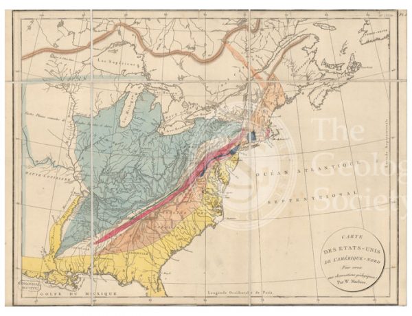
Carte des Etats-Unis de l’Amerique-Nord [Map of North America] (Maclure, 1811)
Iron smelting works, Siberia
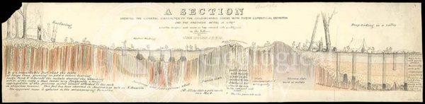
‘Section showing the general characters of the gold-bearing rocks with their superficial detritus…’
Geological Sections in Illustration of the Map of the Mining District of Cornwall (Smith, 1819)
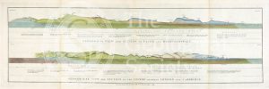
Geological view and sections of Norfolk and Suffolk (Smith, 1819)
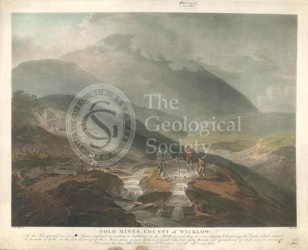
‘Gold mines, County of Wicklow’
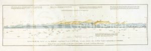
Geological views and sections of Essex/Hertfordshire and between London and Cambridge (Smith, 1819)
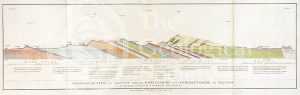
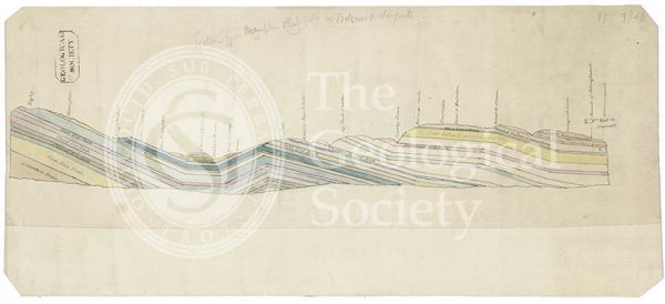
Geological view and section through Dorsetshire and Somersetshire to Taunton (Smith, 1819)
Geological View of the Mining District of Cornwall (Smith, 1819)
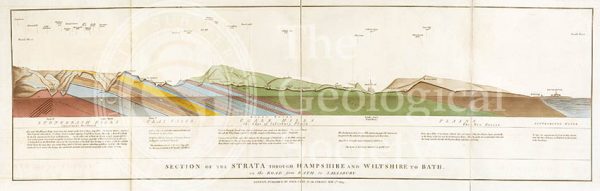
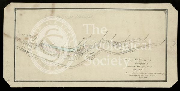
Section of the Strata through Hampshire and Wiltshire to Bath (Smith, 1819)
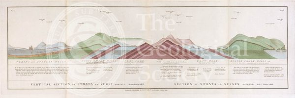
Vertical Section of Strata in Surry (Smith, 1819)
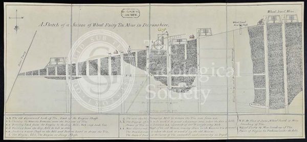
‘A sketch of a section of Wheal Unity Tin Mine in Devonshire’
Proposed Gravesend to Tilbury Fort Tunnel
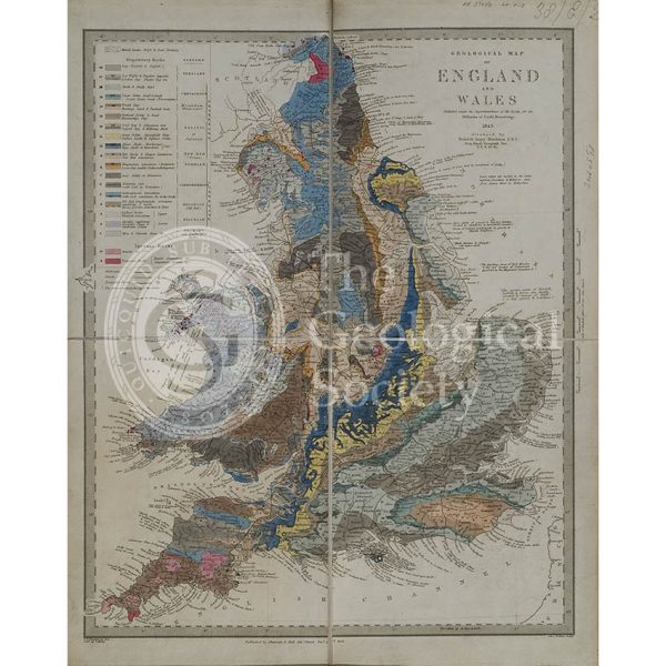
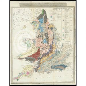
Geological map of England and Wales (Murchison, 1843)
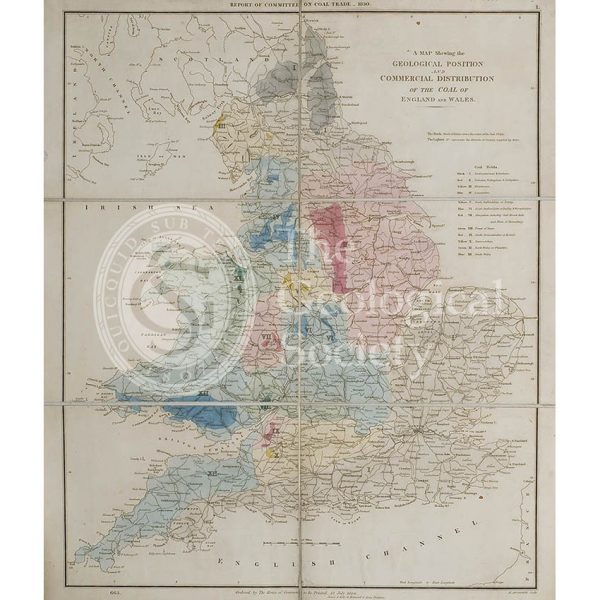
Map showing the Geological Position and Commercial Distribution of the Coal of England and Wales (House of Commons, 1830)
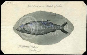
‘Fossil fish in a nodule of Lias’
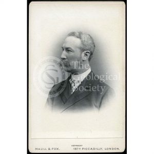
George Simmonds [Simonds] Boulger (1853-1922)
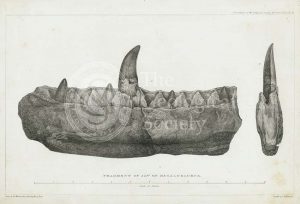
Fragment of jaw of Megalosaurus
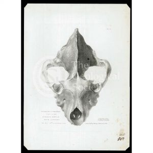
Skull of extinct hyena
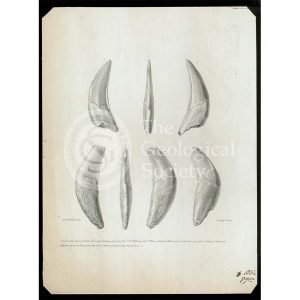
Teeth from Kent’s Cavern
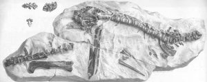
Hypsilophodon skeleton
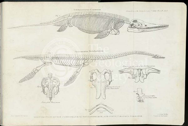
‘Restoration of the Plesiosaurus Dolichodeirus and Ichthyosaurus Communis’
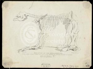
Skeleton of a Megatherium
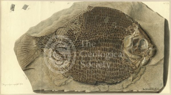
Tetragonolepis angulifer Agassiz
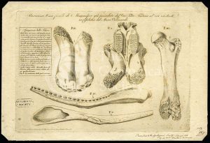
Elephant bones
Skull of a crocodile with the eye, paddle and teeth of various ichthyosauri
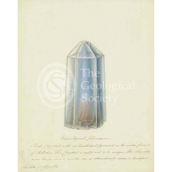
Quartz crystal with asbestos inclusion
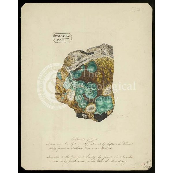
Smithsonite on fluorite
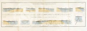
Geological cross sections of Jamaica (Wall, 1864)
Section of England: Petersfield to the Isle of Wight (Greenough, 1812)
Section of England: Chesterfield to Bolsover (Greenough, 1810)
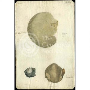
Nautilus and bivalves