
40×27
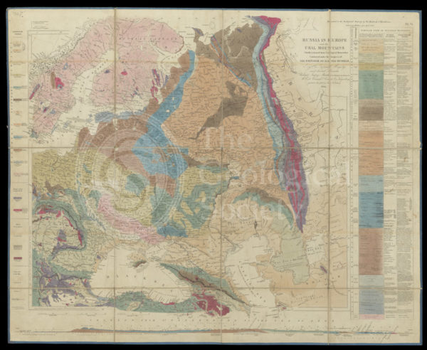
Murchison’s Map of Russia (1847)
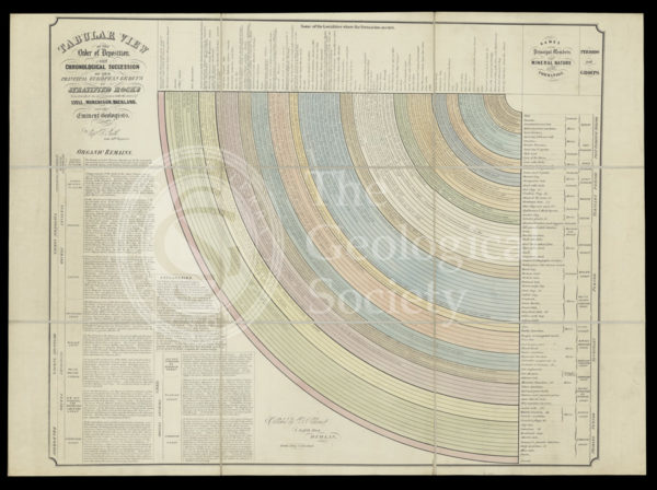
‘Tabular view of the order of deposit and chronological succession of the principal European groups of stratified rocks’
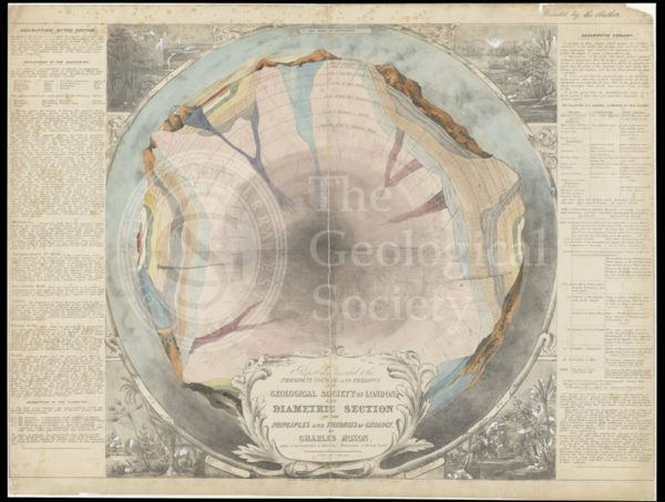
‘The diametric section of the principles and theories of geology’
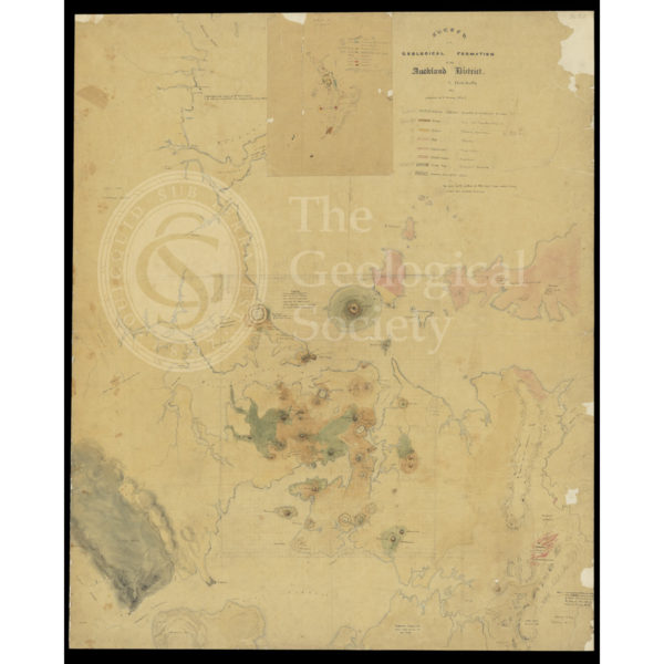
‘Sketch of the Geological Formation of the Auckland District’ (1857-1859)

Geognostic map of Sweden (1834)
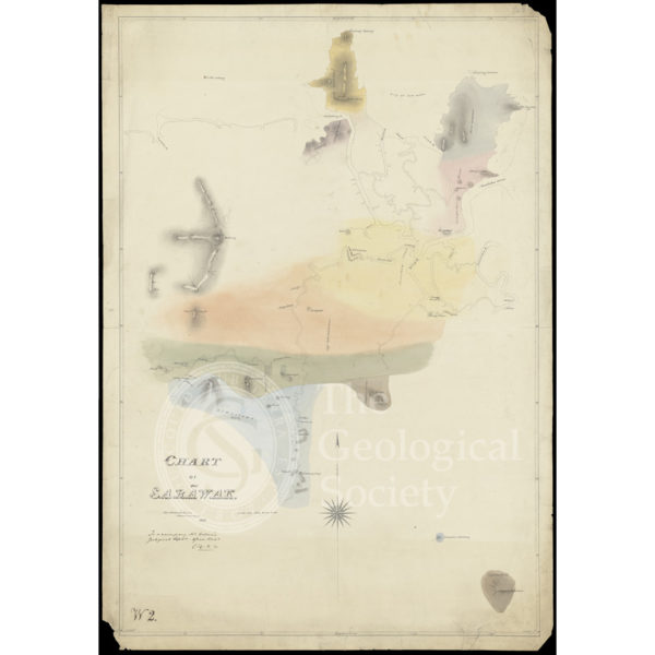
Chart of Sarawak, Borneo (1846)
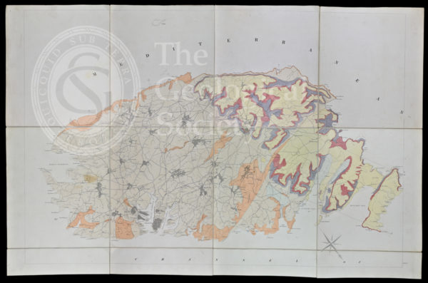
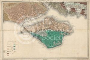
Geological map of Malta (1856)
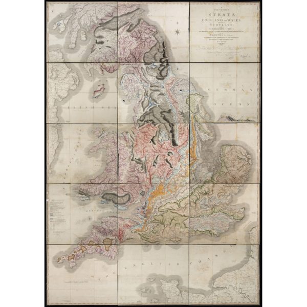
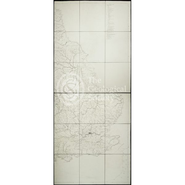
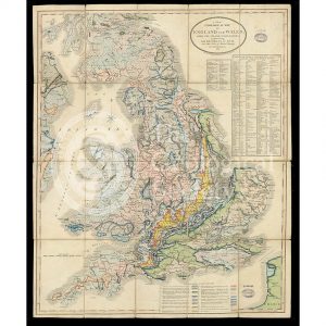
‘A Delineation of the Strata of England and Wales, with part of Scotland… (1815)
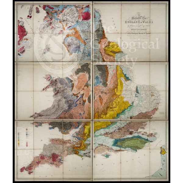
‘Geological Map of England and Wales’ (1865) 3rd edition
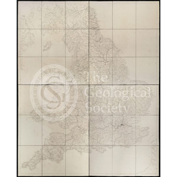
Greenough’s ‘Geological Map of England and Wales’ – uncorrected proof before mountains [1818]
Greenough’s ‘Geological Map of England and Wales’ – earliest surviving proof [1816]
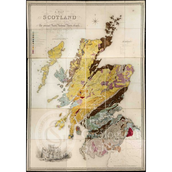
Greenough’s and Sharpe’s Geological Map of Scotland [1852] – final copy
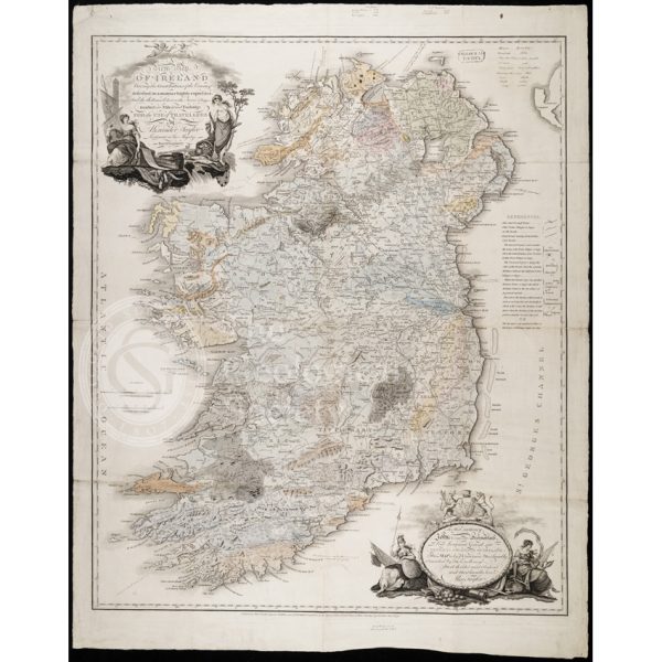
Earliest geological map of Ireland [?1814]
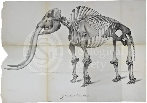
Mastodon giganteus
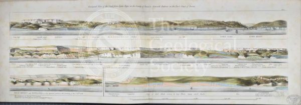
‘Geological view of the coast from Lyme Regis…to Axmouth Harbour…’
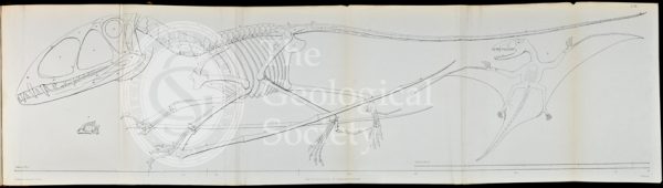
Dimorphodon macronyx
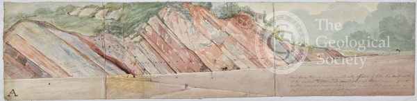
Long section probably showing limestone strata around Bristol
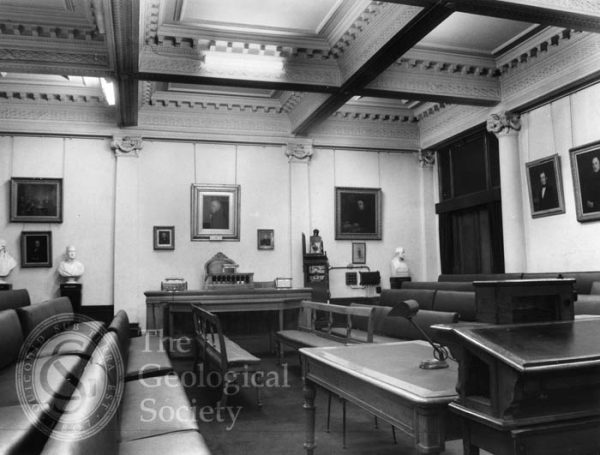
Meeting Room of the Geological Society, 1972
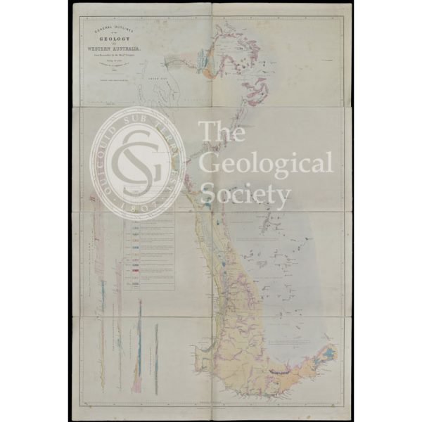
General Outlines of the Geology of Western Australia (Gregory, 1860)
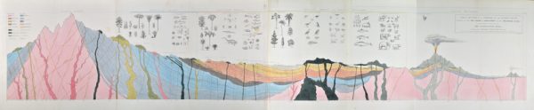
‘Ideal section of a portion of the Earth’s Crust…’
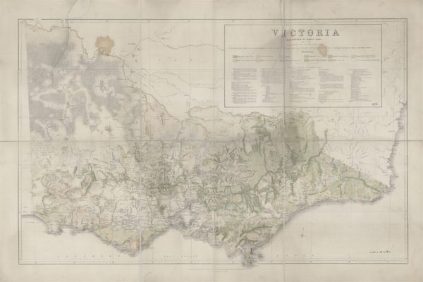
Victoria Distribution of Forest Trees (Everett, 1872)
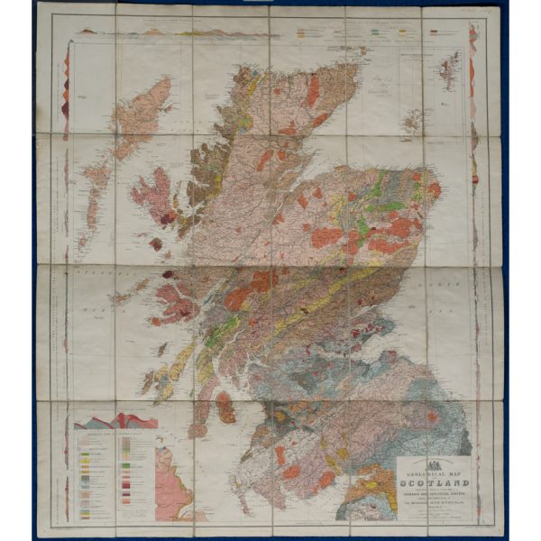
Geological map of Scotland (Geikie, 1910)
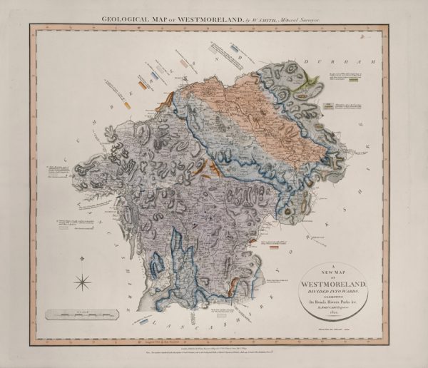
Geological Map of Westmoreland (William Smith, 1824)
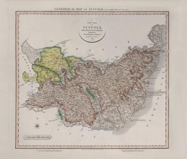
Geological Map of Suffolk (William Smith, 1819)
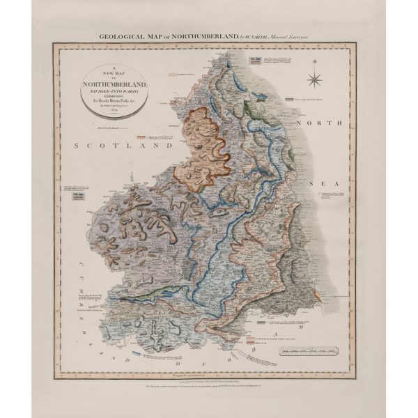
Geological Map of Northumberland (William Smith, 1824)
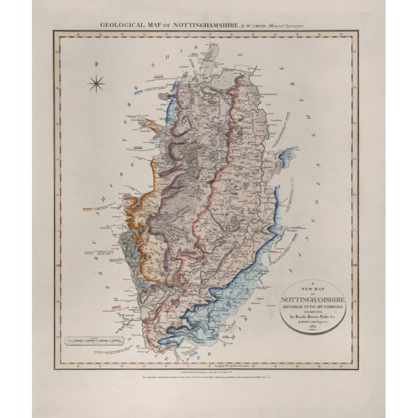
Geological Map of Nottinghamshire (William Smith, 1821)
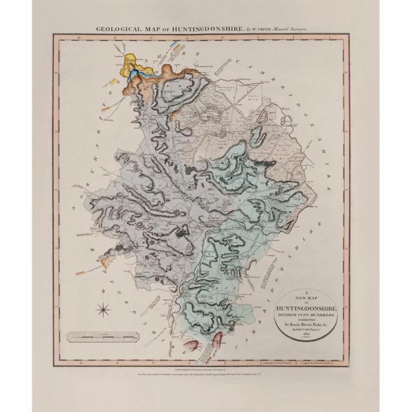
Geological Map of Huntingdonshire (William Smith, 1821)
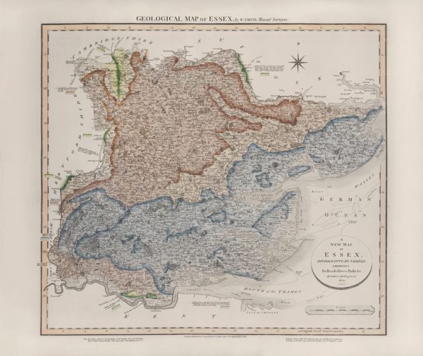
Geological Map of Essex (William Smith, 1820)
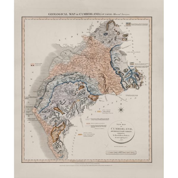
Geological Map of Cumberland (William Smith, 1824)
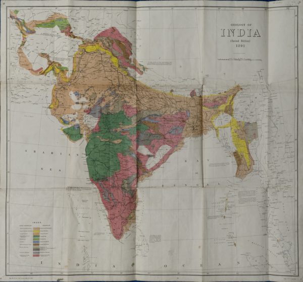
Geological Map of India (Geological Survey of India, 1891)
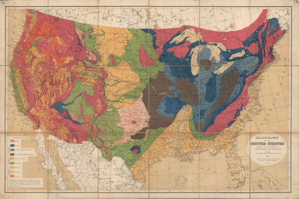
Geological map of the United States (Hitchcock and Blake, 1872)
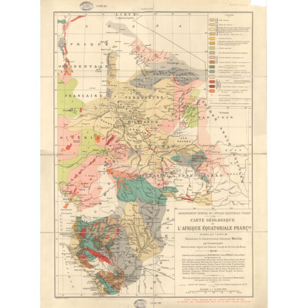
Carte géologique de l’Afrique Équatoriale Française (Loir, 1913)
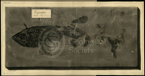
Eugnathus chirotes Agassiz
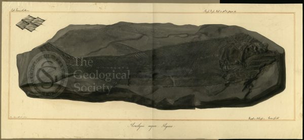
Acrolepis asper Agassiz
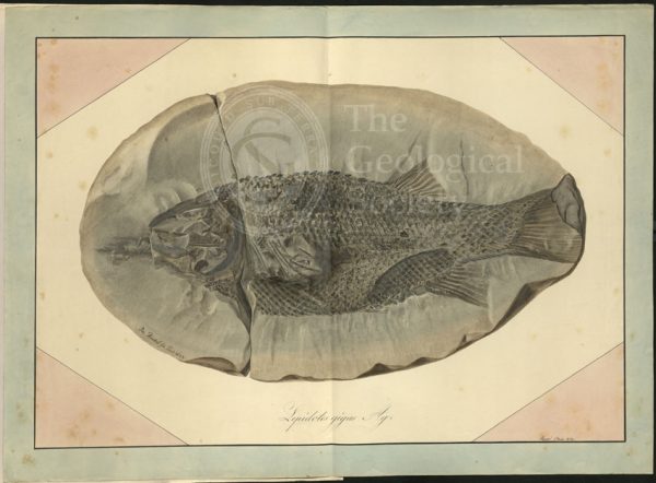
Lepidotus gigas Agassiz
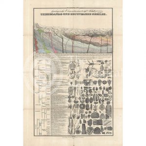
Geologische Elementarkarte, plate 3 (Klöpfel, 1838)
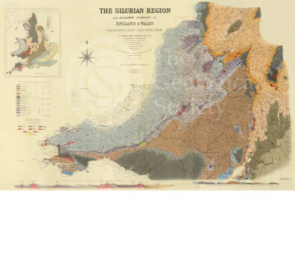
Map of the Silurian Region (Murchison, 1838)
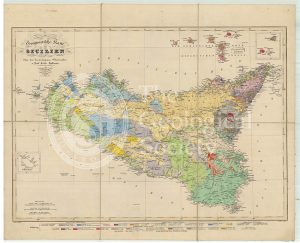
Geognostische Karte Sicilien (Hoffmann, 1839)
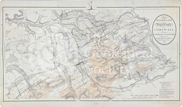
Geological map of the mining district of Cornwall… (Thomas, 1819)
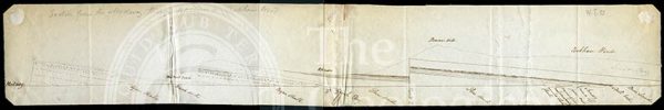
Section from the Medway through Upnor to Cockham Wood (Dadd, 1833)
A New Geological Map of England & Wales… [Smith reduction] (Smith & Cary, 1827)
Geological Map of England & Wales. Sheet 10 Isle of Wight (Murchison, 1856)
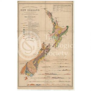
Map of New Zealand (James Hector, 1873)
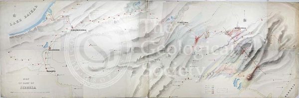
Geological Map of the country east of Lake Baikal, Siberia
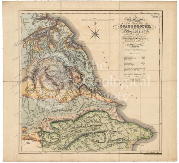
Geological map of Scarborough (Smith, 1831)
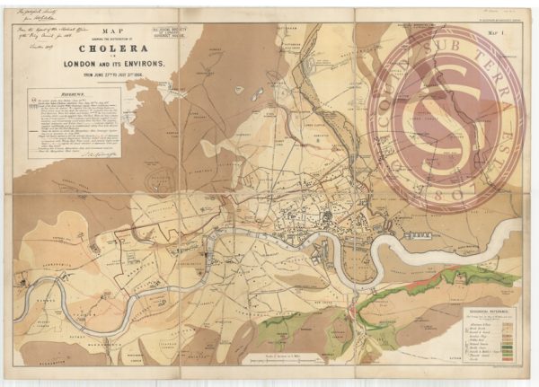
Map showing the distribution of cholera in London
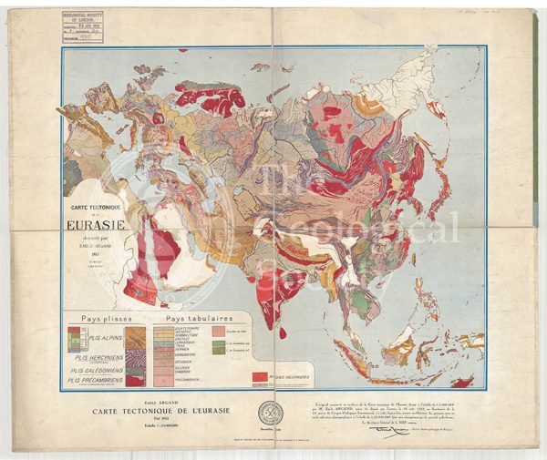
Carte tectonique de l’Eurasie (Argand, 1928)
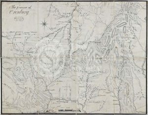
Map of the Province of Orenburg
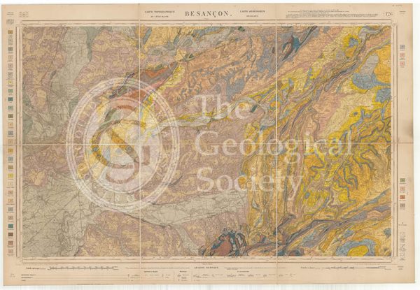
Carte géologique de la France 1:80,000. Feuille 126 Besançon (1892)
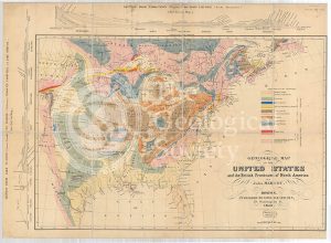
Geological Map of the United States and the British Provinces of North America (Marcou, 1853)
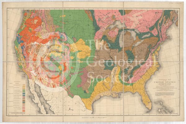
Geological map of the United States and part of Canada (Hitchcock, 1886)
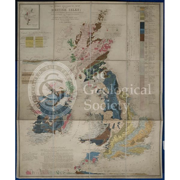
Geological map of the British Isles (Phillips, 1838)
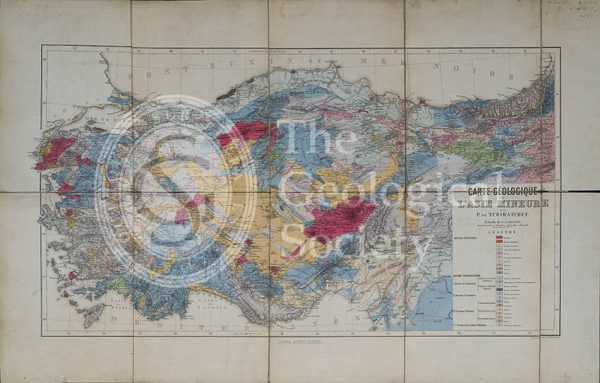
Carte géologique de l’Asia Mineure (Tchihatcheff, 1867)
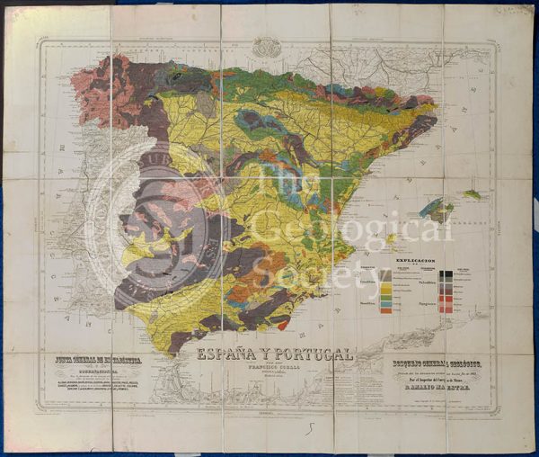
Mapa Geologico de España y Portugal (Coello, 1864)
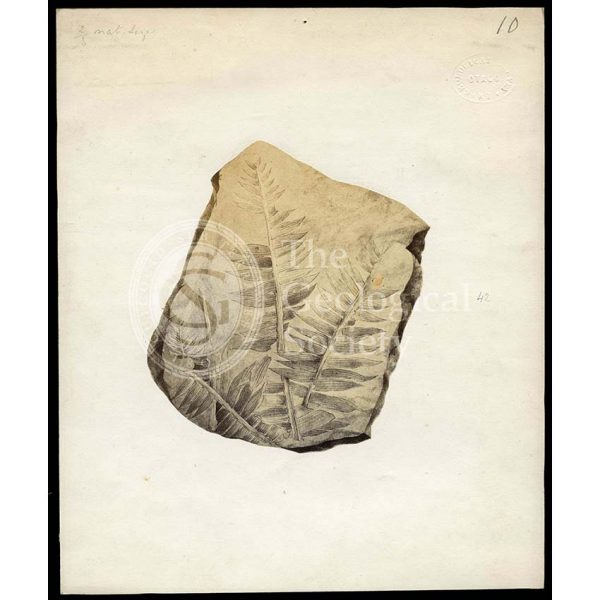
Fossil plant from Otago
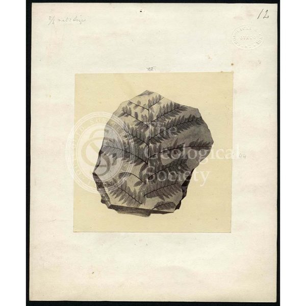
Fossil plant from Otago
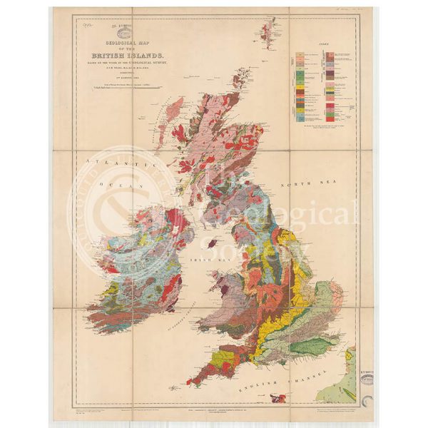
Geological Map of the British Isles (Teall, 1912)