
20×16
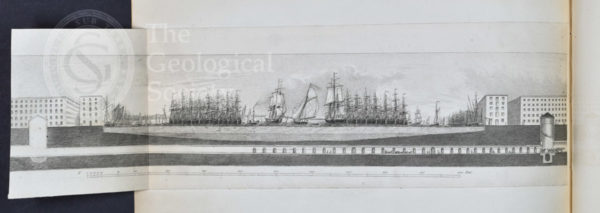
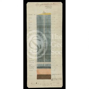
Cross section showing the progress of the Thames Tunnel under the Thames in 1838
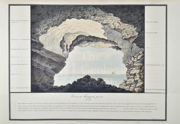
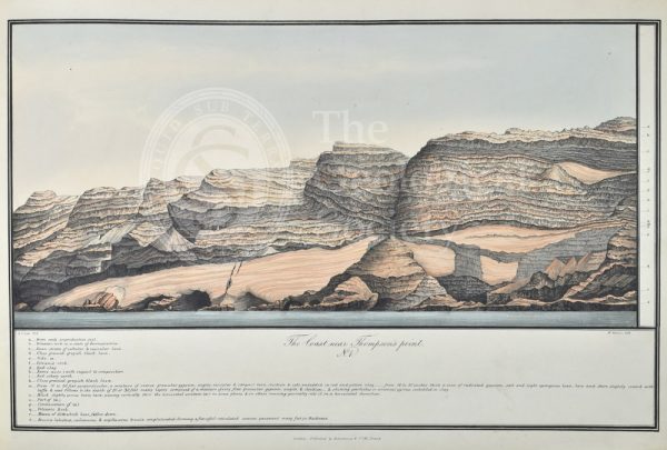
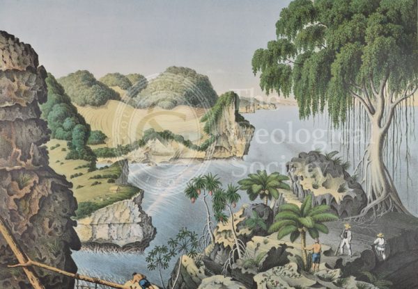
‘Cavern at Thompson’s Point’, St Helena
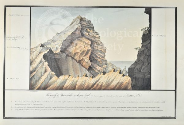
‘Flagstaff & Barnhills with Sugar-loaf in the distance…’, St Helena
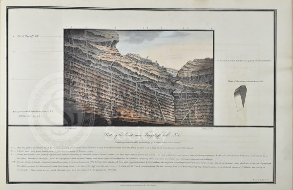
‘Part of the Coast near Flagstaff hill’, St Helena
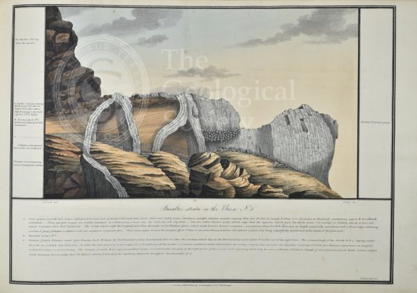
‘Basaltic strata in the Barn’, St Helena
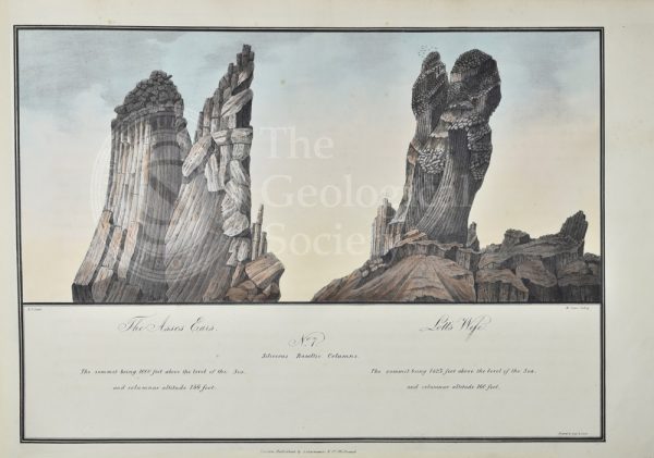
‘The Asses Ears’ & ‘Lott’s Wife’, St Helena
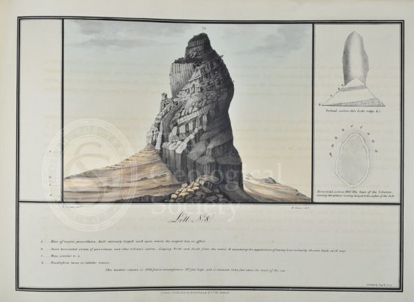
‘Lott’, St Helena
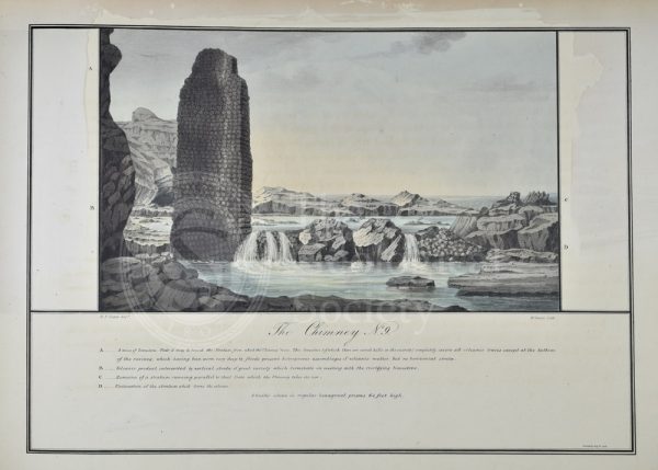
‘The Chimney’, St Helena
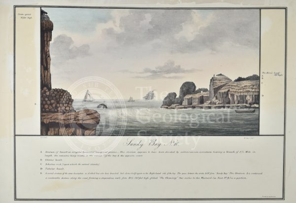
‘Sandy Bay’, St Helena
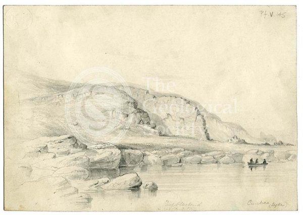
Coast near Thomson’s Point, St Helena
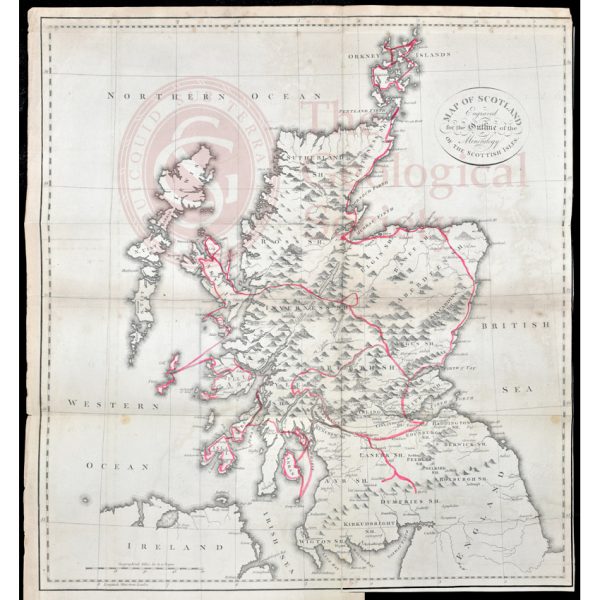
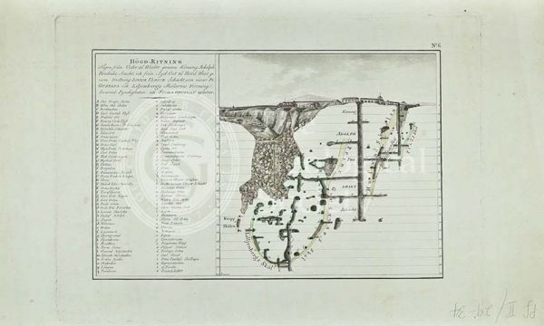
Jameson’s outline map of Scotland (1800)
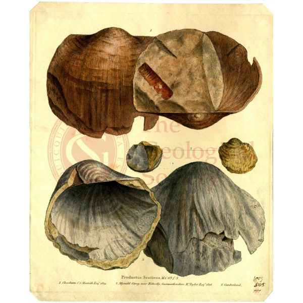
Productus scoticus
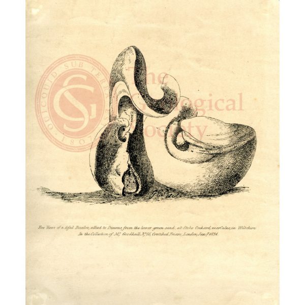
‘Two views of a fossil bivalve allied to Diceras…’
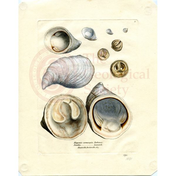
Hypponyx cornucopia & Patella, Hauteville, De Gerville
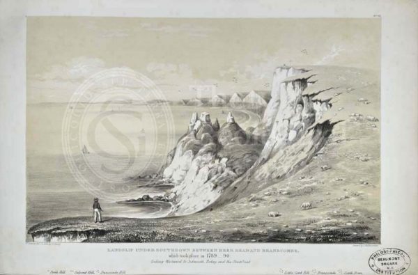
‘Landslip Under Southdown between Beer Head and Branscombe…’
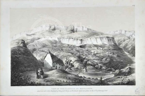
‘View of the Landslip from Whitlands…’
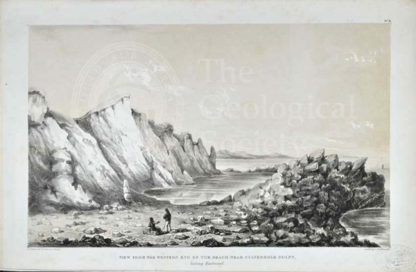
‘View from the Western End of the Beach near Culverhole Point…’
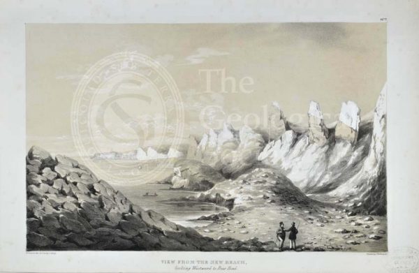
‘View from the New Beach looking Westward to Beer Head’
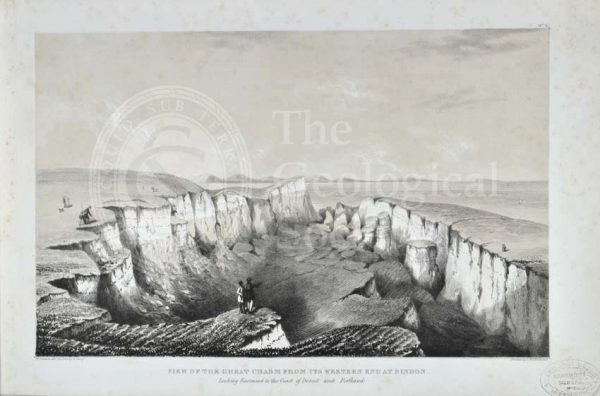
‘View of the Great Chasm from its Western end at Bindon…’
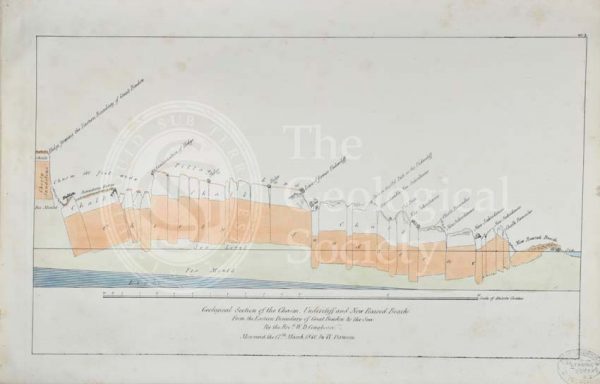
‘Geological section of the Chasm, Undercliff and New Raised Beach from the Eastern boundary of Great Bindon to the sea’
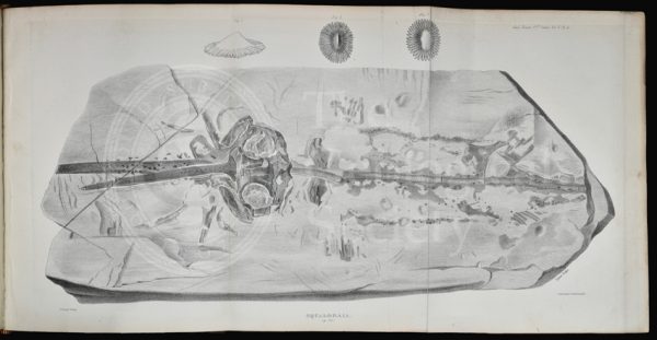
‘Squaloraia’ [lithograph]
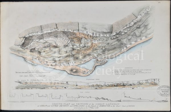
Ground plan and sections of the Great Landslip at Great and Little Bindon and Dowlands…
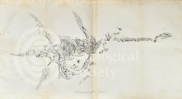
Plesiosaurus from Lyme Regis
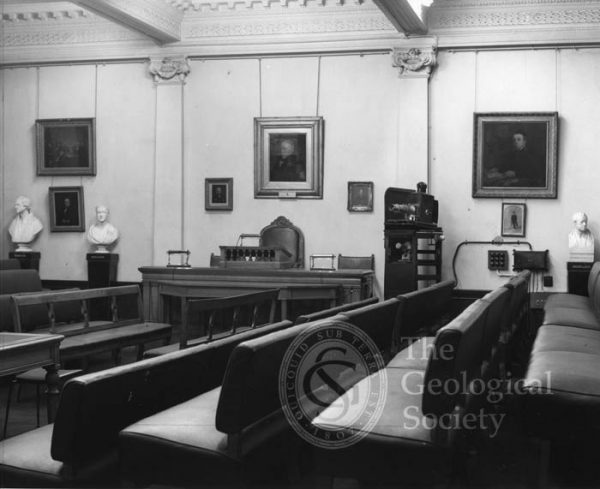
Meeting Room of the Geological Society, 1972
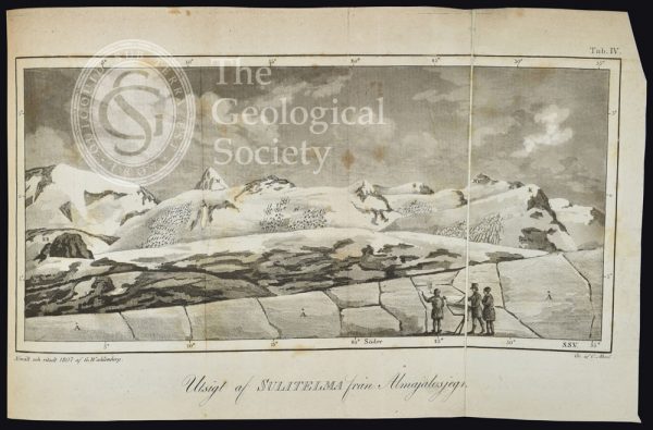
Utsigt af Sulitelma från Ålmajalosjegna’ (1807)
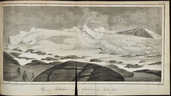
Utsigt af Sulitelma och dess glacierer från fjället Lairo (1807)
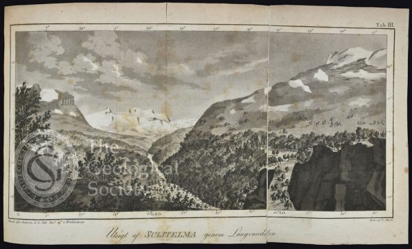
Ustigt af Sulitelma genom Langvandalen, Lapland (1807)
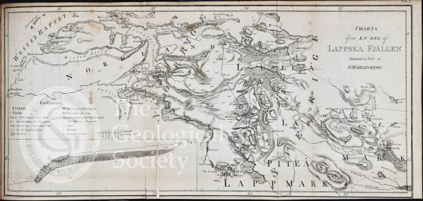
Charta õfver en del af Lappska Fjällen (1807)
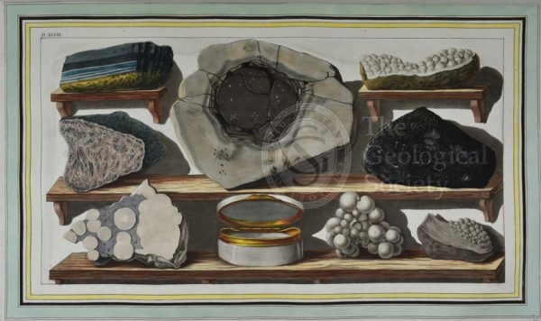
Plate XLVIII: Specimens of curious stones, found by the author on mount Vesuvius.
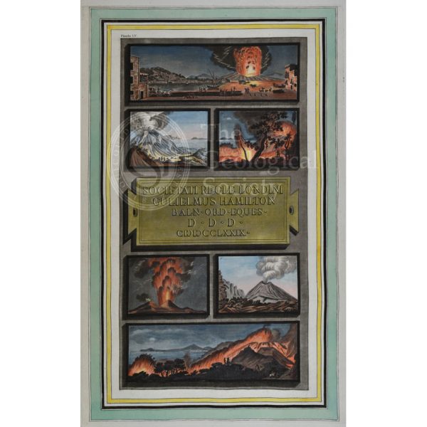
Plate LV: Views of the eruptions of Vesuvius in 1777 and 1779.
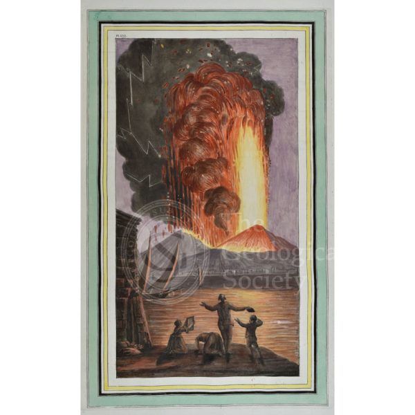
Plate LVI: View of the great eruption of mount Vesuvius, on Sunday night August the 8th 1779
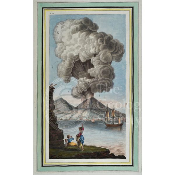
Plate LVII: View of the eruption of mount Vesuvius, Monday morning August the 9th 1779…
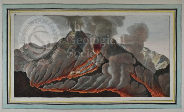
Plate X: Interiour [sic] view of the crater of mount Vesuvius…
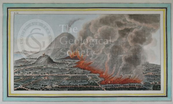
Plate XII: View of an eruption of mount Vesuvius which began on the 23rd of December 1760, and ended the 5th of January 1761
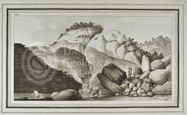
XXI: View of the hot spring called, the Pisciarelli…
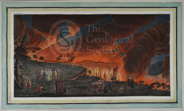
Plate XXXVIII: A night view of a current of lava that ran from mount Vesuvius towards Resina…
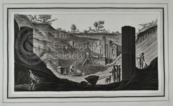
Plate XLI: View of the first discovery of the temple of Isis at Pompeii…
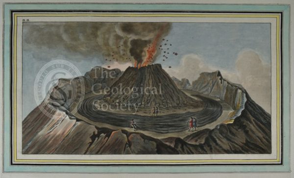
Plate IX: Interiour [sic] view of the crater of mount Vesuvius…
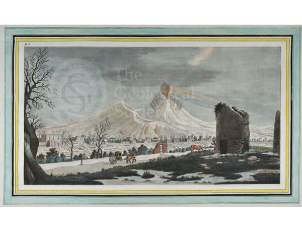
Plate V: View of an eruption of lava from the crater of mount Vesuvius…
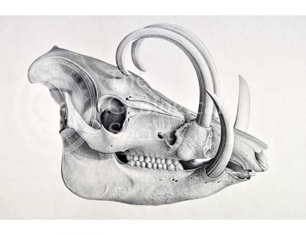
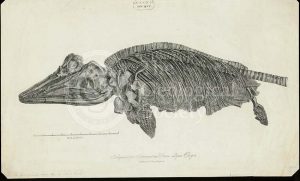
Skull of the recent pig, Babyrussa
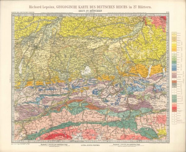
Geologisches Karte des Deutschen Reichs – 27. Munchen (Lepsius, 1897)
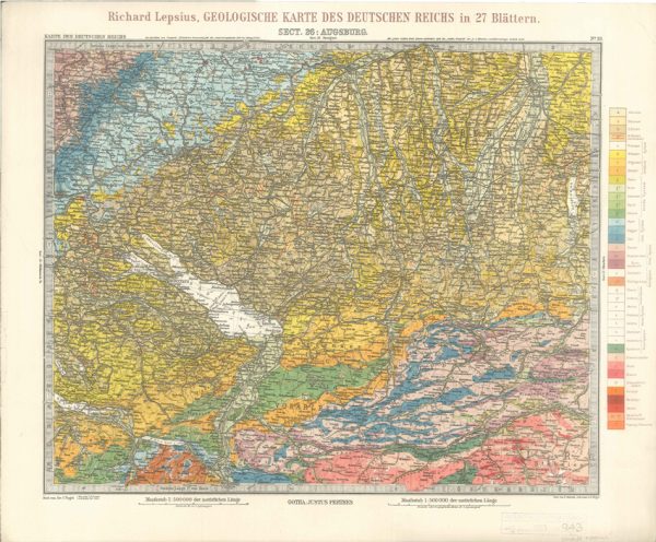
Geologisches Karte des Deutschen Reichs – 26. Augsburg (Lepsius, 1897)
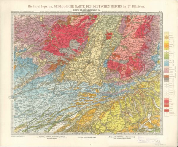
Geologisches Karte des Deutschen Reichs – 25. Mulhausen I-E (Lepsius, 1897)
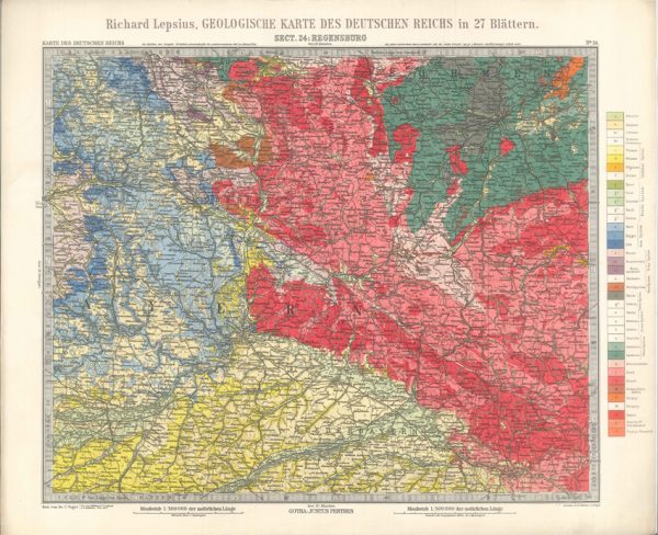
Geologisches Karte des Deutschen Reichs – 24. Regensburg (Lepsius, 1897)
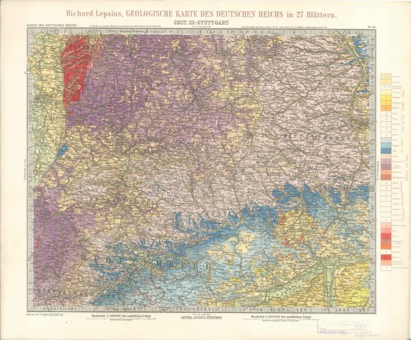
Geologisches Karte des Deutschen Reichs – 23. Stuttgart (Lepsius, 1897)
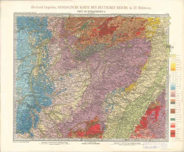
Geologisches Karte des Deutschen Reichs – 22. Strassburg I-E (Lepsius, 1897)
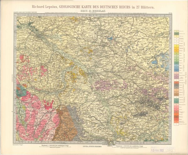
Geologisches Karte des Deutschen Reichs – 21. Breslau (Lepsius, 1897)
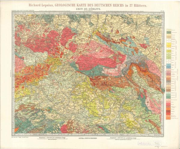
Geologisches Karte des Deutschen Reichs – 20. Gorlitz (Lepsius, 1897)
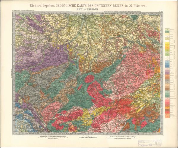
Geologisches Karte des Deutschen Reichs – 19. Dresden (Lepsius, 1897)
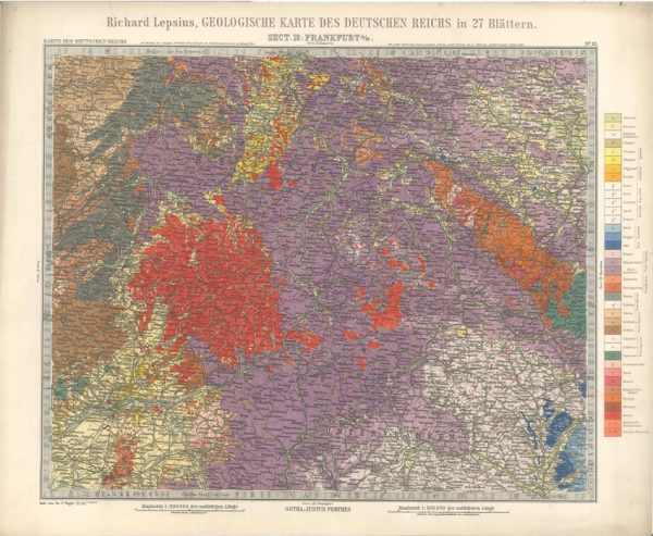
Geologisches Karte des Deutschen Reichs – 18. Frankfurt A-M (Lepsius, 1897)
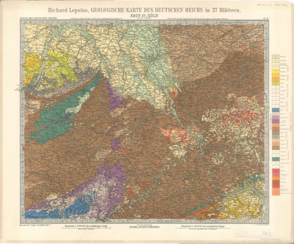
Geologisches Karte des Deutschen Reichs – 17. Koln (Lepsius, 1897)
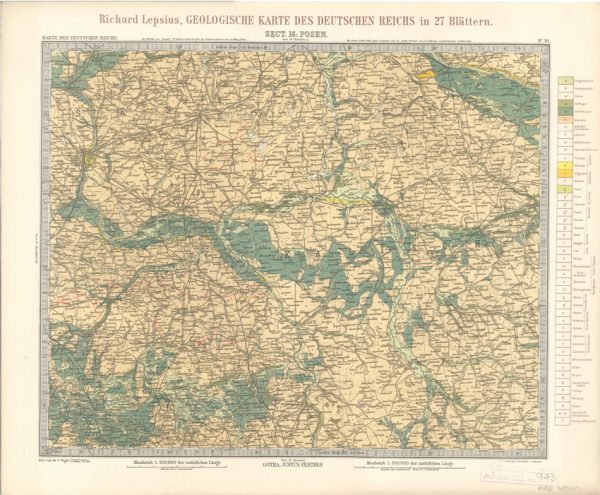
Geologisches Karte des Deutschen Reichs – 16. Posen (Lepsius, 1897)
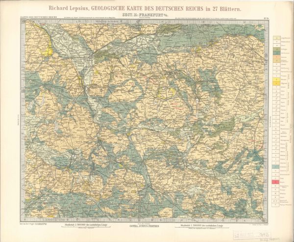
Geologisches Karte des Deutschen Reichs – 15. Frankfurt A-O (Lepsius, 1897)
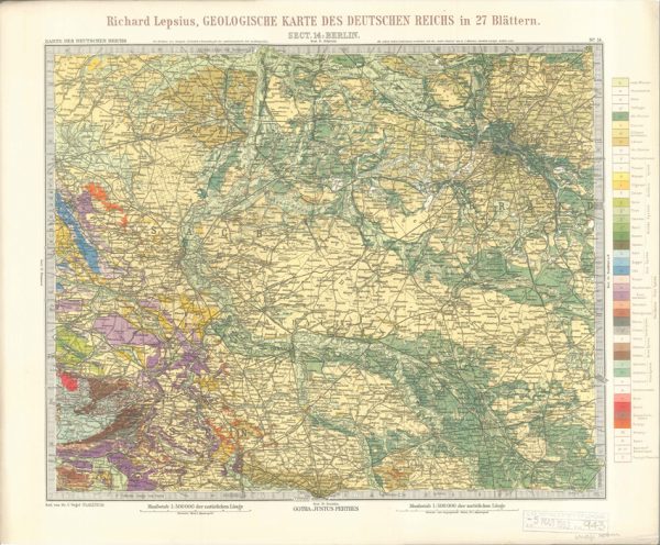
Geologisches Karte des Deutschen Reichs – 14. Berlin (Lepsius, 1897)
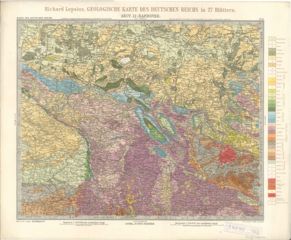
Geologisches Karte des Deutschen Reichs – 13. Hannover (Lepsius, 1897)
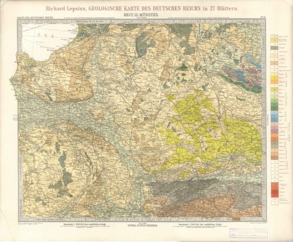
Geologisches Karte des Deutschen Reichs – 12. Munster (Lepsius, 1897)
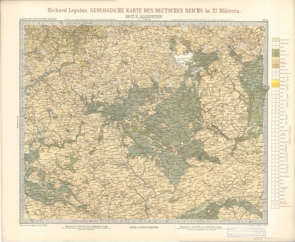
Geologisches Karte des Deutschen Reichs – 11. Allenstein (Lepsius, 1897)
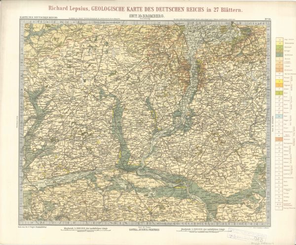
Geologisches Karte des Deutschen Reichs – 10. Bromberg (Lepsius, 1897)
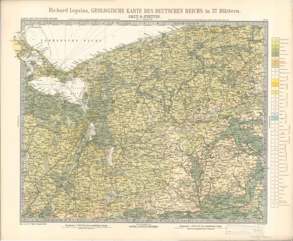
Geologisches Karte des Deutschen Reichs – 9. Stettin (Lepsius, 1897)
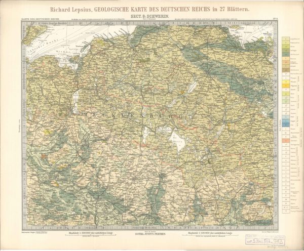
Geologisches Karte des Deutschen Reichs – 8. Schwerin (Lepsius, 1897)
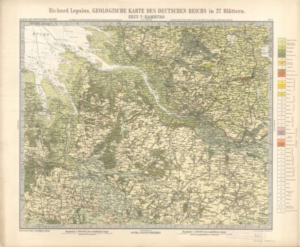
Geologisches Karte des Deutschen Reichs – 7. Hamburg (Lepsius, 1897)
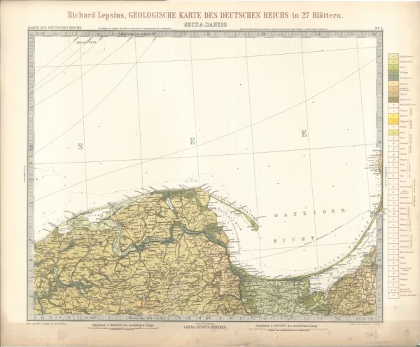
Geologisches Karte des Deutschen Reichs – 4. Danzig (Lepsius, 1897)
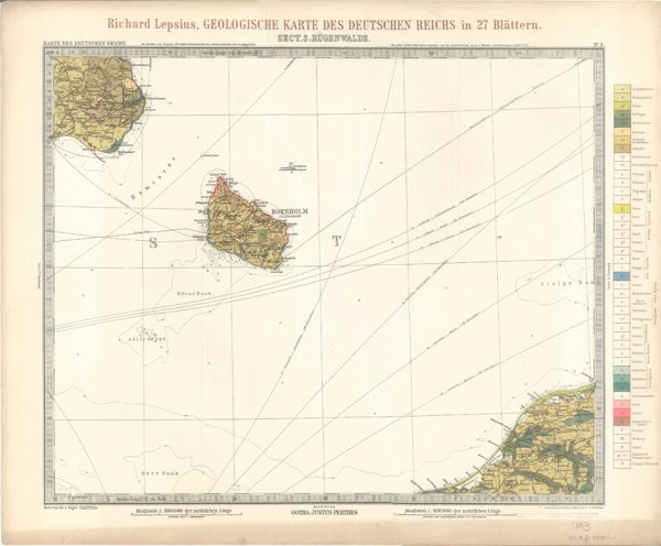
Geologisches Karte des Deutschen Reichs – 3. Rugenwalde (Lepsius, 1897)
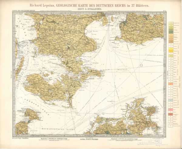
Geologisches Karte des Deutschen Reichs – 2. Stralsund (Lepsius, 1897)
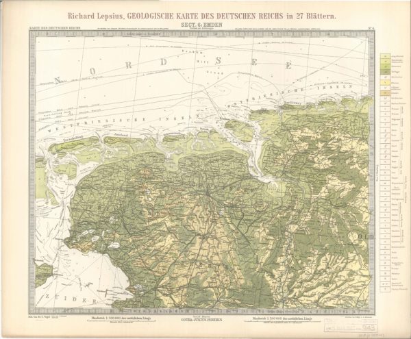
Geologisches Karte des Deutschen Reichs – 6. Emden (Lepsius, 1897)
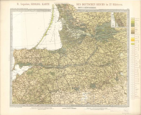
Geologisches Karte des Deutschen Reichs – 5. Konigsberg (Lepsius, 1897)
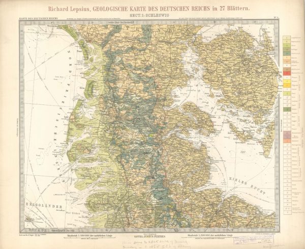
Geologisches Karte des Deutschen Reichs – 1. Schleswig (Lepsius, 1897)
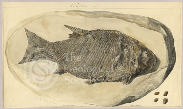
Lepidotus minor
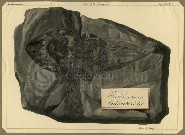
Pachycormus latirostris Agassiz
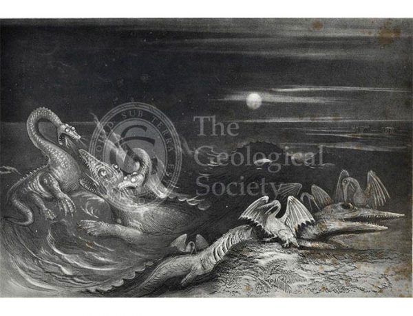
‘Great Sea Dragons’
Anniversary Dinner Menu, 1894
Sections of Glen Roy (MacCulloch, 1817)
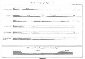
Curvilinear Sections from Glen Roy to the Sea (MacCulloch, 1817)
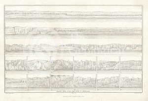
Selected parts of the East Coast of Trotternish (Stewart after MacCulloch, 1819)
Granite veins and gneiss at Cape Wrath… (Stewart after MacCulloch, 1819)
Imaginary plan and sections of Wernerian formations (Theonert, c.1810)
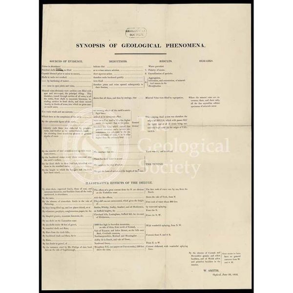
‘Synopsis of Geological Phenomena’
Dyke on Great Cumbra, Western Isles, Scotland
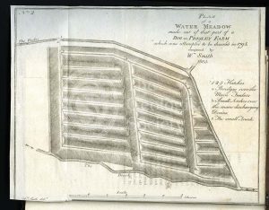
‘Plan of a Water-Meadow made out of part of a Bog…’
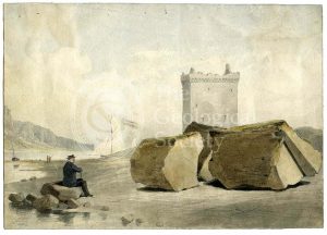
Split boulder on Little Cumbra, Western Isles
Section of the Bath Easton Coal Mine, Avon (Unknown, 1808?)
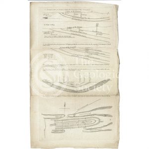
Sections and plan of the collieries around Nailsea (Martin and Smith, 1811)
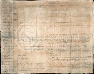
Table of Strata in the Vicinity of Bath (Smith & Richardson, 1799)
Reproduction of William Smith’s Table of Strata… (Judd after Smith & Richardson, 1897)
Geological Map of Bath (Smith, 1799)
Roderick Murchison’s travel permit for Russia
Roderick Murchison’s Russian ‘passport’
View of the Rhenosterberg mountains, South Africa
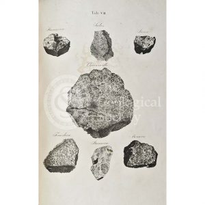
Meteorites (ordinary chondrite)
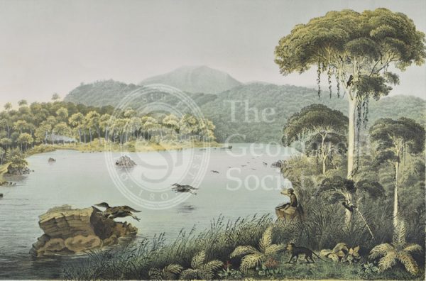
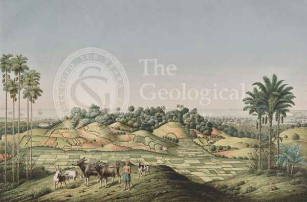
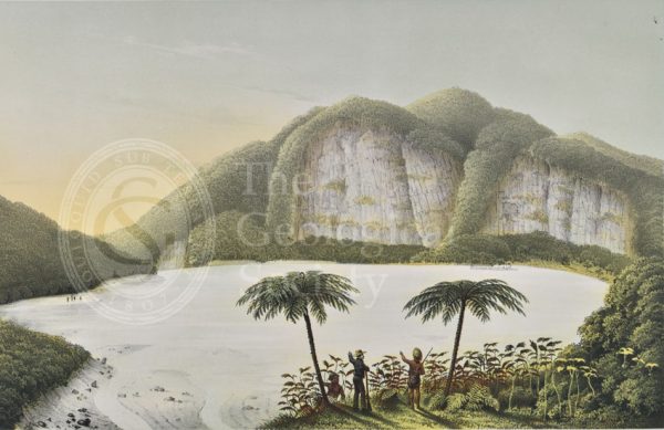
Lake Patengan, Java
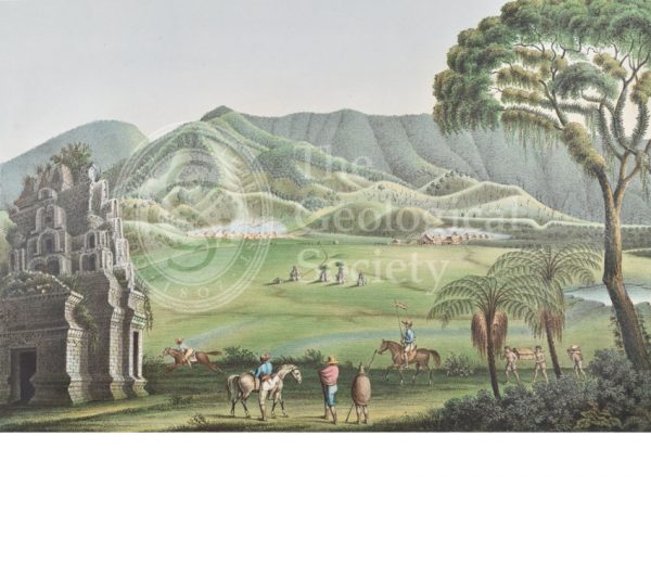
Dieng Plateau, Java
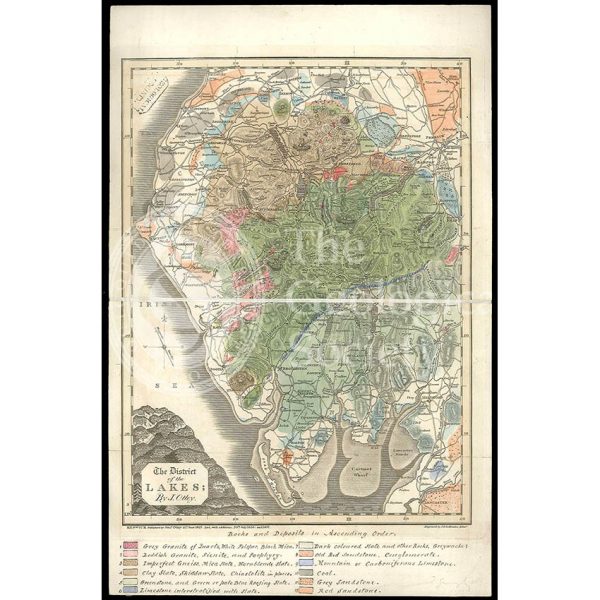
District of the Lakes (Otley, 1837)
North coast of Java, Indonesia
South coast of Java, Indonesia

The Gigantic Greenland Whale
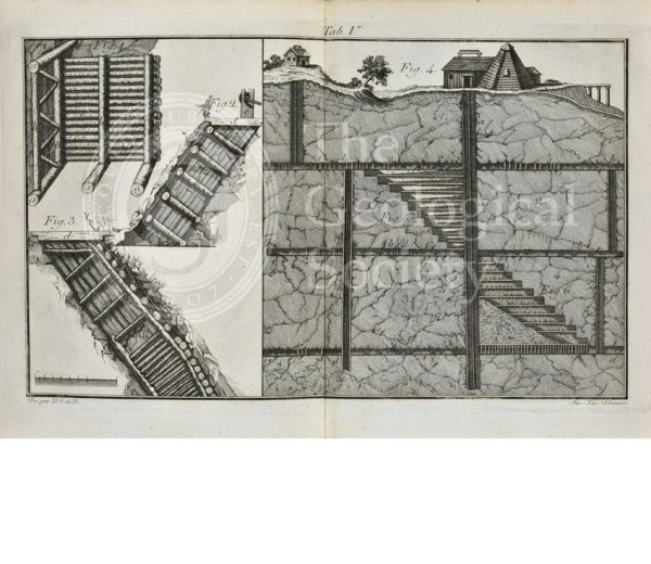
Timber supports for mining
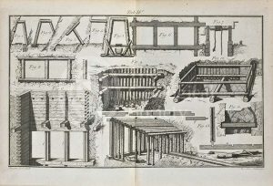
Timber supports for mining
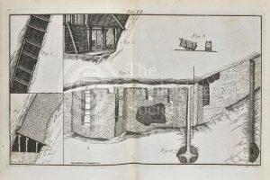
Timber supports for mining
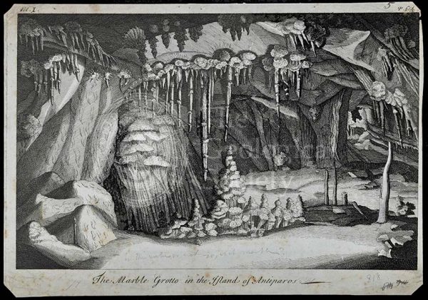
Marble Grotto in the Island of Antiparos
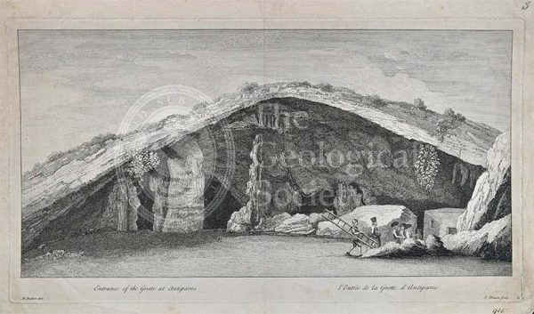
Entrance to the Grotto of Antiparos
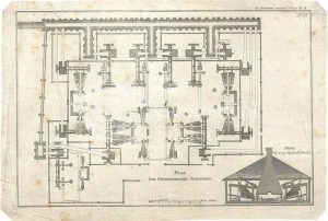
Plan of the Pyschminskischen Steel Factory
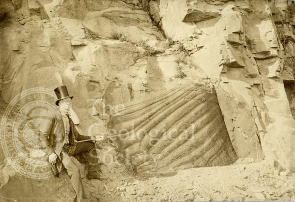
Peculiar appearance of a rock surface
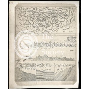
Section of Stora Grufna coppermine, Sweden
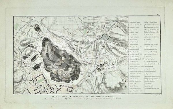
Plan of Stora Grufna coppermine, Sweden
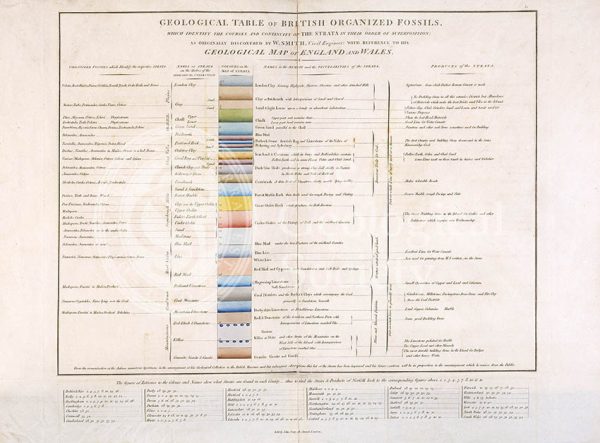
Geological Table of British Organized Fossils

Section of an artesian well
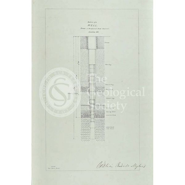
Section of a well sunk at Hampstead Road Reservoir
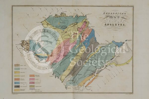
Geological map of Anglesea (Henslow, 1822)
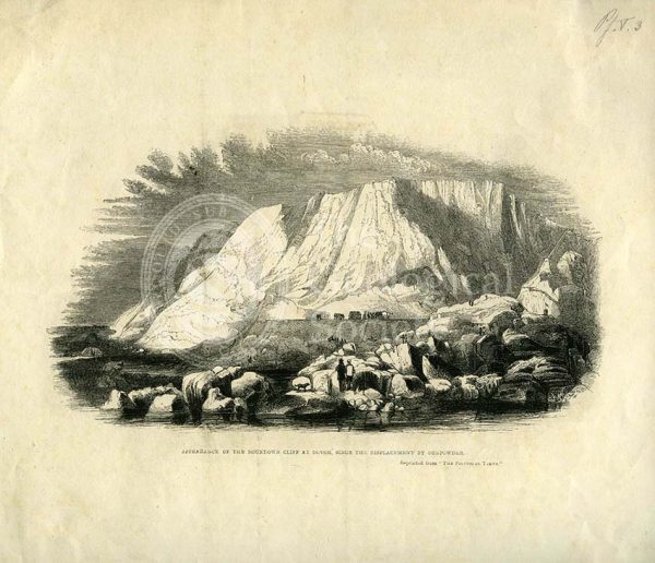
‘Appearance of the Roundown Cliff at Dovor (sic) since the displacement by gunpowder’
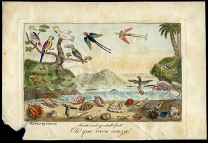
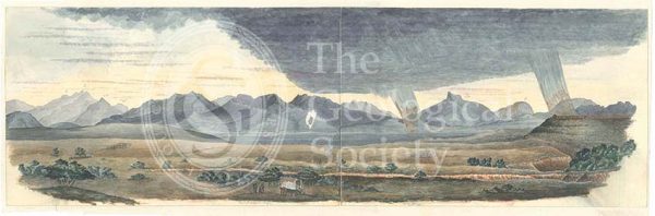
‘Oh! que rara couza!…’

Sir Charles Lyell (1797-1875)

‘Highbury Grove in 1846’
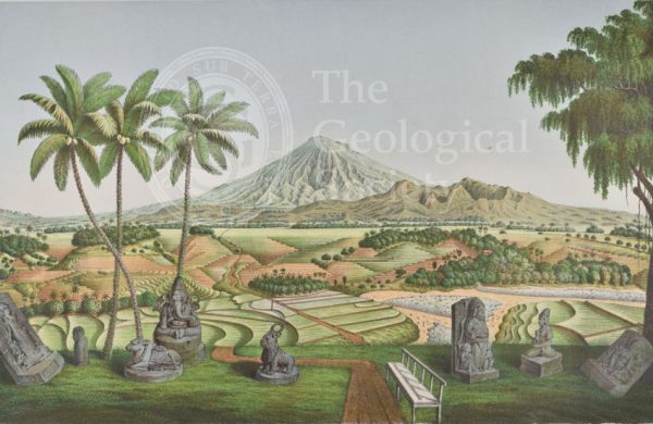
Mount Sumbing, Java
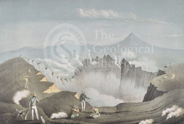
Mount Guntur, Java
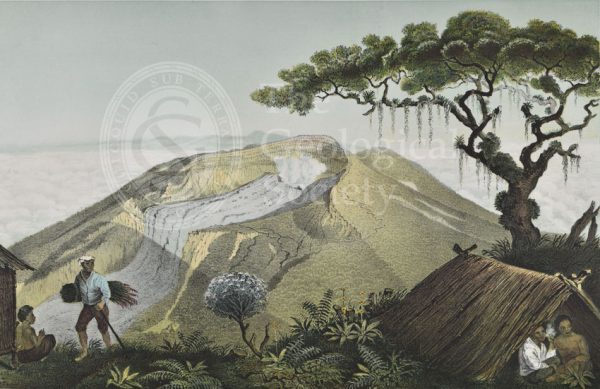
Mount Gede, Java
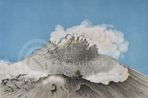
Mount Merapi, Java
Kawah Putih, Java
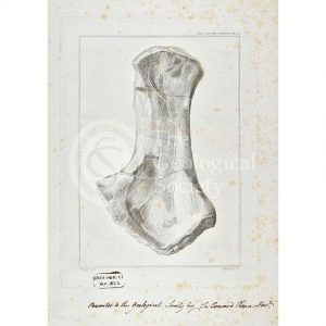
Ichthyosaur limb bone
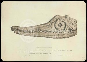
Head of an ichthyosaur
Plesiosaurus macrocephalus (original artwork)
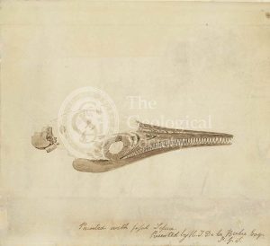
Ichthyosaur skull in fossil sepia
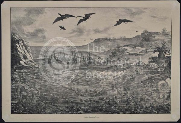
‘Jura Formation’
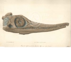
Skull of an Ichthyosaur
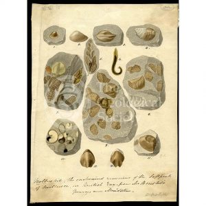
Molluskite (fossilised molluscs)
Plesiosaurus macrocephalus (lithograph)
Polypothecia agariciformis
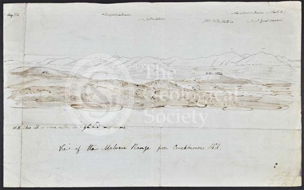
Malvern Range from Crookbarrow Hill
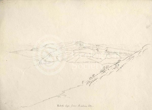
Wenlock Edge
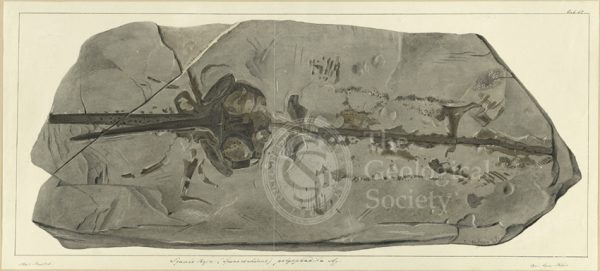
Squalo-raja (Spinacorhinus) polyspondila Agassiz
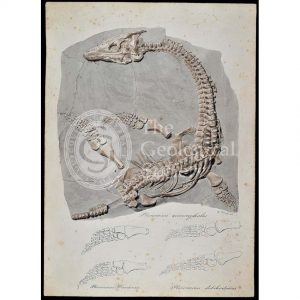
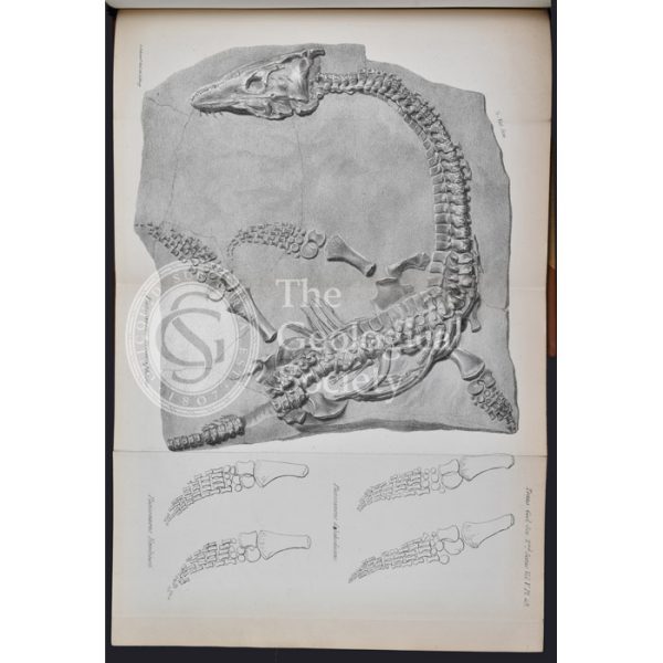
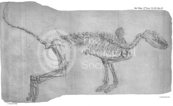
Ichthyosaurus Intermedius from Lyme Regis
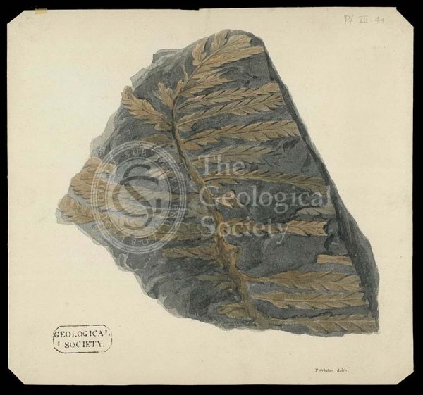
Fossil fern from the Alps
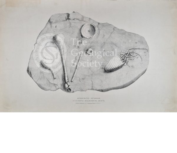
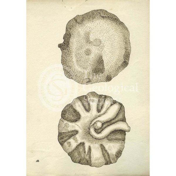
Apiocrinites rotundus
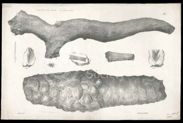
Fossil horsetail from Bristol
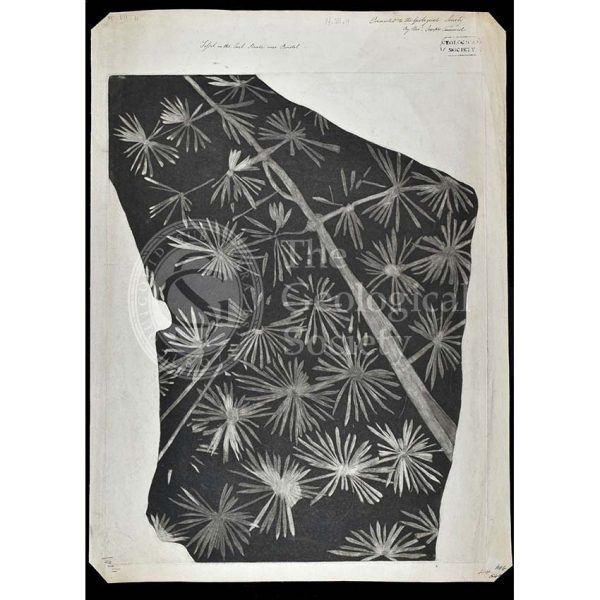
Clathraria lyelli
Fossil fox from Oeningen
Geological cross section of Otago, New Zealand (Hector, 1862-1864)
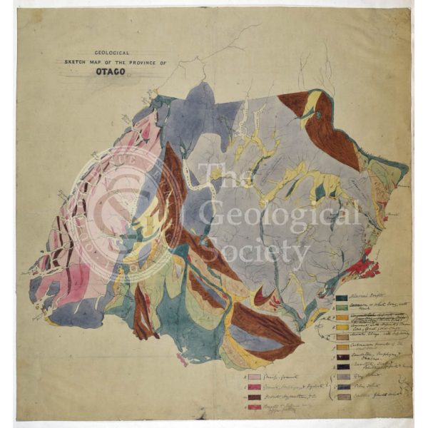
Map of Otago, New Zealand (Hector, 1862-1864)
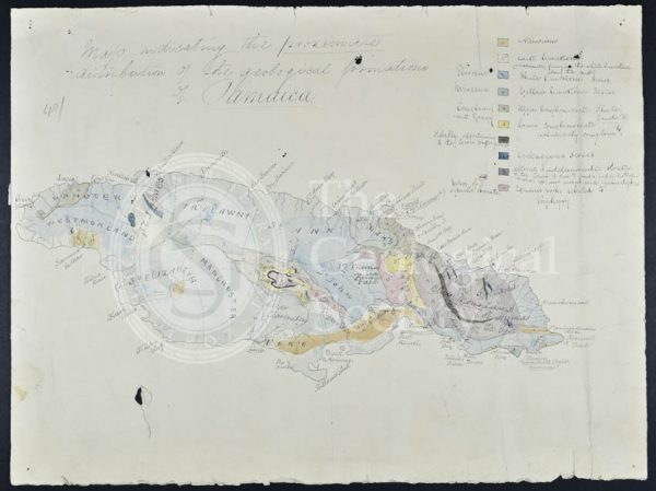
Map of Jamaica (Wall, 1864)
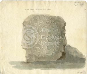
Madrepore from the white chalk, Hunstanton Cliff
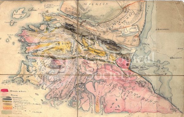
Geological Map of Connemara, Ireland (Nimmo, c.1813)