
16×12
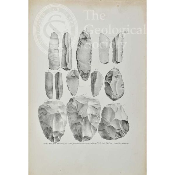
Knives, arrow heads and hatchets of flint and chert found in Kent’s Cavern
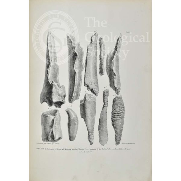
Bones bearing marks of having been gnawed by hyaenas, from Kent’s Cavern
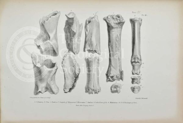
Bones of rhinoceros and horse found in Kent’s Cavern
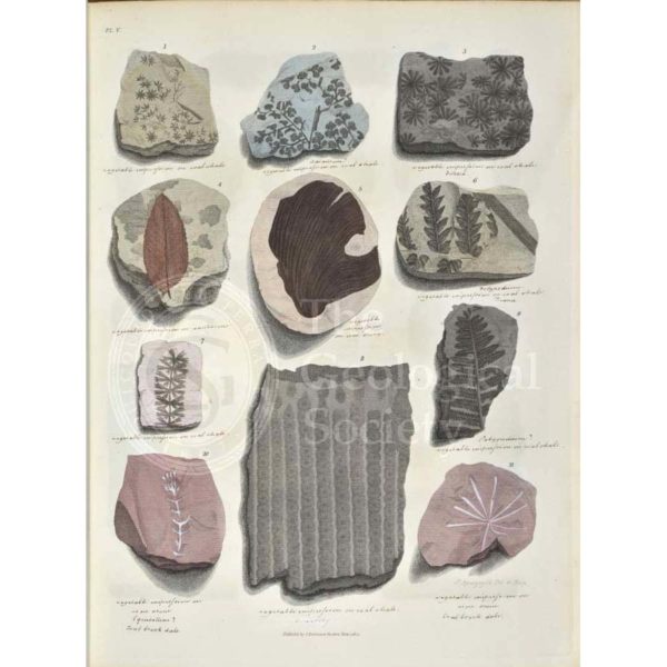
Remains of fossil plants
Remains of fossil plants
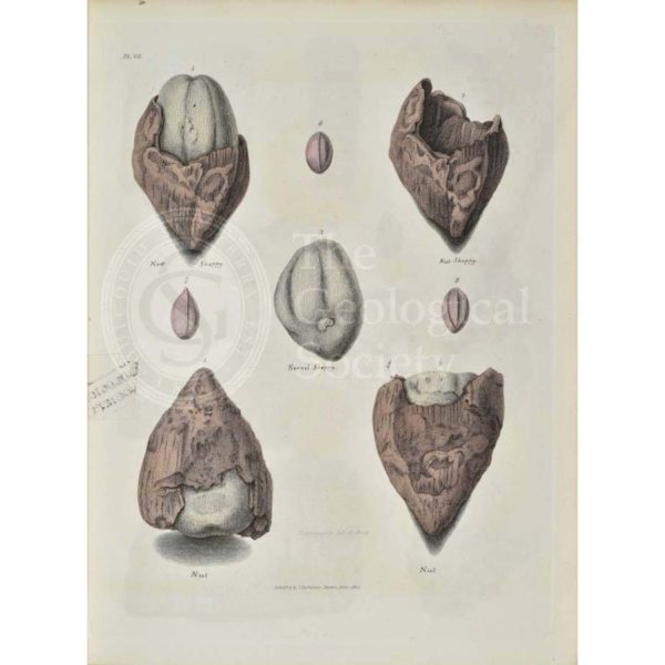
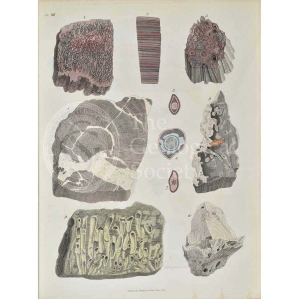
Remains of fossil plants, mostly nuts from the Isle of Sheppey
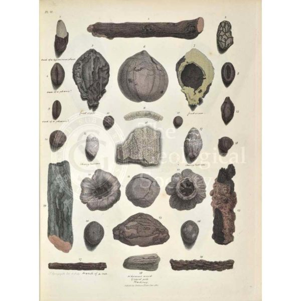
Remains of fossil plants, including twigs and nuts
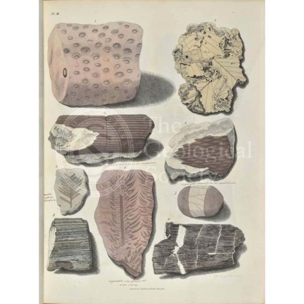
Remains of fossil plants, mostly leaves
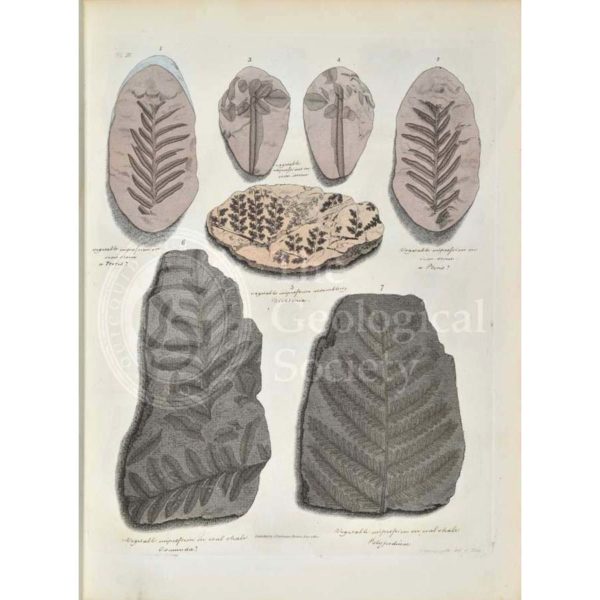
Remains of fossil plants, mostly ferns
Remains of fossil plants
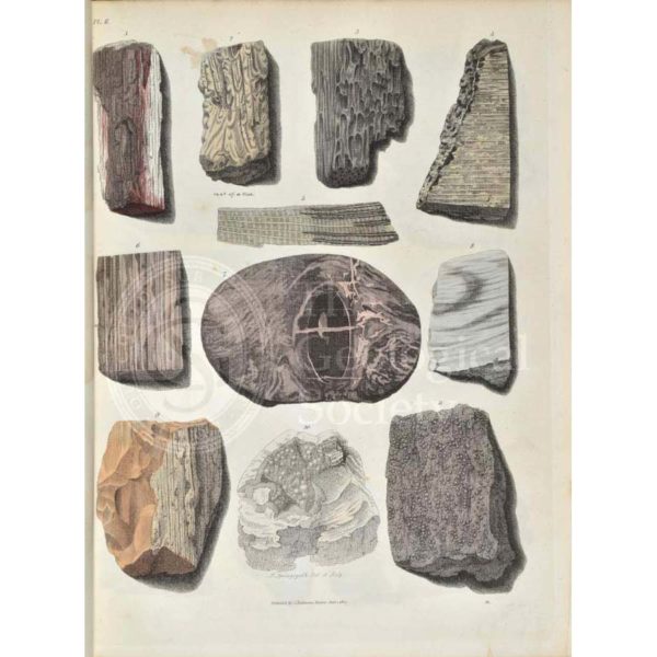
Remains of fossil plants, mostly trees
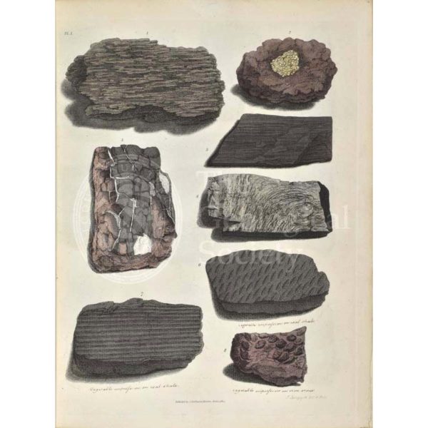
Remains of fossil plants, including fossil wood and bark
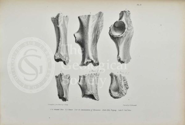
Gnawed bones of Rhinoceros found in Kent’s Cavern
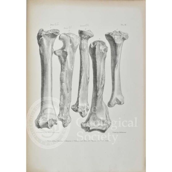
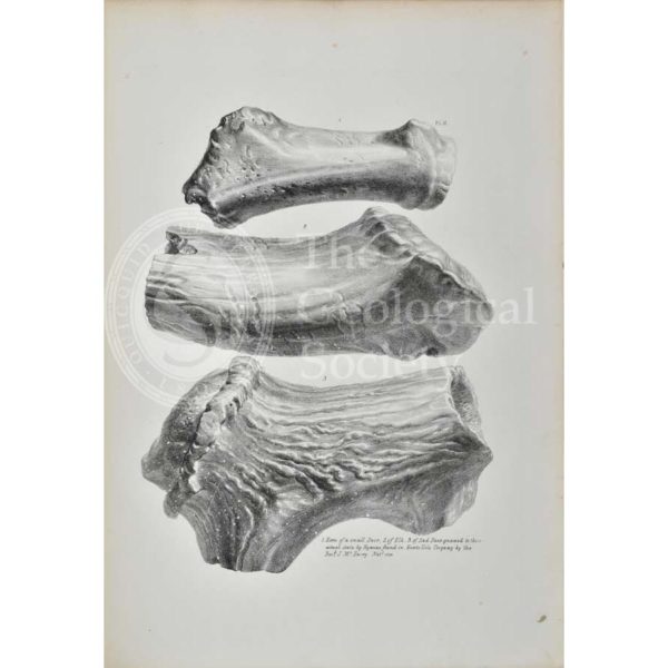
Femur, ulna, radius, humerus and tibia of Bear found in Kent’s Cavern
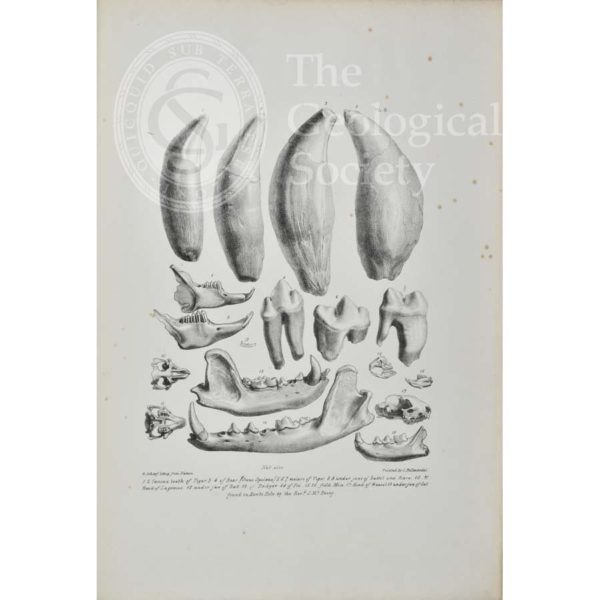
Teeth and jaws of young elephants, rhinoceros, deer, bear and hyaenas found in Kent’s Cavern
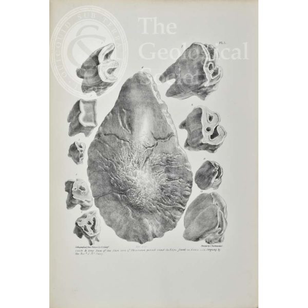
Teeth & bony base of the nose of Rhinoceros from Kent’s Cavern
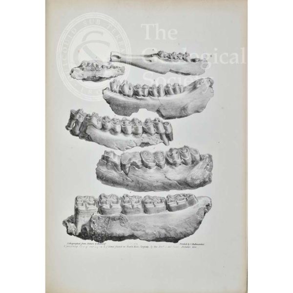
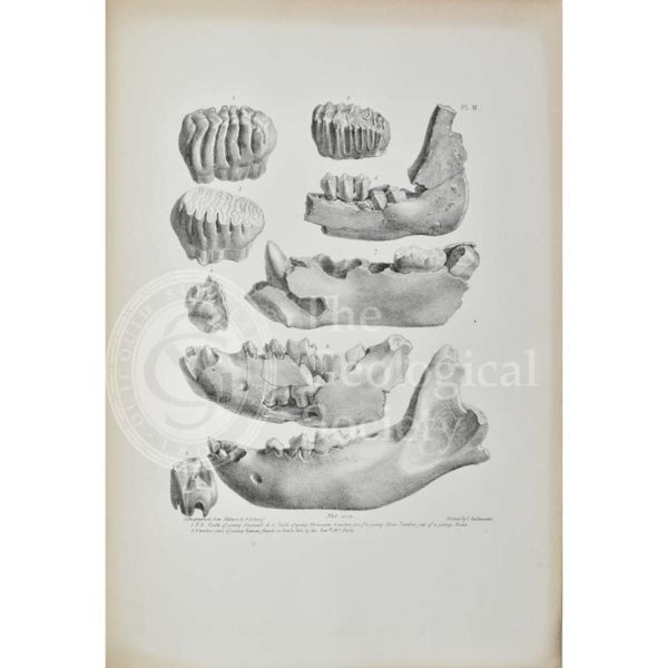
Jaws of a hog, deer, fox and horse found in Kent’s Cavern
Horns of a small deer, elk and red deer from Kent’s Cavern
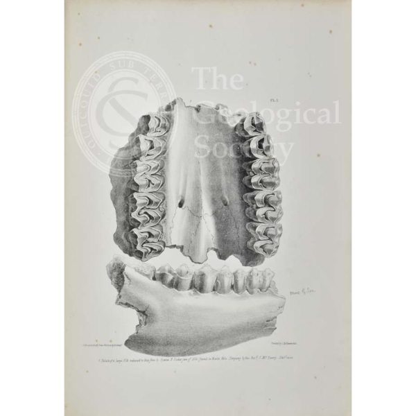
Palate of an elk, partially eaten by a hyaena, from Kent’s Cavern
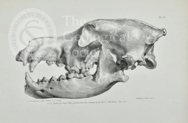
Head of a large wolf found in Kent’s Cavern, Torquay
Teeth of tigers and bears, with jaws from a rabbit, hare, bat, badger, fox, field mice, weasel and cat from Kent’s Cavern
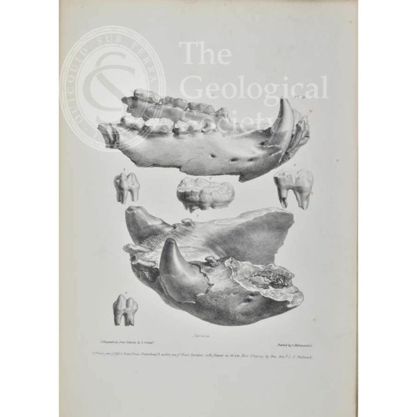
Jaws of bears found in Kent’s Cavern
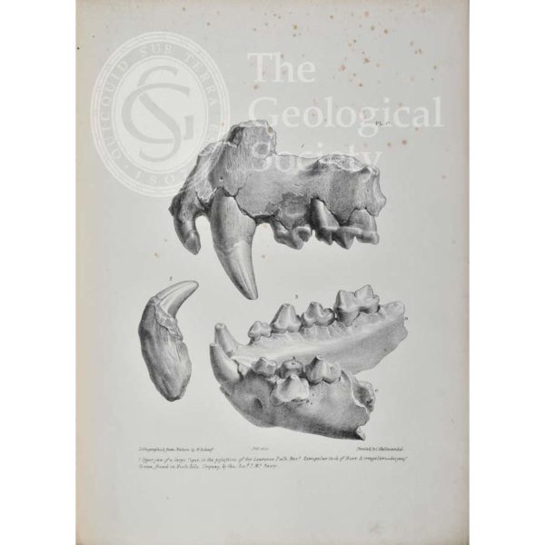
Jaws and teeth of a tiger, bear and hyaena from Kent’s Cavern
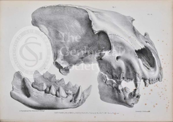
Skull of a hyaena from Kent’s Cavern
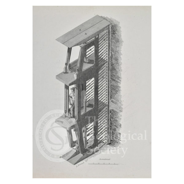
Isometrical view of Marc Brunel’s patent shield
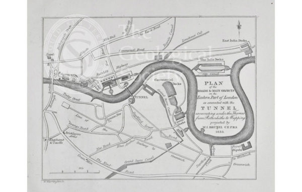
Plan of the roads & main objects on the Eastern Part of London as connected with the [Thames] Tunnel, 1835

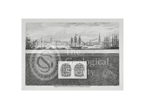
View of the Western Archway of the Thames Tunnel
Section showing the construction of the Thames Tunnel in progress
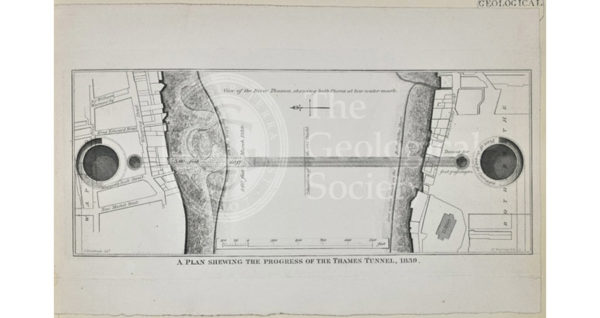
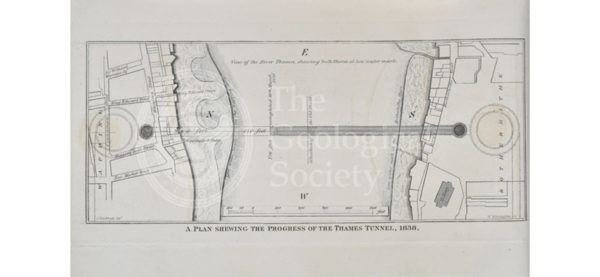
Plan shewing the progress of the Thames Tunnel, 1839
Plan shewing the progress of the Thames Tunnel, 1836
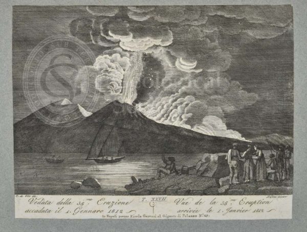
View of the 35th eruption of Mount Vesuvius, 1 January 1812
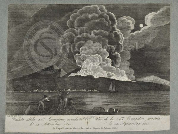
View of the 34th eruption of Mount Vesuvius, 13th September 1810
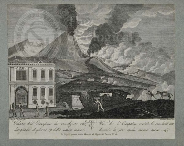
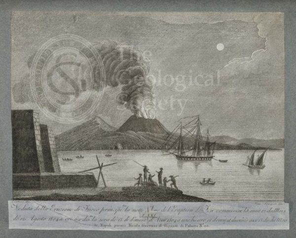
View of the eruption of Mount Vesuvius, 12 August 1805
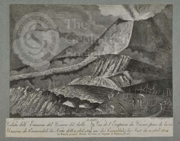
View of the eruption of Vesuvius on the night of 11 September 1804
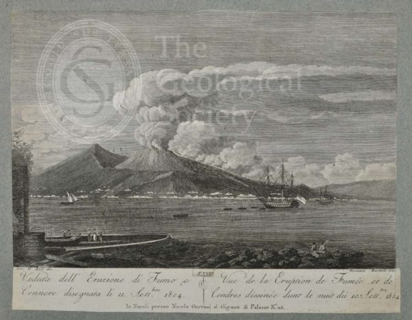
View of the eruption of smoke and ash from Mount Vesuvius, 11 September 1804
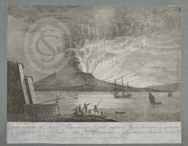
Great eruption of fire and lava from Mount Vesuvius, 9 September 1804
View of the eruption of Vesuvius which began in the night of 12 August 1804
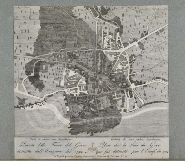
Plan of the Torre del Greco destroyed by the eruption of 1794
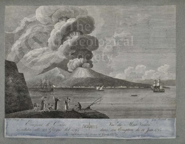
Eruption of ash from Mount Vesuvius, 19 June 1794
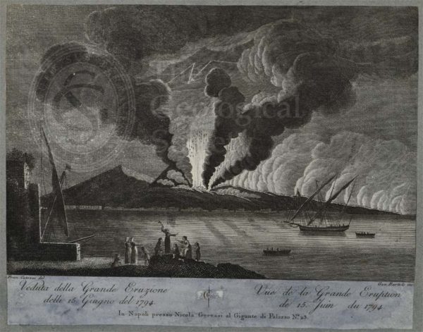
View of great eruption of Mount Vesuvius, 15 June 1794
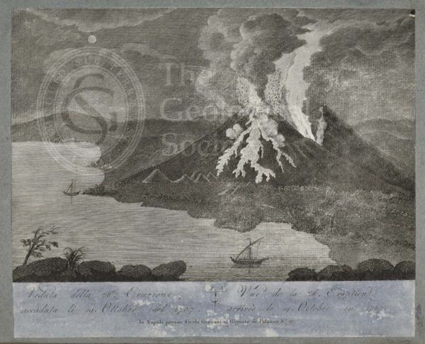
View of 28th eruption of Mount Vesuvius, 19 October 1767
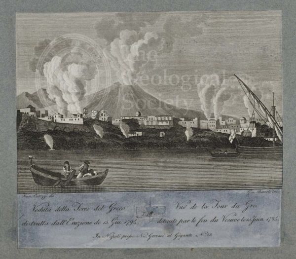
View of Torre del Greco destroyed by the eruption of 15 June 1794
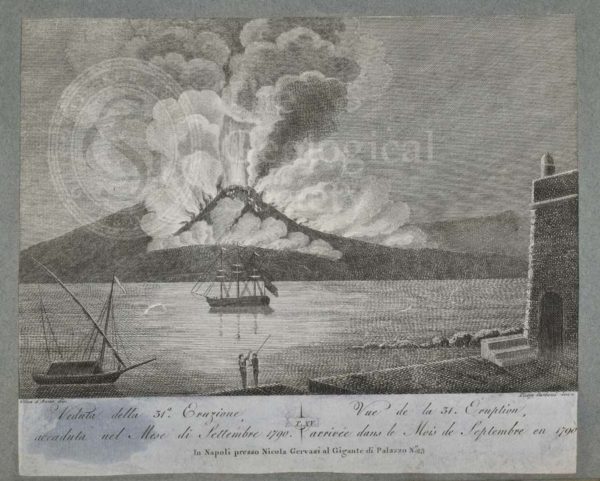
View of 31st eruption of Mount Vesuvius, September 1790
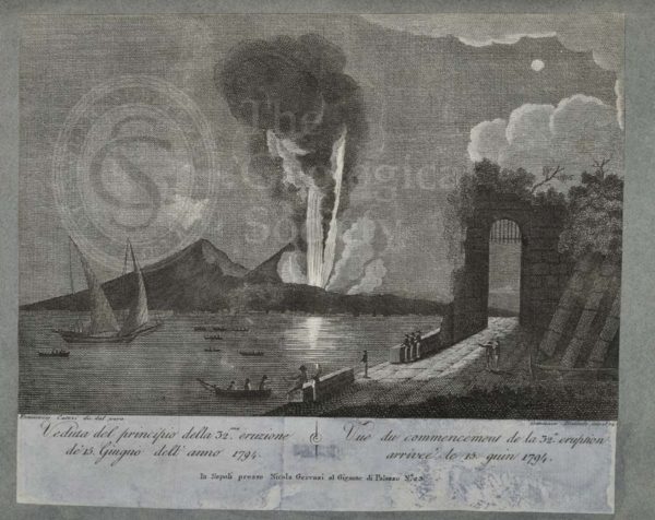
View of beginning of the 32nd eruption of Mount Vesuvius, 15 June 1794
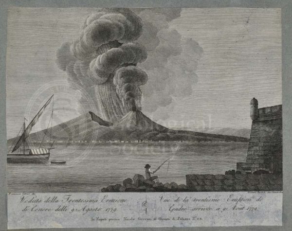
View of 30th eruption of ash of Mount Vesuvius, 9 August 1779
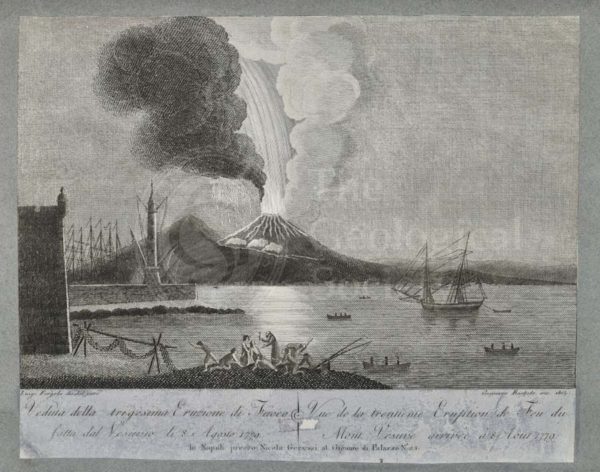
View of the 30th eruption of Mount Vesuvius, 8 August 1779
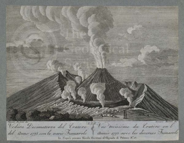
View of the crater of Mount Vesuvius, 1775
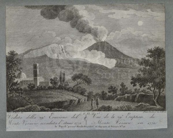
View of the 29th eruption of Mount Vesuvius, 1771
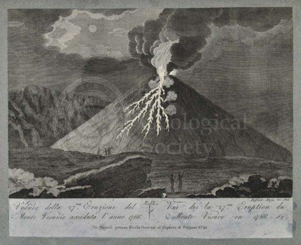
View of the 27th eruption of Mount Vesuvius, 1766
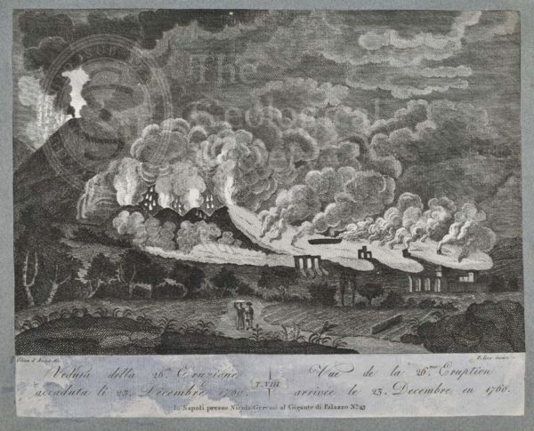
View of the 26th eruption of Mount Vesuvius, 23 December 1760
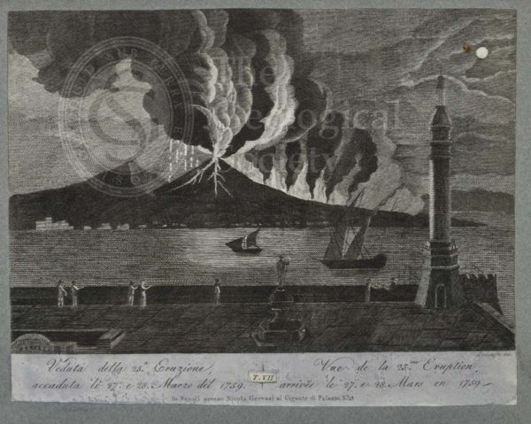
View of the 25th eruption of Mount Vesuvius, 27 and 28 March 1759
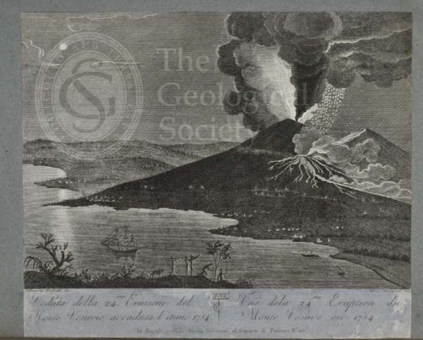
View of the 24th eruption of Mount Vesuvius, 1754
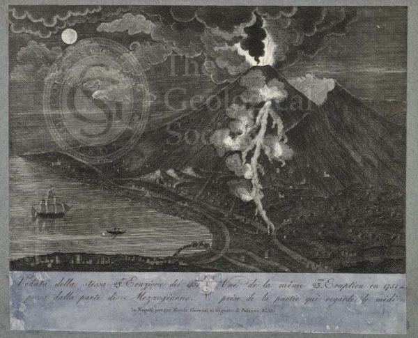
View of the 23rd eruption of Mount Vesuvius, 1751, taken from the south side
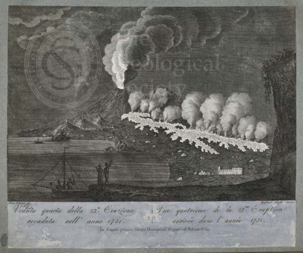
View of the 23rd eruption of Mount Vesuvius, 1751
View of the 22nd eruption of Mount Vesuvius, 1737
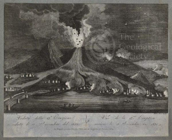
View of the 13th eruption of Mount Vesuvius, 16 December 1631
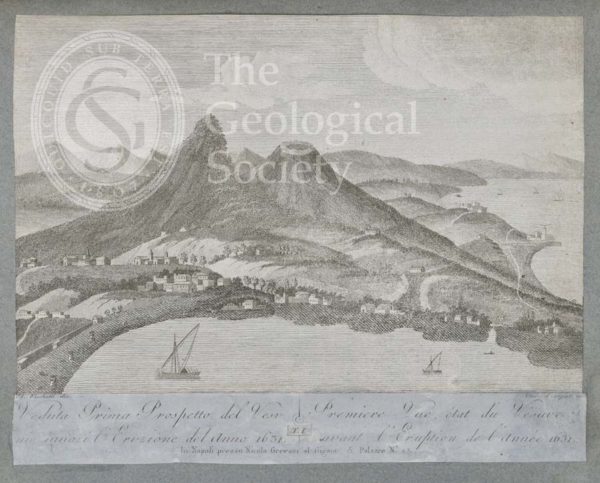
View of Mount Vesuvius before the eruption of 1631
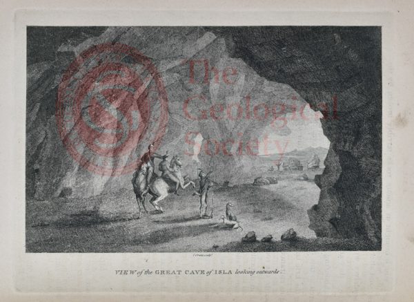
View of the Great Cave of Isla looking outwards
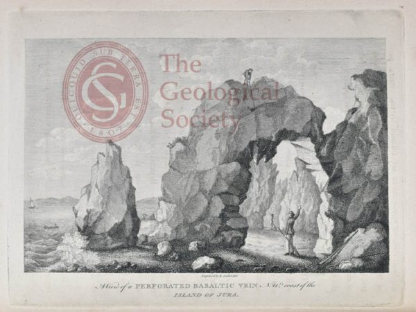
View of a perforated Basaltic Vein N W Coast of Jura
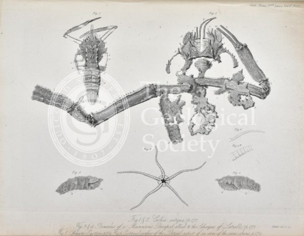
Coleia Antiqua
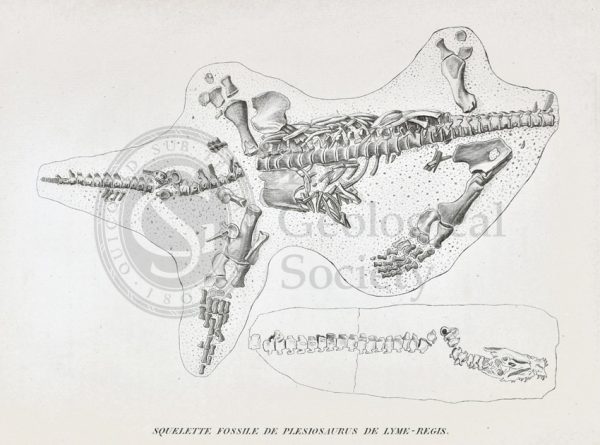
Skeleton of a Plesiosaur from Lyme Regis
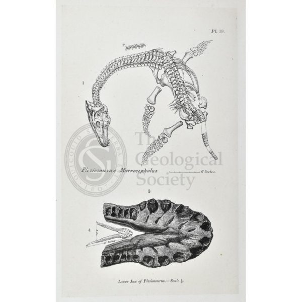
Plesiosaurus macrocephalus
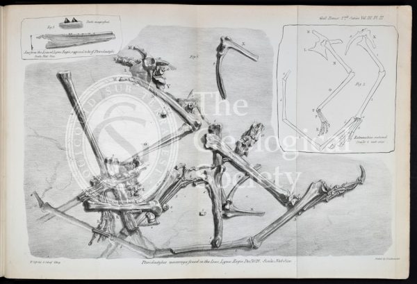
Pterodactylus macronyx
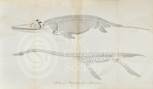
‘Skeleton of Ichthyosaurus and Plesiosaurus’
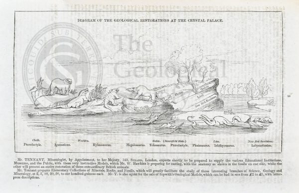
Diagram of the geological restorations at Crystal Palace
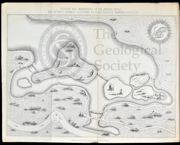
Map of Crystal Palace Park (1854)

William Smith (1769-1839)

Mary Anning (1799-1847)
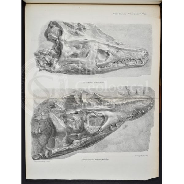
Skulls of Plesiosaurus hawkinsii and Plesiosaurus macrocephalus
Ribs of an ichthyosaur
Section through the vertebrae of an ichthyosaur
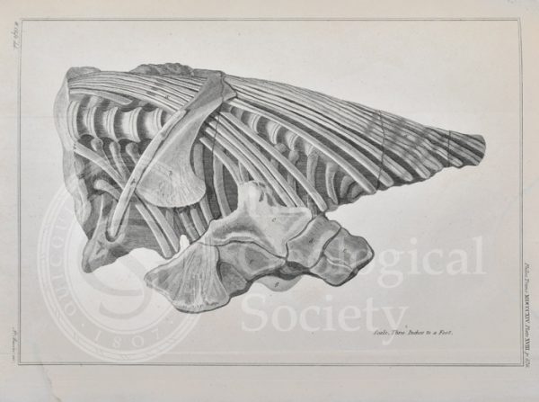
Vertebrae and ribs of an ichthyosaur
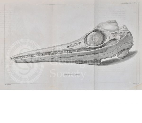
Head of an ichthyosaur
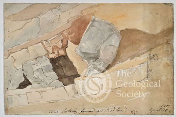
‘Cave lately found at Redland’
‘Sandstone at the new cut, River Avon, Bristol’
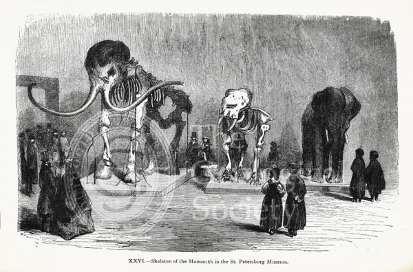
Skeleton of the Mammoth in the St Petersburg Museum
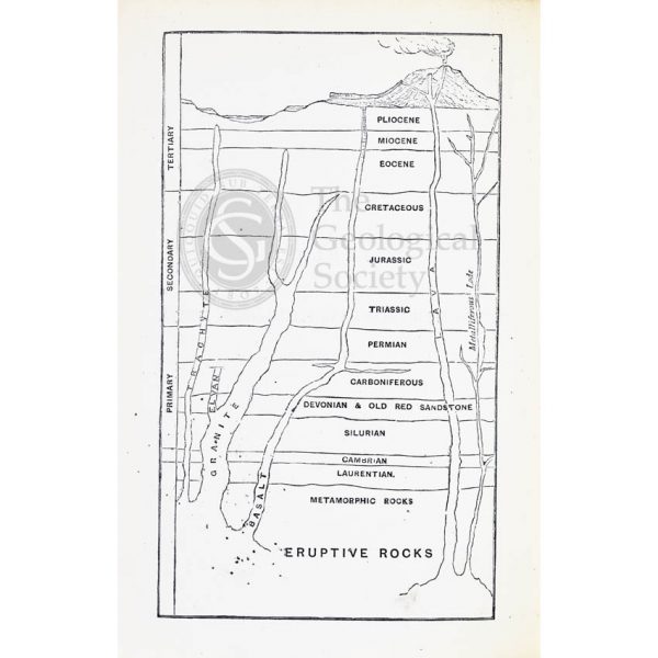
Geological timescale (1867)
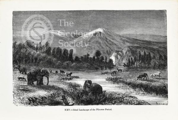
Ideal landscape of the Pliocene Period
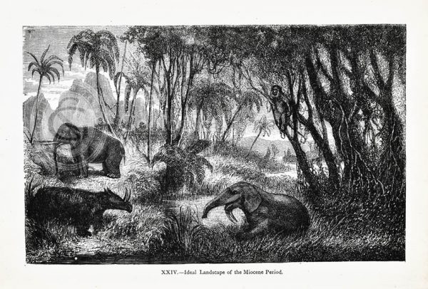
Ideal landscape of the Miocene Period
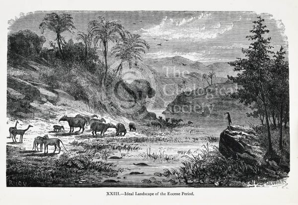
Ideal landscape of the Eocene Period
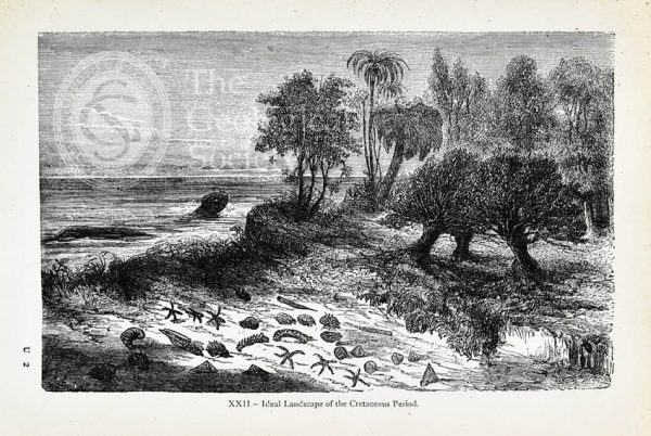
Ideal landscape of the Cretaceous Period
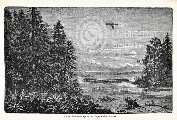
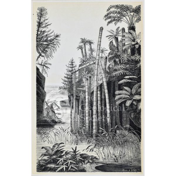
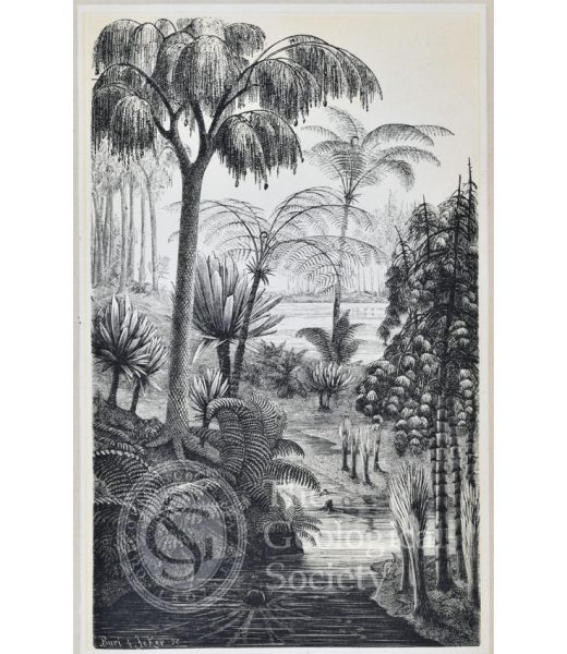
Ideal landscape of the Upper Oolitic Period
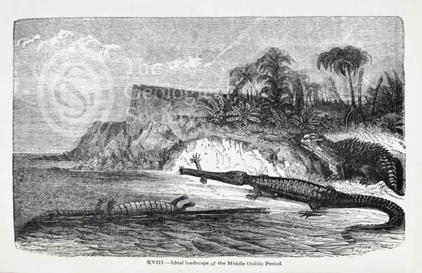
Ideal landscape of the Middle Oolitic Period
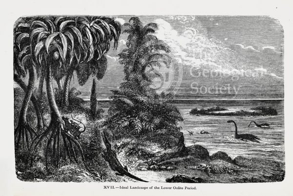
Ideal landscape of the Lower Oolite Period
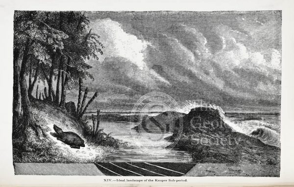
Ideal landscape of the Keuper Sub-period
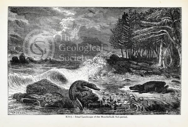
Ideal landscape of the Muschelkalk Sub-period
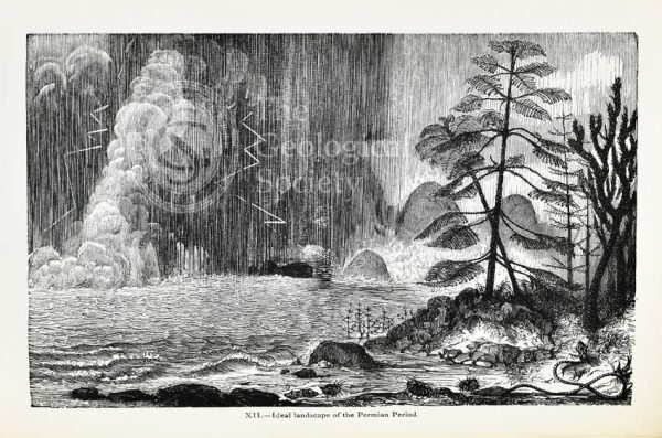
Ideal landscape of the Permian Period
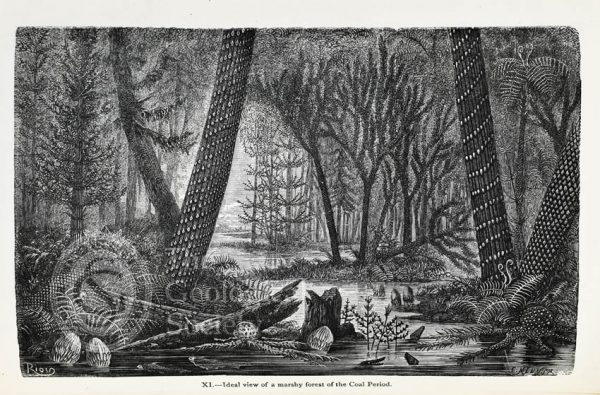
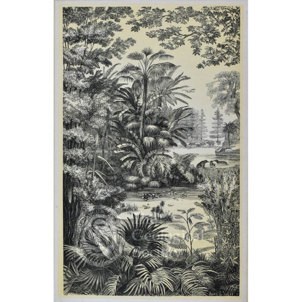
Ideal view of a marshy forest of the Coal Period
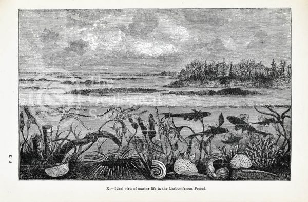
Ideal view of marine life in the Carboniferous Period
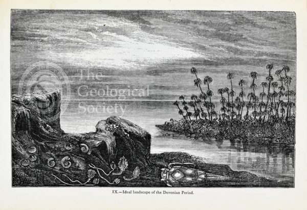
Ideal landscape of the Devonian Period
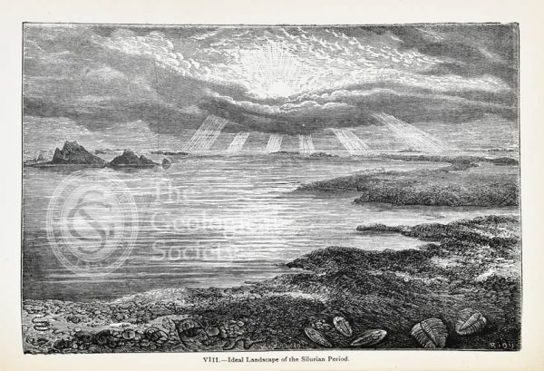
Ideal landscape of the Silurian Period
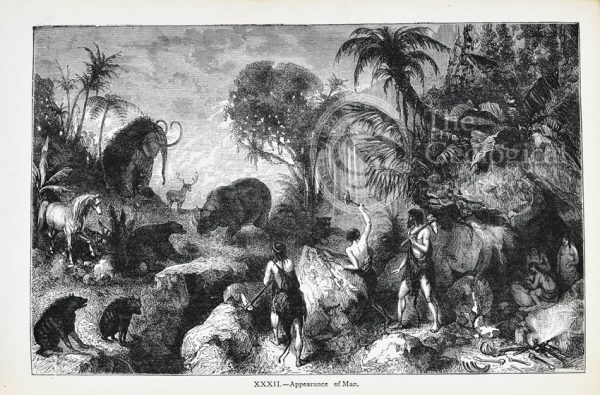
‘Appearance of Man’
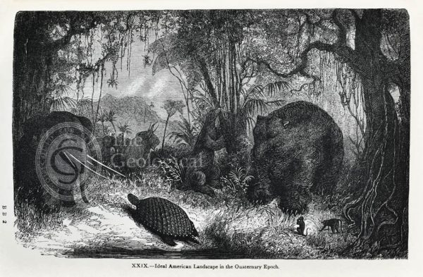
Ideal American landscape in the Quaternary Epoch
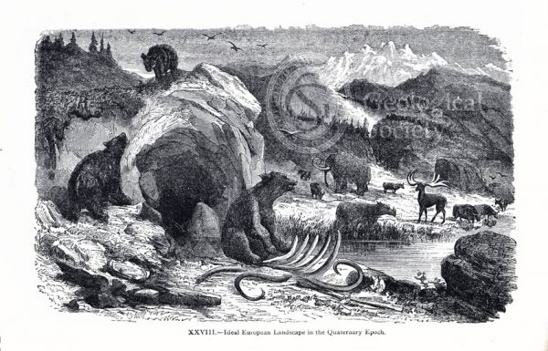
Ideal European landscape in the Quaternary Epoch
Dürnten during the formation of lignite
Lausanne during the Miocene Period
Life in the Miocene Period, Oeningen near Constance
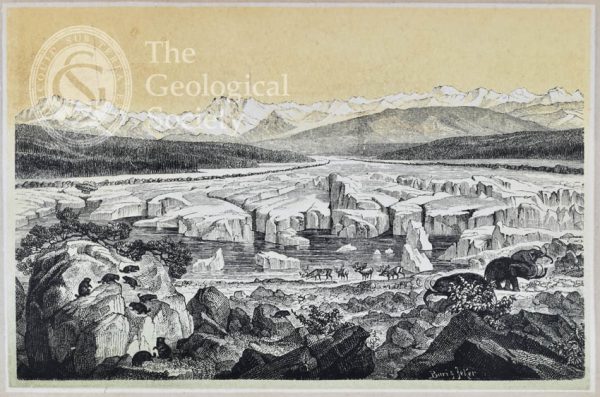
Zurich at the Glacial Period
The coral islands of the Jura [Jurassic]
Submarine life of the Schambelen [Lower Jurassic]
Basle during the Keuper Period [Middle to Upper Triassic]
Carboniferous flora of Switzerland
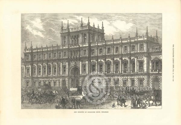
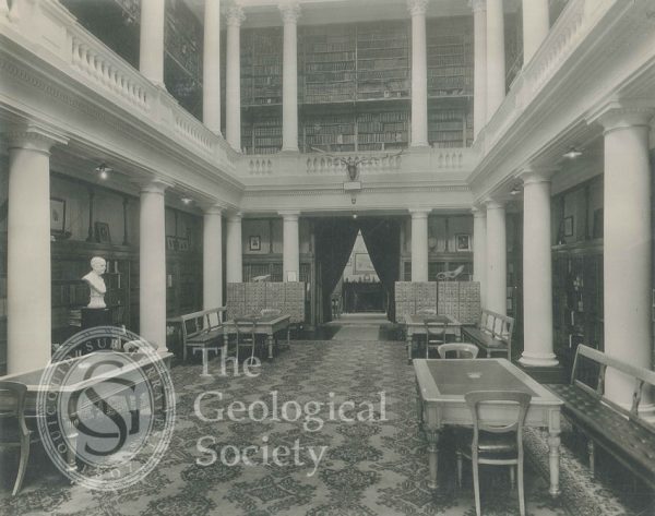
Burlington House, 1873
Upper Library of the Geological Society, 1931
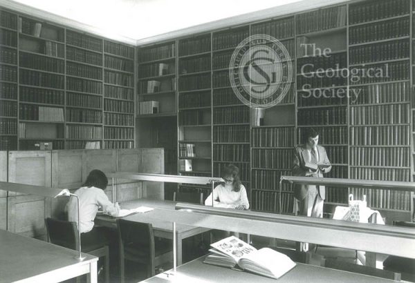
New Reading Room, Geological Society, 1972
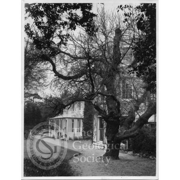
Photograph of Down House, home of Charles Darwin
Photograph of Down House, home of Charles Darwin
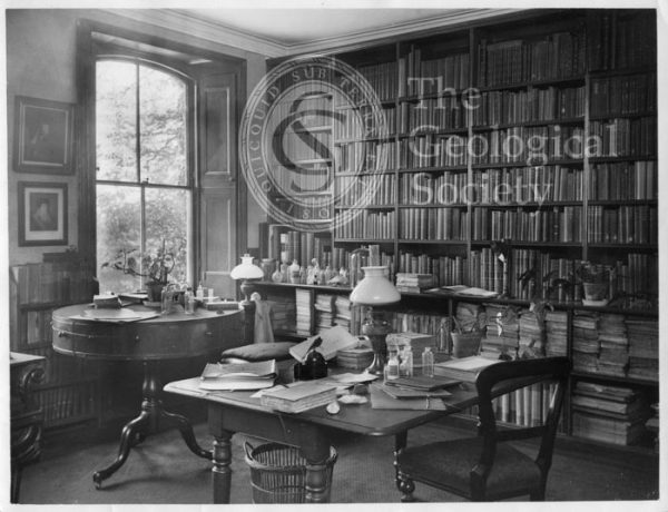
Photograph of Down House, home of Charles Darwin
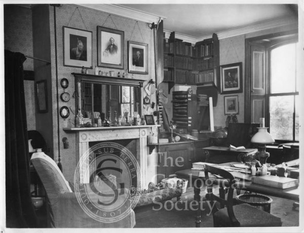
Photograph of Down House, home of Charles Darwin
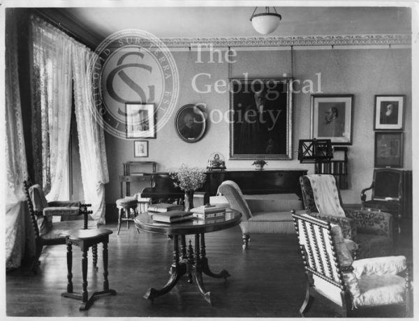
Photograph of Down House, home of Charles Darwin
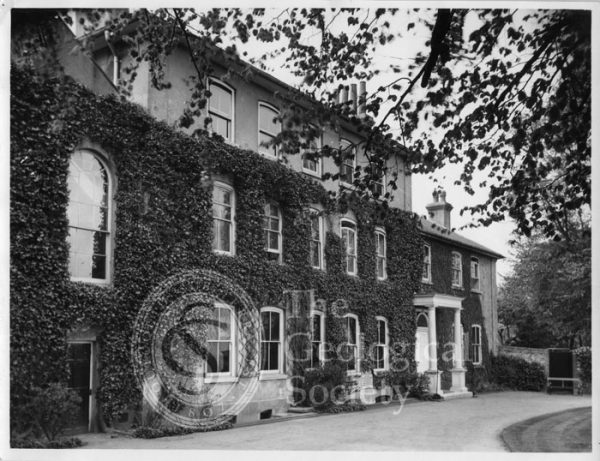
Photograph of Down House, home of Charles Darwin
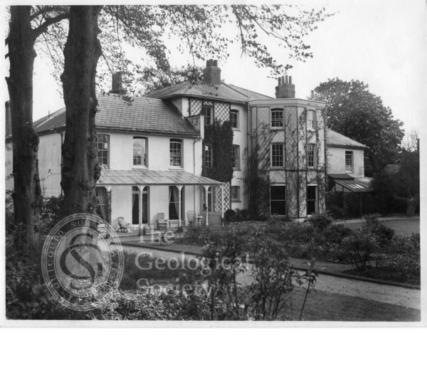
Photograph of Down House, home of Charles Darwin
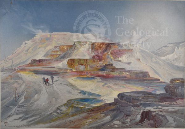
Hot springs of Gardiner’s River, Yellowstone
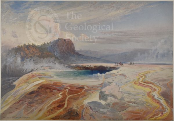
Great Blue Spring of the Lower Geyser Basin, Yellowstone
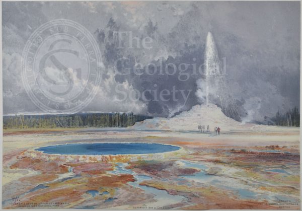
Castle Geyser, Upper Geyser Basin, Yellowstone
Lower Yellowstone Range
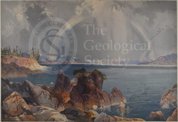
Yellowstone Lake
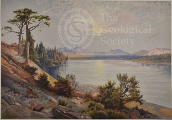
Head of Yellowstone River
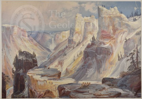
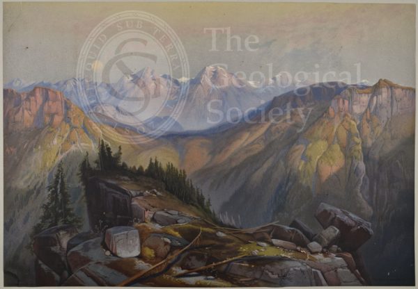
Grand Cañon, Yellowstone
Towers of Tower Falls, Yellowstone
Mountain of the Holy Cross, Colorado
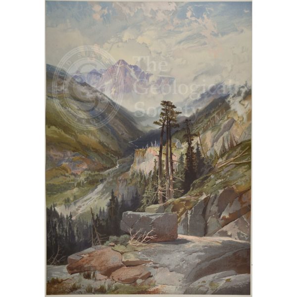
Mosquito Trail, Rocky Mountains of Colorado
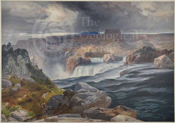
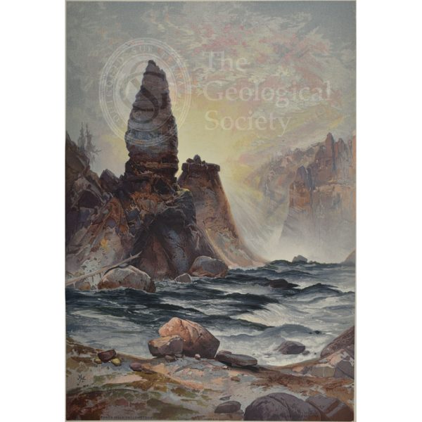
Great Falls of Snake River, Idaho Territory
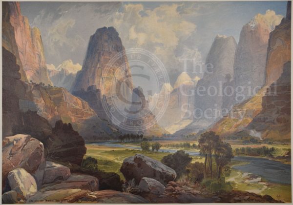
Valley of Babbling Waters, Southern Utah
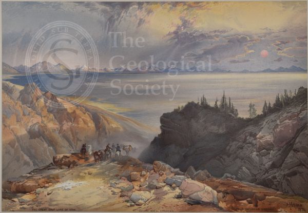
Great Salt Lake of Utah
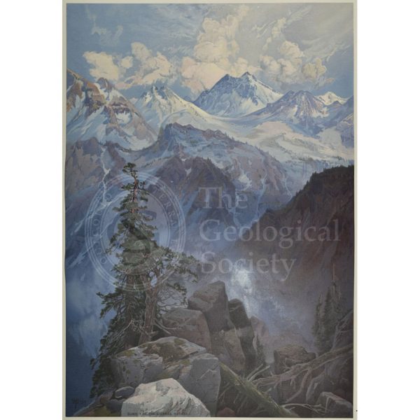
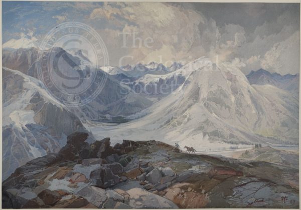
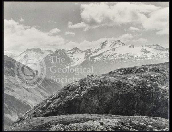
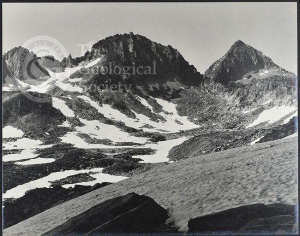
Summit of the Sierras, Nevada
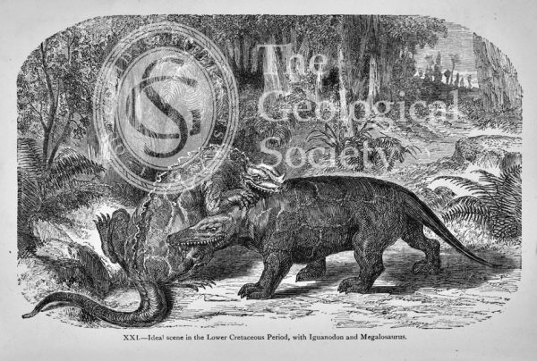
Ideal scene in the Lower Cretaceous Period
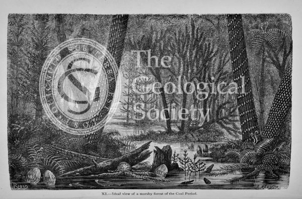
Ideal view of a marshy forest of the Coal Period
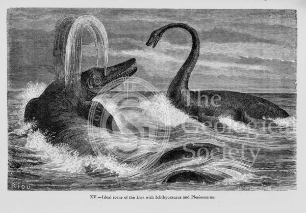
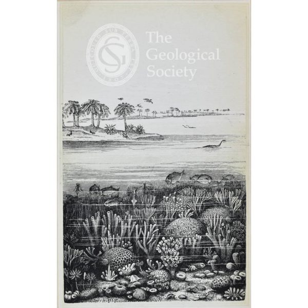
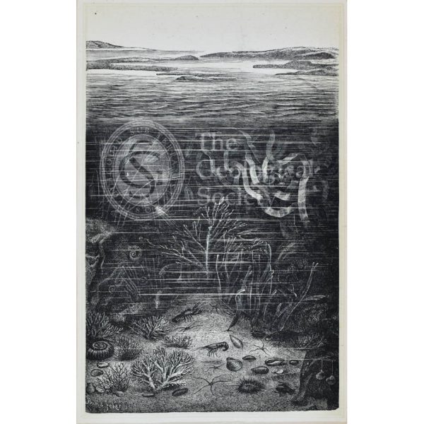
Ideal scene of the Lias with Ichthyosaurus and Plesiosaurus
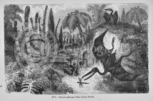
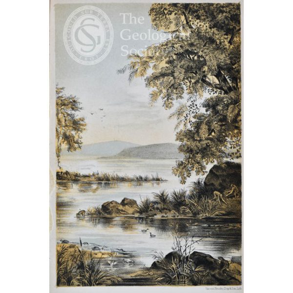
Ideal landscape of the Liassic Period
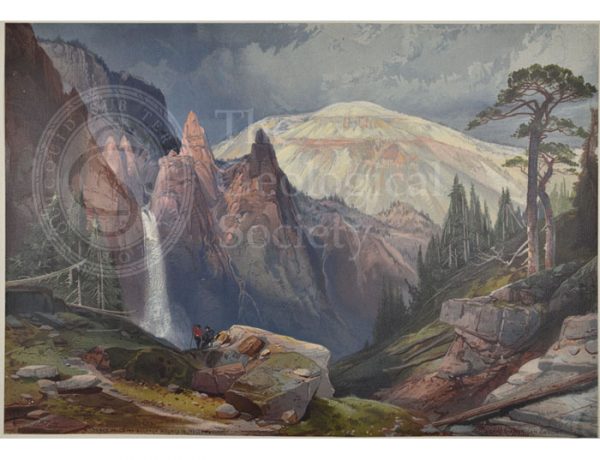
Tower Falls and Sulphur Mountain, Yellowstone
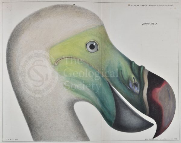
Head of a dodo
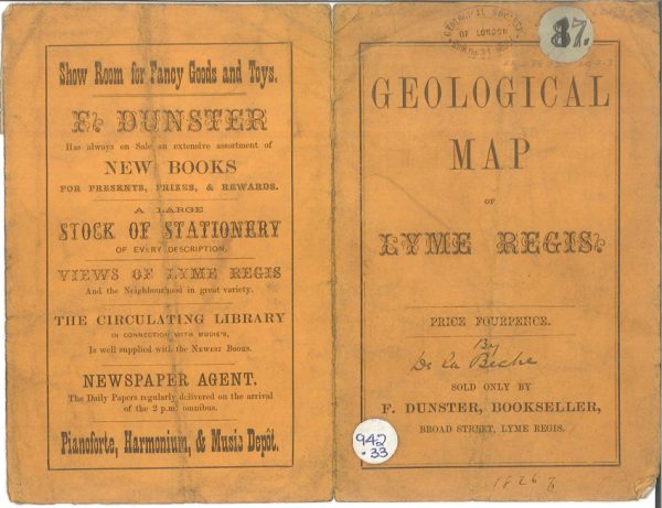
Geological map of the environs of Lyme Reis – Cover (De La Beche, 1826)
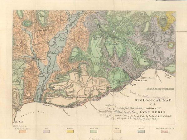
Geological map of the environs of Lyme Reis (De La Beche, 1826)
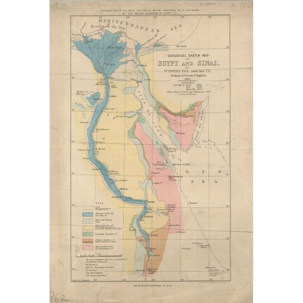
Geological Sketch Map of Egypt and Sinai (Topley 1888)
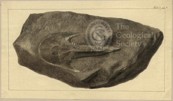
Cephalaspis Lyelli Agassiz
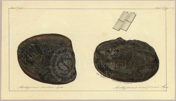
Amblypterus striatus Agassiz and Amblypterus nemopterus Agassiz
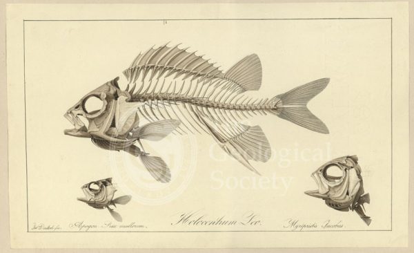
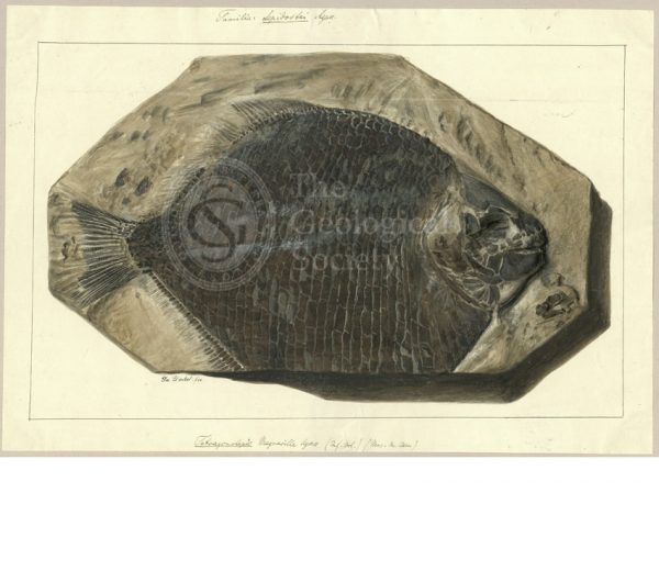
Holocentrum Leo; Apogon Rex multorum; Myrlpristis Jacobus
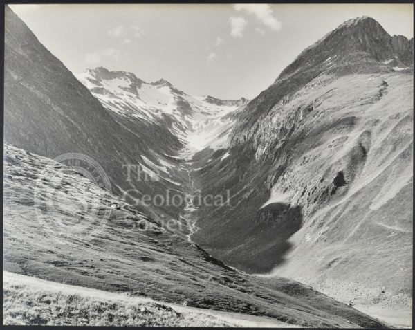
“Culmatsch and Piz Ner from near St. Anton Surrhein”
“The Val Giuf…”
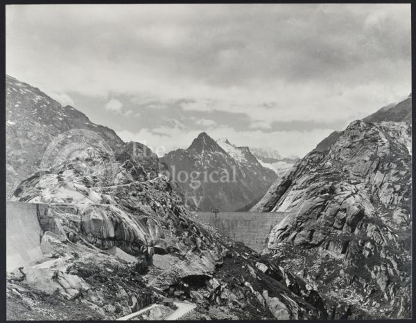
“The Grimsel Hospiz on the Nollen…”
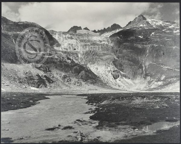
“The Rhone Gletscher…”
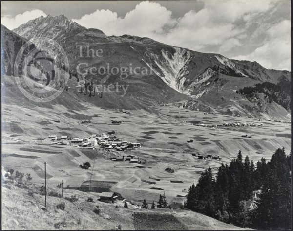
“The Tobel Drun and the villages of Ruèras, Zarcuns, Camischolas and Sedrun…”
“A view…to the east of the Todtensee near the summit of the Grimsel Pass”
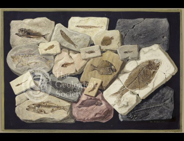
Fossil fish from the collection of William Willoughby Cole
“The Schienstock and Bächistock…”
Tetragonolepis Magneville Agassiz
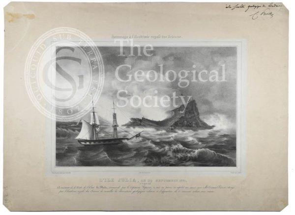
L’ile Julia (Julia’s Isle)
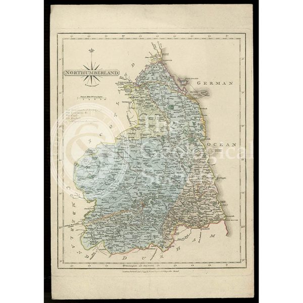
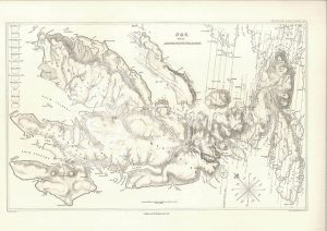
Geological map of Northumberland (Fry, c.1814)
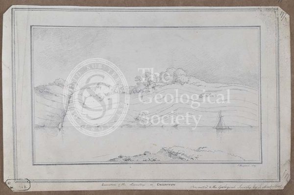
‘Curvature of the limestone at Chepstow’
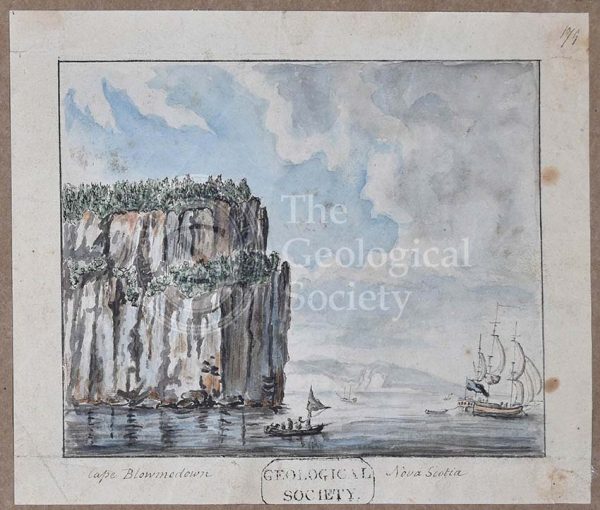
‘Cape Blowmedown [Blomidon], Nova Scotia’

Sir Charles Lyell (1797-1875)

William Buckland (1784-1856)

Discussion on the Piltdown Skull
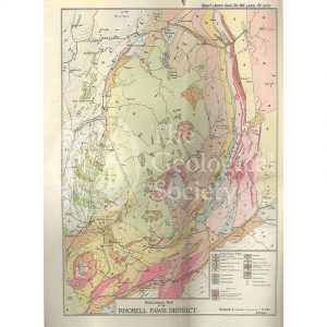
Geological Map of the Rhobell Fawr District (Wells, 1925)
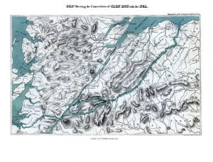
Map shewing the Connections of Glen Roy with the Sea (Cross, 1817)
Various flexures of gneiss in Lewis (Stewart after MacCulloch, 1819)
Trap veins at Airdnamurchan point… (Stewart after MacCulloch, 1819)
Sky and the adjoining islands (Stewart after MacCulloch, 1817)
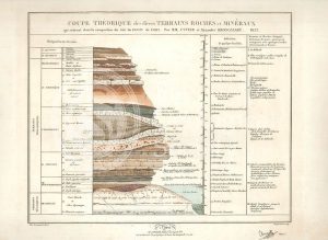
Theoretical section through the Paris Basin (Cuvier, Brongniart and Clerget, 1832)
Vixen Tor, Dartmoor
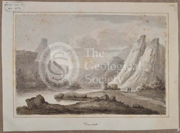
‘Dovedale’
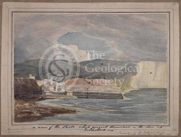
‘A view of the strata which present themselves on the shore of Folkestone’
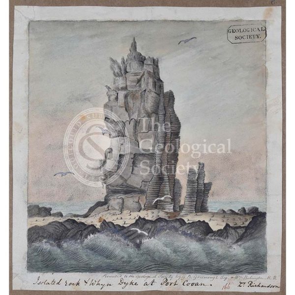
‘Isolated rock and whyn dyke at Port Cooan’
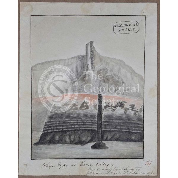
‘Whyn dyke at Rovin Valley’
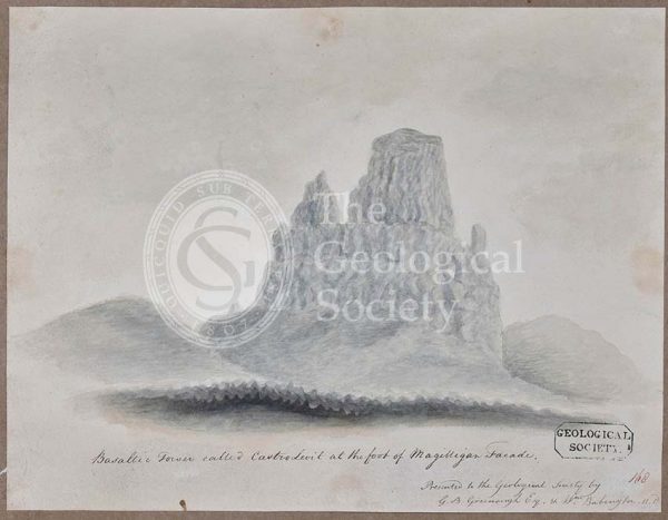
‘Basaltic tower called Castro Levit at the foot of Magilligan Facade’
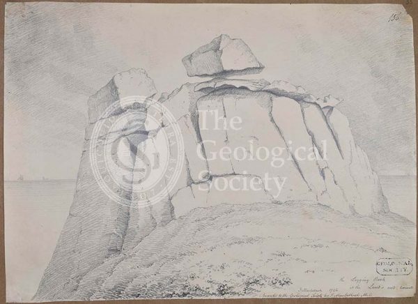
The logging rock at the Lands End Cornwall
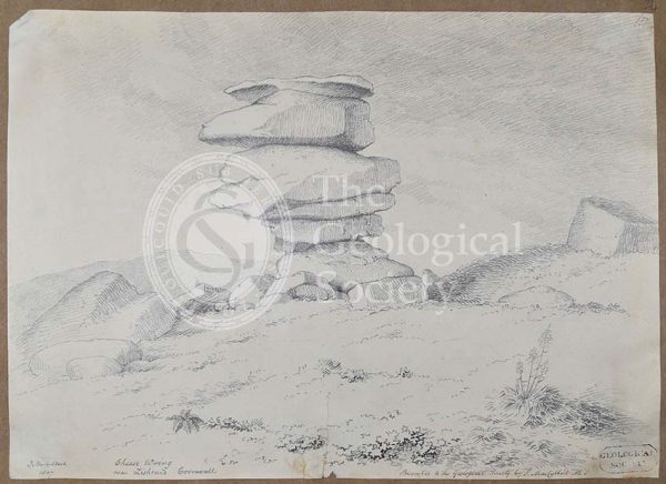
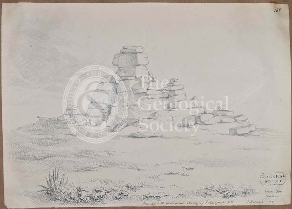
Cheese Wring near Liskeard, Cornwall
‘Parallel roads of Glen Roy’
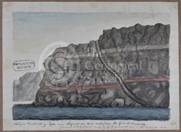
‘Oblique undulating dyke near Seaport one mile west from the Giants Causeway’
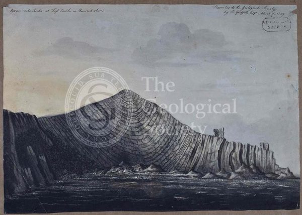
‘Grauwacke rocks at Fass Castle in Berwickshire’
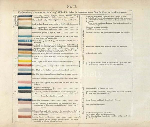
Table of the ‘Explanation of Colours on the Map of Strata…’
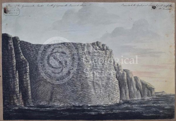
‘View of the Grauwacke rocks south of Eyemouth Berwickshire’
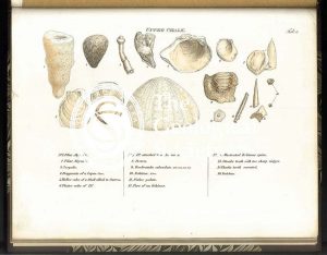
Upper Oolite fossils
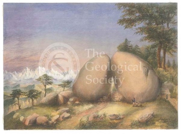
Boulder rocks at Debre Doura, Kumaun, India
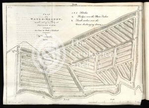
‘Plan of a Water-Meadow made out of a Bog…’
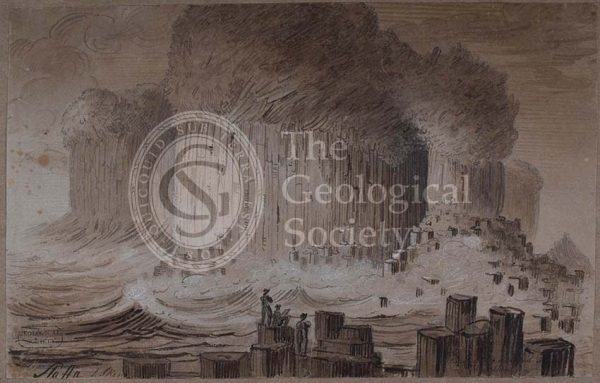
‘Staffa’
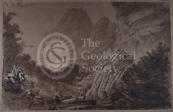
‘Scur Eigg in the Hebrides’
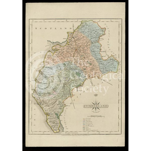
Geological map of Cumberland (Fry, c.1814)
Forest Marble fossils
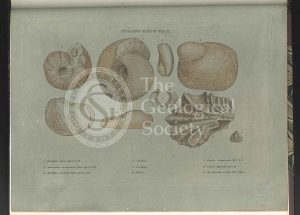
Clay over the Upper Oolite fossils
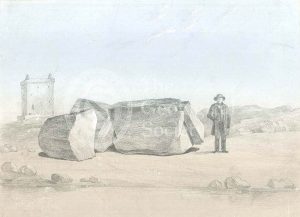
Split boulder on Little Cumbra, Western Isles
Fullers Earth fossils
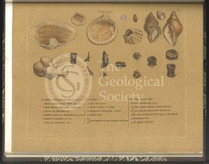
Clunch Clay fossils
Kelloways Stone fossils
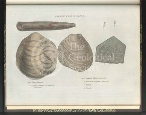
Cornbrash fossils
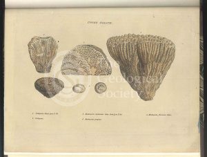
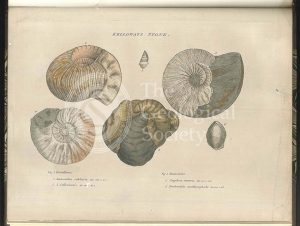
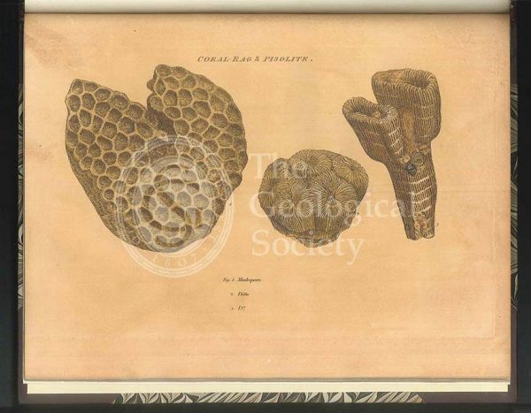
Coral Rag fossils
‘Cape Wrath’
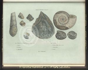
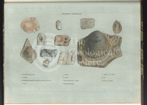
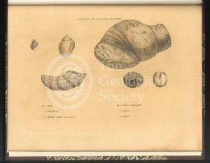
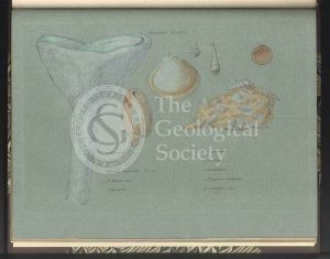
Oak Tree Clay fossils
‘North Suter from South Suter’
Coral Rag fossils
Green Sand fossils
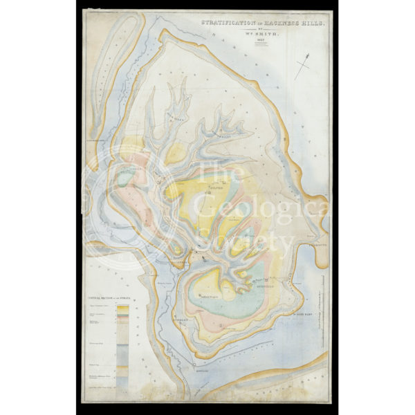
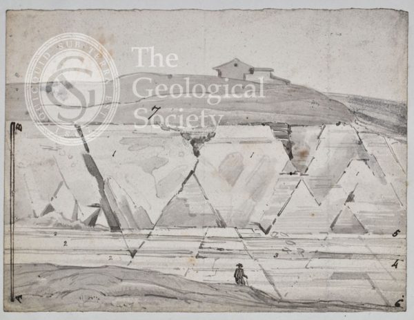
Stratification in Hackness Hills (Smith, 1832)
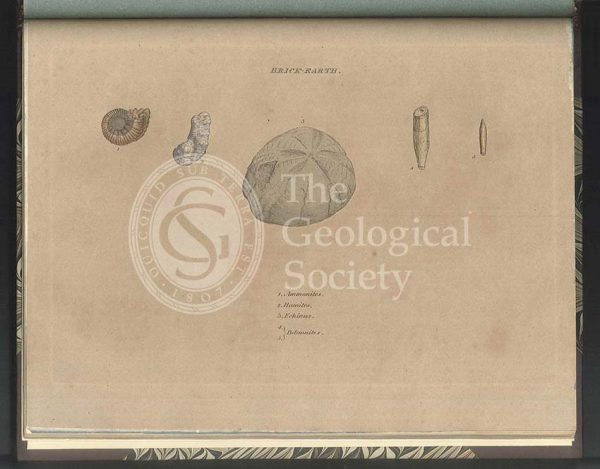
Brick Earth fossils
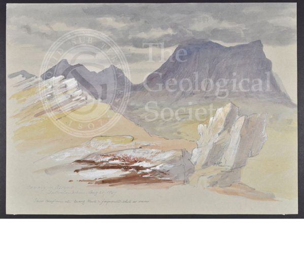
‘Cunaig in Assynt, Sutherlandshire’
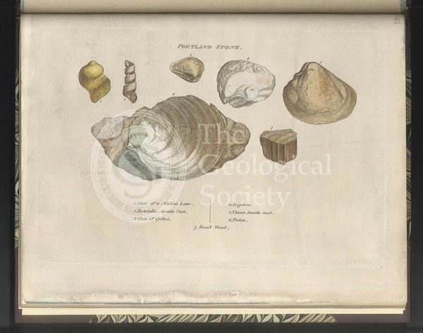
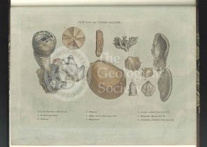
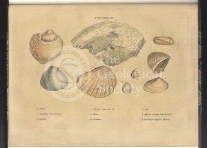
Portland Stone fossils
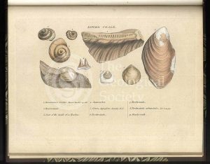
‘Craig’ [Crag] fossils
Upper Chalk fossils
Lower Chalk fossils
Green Sand fossils