
000Paper
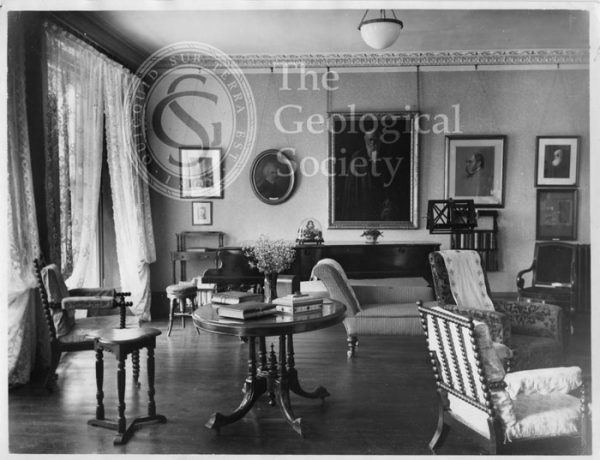
Photograph of Down House, home of Charles Darwin
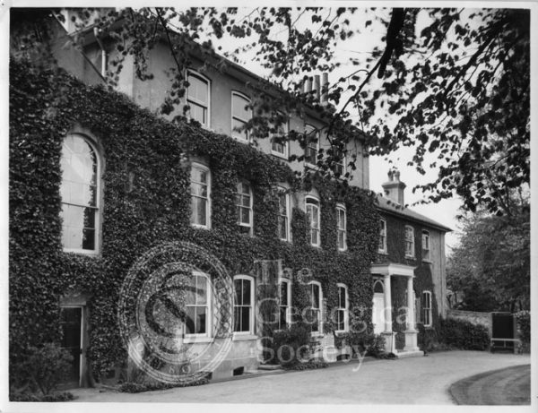
Photograph of Down House, home of Charles Darwin
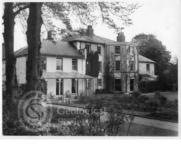
Photograph of Down House, home of Charles Darwin
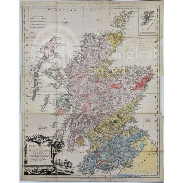
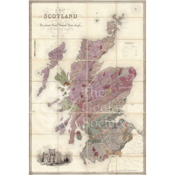
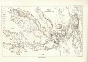
First Geological Map of Scotland [1808]
Greenough’s and Sharpe’s Geological Map of Scotland [1852] – draft
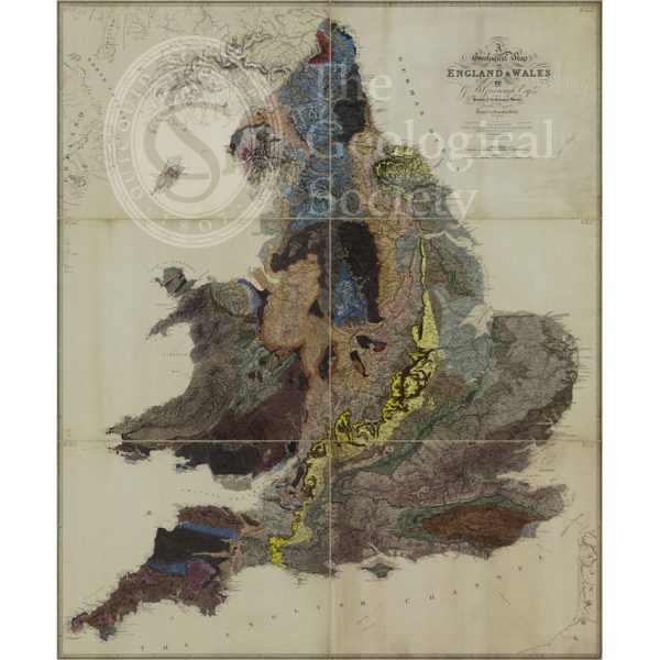
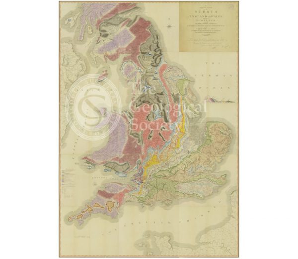
Geological Map of England and Wales [1839] 2nd edition
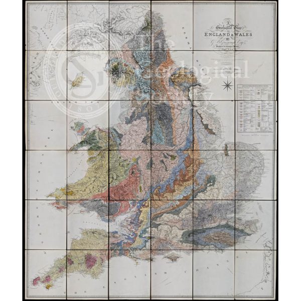
Geological Map of England and Wales (1820) 1st edition
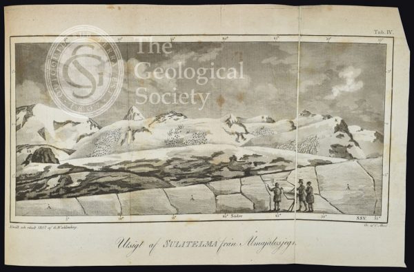
Utsigt af Sulitelma från Ålmajalosjegna’ (1807)
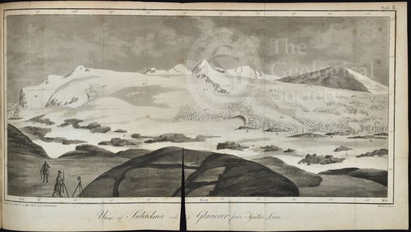
Utsigt af Sulitelma och dess glacierer från fjället Lairo (1807)
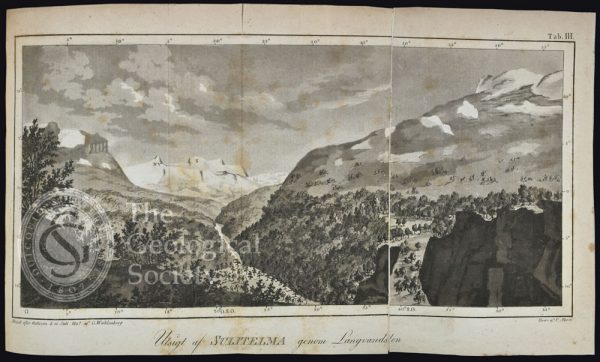
Ustigt af Sulitelma genom Langvandalen, Lapland (1807)
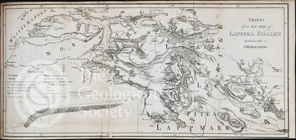
Charta õfver en del af Lappska Fjällen (1807)
Flint tool found at the Fréville Pit at Saint-Acheul, Amiens, France
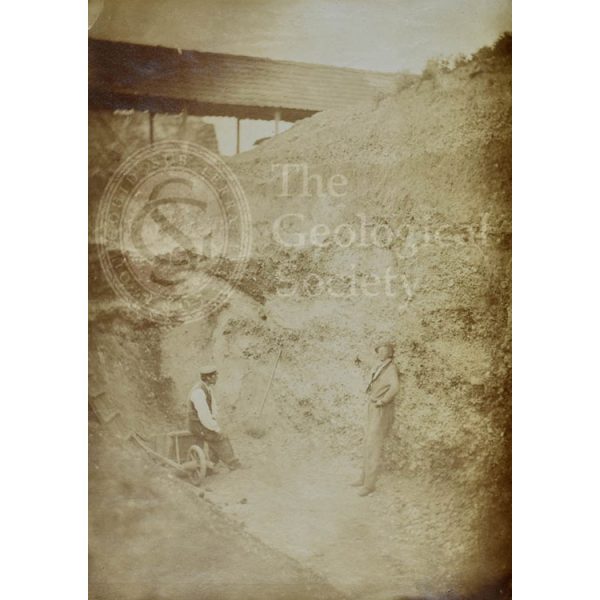
Fréville Pit at Saint-Acheul, Amiens, France
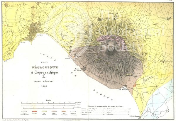
Carte géologique et topographique du Mont Vésuve (Dufrenoy, 1838)
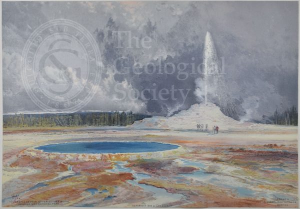
Castle Geyser, Upper Geyser Basin, Yellowstone
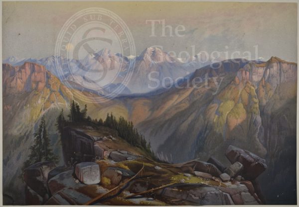
Lower Yellowstone Range
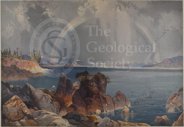
Yellowstone Lake
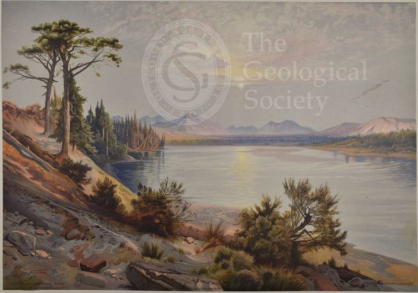
Head of Yellowstone River
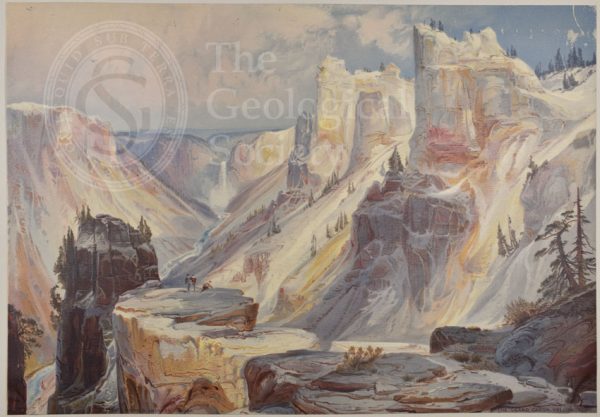
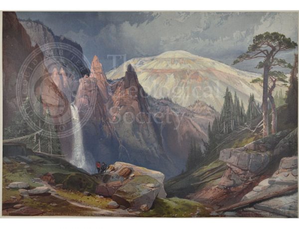
Grand Cañon, Yellowstone
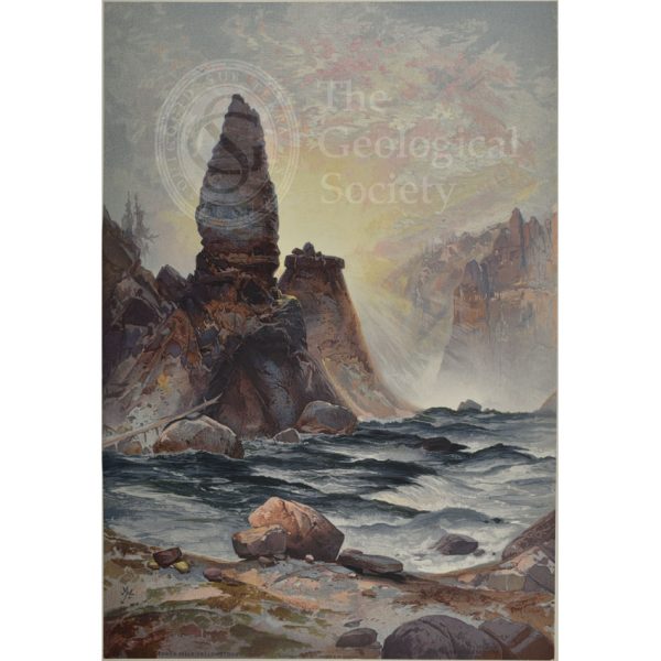
Towers of Tower Falls, Yellowstone
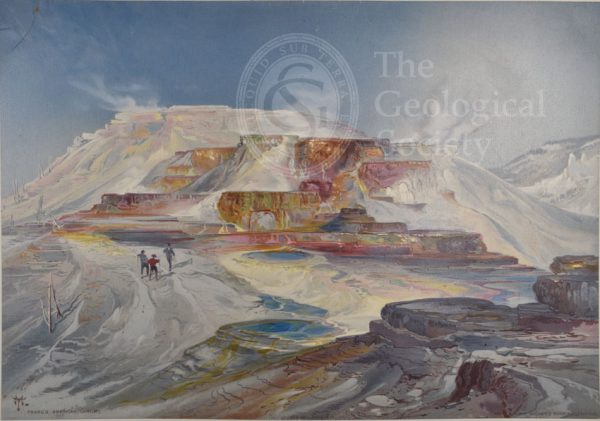
Hot springs of Gardiner’s River, Yellowstone
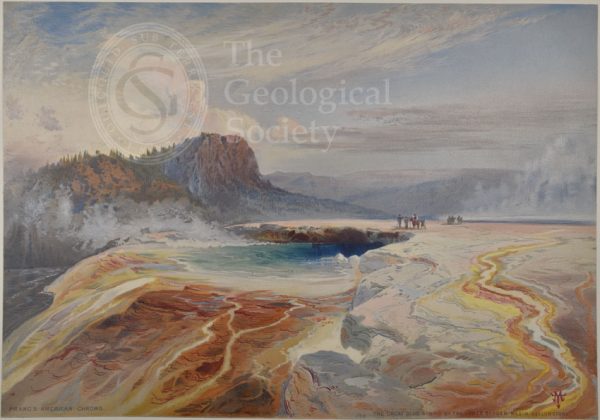
Great Blue Spring of the Lower Geyser Basin, Yellowstone
Mountain of the Holy Cross, Colorado
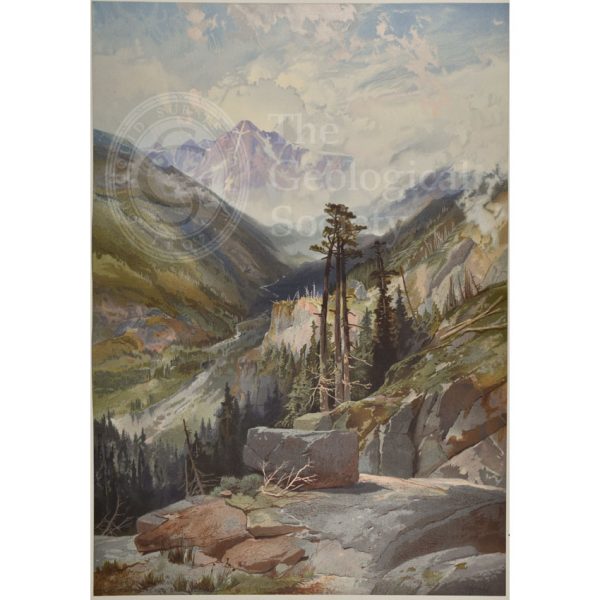
Mosquito Trail, Rocky Mountains of Colorado
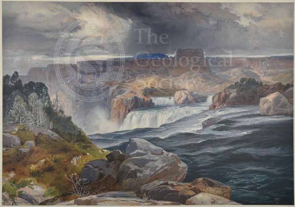
Great Falls of Snake River, Idaho Territory
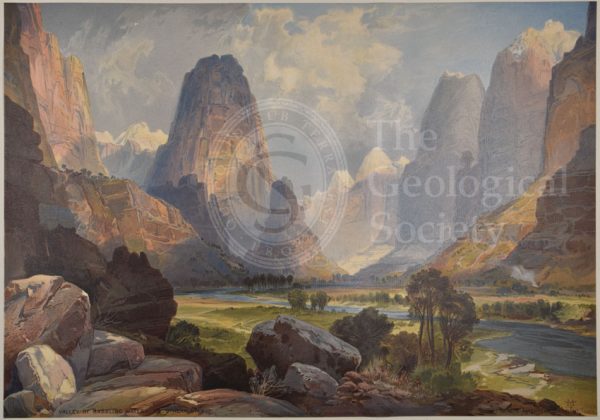
Valley of Babbling Waters, Southern Utah
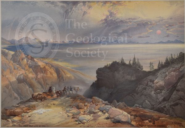
Great Salt Lake of Utah
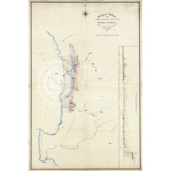
Map of the geology around Swan River, Western Australia
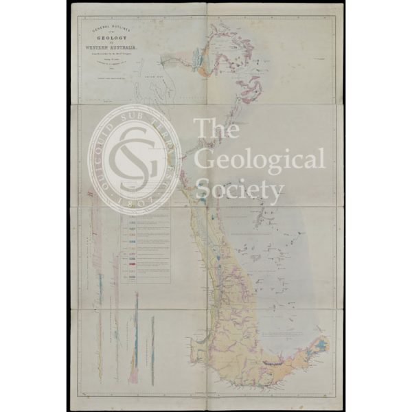
General Outlines of the Geology of Western Australia (Gregory, 1860)
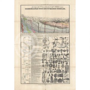
‘Ubergangsformation’
‘Steinkholenformation’
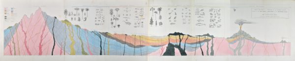
‘Ideal section of a portion of the Earth’s Crust…’
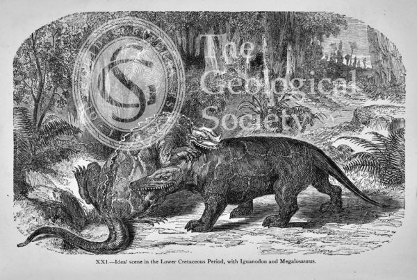
Ideal scene in the Lower Cretaceous Period
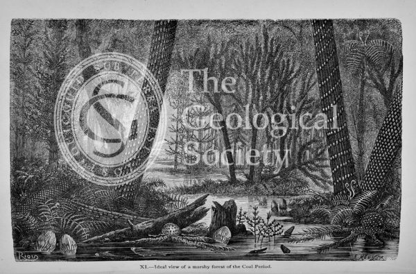
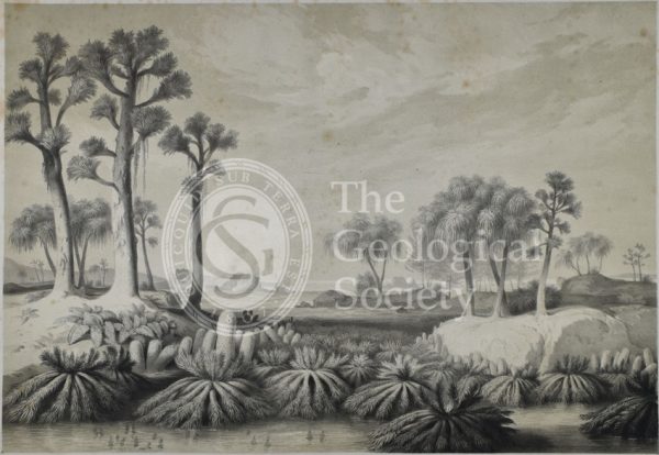
Ideal view of a marshy forest of the Coal Period
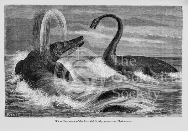
Ideal scene of the Lias with Ichthyosaurus and Plesiosaurus
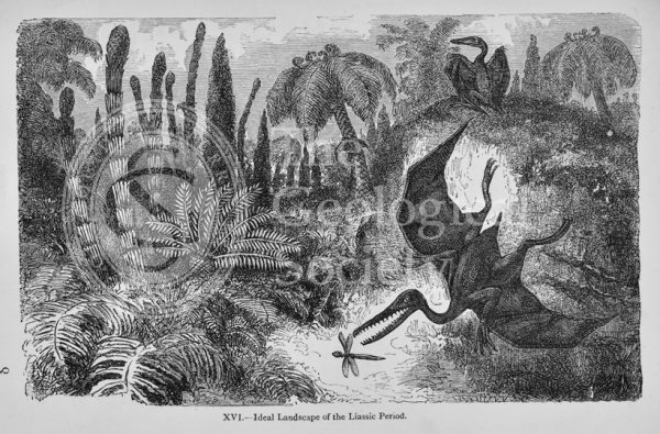
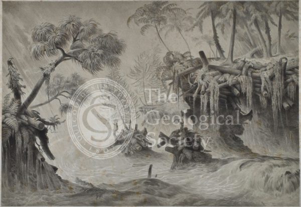
Ideal landscape of the Liassic Period
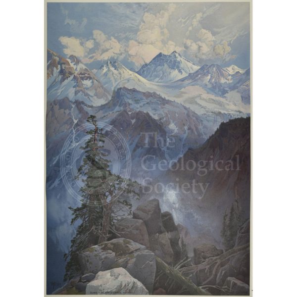
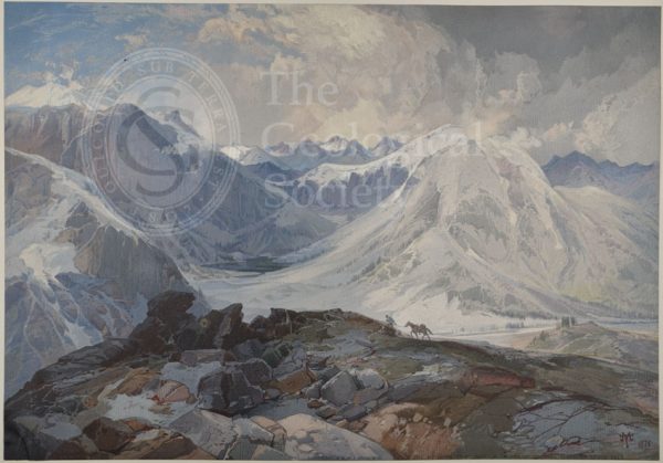
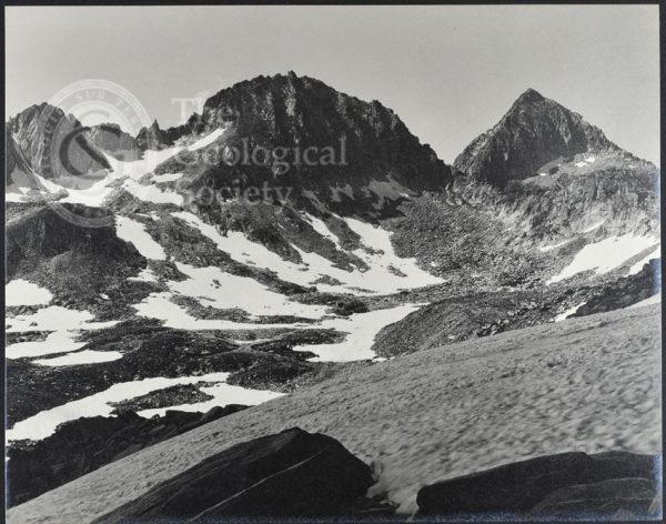
Summit of the Sierras, Nevada
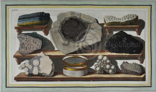
Plate XLVIII: Specimens of curious stones, found by the author on mount Vesuvius.
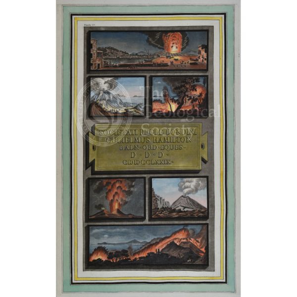
Plate LV: Views of the eruptions of Vesuvius in 1777 and 1779.
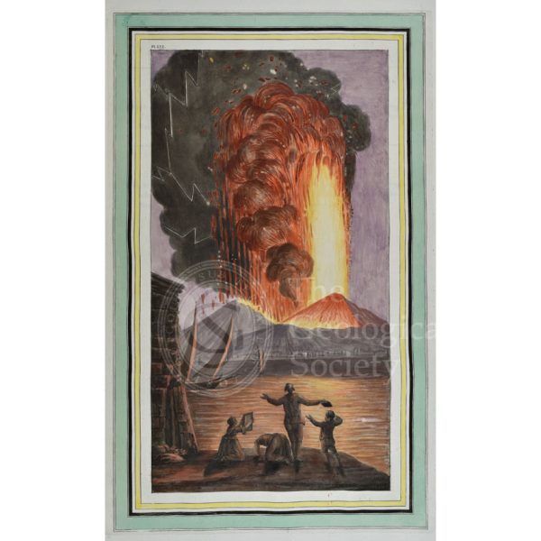
Plate LVI: View of the great eruption of mount Vesuvius, on Sunday night August the 8th 1779
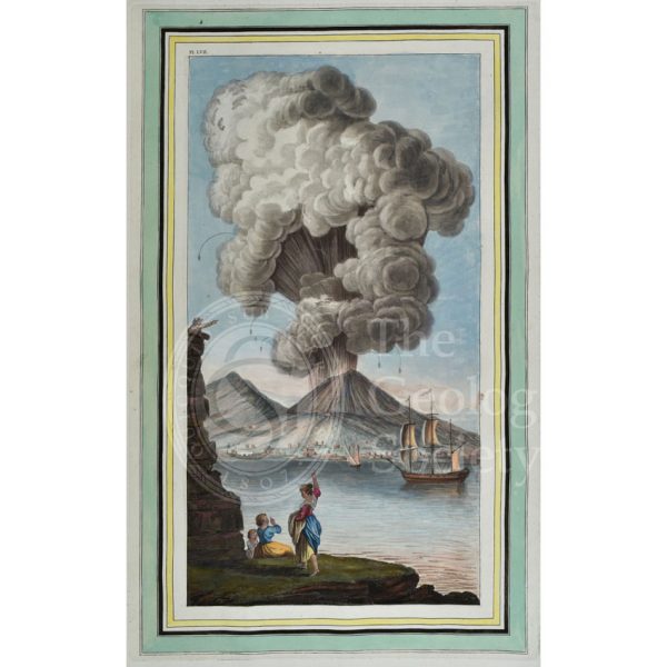
Plate LVII: View of the eruption of mount Vesuvius, Monday morning August the 9th 1779…
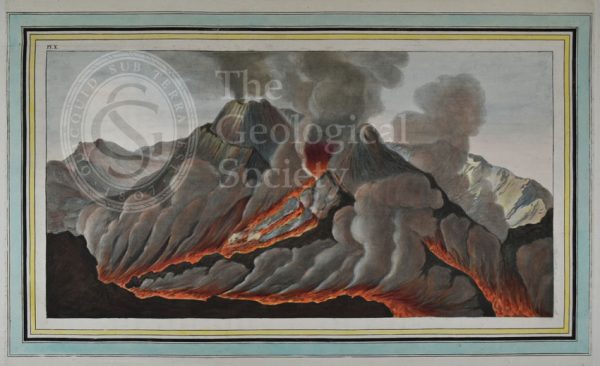
Plate X: Interiour [sic] view of the crater of mount Vesuvius…
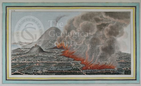
Plate XII: View of an eruption of mount Vesuvius which began on the 23rd of December 1760, and ended the 5th of January 1761
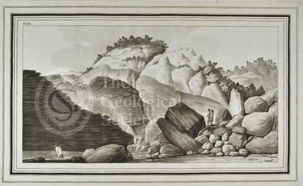
XXI: View of the hot spring called, the Pisciarelli…
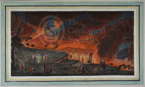
Plate XXXVIII: A night view of a current of lava that ran from mount Vesuvius towards Resina…
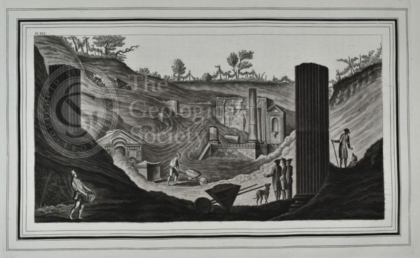
Plate XLI: View of the first discovery of the temple of Isis at Pompeii…
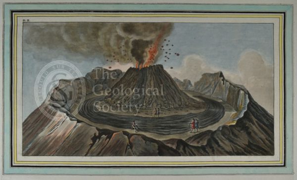
Plate IX: Interiour [sic] view of the crater of mount Vesuvius…
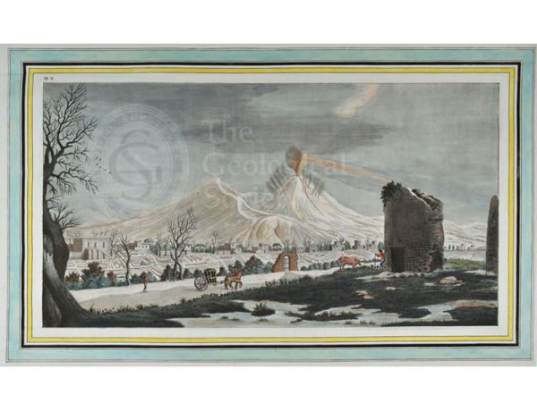
Plate V: View of an eruption of lava from the crater of mount Vesuvius…
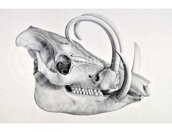
Skull of the recent pig, Babyrussa
Tower Falls and Sulphur Mountain, Yellowstone
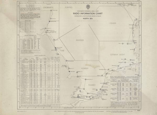
Yachtsmen’s, Fishermen’s & Small Craft Radio Information Chart (Hydrographic Office 1961)
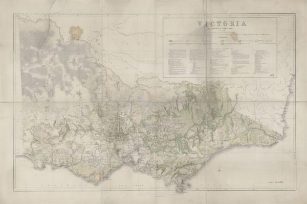
Victoria Distribution of Forest Trees (Everett, 1872)
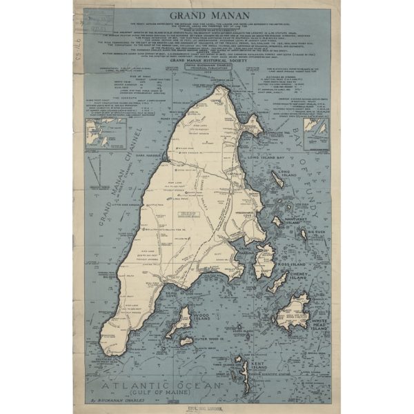
Grand Manan (Charles, 1939)
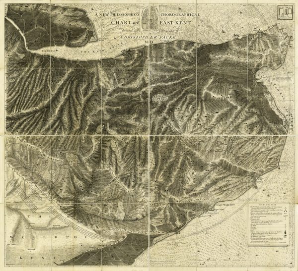
A new philosophico chorographical chart of East-Kent (Packe, 1743)
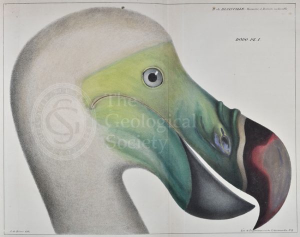
Head of a dodo

Map of the English Lakes (Ruthven, 1855)
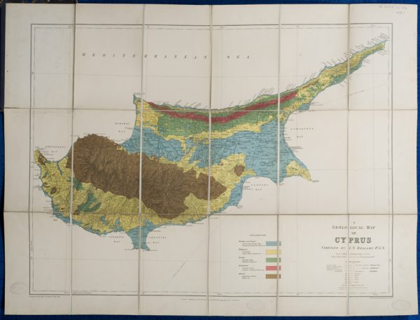
Geological map of Cyprus (Bellamy, 1905)
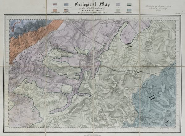
Geological map of the neighbourhood of Cambridge (Jukes-Browne, 1874)
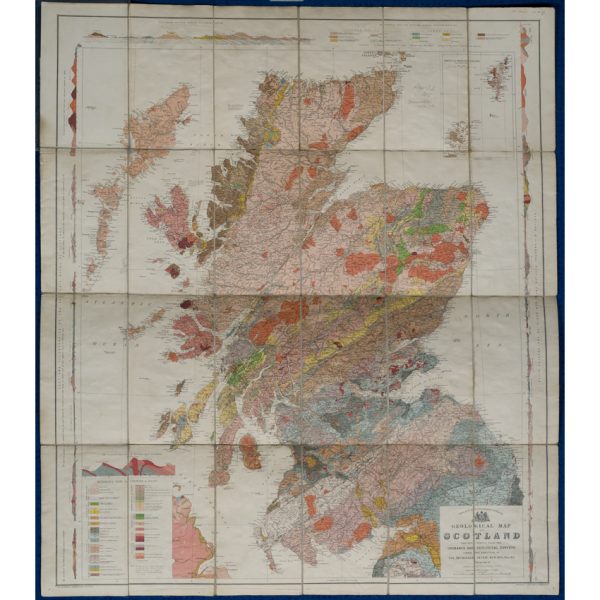
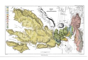
Geological map of Scotland (Geikie, 1910)
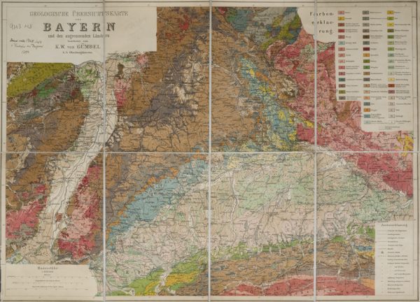
Geologische Übersichtskarte von Bayern und den angrenzenden Ländern (Karl Wilhelm von Gümbel, 1893)
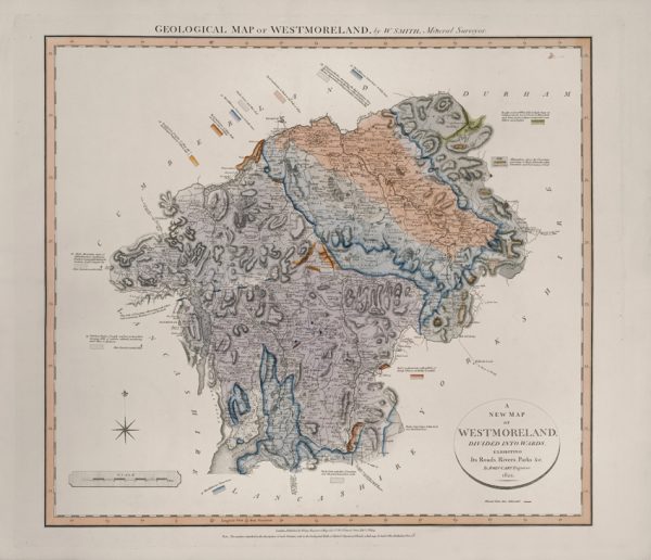
Geological Map of Westmoreland (William Smith, 1824)
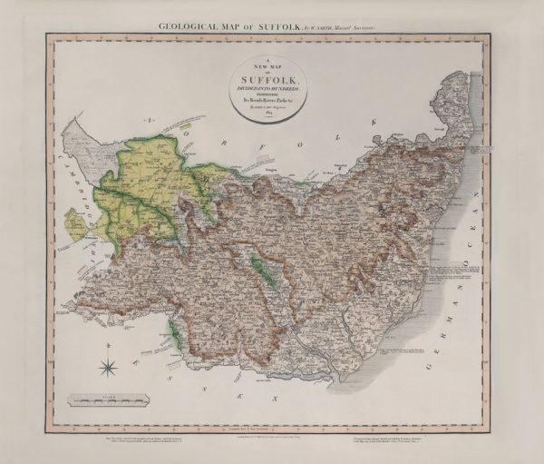
Geological Map of Suffolk (William Smith, 1819)
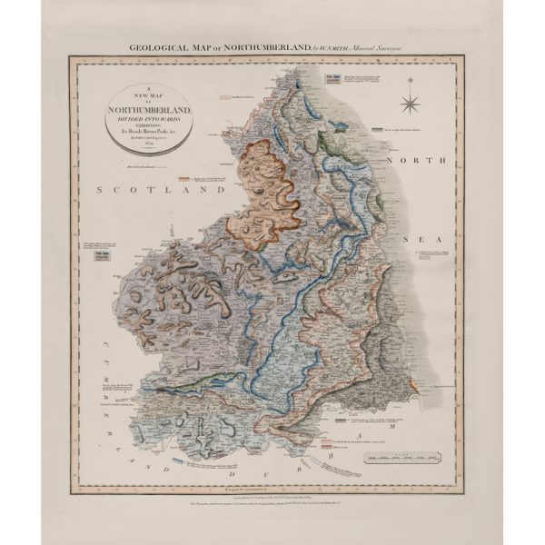
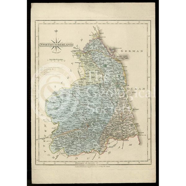
Geological Map of Northumberland (William Smith, 1824)
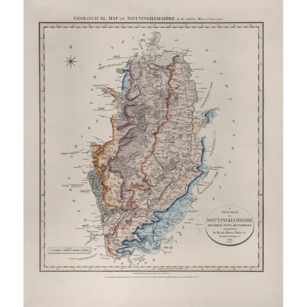
Geological Map of Nottinghamshire (William Smith, 1821)
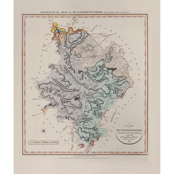
Geological Map of Huntingdonshire (William Smith, 1821)
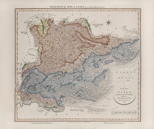
Geological Map of Essex (William Smith, 1820)
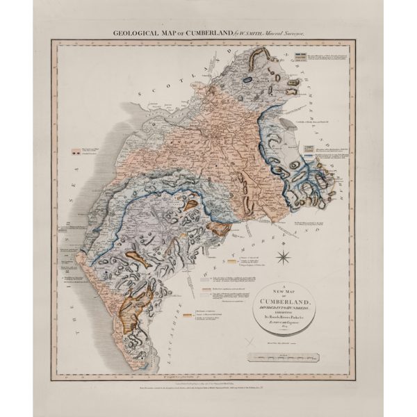
Geological Map of Cumberland (William Smith, 1824)
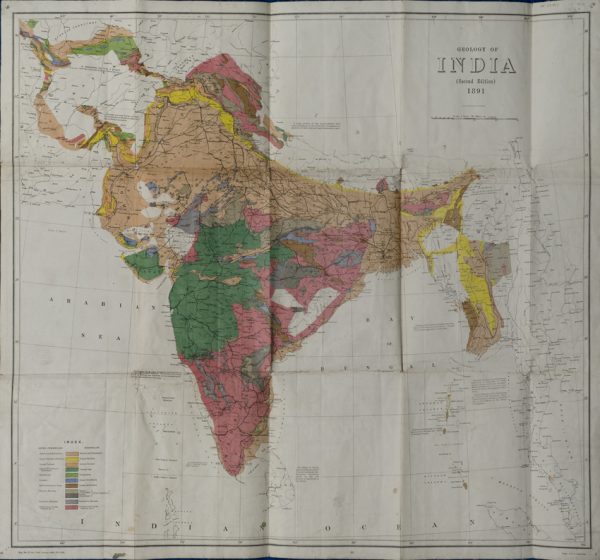
Geological Map of India (Geological Survey of India, 1891)
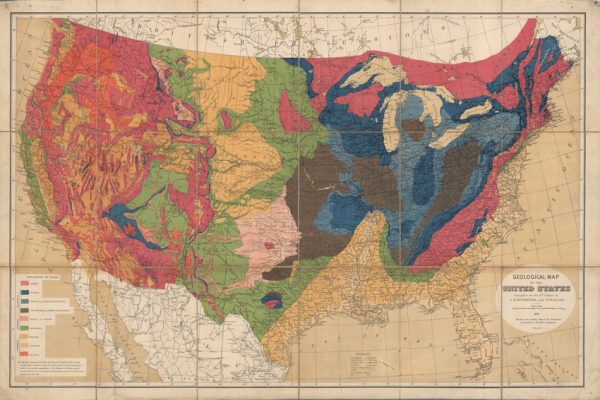
Geological map of the United States (Hitchcock and Blake, 1872)
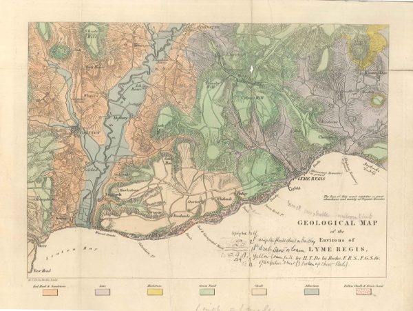
Geological map of the environs of Lyme Reis (De La Beche, 1826)
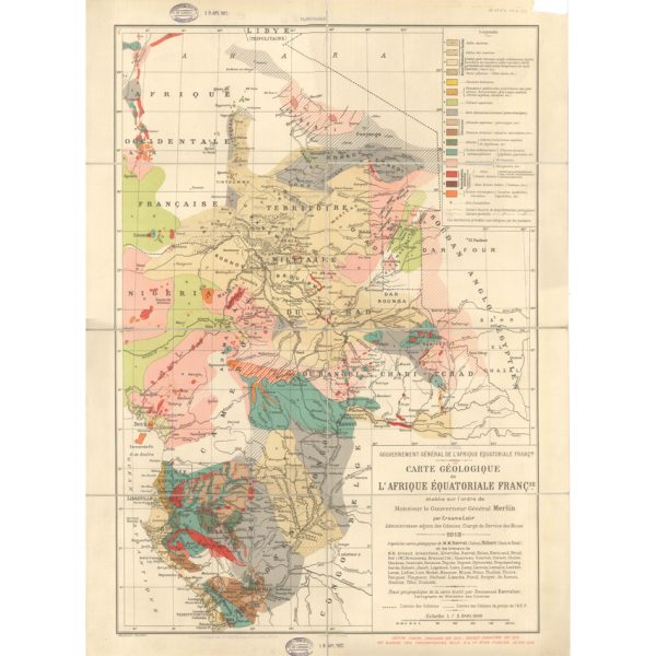
Carte géologique de l’Afrique Équatoriale Française (Loir, 1913)
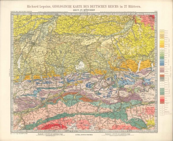
Geologisches Karte des Deutschen Reichs – 27. Munchen (Lepsius, 1897)
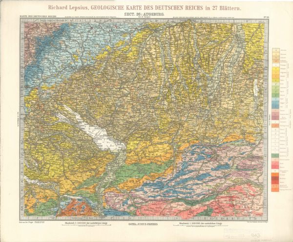
Geologisches Karte des Deutschen Reichs – 26. Augsburg (Lepsius, 1897)
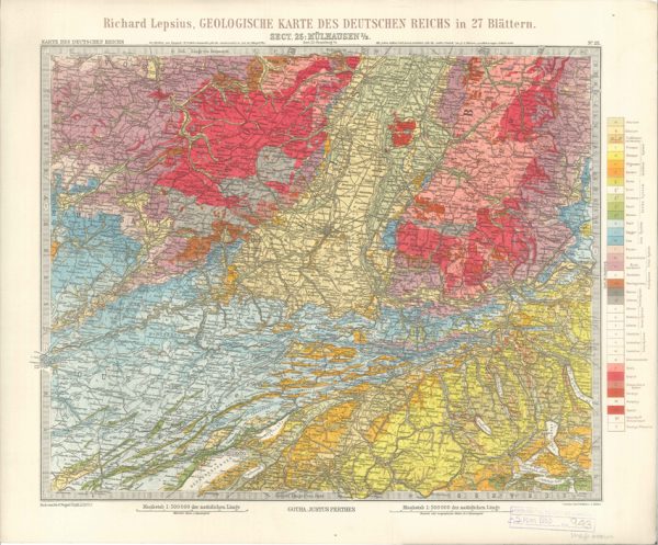
Geologisches Karte des Deutschen Reichs – 25. Mulhausen I-E (Lepsius, 1897)
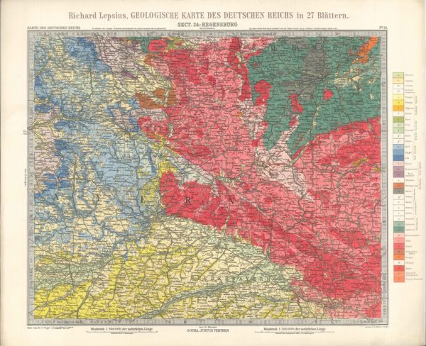
Geologisches Karte des Deutschen Reichs – 24. Regensburg (Lepsius, 1897)
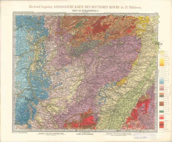
Geologisches Karte des Deutschen Reichs – 22. Strassburg I-E (Lepsius, 1897)
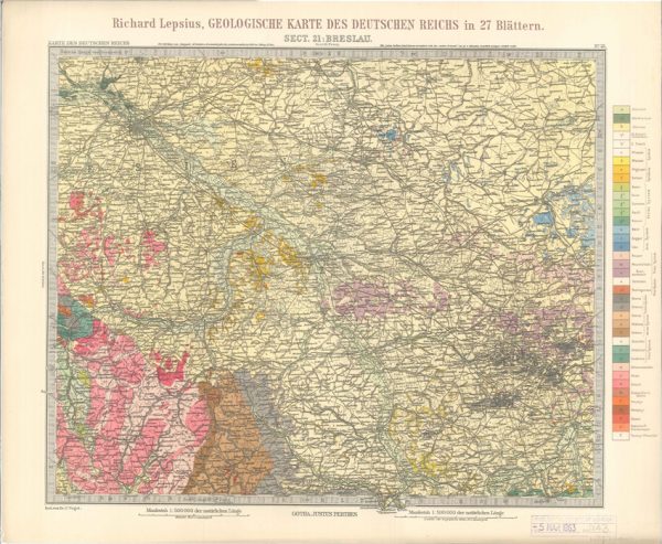
Geologisches Karte des Deutschen Reichs – 21. Breslau (Lepsius, 1897)
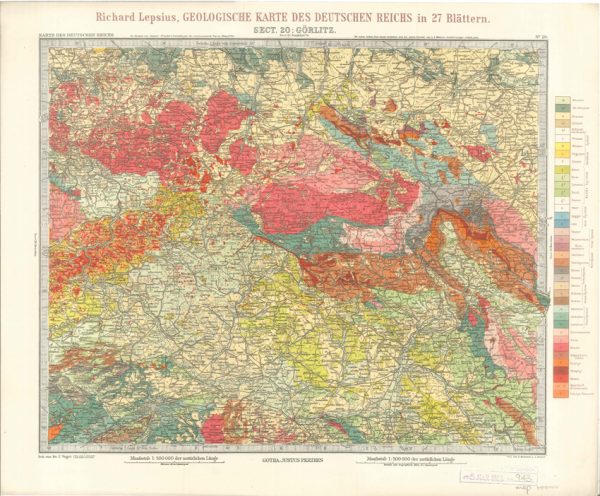
Geologisches Karte des Deutschen Reichs – 20. Gorlitz (Lepsius, 1897)
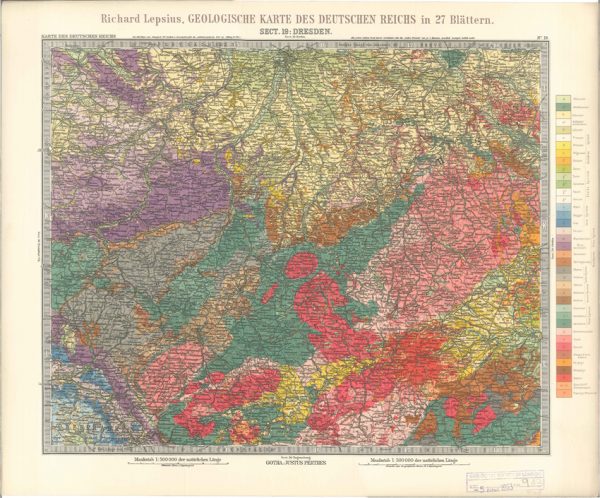
Geologisches Karte des Deutschen Reichs – 19. Dresden (Lepsius, 1897)
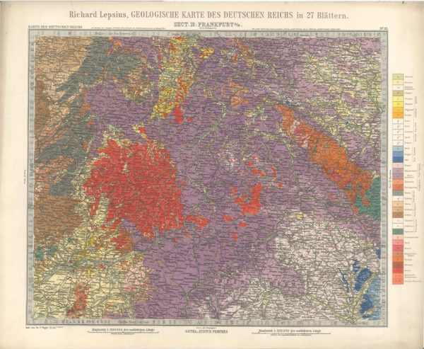
Geologisches Karte des Deutschen Reichs – 18. Frankfurt A-M (Lepsius, 1897)
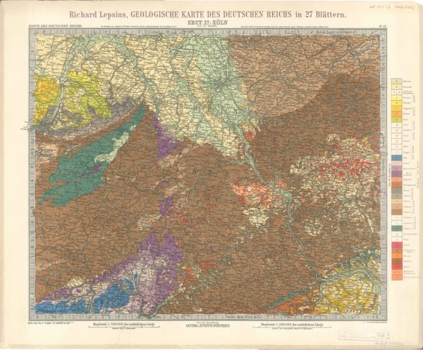
Geologisches Karte des Deutschen Reichs – 17. Koln (Lepsius, 1897)
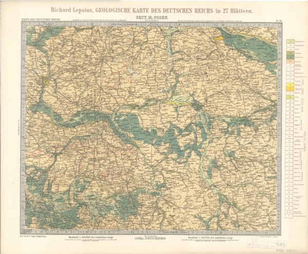
Geologisches Karte des Deutschen Reichs – 16. Posen (Lepsius, 1897)
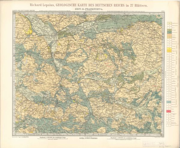
Geologisches Karte des Deutschen Reichs – 15. Frankfurt A-O (Lepsius, 1897)
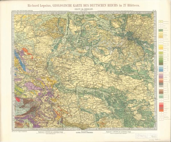
Geologisches Karte des Deutschen Reichs – 14. Berlin (Lepsius, 1897)
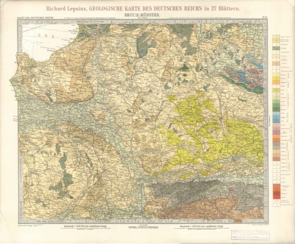
Geologisches Karte des Deutschen Reichs – 12. Munster (Lepsius, 1897)
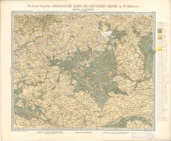
Geologisches Karte des Deutschen Reichs – 11. Allenstein (Lepsius, 1897)
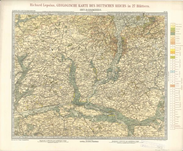
Geologisches Karte des Deutschen Reichs – 10. Bromberg (Lepsius, 1897)
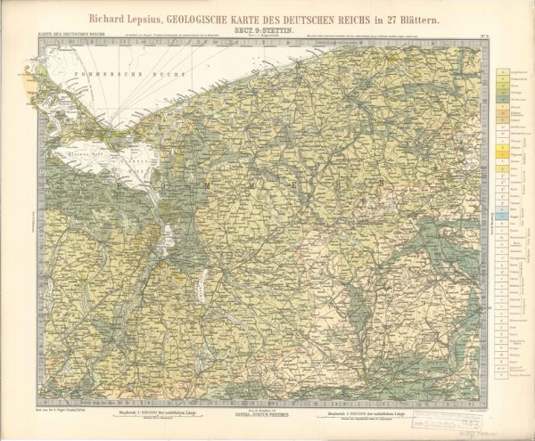
Geologisches Karte des Deutschen Reichs – 9. Stettin (Lepsius, 1897)
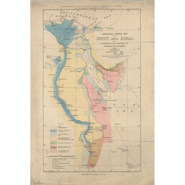
Geological Sketch Map of Egypt and Sinai (Topley 1888)
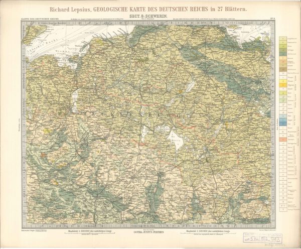
Geologisches Karte des Deutschen Reichs – 8. Schwerin (Lepsius, 1897)
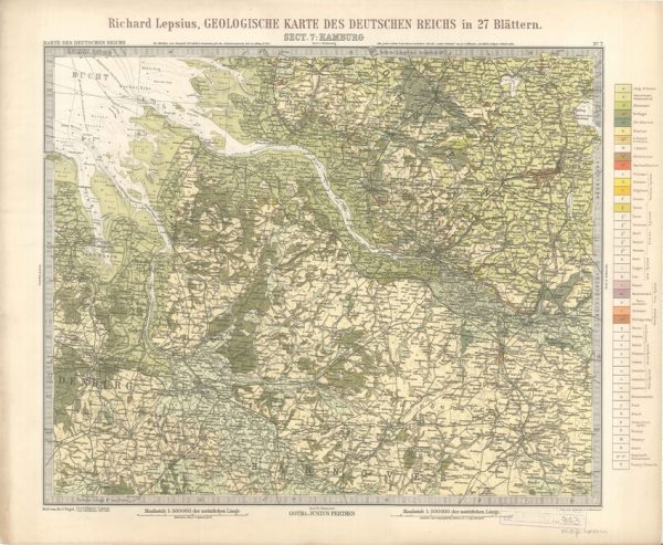
Geologisches Karte des Deutschen Reichs – 7. Hamburg (Lepsius, 1897)
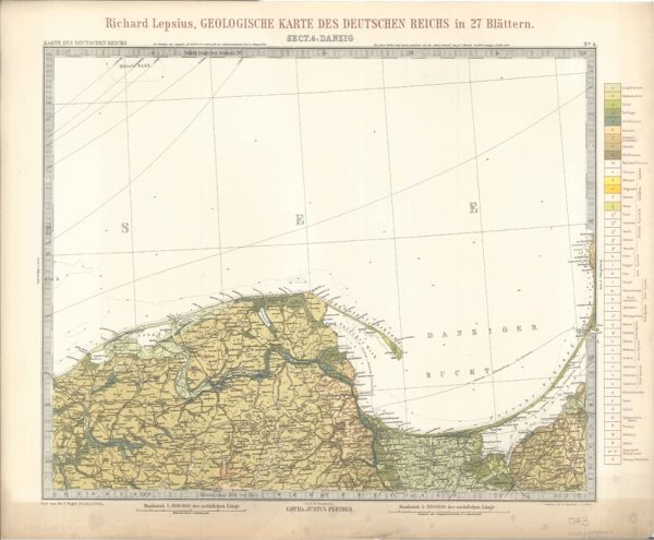
Geologisches Karte des Deutschen Reichs – 4. Danzig (Lepsius, 1897)
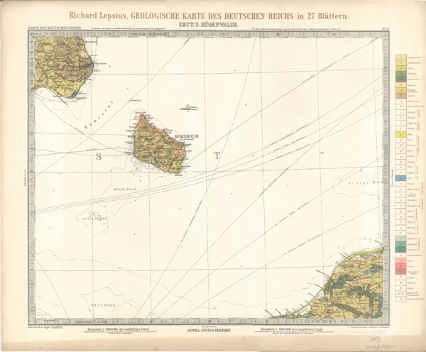
Geologisches Karte des Deutschen Reichs – 3. Rugenwalde (Lepsius, 1897)
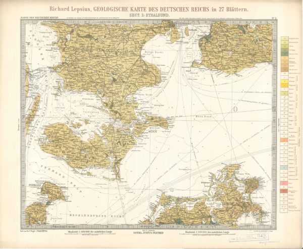
Geologisches Karte des Deutschen Reichs – 2. Stralsund (Lepsius, 1897)
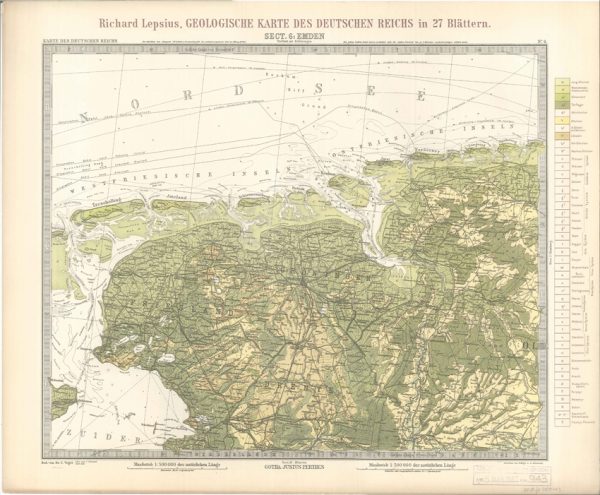
Geologisches Karte des Deutschen Reichs – 6. Emden (Lepsius, 1897)
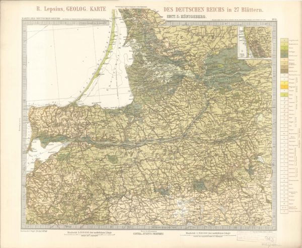
Geologisches Karte des Deutschen Reichs – 5. Konigsberg (Lepsius, 1897)
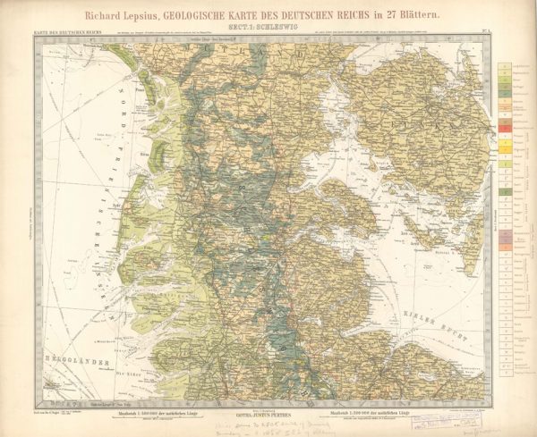
Geologisches Karte des Deutschen Reichs – 1. Schleswig (Lepsius, 1897)
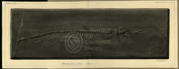
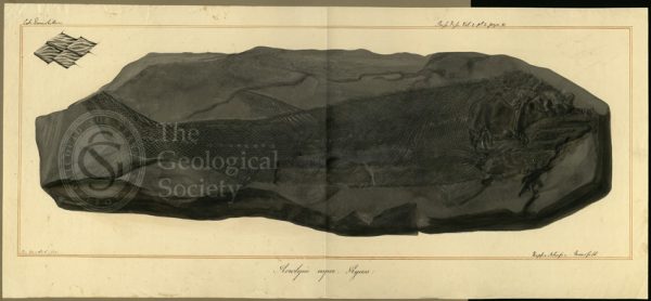
Palaeorhynchum latum Agassiz
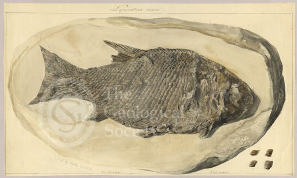
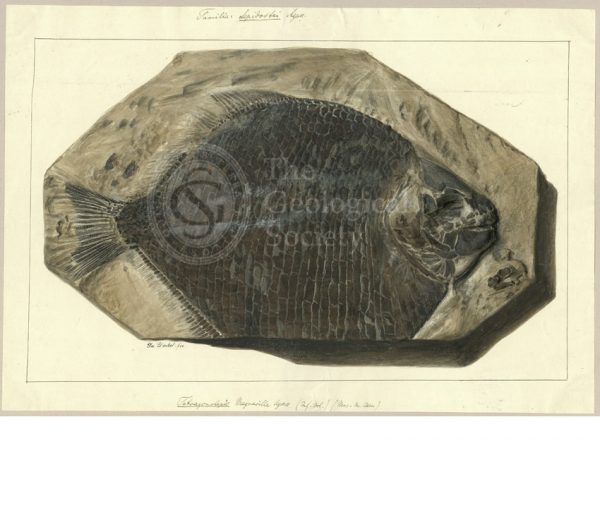
Lepidotus minor
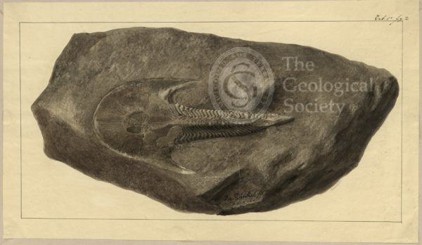
Cephalaspis Lyelli Agassiz
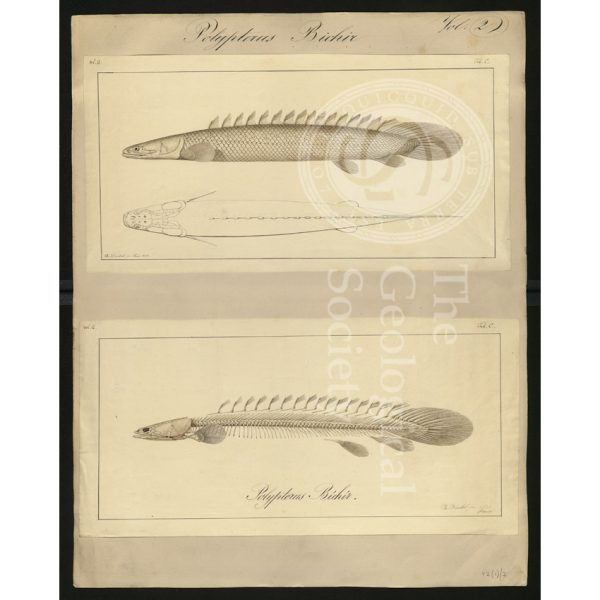
Polypterus bichir
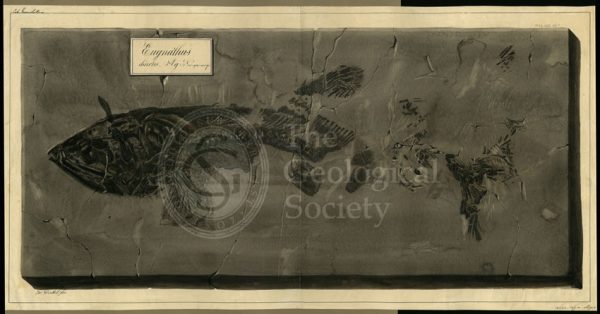
Eugnathus chirotes Agassiz
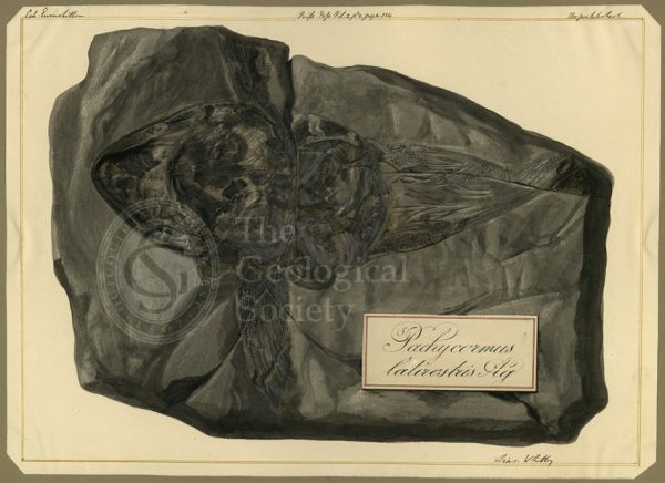
Pachycormus latirostris Agassiz
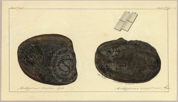
Amblypterus striatus Agassiz and Amblypterus nemopterus Agassiz
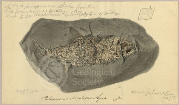
Palaeoniscus striolatus Agassiz
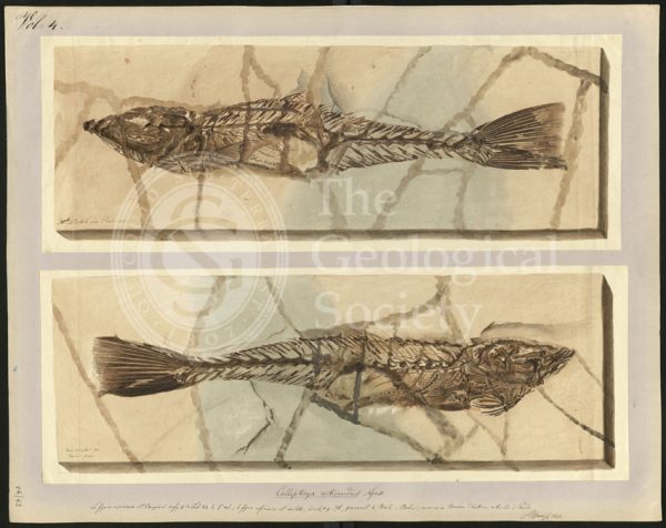
Callipteryx reticaudus Agassiz
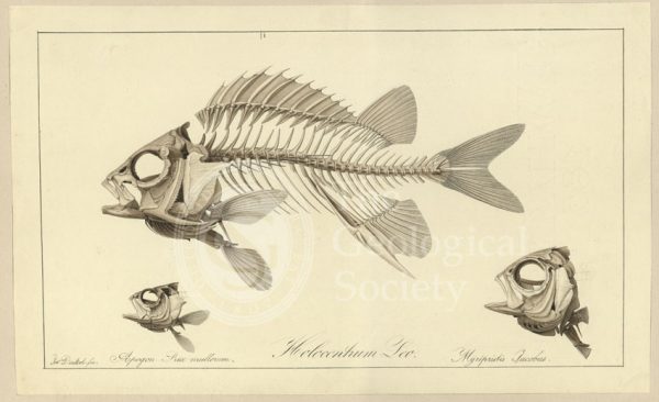
Holocentrum Leo; Apogon Rex multorum; Myrlpristis Jacobus
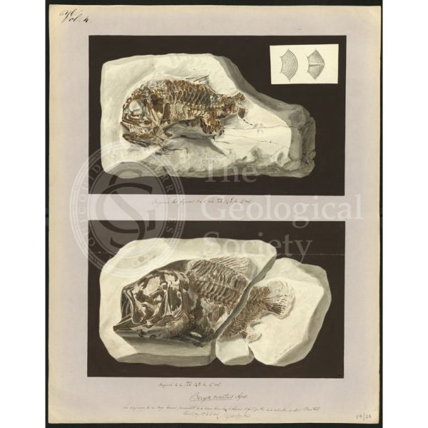
Beryx ornatus Agassiz
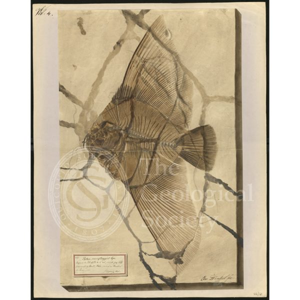
Platax macropterygius Agassiz
Acrolepis asper Agassiz
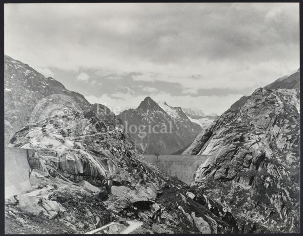
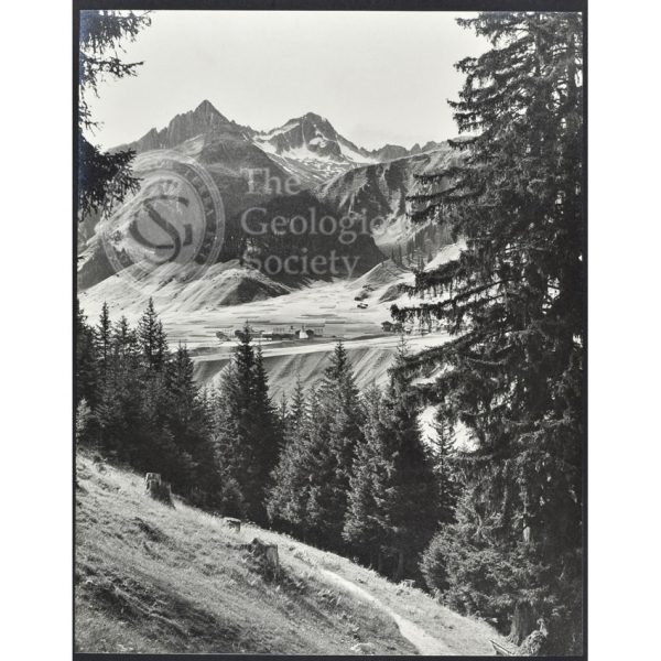
“The Grimsel Hospiz on the Nollen…”
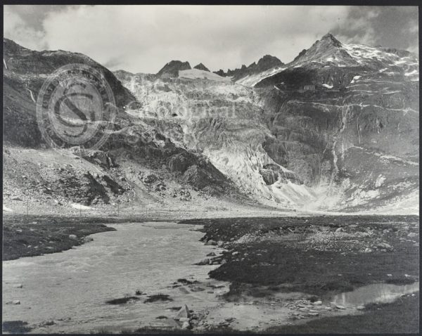
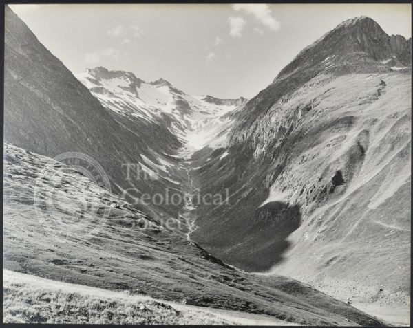
“The Rhone Gletscher…”
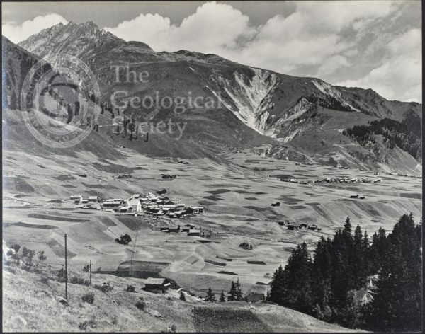
“The Tobel Drun and the villages of Ruèras, Zarcuns, Camischolas and Sedrun…”
“Culmatsch and Piz Ner from near St. Anton Surrhein”
“The Val Giuf…”
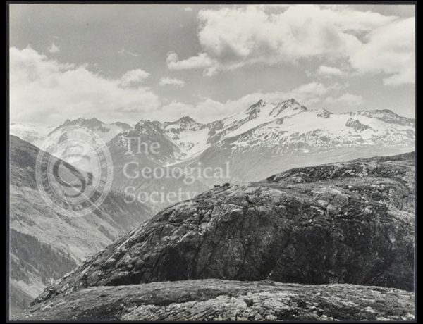
“A view…to the east of the Todtensee near the summit of the Grimsel Pass”
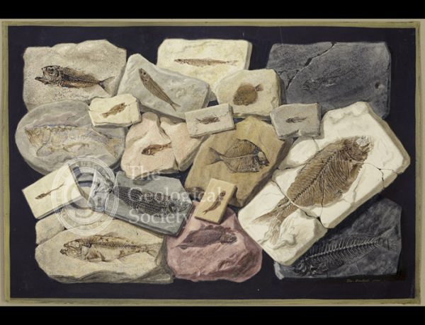
Fossil fish from the collection of William Willoughby Cole
“The Schienstock and Bächistock…”
Tetragonolepis Magneville Agassiz
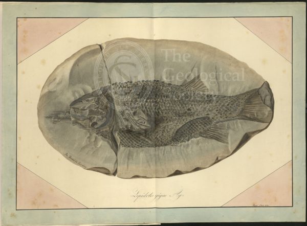
Lepidotus gigas Agassiz
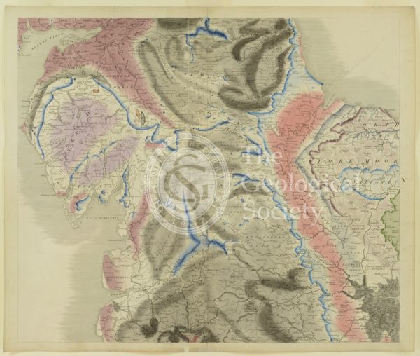
Plate V [Yorkshire]
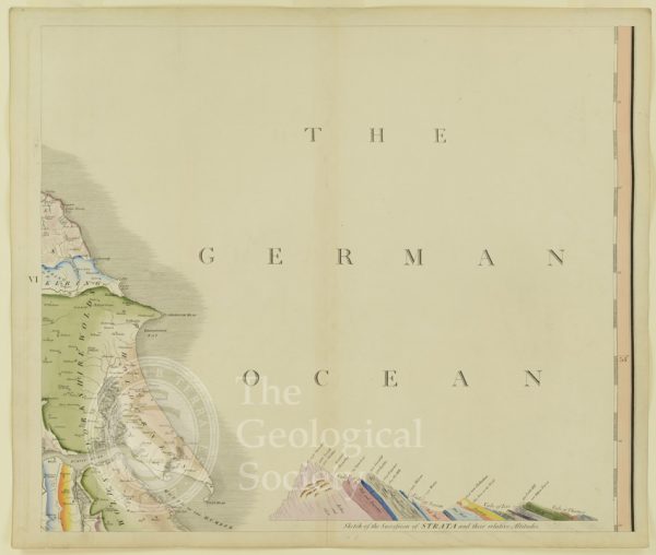
Plate VI [German Ocean]
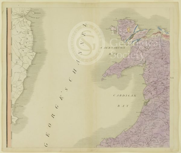
Plate VII [St George’s Channel]
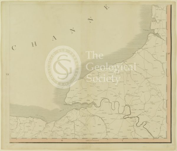
Plate XV [France]
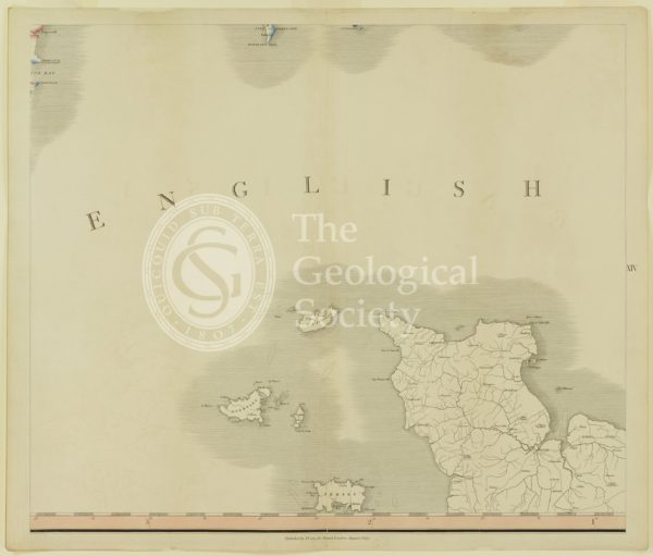
Plate XIV [English Channel]
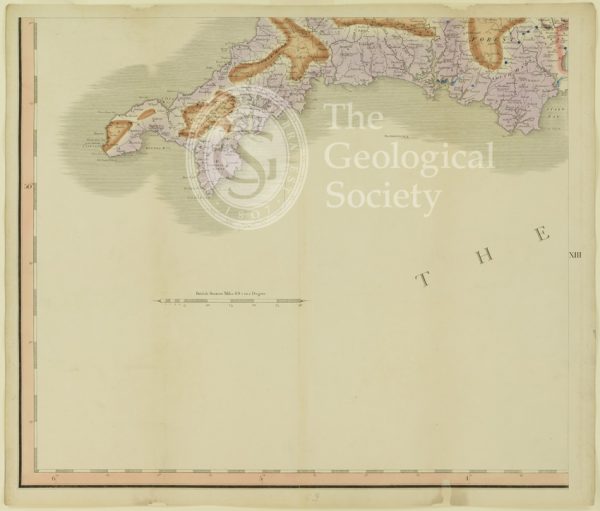
Plate XIII [Cornwall]
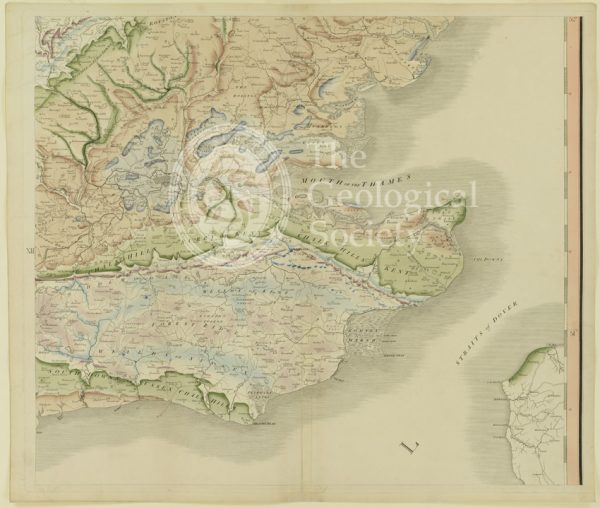
Plate XII [Kent]
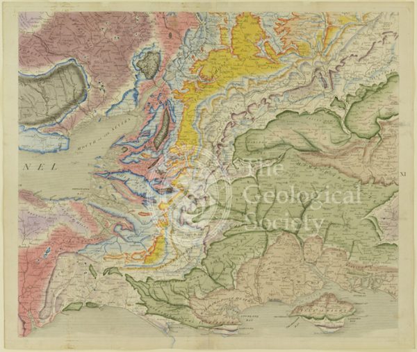
Plate X [Isle of Wight]
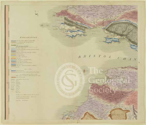
Plate X [Bristol Channel]
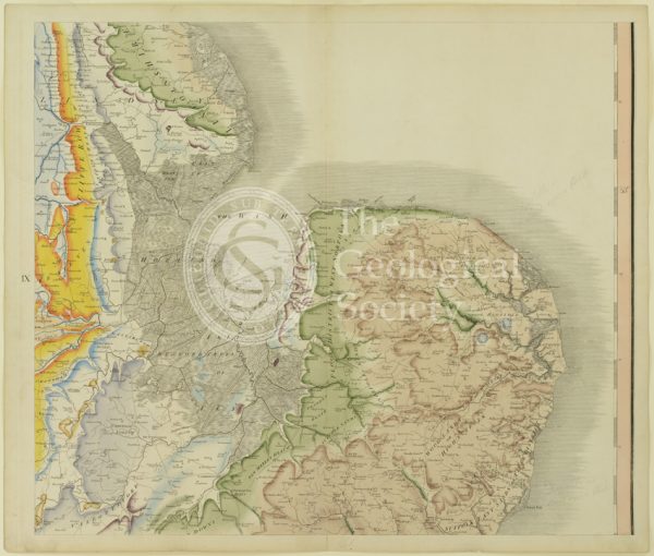
Plate IX [East Anglia]
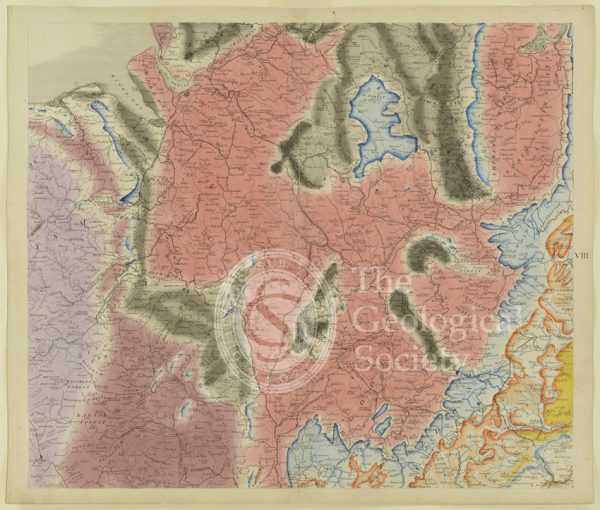
Plate VIII [Welsh border]
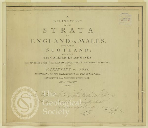
Plate III [Title page]
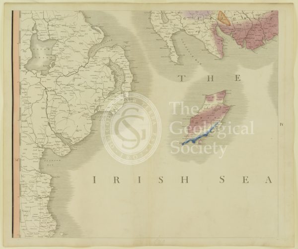
Plate IV [Irish Sea]
‘A Delineation of the Strata of England and Wales…’ (Smith, 1815)
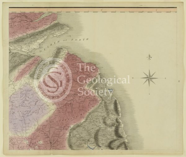
Plate II [Firth of Forth]
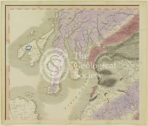
Plate I [Firth of Clyde]

Hanging Stone, Charnwood
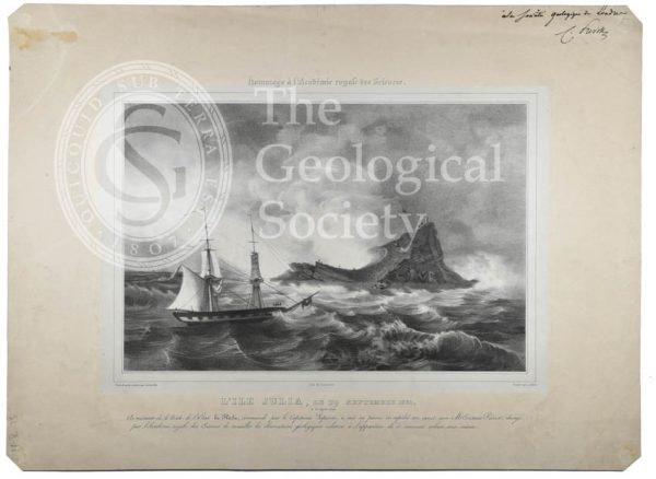
L’ile Julia (Julia’s Isle)

John MacCulloch (1773-1835)
Geological map of Northumberland (Fry, c.1814)
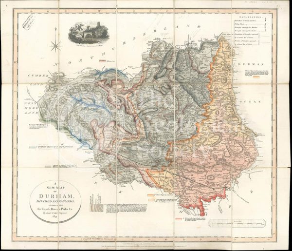
‘A New Map of Durham divided into Wards…’ (Smith, 1831)
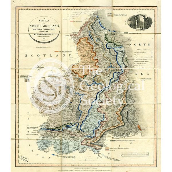
‘A New Map of Northumberland divided into Wards…’ (Smith, 1831)
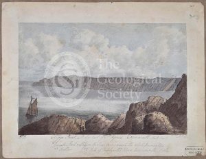
‘Eastern side of second cove east of St Agnes called Park Cove’
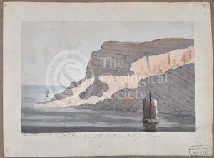
‘Eastern side of the fourth cove east of St Agnes’
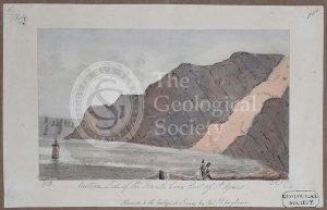
‘Eastern promontory of the first cove east of St Agnes’
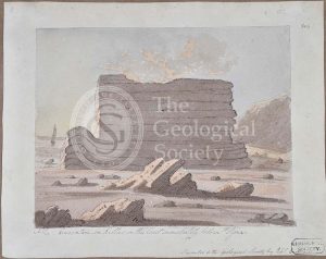
‘Cligga Point 4 miles east of St Agnes Cornwall north coast’
‘Curvature in killas on the coast immediately below St Agnes’
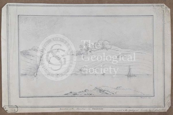
‘Curvature of the limestone at Chepstow’
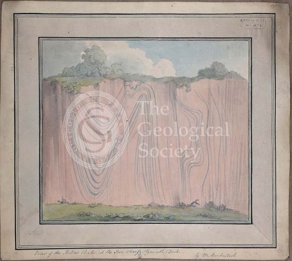
View of the killas rocks at the Gun Wharf Plymouth Dock’
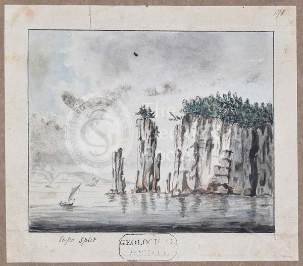
‘Cape Split, Nova Scotia’
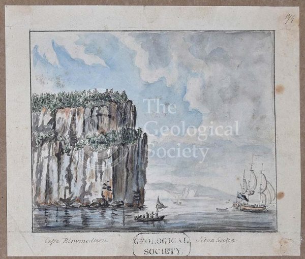
‘Cape Blowmedown [Blomidon], Nova Scotia’
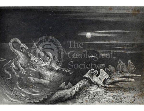
‘Great Sea Dragons’
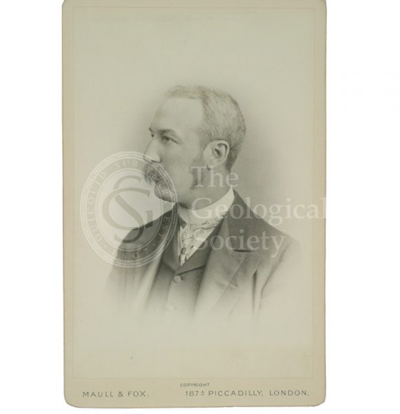
George Simmonds [Simonds] Boulger (1853-1922)
Anniversary Dinner Menu, 1894
Charles Dawson (1864-1916)
Joseph Dalton Hooker (1817-1911)

Sir Charles Lyell (1797-1875)
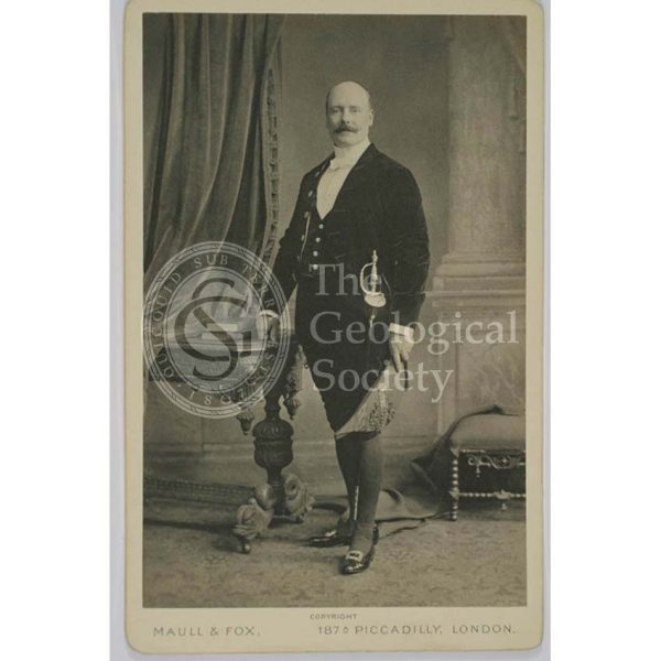
William Buckland (1784-1856)
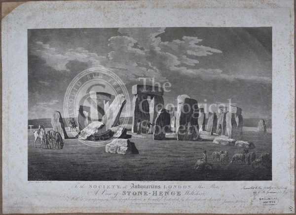
‘A view of Stone-Henge [Stonehenge] Wiltshire’

Discussion on the Piltdown Skull
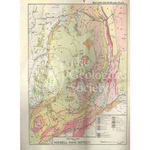
Geological Map of the Rhobell Fawr District (Wells, 1925)
Trap veins at Airdnamurchan point… (Stewart after MacCulloch, 1819)
Sky and the adjoining islands (Stewart after MacCulloch, 1817)
Sky and the adjoining islands (Stewart after MacCulloch, 1817)
Geologische Elementarkarte, plate 3 (Klöpfel, 1838)
Sketch map of the Rhenosterberg, South Africa (Stow, 1858)
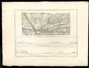
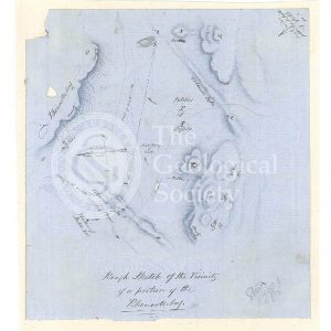
Plan of Glen Roy and of the Parallel Roads (MacCulloch, 1817)
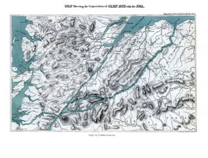
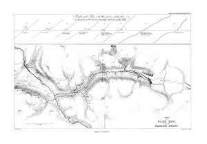
Map shewing the Connections of Glen Roy with the Sea (Cross, 1817)
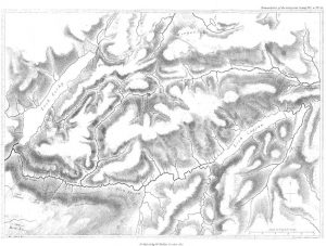
Map of Glen Roy (MacCulloch, 1817)
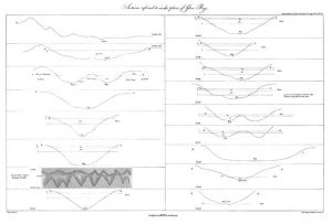
Sections of Glen Roy (MacCulloch, 1817)
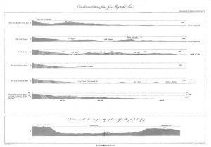
Curvilinear Sections from Glen Roy to the Sea (MacCulloch, 1817)
Various flexures of gneiss in Lewis (Stewart after MacCulloch, 1819)
Selected parts of the East Coast of Trotternish (Stewart after MacCulloch, 1819)
Granite veins and gneiss at Cape Wrath… (Stewart after MacCulloch, 1819)
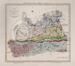
Geological Map of Surry (William Smith, 1819)
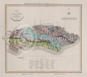
Geological Map of Sussex (William Smith, 1819)
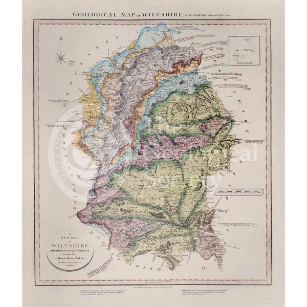
Geological Map of Wiltshire (William Smith, 1819)
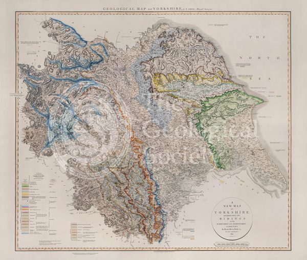
Geological Map of Yorkshire (William Smith, 1821)
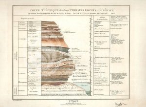
Theoretical section through the Paris Basin (Cuvier, Brongniart and Clerget, 1832)
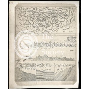
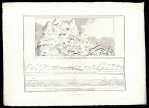
Imaginary plan and sections of Wernerian formations (Theonert, c.1810)
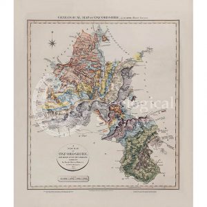
Geological map of Oxfordshire (William Smith, 1820)
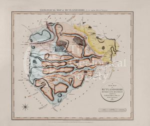
Geological Map of Rutlandshire (William Smith, 1822)
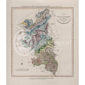
Geological Map of Buckinghamshire (William Smith, 1820)
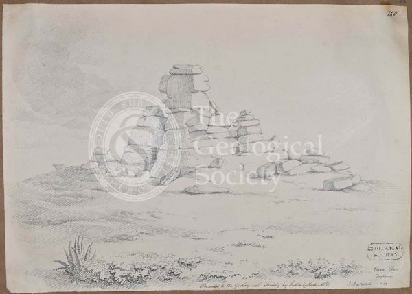
Vixen Tor, Dartmoor
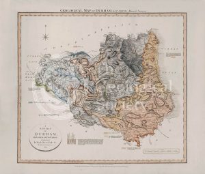
Geological Map of Durham (William Smith, 1824)
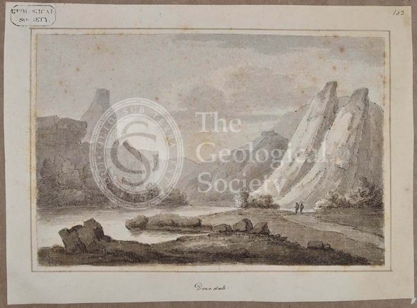
‘Dovedale’
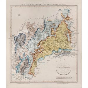
Geological Map of Gloucestershire (William Smith, 1819)
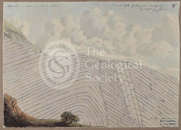
‘Curvature in Lias near Shepton Mallet’
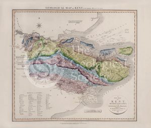
Geological Map of Kent (William Smith, 1819)
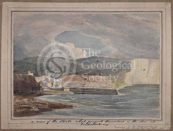
‘A view of the strata which present themselves on the shore of Folkestone’
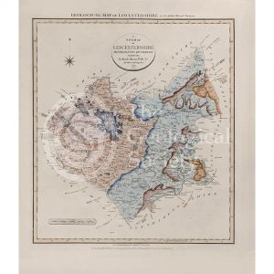
Geological Map of Leicestershire (William Smith, 1822)
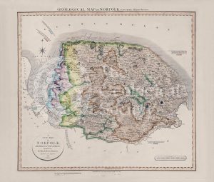
Geological Map of Norfolk (William Smith, 1819)
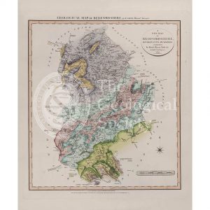
Geological Map of Bedfordshire (William Smith, 1820)
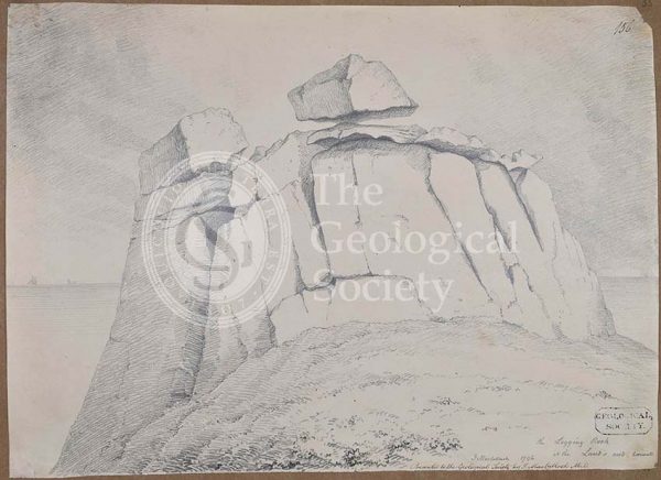
The logging rock at the Lands End Cornwall
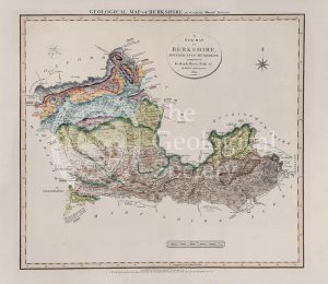
Geological Map of Berkshire (William Smith, 1819)
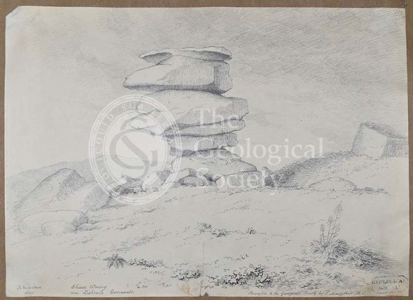
Cheese Wring near Liskeard, Cornwall
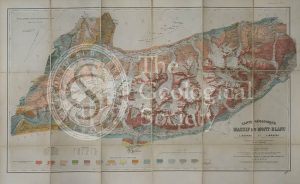
Carte géologique du Massif du Mont-Blanc (Duparc and Mrazec, 1896)
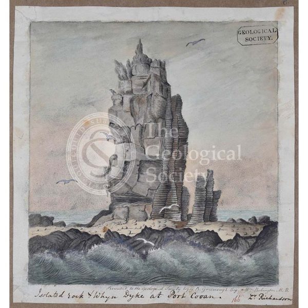
‘Isolated rock and whyn dyke at Port Cooan’
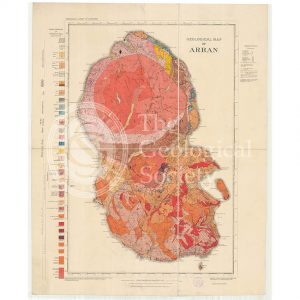
Geological Map of Arran (The Survey, 1910)
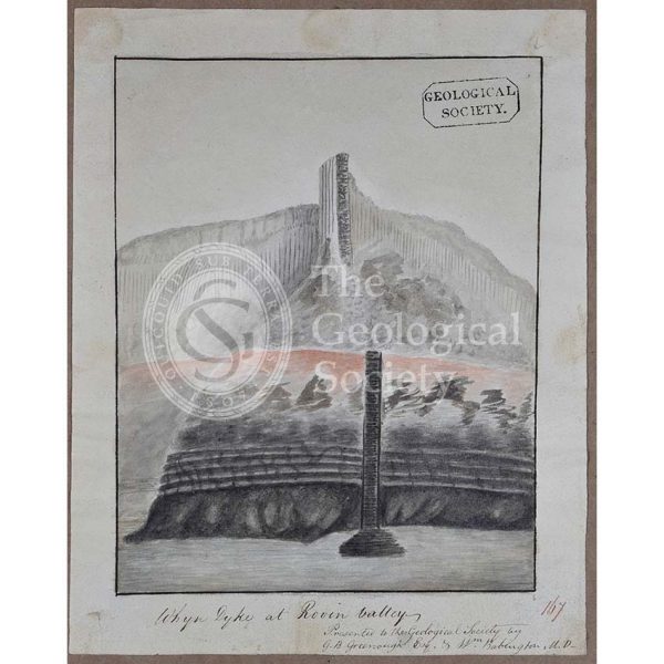
‘Whyn dyke at Rovin Valley’