
000Maximum-Sizes
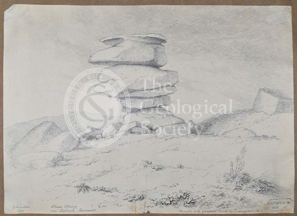
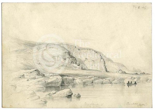
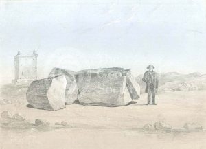
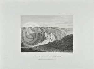
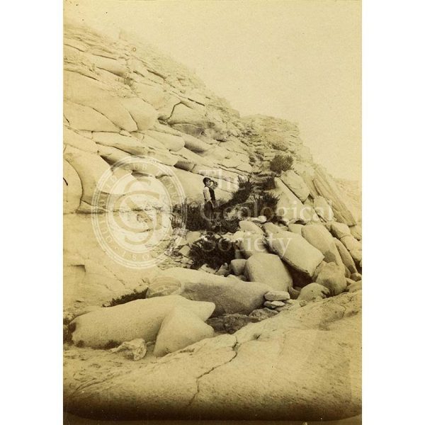
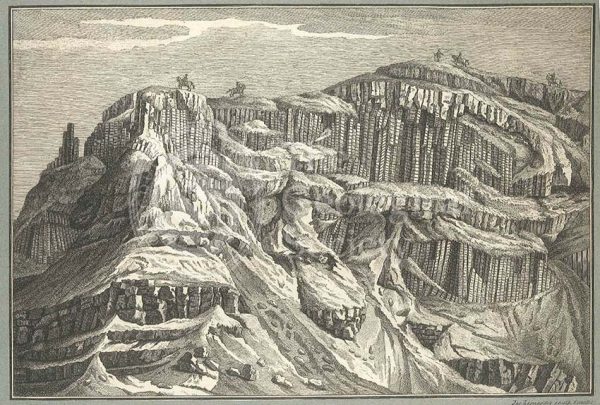
Cheese Wring near Liskeard, Cornwall
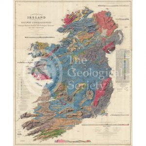
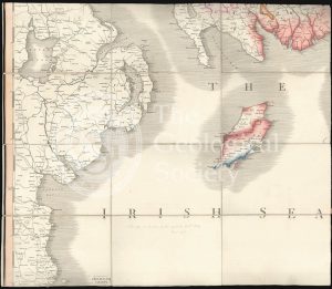
A general map of Ireland… (Griffith, 1855)
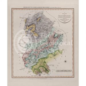
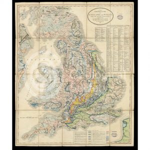
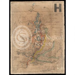
Geological Map of Bedfordshire (William Smith, 1820)
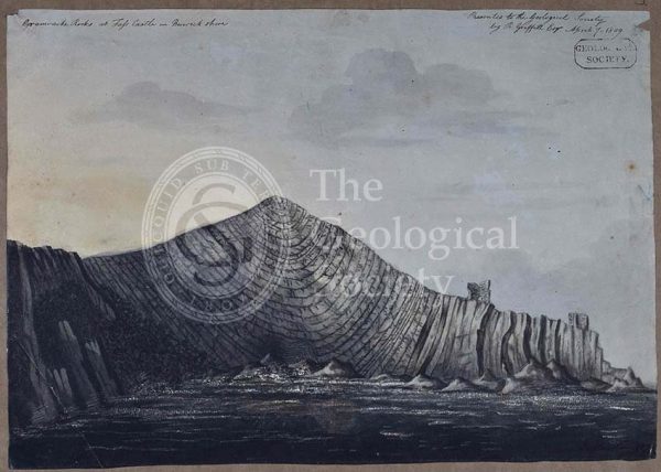
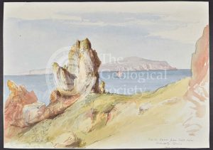
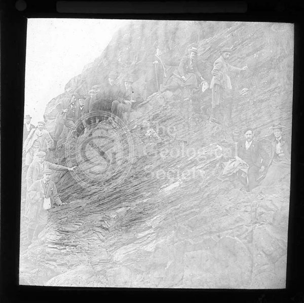
‘Grauwacke rocks at Fass Castle in Berwickshire’
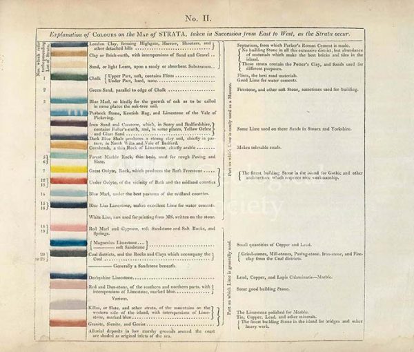
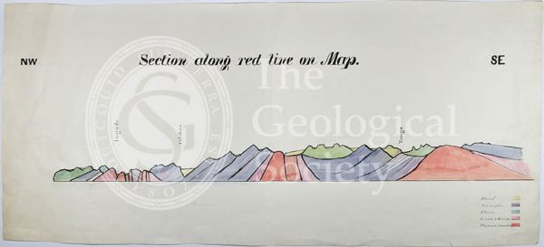
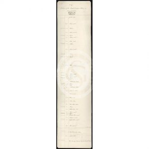
Table of the ‘Explanation of Colours on the Map of Strata…’
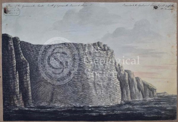
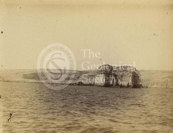
‘View of the Grauwacke rocks south of Eyemouth Berwickshire’
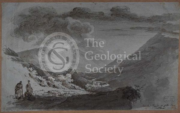
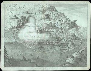
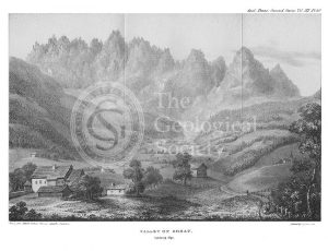
‘Parallel roads of Glen Roy’
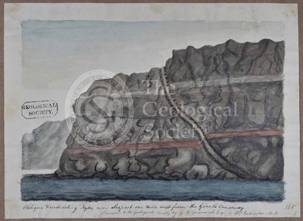
‘Oblique undulating dyke near Seaport one mile west from the Giants Causeway’
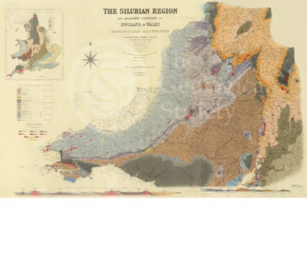
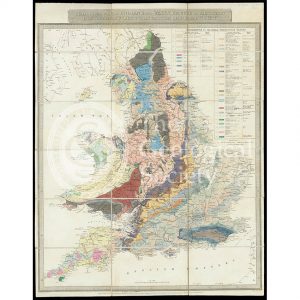
Map of the Silurian Region (Murchison, 1838)
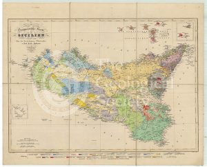
Geognostische Karte Sicilien (Hoffmann, 1839)
Geological map of Brough-under-Stainmore (Geological Survey of England & Wales, 1893)
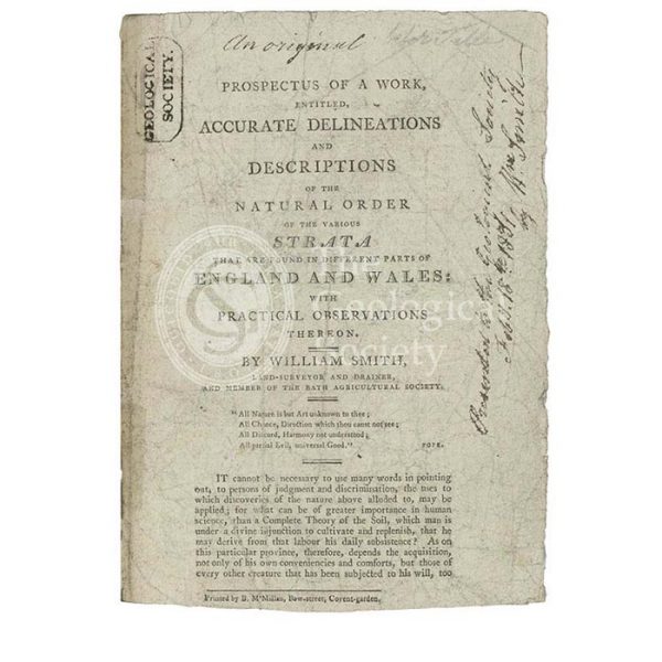
Prospectus for ‘Accurate Delineations and Descriptions of the Natural Order of the Various Strata…’
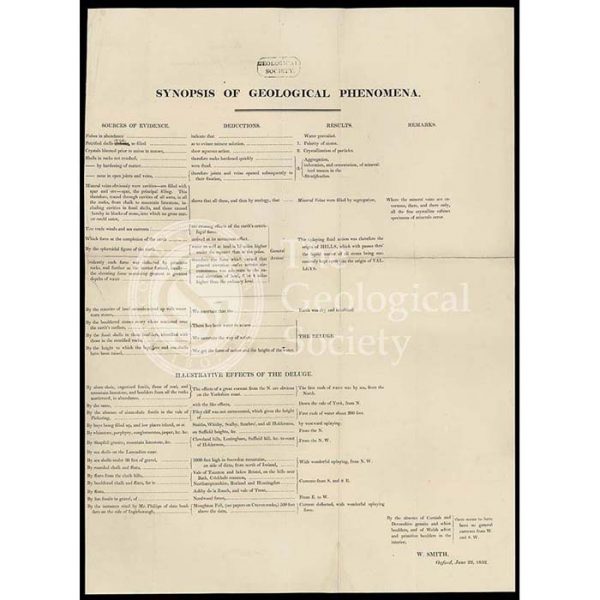
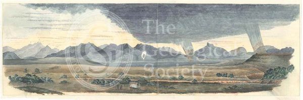
‘Synopsis of Geological Phenomena’
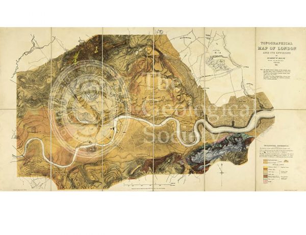
Topographical [and Geological] Map of London… (Mylne, 1851)
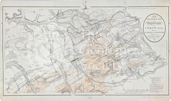
Geological map of the mining district of Cornwall… (Thomas, 1819)
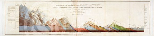
Geological Section from London to Snowdon (Smith, 1817)
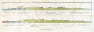
Section of the country east of Lake Baikal, Siberia (geology near Nerchinsk) (Austin, 1848-1862)
Dyke on Great Cumbra, Western Isles, Scotland
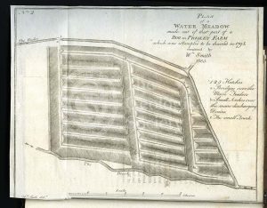
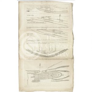
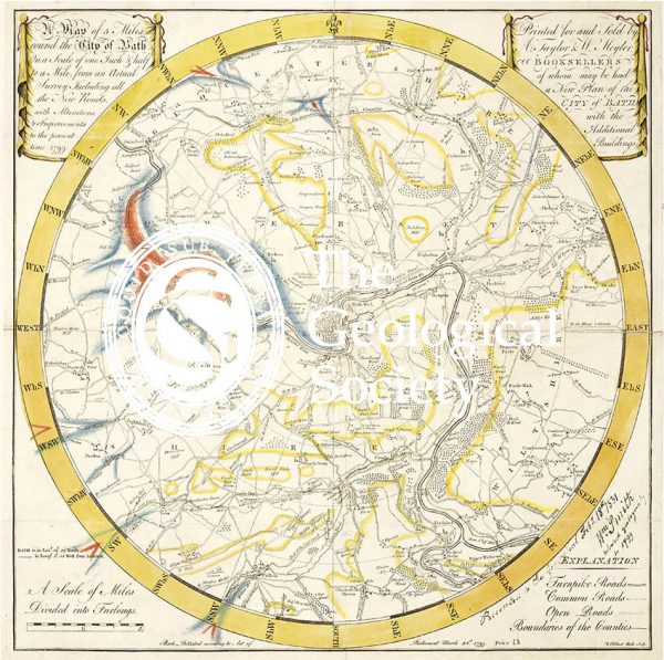
‘Plan of a Water-Meadow made out of part of a Bog…’
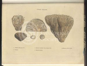
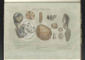
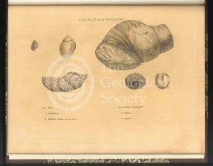
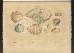
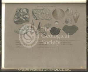
Upper Oolite fossils
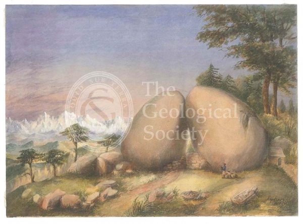
Boulder rocks at Debre Doura, Kumaun, India
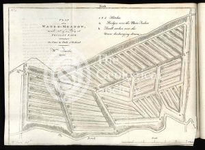
‘Plan of a Water-Meadow made out of a Bog…’
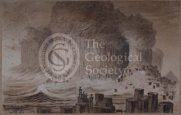
‘Staffa’
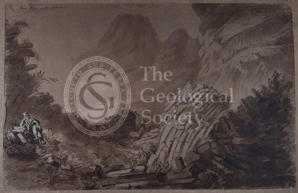
‘Scur Eigg in the Hebrides’
Granite outcrops in Kolyvan, Sibiera
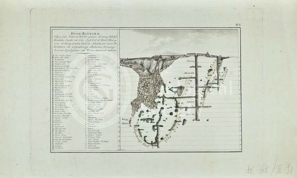
Sukhoboisk, Samilovsky and Froloosky copper mines
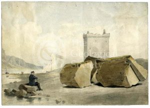
Split boulder on Little Cumbra, Western Isles
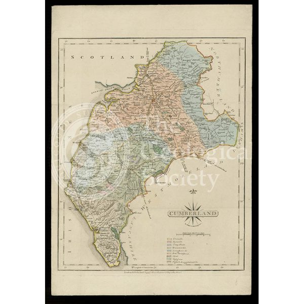
Geological map of Cumberland (Fry, c.1814)
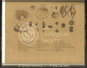
Forest Marble fossils
Clay over the Upper Oolite fossils
Split boulder on Little Cumbra, Western Isles
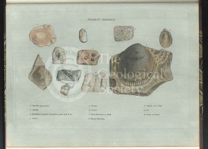
Fullers Earth fossils
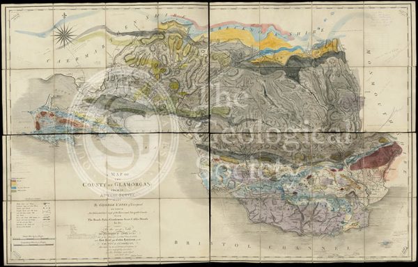
Geological map of Glamorgan (Greenough/Smith 1799-1818)
Geological Map of England & Wales… [Greenough reduction] (Gardner after Greenough, 1826)
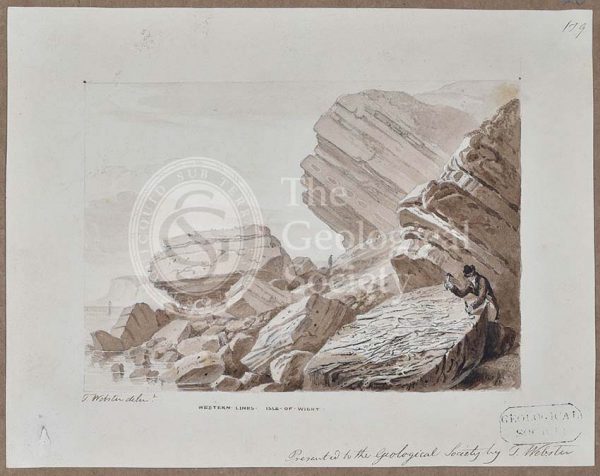
Geological Map of England & Wales. Sheet 10 Isle of Wight (Murchison, 1856)
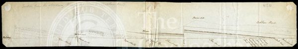
Section from the Medway through Upnor to Cockham Wood (Dadd, 1833)
Coral Rag fossils
A New Geological Map of England & Wales… [Smith reduction] (Smith & Cary, 1827)
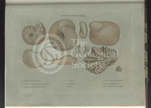
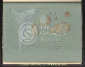
Clunch Clay fossils
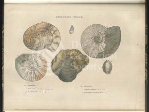
Kelloways Stone fossils
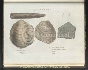
Cornbrash fossils
‘North Suter from South Suter’
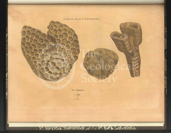
Coral Rag fossils
Section of the Bath Easton Coal Mine, Avon (Unknown, 1808?)
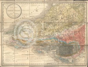
A New Map of South Wales (Greenough and Coltman, between 1813-1839)
‘Cape Wrath’
Section of the Bath Easton Mine in Somersetshire (Webster, 1812)
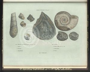
Oak Tree Clay fossils
Greenough’s copy of William Smith’s geological map (Smith with notes by Greenough, 1815/1818)
Sections and plan of the collieries around Nailsea (Martin and Smith, 1811)
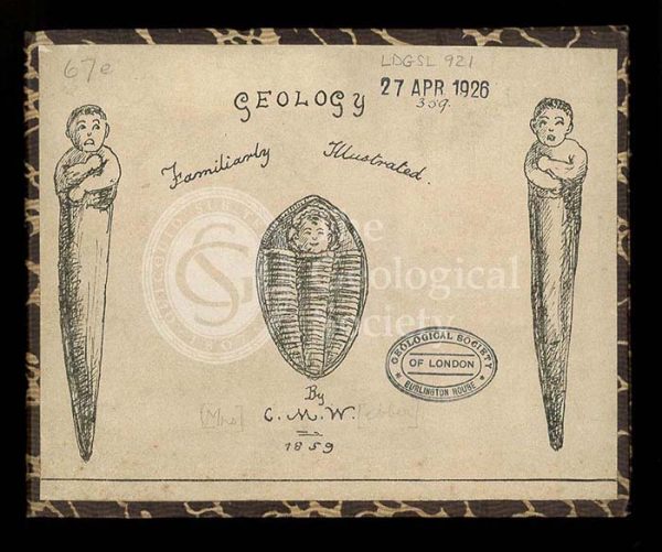
‘Geology, familiarly illustrated’
Green Sand fossils
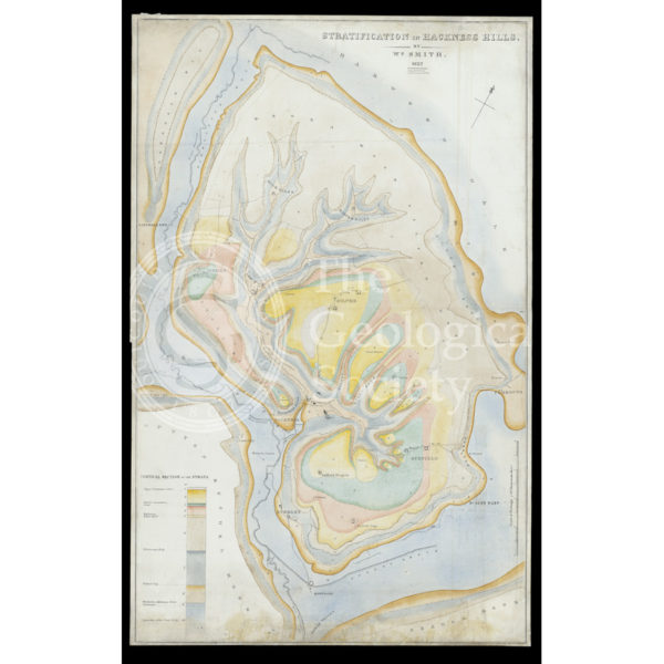
Stratification in Hackness Hills (Smith, 1832)
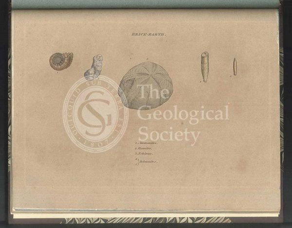
Brick Earth fossils
‘Cunaig in Assynt, Sutherlandshire’
William Smith’s Table of Strata… under UVA light (Smith original 1799, UVA negative 1972)
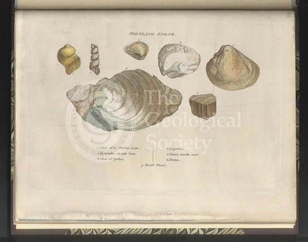
Portland Stone fossils
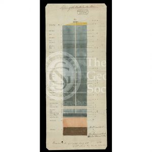
Table of Strata in the Vicinity of Bath (Smith & Richardson, 1799)
Reproduction of William Smith’s Table of Strata… (Judd after Smith & Richardson, 1897)
‘Craig’ [Crag] fossils
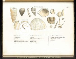
Upper Chalk fossils
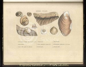
Lower Chalk fossils
Green Sand fossils
‘General Map of Strata…’ under infrared light (Smith, 1801 – negative created 1972)
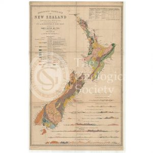
Map of New Zealand (James Hector, 1873)
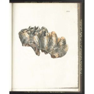
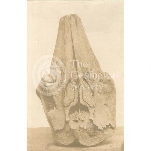
Tooth of a Mastodon
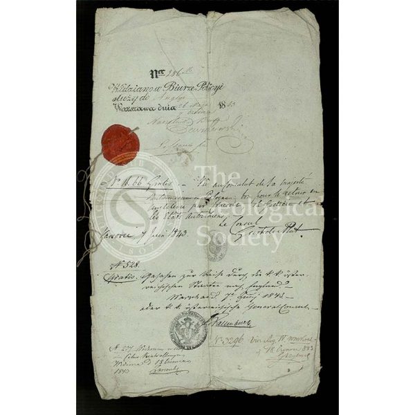
Roderick Murchison’s Russian ‘passport’
London Clay fossils
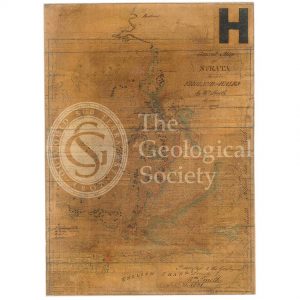
General map of strata found in England & Wales (Smith 1794/1801)
Reconstruction of William Smith’s “General Map of Strata found in England & Wales” (Judd & Reekes, 1897)
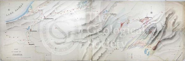
Geological Map of the country east of Lake Baikal, Siberia
Reconstruction of William Smith’s Geological Map of Bath (1799) (Lam, 2014)
Roderick Murchison’s Russian ‘passport’
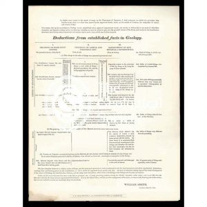
‘Deductions from established facts in geology’
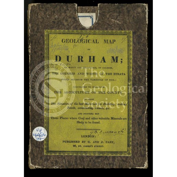
Original box and label for a ‘Geological Map of Durham’ (1831)
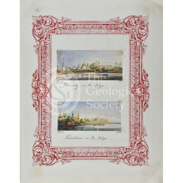
Jurievetz & Kinschina on the Volga
Geological Map of Bath (Smith, 1799)
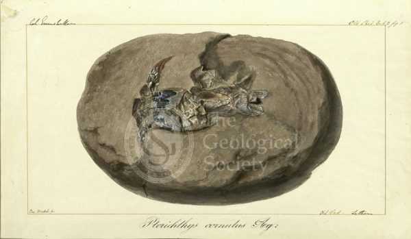
Pterichthys cornutus Agassiz
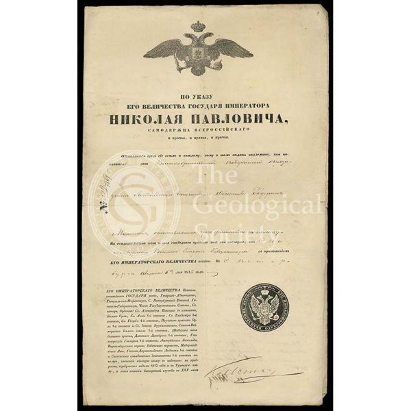
Roderick Murchison’s travel permit for Russia
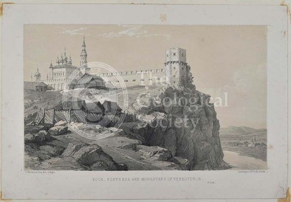
‘Rock, Fortress and monastery of Verkoturie’
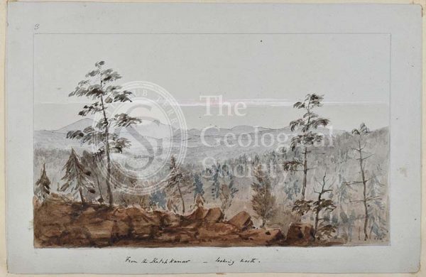
‘From the Katchnakar – looking north’
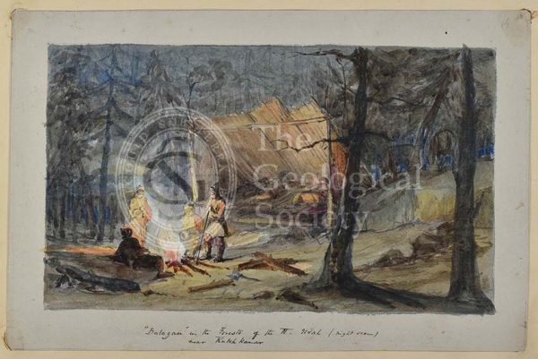
‘Balagan in the Forests of the N Ural’
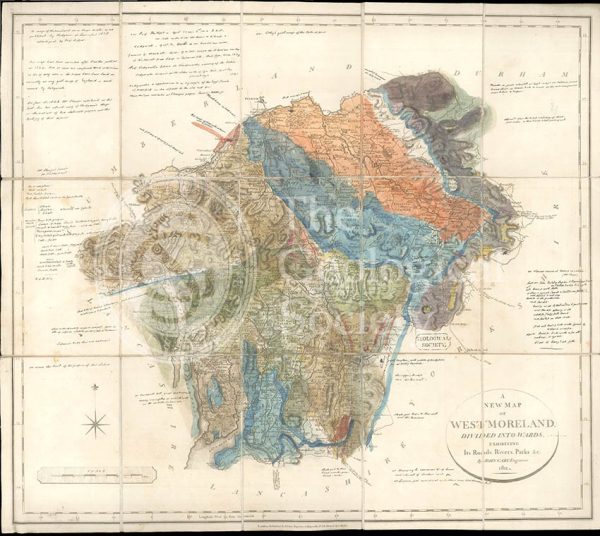
Greenough’s Map of Westmoreland (Greenough after Smith, 1824-1843)
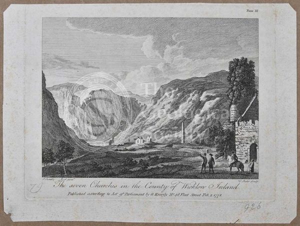
‘The seven churches in the County of Wicklow Ireland’
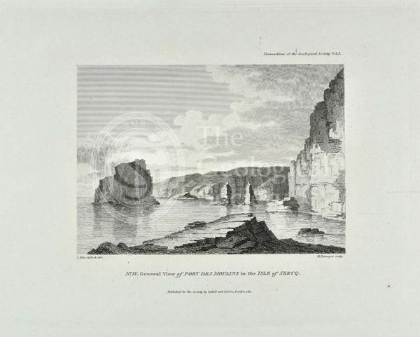
‘General view of Port Des Moulins in the Isle of Sercq’
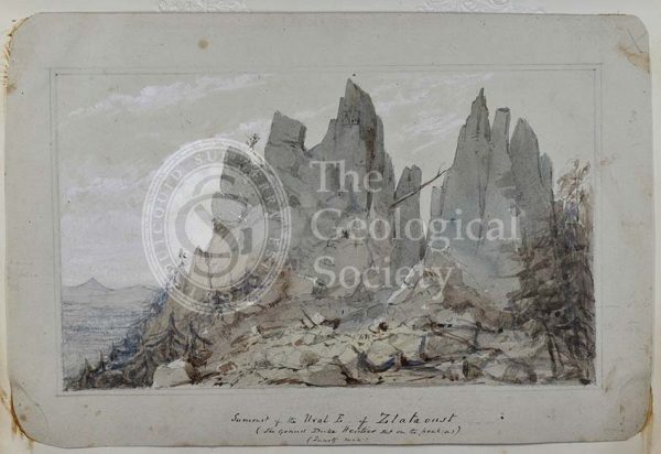
‘Summit of the Ural E of Zlatoust’
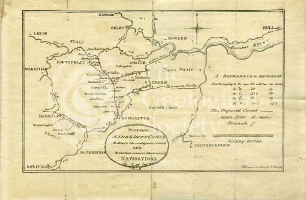
Plan of the ‘Proposed Aire & Dunn Canal’ (Smith and Phillips, 1819)
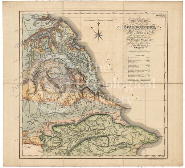
Geological map of Scarborough (Smith, 1831)
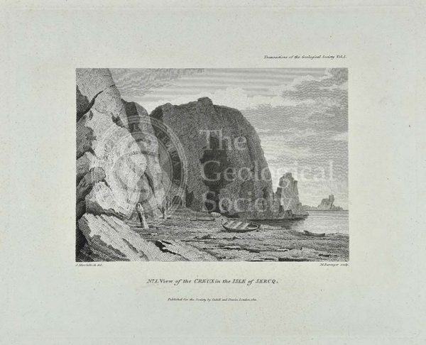
‘View of the Creux in the Isle of Sercq’
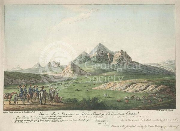
Mount Beshtau, Russia
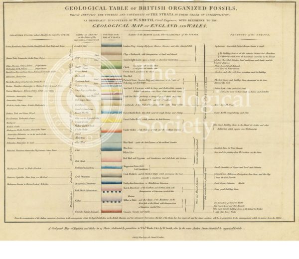
‘Geological table of British organized fossils…’
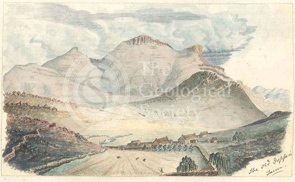
Old Dopper’s Farm, in the Rhenosterberg mountains, South Africa
‘View of the Coupee in the Isle of Sercq’
View of the Rhenosterberg mountains, South Africa
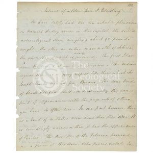
‘Extract of a letter from St Petersburg’
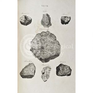
Meteorites (ordinary chondrite)
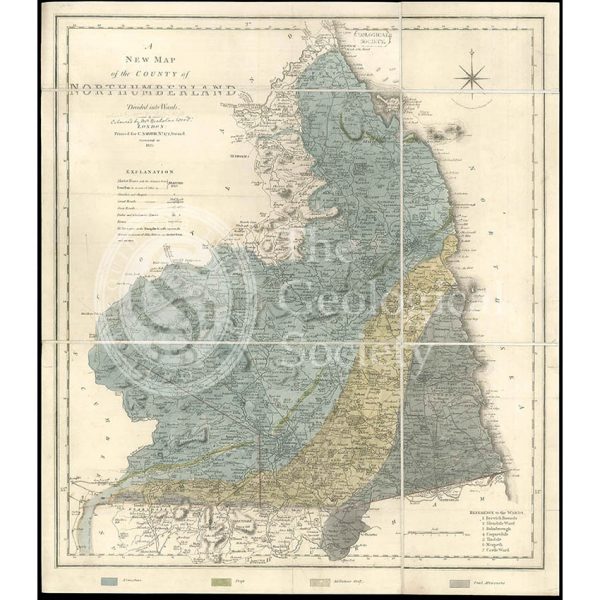
Geological map of Northumberland (Wood, 1831)
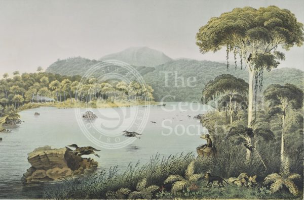
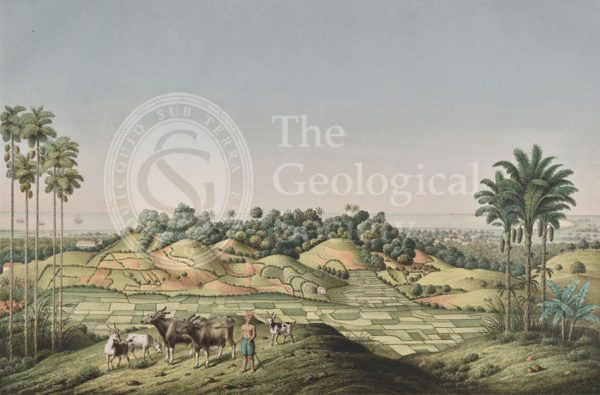
Lake Patengan, Java
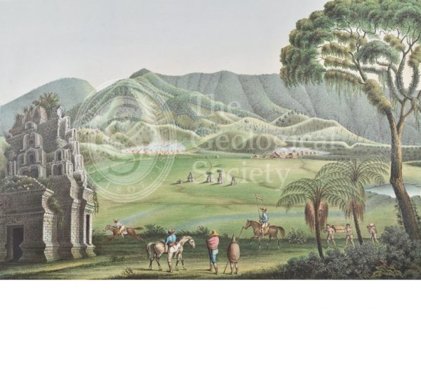
Dieng Plateau, Java
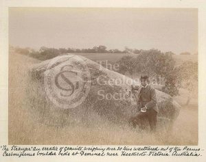
‘The Stranger’
Valley of Gosau, Salzburg Alps
Skull of a whale from Spitzbergen
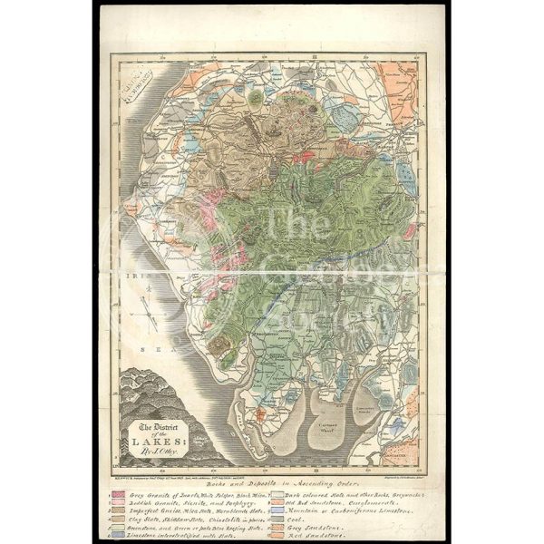
District of the Lakes (Otley, 1837)
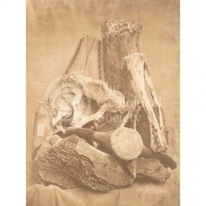
Whale bones from Spitzbergen
North coast of Java, Indonesia
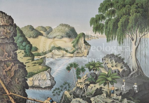
South coast of Java, Indonesia
Section of a [gold] mine, north of Orenburg, Russia
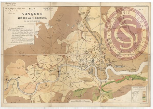
Map showing the distribution of cholera in London
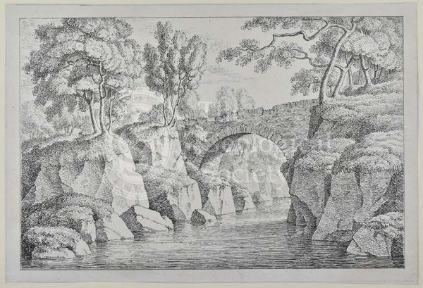
Bridge at Dunkeld

The Gigantic Greenland Whale
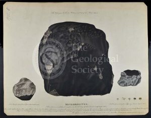
‘Meteorolites’
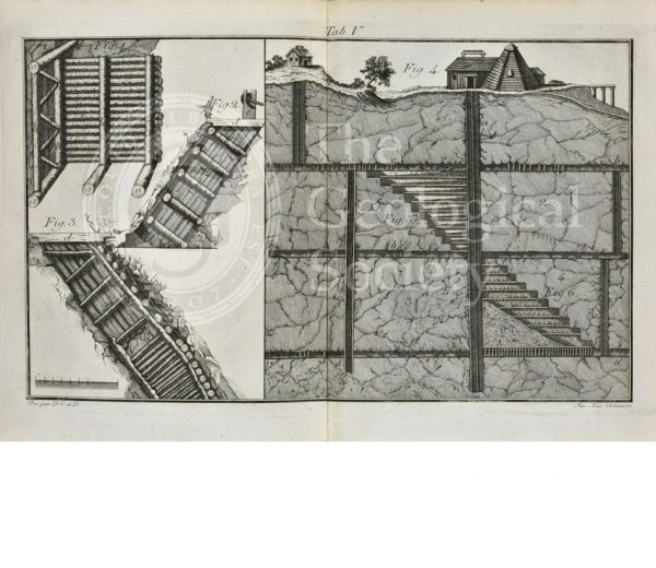
Timber supports for mining
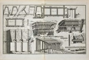
Timber supports for mining
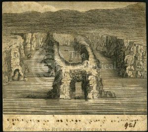
‘The Bullers of Buchan’
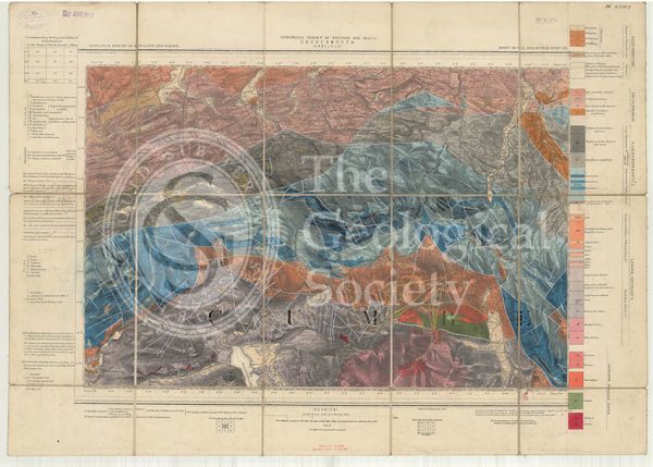
Geological map of England and Wales, Sheet 101 NE Cockermouth (1890)
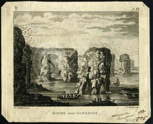
‘Rocks near Sandside’
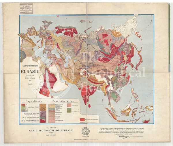
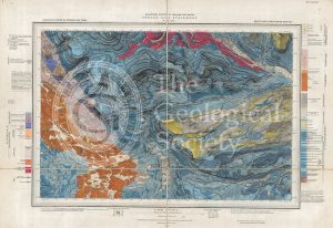
Carte tectonique de l’Eurasie (Argand, 1928)
‘Human fossil’
Buildings on a rocky outcrop
Lake Geneva, Switzerland/France
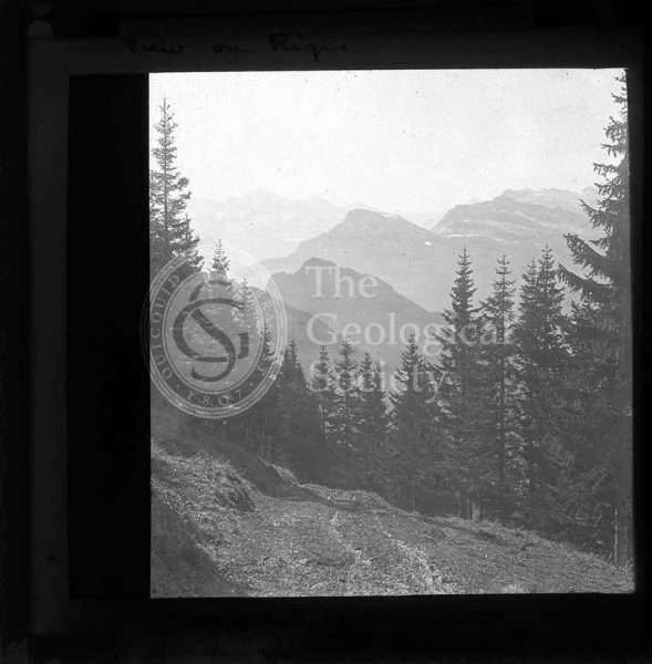
On Mount Rigi, Switzerland
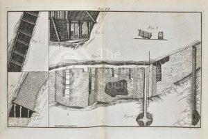
Timber supports for mining
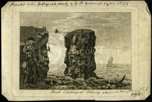
‘Bird catching at Orkney’
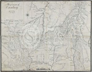
Map of the Province of Orenburg
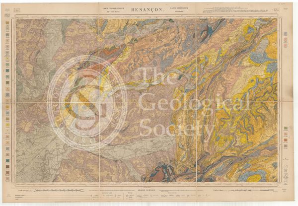
Carte géologique de la France 1:80,000. Feuille 126 Besançon (1892)
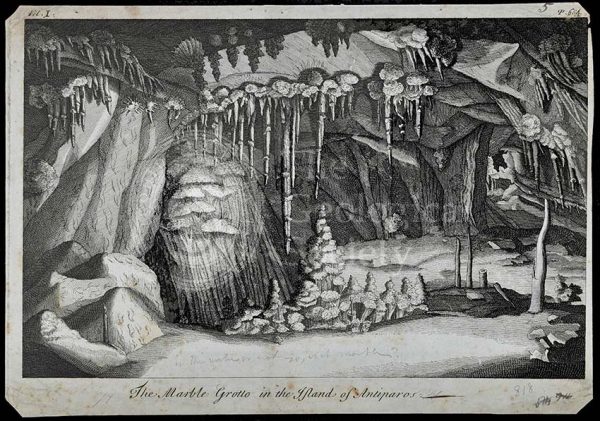
Marble Grotto in the Island of Antiparos
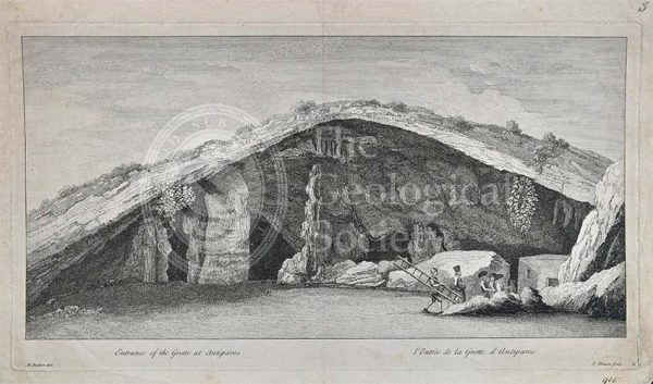
Entrance to the Grotto of Antiparos
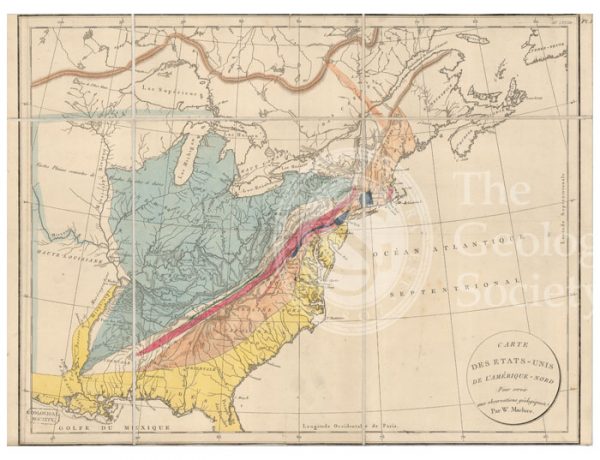
Carte des Etats-Unis de l’Amerique-Nord [Map of North America] (Maclure, 1811)
Iron smelting works, Siberia
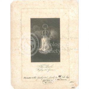
The ‘Hope Pearl’
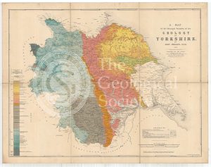
A Map of the Principal Features of the Geology of Yorkshire (Phillips, 1853)
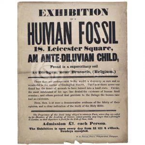
Advertisement for a ‘Human Fossil’
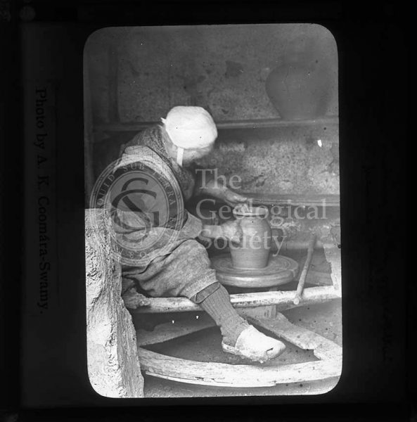
Woman making pottery, Brittany
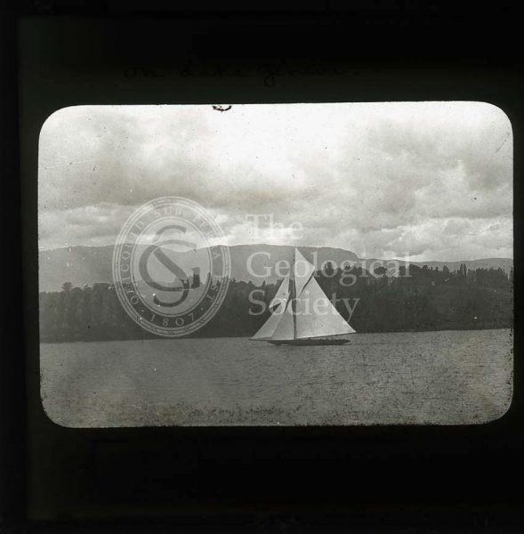
Lake Lucerne, Switzerland
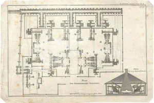
Plan of the Pyschminskischen Steel Factory
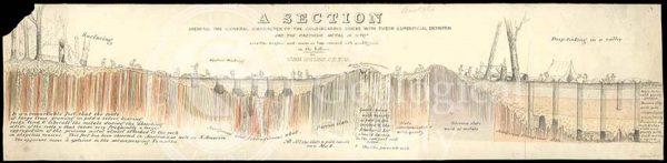
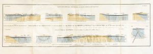
‘Section showing the general characters of the gold-bearing rocks with their superficial detritus…’
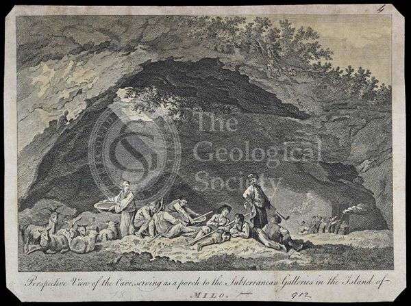
Subterranean galleries in the Island of Milo
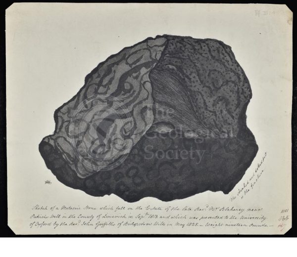
Meteorite that fell in County Limerick
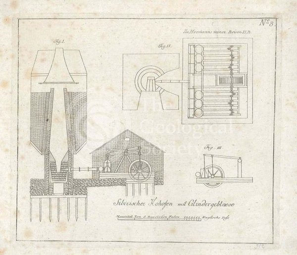
Smelting works, Siberia
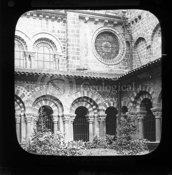
Cathedral cloisters, Le Puy
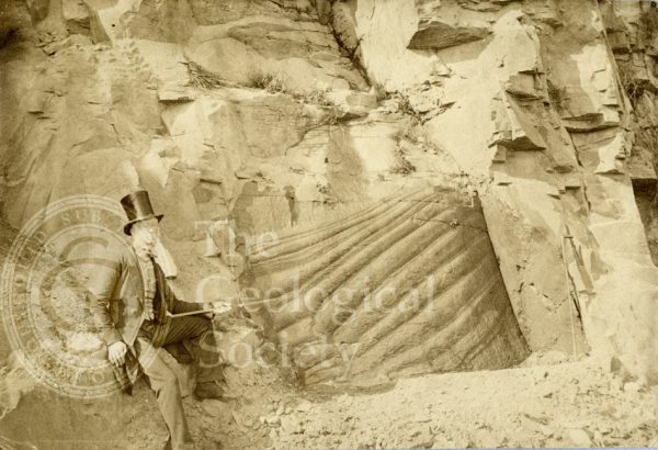
Peculiar appearance of a rock surface
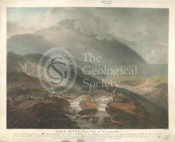
‘Gold mines, County of Wicklow’
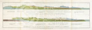
Geological views and sections of Essex/Hertfordshire and between London and Cambridge (Smith, 1819)
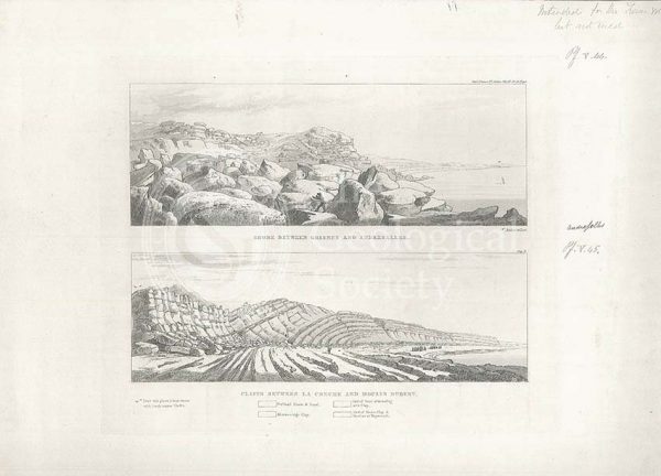
Views of the French coast
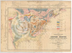
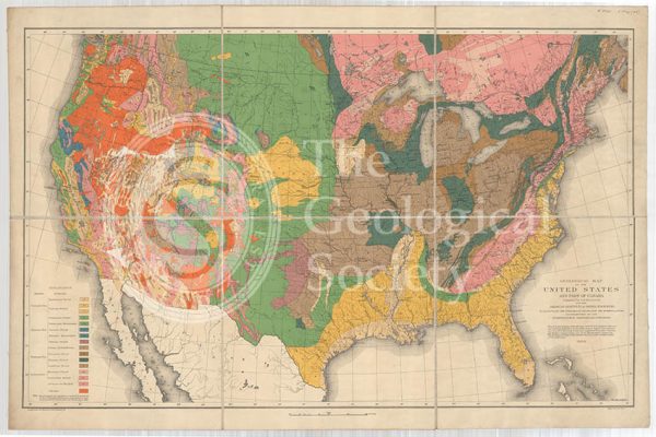
Geological Map of the United States and the British Provinces of North America (Marcou, 1853)
Le Puy, France
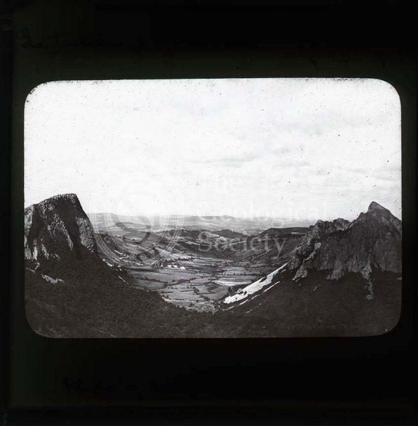
Glacial valley, France
Geological Sections in Illustration of the Map of the Mining District of Cornwall (Smith, 1819)
Geological view and sections of Norfolk and Suffolk (Smith, 1819)
Section of Stora Grufna coppermine, Sweden
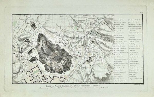
Plan of Stora Grufna coppermine, Sweden
Visitors to Brehec, Brittany
Fungus Rock, Gozo
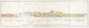
Geological view and section through Dorsetshire and Somersetshire to Taunton (Smith, 1819)
Geological View of the Mining District of Cornwall (Smith, 1819)
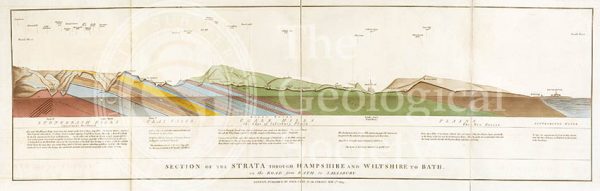
Section of the Strata through Hampshire and Wiltshire to Bath (Smith, 1819)
Pleistocene geological feature, Malta
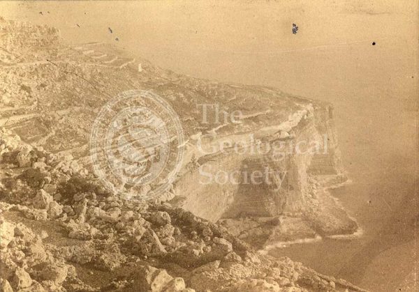
Malta Beds from Gebel Ciantar
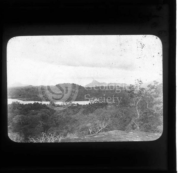
View from a Kurunegala rock, Sri Lanka
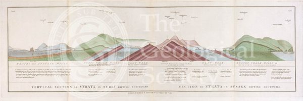
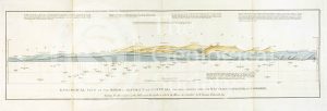
Vertical Section of Strata in Surry (Smith, 1819)
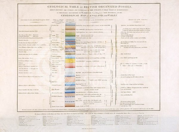
Geological Table of British Organized Fossils

Section of an artesian well
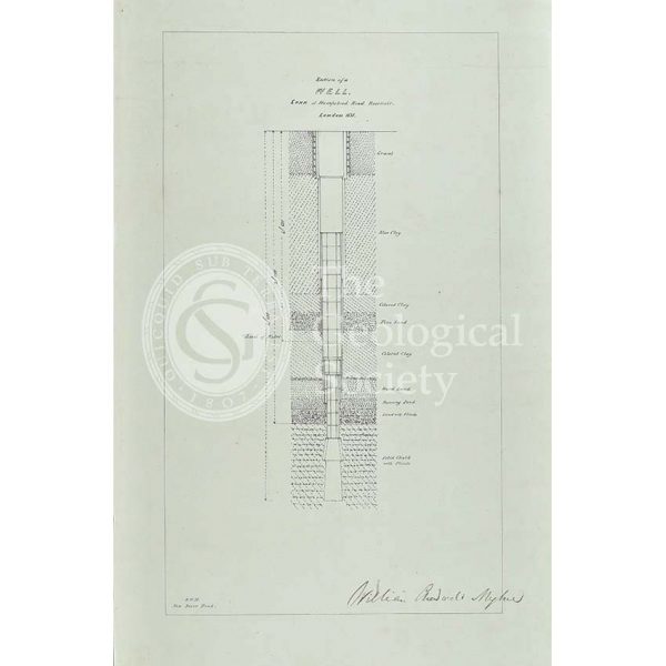
Section of a well sunk at Hampstead Road Reservoir
Syncline, Malta
Swanscombe Hill. Looking NNW
Mellieha Fault, Malta
Nalanda, Sri Lanka
Geological map of the United States and part of Canada (Hitchcock, 1886)
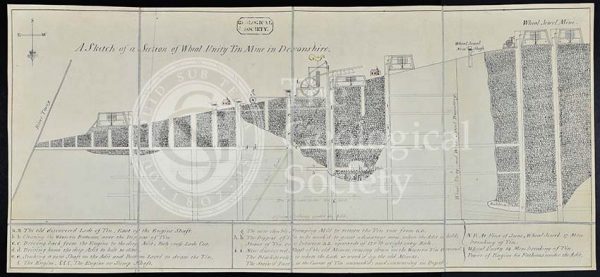
‘A sketch of a section of Wheal Unity Tin Mine in Devonshire’
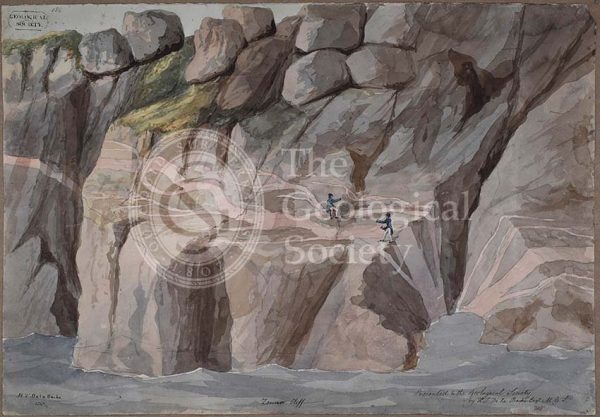
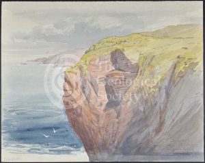
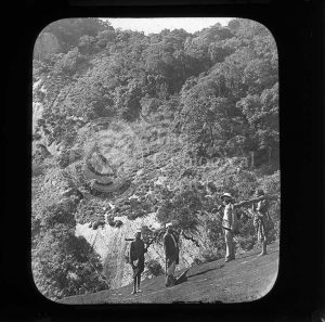
Cliffs at Zennor, Cornwall
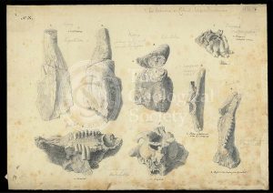
Bones from a cave in Wellington Valley, New South Wales, Australia
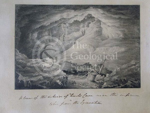
Inside Kent’s Cavern
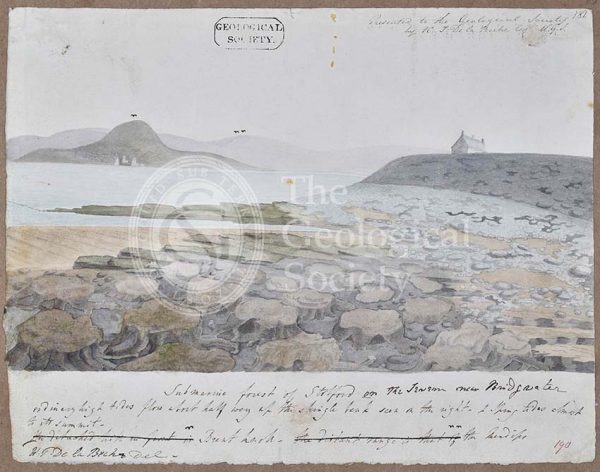
‘Submarine forest of Stolford on the Severn near Bridgwater’
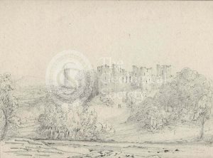
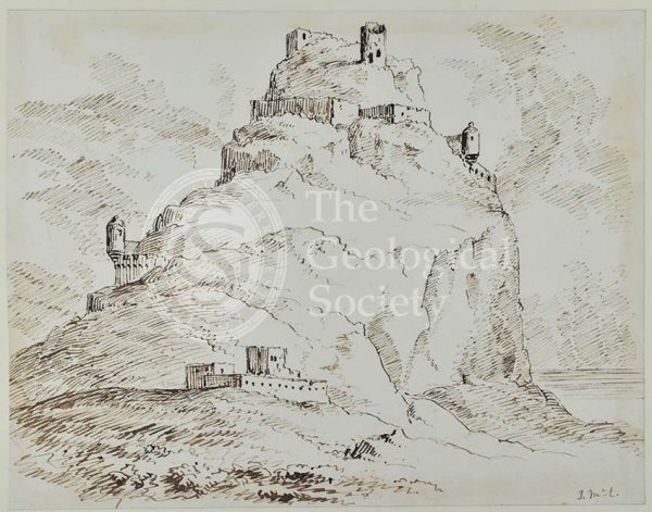
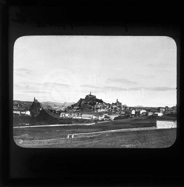
Ludlow Castle, Shropshire
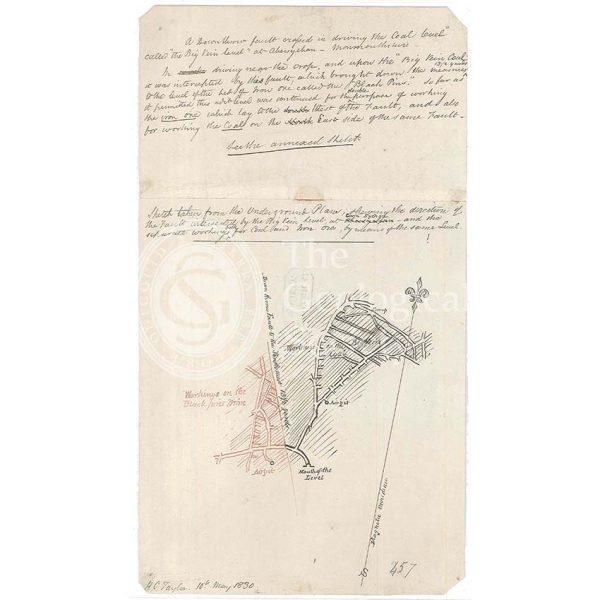
Fault in the coal workings of Cwm Sychan, Monmouthshire
Proposed Gravesend to Tilbury Fort Tunnel
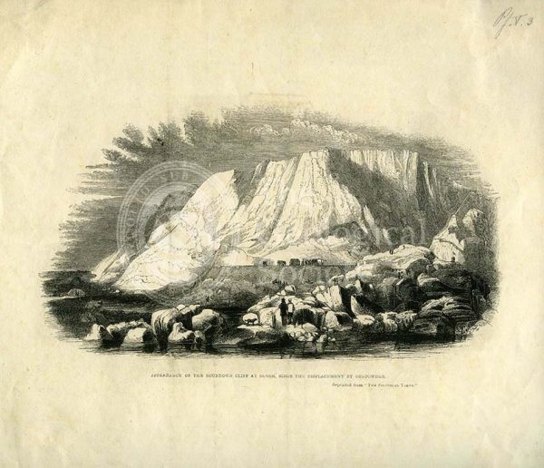
‘Appearance of the Roundown Cliff at Dovor (sic) since the displacement by gunpowder’
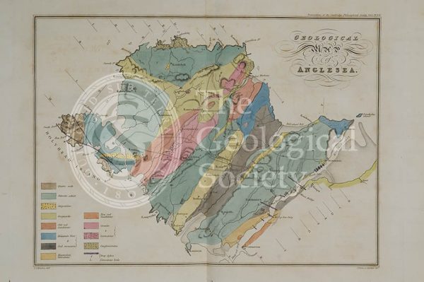
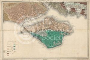
Geological map of Anglesea (Henslow, 1822)
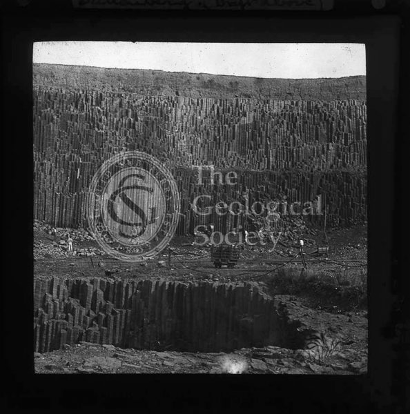
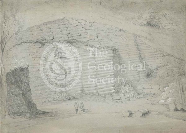
Dattenberg Quarry, Germany
Isle of Wight coast
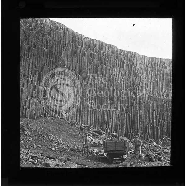
Dattenberg Quarry, Germany
Bones from a cave in Wellington Valley, New South Wales, Australia
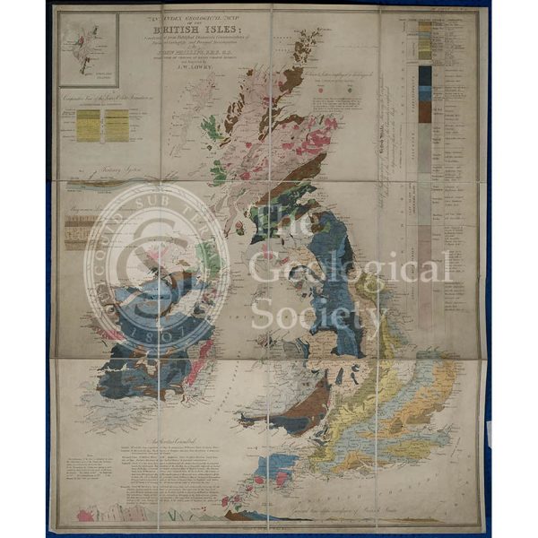
Geological map of the British Isles (Phillips, 1838)
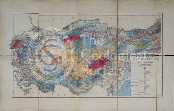
Carte géologique de l’Asia Mineure (Tchihatcheff, 1867)
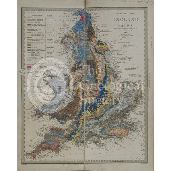
Geological map of England and Wales (Murchison, 1843)
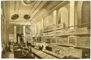
Charles Moore’s ‘Free Museum’ in Bath
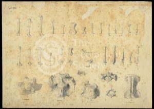
Bones from a cave in Wellington Valley, New South Wales, Australia
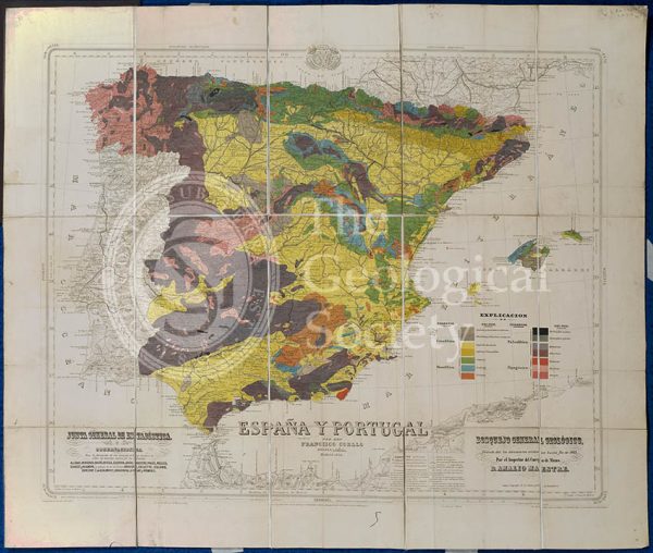
Mapa Geologico de España y Portugal (Coello, 1864)
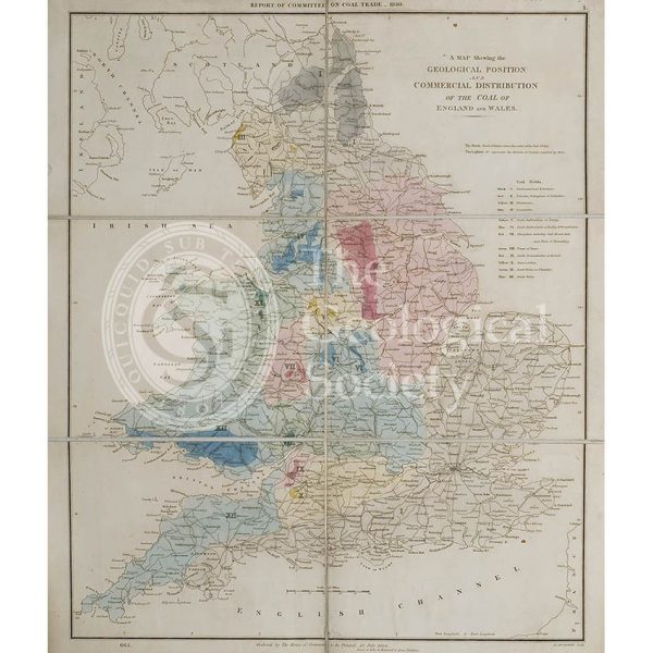
Map showing the Geological Position and Commercial Distribution of the Coal of England and Wales (House of Commons, 1830)
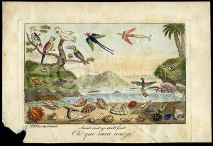
‘Oh! que rara couza!…’
Standard Quarry, Welshpool
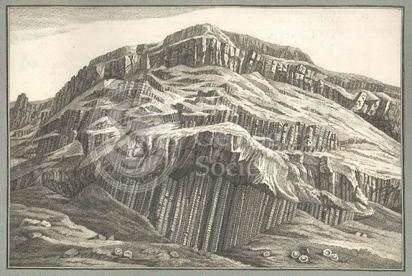
Giant’s Causeway
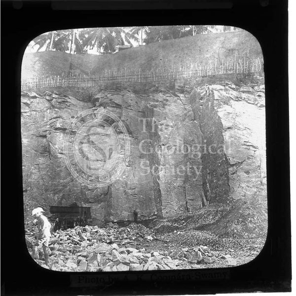
Mahara Quarry, Sri Lanka
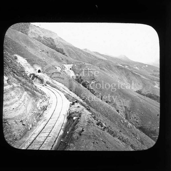
Railway line near Haputale, Sri Lanka
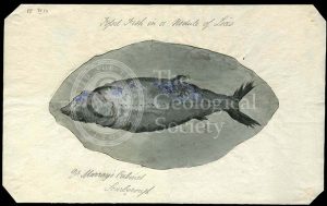
‘Fossil fish in a nodule of Lias’
Giant’s Causeway
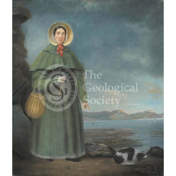
Mary Anning (1799-1847)
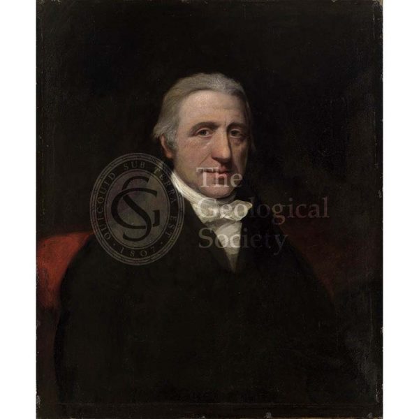
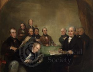
William Babington (1756-1833)
The British Association at Newcastle
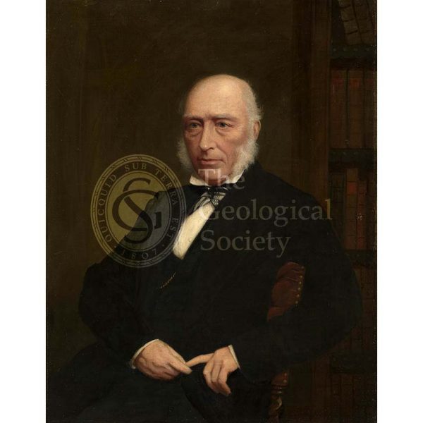
John Phillips (1800-1874)