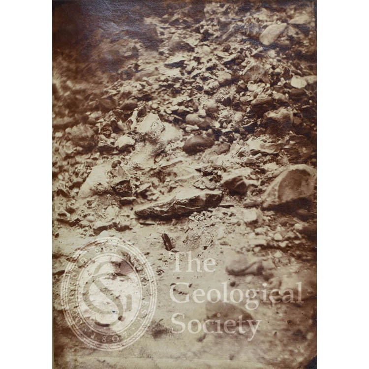
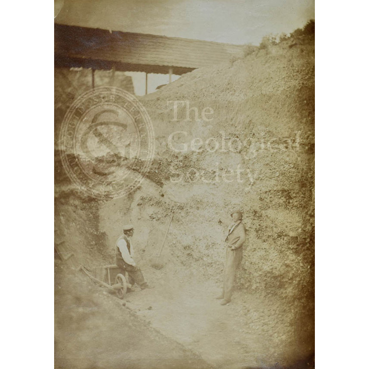
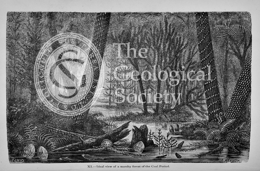
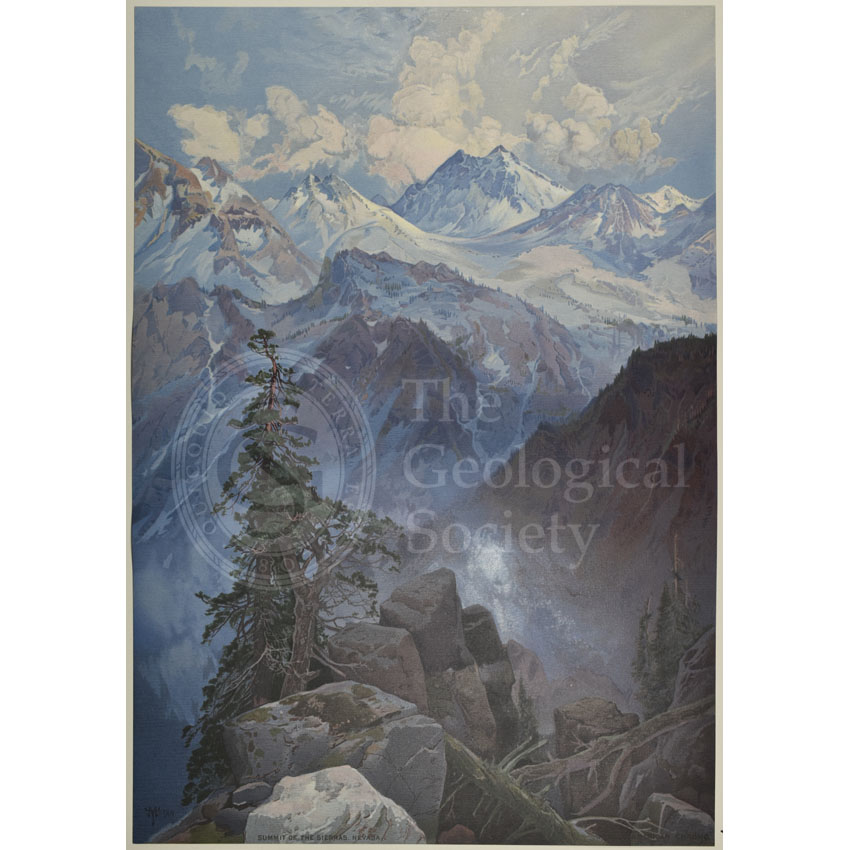
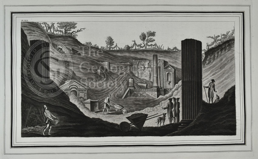
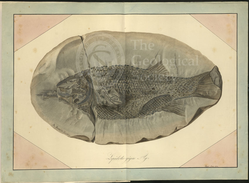
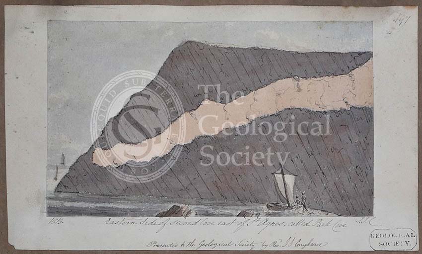
Title: Fréville Pit at St Acheul, Amiens, France
Creator: Charles Pinsard (1819-1911)
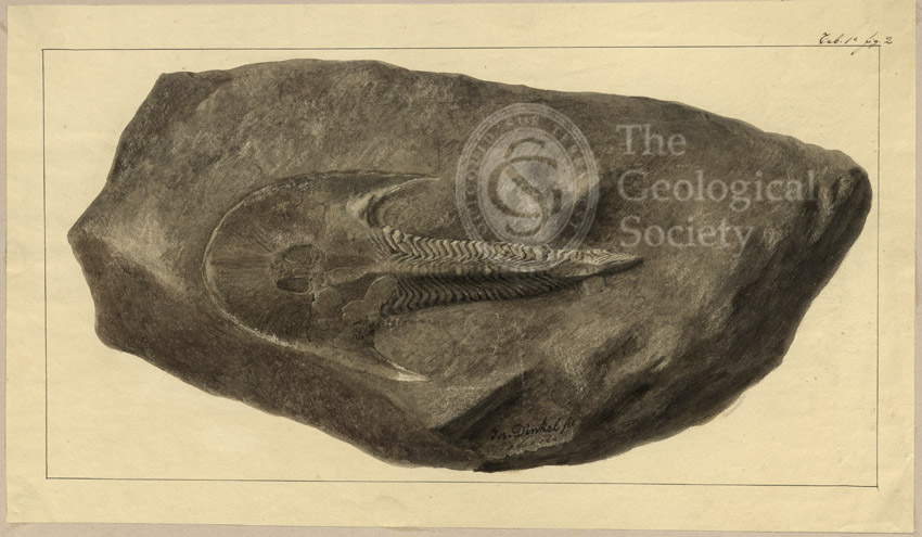
Description: Photograph showing the quarry pit where a hand-axe, the first worked flint tool to be recorded and witnessed in situ by Joseph Prestwich (1812-1896) and John Evans (1823-1908), was found and which became the final proof for the long suspected ‘Antiquity of Man’. In the photograph, the figure on the right is pointing to the location of the flint.
Apparent hand worked flints had long been found together with the remains of extinct animals but many geologists in the early 19th century held the widespread belief that humanity was of recent origin, specifically ‘post-diluvian’ that is deriving from after Noah’s Flood. Therefore up until 1859, there was a tendency to either ignore their co-existence or come up with other explanations as to why flint and animal remains were intermixed.
In November 1858, the geologist Hugh Falconer (1808-1865) was in France where he visited the private collection of Jacques Boucher de Perthes (1788-1868). De Perthes was a customs officer and amateur archaeologist who found in Abbeville, France, the jaw of a fossil elephant alongside a primitive axe in 1841. The French scientific community refused to accept his claims, despite his finding similar juxtapositions in other areas of the Somme Valley. Yet Falconer was convinced not only of the antiquity of the flints but also in the veracity of de Perthes’ claims. He therefore urged Prestwich to visit the sites in question.
In April 1859 Joseph Prestwich, accompanied by his close friend John Evans, travelled to France to meet with the now aged de Perthes. He showed them around his collection and took them to the various gravel pits in the area where the flint tools had been discovered. It was whilst visiting a site in Abbeville that he received a telegram stating that another flint tool had been found at Saint-Acheul, near Amiens and had been left in situ for Prestwich’s inspection. On 27 April 1859 Prestwich and Evans returned to Saint-Acheul to see it for themselves. Such was the momentous occasion, this was one of two photographs taken of the site before the flint’s removal. In his paper, presented at the Royal Society on 26 May 1859, Prestwich wrote:
“It was lying in the gravel at a depth of 17 feet from the original surface and 6 1/2 feet from the chalk. One side slightly projected. The gravel around was undisturbed, and presented its usual perpendicular face. I carefully examined the specimen, and saw no reason to doubt that it was in its natural position, for the gravel is generally so loose that a blow with a pick disturbs and brings it down for some way around…I carefully examined the ground above, and could detect no trace of any artificial disturbance. Each bed followed its natural course above the place where the flint implement was imbedded, and the lines of division of the upper brown gravel and clay, of the light-coloured sands, and of the lower gravel, were continuous and unbroken.” From John Prestwich, “On the occurrence of flint-implements: associated with the remains of animals of extinct species in beds of a late geological period, in France at Amiens and Abbeville, and in England at Hoxne”, ‘Philosophical Transactions of the Royal Society’, vol 150 (1860), pp291-292.
Date: 27 April 1859
Format: Albumen photograph
Archive reference: LDGSL/800a
Image reference: 06-08
Recommended print size: Up to A4 (30 x 20cm)

![First Geological Map of Scotland [1808]](https://gslpicturelibrary.org.uk/wp-content/uploads/2020/04/07-170-LDGSL-701.jpg)
![Greenough’s and Sharpe’s Geological Map of Scotland [1852] – draft](https://gslpicturelibrary.org.uk/wp-content/uploads/2020/04/07-169-LDGSL-947-6-C-5.jpg)
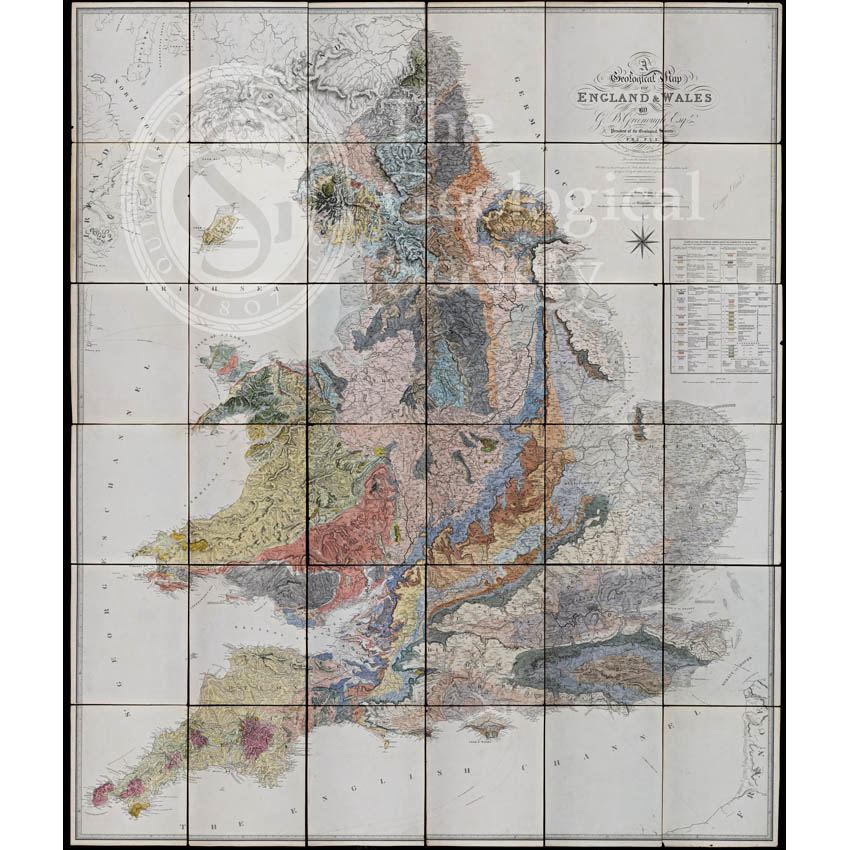
![Geological Map of England and Wales [1839] 2nd edition](https://gslpicturelibrary.org.uk/wp-content/uploads/2020/04/07-168-LDGSL-979A-2.jpg)


![Plate X: Interiour [sic] view of the crater of mount Vesuvius…](https://gslpicturelibrary.org.uk/wp-content/uploads/2018/10/02-35-Hamilton-Plate-10.jpg)
![Plate IX: Interiour [sic] view of the crater of mount Vesuvius…](https://gslpicturelibrary.org.uk/wp-content/uploads/2018/10/02-34-Hamilton-Plate-09.jpg)


![Plate VII [St George’s Channel]](https://gslpicturelibrary.org.uk/wp-content/uploads/2017/10/22-07-Plate-VII-St-Georges-Channel.jpg)
![Plate VI [German Ocean]](https://gslpicturelibrary.org.uk/wp-content/uploads/2017/10/22-06-Plate-VI-German-Ocean.jpg)
![Plate V [Yorkshire]](https://gslpicturelibrary.org.uk/wp-content/uploads/2017/10/22-05-Plate-V-Yorkshire.jpg)
![Plate XV [France]](https://gslpicturelibrary.org.uk/wp-content/uploads/2017/10/22-15-Plate-XV-France.jpg)
![Plate XIV [English Channel]](https://gslpicturelibrary.org.uk/wp-content/uploads/2017/10/22-14-Plate-XIV-English-Channel-Channel-Islands.jpg)
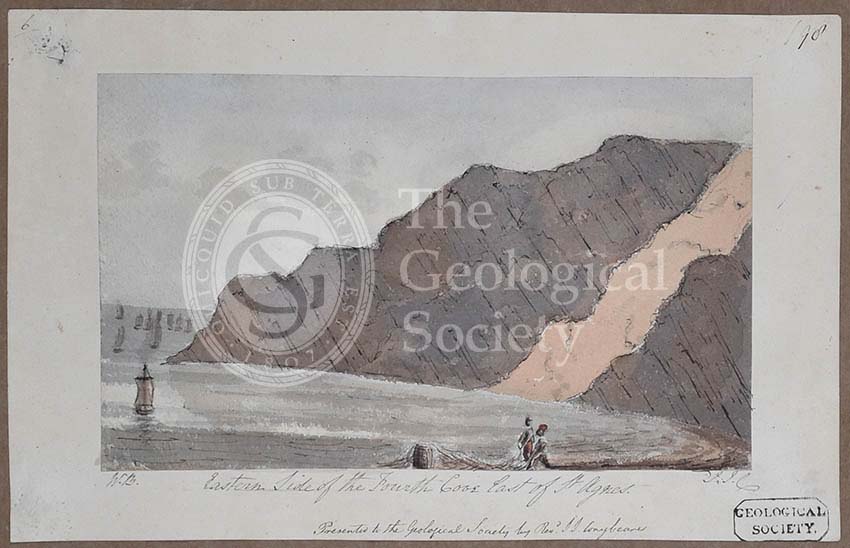
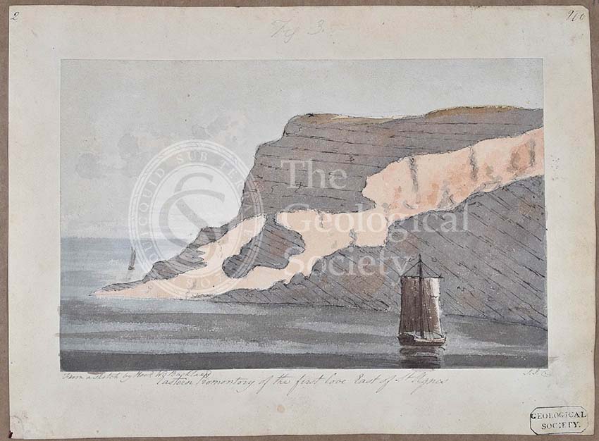
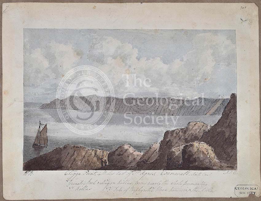
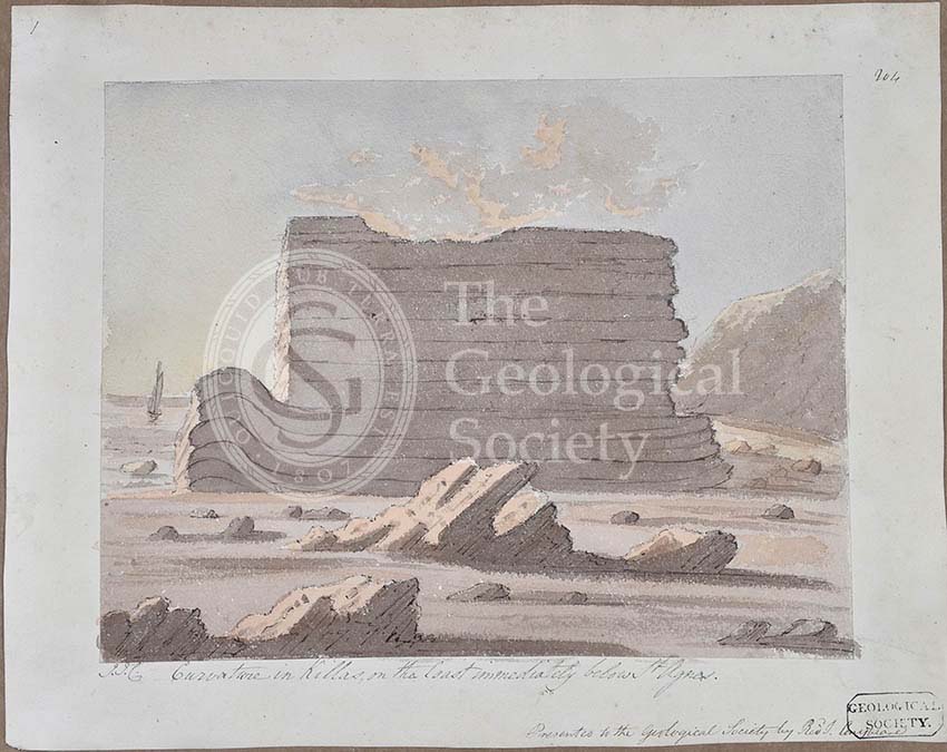
![Plate XIII [Cornwall]](https://gslpicturelibrary.org.uk/wp-content/uploads/2017/10/22-13-Plate-XIII-Cornwall.jpg)
![Plate XII [Kent]](https://gslpicturelibrary.org.uk/wp-content/uploads/2017/10/22-12-Plate-XII-Kent.jpg)
![Plate X [Isle of Wight]](https://gslpicturelibrary.org.uk/wp-content/uploads/2017/10/22-11-Plate-XI-Isle-of-Wight-700-test.jpg)
![Plate X [Bristol Channel]](https://gslpicturelibrary.org.uk/wp-content/uploads/2017/10/22-10-Plate-X-Bristol-Channel.jpg)
![Plate IX [East Anglia]](https://gslpicturelibrary.org.uk/wp-content/uploads/2017/10/22-09-Plate-IX-East-Anglia.jpg)
![Plate VIII [Welsh border]](https://gslpicturelibrary.org.uk/wp-content/uploads/2017/10/22-08-Plate-VIII-Welsh-border-mid-England.jpg)
![Plate III [Title page]](https://gslpicturelibrary.org.uk/wp-content/uploads/2017/10/22-03-Plate-III-Title-sheet-original.jpg)
![Plate IV [Irish Sea]](https://gslpicturelibrary.org.uk/wp-content/uploads/2017/10/22-04-Plate-IV-Irish-Sea.jpg)
![Plate II [Firth of Forth]](https://gslpicturelibrary.org.uk/wp-content/uploads/2017/10/22-02-Plate-II-Firth-of-Forth.jpg)
![Plate I [Firth of Clyde]](https://gslpicturelibrary.org.uk/wp-content/uploads/2017/10/22-01-Plate-I-Firth-of-Clyde.jpg)

![‘Cape Blowmedown [Blomidon], Nova Scotia’](https://gslpicturelibrary.org.uk/wp-content/uploads/2017/02/05-92-LDGSL-400_562002.jpg)
![George Simmonds [Simonds] Boulger (1853-1922)](https://gslpicturelibrary.org.uk/wp-content/uploads/2017/01/01-63-POR-49-02-01-Boulger-recrop.jpg)

![‘A view of Stone-Henge [Stonehenge] Wiltshire’](https://gslpicturelibrary.org.uk/wp-content/uploads/2017/01/06-07-LDGSL-400_742002.jpg)